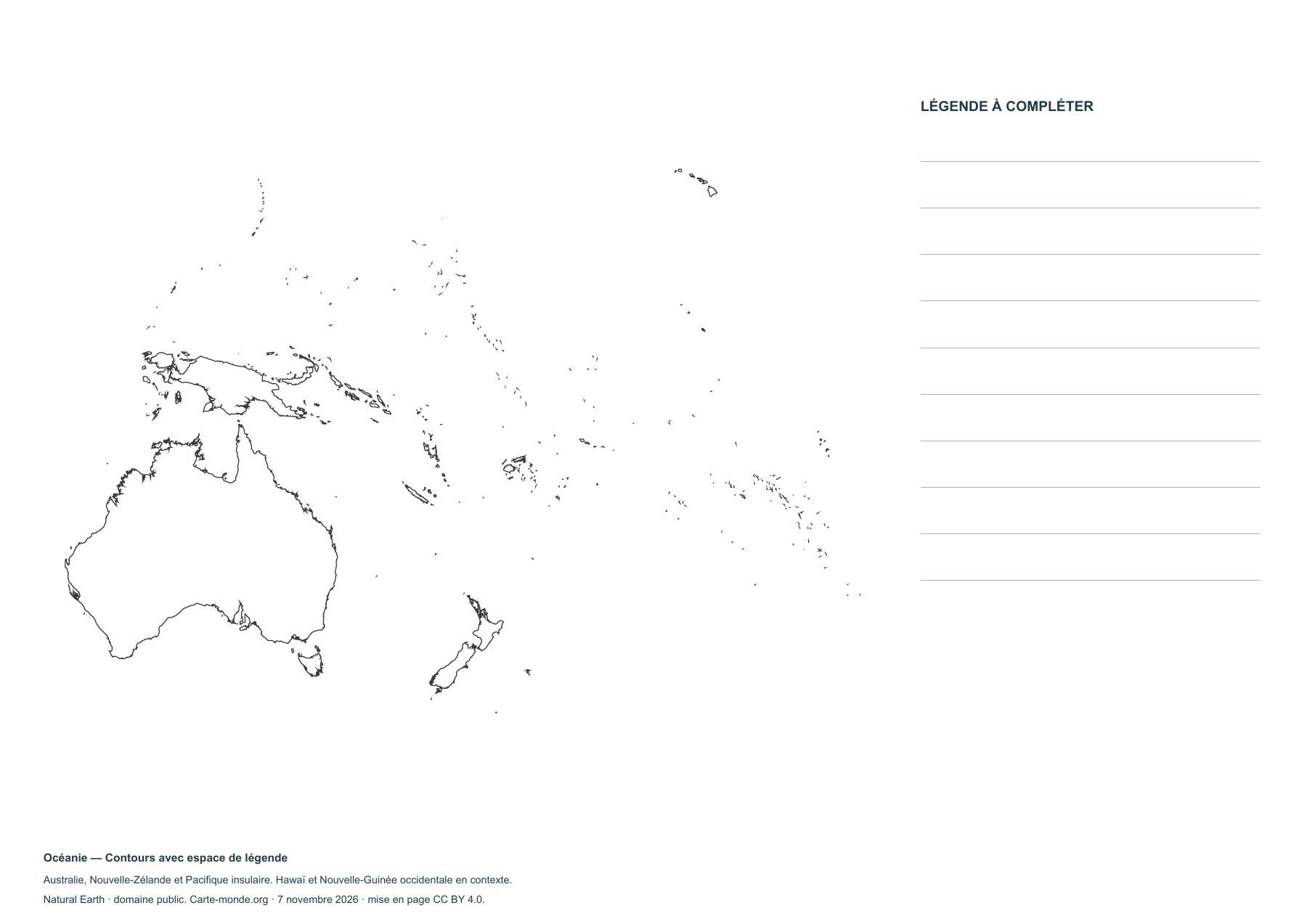
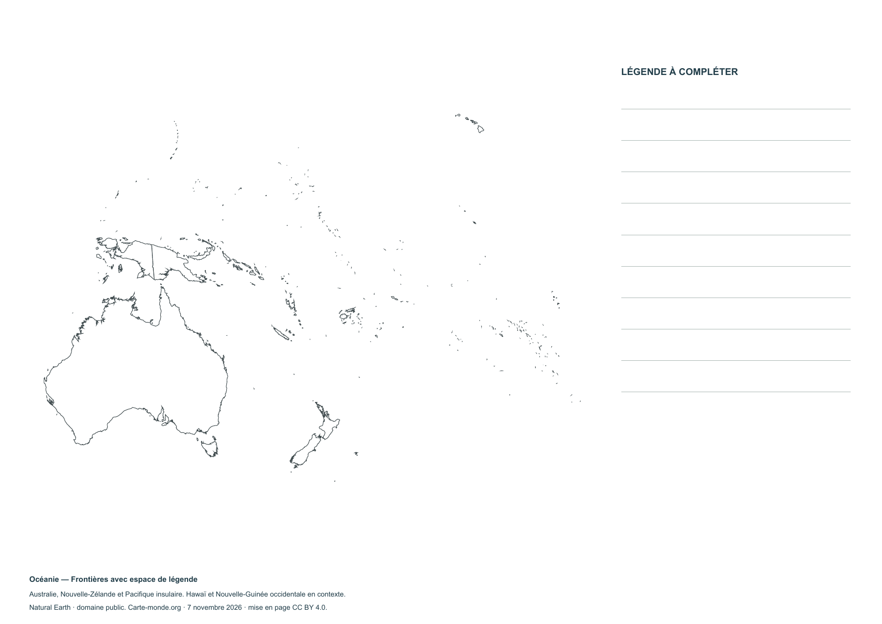
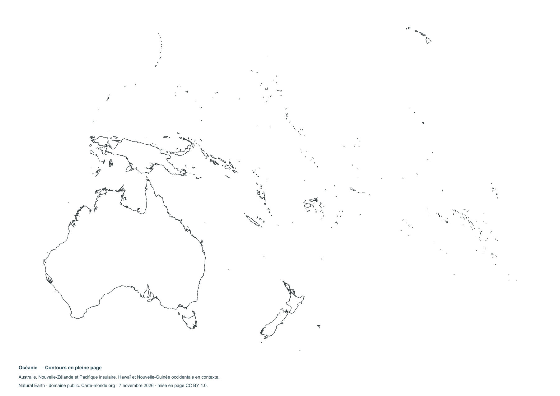
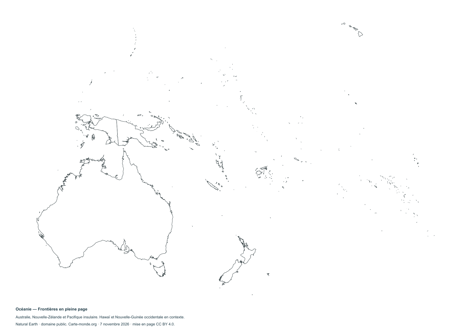
Australia, New Zealand, Melanesia, Micronesia and Polynesia. Hawaii and western New Guinea shown for context; Rapa Nui and the remote Indian Ocean territories are outside the map. Lambert azimuthal equal-area projection centred on the Pacific (16° S, 170° E). Very small islands are generalised; the country pages will provide enlarged views.
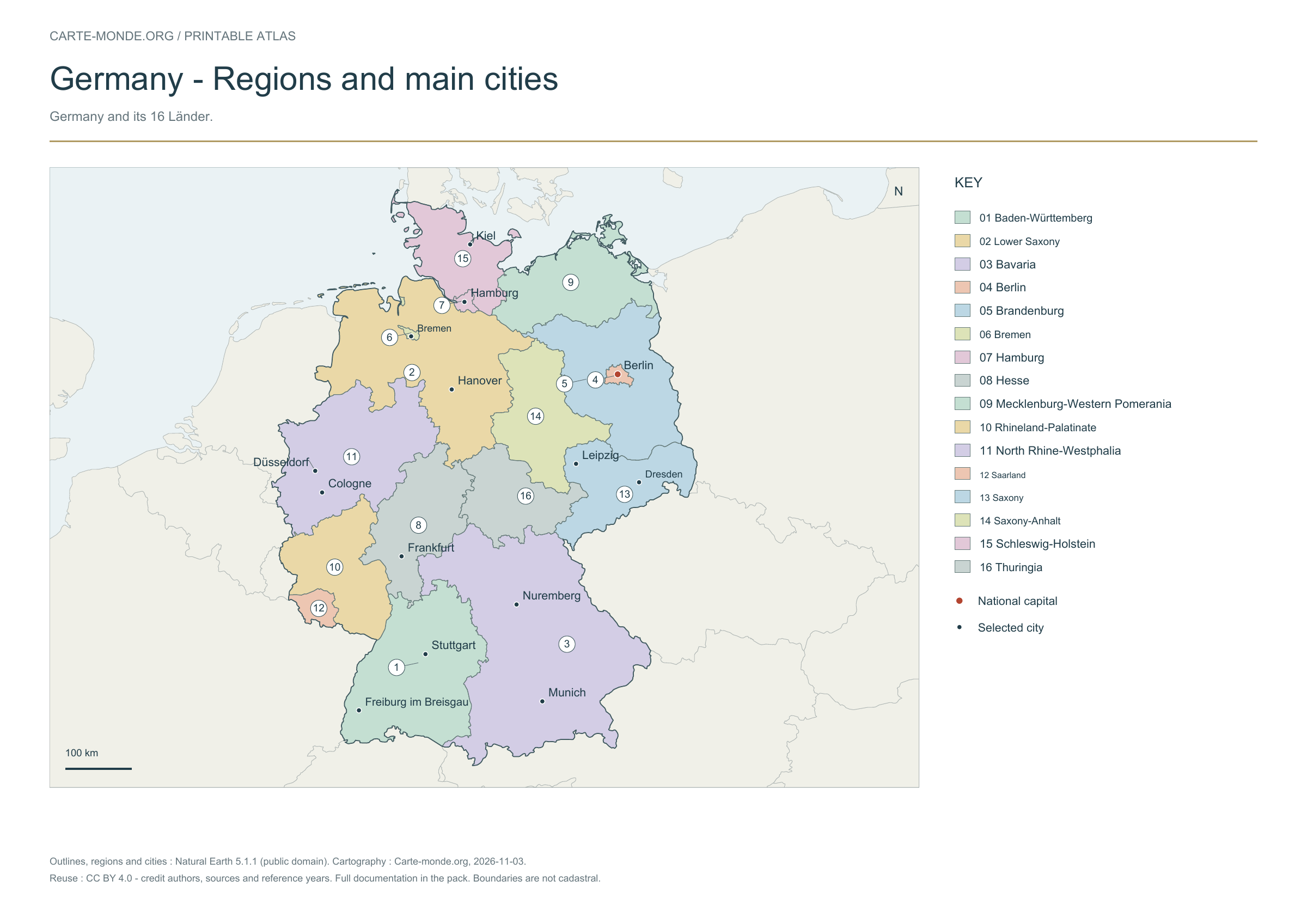
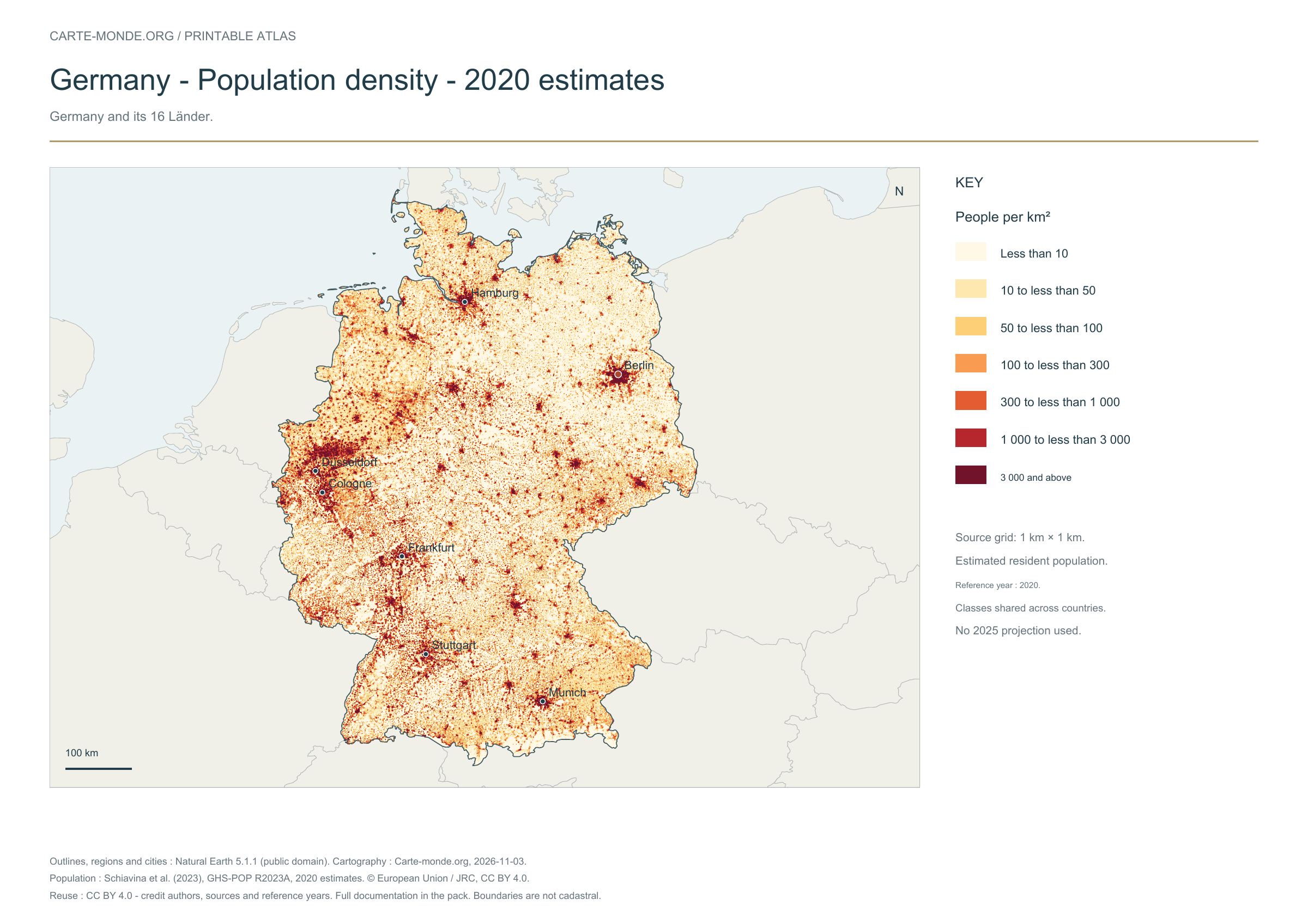
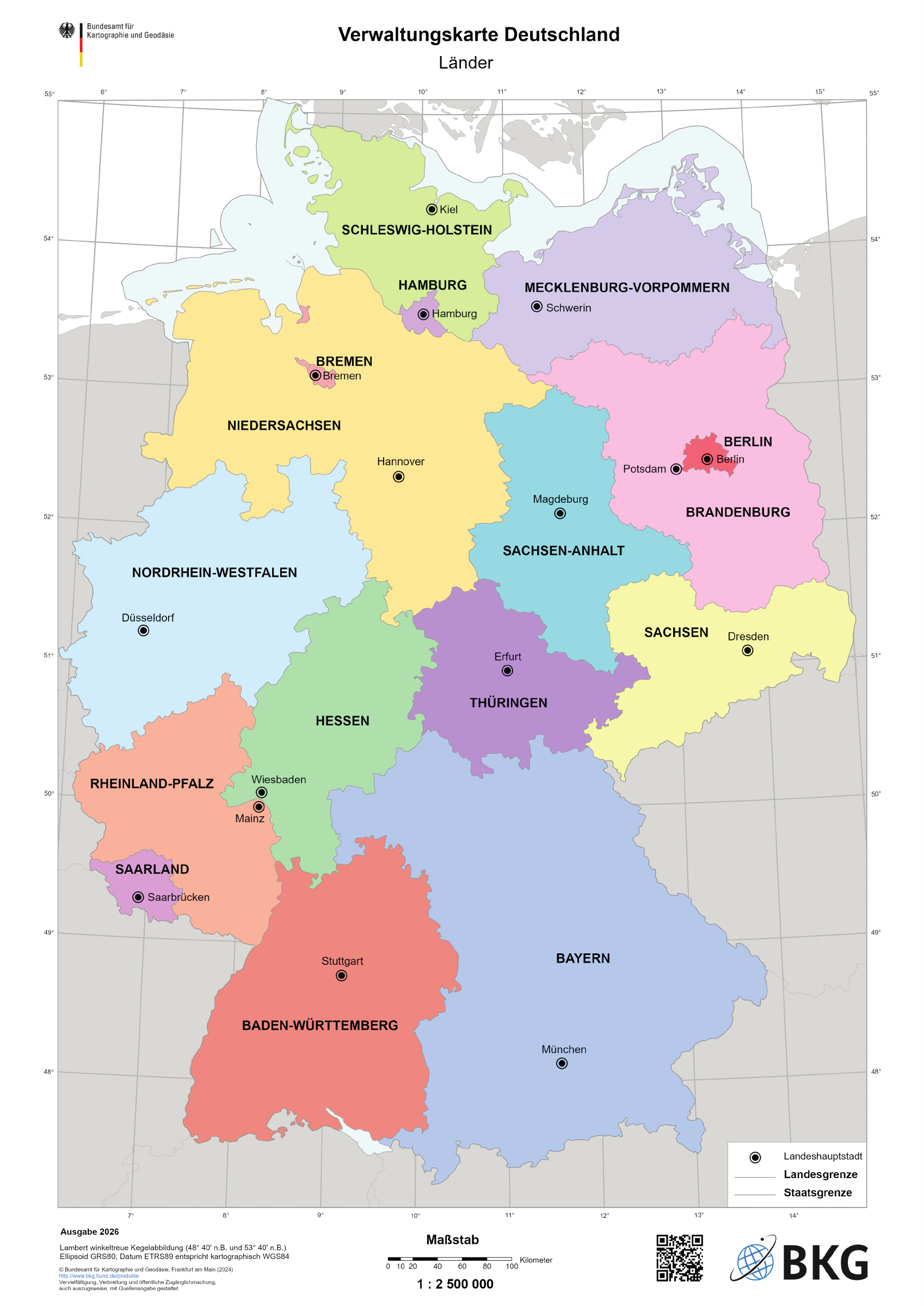
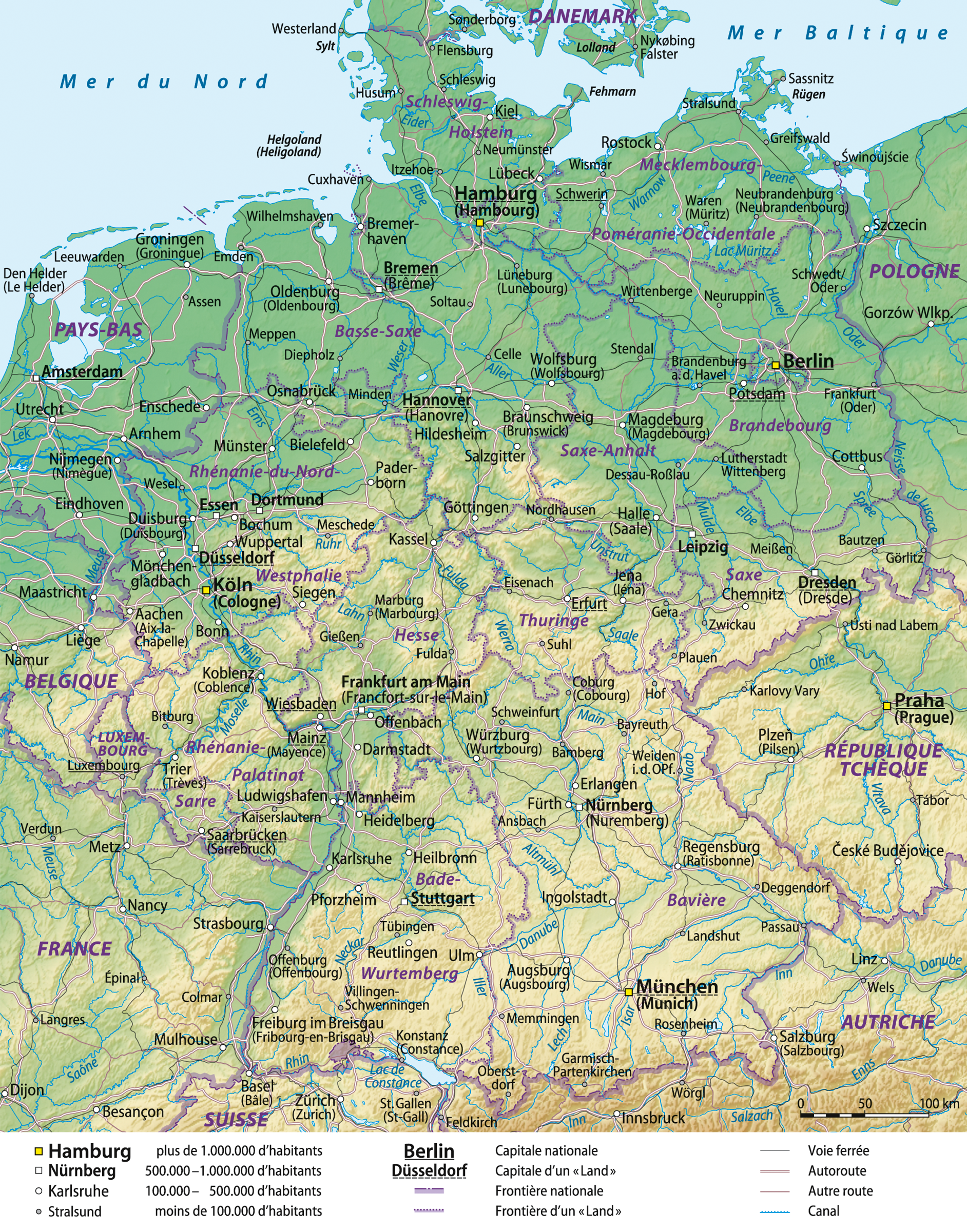
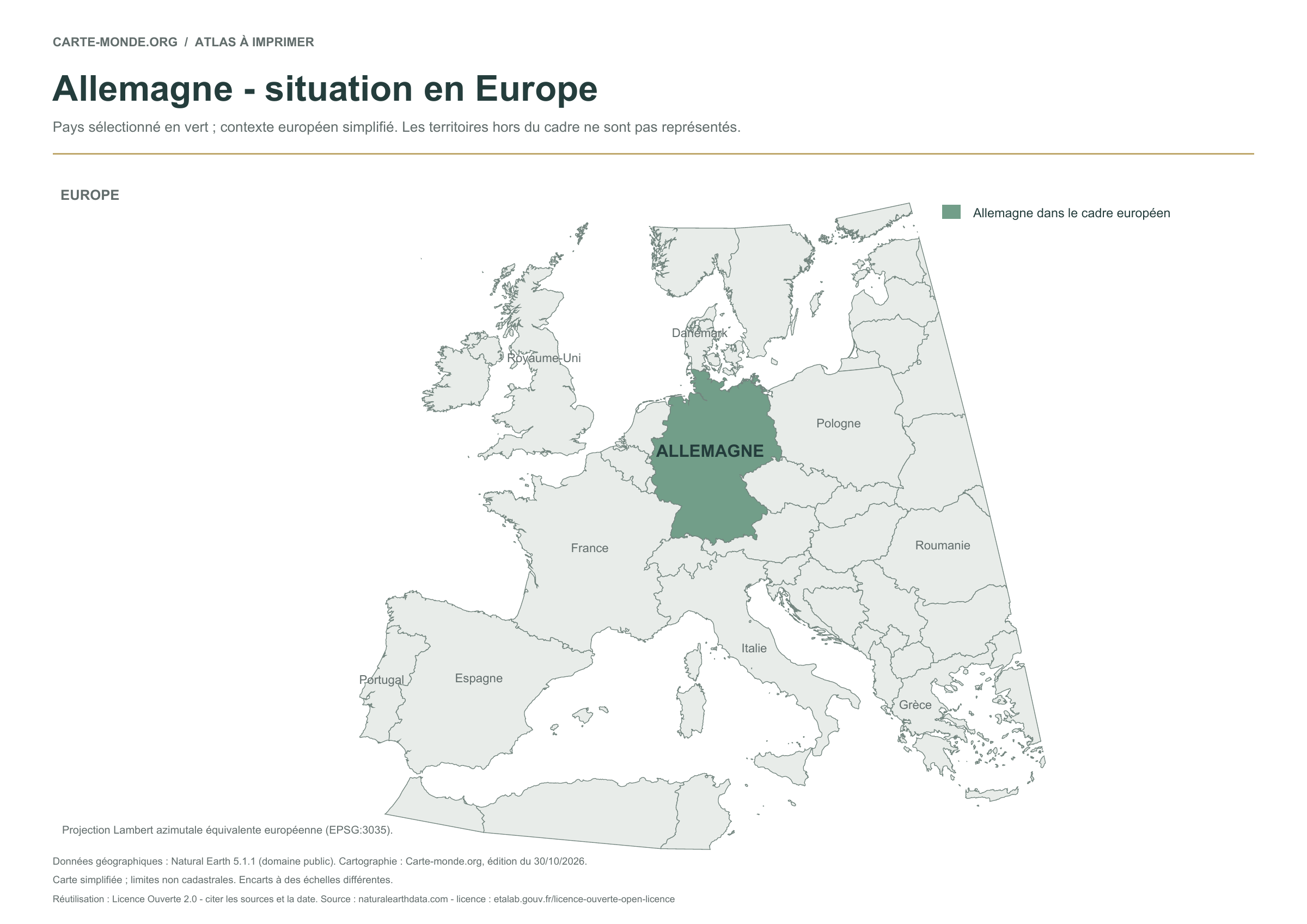
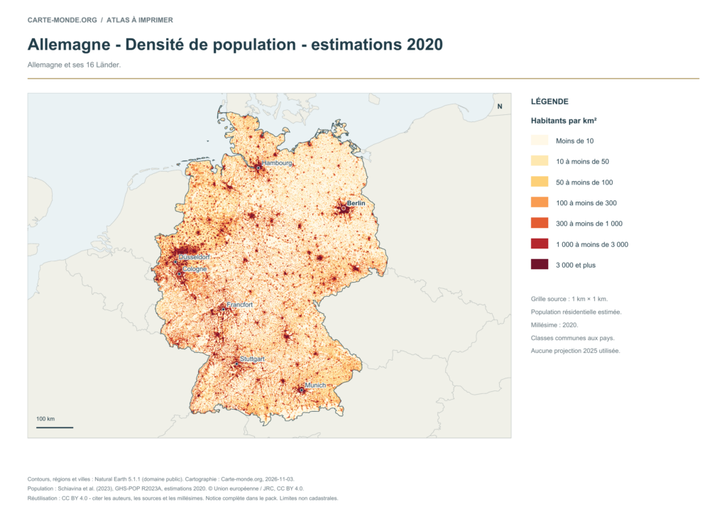
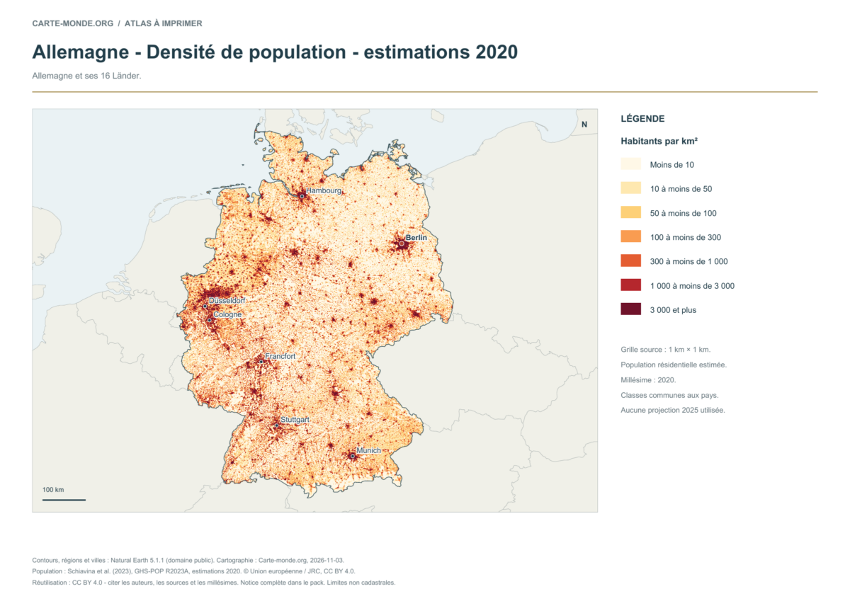
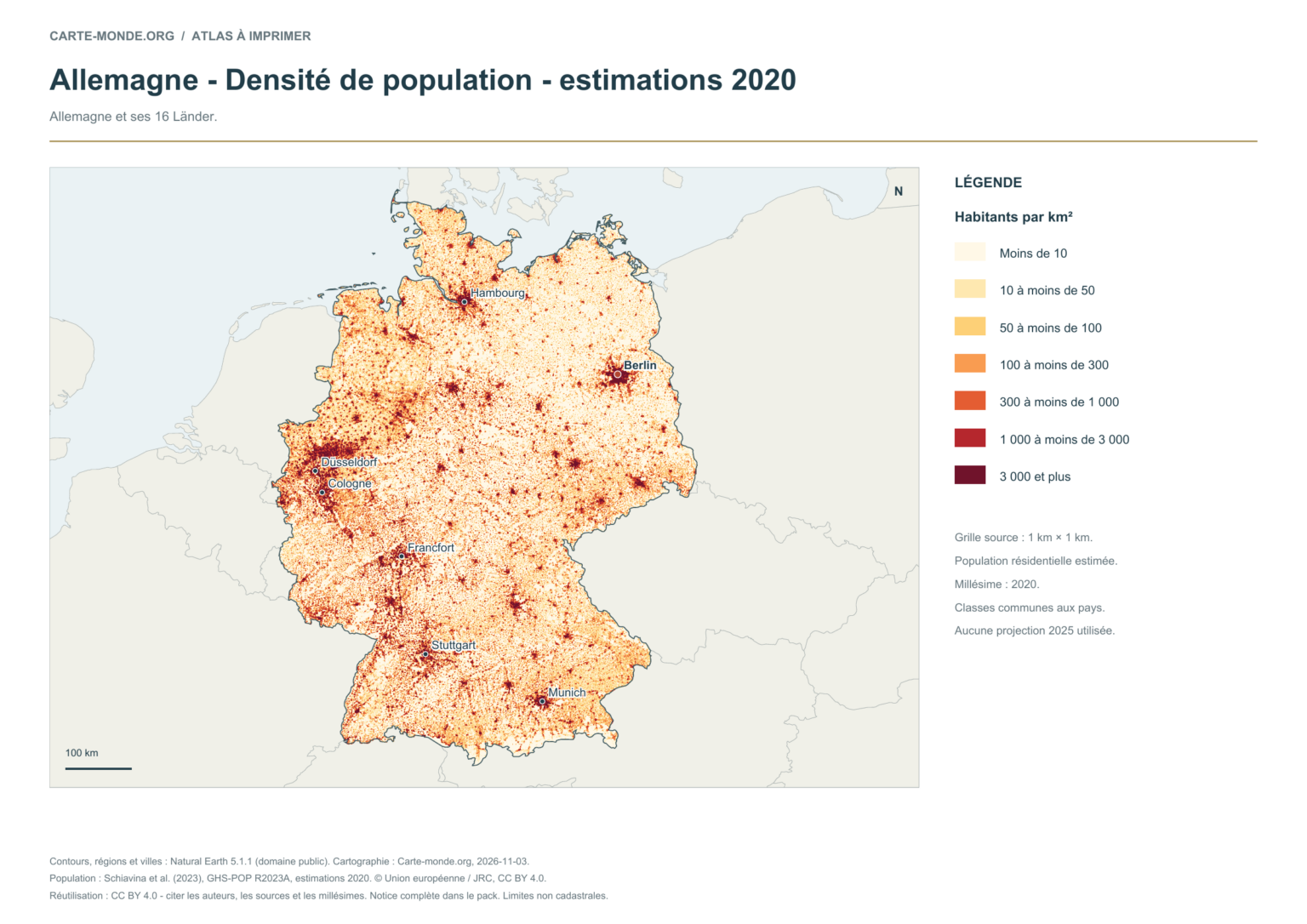
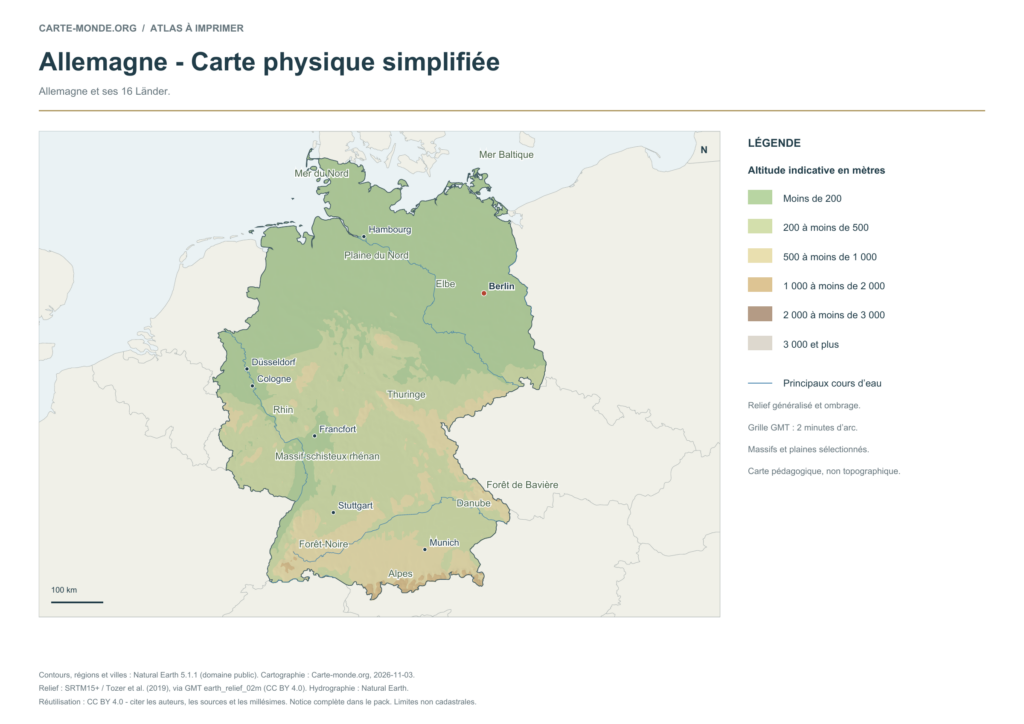
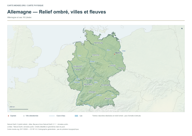
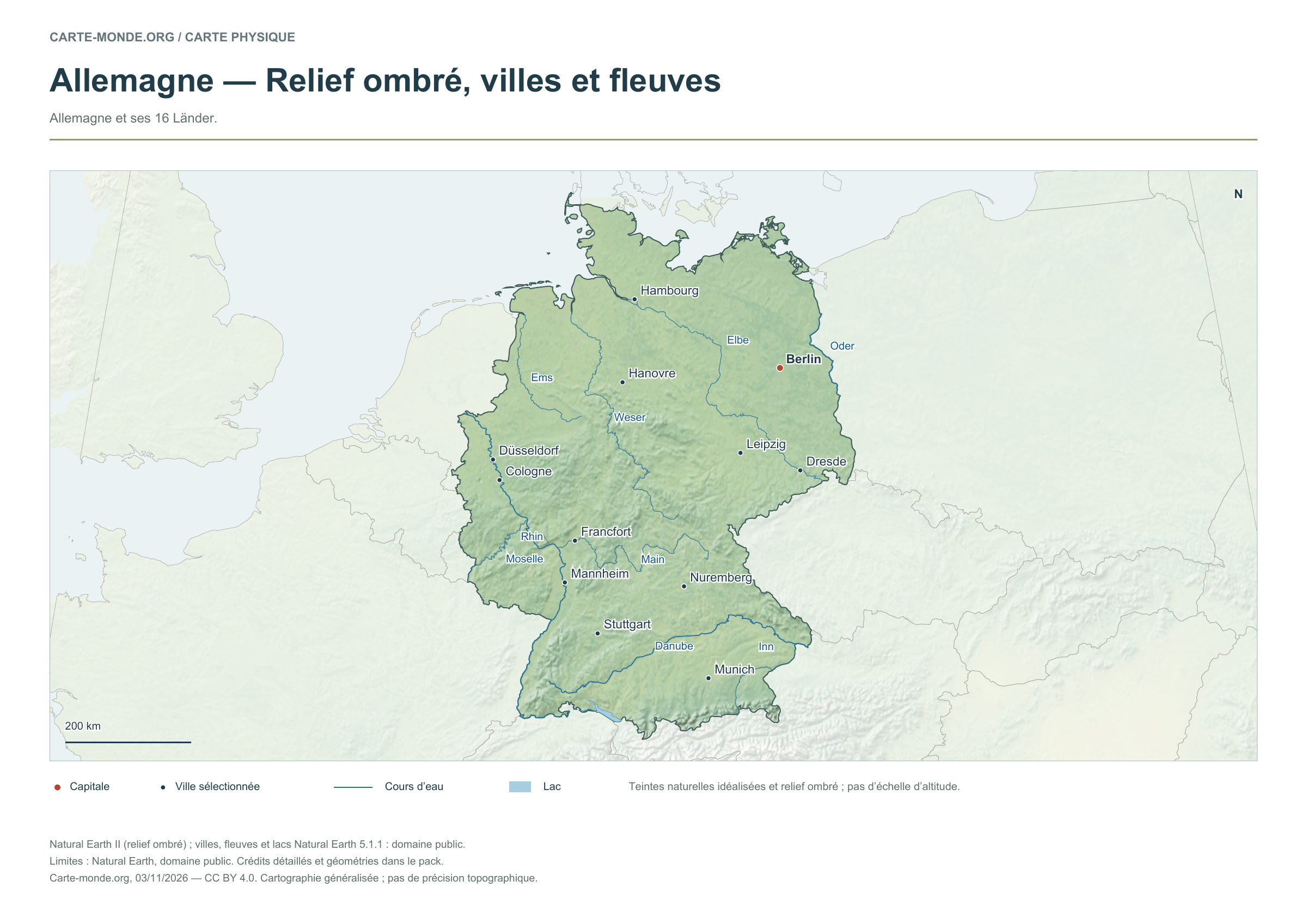
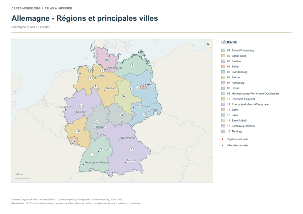
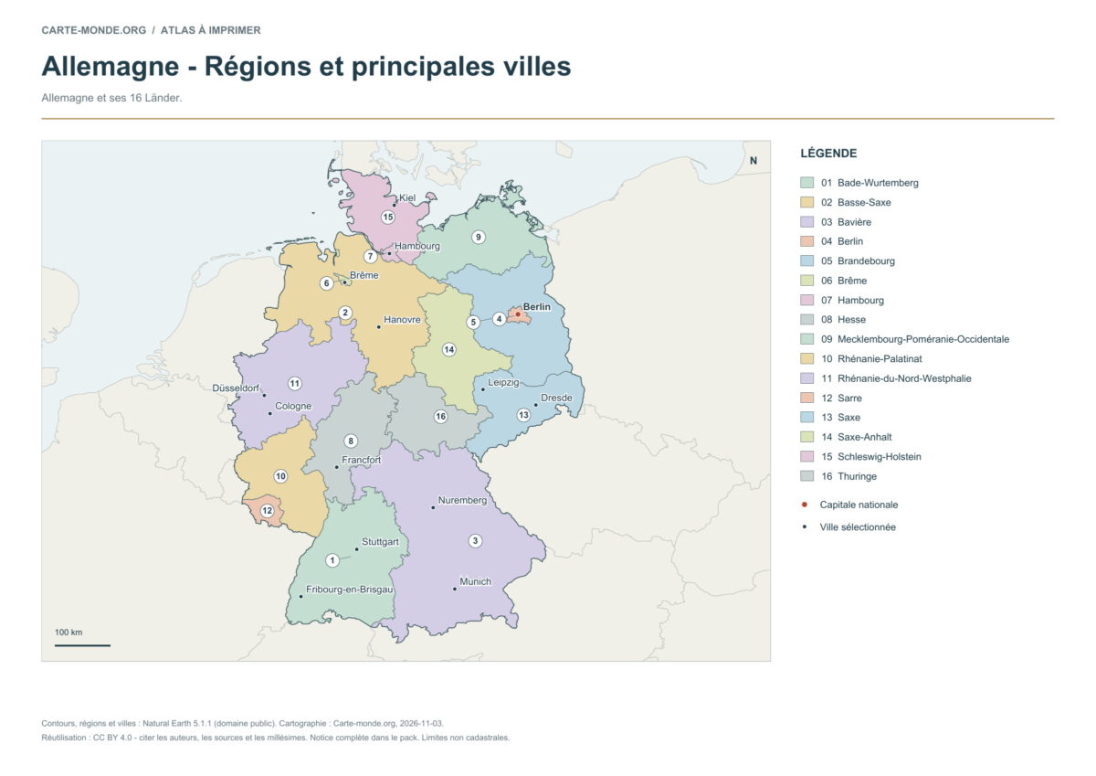
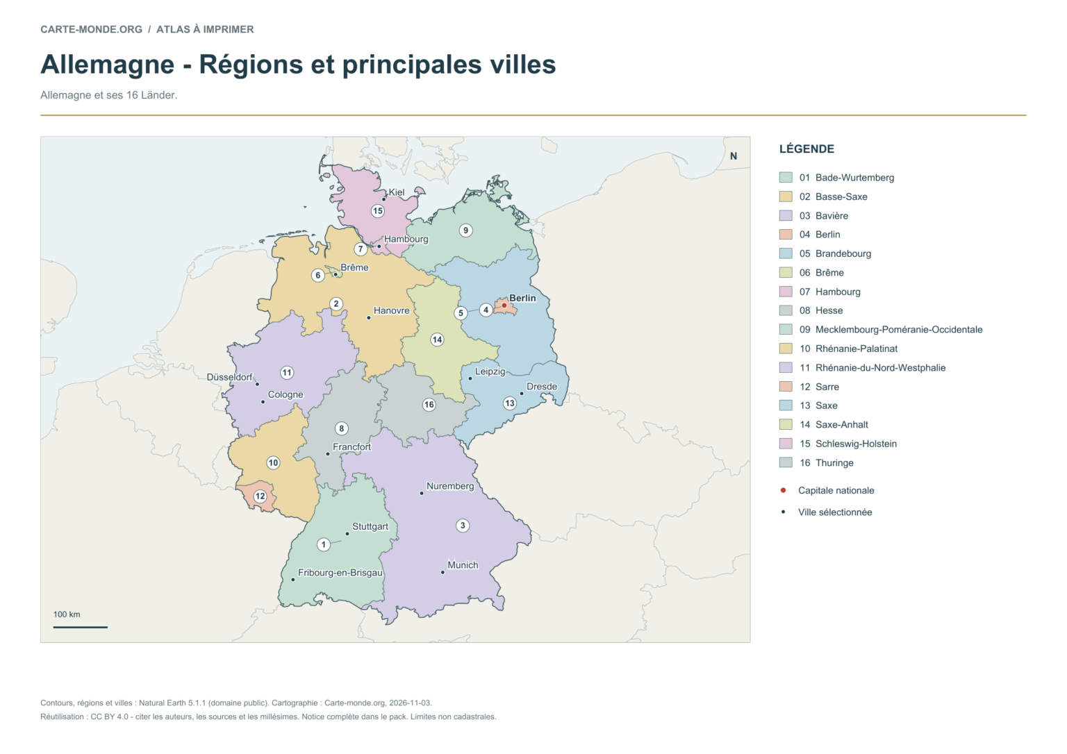
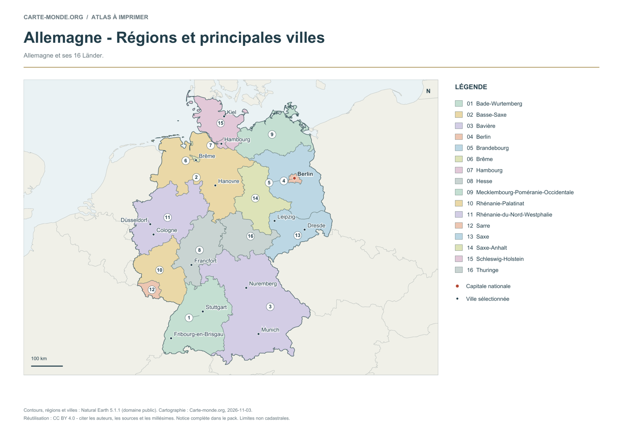
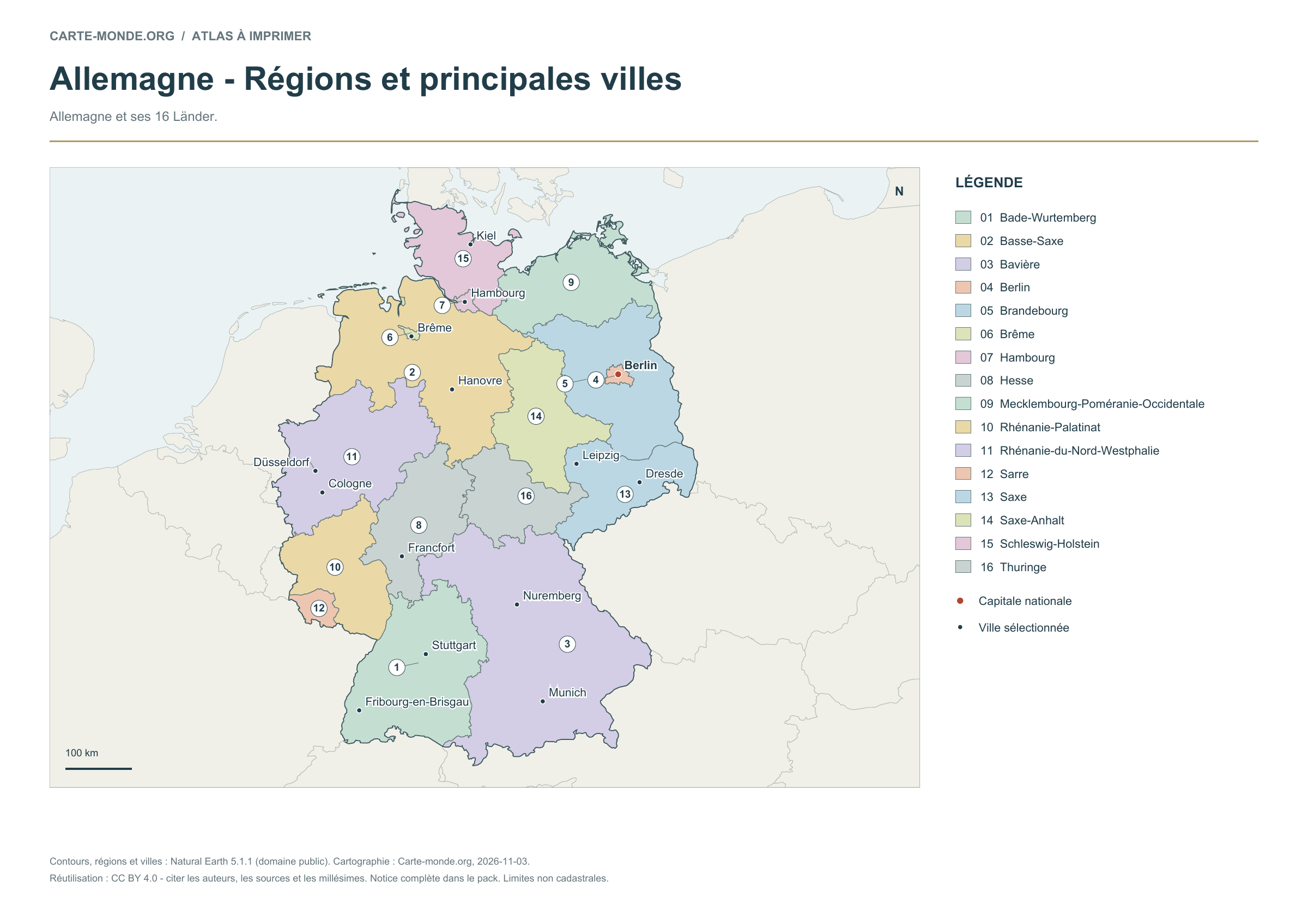
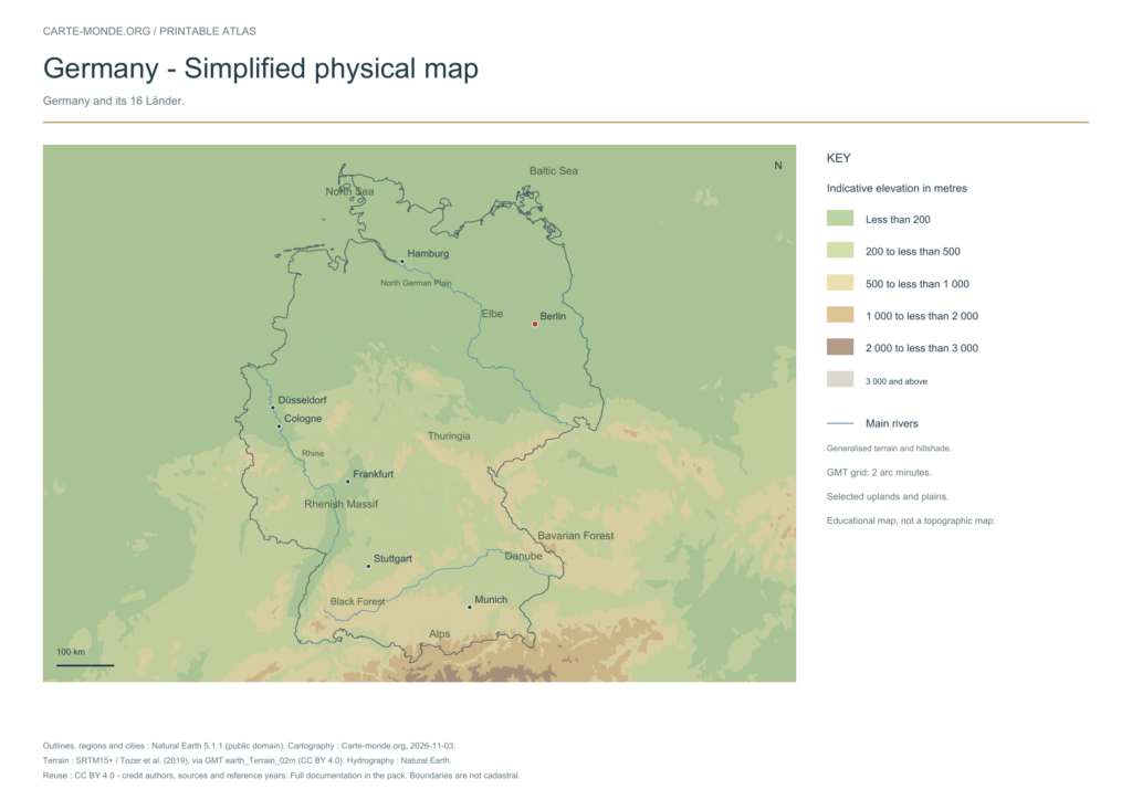
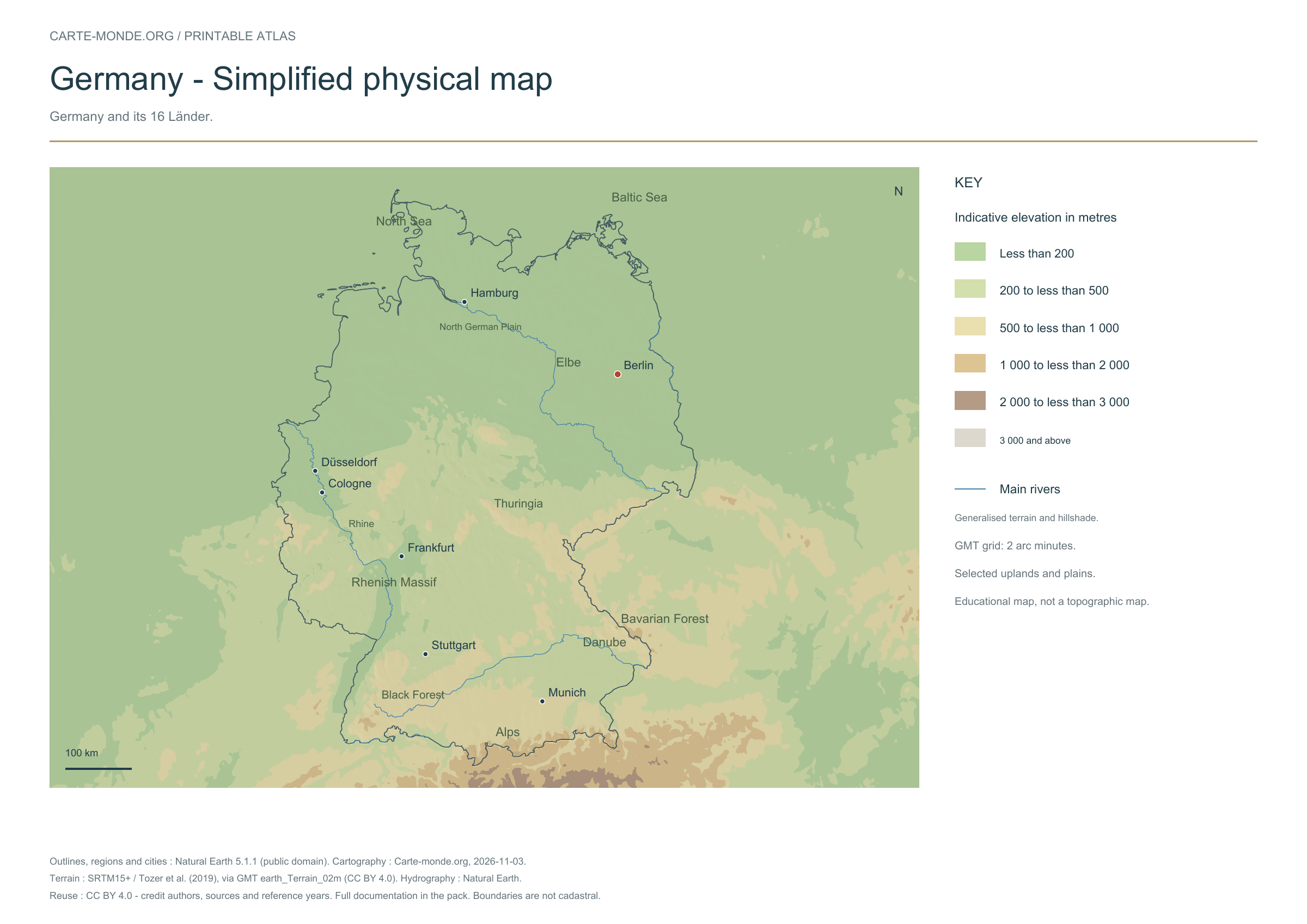
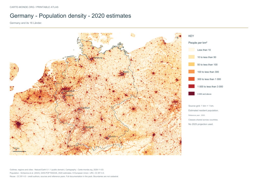
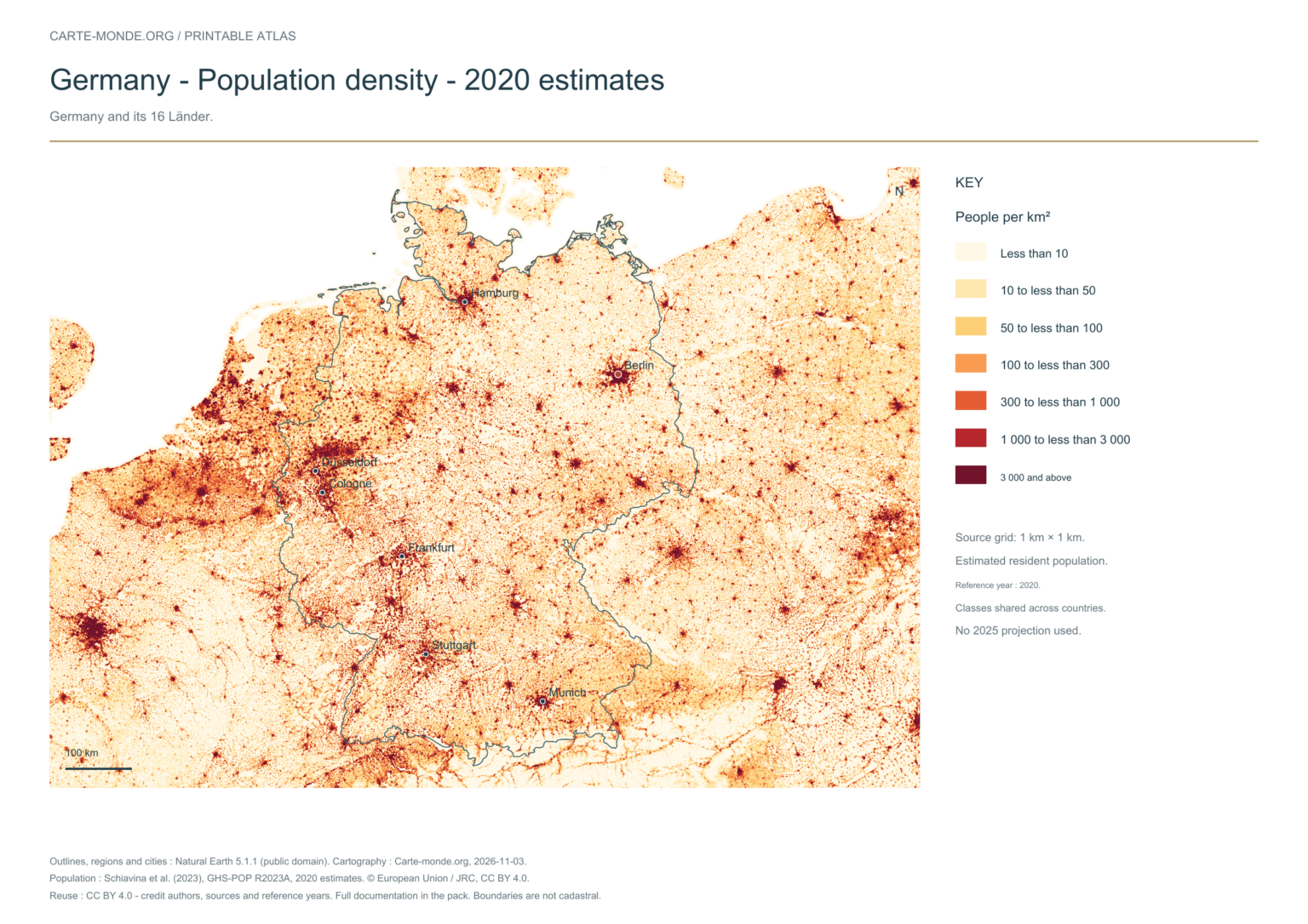
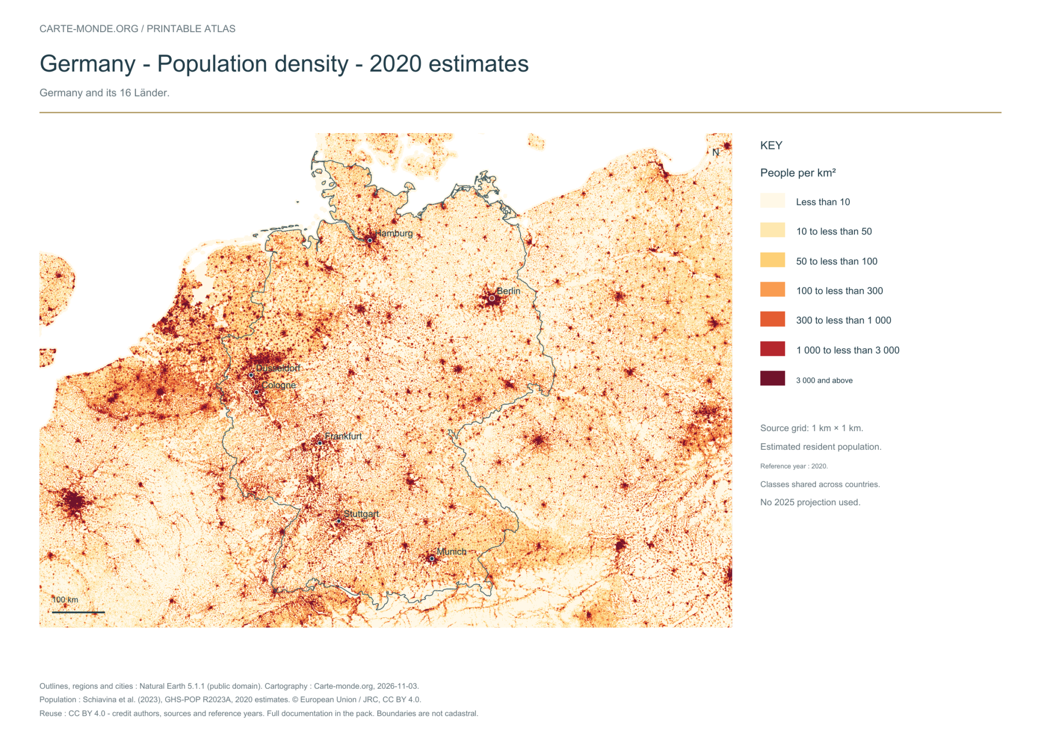
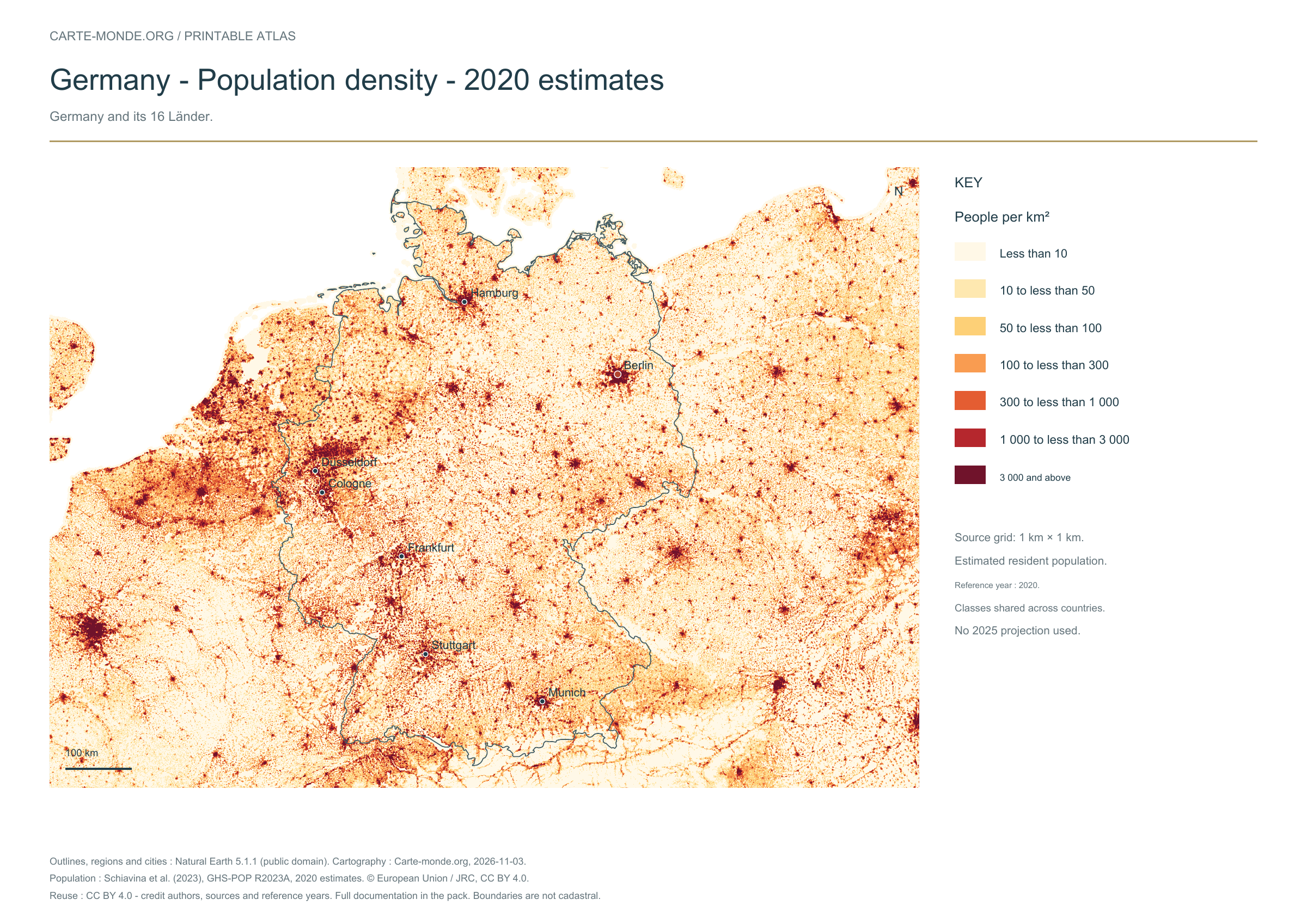
Locate the 16 Länder and main cities of Germany, then explore the terrain and estimated population distribution in 2020. Five labeled maps are available: divisions and cities, location in Europe, elevations, shaded relief and density. For an exercise to complete, see the six blank maps too.
Our five maps are now labeled in English. Maps from other publishers retain their original language.
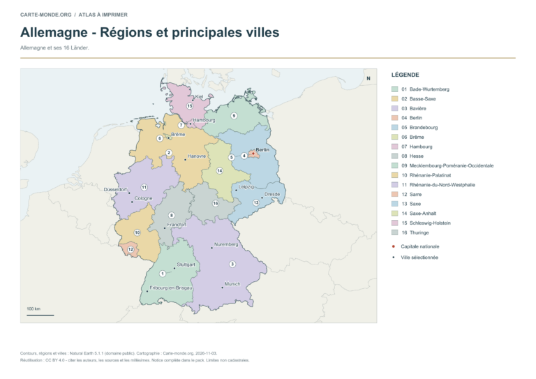
The 16 Länder are identified by numbers and a key. The map adds 14 cities selected for their importance and distribution across the country, with the capital highlighted in colour. This selection is not a complete inventory of cities.
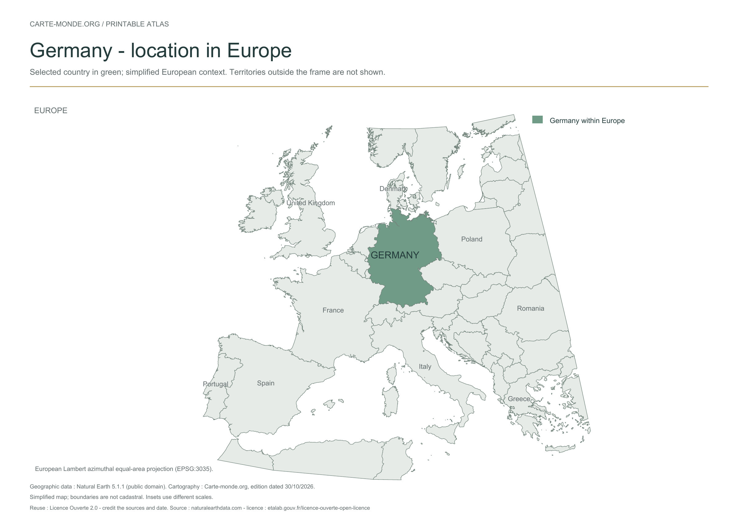
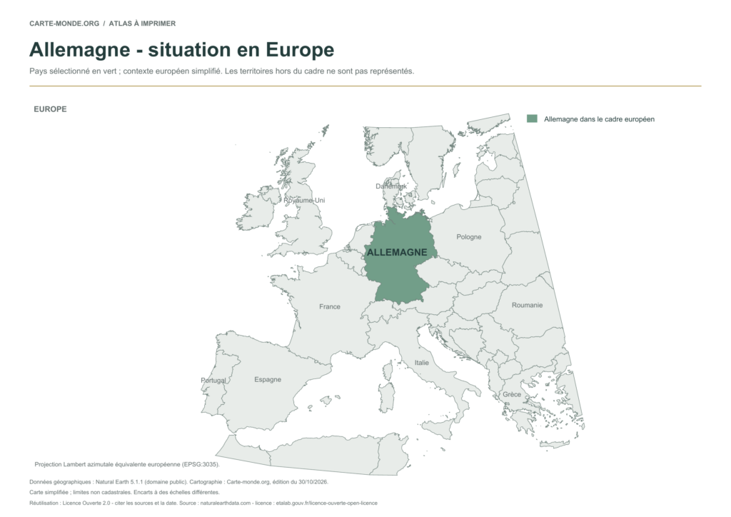
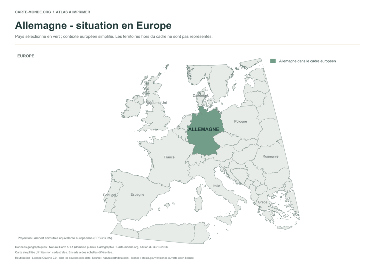
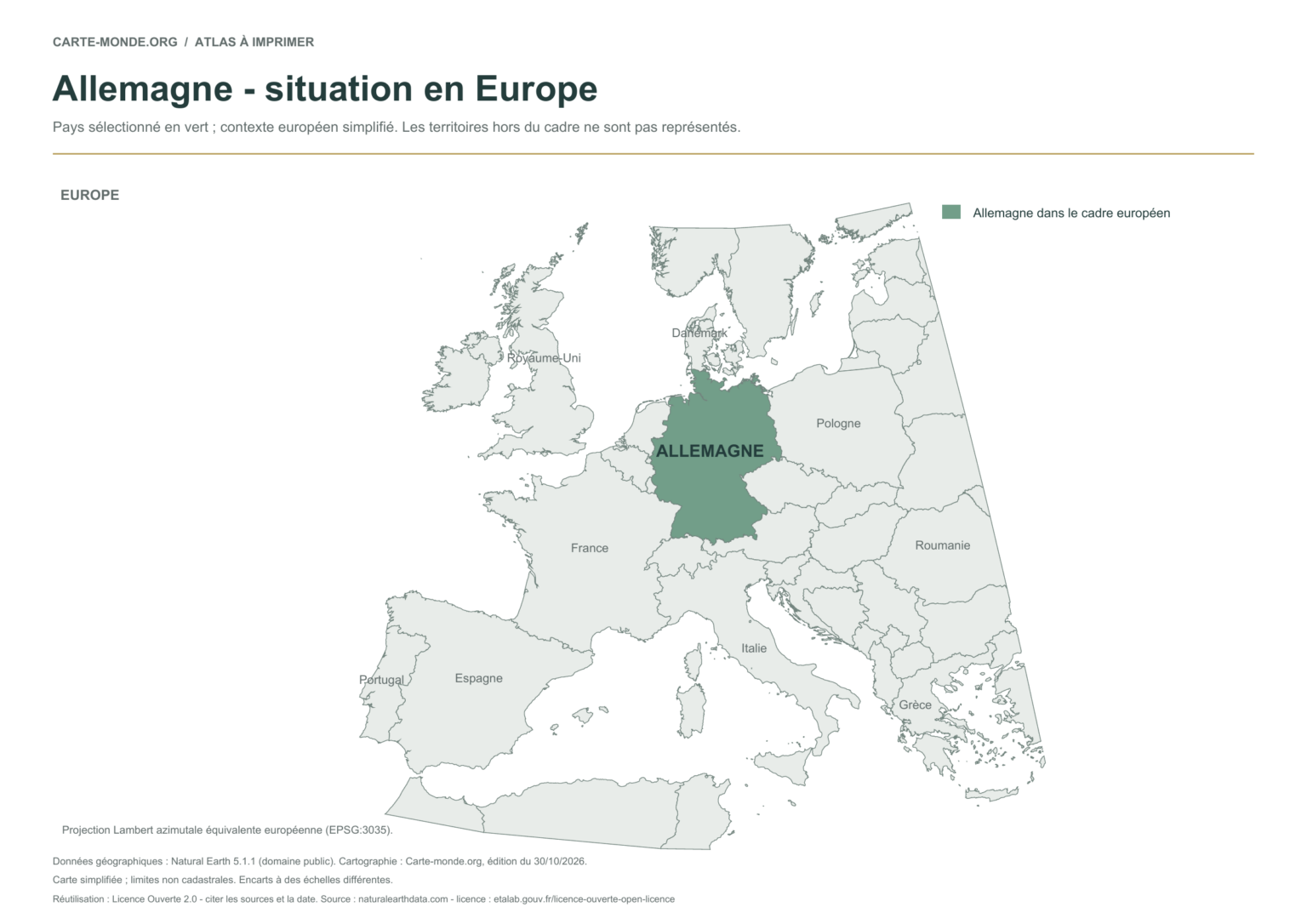
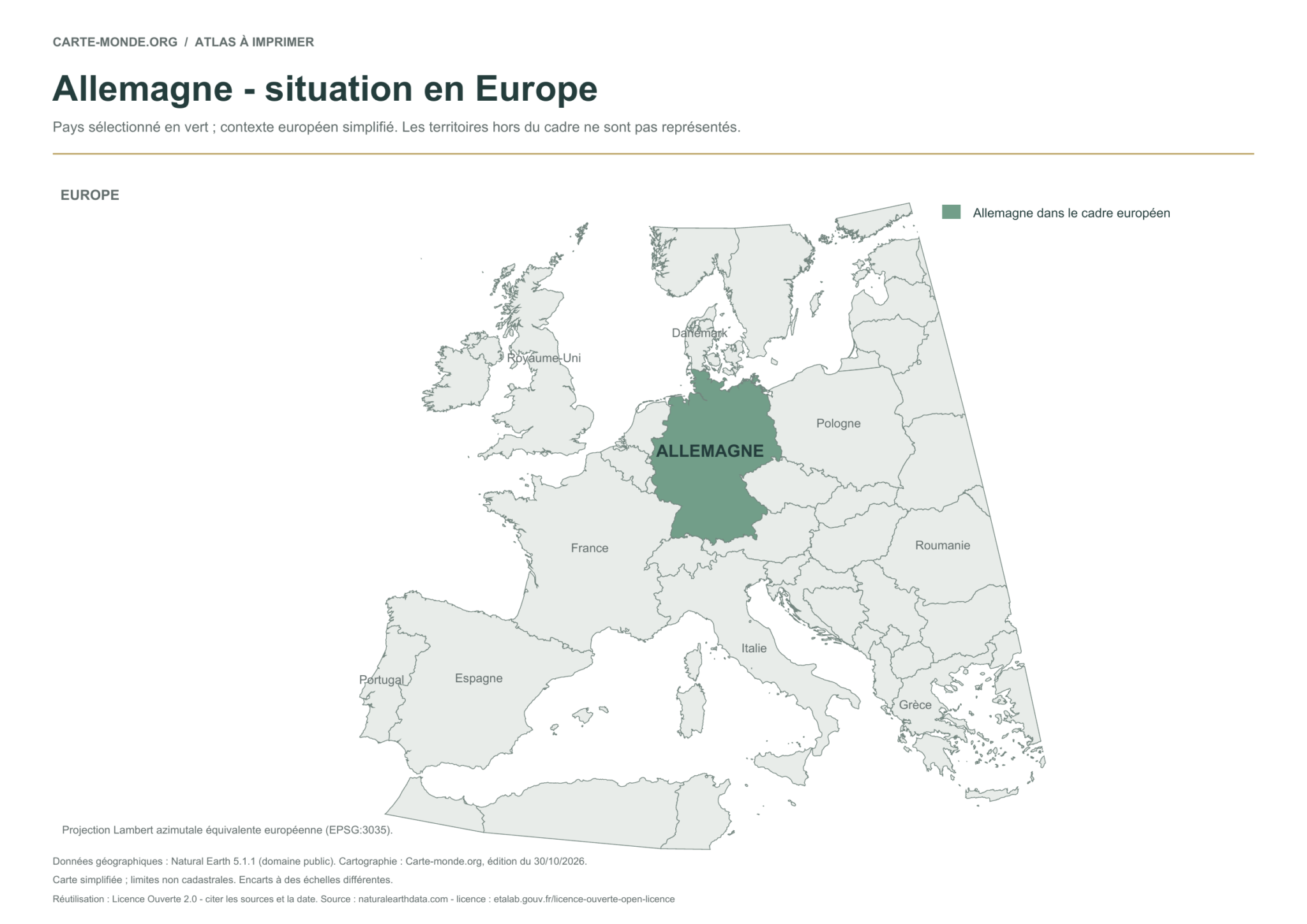
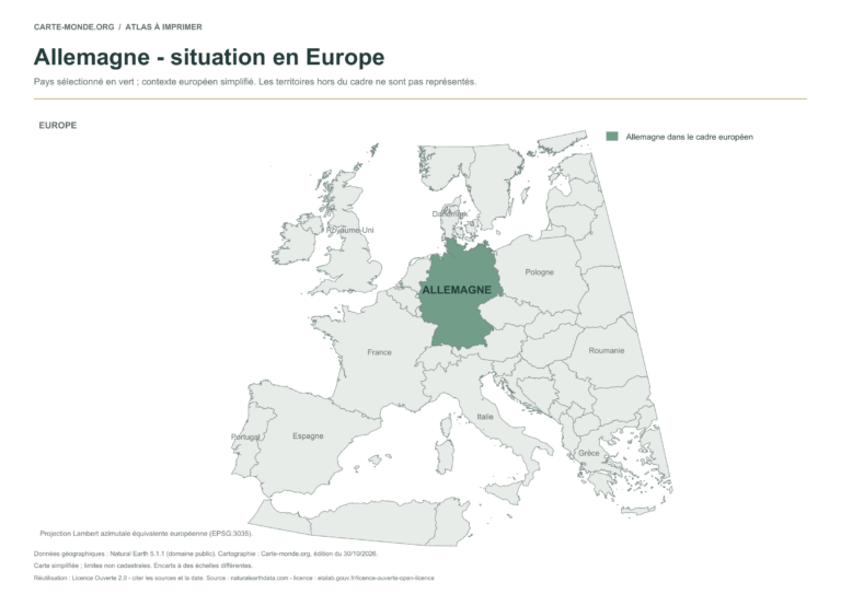
The previously published location map is retained unchanged: the country is highlighted in a simplified European map extent. Territories outside the frame are not shown.
Raster base map, cities, rivers and lakes: Natural Earth, public domain. Other boundary credits and licences are retained in the pack. Cartographic work CC BY 4.0; ODbL-derived data retains its licence. No topographic accuracy is claimed.
Territory, data and selection of names
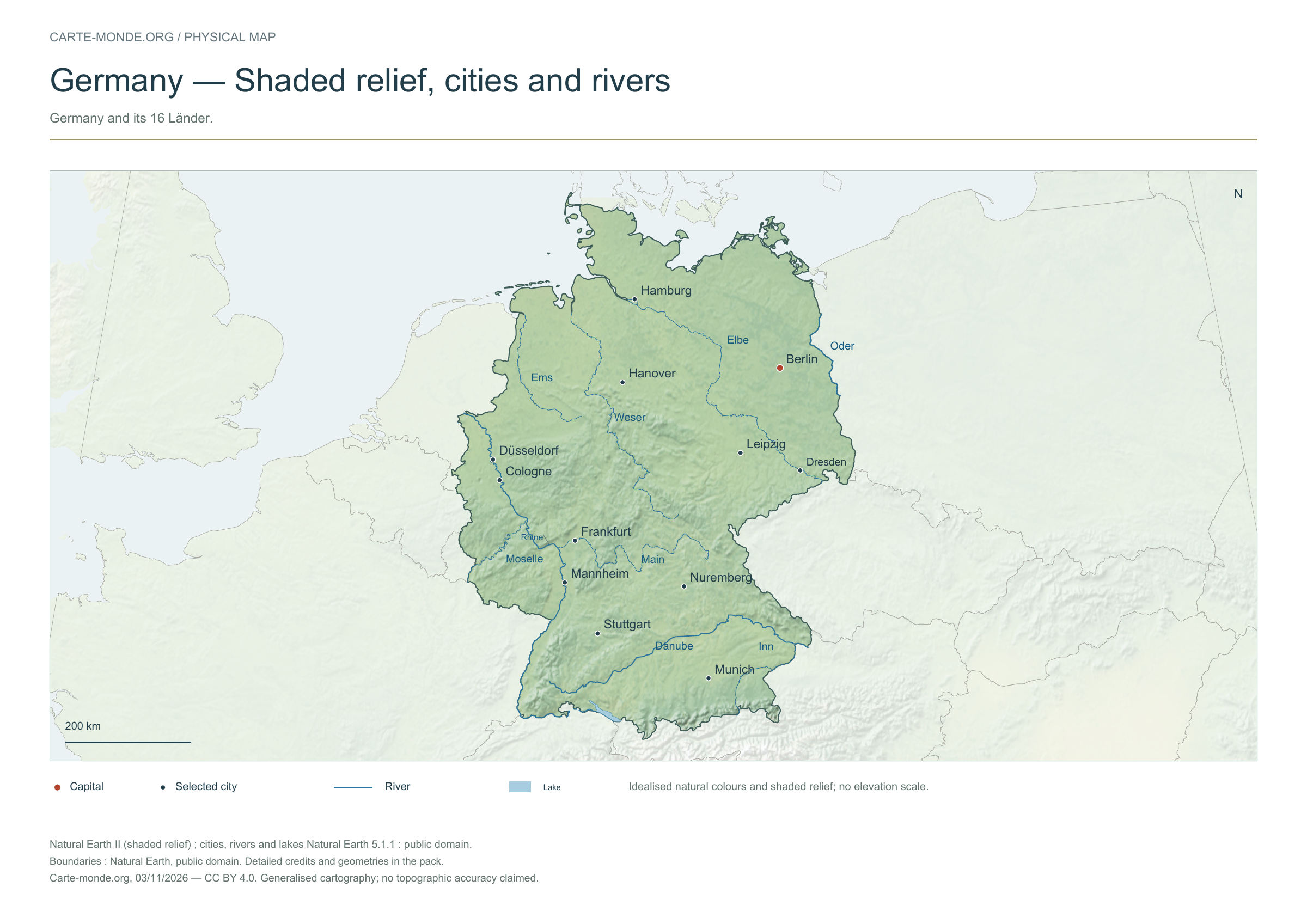
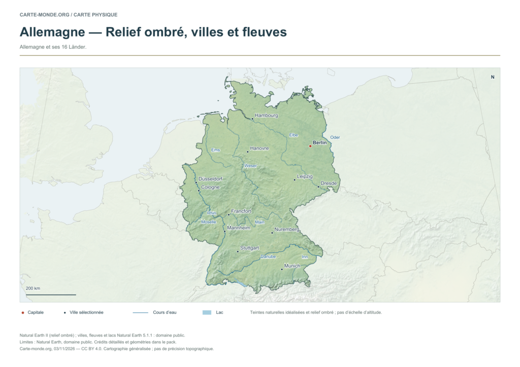
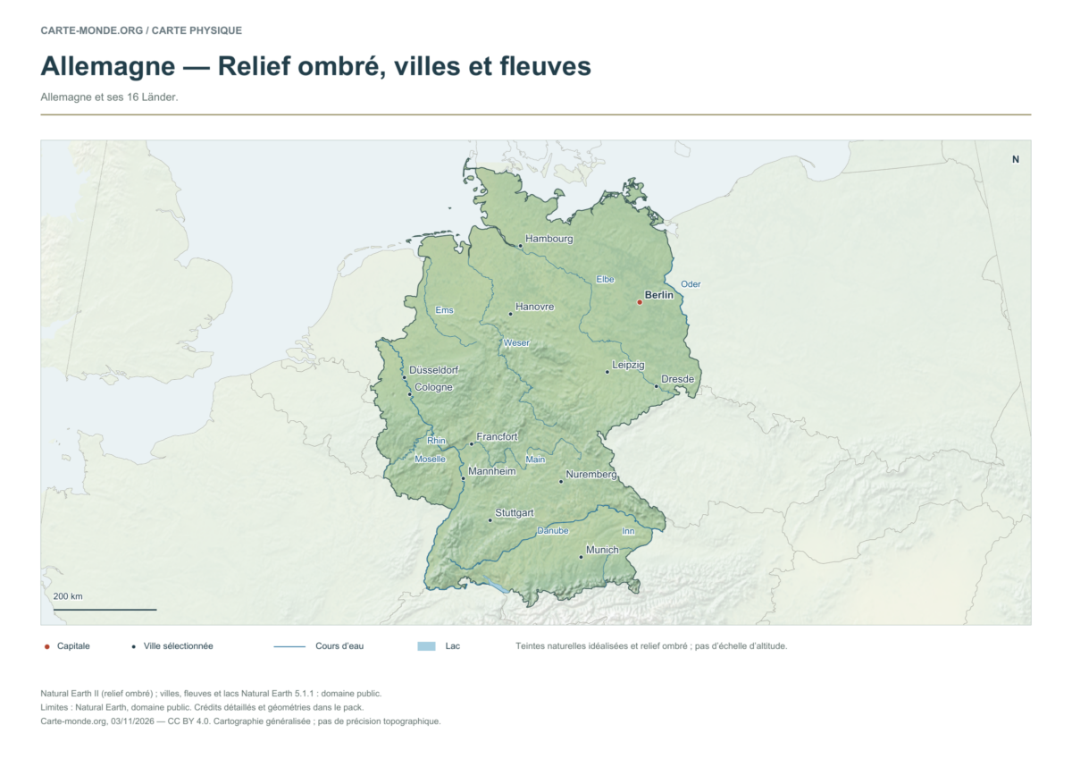
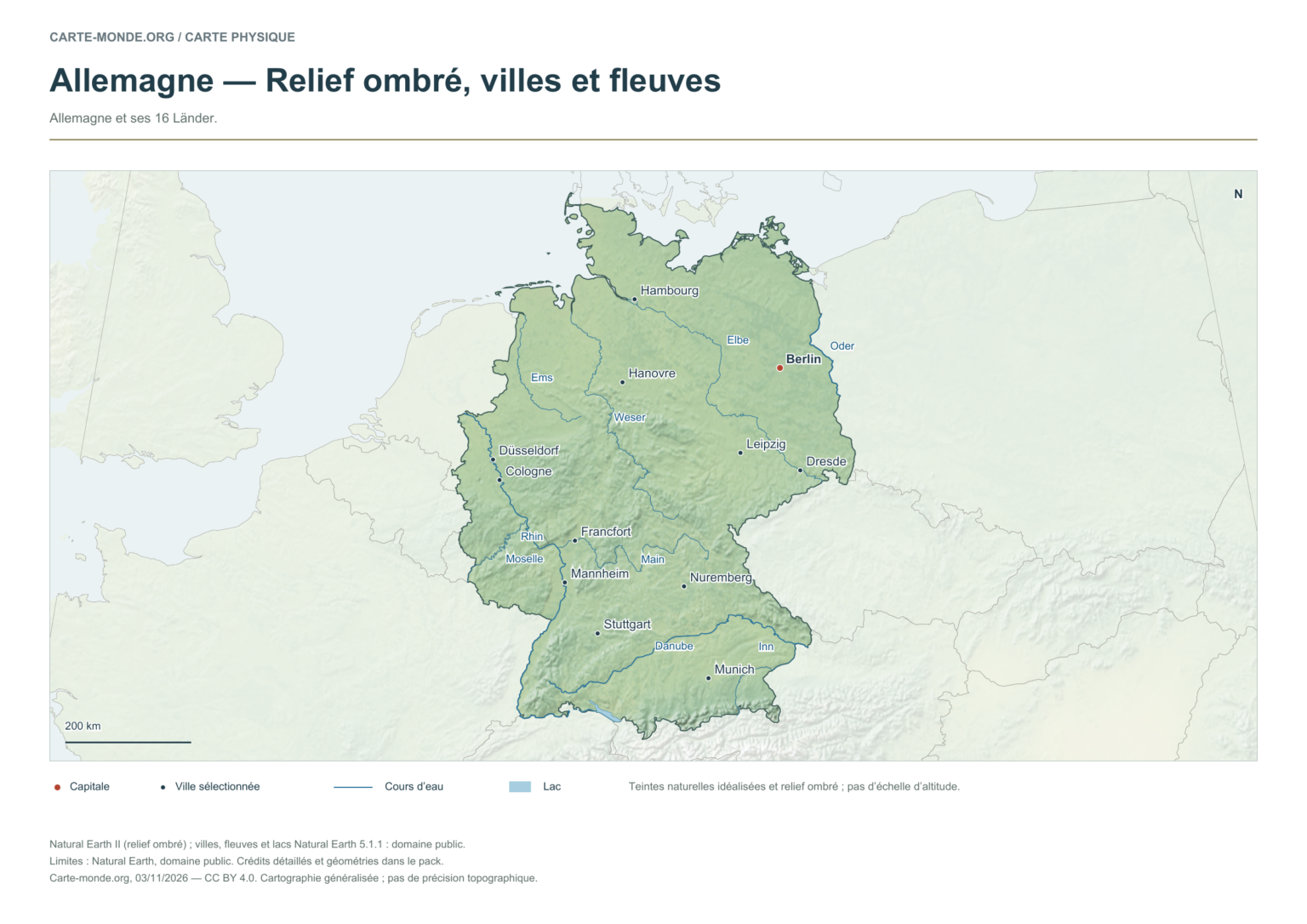
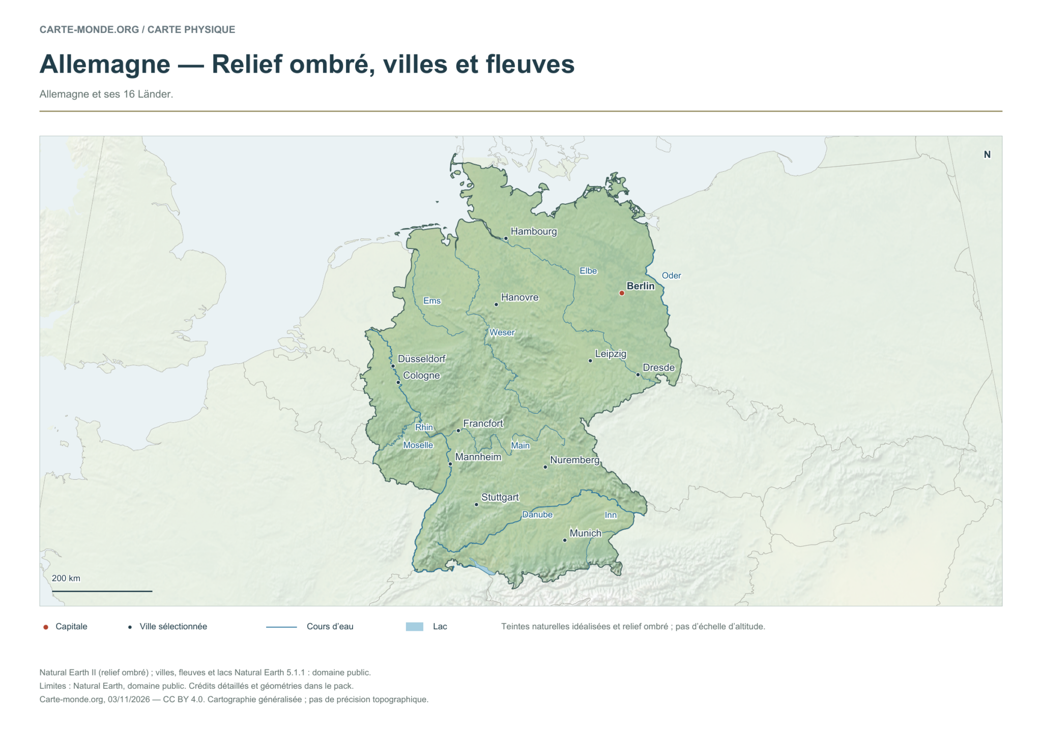
Germany and its 16 Länder.
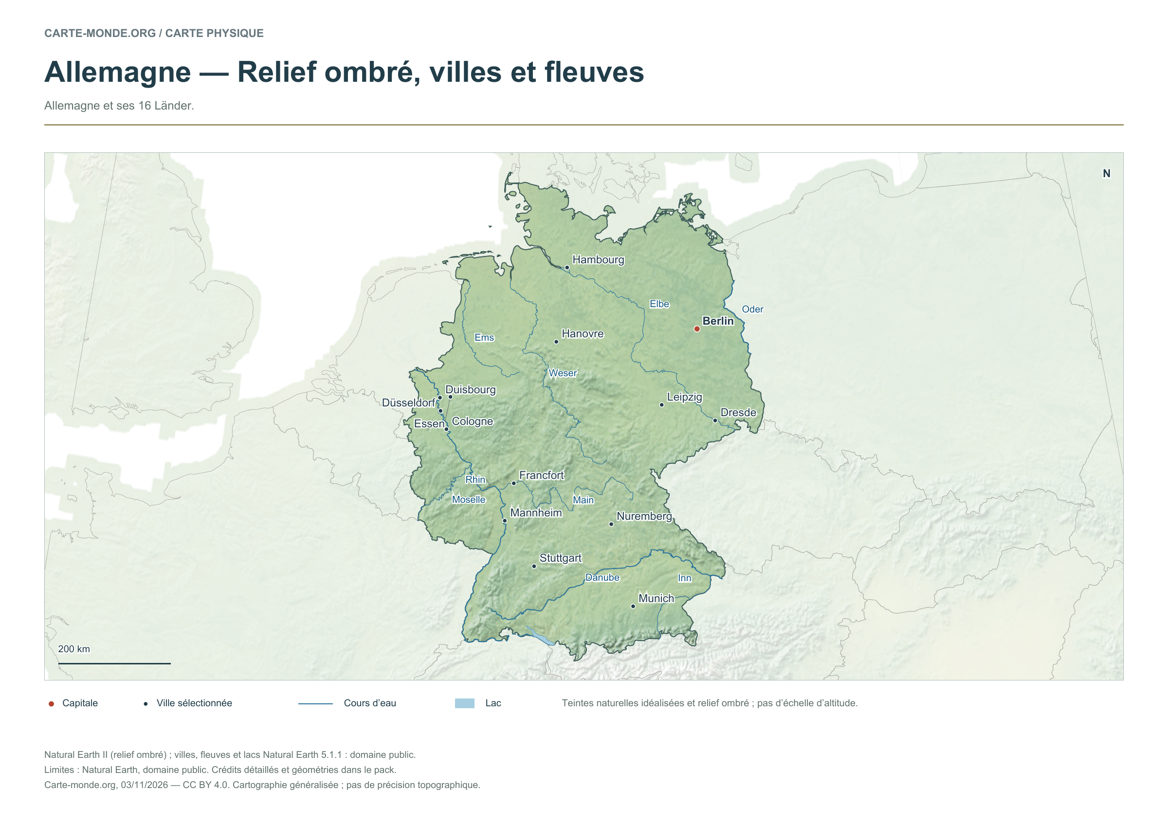
Natural Earth II shaded relief base map, 12 selected cities. Named rivers: Danube, Elbe, Ems, Inn, Main, Moselle, Oder, Rhin, Weser.
The colours represent idealised natural cover; they do not correspond to elevation classes. This global background remains generalised, particularly for small states.
Carte-monde.org · November 2026
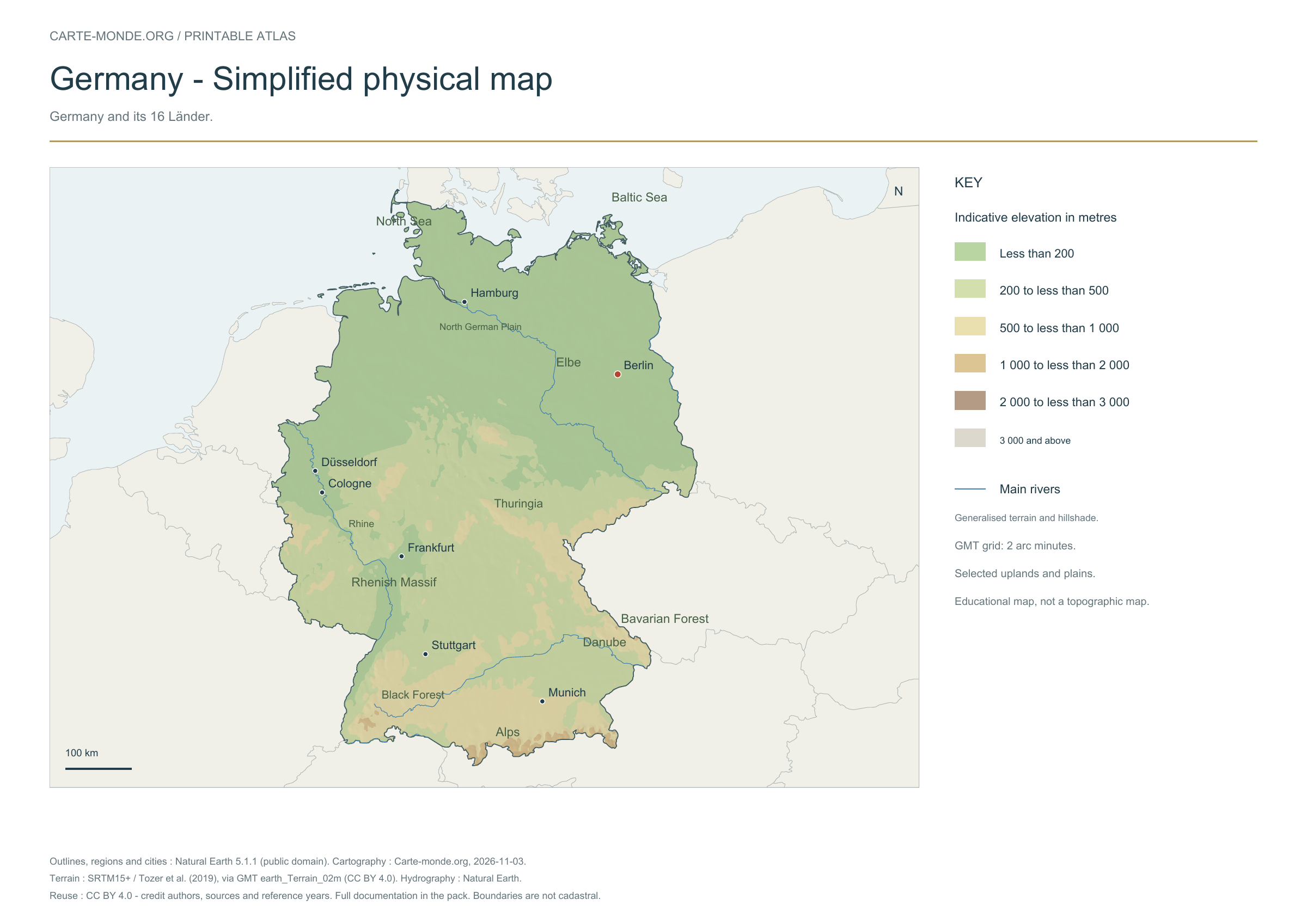
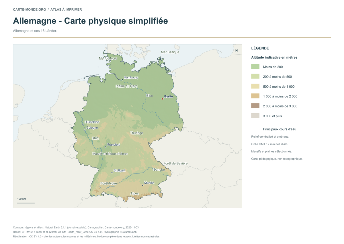
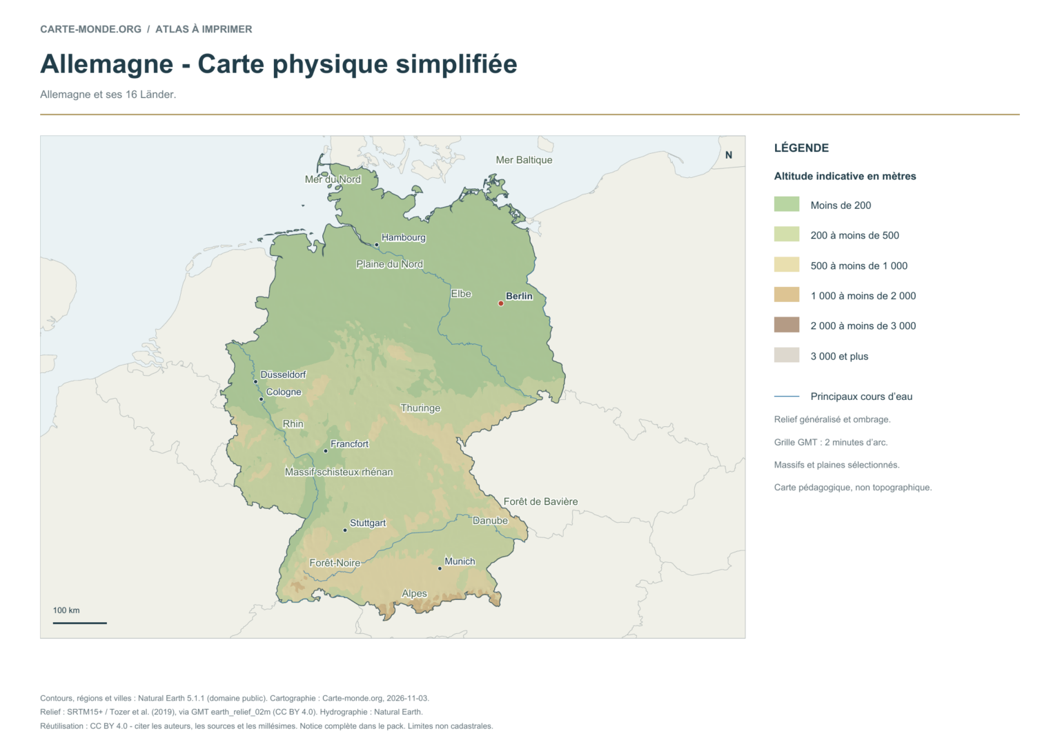
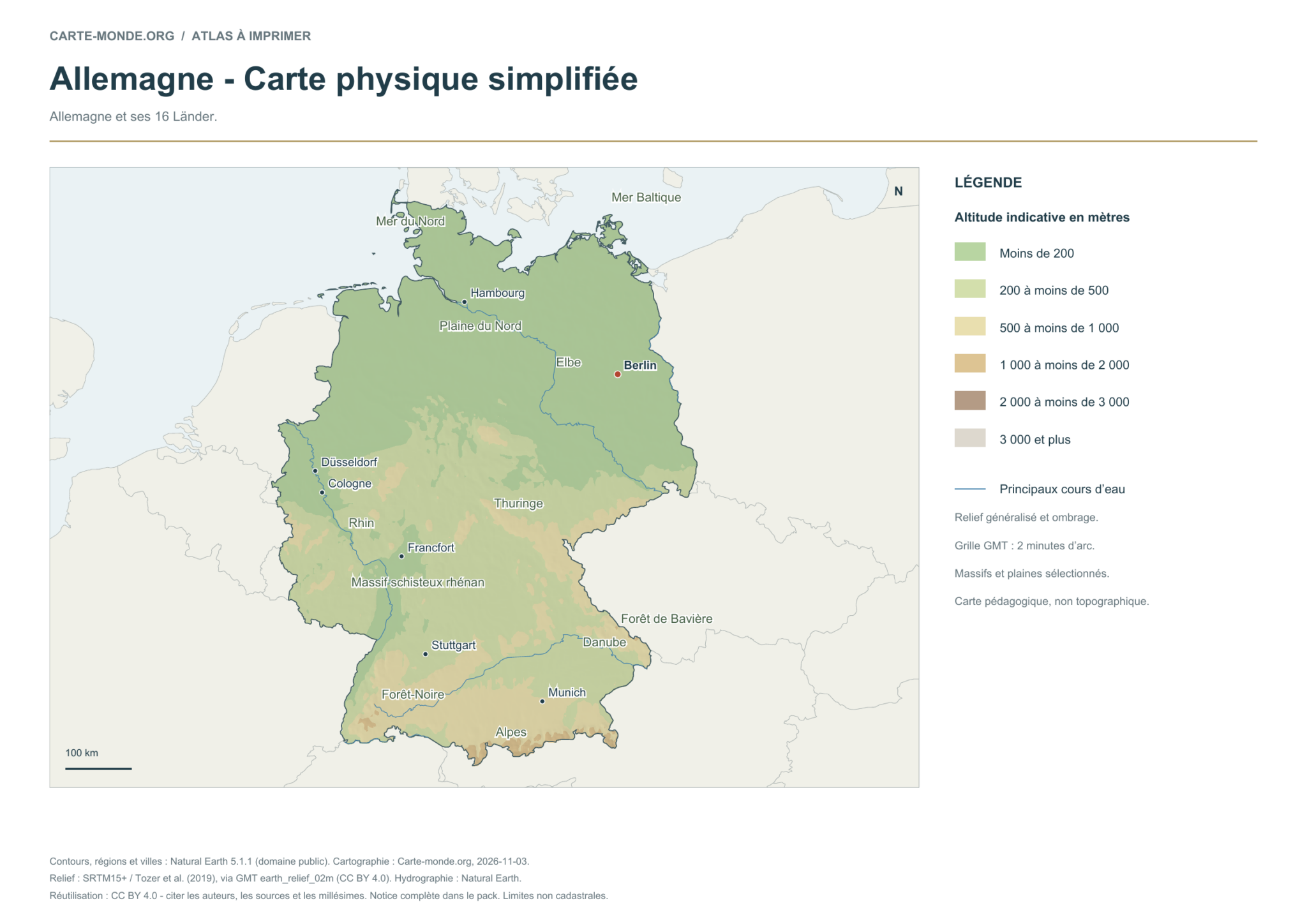
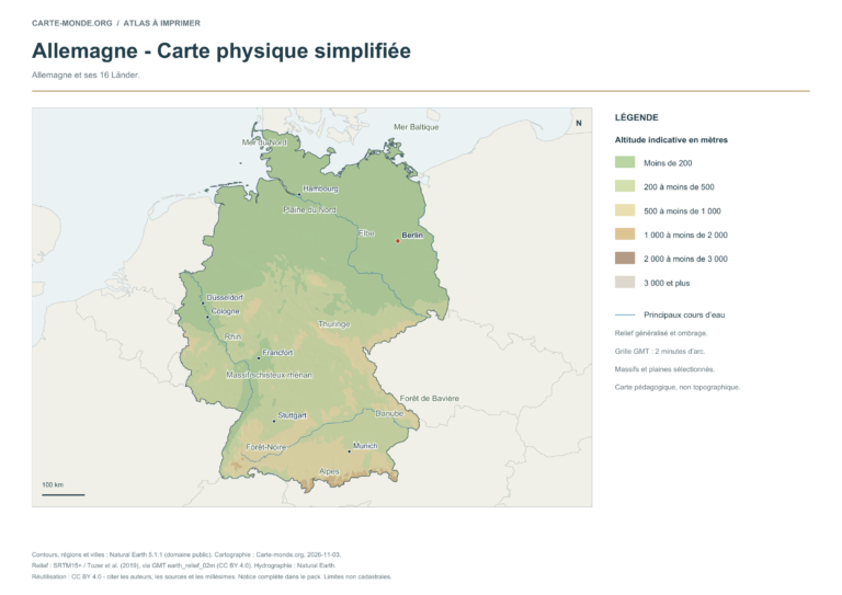
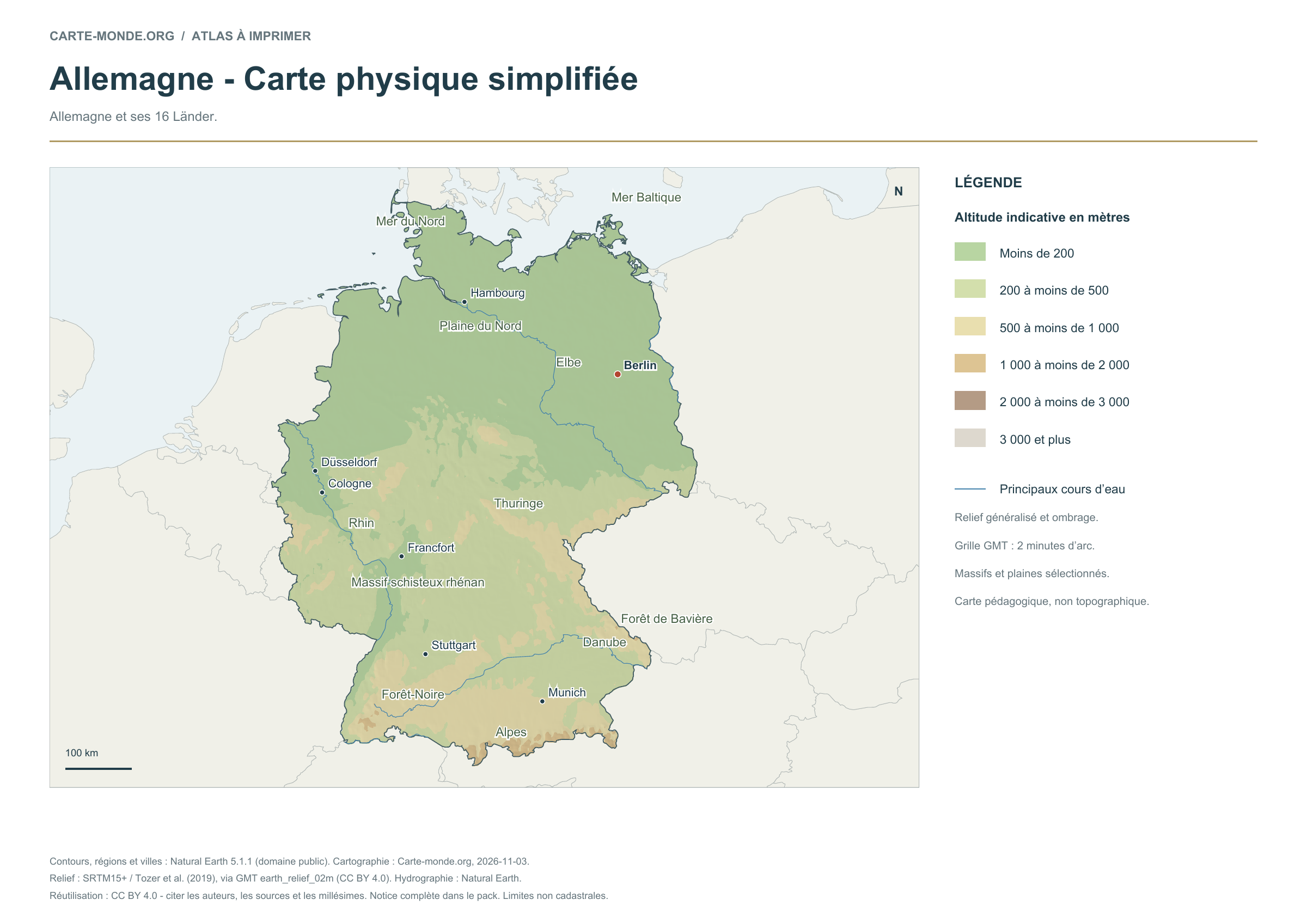
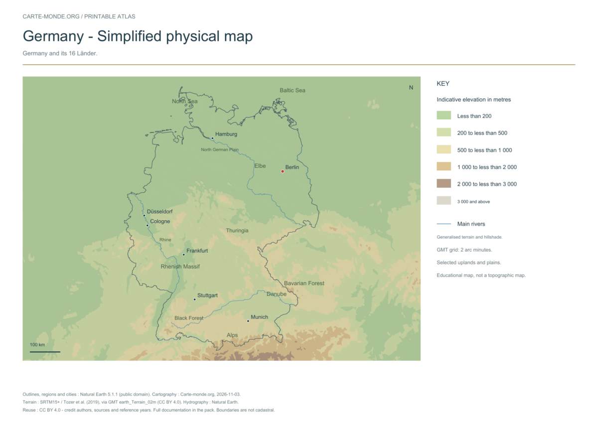
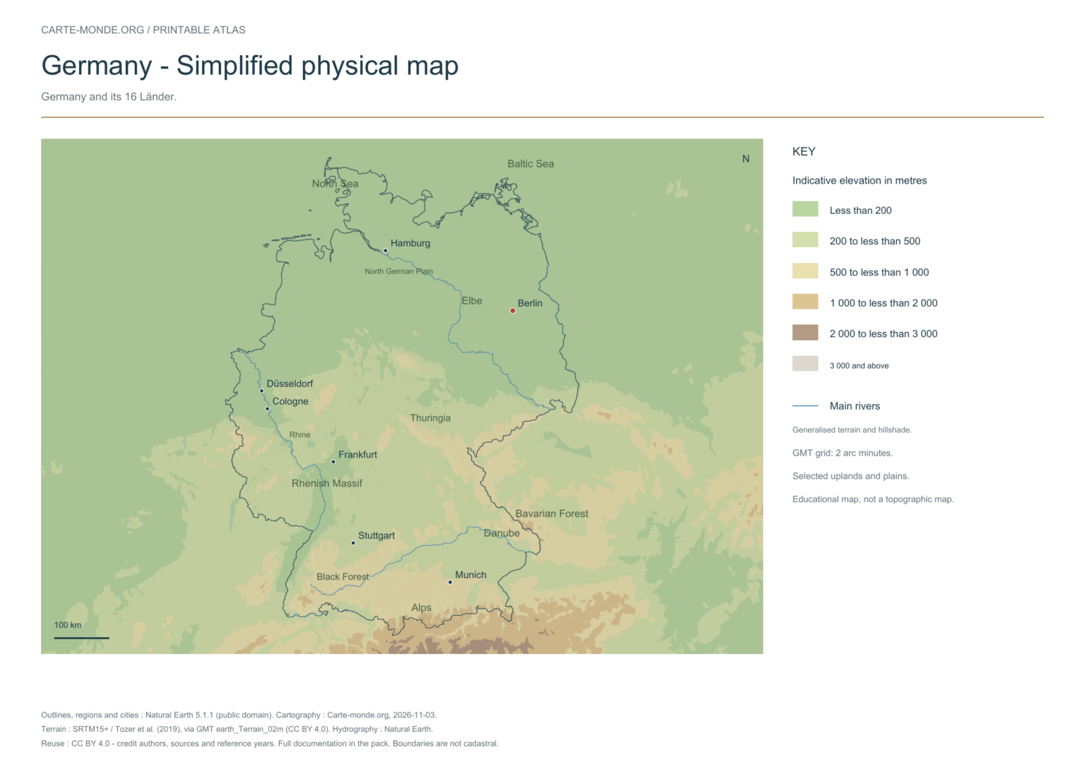
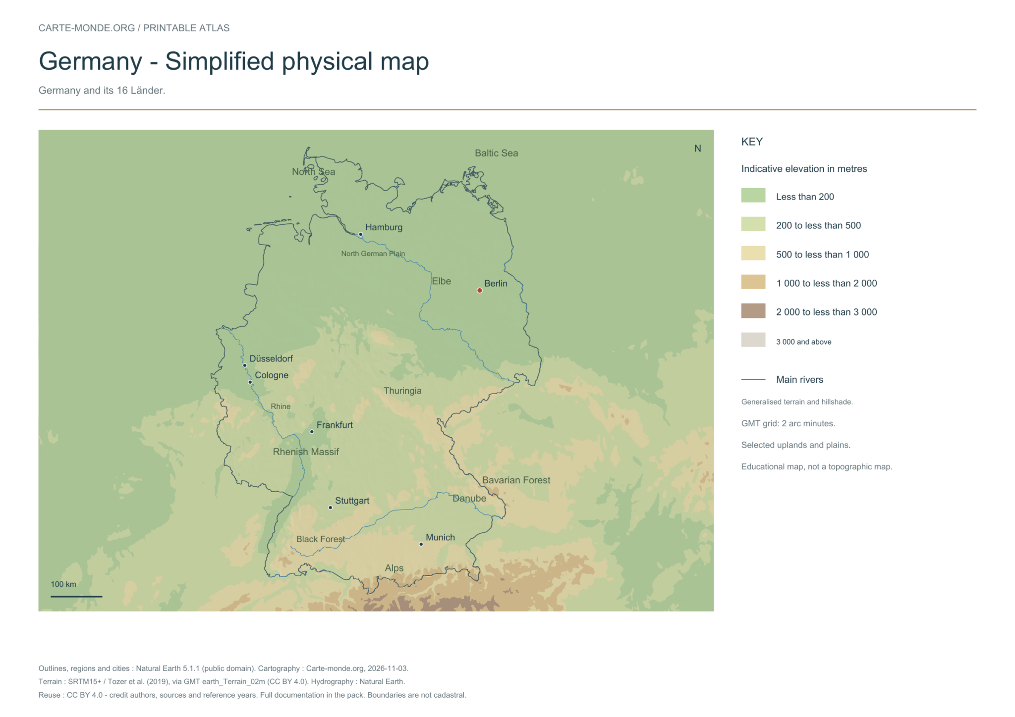
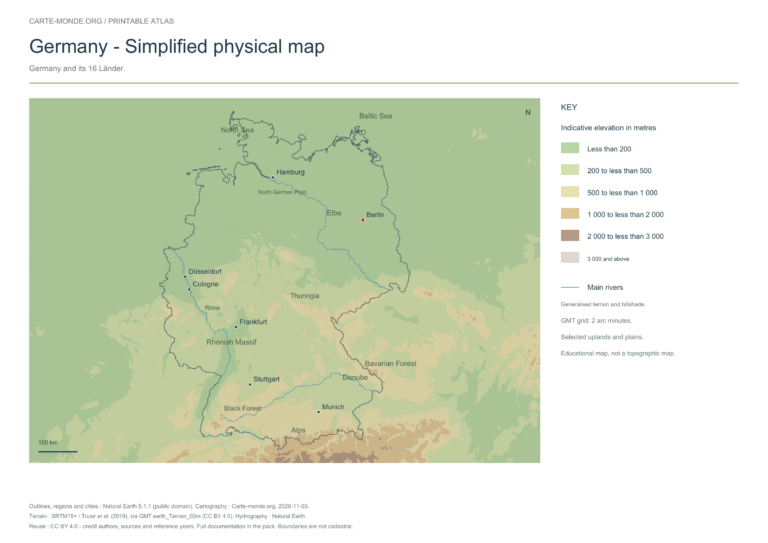
Simplified elevations
Elevation colours, shaded relief, major mountain ranges, plains and waterways. The relief is deliberately generalised for a national overview; this document does not replace a topographic map.
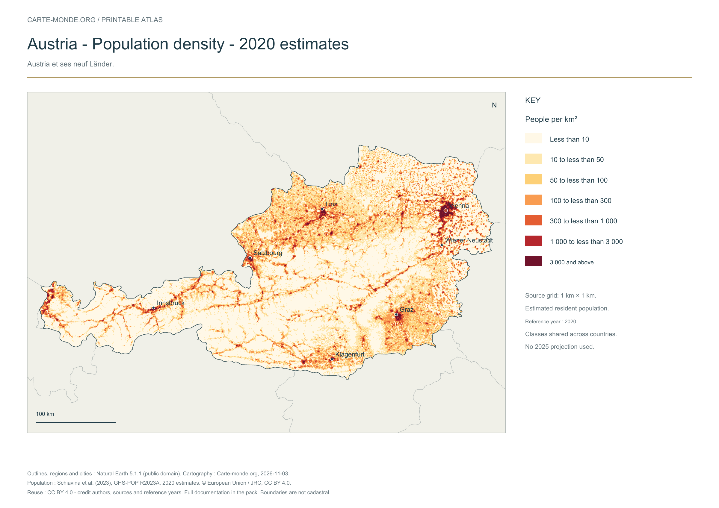
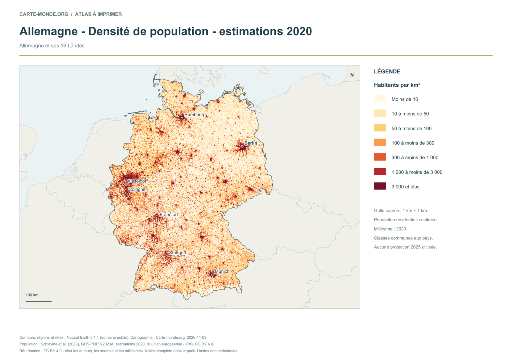
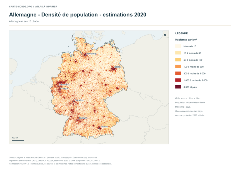
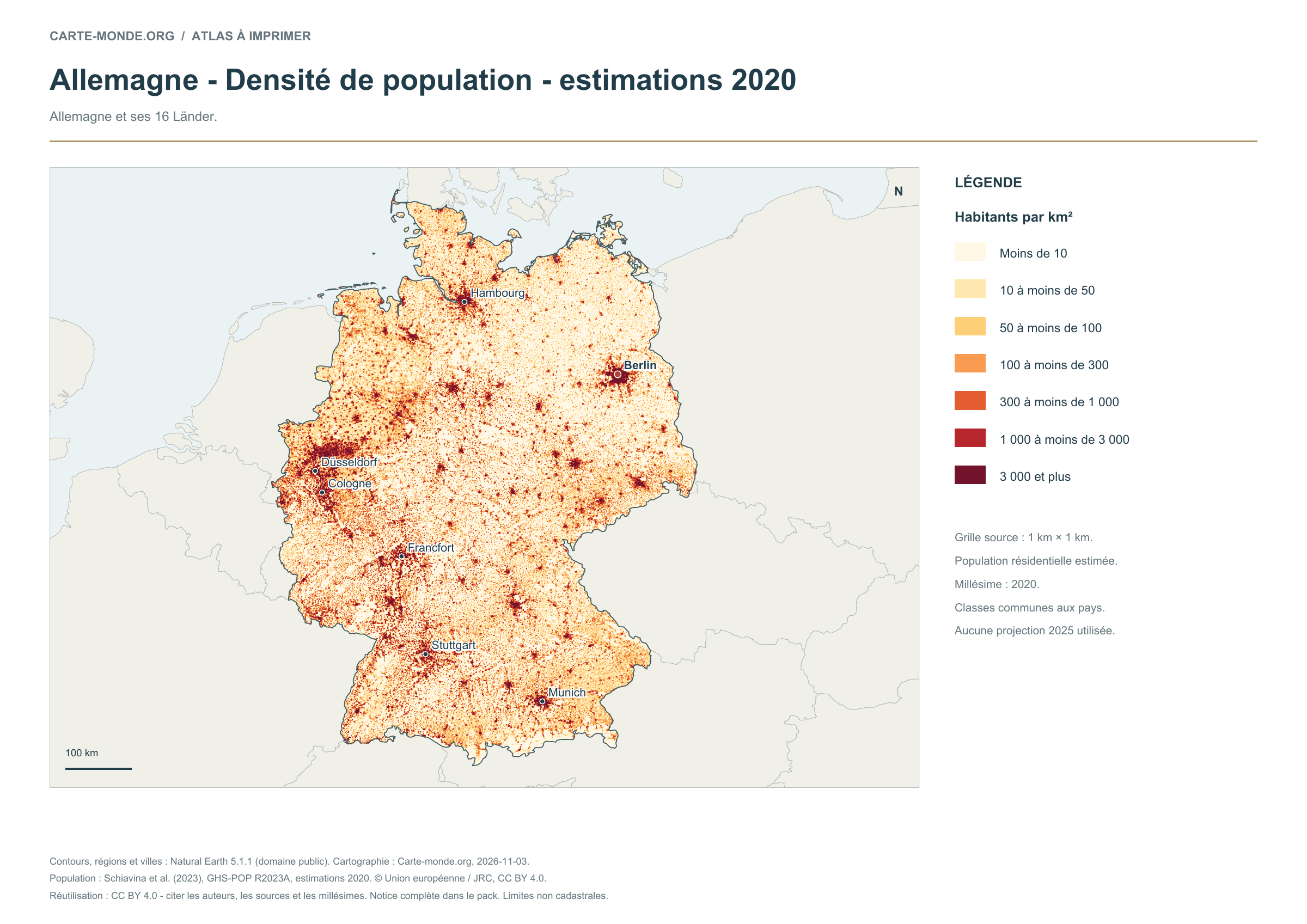
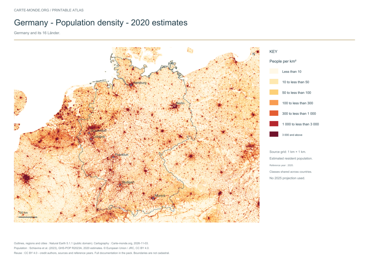
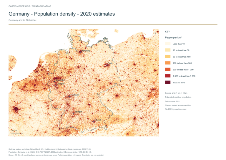
Estimated residential population distribution in 2020, on a source grid of 1 km². Inhabitants/km² classes are shared across countries. These are spatial estimates, with no 2025 projection.
The data represents estimated residential population in 2020, on a 1 km² source grid. The document’s creation date does not change this reference year.
The five in-house maps in one pack
Regions and cities, location in Europe, simplified elevations, 2020 population density and shaded relief: five A4 PDFs, their PNGs and SVGs, with sources and licences.
A4 PDF, PNG and SVG, with source notes. Text and linework are vector-based; terrain and density use images embedded in the PDFs and SVGs. The October location map is reused without uploading it again.
These existing maps are provided with their own credits and licences. Originals remain in their original language; previews are converted or reduced for display.
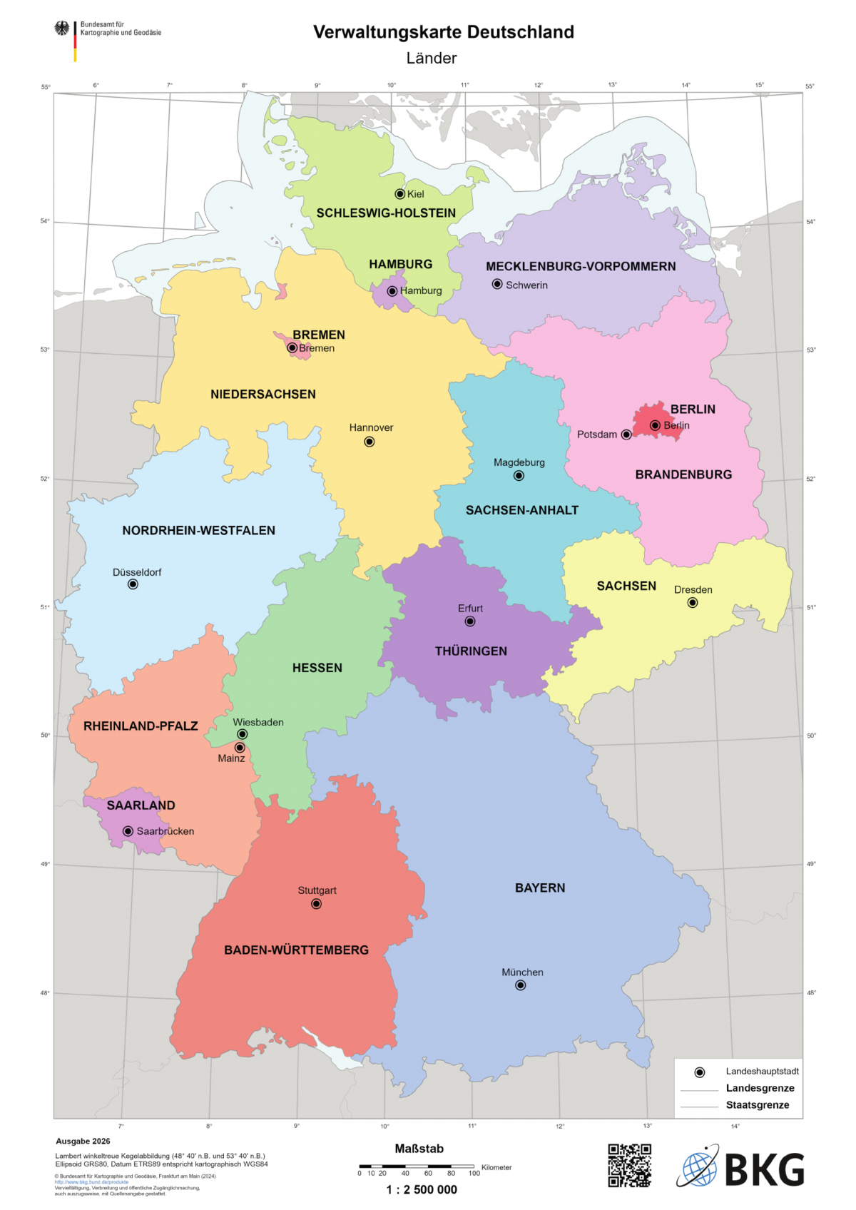
2026 edition; status as of 31 December 2025 according to the BKG record · German
The Länder and their capitals — BKG
Official map at 1:2 500 000, intended for A3 printing. Names of the Länder and regional capitals. Original unchanged; preview converted to PNG.
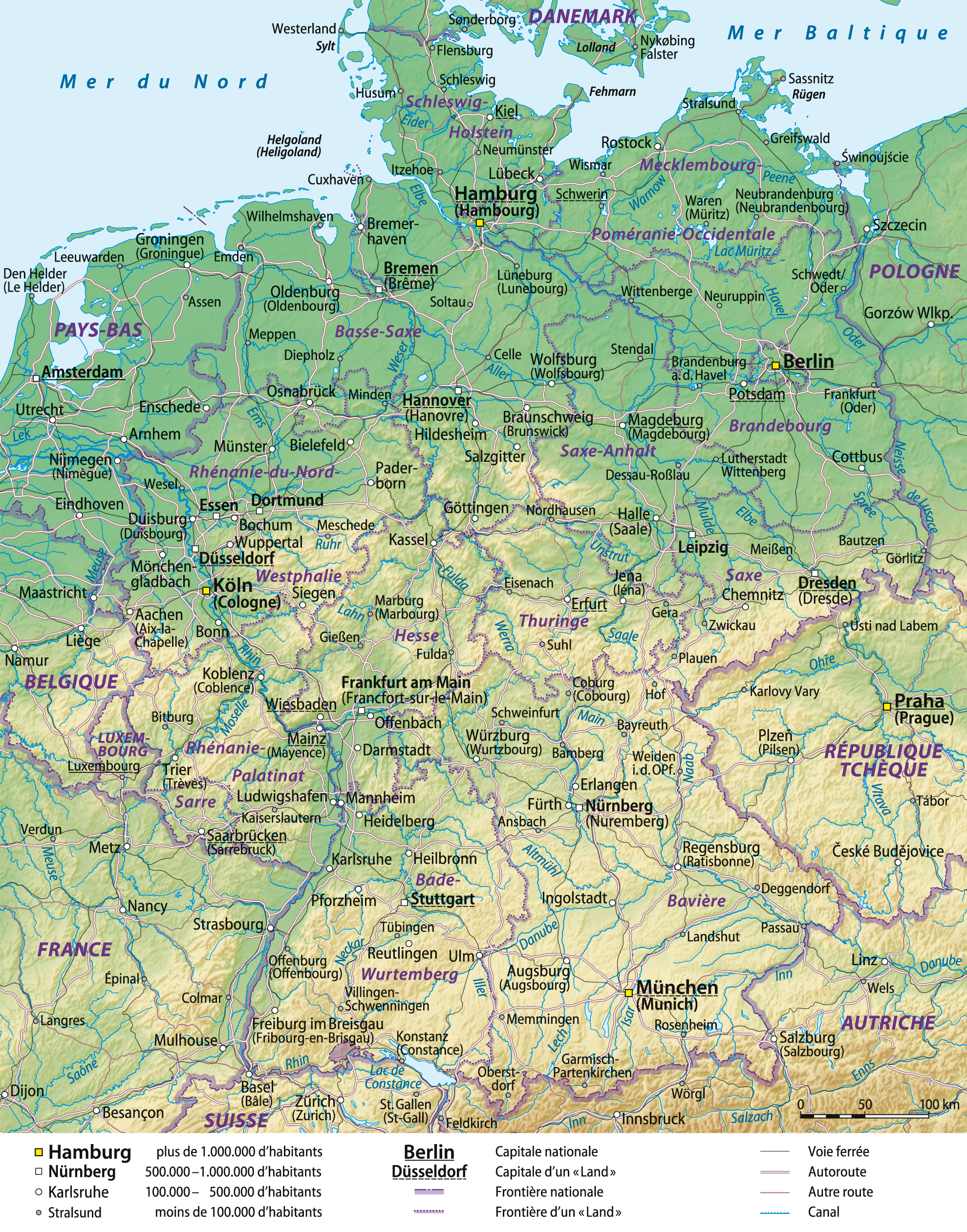
Terrain, cities and rivers named in French. Older reference map, retained for its geographical richness; it does not replace the current administrative map. Unchanged original; reduced preview. Adaptations remain under CC BY-SA 3.0.
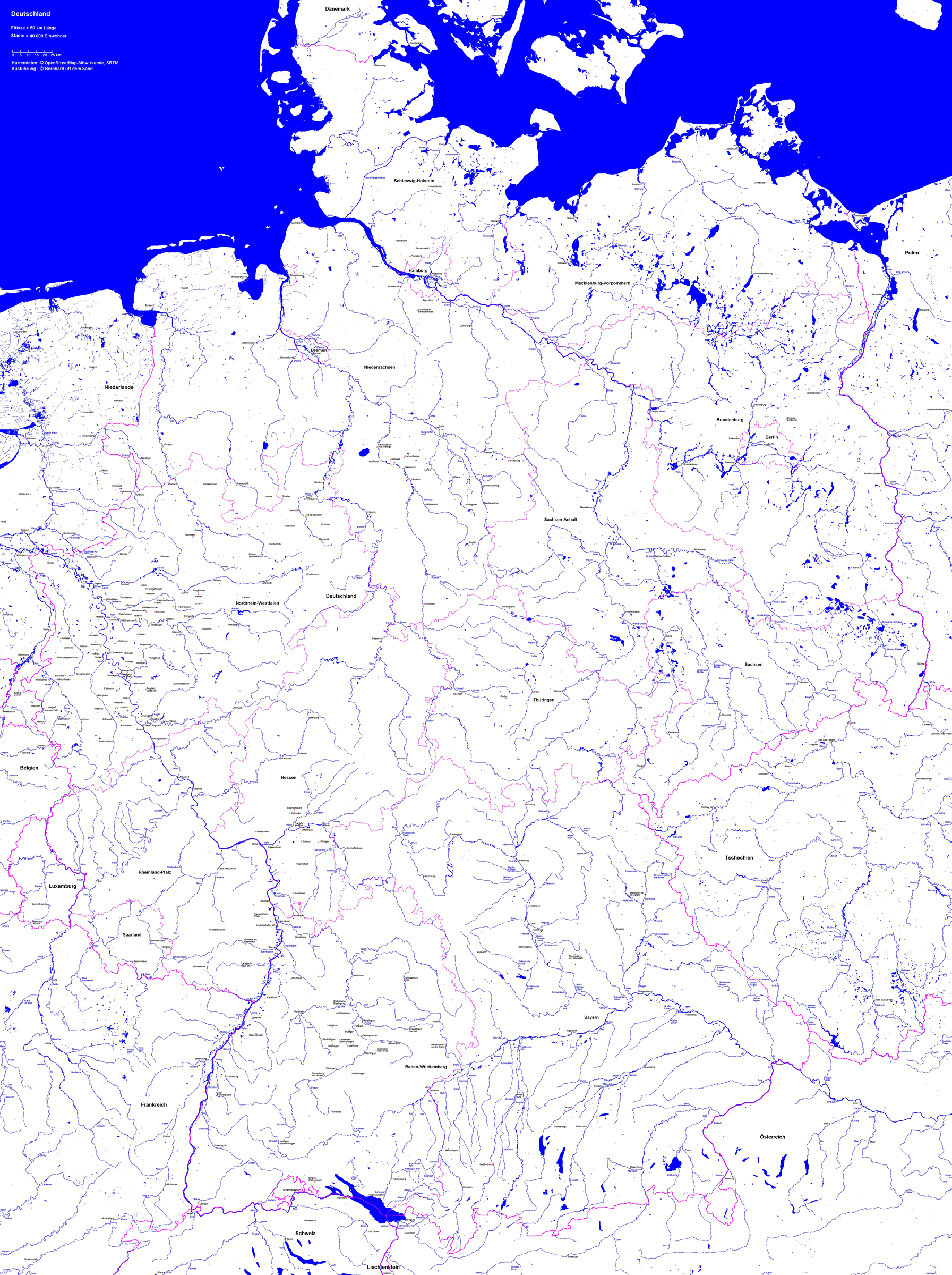
Detailed map of rivers longer than 50 km and selected cities. Original unchanged; reduced preview. Adaptations remain under CC BY-SA 4.0. OSM data under ODbL: https://www.openstreetmap.org/copyright.
The files from the original collection, the first administrative map and the October pack are preserved at their old URLs. Access is grouped in the archives, with credits and notes about their currency.
Choose regions and cities for territorial organisation, the location map for geographical position, relief for major natural features and density for population distribution. The detailed maps provide more names and landmarks.
Choose the A4 PDF for printing. For an image to insert in a document, use the PNG; licences and data years are stated with each map.
Physical map: SRTM15+ / Tozer et al. (2019), reference publication, grid GMT earth_relief_02m, derived from SRTM15+V2.7. Relief smoothed to 2 arc minutes, Natural Earth hydrography; small enclaves are not detailed.
Our three new maps: created by Carte-monde.org, November 2026, under CC BY 4.0, retaining authors, sources, reference years and modification notices. Location in Europe: October 2026 map under Licence Ouverte 2.0, reused unchanged. Full notes accompany the packs.
Detailed maps retain the licenses stated beneath each document. CC BY-SA licenses require adaptations to retain an identical or compatible license. The new Carte-monde.org license does not apply to older files in the collection.
Shaded relief: find the credits and interpretation limitations in the shaded relief map notes. Detailed sources are also included in its pack.
Other maps: sources and reuse
Reference maps by external authors. Each document retains its licence, credits and date. “View map” links open the document on Commons; ZIP buttons provide access to the files kept in this collection.
To reuse a CC BY map, cite its authors, source and licence and indicate any changes. Adaptations of a CC BY-SA map retain the same or a compatible licence. CC0 documents may be reused freely; retaining the source makes them easier to identify. These rights do not make all administrative boundaries current.
Previous collection — original files preservedFlag of Germany
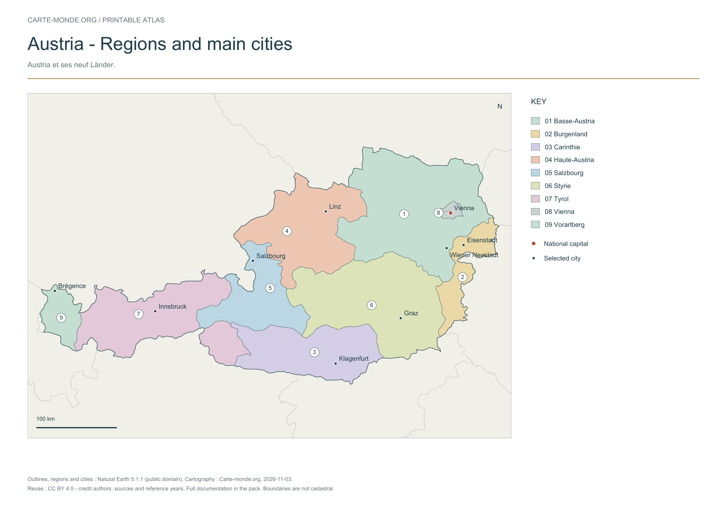
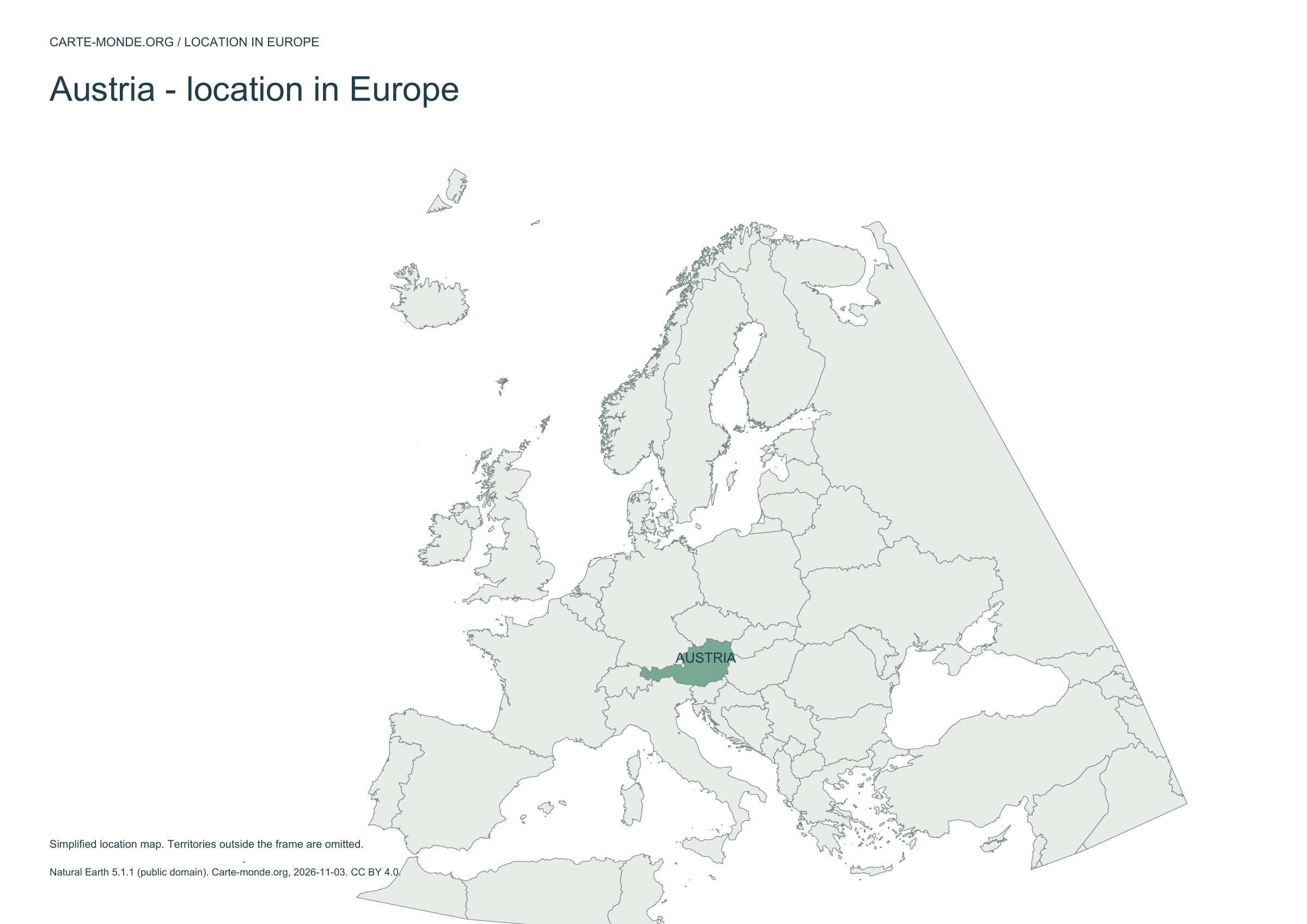
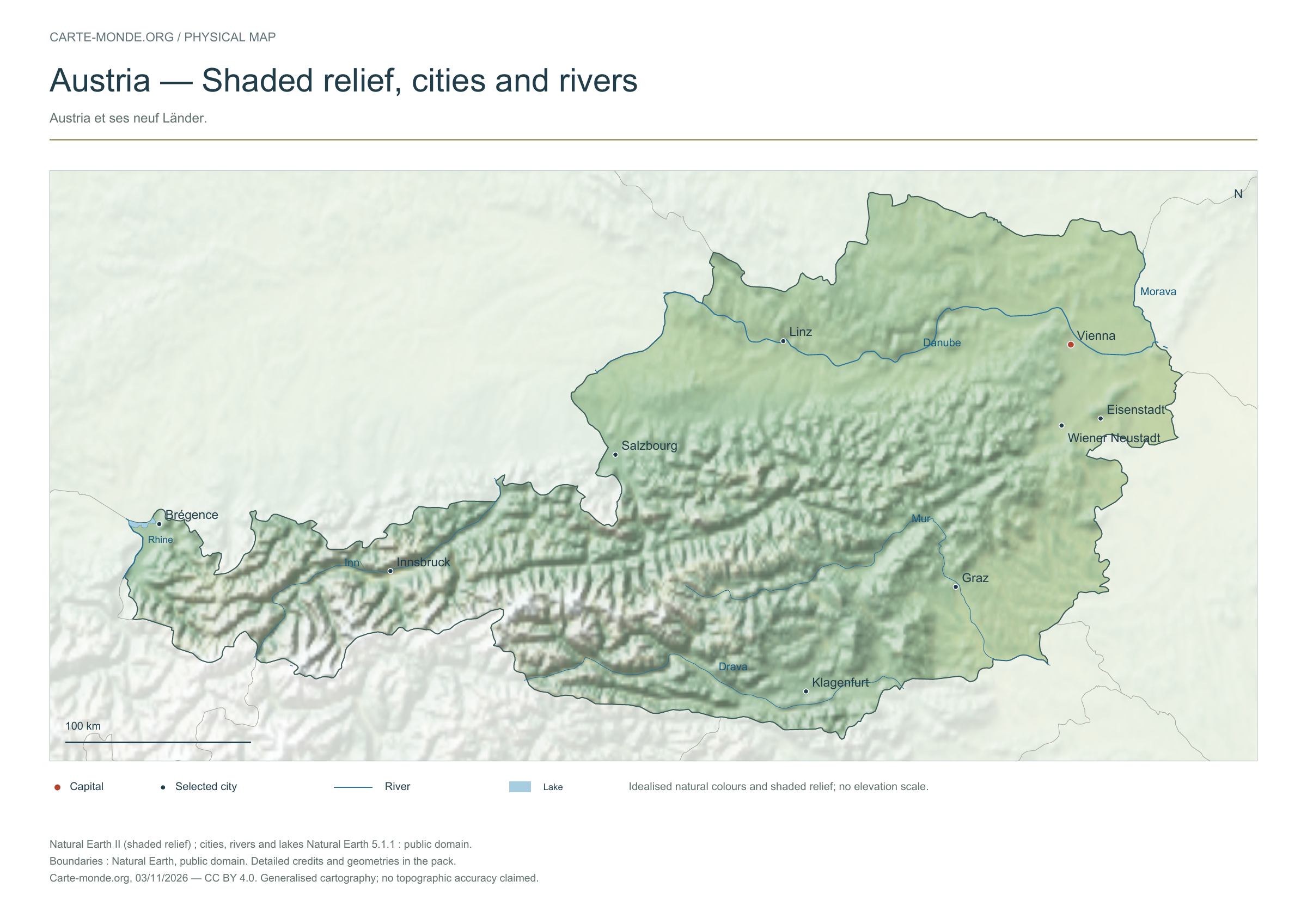
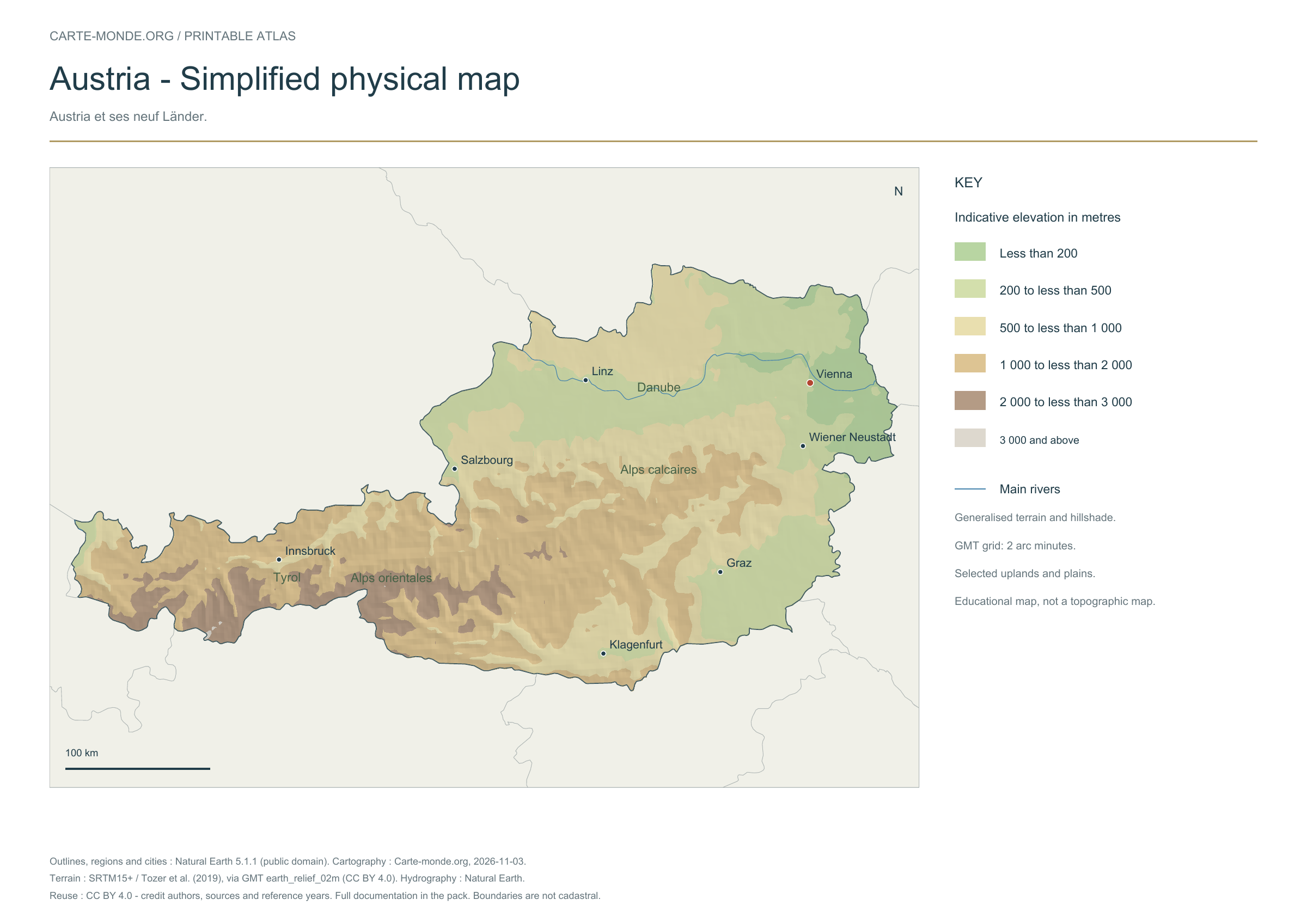
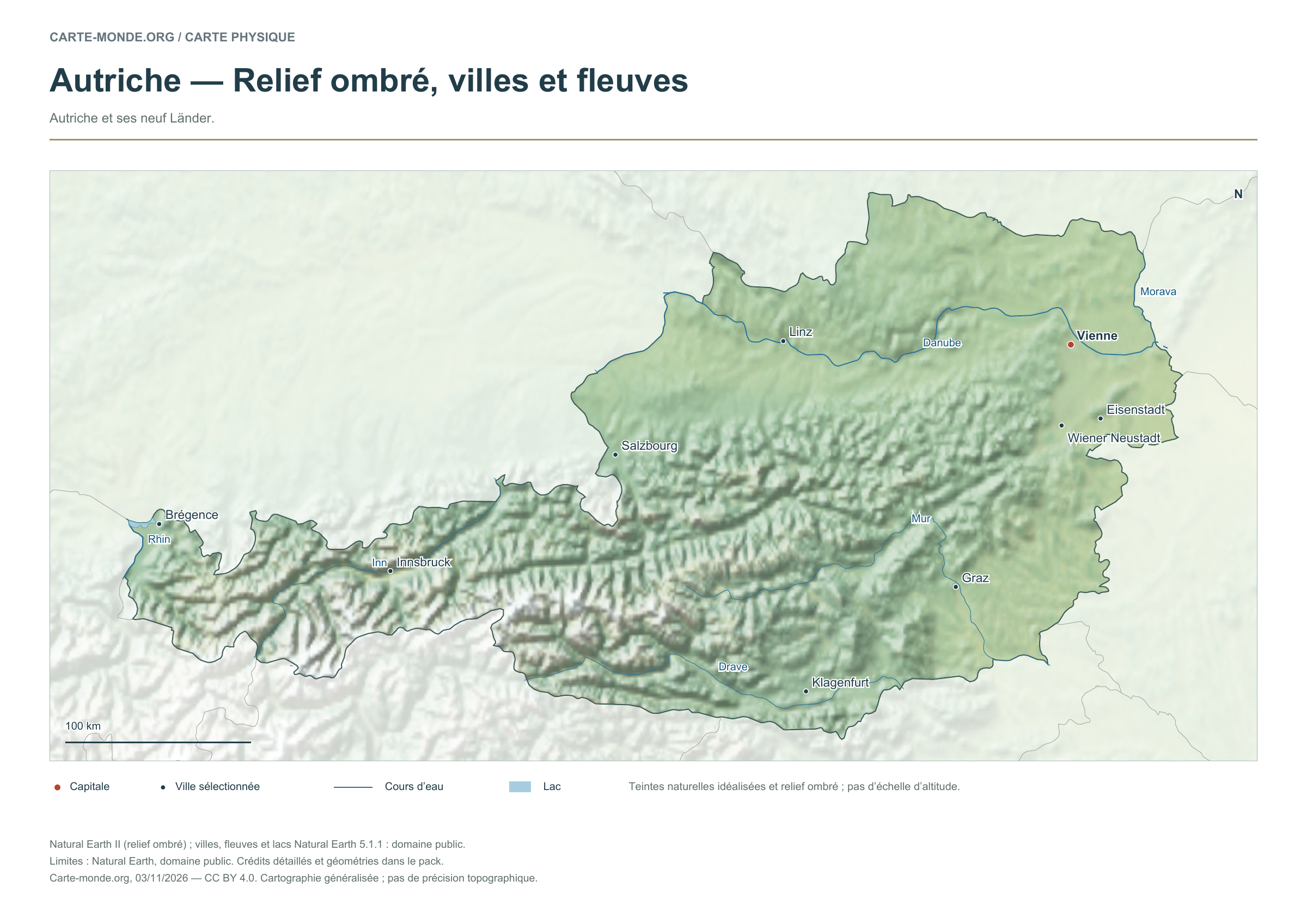
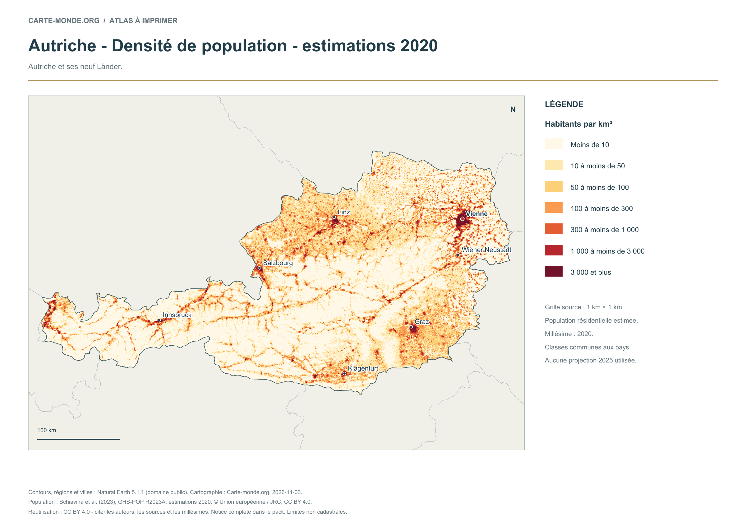
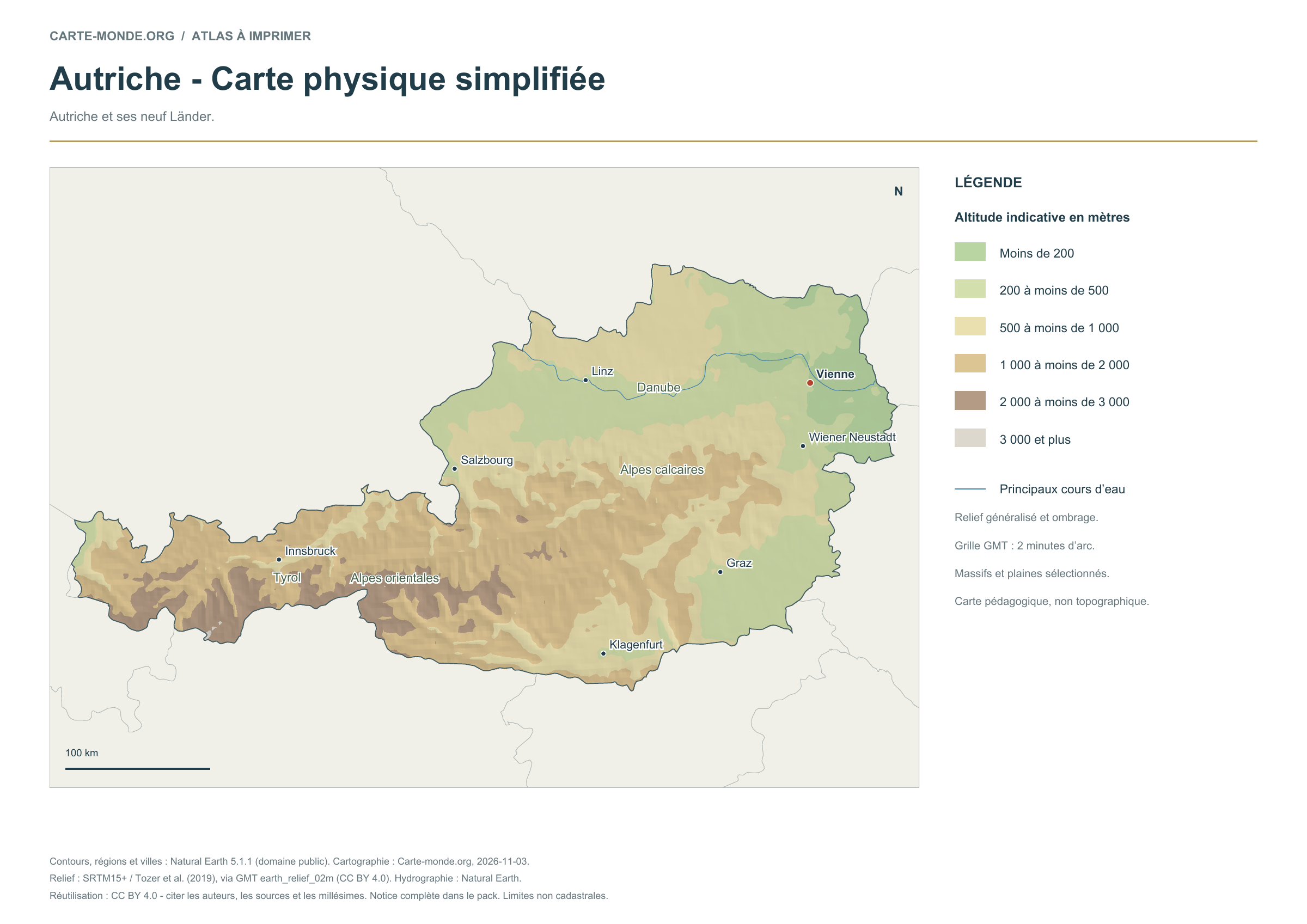
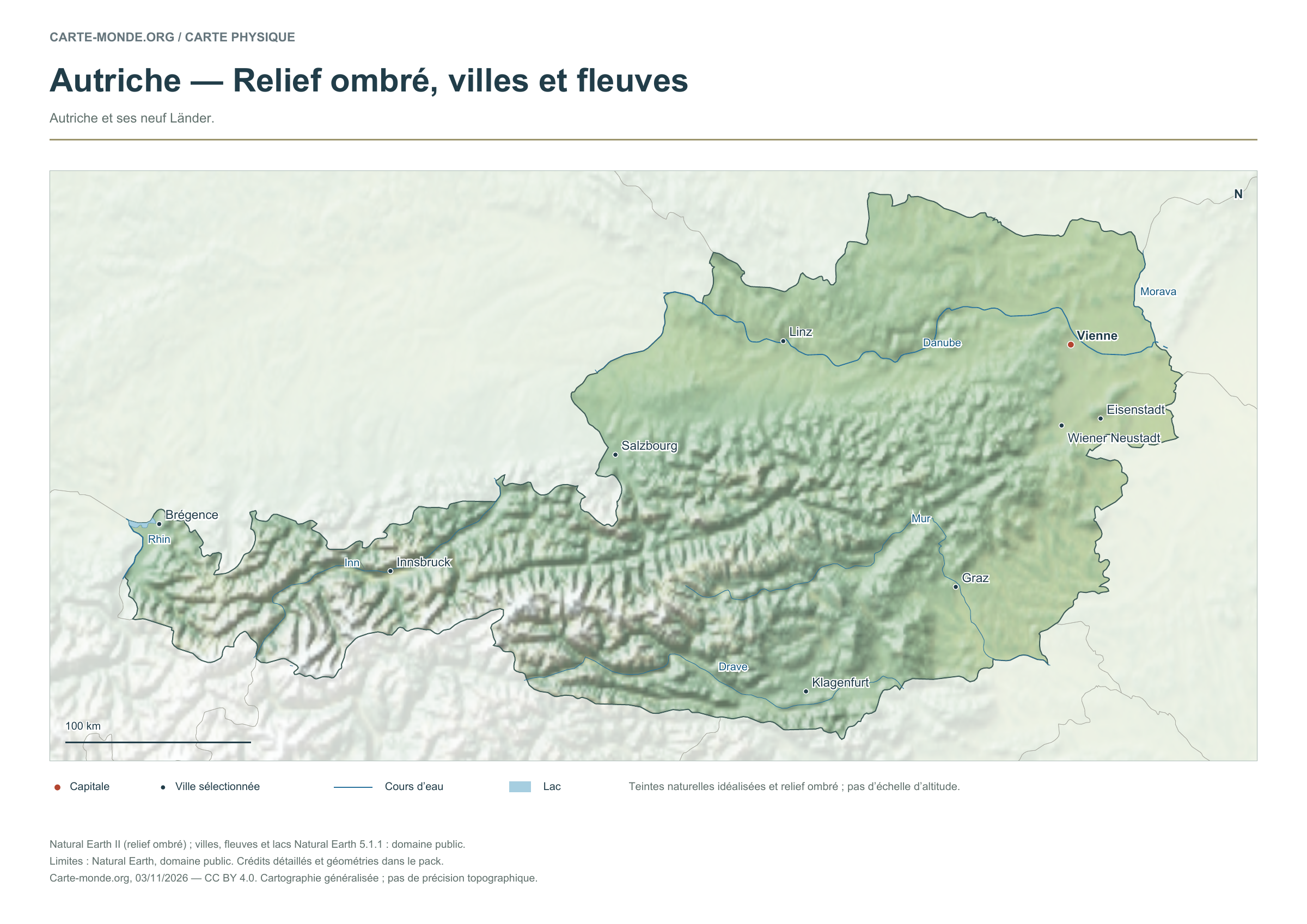
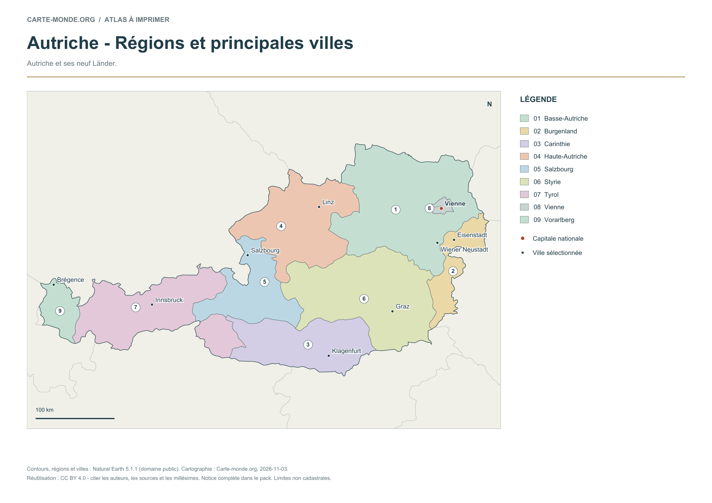
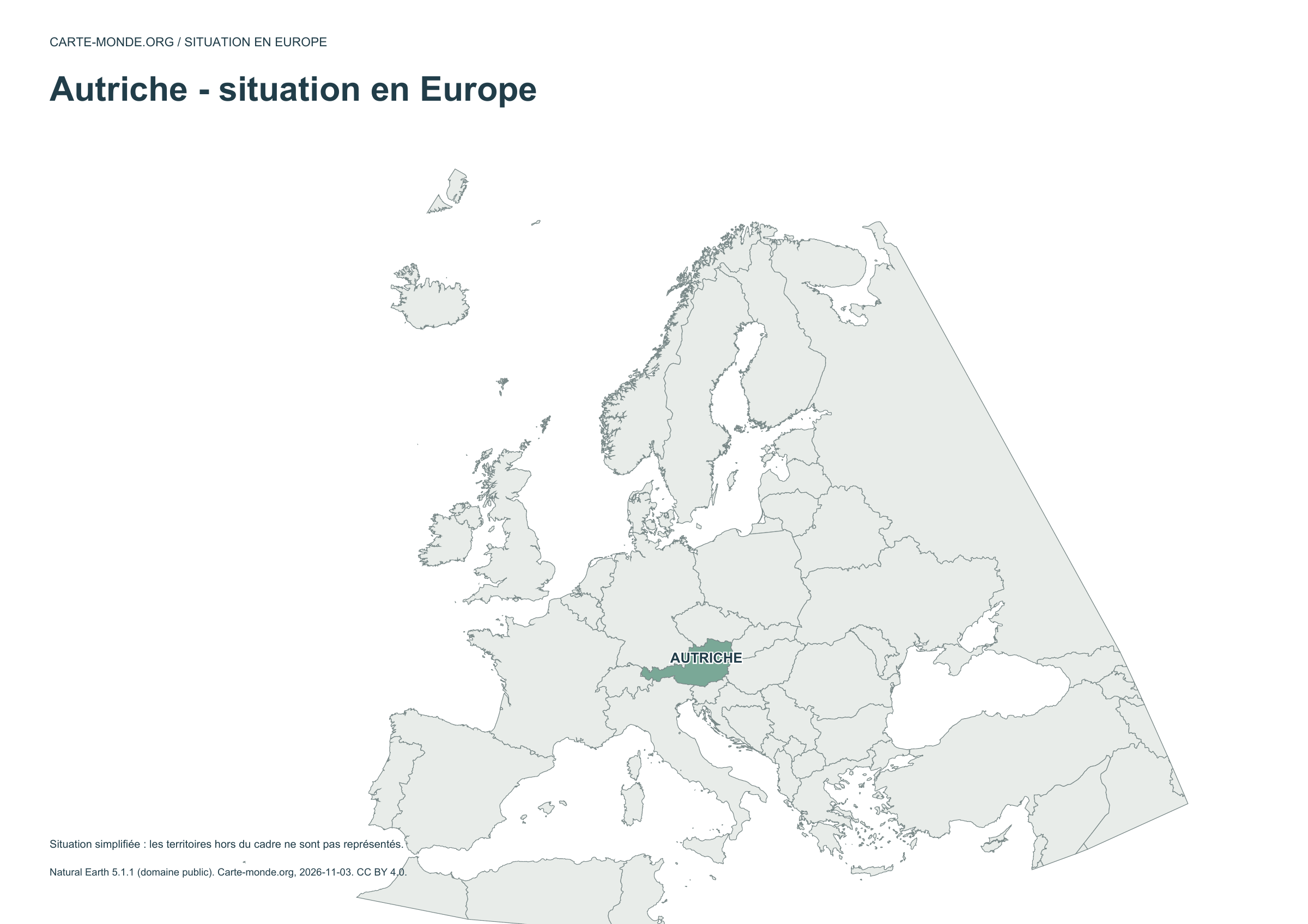
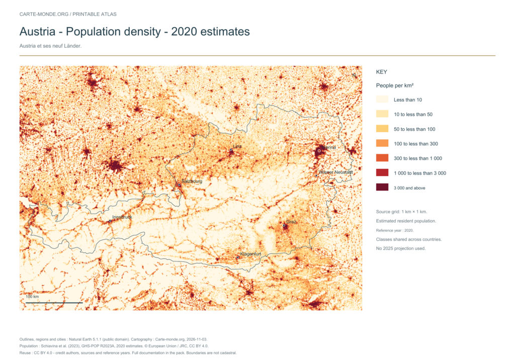
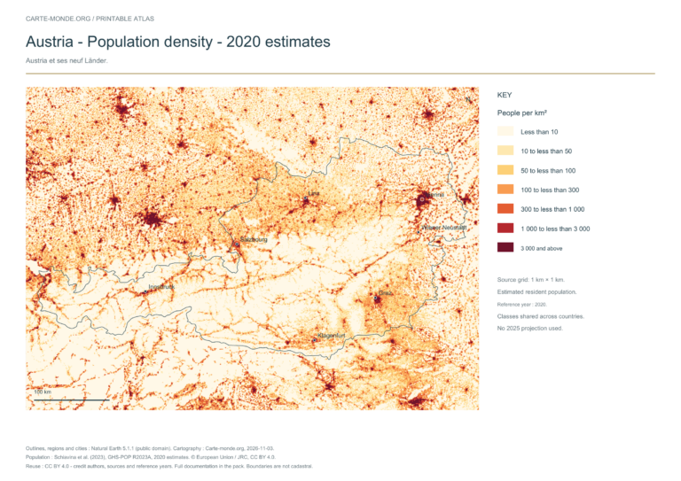
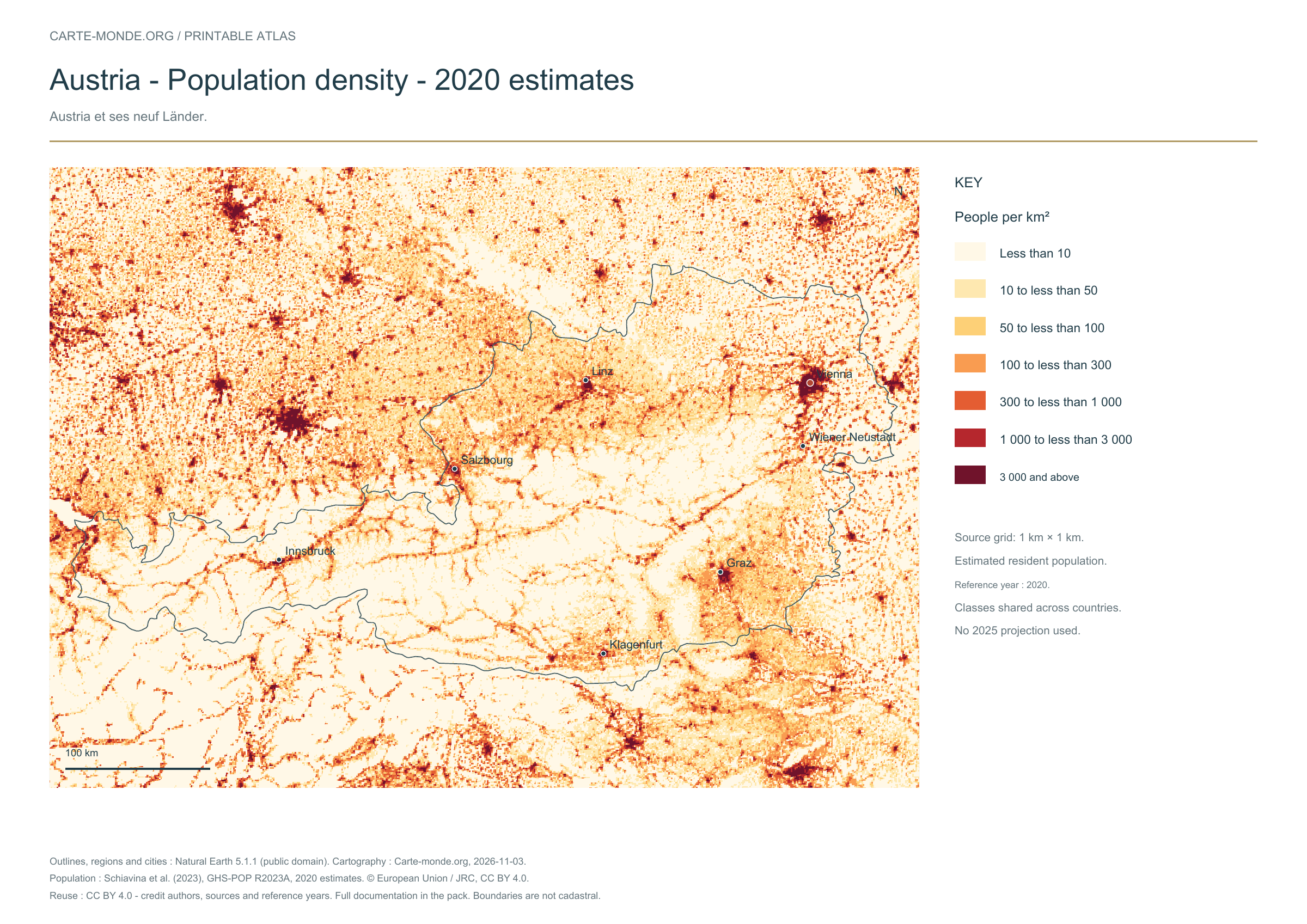
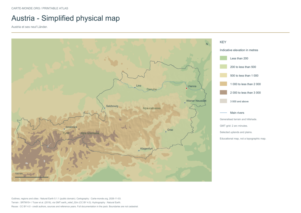
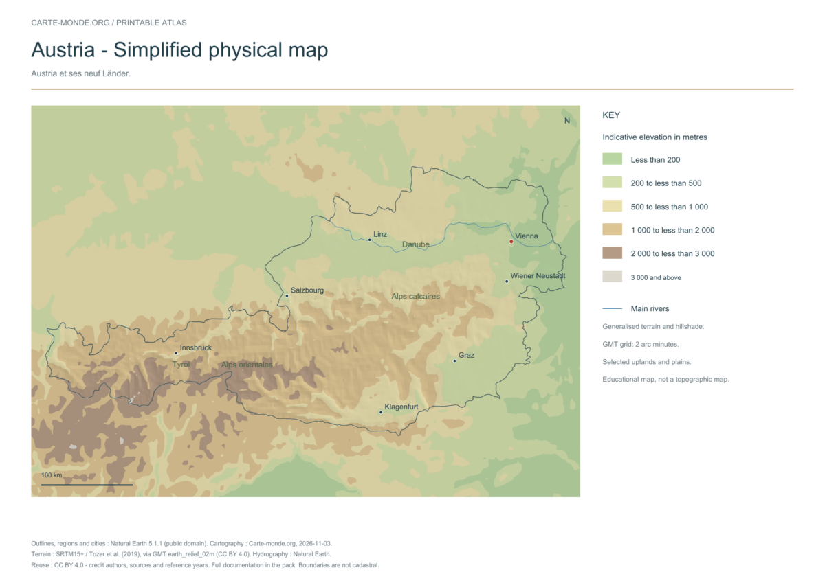
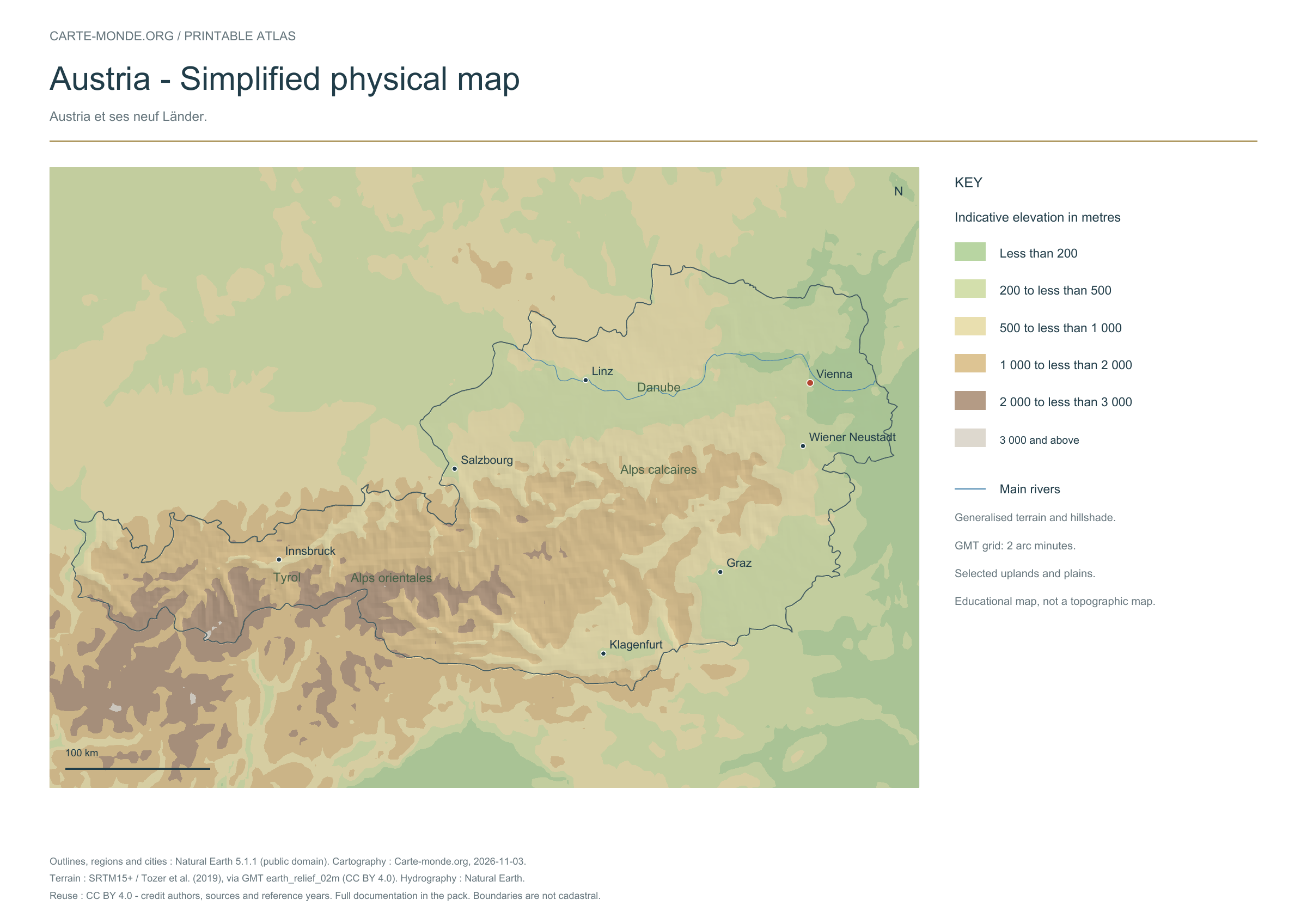
Five printable maps of Austria: regions and cities, location in Europe, two views of the relief and population. PDFs, images and sources are available below.
Our five maps have English labels. Maps from other publishers retain their original language.
Raster base map, cities, rivers and lakes: Natural Earth, public domain. Other boundary credits and licences are retained in the pack. Cartographic work CC BY 4.0; ODbL-derived data retains its licence. No topographic accuracy is claimed.
Territory, data and selection of names
Austria and its nine Länder.
Natural Earth II shaded relief base map, 9 selected cities. Named rivers: Danube, Drave, Inn, Morava, Mur, Rhin.
The colours represent idealised natural cover; they do not correspond to elevation classes. This global background remains generalised, particularly for small states.
Carte-monde.org · November 2026
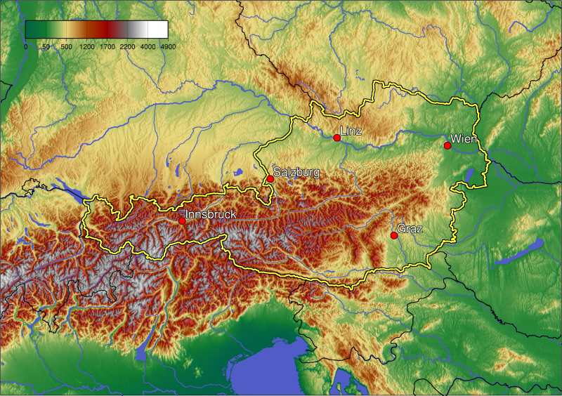
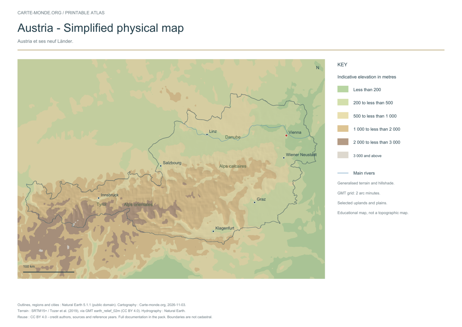
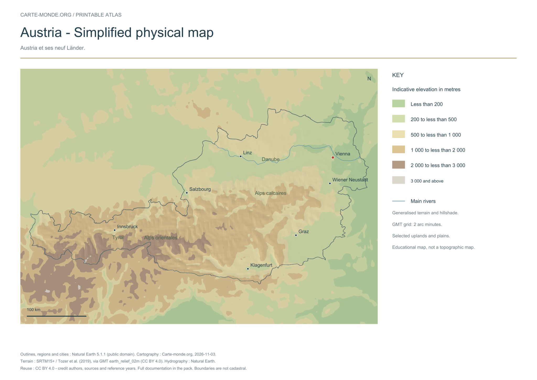
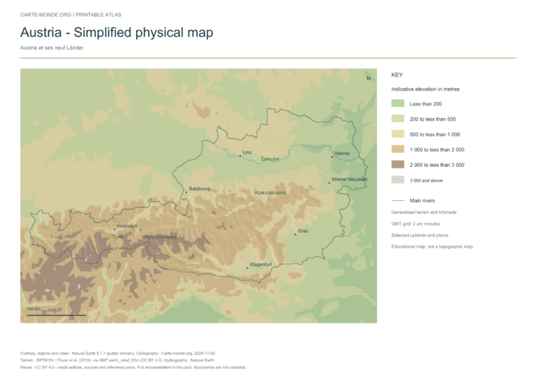
Simplified elevations
Smoothed relief, elevation colours, main mountain ranges, plains and watercourses. Educational map at national scale.
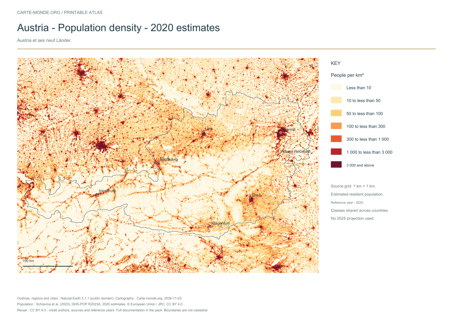
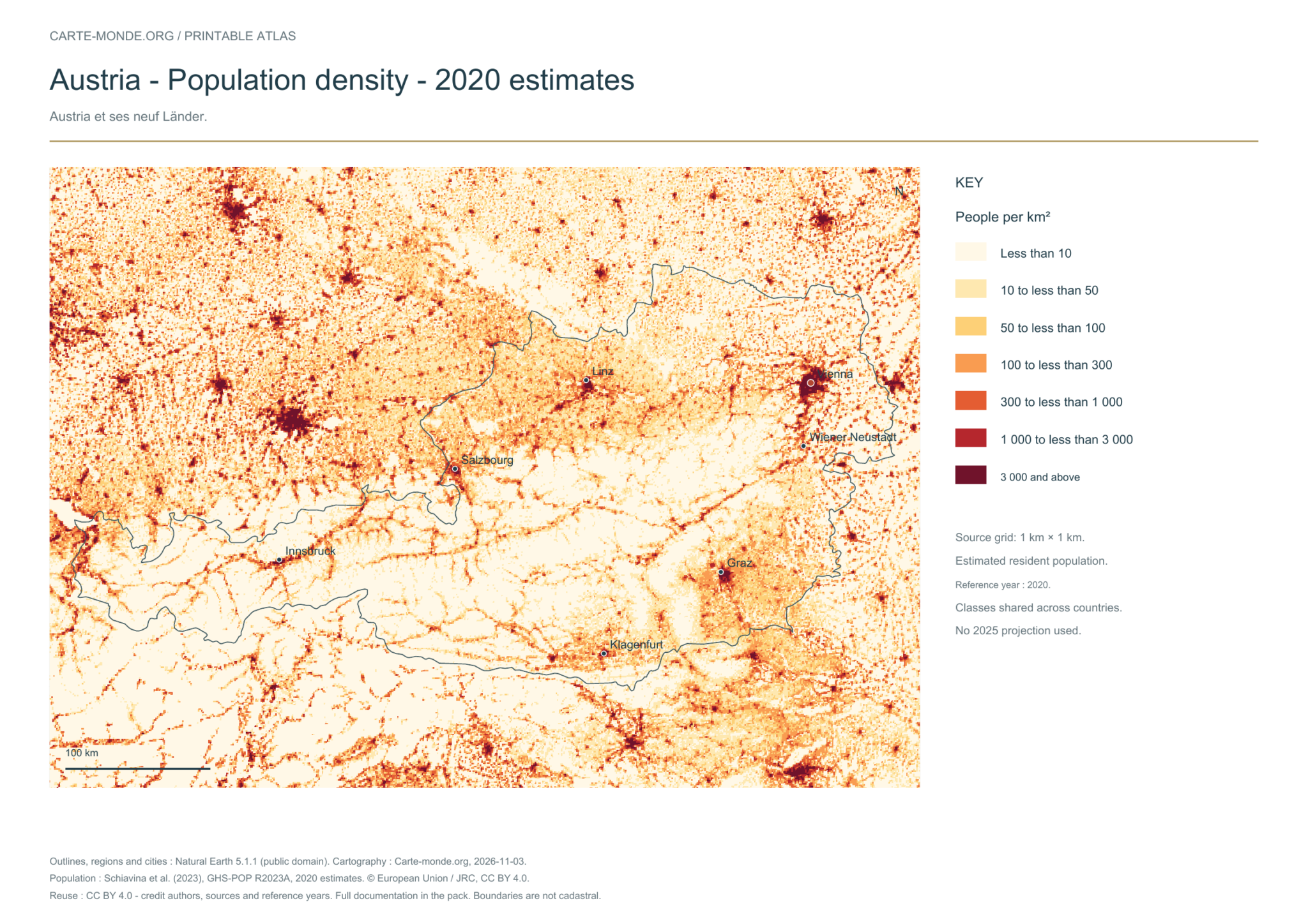
The data represents estimated residential population in 2020, on a 1 km² source grid. The document’s creation date does not change this reference year.
The five in-house maps in one pack
Regions and cities, location in Europe, simplified elevations, 2020 population density and shaded relief: five A4 PDFs, their PNGs and SVGs, with sources and licences.
Regions and cities show how the territory is organized; the location map places the country; terrain shows the main natural regions; density shows population distribution. Print the in-house PDFs in A4 landscape with “Fit to page”. Insets have their own scales.
Outlines, regions, cities and hydrography:Natural Earth 5.1.1, public domain. Generalized boundaries at 1:10 million, not cadastral; edition year 2026 does not mean that all geometries have been updated.
Relief: SRTM15+ / Tozer et al. (2019), reference publication, via GMT earth_relief_02m derived from SRTM15+V2.7. Grid smoothed to two arc minutes, suitable for a national overview, without topographic precision.
The four new maps: created by Carte-monde.org, November 2026, under CC BY 4.0. Cite authors, sources and reference years, and indicate adaptations. Additional and older maps retain their own rights.
Raster base map, cities, rivers and lakes: Natural Earth, public domain. Other boundary credits and licences are retained in the pack. Cartographic work CC BY 4.0; ODbL-derived data retains its licence. No topographic accuracy is claimed.
Other maps: sources and reuse
Reference maps by external authors. Each document retains its licence, credits and date. “View map” links open the document on Commons; ZIP buttons provide access to the files kept in this collection.
To reuse a CC BY map, cite its authors, source and licence and indicate any changes. Adaptations of a CC BY-SA map retain the same or a compatible licence. CC0 documents may be reused freely; retaining the source makes them easier to identify. These rights do not make all administrative boundaries current.
Previous collection — original files preservedFlag of Austria
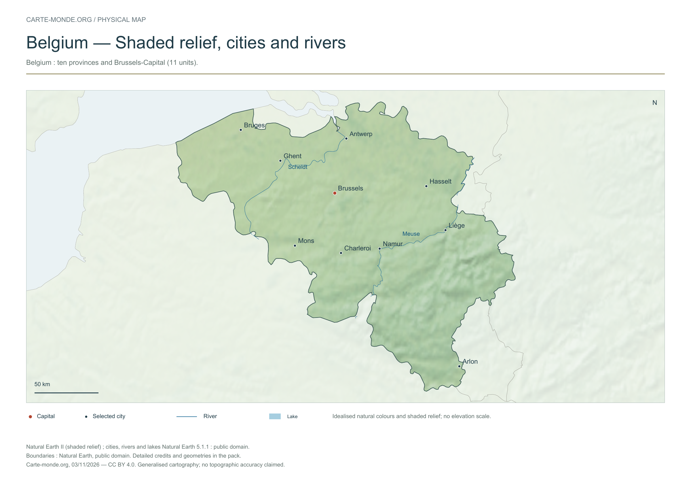
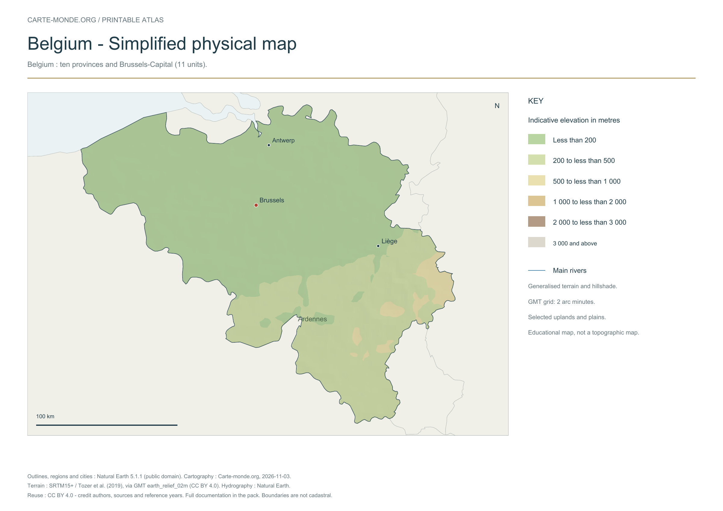
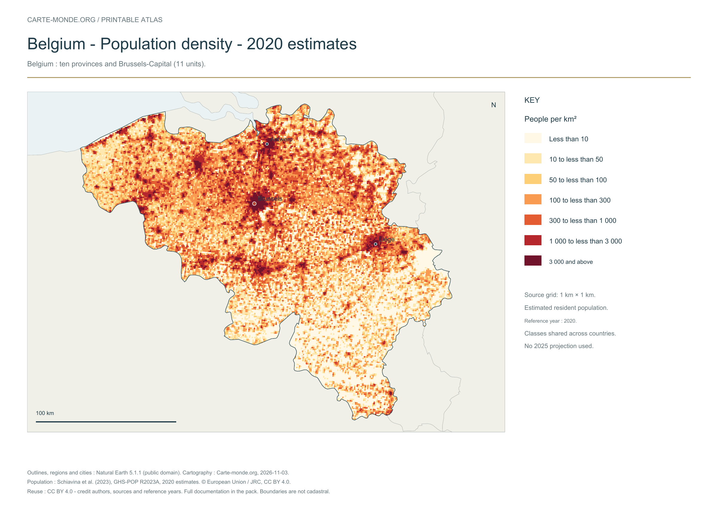
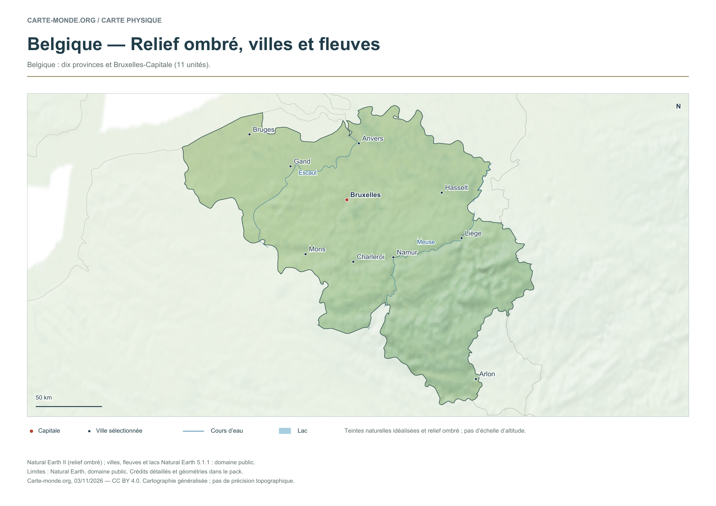
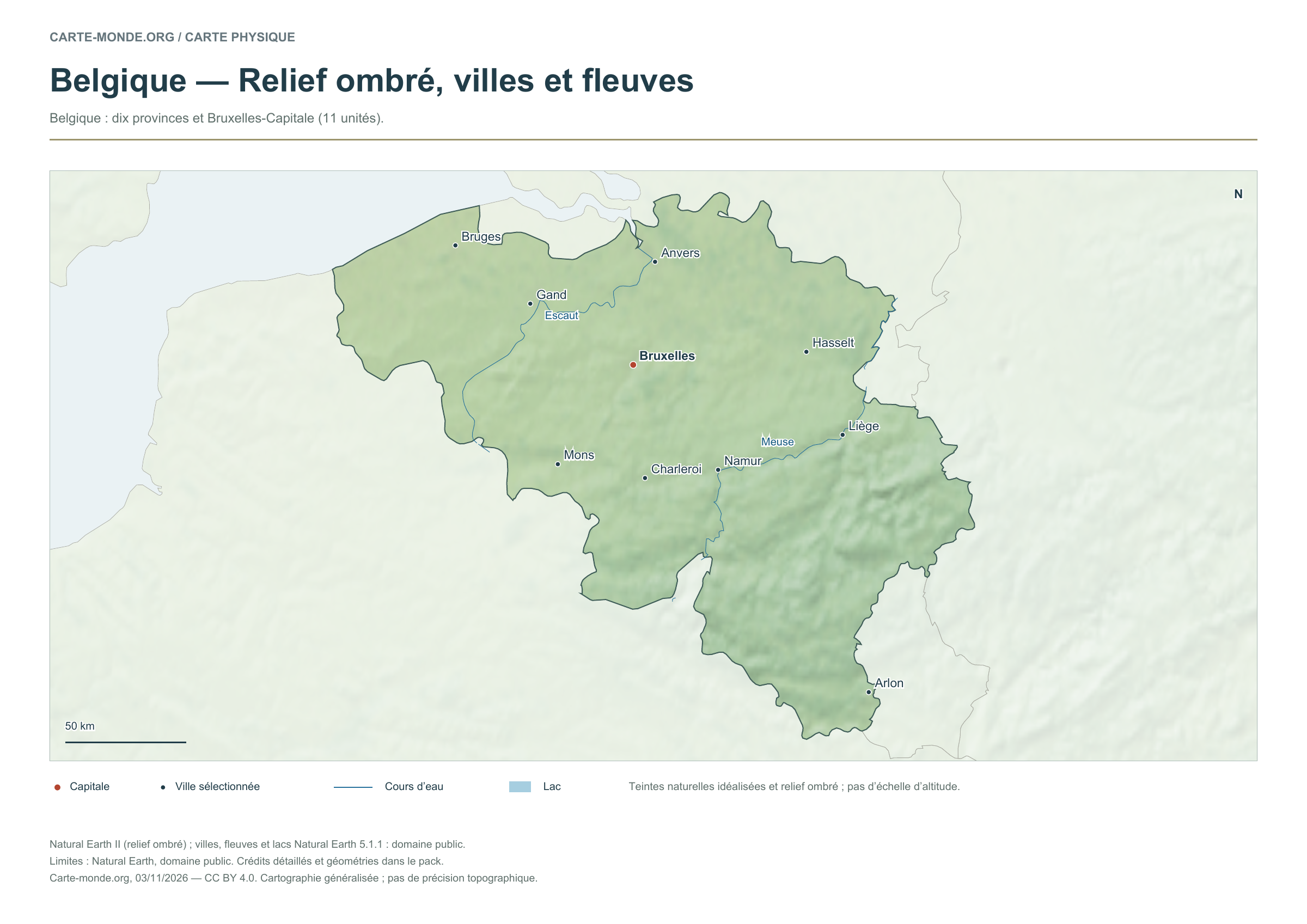
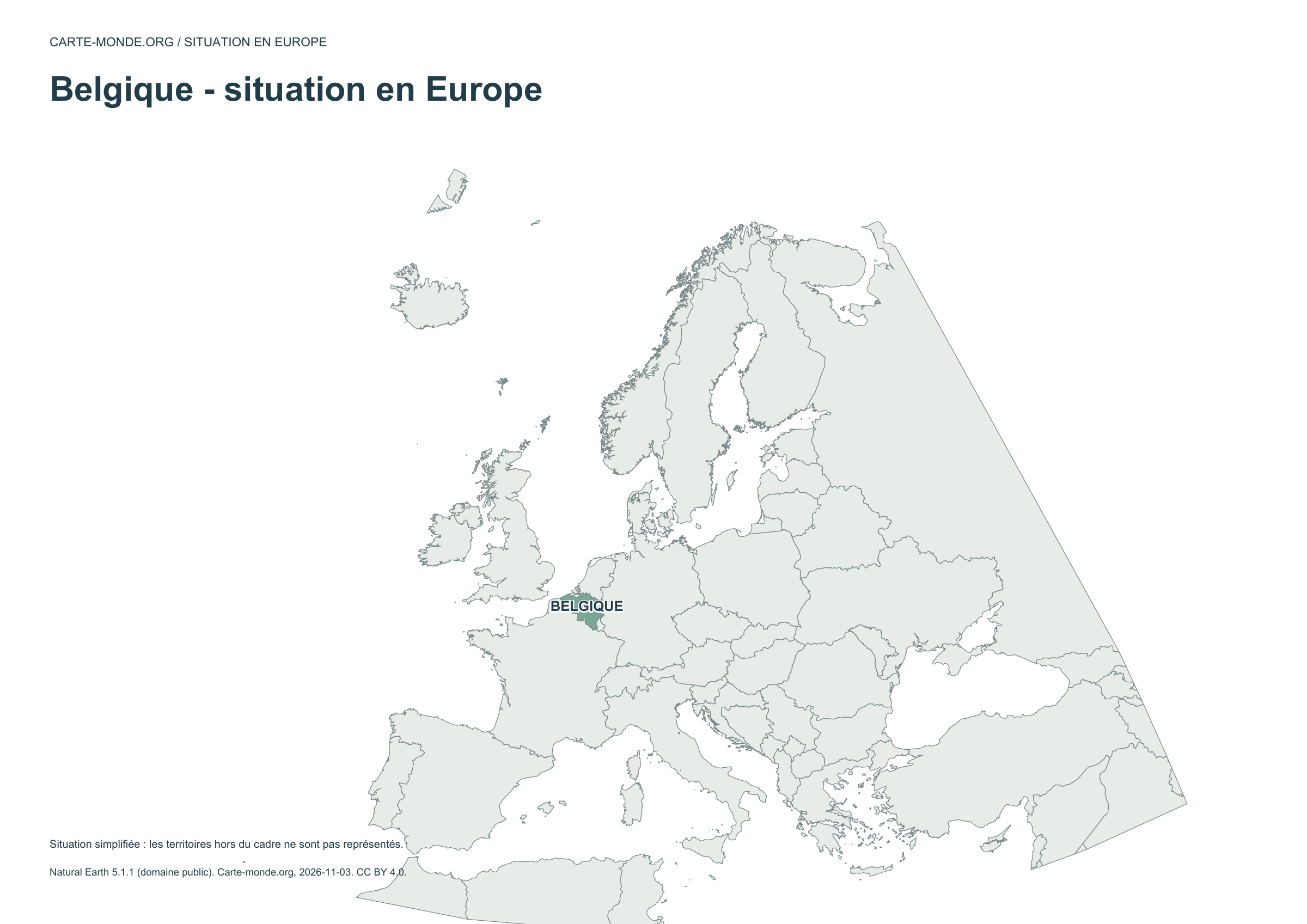
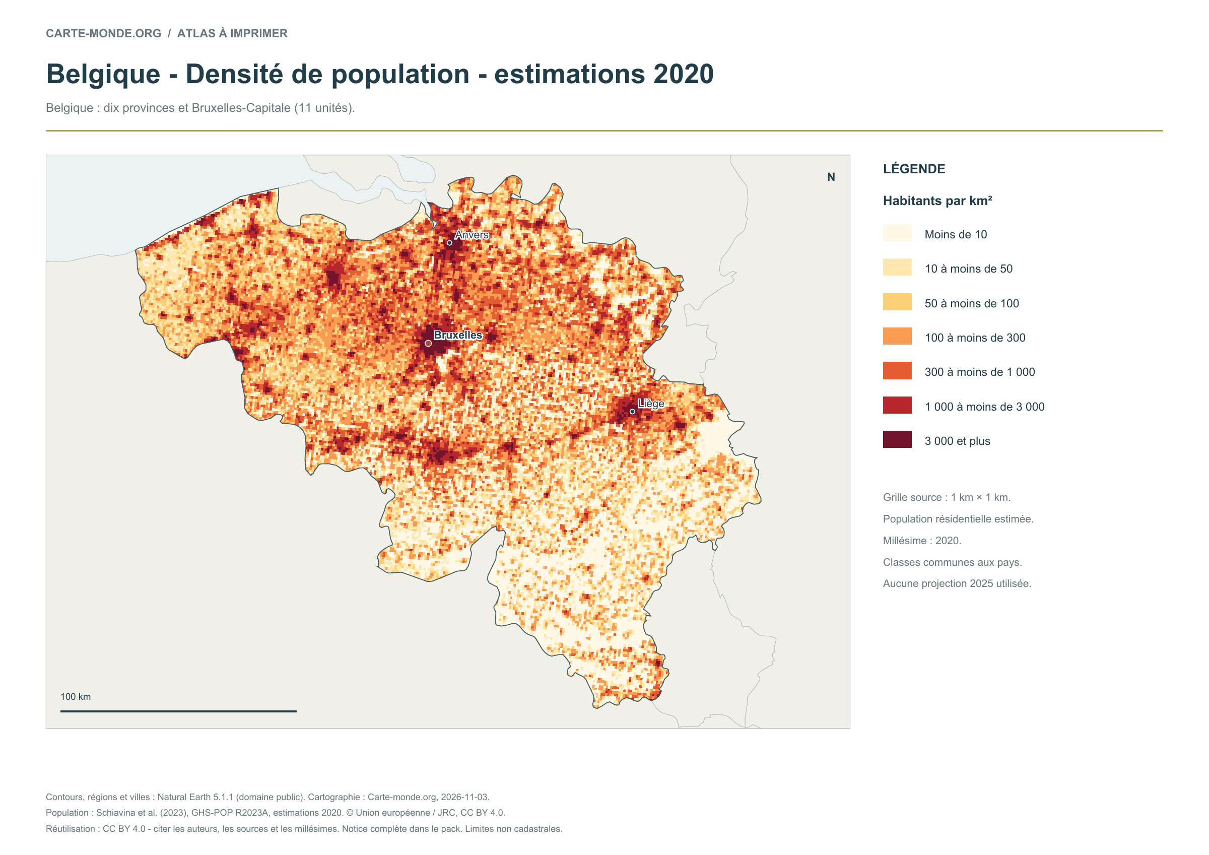
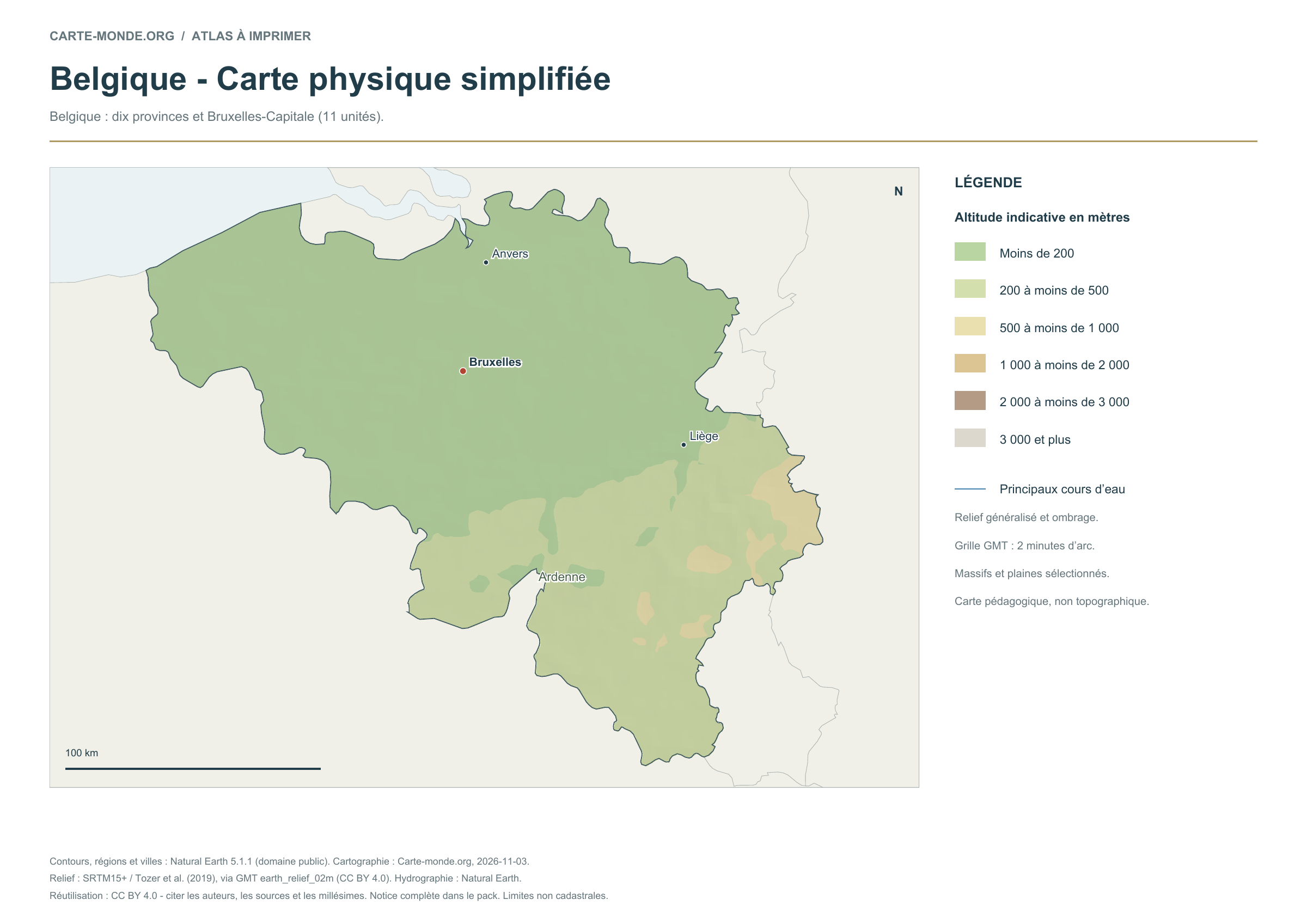
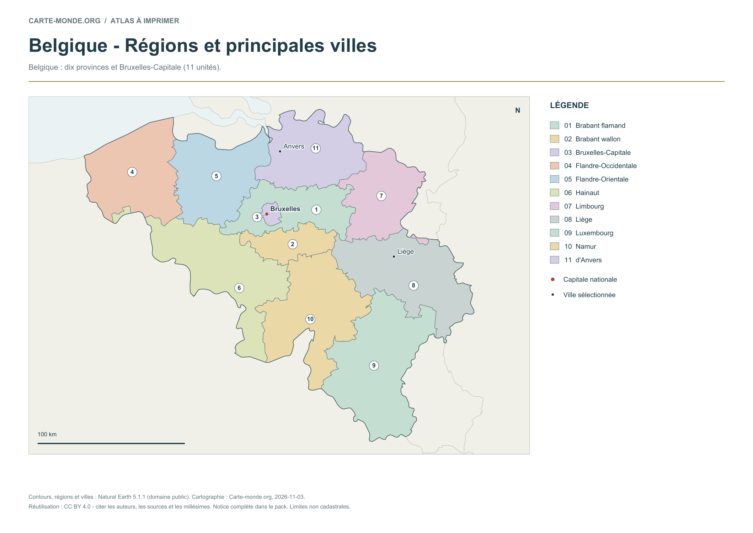
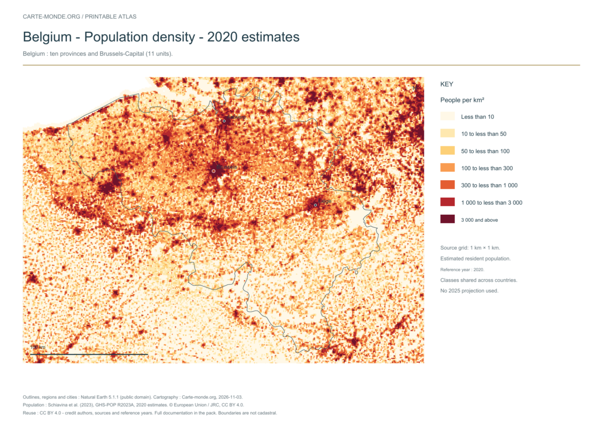
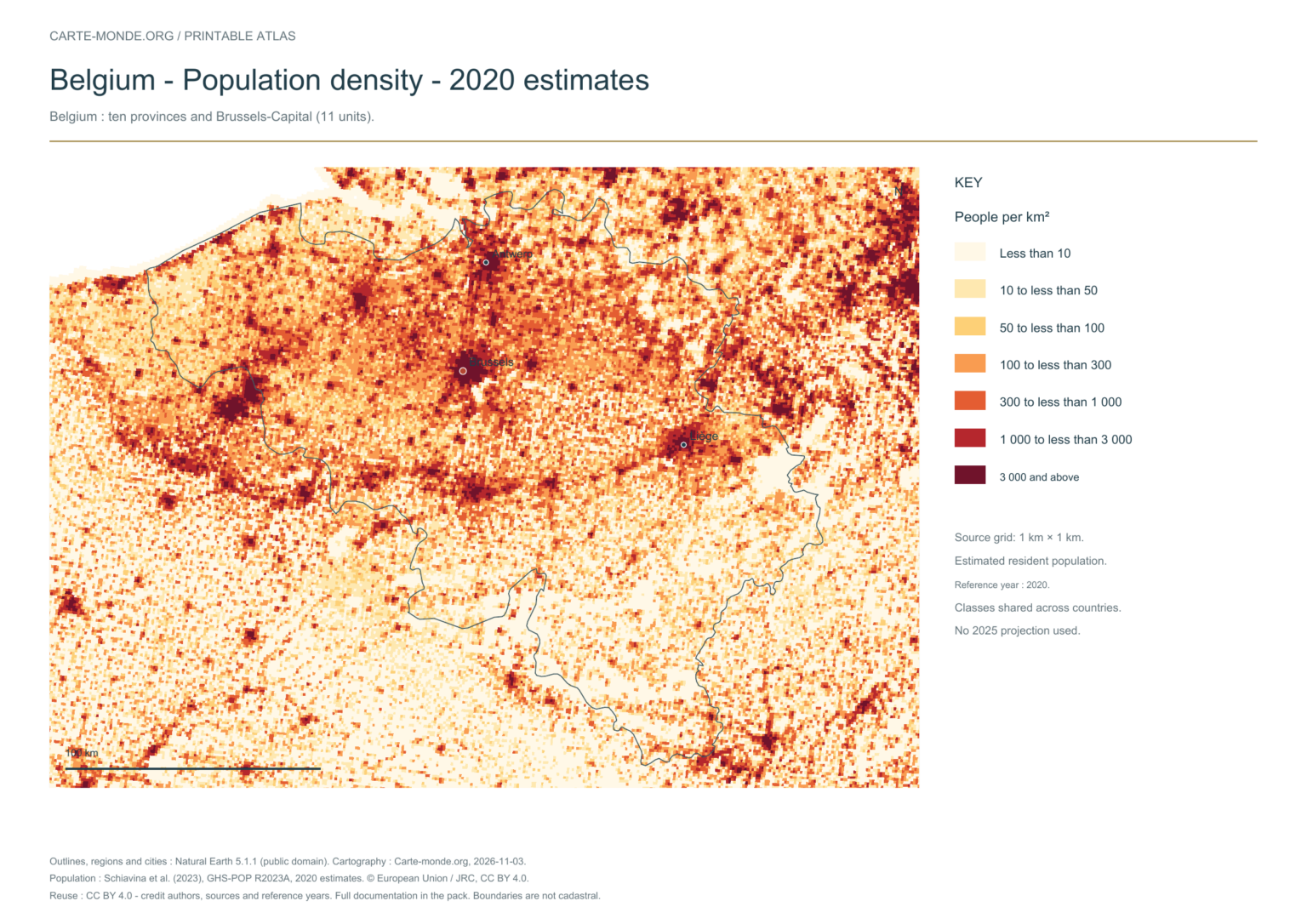
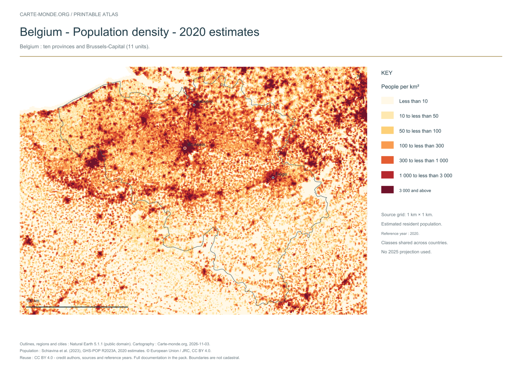
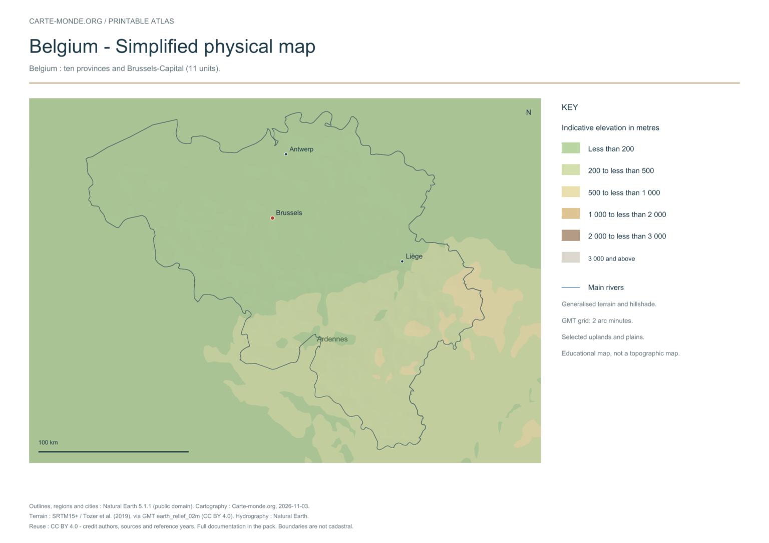
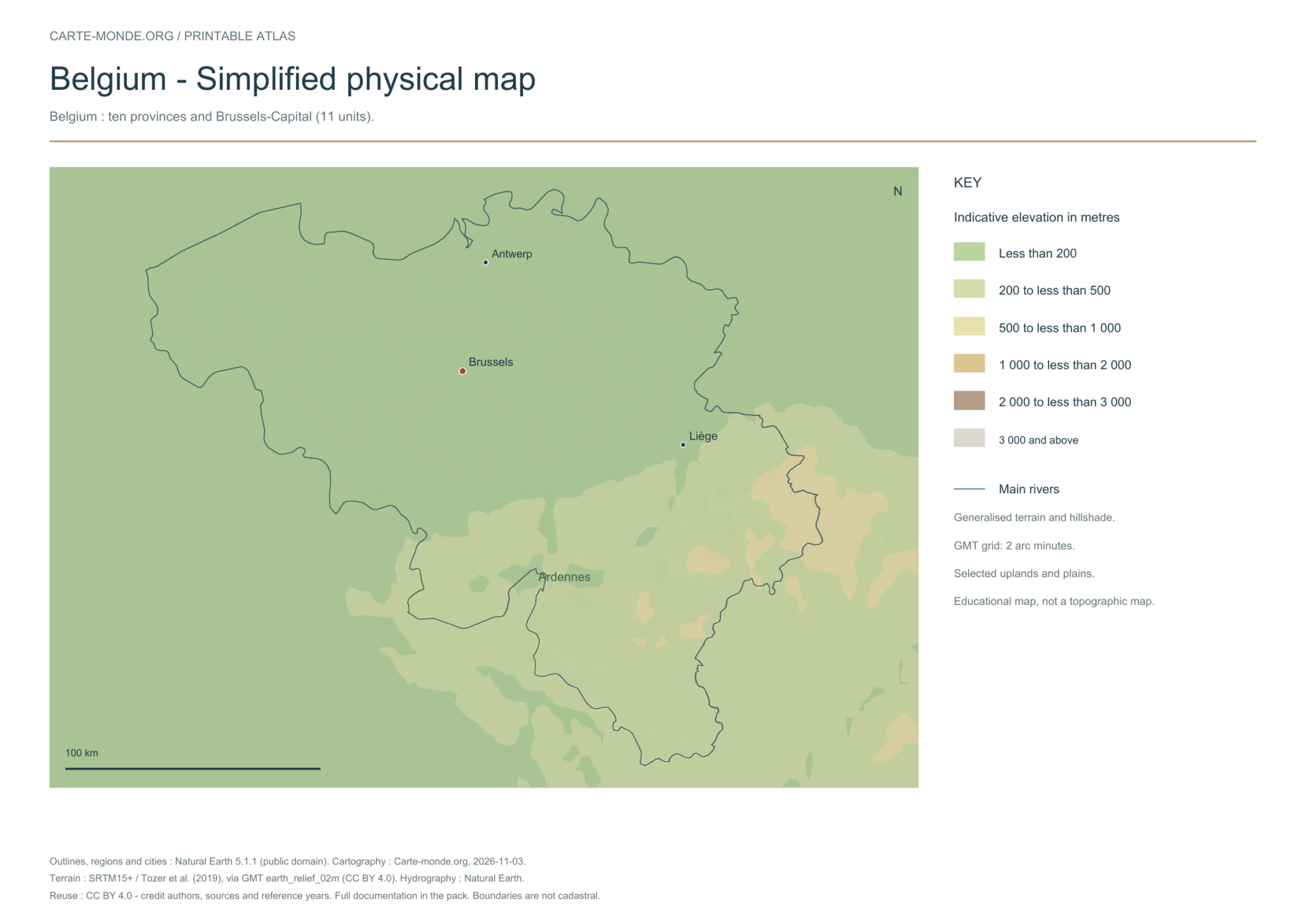
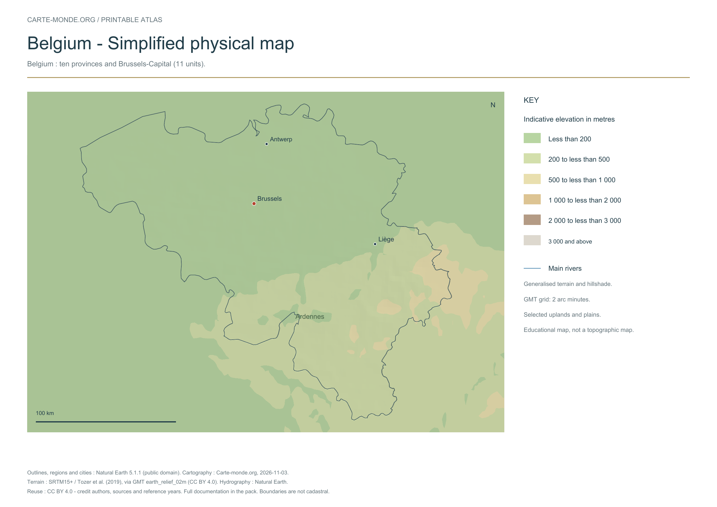
Five printable maps of Belgium: regions and cities, location in Europe, two views of the relief and population. PDFs, images and sources are available below.
Our five maps have English labels. Maps from other publishers retain their original language.
Raster base map, cities, rivers and lakes: Natural Earth, public domain. Other boundary credits and licences are retained in the pack. Cartographic work CC BY 4.0; ODbL-derived data retains its licence. No topographic accuracy is claimed.
Territory, data and selection of names
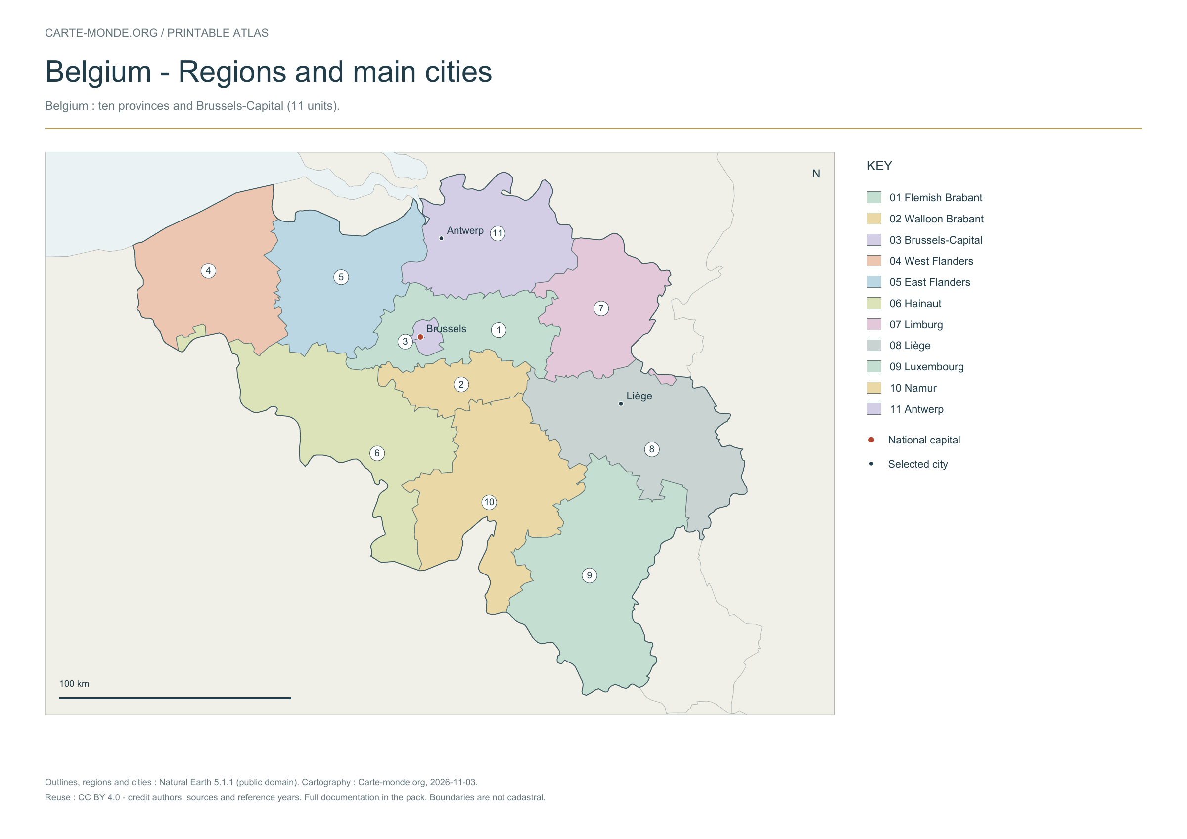
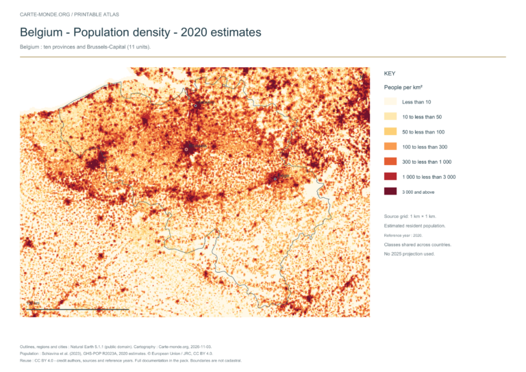
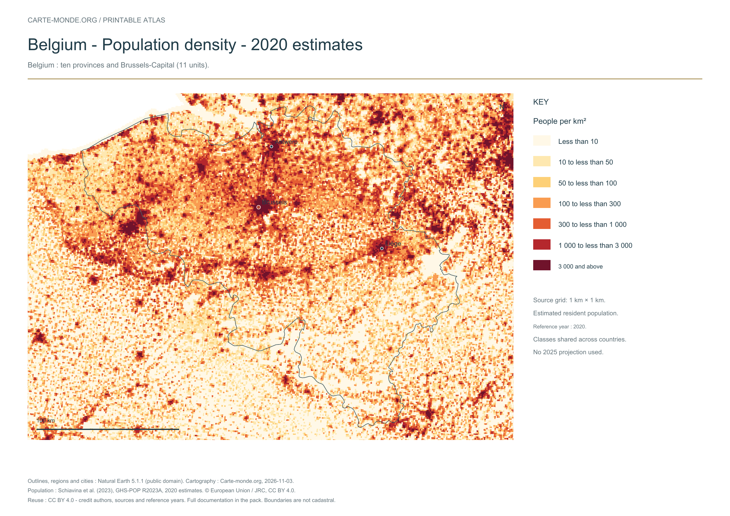
Belgium: ten provinces and Brussels-Capital (11 units).
Natural Earth II shaded relief background, 10 selected cities. Named waterways: Escaut, Meuse.
The colours represent idealised natural cover; they do not correspond to elevation classes. This global background remains generalised, particularly for small states.
Carte-monde.org · November 2026
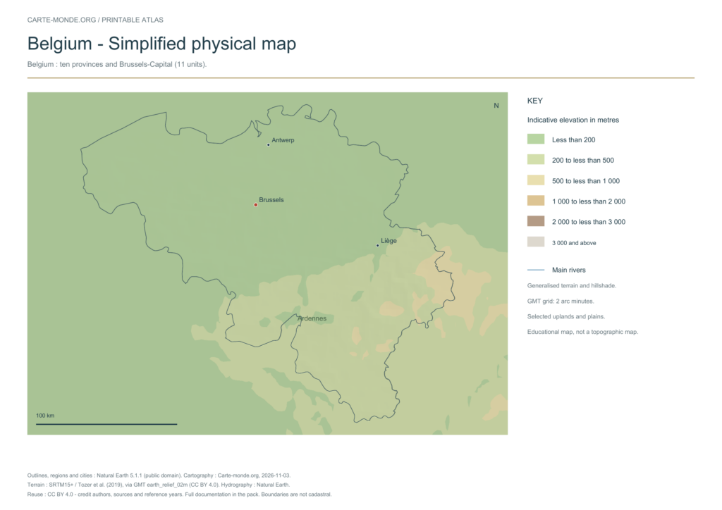
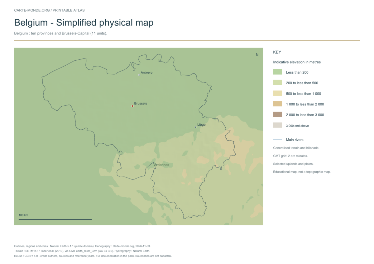
Simplified elevations
Smoothed relief, elevation colours, main mountain ranges, plains and watercourses. Educational map at national scale.
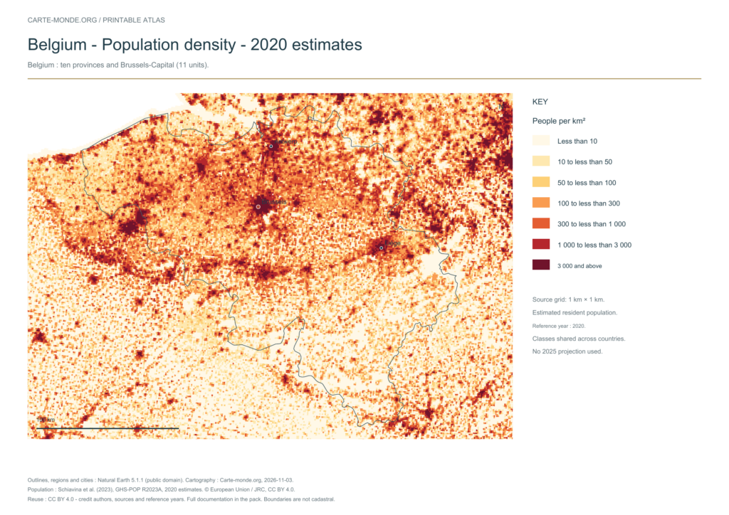
The data represents estimated residential population in 2020, on a 1 km² source grid. The document’s creation date does not change this reference year.
The five in-house maps in one pack
Regions and cities, location in Europe, simplified elevations, 2020 population density and shaded relief: five A4 PDFs, their PNGs and SVGs, with sources and licences.
Older documents in English provided by the University of Texas’s Perry–Castañeda collection. The links open the collection page where you can choose the indicated map. The dates below refer to the documents: these references do not necessarily describe the current situation.
Author: Central Intelligence Agency, except where otherwise stated on the document. Source: University of Texas Libraries. The collection states that most of its maps are in the public domain; retain these credits and check exceptions: reuse terms.
External references: no new file from this collection has been hosted on this site for this batch.
Find the old maps of Belgium
Previously published maps remain accessible at their original URLs, with the collection’s text and credits.
Regions and cities show how the territory is organized; the location map places the country; terrain shows the main natural regions; density shows population distribution. Print the in-house PDFs in A4 landscape with “Fit to page”. Insets have their own scales.
Outlines, regions, cities and hydrography:Natural Earth 5.1.1, public domain. Generalized boundaries at 1:10 million, not cadastral; edition year 2026 does not mean that all geometries have been updated.
Relief: SRTM15+ / Tozer et al. (2019), reference publication, via GMT earth_relief_02m derived from SRTM15+V2.7. Grid smoothed to two arc minutes, suitable for a national overview, without topographic precision.
The four new maps: created by Carte-monde.org, November 2026, under CC BY 4.0. Cite authors, sources and reference years, and indicate adaptations. Additional and older maps retain their own rights.
Raster base map, cities, rivers and lakes: Natural Earth, public domain. Other boundary credits and licences are retained in the pack. Cartographic work CC BY 4.0; ODbL-derived data retains its licence. No topographic accuracy is claimed.
Previous collection — original files preservedFlag of Belgium
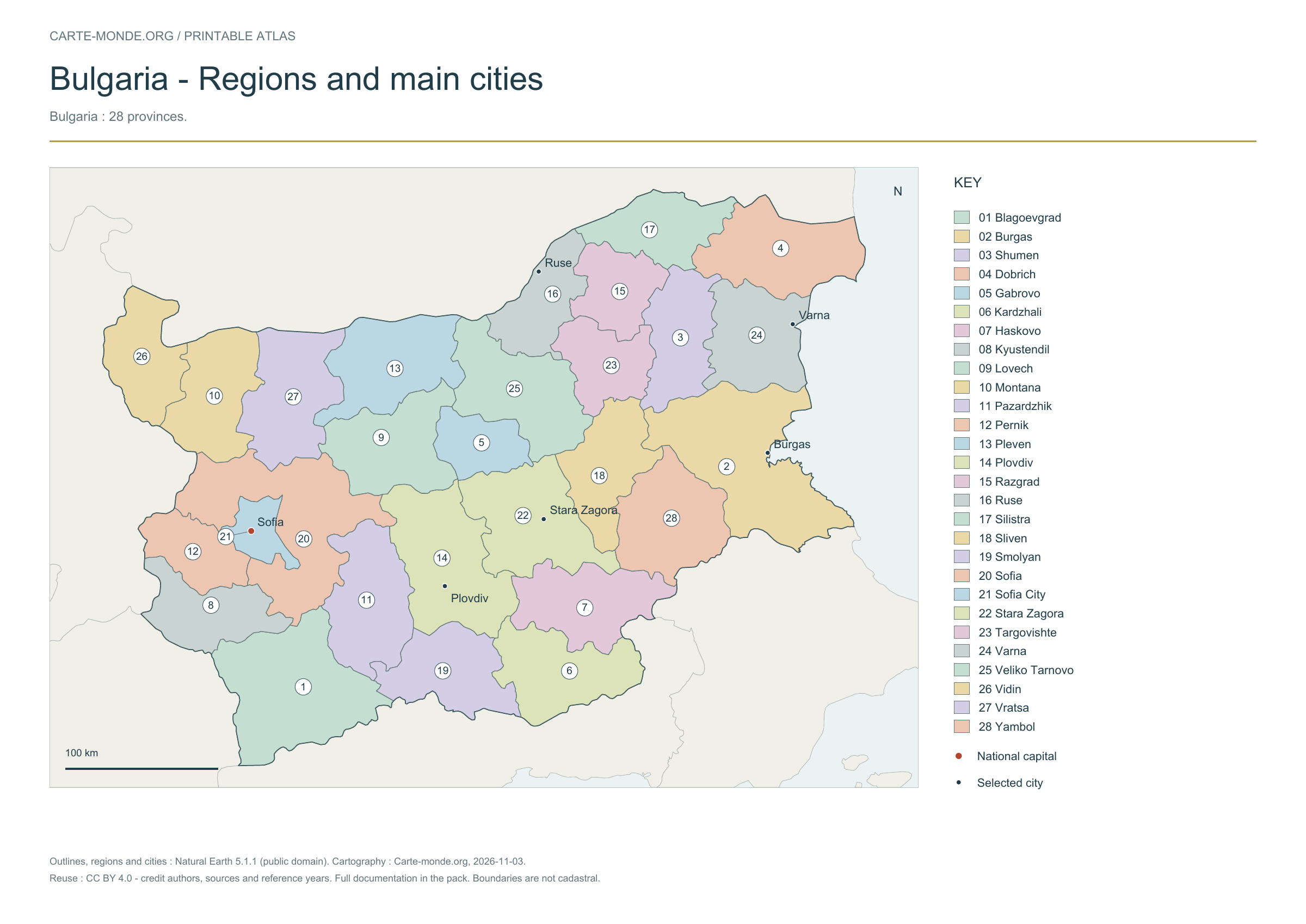
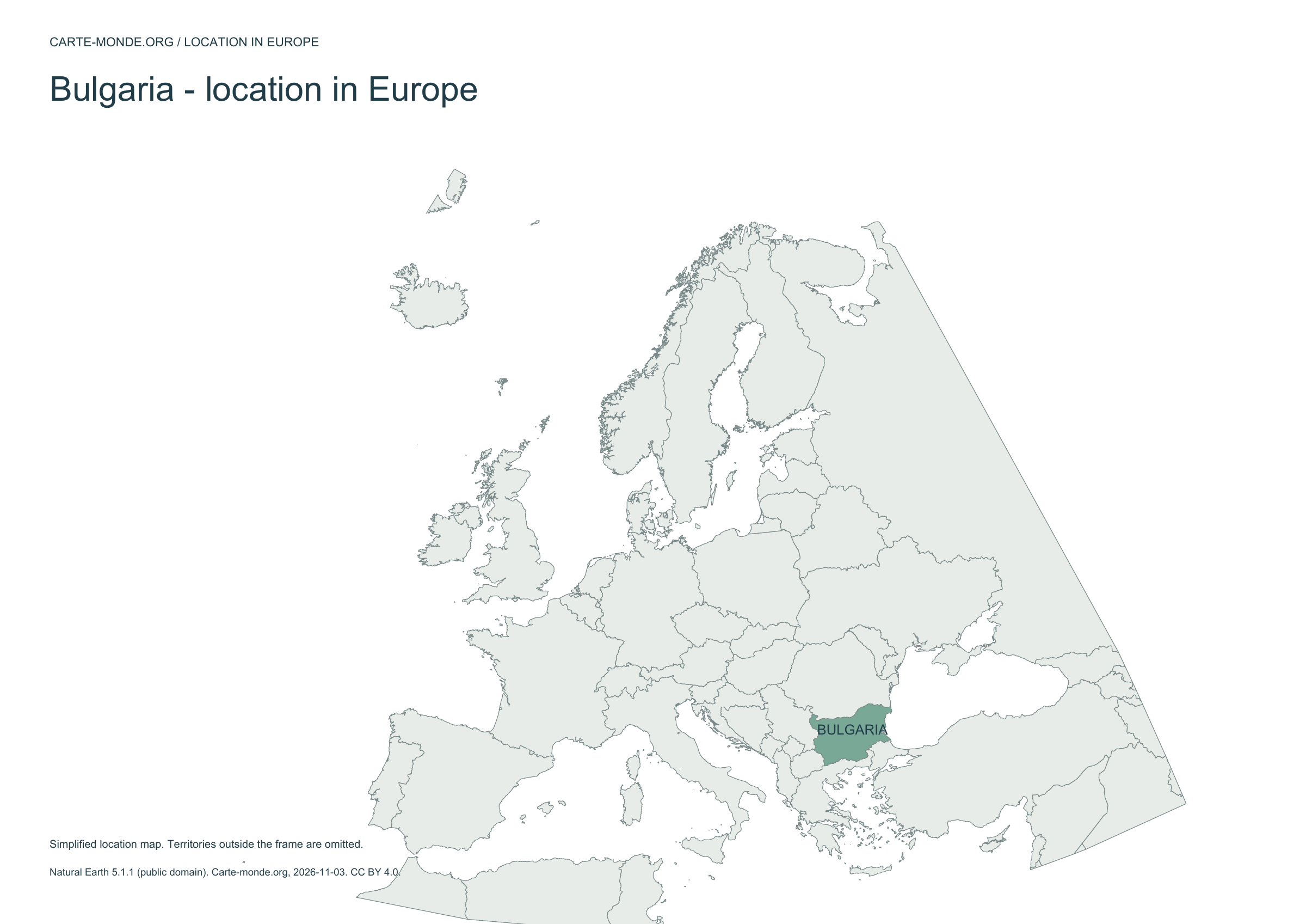
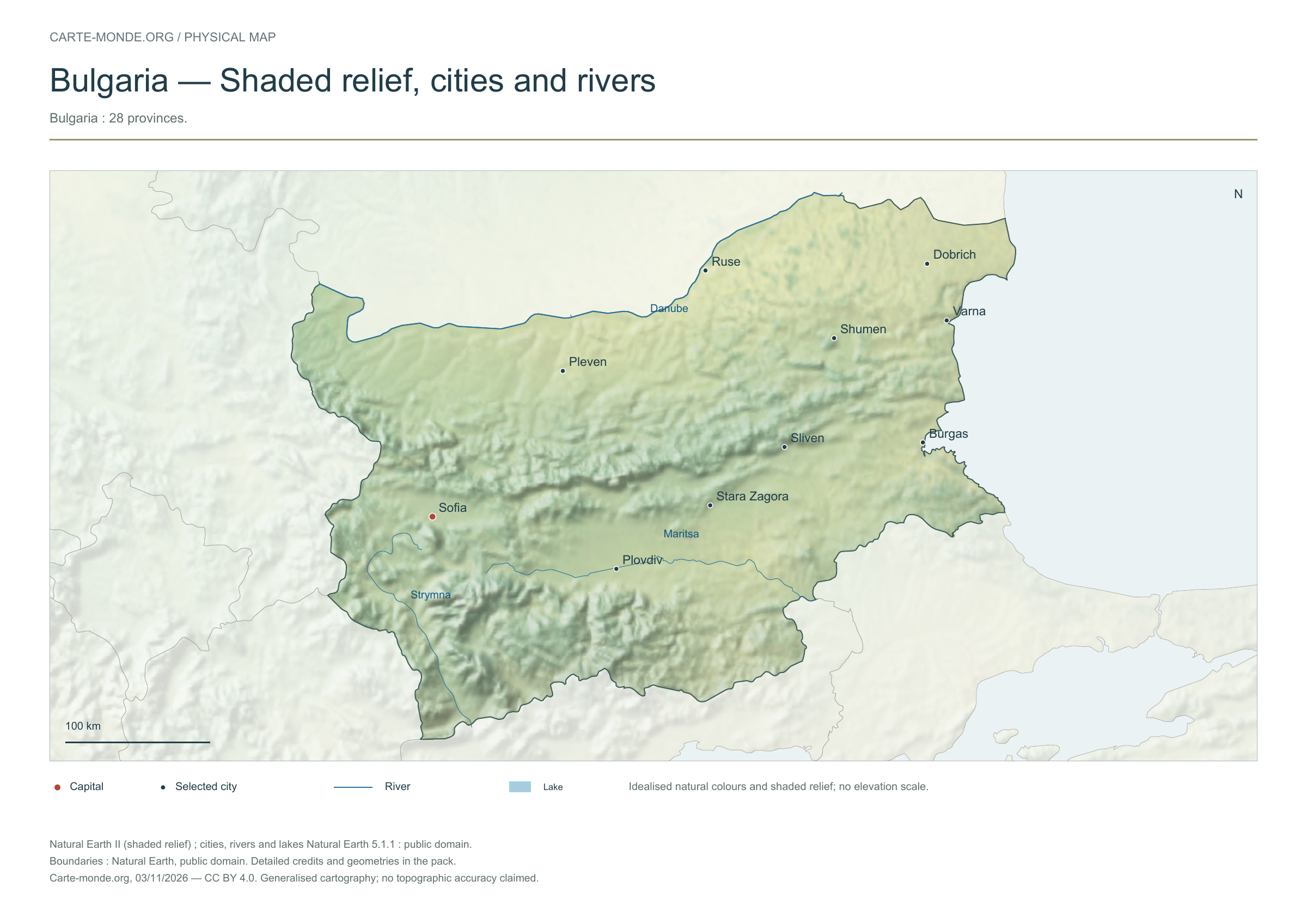
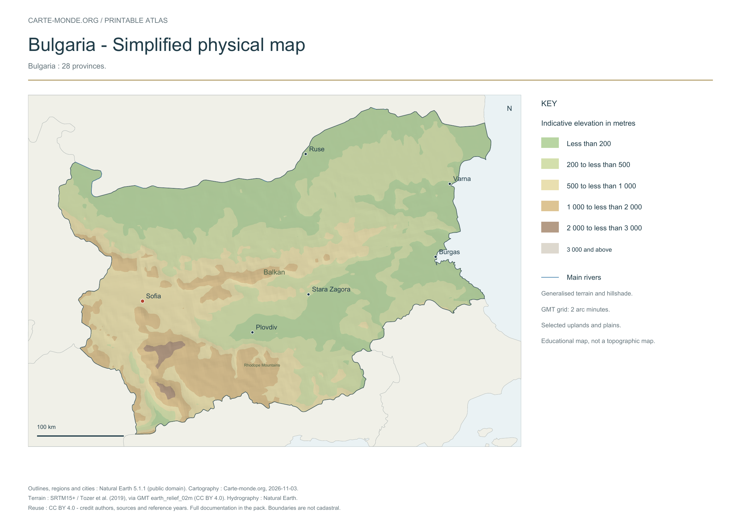
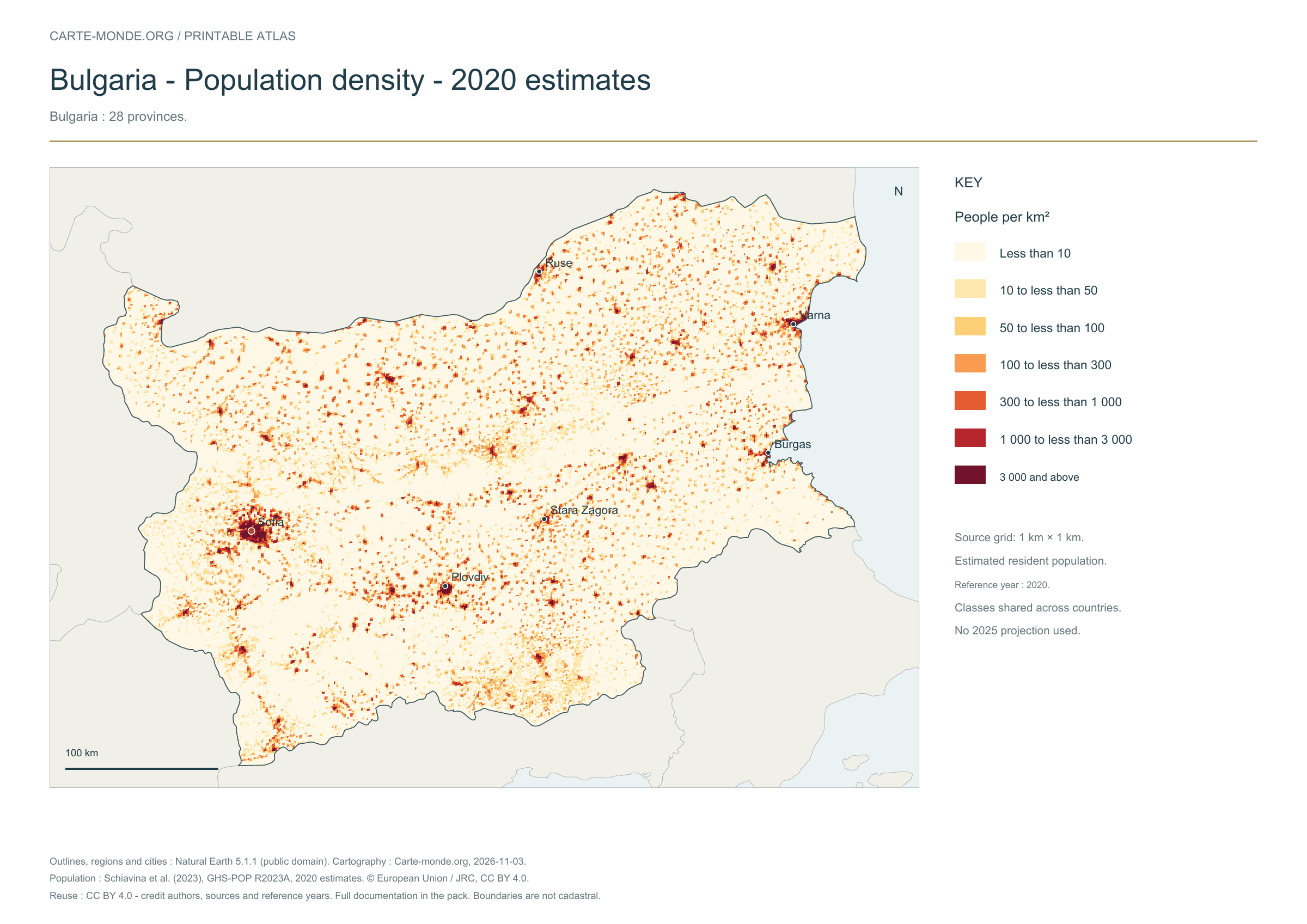
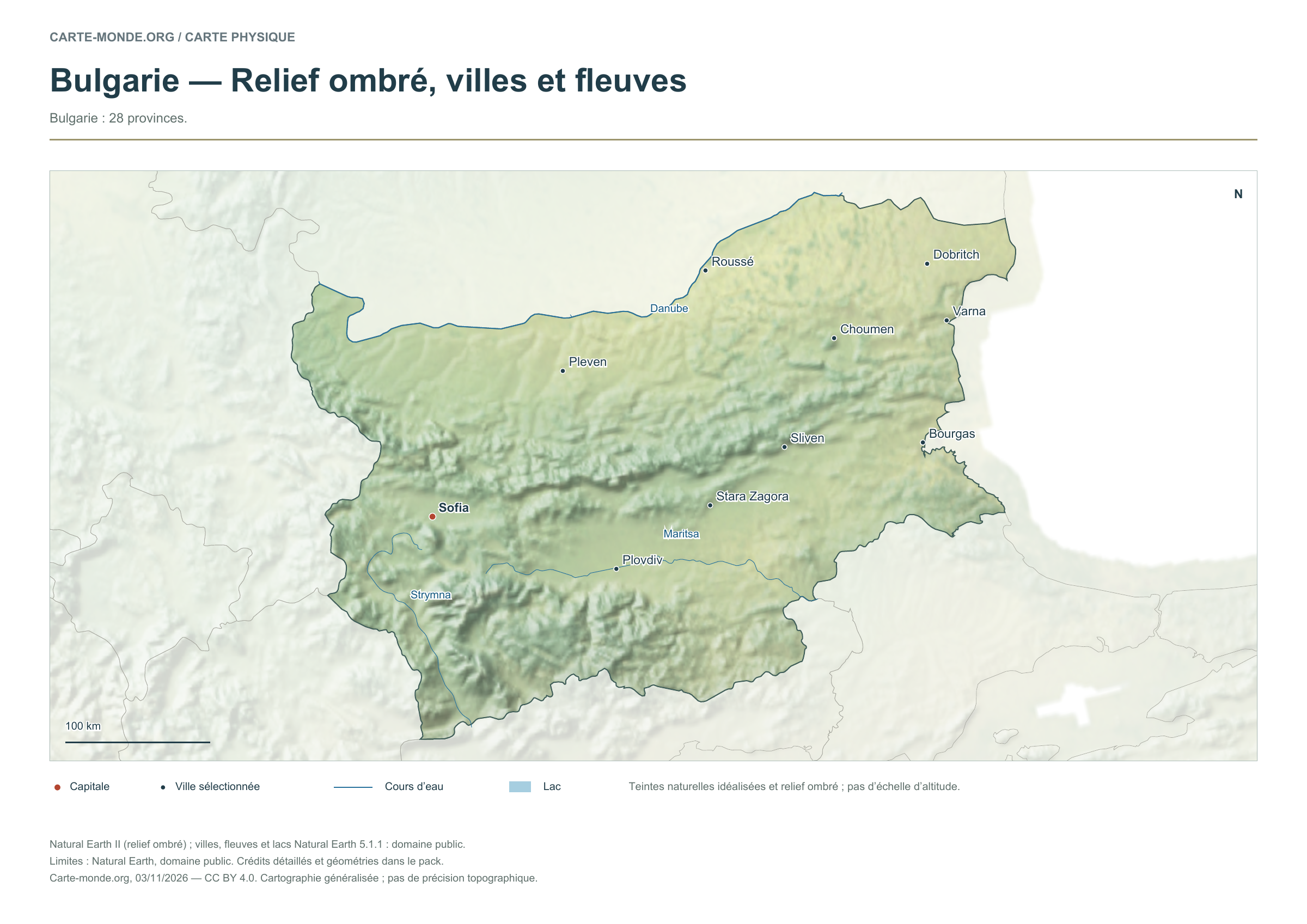
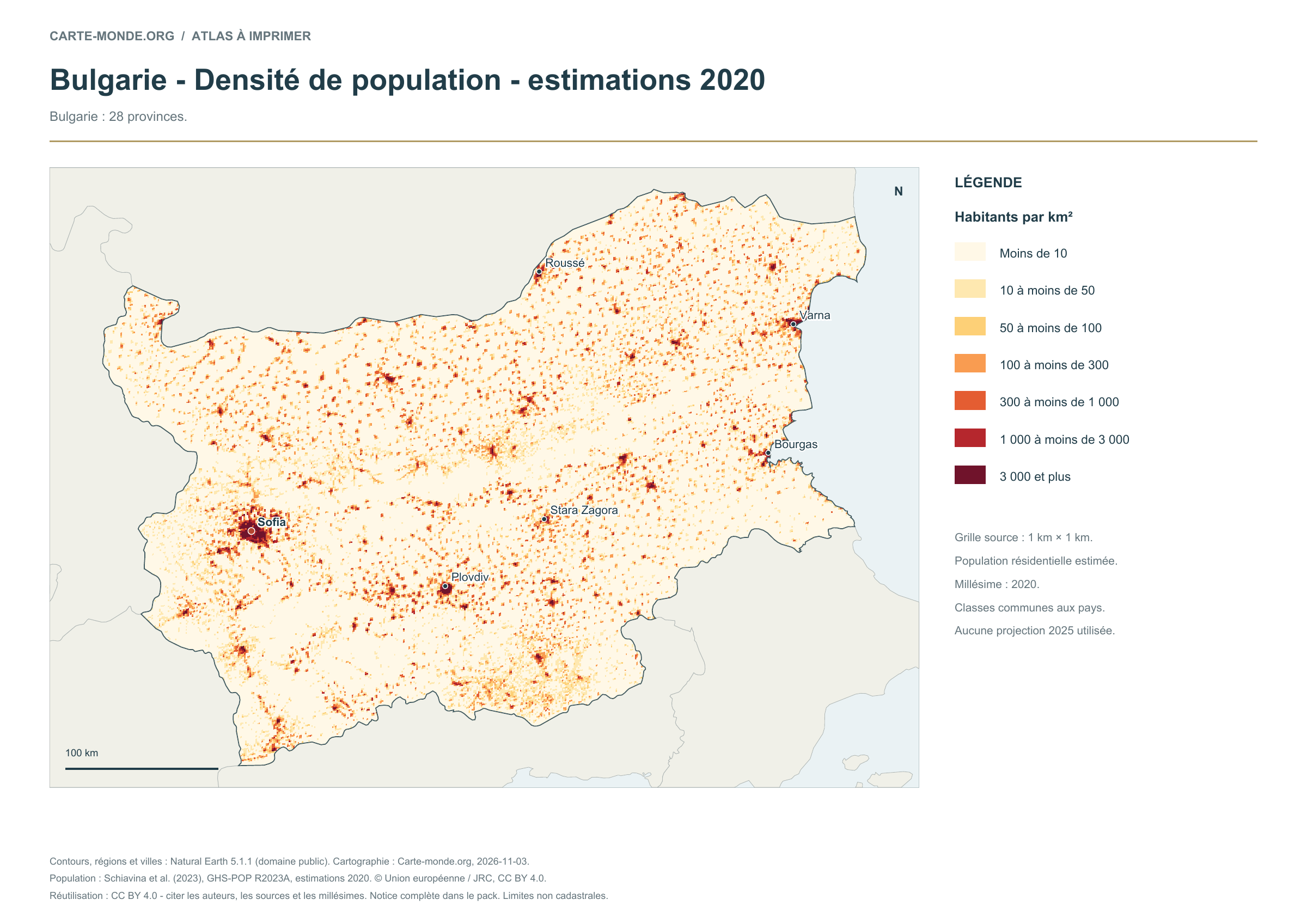
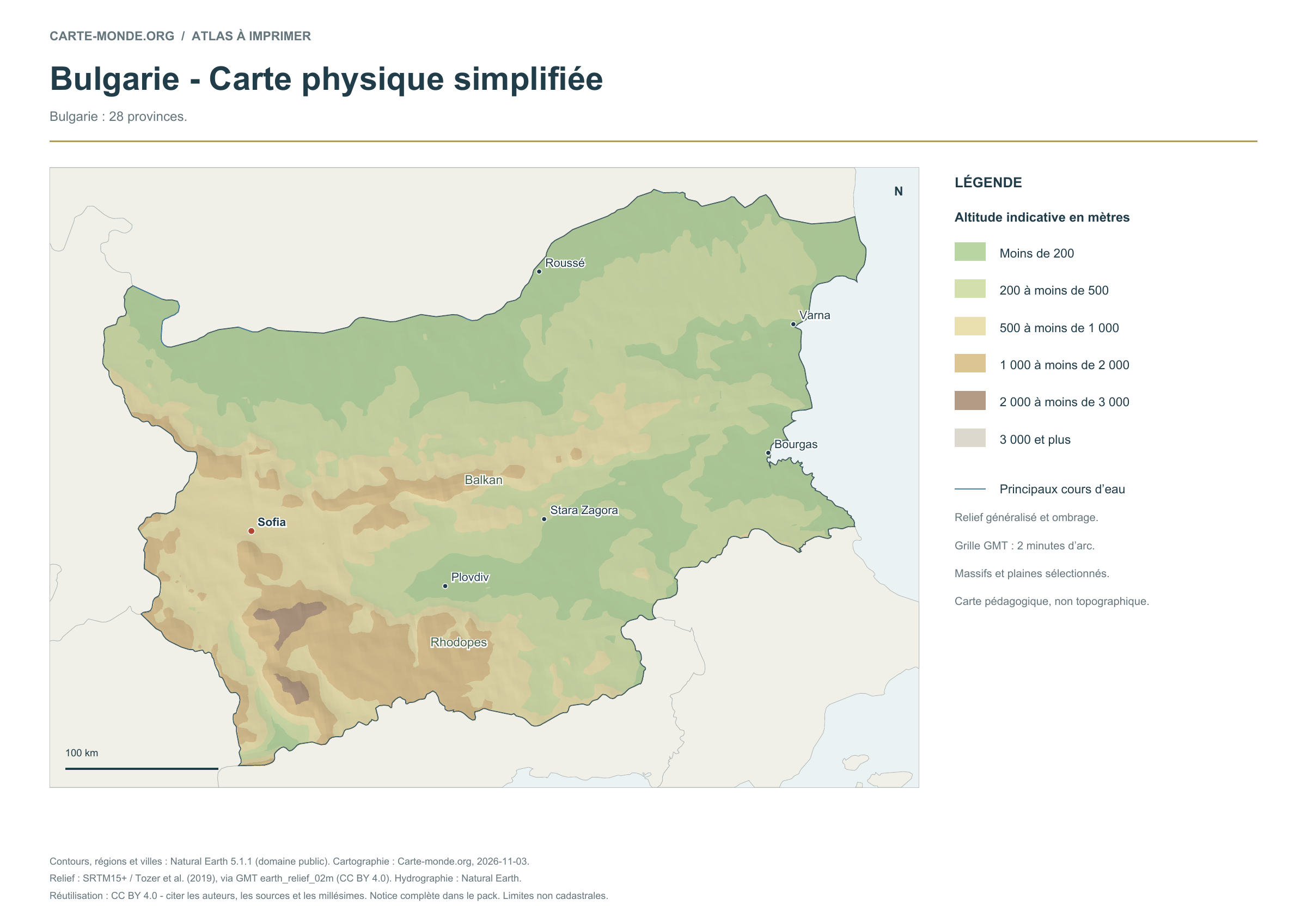
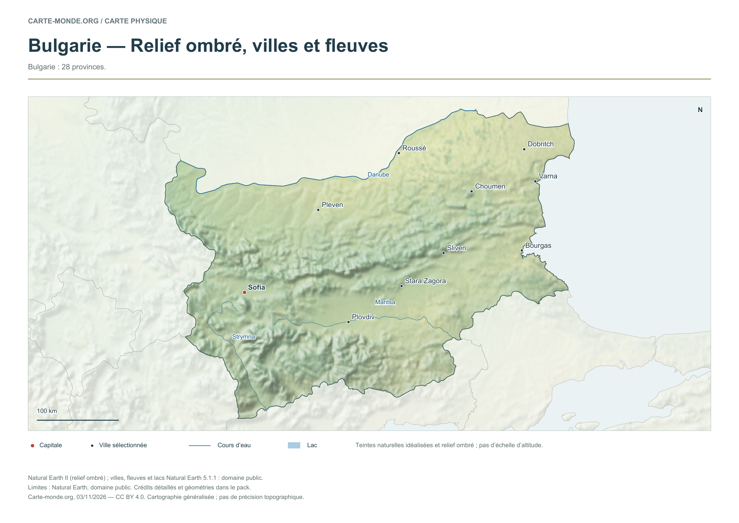
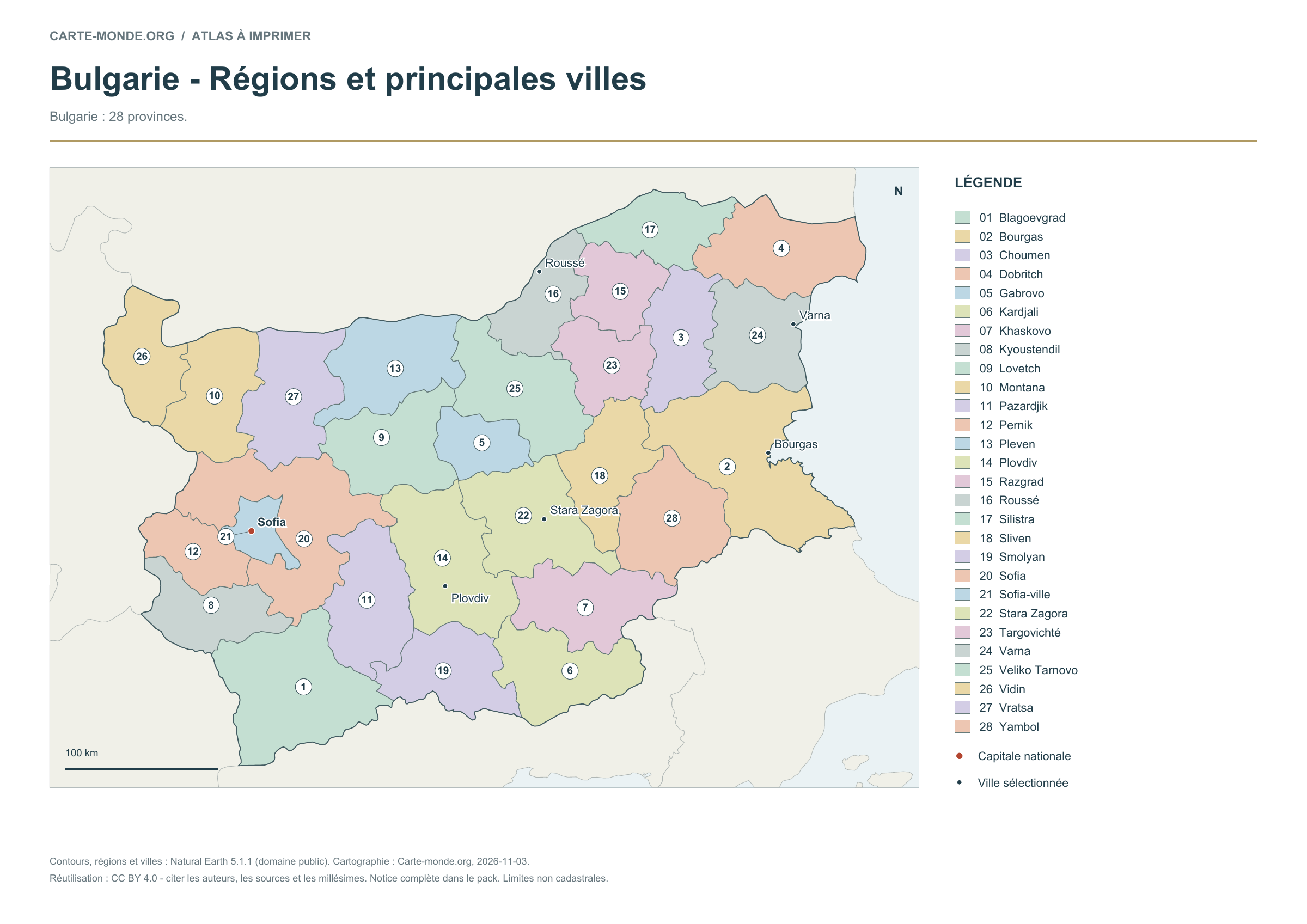
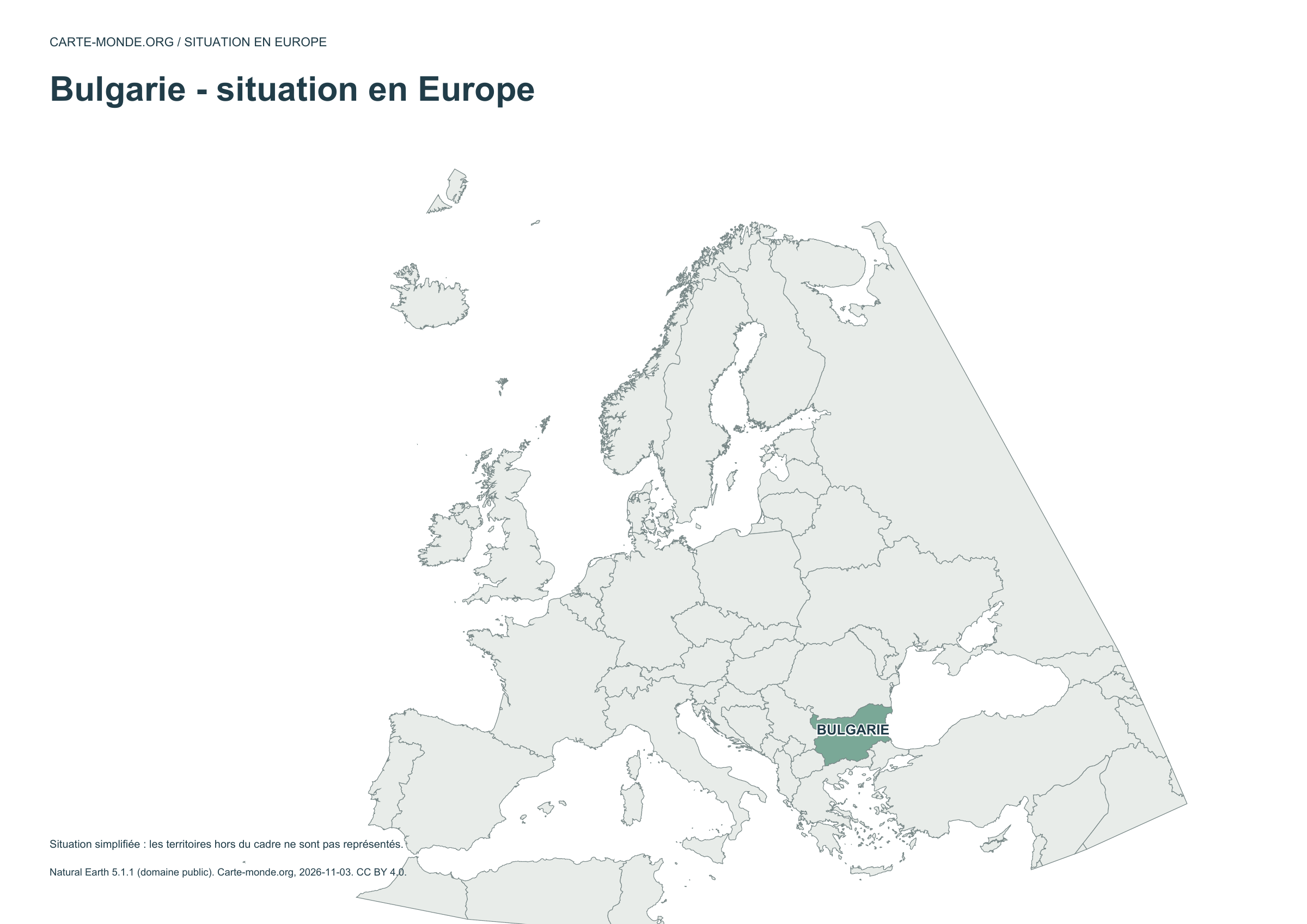
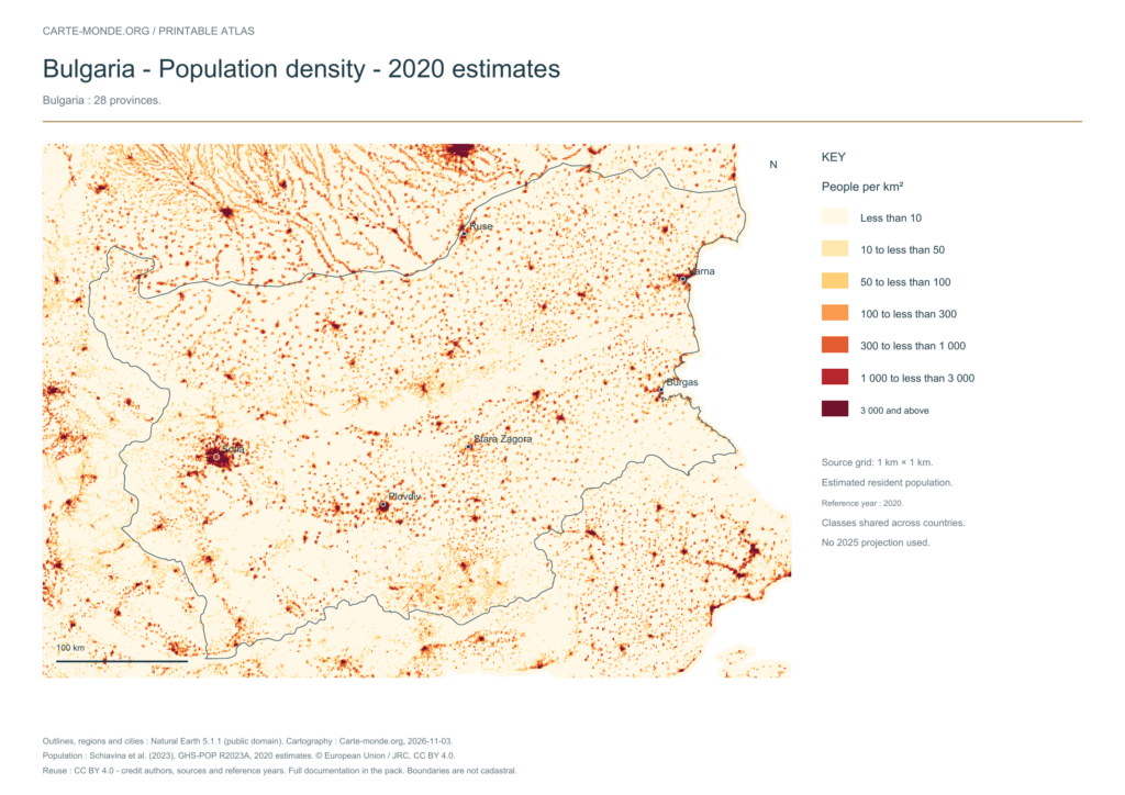
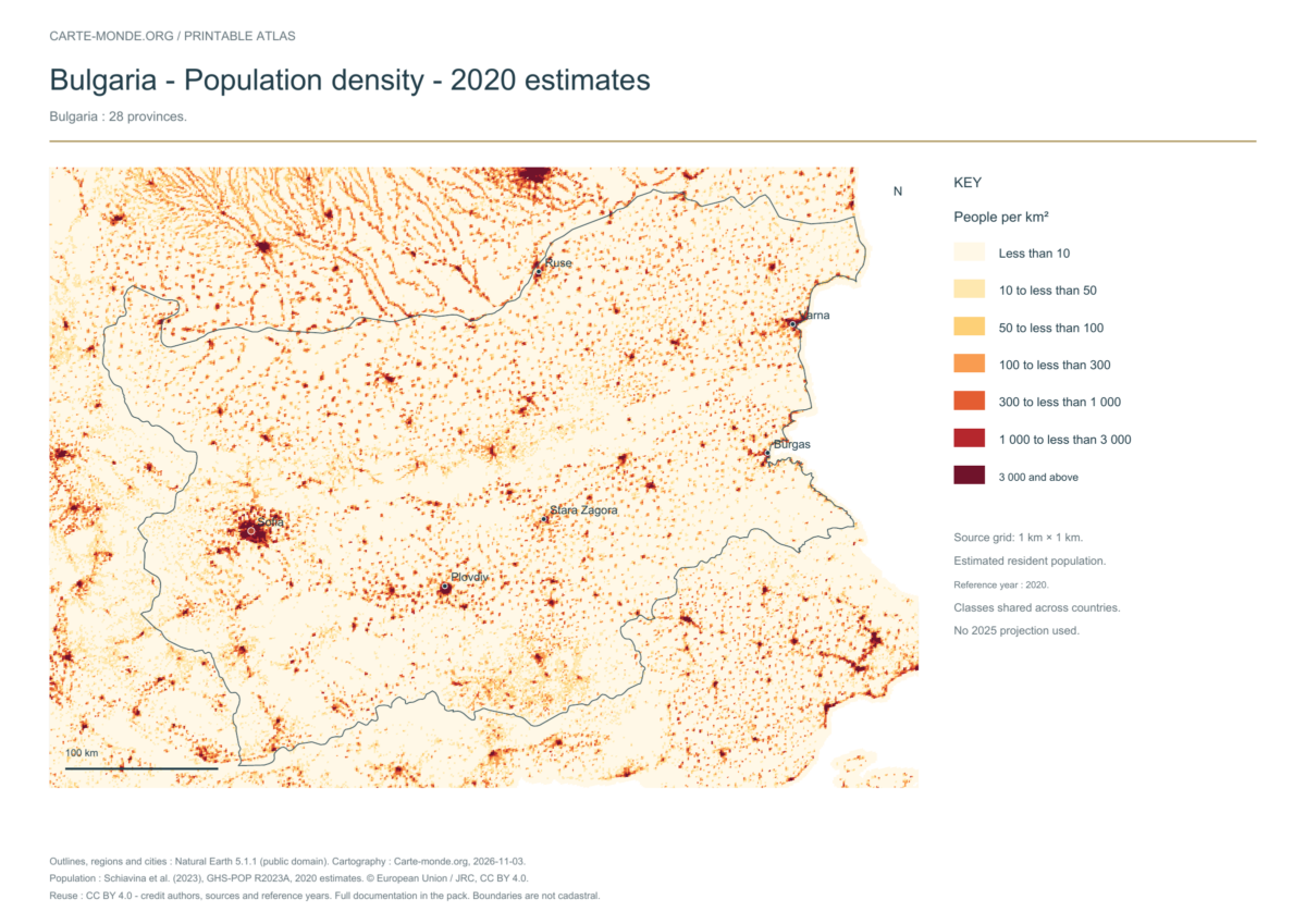
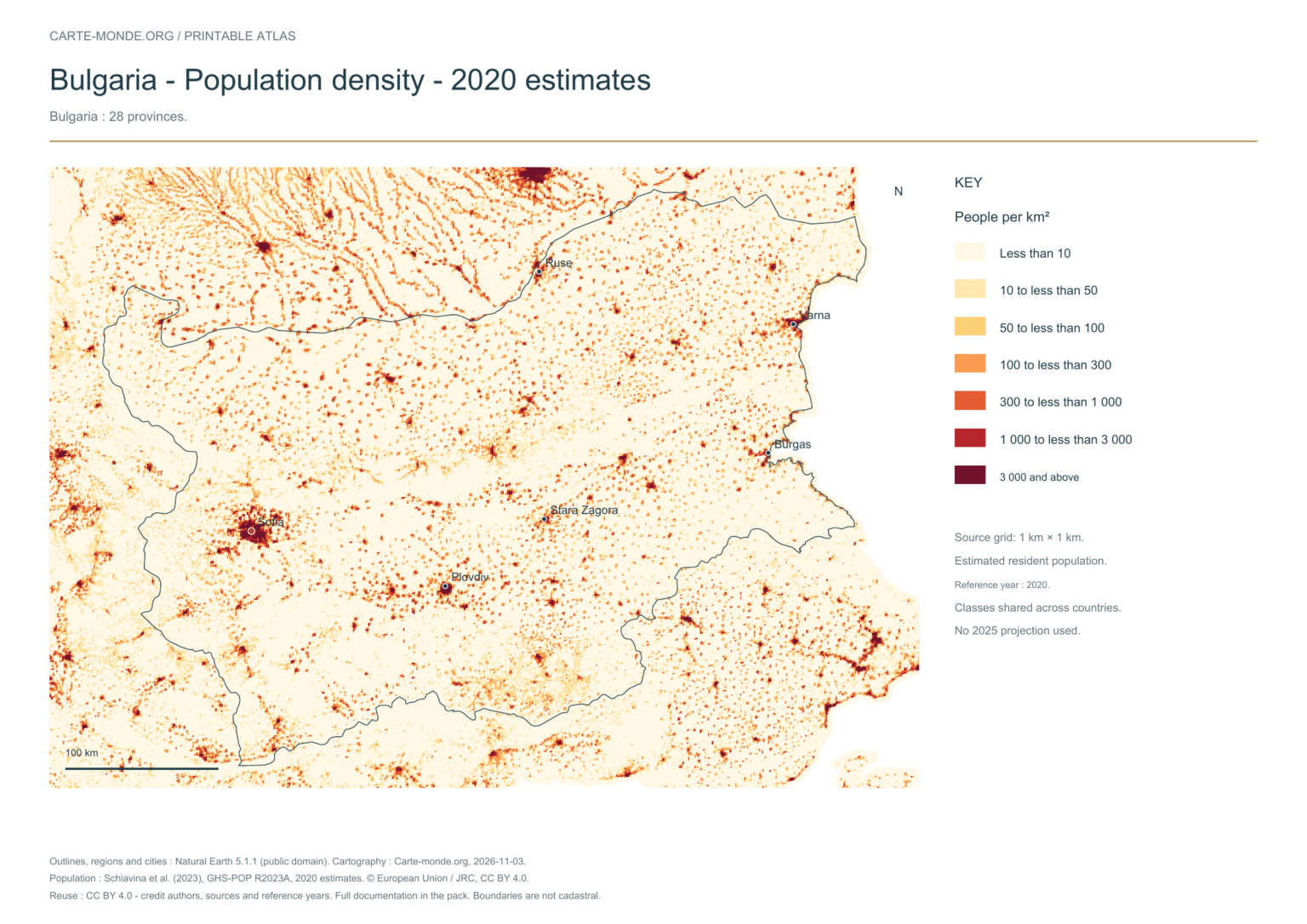
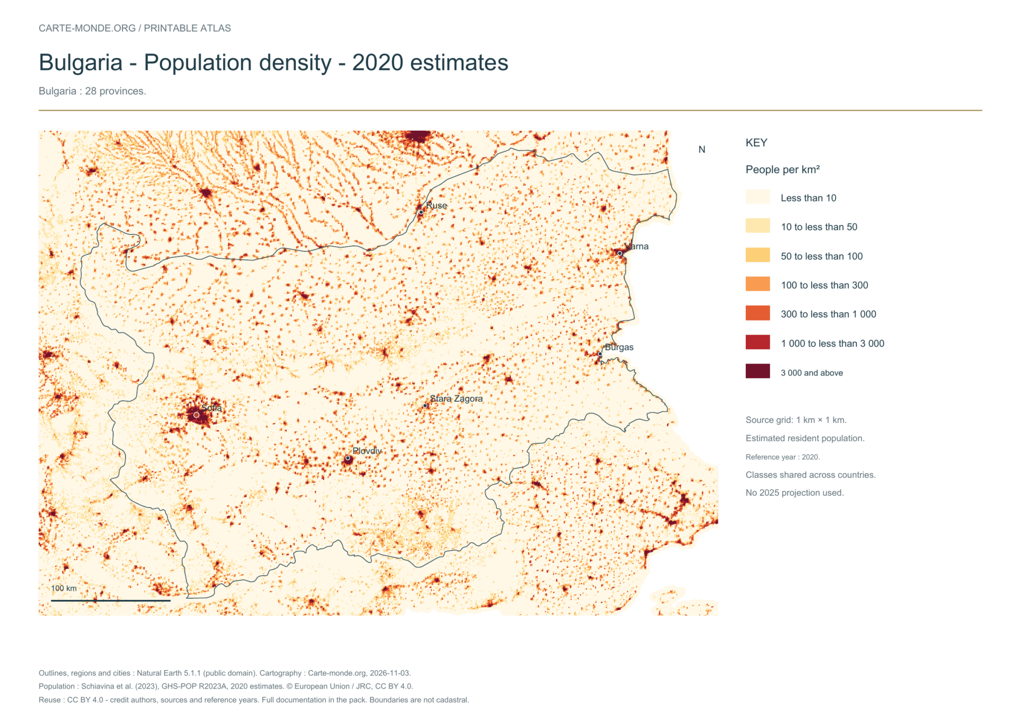
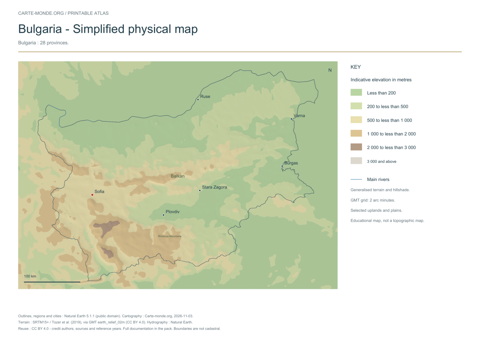
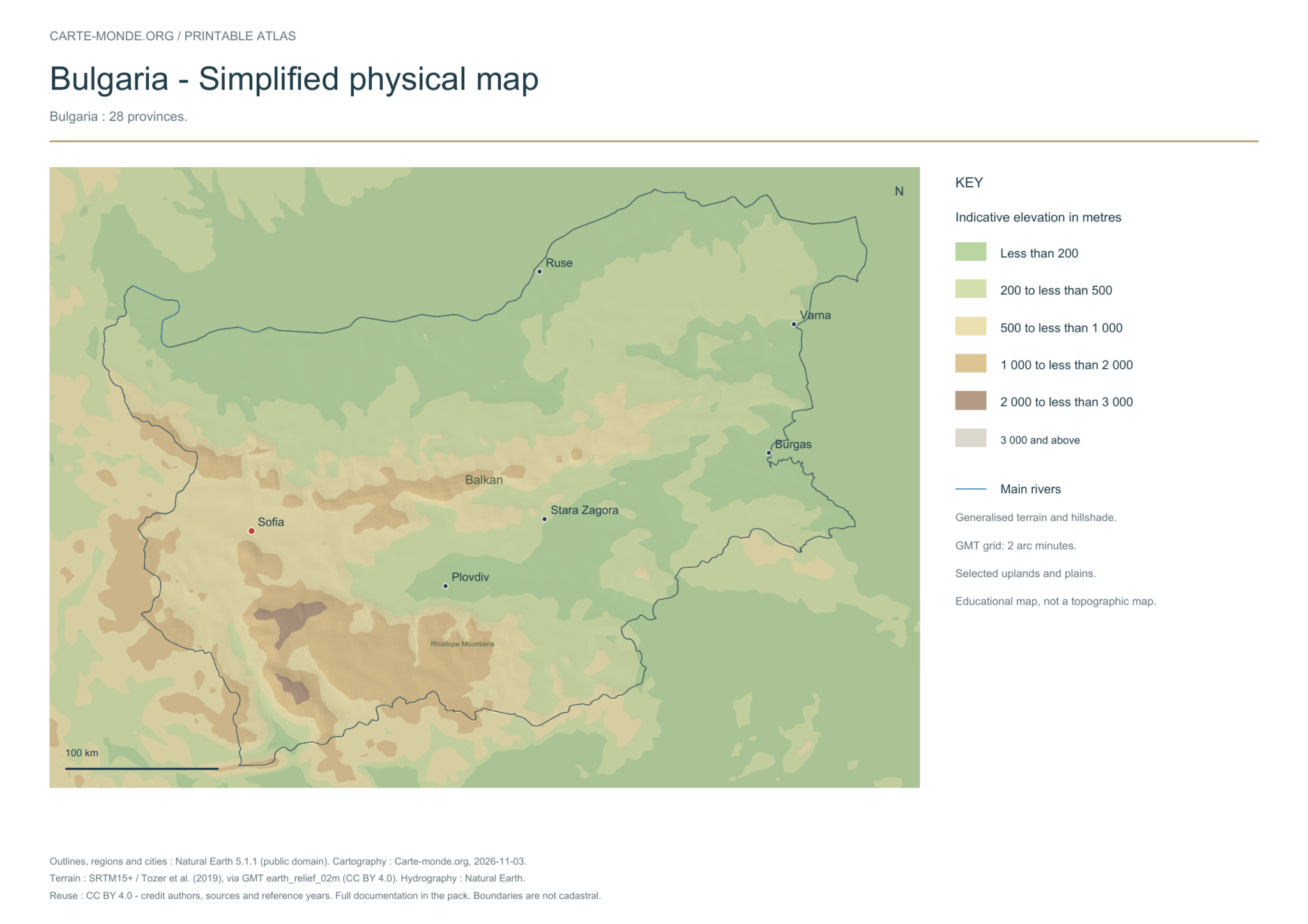
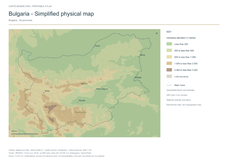
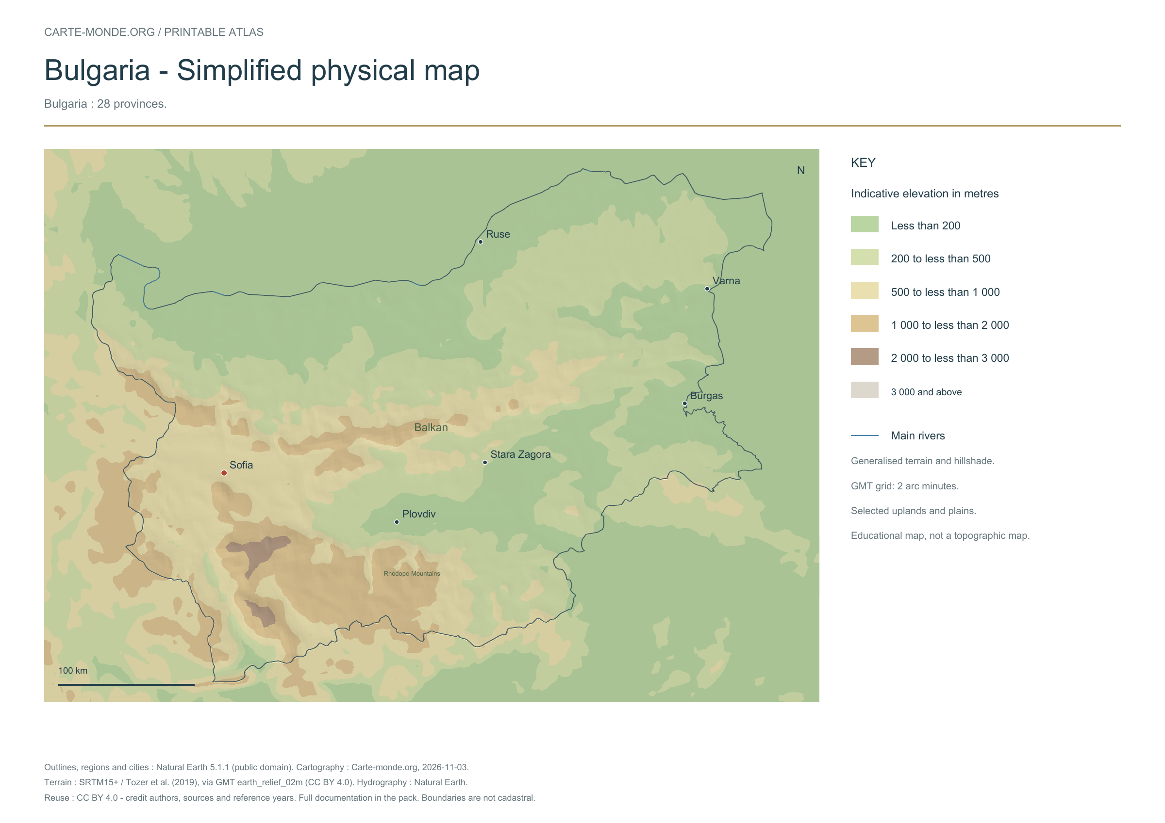
Five printable maps of Bulgaria: regions and cities, location in Europe, two views of the relief and population. PDFs, images and sources are available below.
Our five maps have English labels. Maps from other publishers retain their original language.
Raster base map, cities, rivers and lakes: Natural Earth, public domain. Other boundary credits and licences are retained in the pack. Cartographic work CC BY 4.0; ODbL-derived data retains its licence. No topographic accuracy is claimed.
Territory, data and selection of names
Bulgaria: 28 provinces.
Natural Earth II shaded relief background, 10 selected cities. Named rivers: Danube, Maritsa, Strymna.
The colours represent idealised natural cover; they do not correspond to elevation classes. This global background remains generalised, particularly for small states.
Carte-monde.org · November 2026
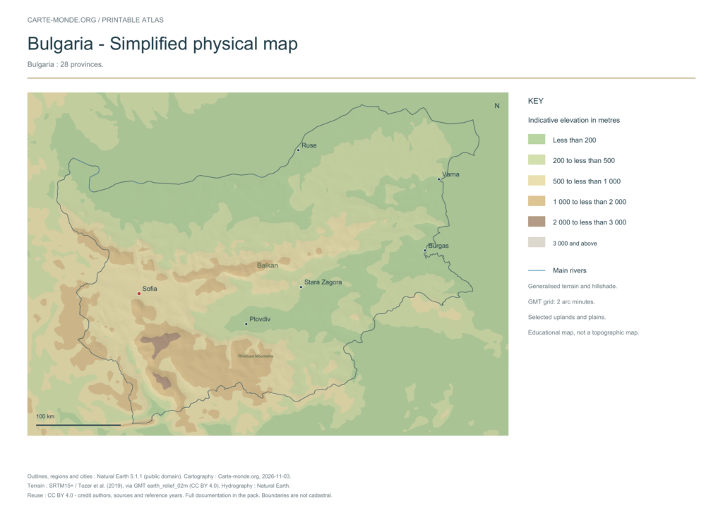
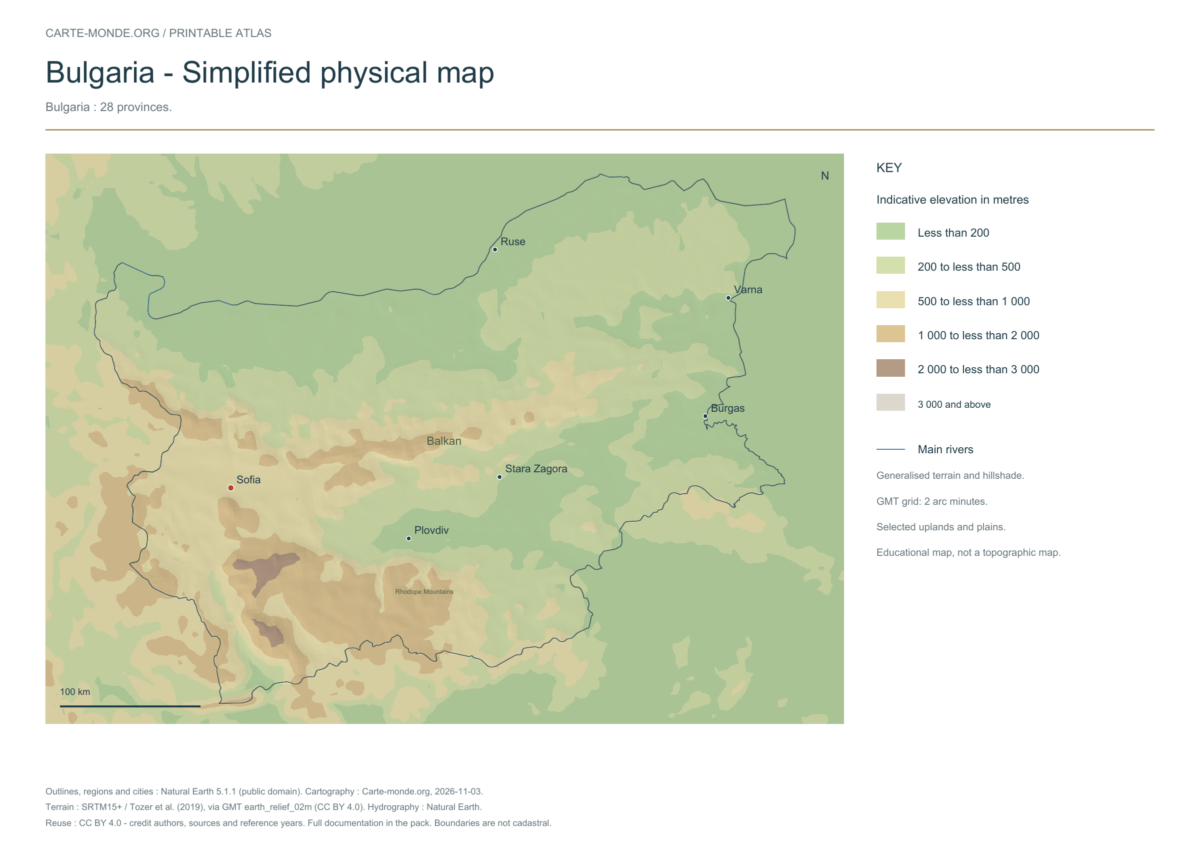
Simplified elevations
Smoothed relief, elevation colours, main mountain ranges, plains and watercourses. Educational map at national scale.
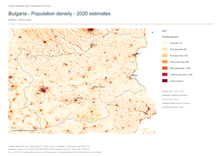
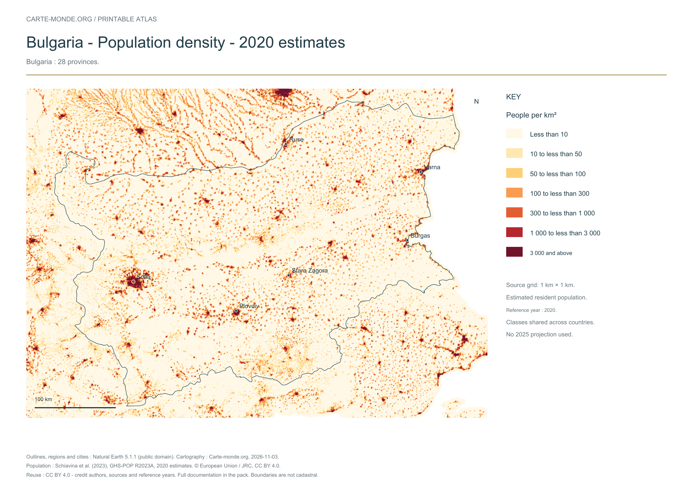
The data represents estimated residential population in 2020, on a 1 km² source grid. The document’s creation date does not change this reference year.
The five in-house maps in one pack
Regions and cities, location in Europe, simplified elevations, 2020 population density and shaded relief: five A4 PDFs, their PNGs and SVGs, with sources and licences.
Older documents in English provided by the University of Texas’s Perry–Castañeda collection. The links open the collection page where you can choose the indicated map. The dates below refer to the documents: these references do not necessarily describe the current situation.
Author: Central Intelligence Agency, except where otherwise stated on the document. Source: University of Texas Libraries. The collection states that most of its maps are in the public domain; retain these credits and check exceptions: reuse terms.
External references: no new file from this collection has been hosted on this site for this batch.
Find the old maps of Bulgaria
Previously published maps remain accessible at their original URLs, with the collection’s text and credits.
Regions and cities show how the territory is organized; the location map places the country; terrain shows the main natural regions; density shows population distribution. Print the in-house PDFs in A4 landscape with “Fit to page”. Insets have their own scales.
Outlines, regions, cities and hydrography:Natural Earth 5.1.1, public domain. Generalized boundaries at 1:10 million, not cadastral; edition year 2026 does not mean that all geometries have been updated.
Relief: SRTM15+ / Tozer et al. (2019), reference publication, via GMT earth_relief_02m derived from SRTM15+V2.7. Grid smoothed to two arc minutes, suitable for a national overview, without topographic precision.
The four new maps: created by Carte-monde.org, November 2026, under CC BY 4.0. Cite authors, sources and reference years, and indicate adaptations. Additional and older maps retain their own rights.
Raster base map, cities, rivers and lakes: Natural Earth, public domain. Other boundary credits and licences are retained in the pack. Cartographic work CC BY 4.0; ODbL-derived data retains its licence. No topographic accuracy is claimed.
Previous collection — original files preservedFlag of Bulgaria
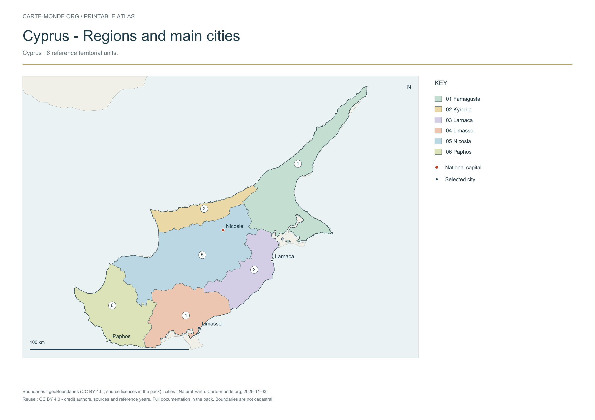
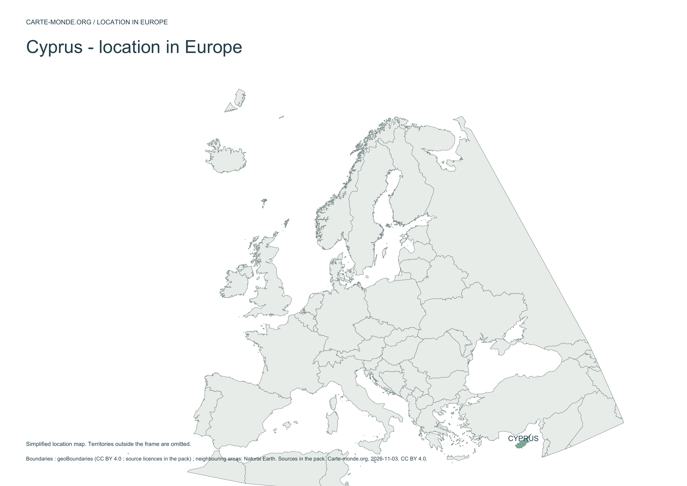
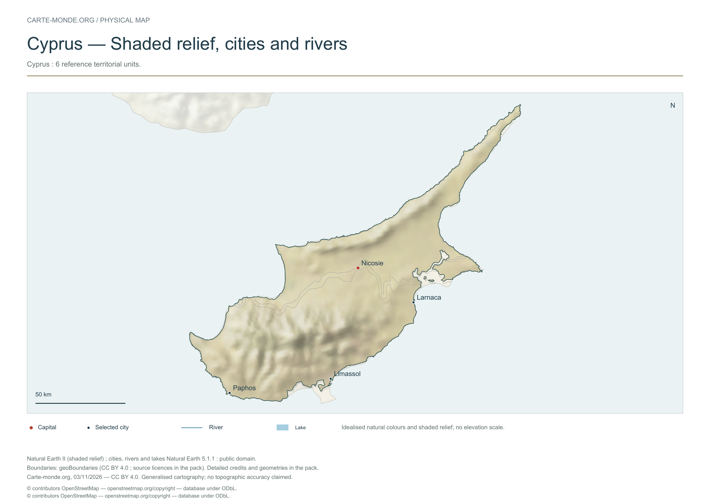
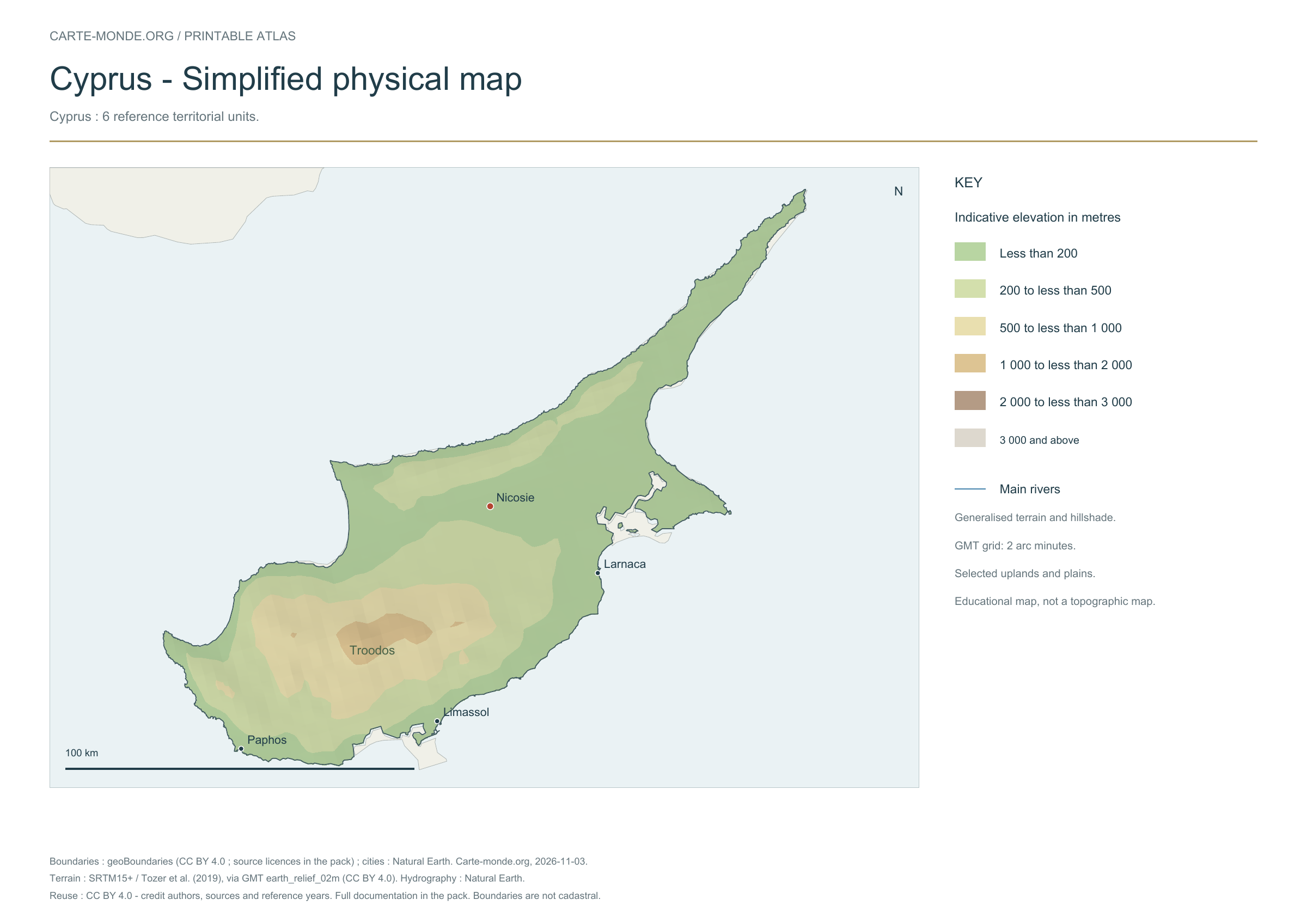
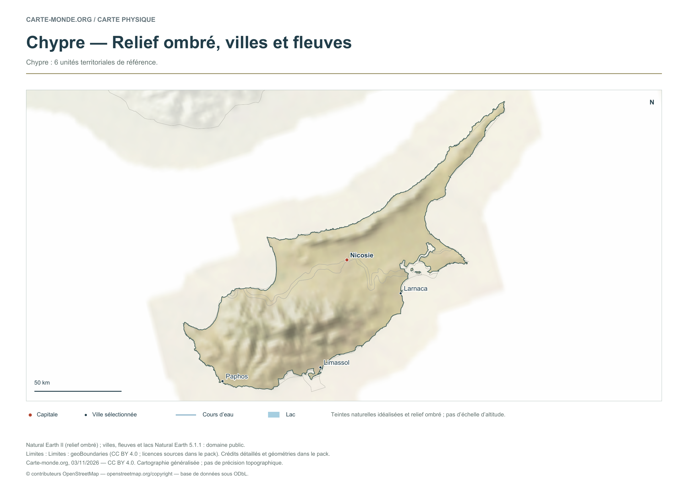
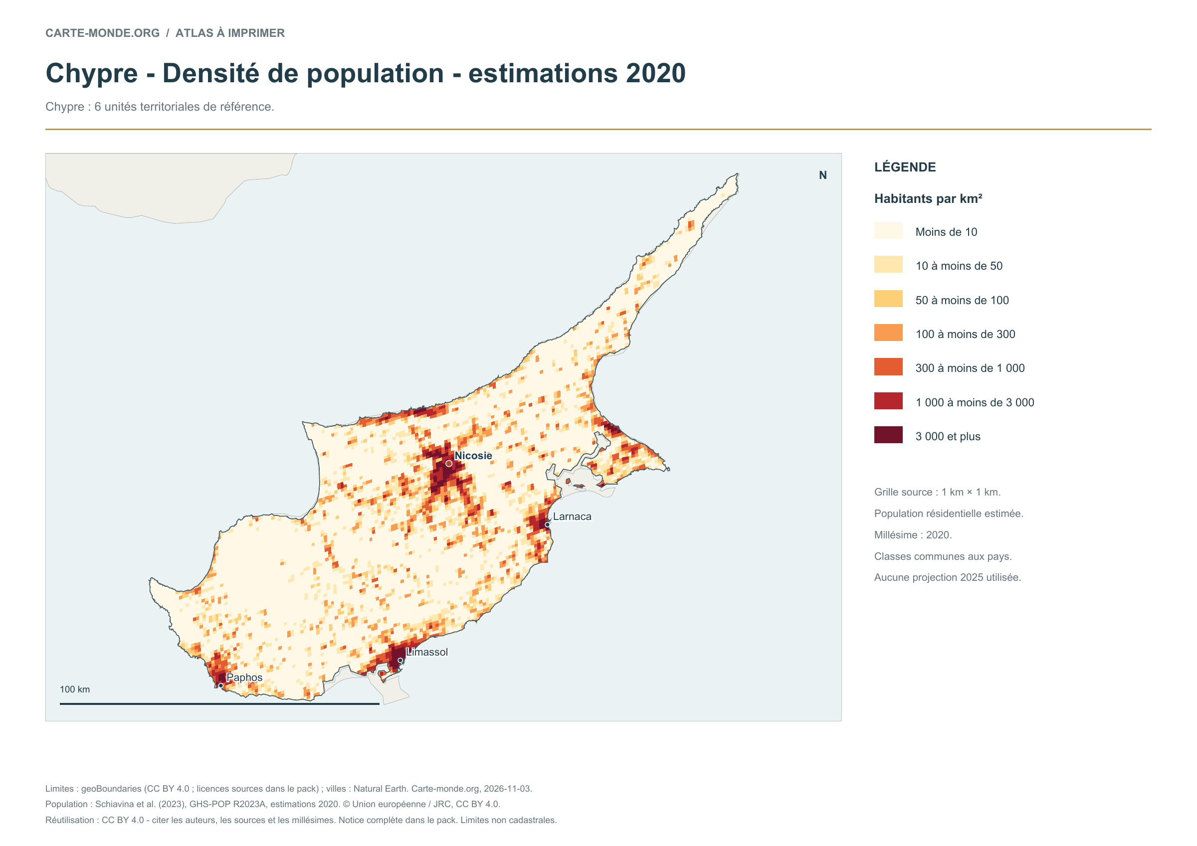
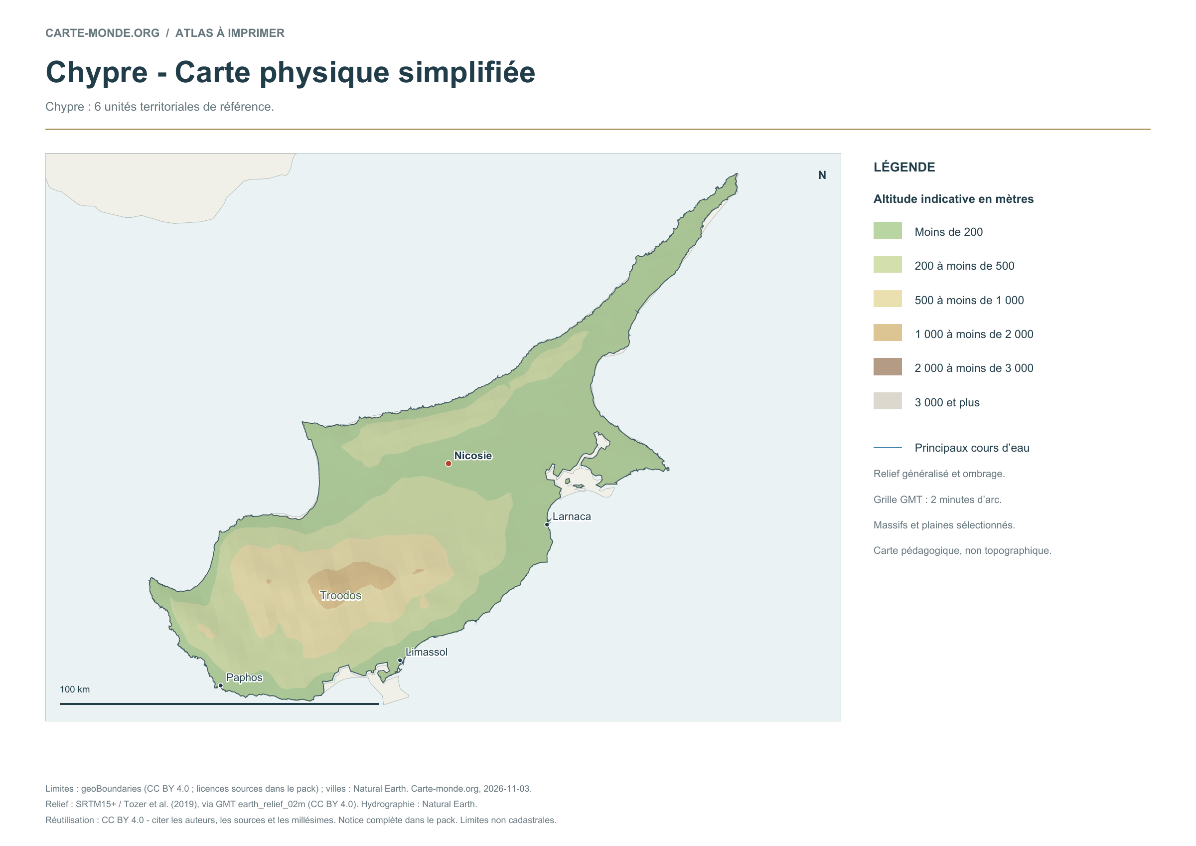
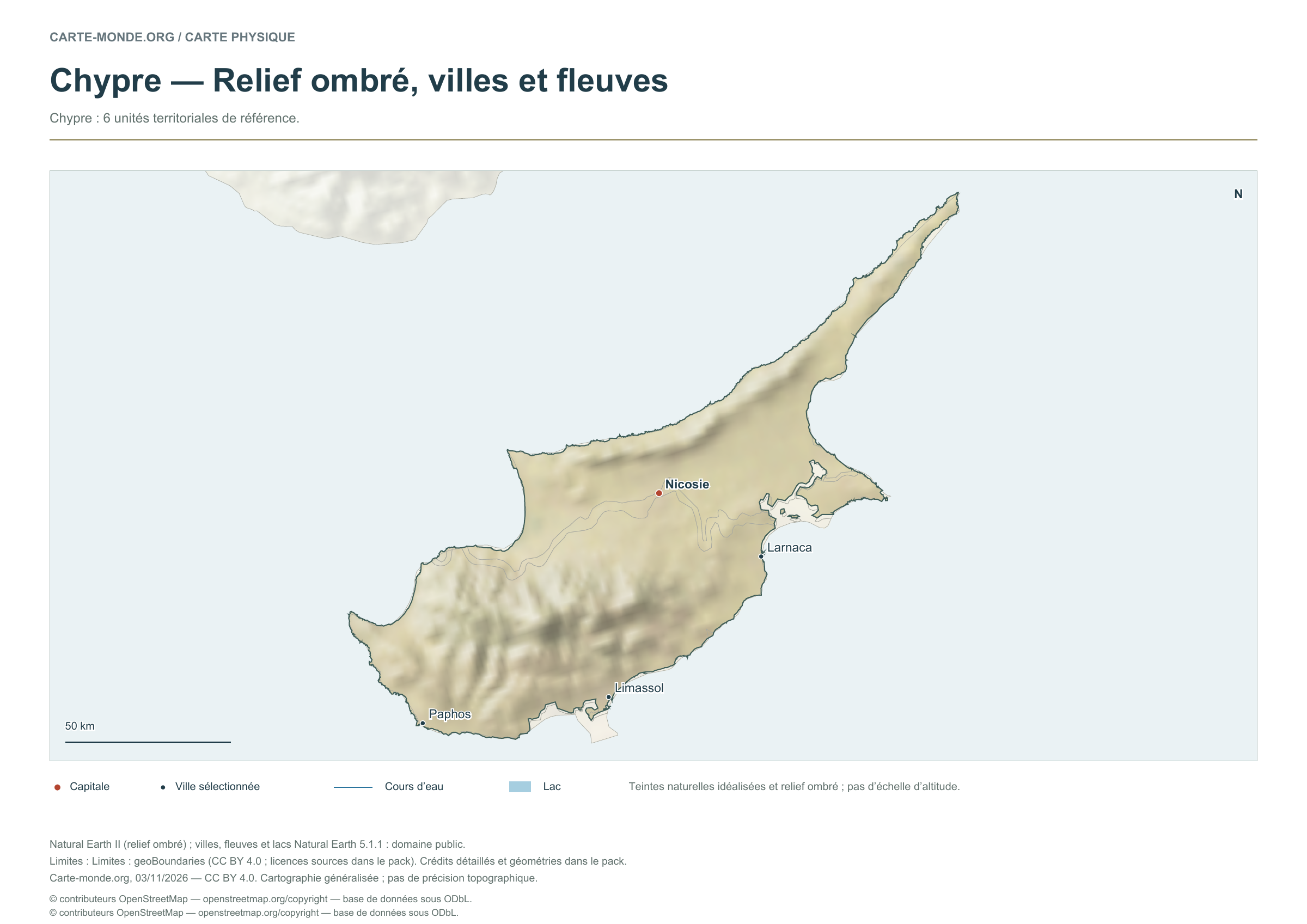
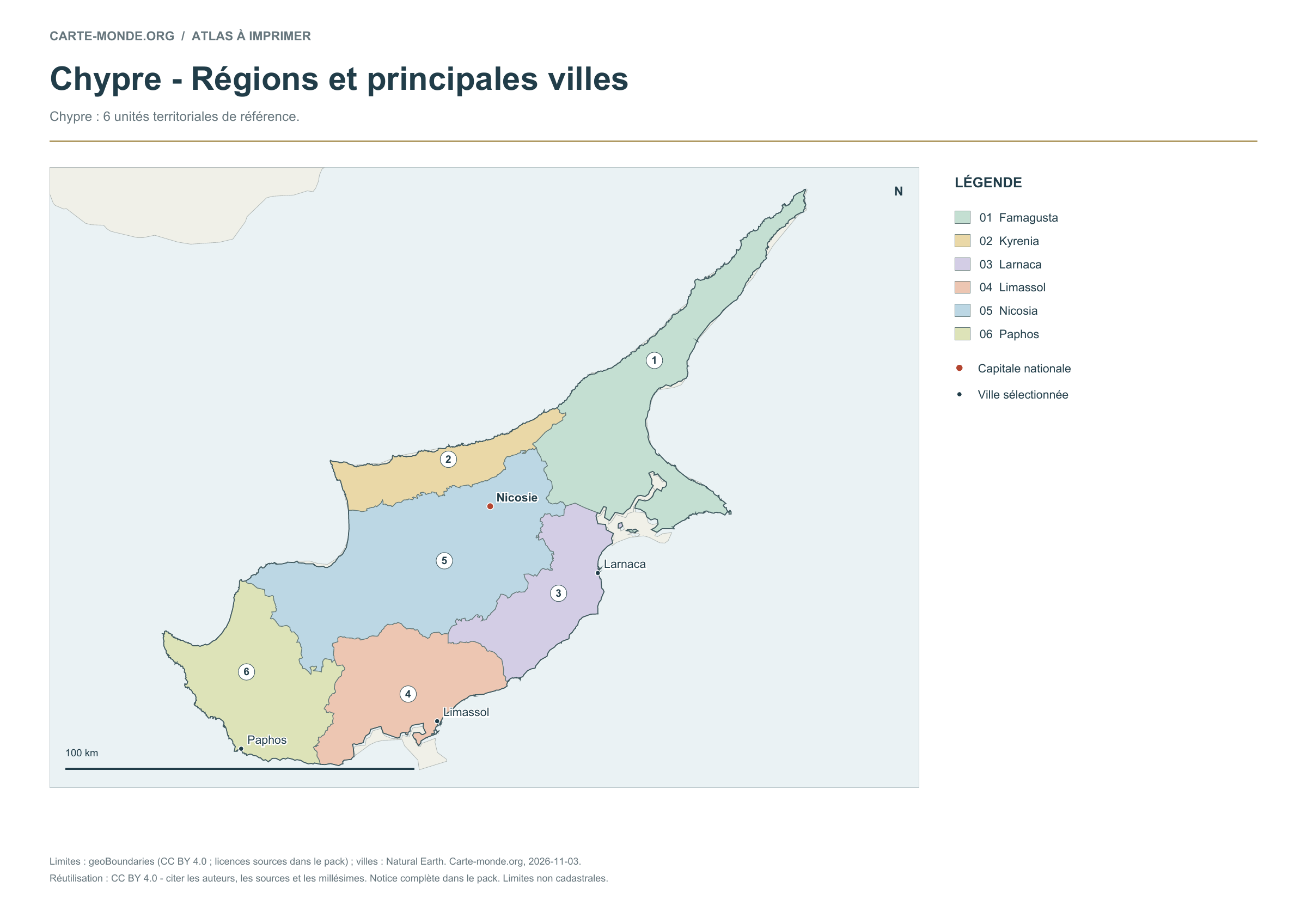
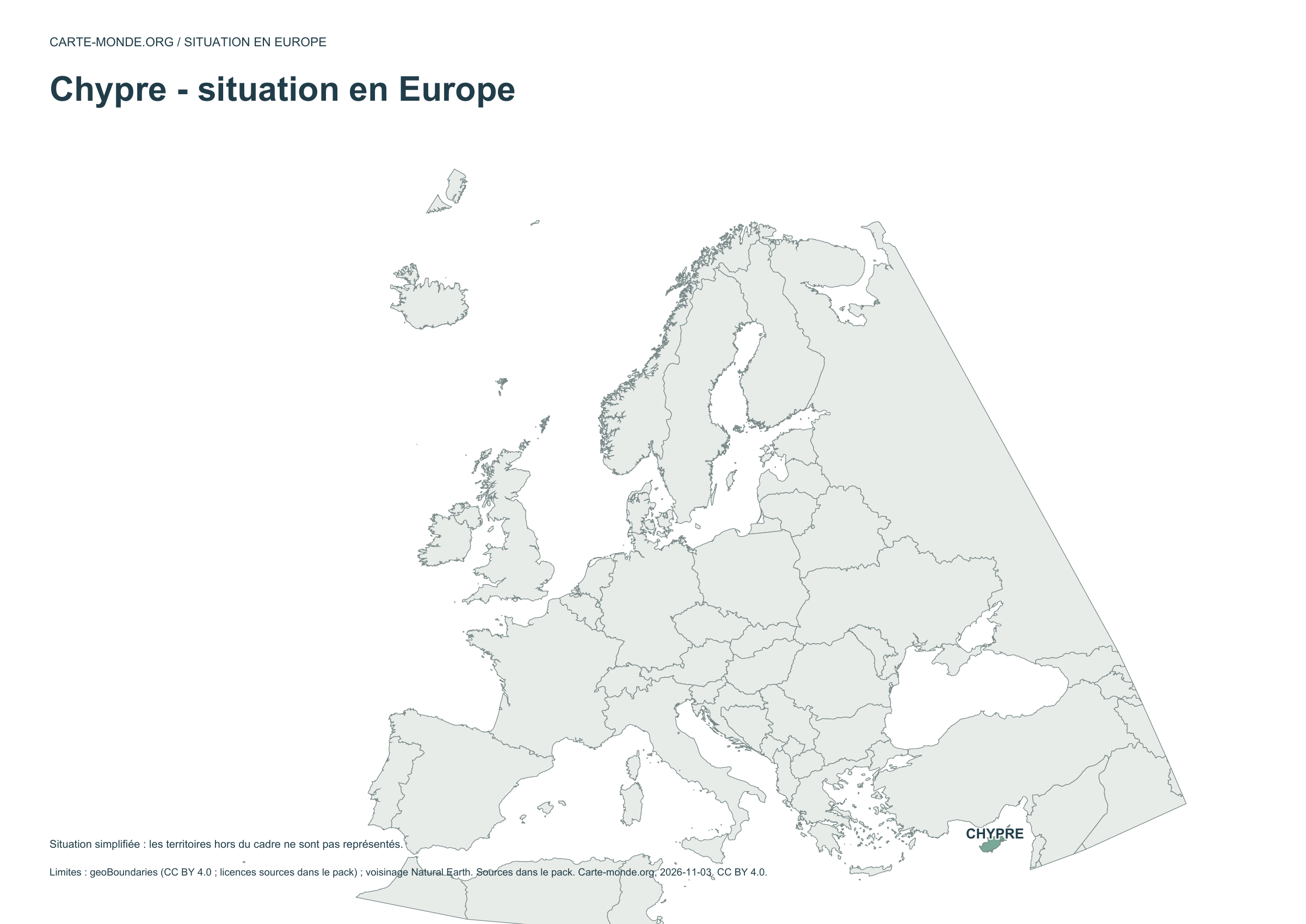
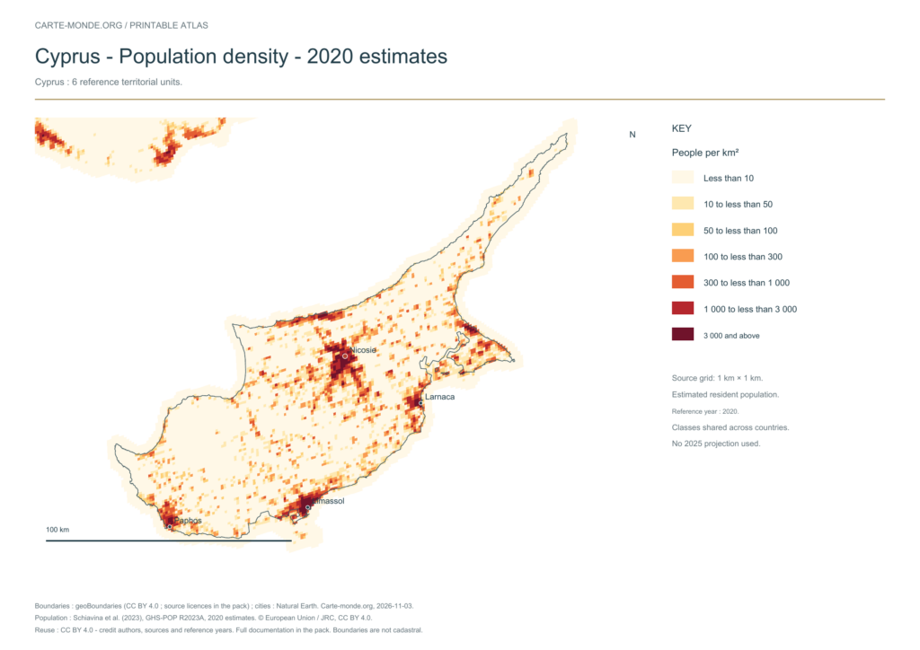
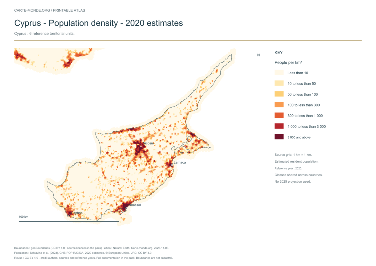
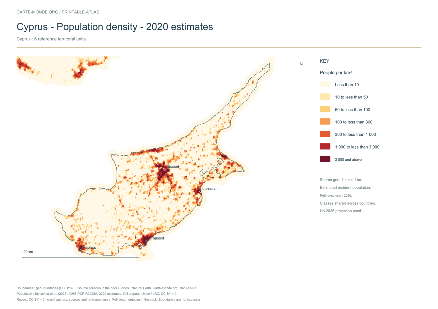
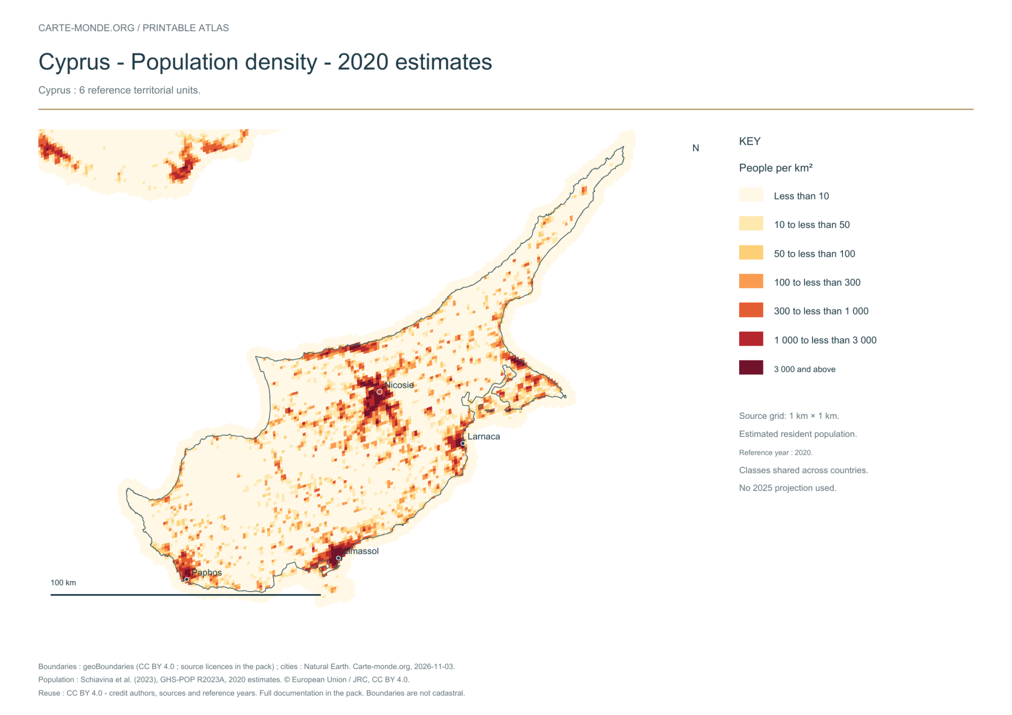
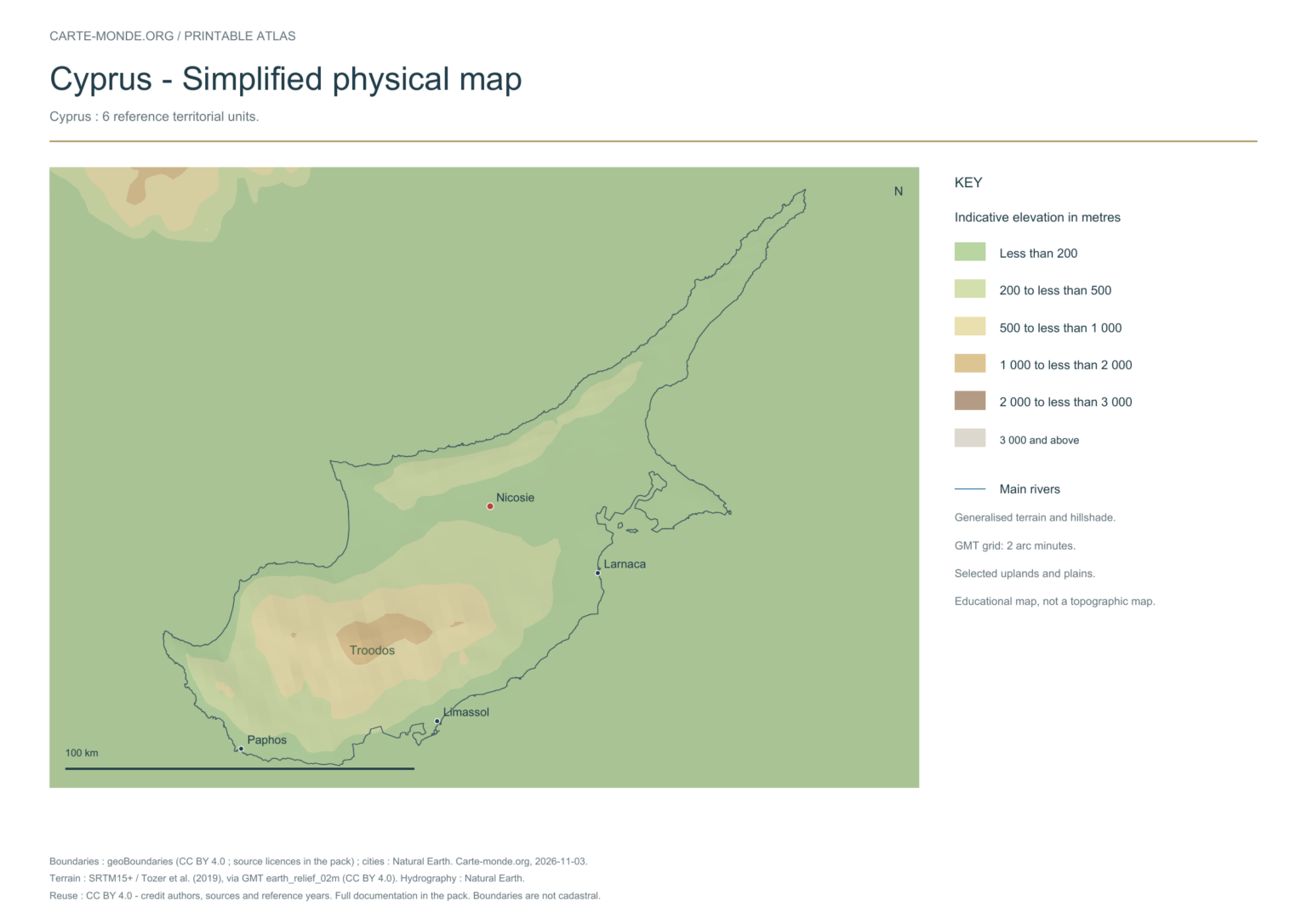
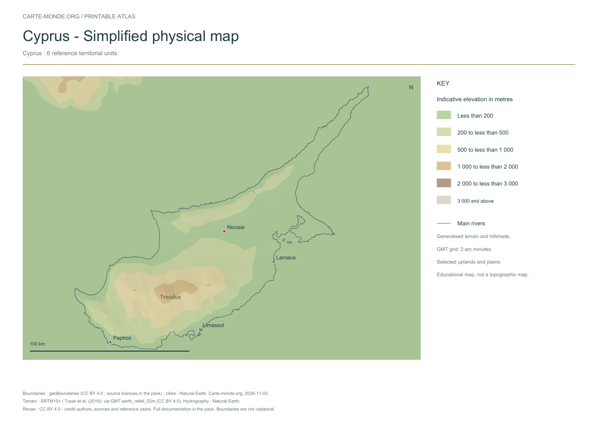
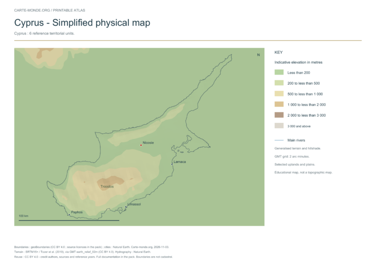
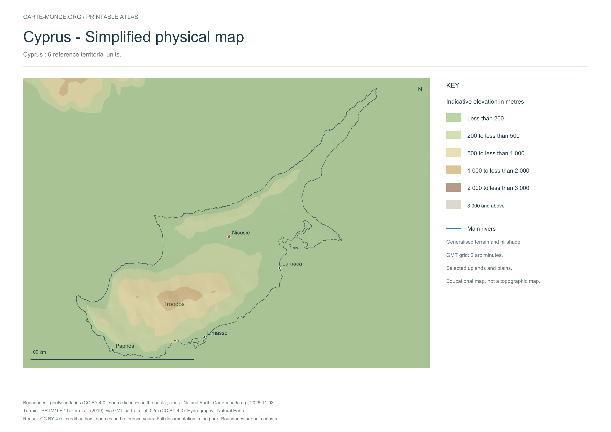
Five printable maps of Cyprus: regions and cities, location in Europe, two views of the relief and population. PDFs, images and sources are available below.
Our five maps have English labels. Maps from other publishers retain their original language.
Raster base map, cities, rivers and lakes: Natural Earth, public domain. Other boundary credits and licences are retained in the pack. Cartographic work CC BY 4.0; ODbL-derived data retains its licence. No topographic accuracy is claimed.
Territory, data and selection of names
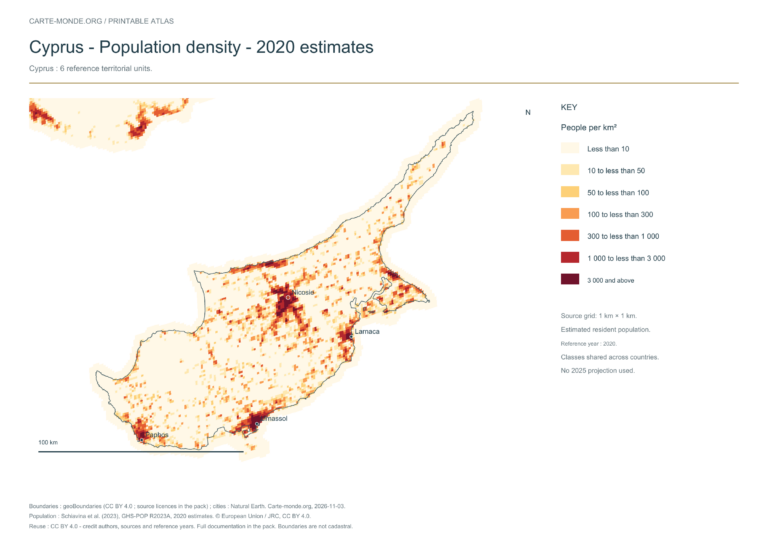
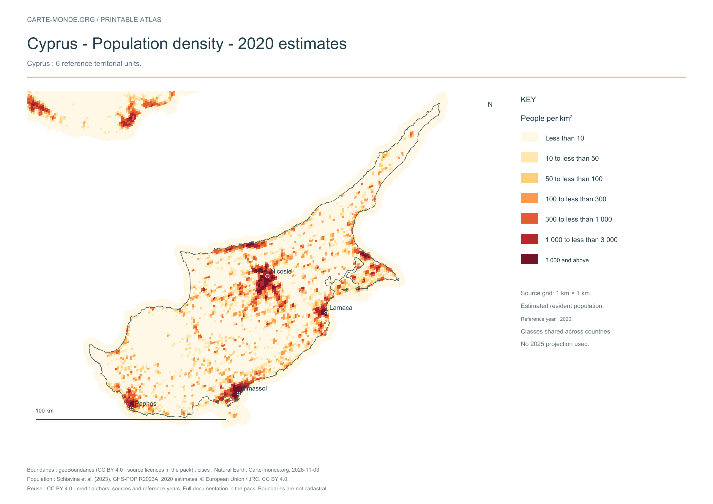
Cyprus: 6 reference territorial units.
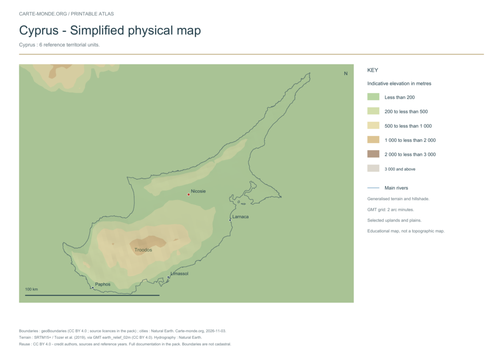
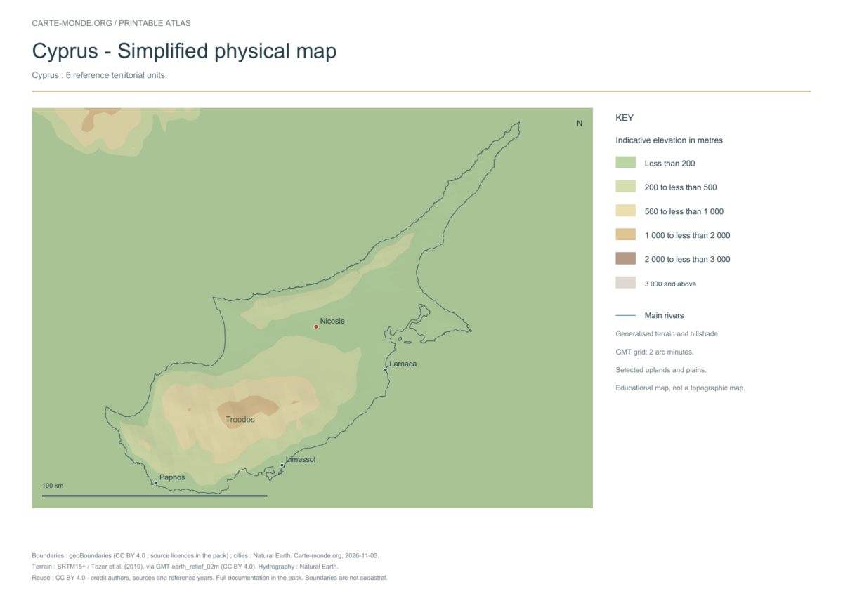
Natural Earth II shaded relief background, 4 selected cities. No named waterway from this global dataset was selected within this map extent.
The colours represent idealised natural cover; they do not correspond to elevation classes. This global background remains generalised, particularly for small states.
Carte-monde.org · November 2026
Simplified elevations
Smoothed relief, elevation colours, main mountain ranges, plains and watercourses. Educational map at national scale.
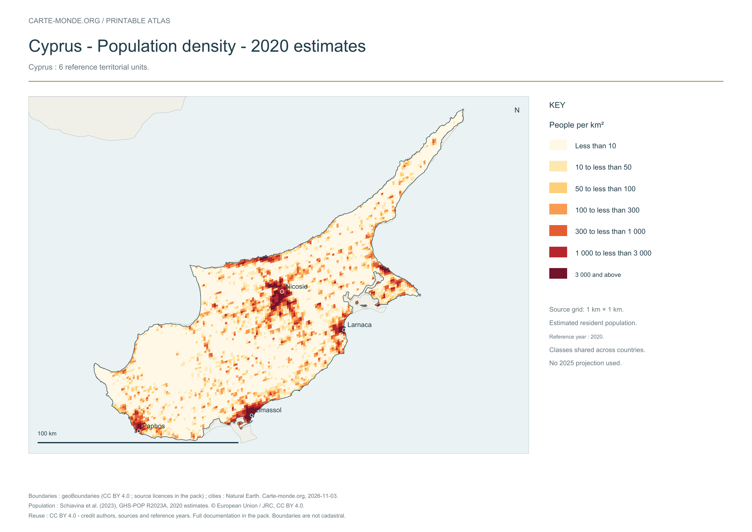
The data represents estimated residential population in 2020, on a 1 km² source grid. The document’s creation date does not change this reference year.
The five in-house maps in one pack
Regions and cities, location in Europe, simplified elevations, 2020 population density and shaded relief: five A4 PDFs, their PNGs and SVGs, with sources and licences.
Regions and cities show how the territory is organized; the location map places the country; terrain shows the main natural regions; density shows population distribution. Print the in-house PDFs in A4 landscape with “Fit to page”. Insets have their own scales.
Administrative boundaries: geoBoundaries / OpenStreetMap, Wambacher. Island of Cyprus; reference districts, excluding British sovereign bases — Geographical data year: 2017. The file edition date does not mean all boundaries have been updated. Reference district boundaries, without showing the line of control or claims. Boundary source and terms. Primary licence: Open Data Commons Open Database License 1.0. The geometries used and credits are included in the pack; derived databases under ODbL remain under ODbL.
Neighbouring area, cities and hydrography: Natural Earth 5.1.1, public domain, generalised boundaries not for cadastral use.
Relief: SRTM15+ / Tozer et al. (2019), reference publication, via GMT earth_relief_02m derived from SRTM15+V2.7. Grid smoothed to two arc minutes, suitable for a national overview, without topographic precision.
The four new maps: created by Carte-monde.org, November 2026, under CC BY 4.0. Cite authors, sources and reference years, and indicate adaptations. Additional and older maps retain their own rights.
Raster base map, cities, rivers and lakes: Natural Earth, public domain. Other boundary credits and licences are retained in the pack. Cartographic work CC BY 4.0; ODbL-derived data retains its licence. No topographic accuracy is claimed.
Previous collection — original files preservedFlag of Cyprus
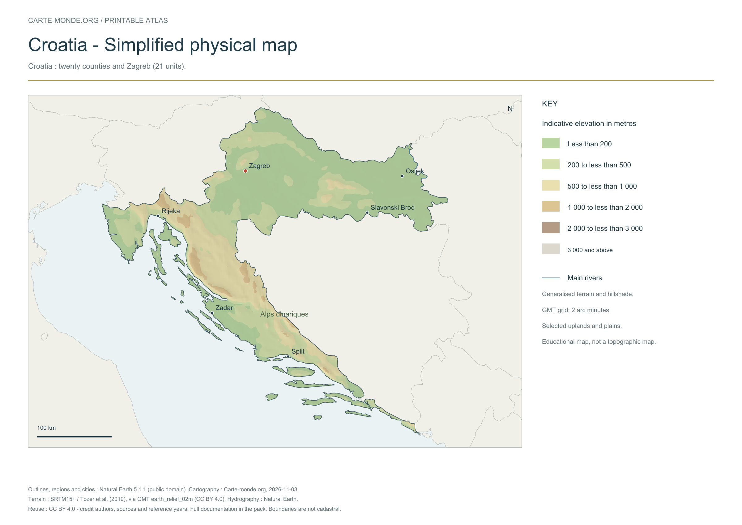
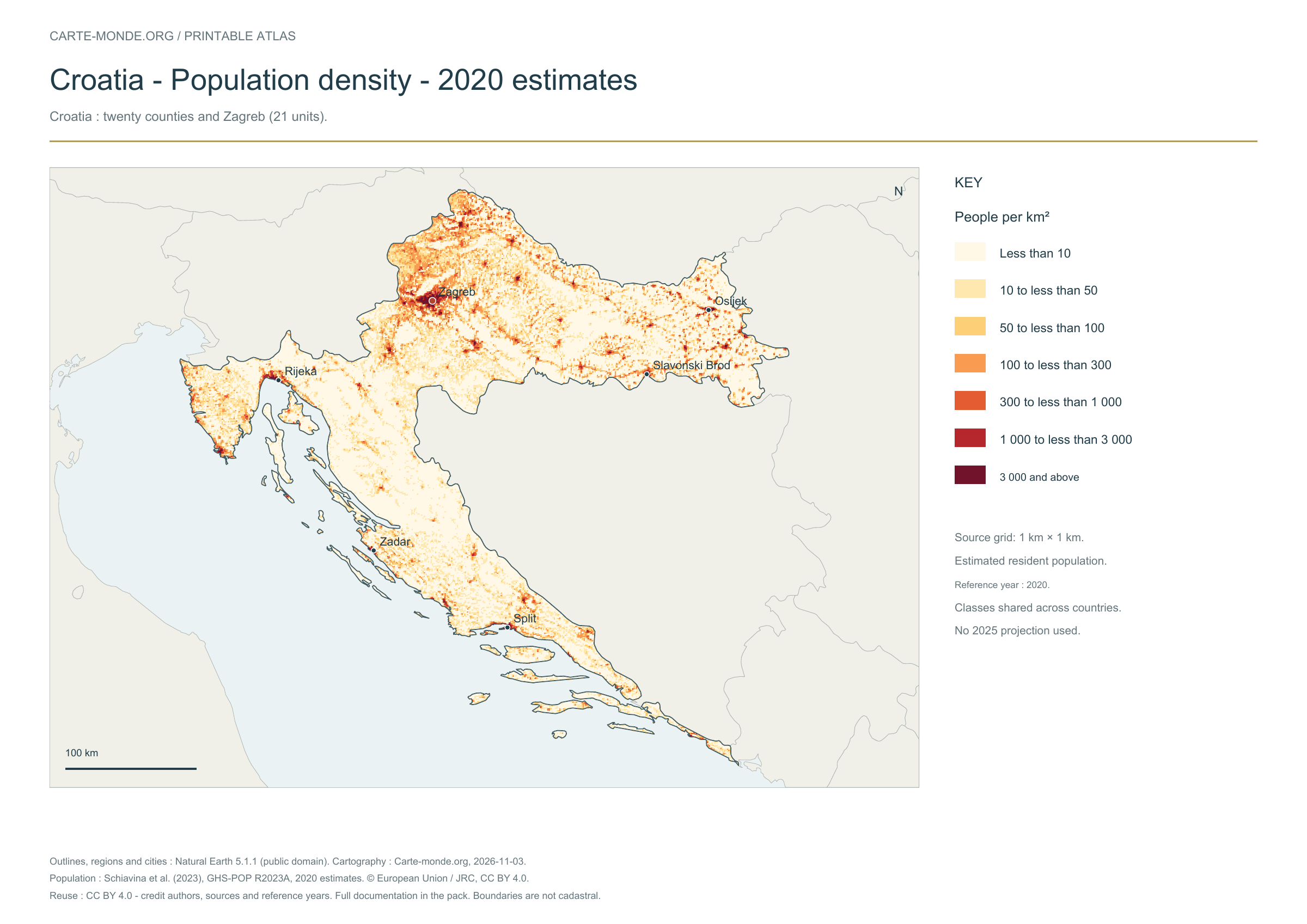
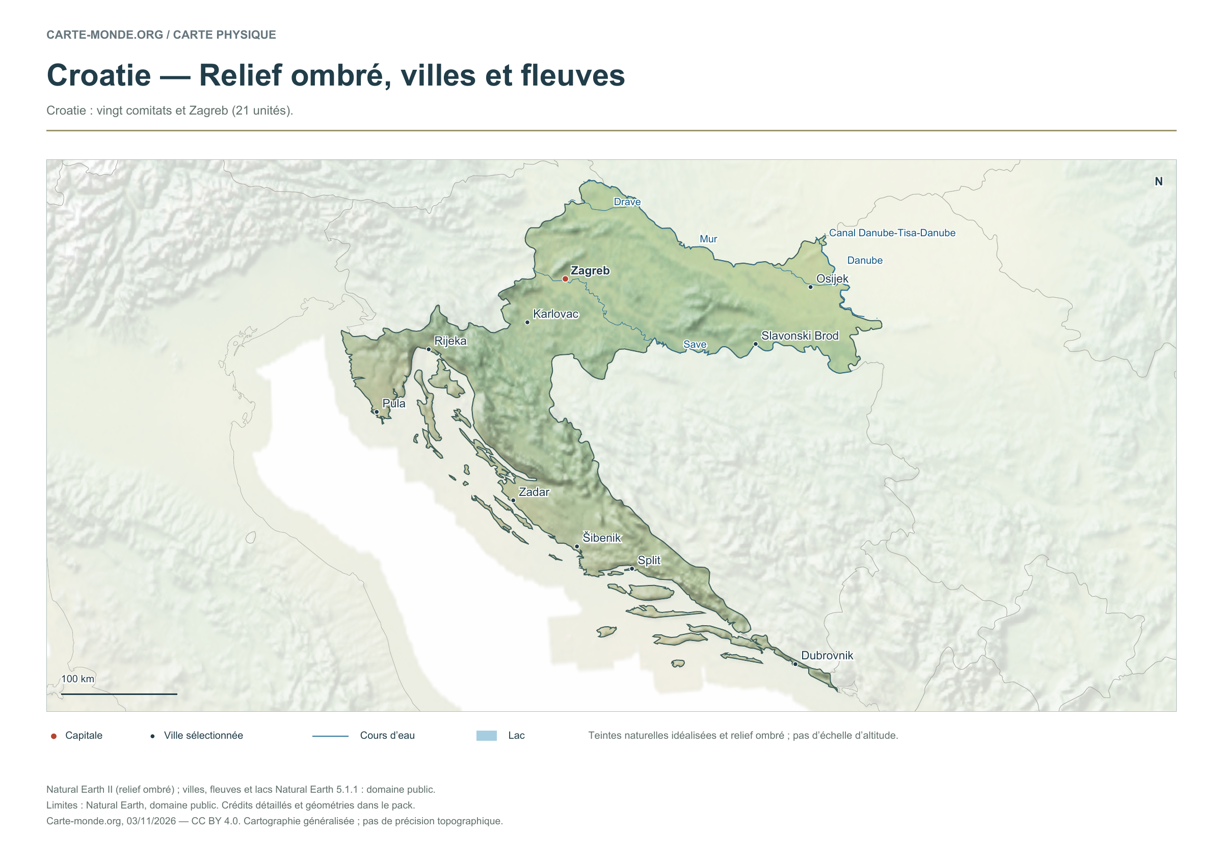
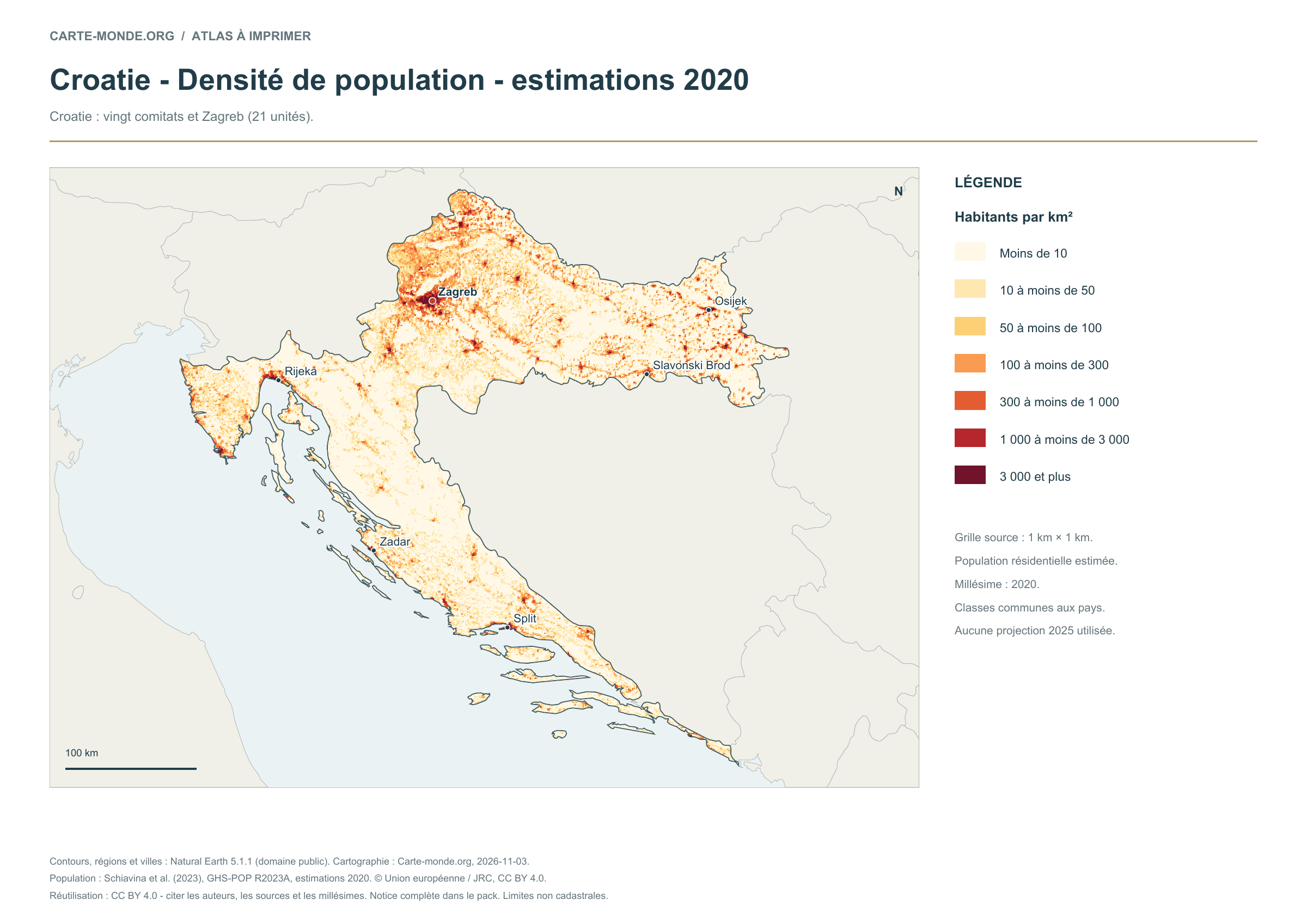
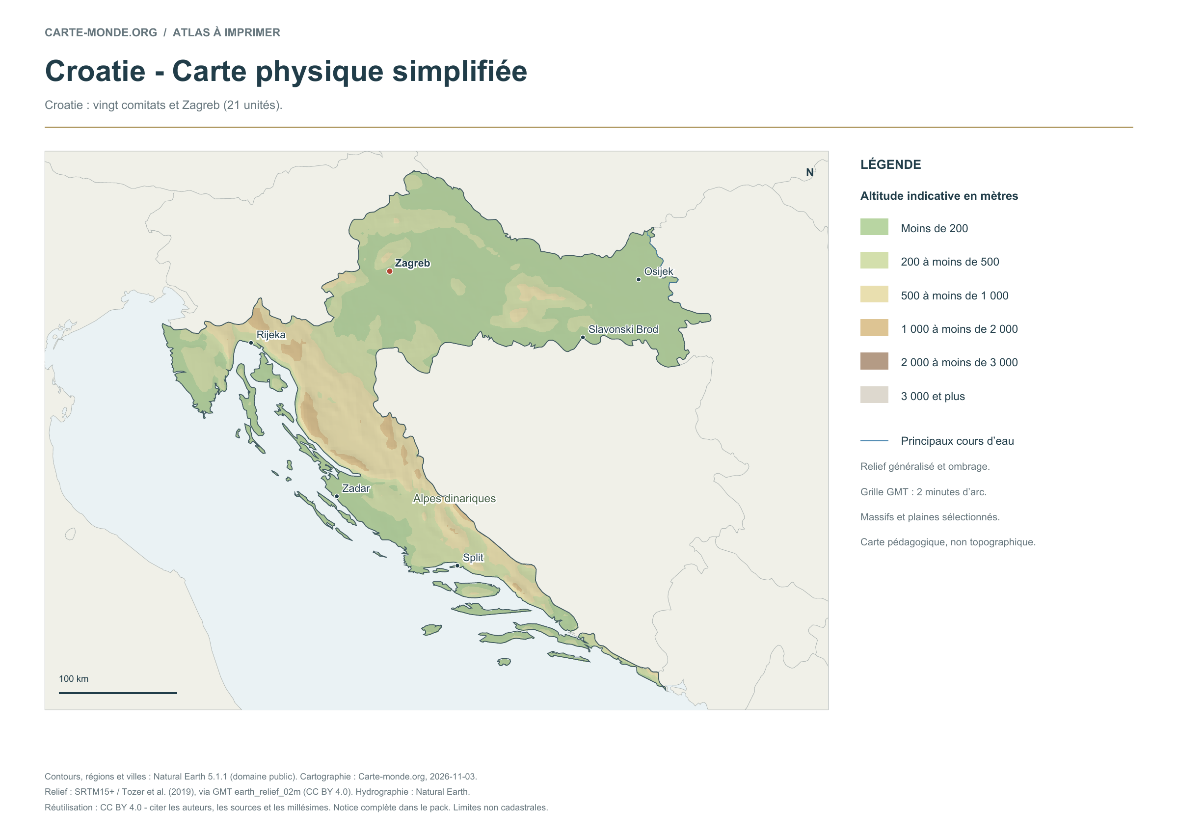
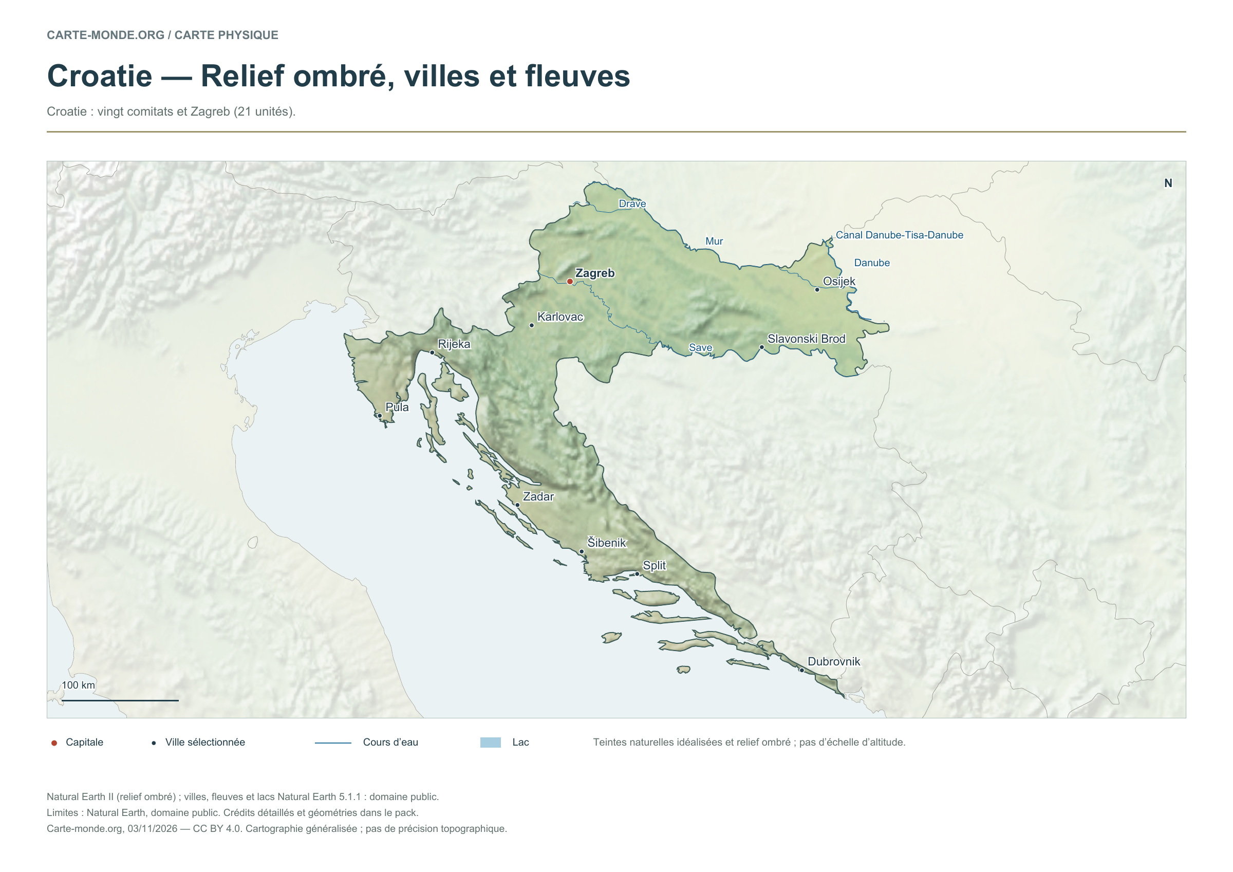
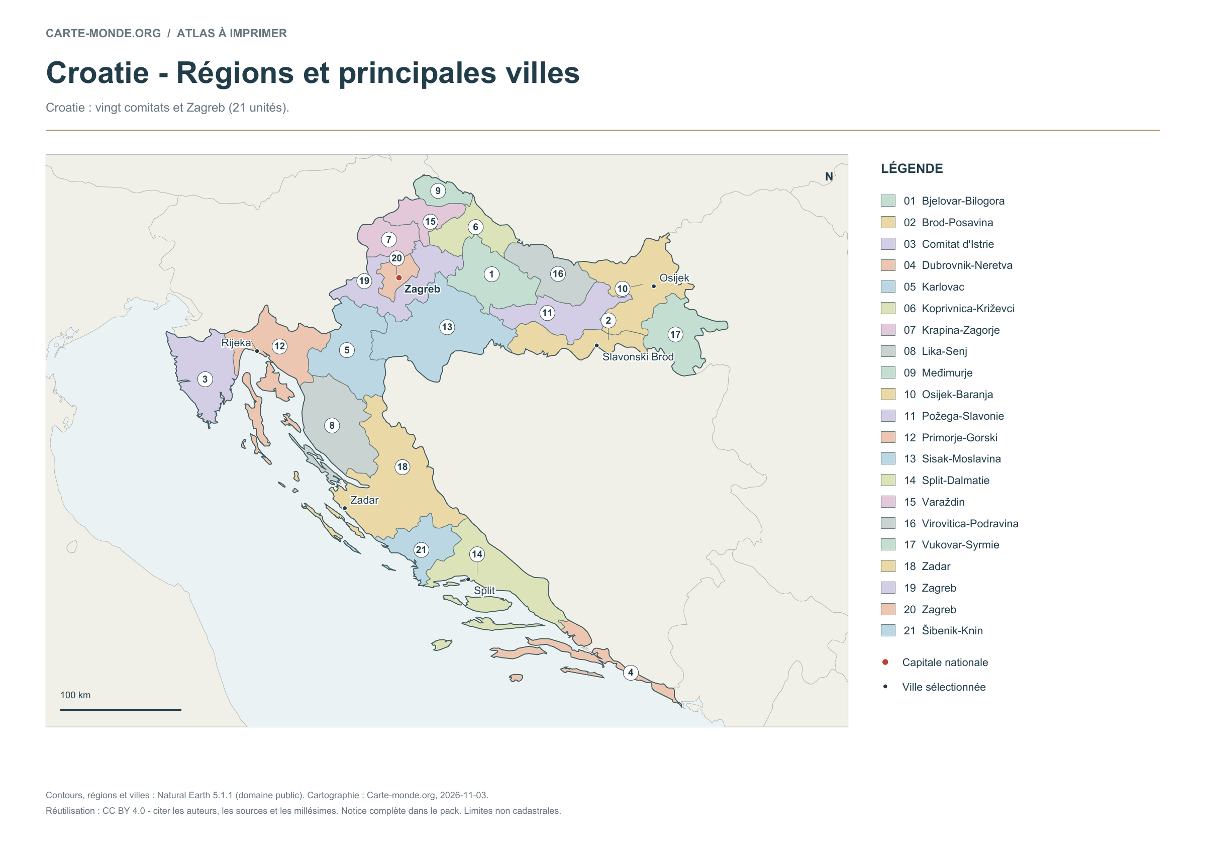
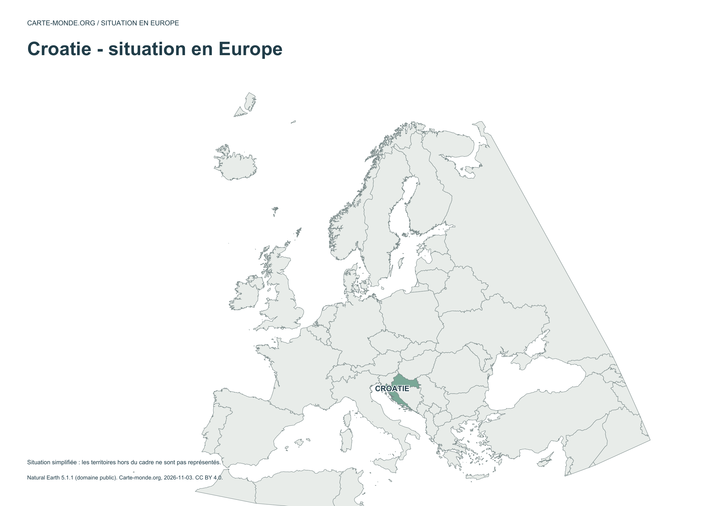
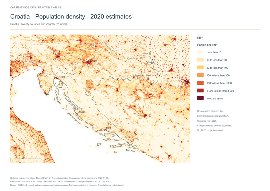
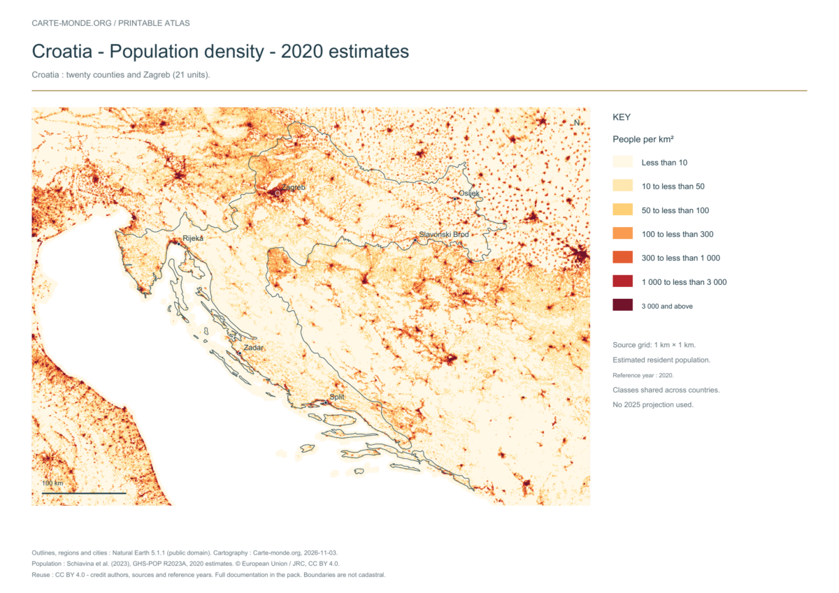
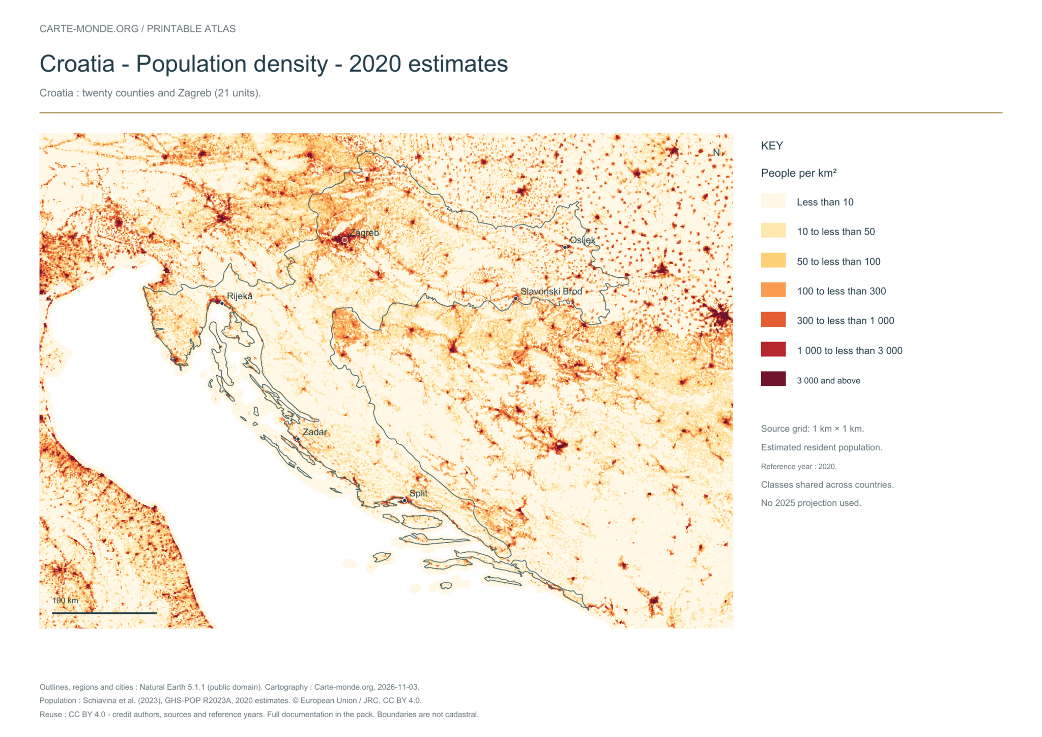
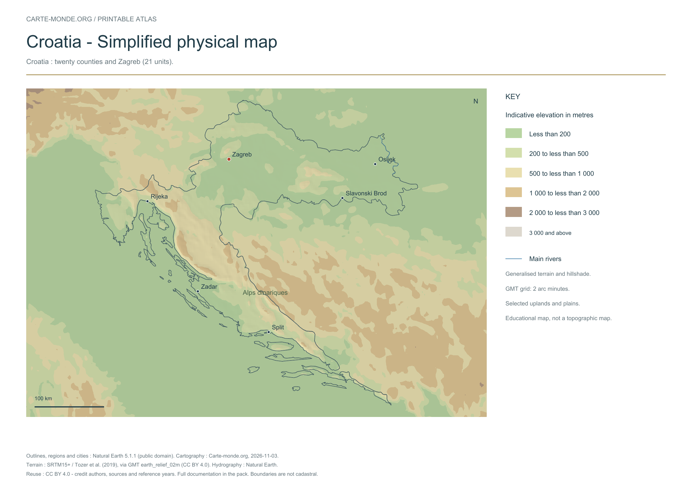
Five printable maps of Croatia: regions and cities, location in Europe, two views of the relief and population. PDFs, images and sources are available below.
Our five maps have English labels. Maps from other publishers retain their original language.
Raster base map, cities, rivers and lakes: Natural Earth, public domain. Other boundary credits and licences are retained in the pack. Cartographic work CC BY 4.0; ODbL-derived data retains its licence. No topographic accuracy is claimed.
Territory, data and selection of names
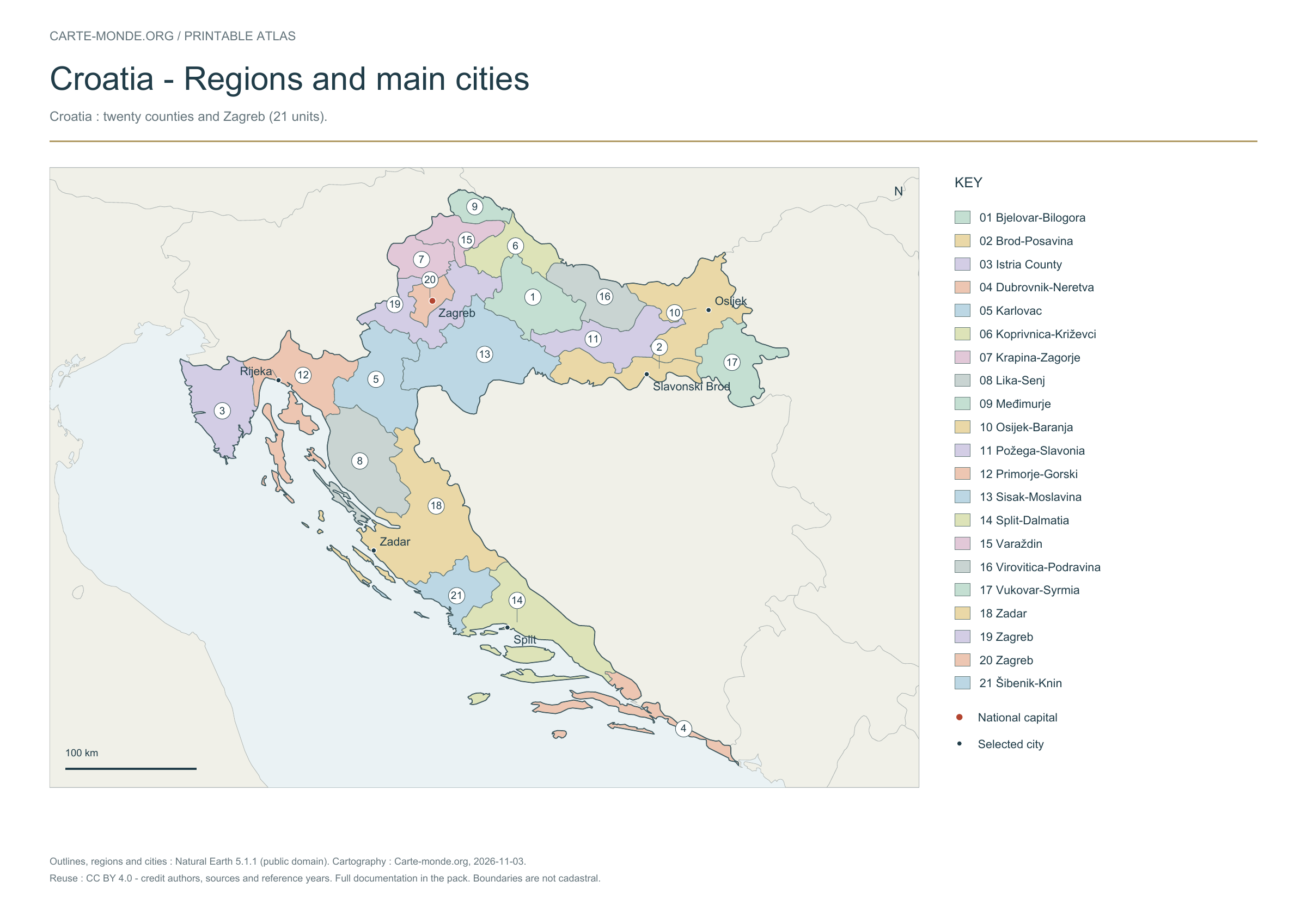
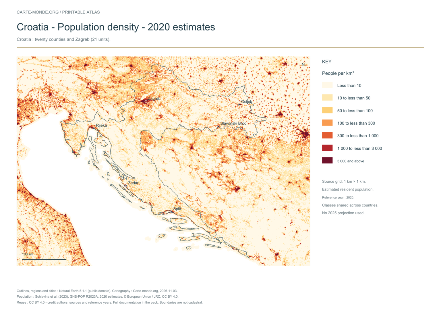
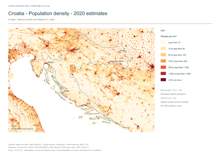
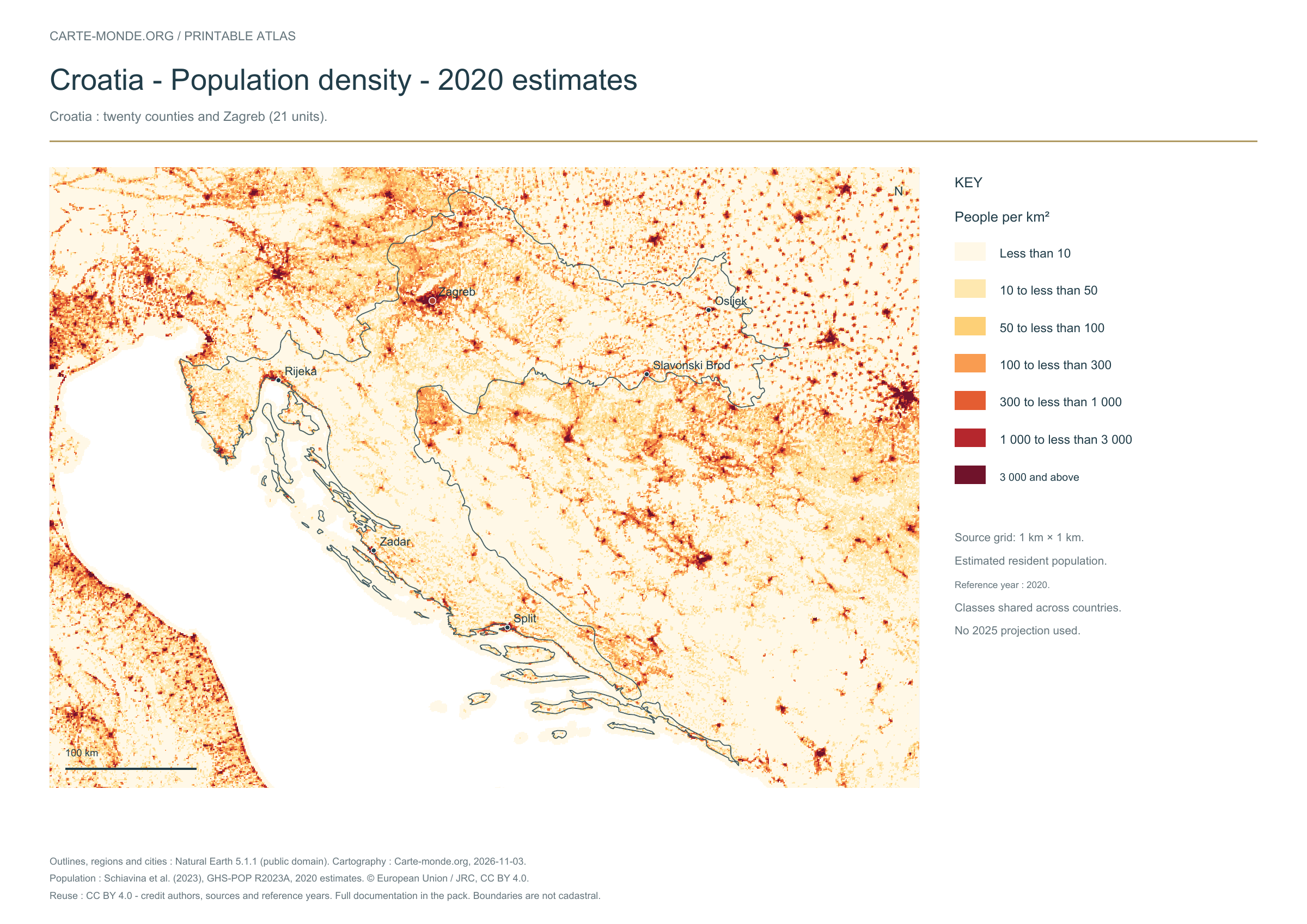
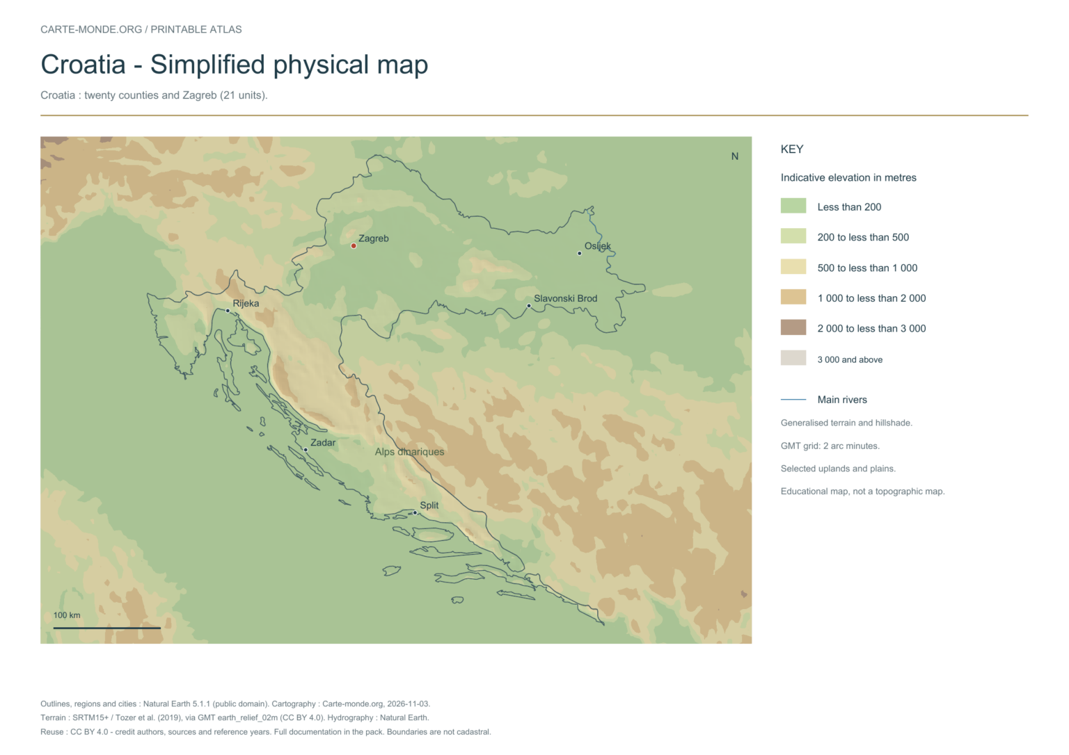
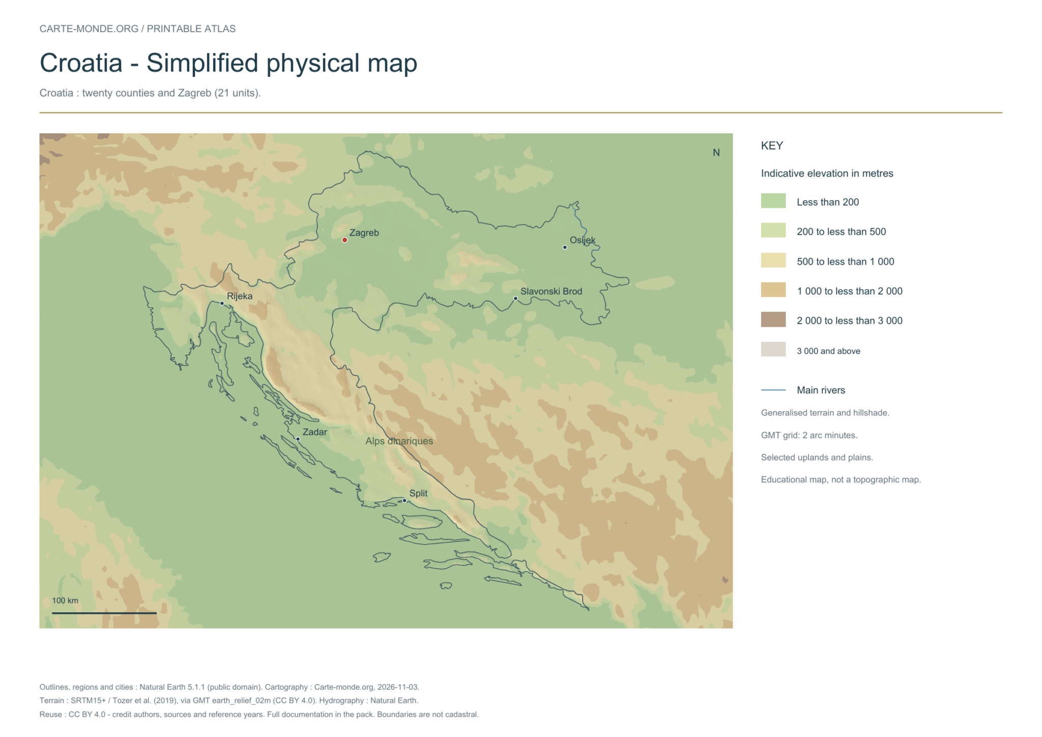
Croatia: twenty counties and Zagreb (21 units).
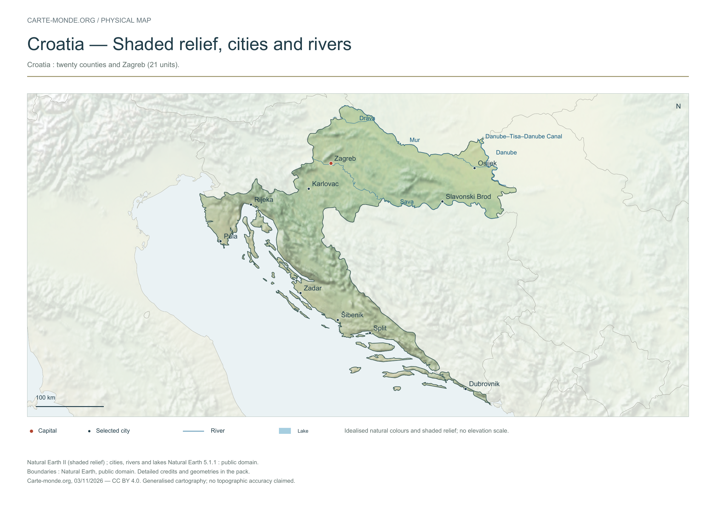
Natural Earth II shaded relief base map, 10 selected cities. Named rivers: Canal Danube-Tisa-Danube, Danube, Drave, Mur, Save.
The colours represent idealised natural cover; they do not correspond to elevation classes. This global background remains generalised, particularly for small states.
Carte-monde.org · November 2026
Simplified elevations
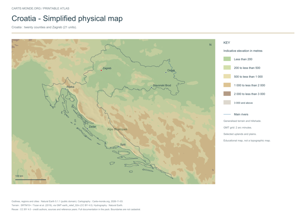
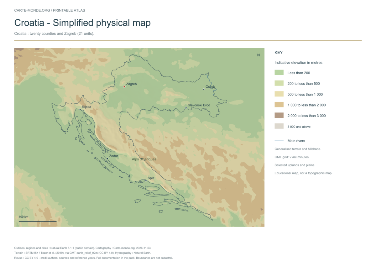
Smoothed relief, elevation colours, main mountain ranges, plains and watercourses. Educational map at national scale.
The data represents estimated residential population in 2020, on a 1 km² source grid. The document’s creation date does not change this reference year.
The five in-house maps in one pack
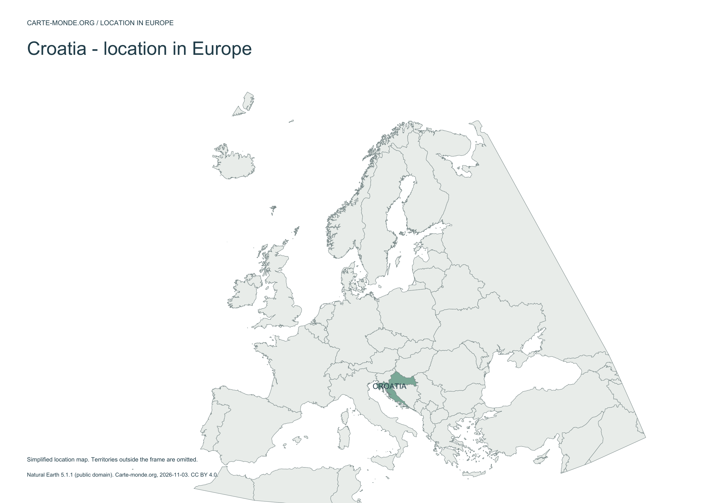
Regions and cities, location in Europe, simplified elevations, 2020 population density and shaded relief: five A4 PDFs, their PNGs and SVGs, with sources and licences.
Older documents in English provided by the University of Texas’s Perry–Castañeda collection. The links open the collection page where you can choose the indicated map. The dates below refer to the documents: these references do not necessarily describe the current situation.
Author: Central Intelligence Agency, except where otherwise stated on the document. Source: University of Texas Libraries. The collection states that most of its maps are in the public domain; retain these credits and check exceptions: reuse terms.
External references: no new file from this collection has been hosted on this site for this batch.
Find the old maps of Croatia
Previously published maps remain accessible at their original URLs, with the collection’s text and credits.
Regions and cities show how the territory is organized; the location map places the country; terrain shows the main natural regions; density shows population distribution. Print the in-house PDFs in A4 landscape with “Fit to page”. Insets have their own scales.
Outlines, regions, cities and hydrography:Natural Earth 5.1.1, public domain. Generalized boundaries at 1:10 million, not cadastral; edition year 2026 does not mean that all geometries have been updated.
Relief: SRTM15+ / Tozer et al. (2019), reference publication, via GMT earth_relief_02m derived from SRTM15+V2.7. Grid smoothed to two arc minutes, suitable for a national overview, without topographic precision.
The four new maps: created by Carte-monde.org, November 2026, under CC BY 4.0. Cite authors, sources and reference years, and indicate adaptations. Additional and older maps retain their own rights.
Raster base map, cities, rivers and lakes: Natural Earth, public domain. Other boundary credits and licences are retained in the pack. Cartographic work CC BY 4.0; ODbL-derived data retains its licence. No topographic accuracy is claimed.
Other maps: sources and reuse
Reference maps by external authors. Each document retains its licence, credits and date. “View map” links open the document on Commons; ZIP buttons provide access to the files kept in this collection.
To reuse a CC BY map, cite its authors, source and licence and indicate any changes. Adaptations of a CC BY-SA map retain the same or a compatible licence. CC0 documents may be reused freely; retaining the source makes them easier to identify. These rights do not make all administrative boundaries current.
Previous collection — original files preservedFlag of Croatia
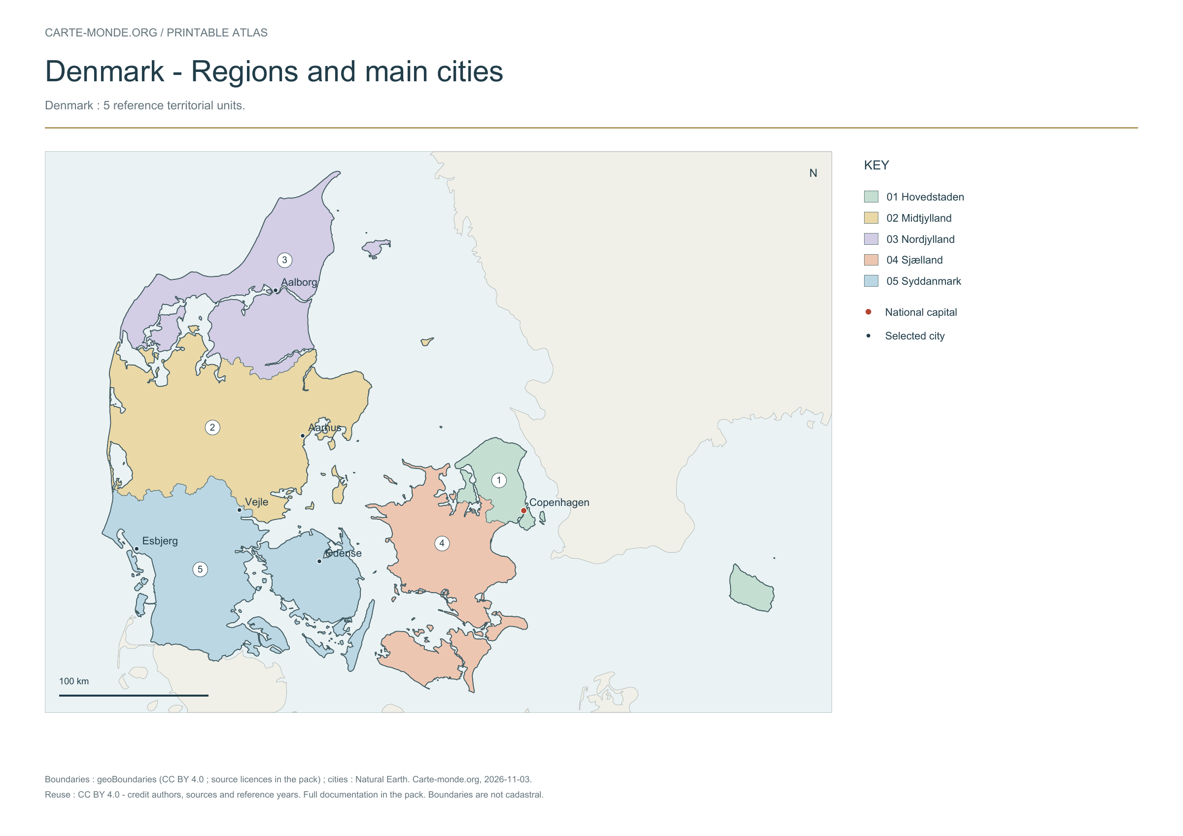
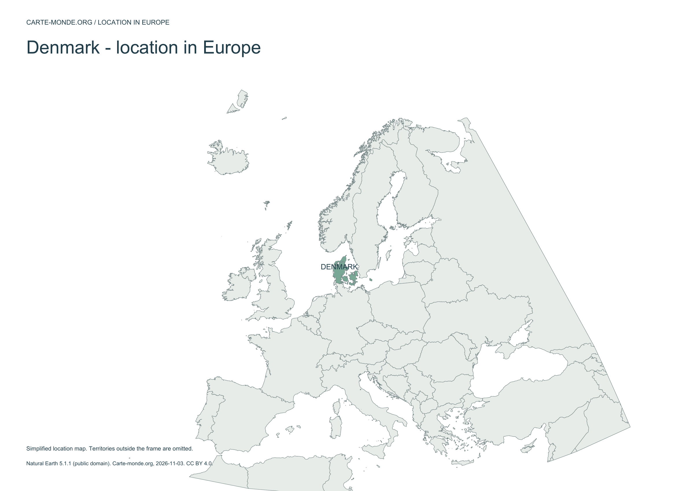
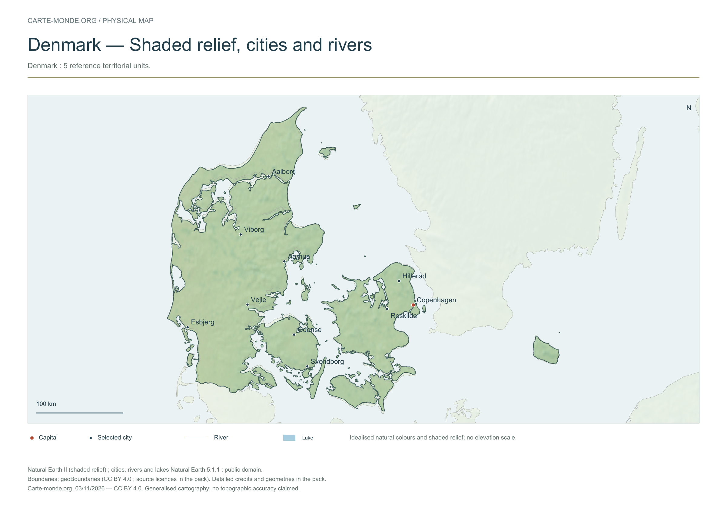
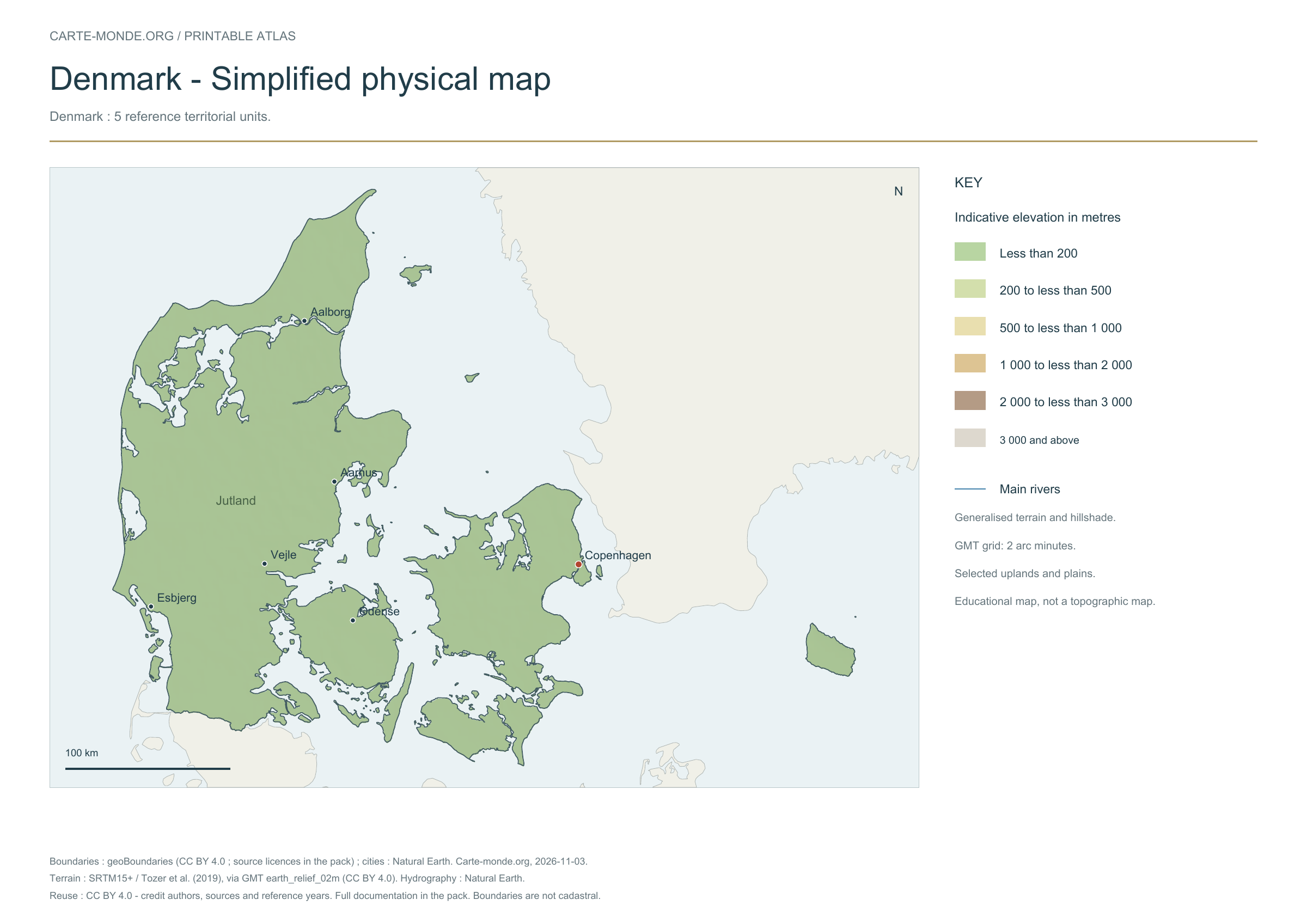
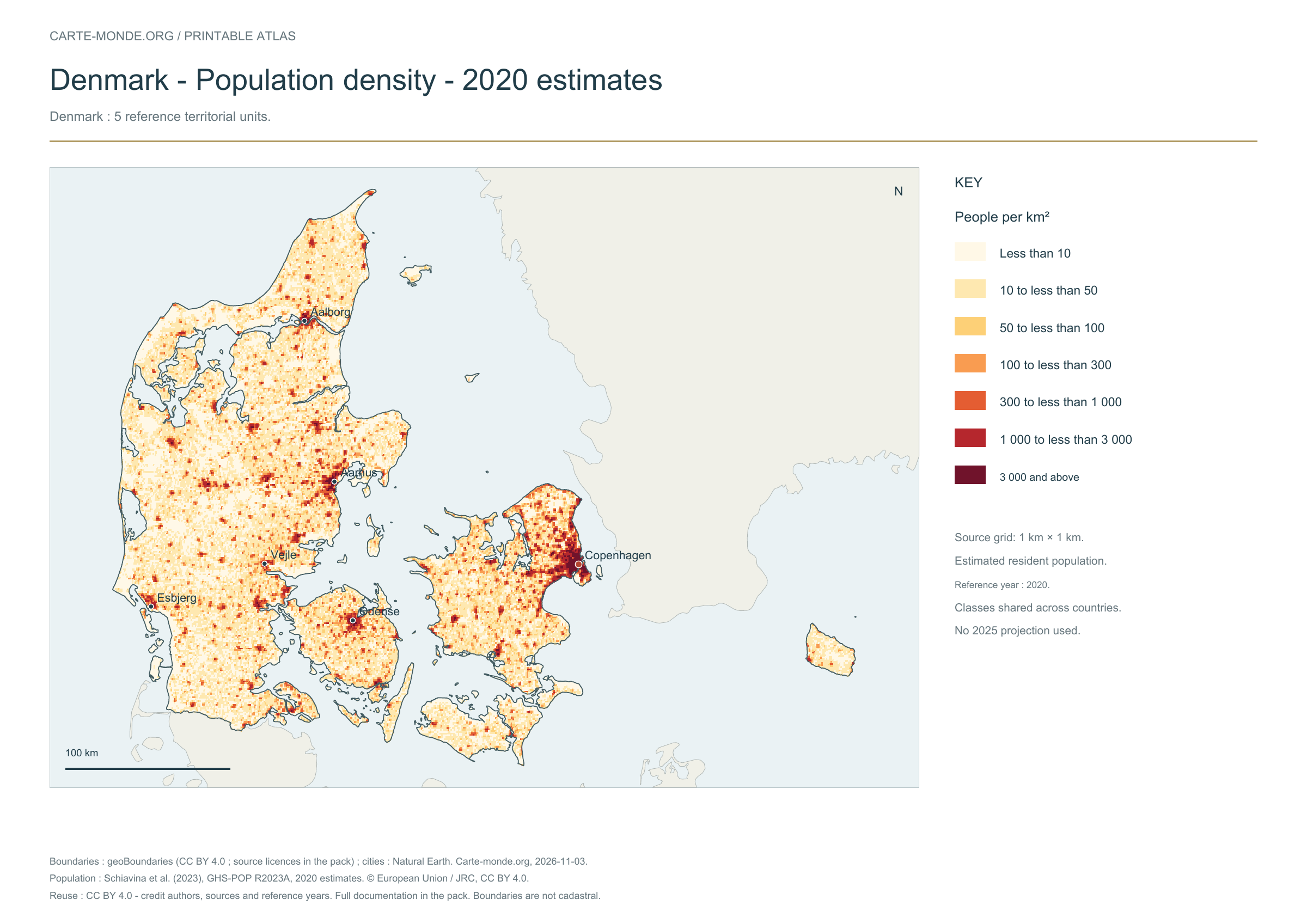
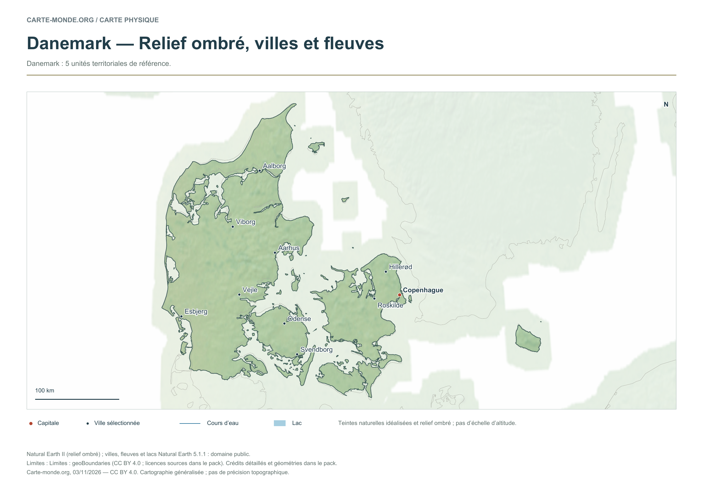
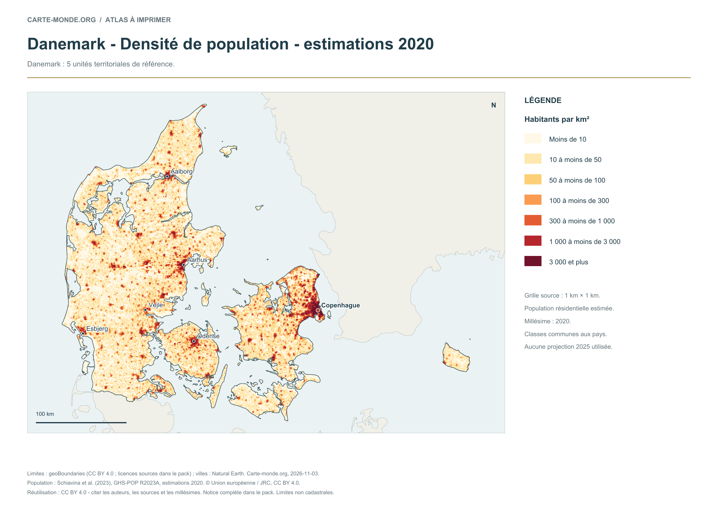
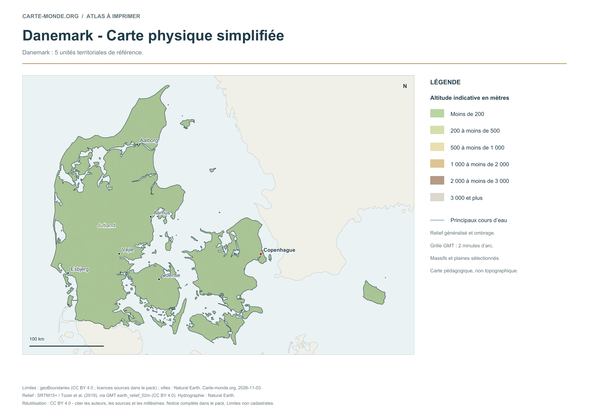
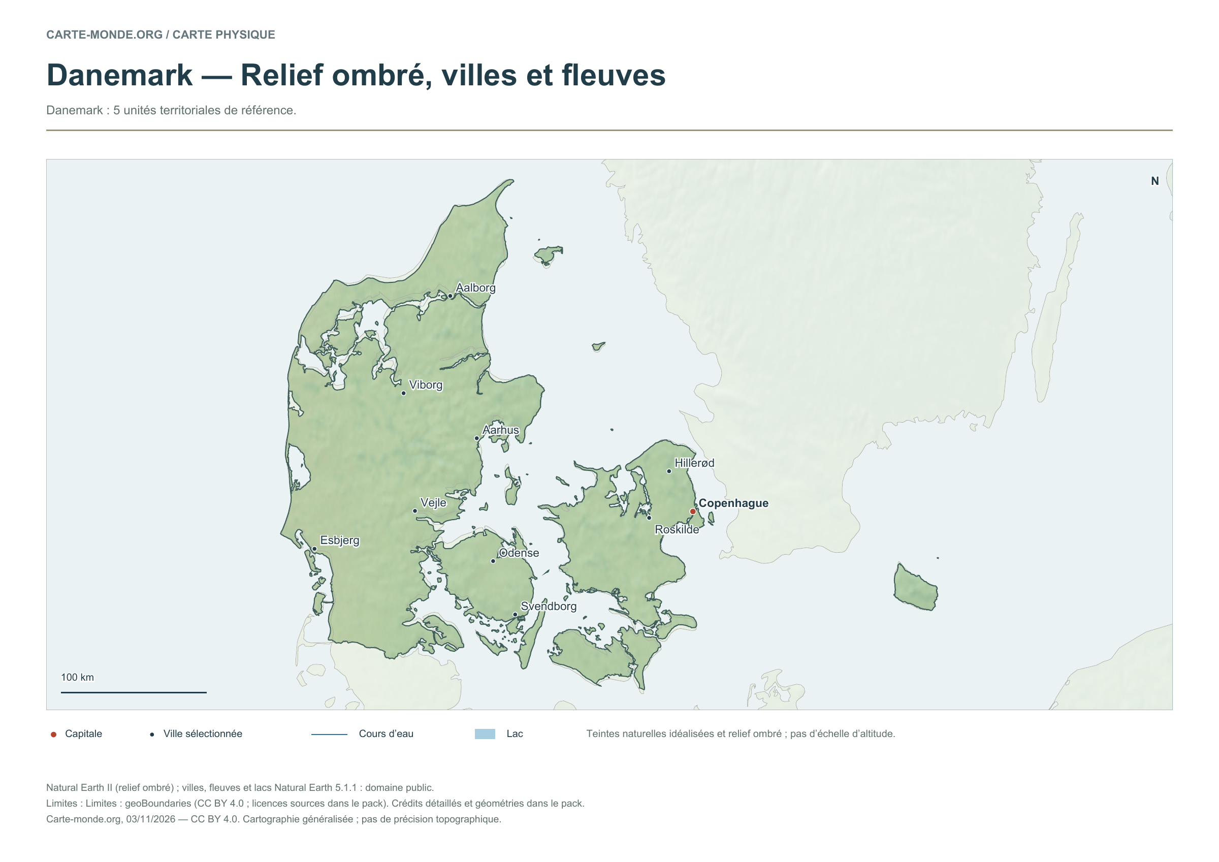
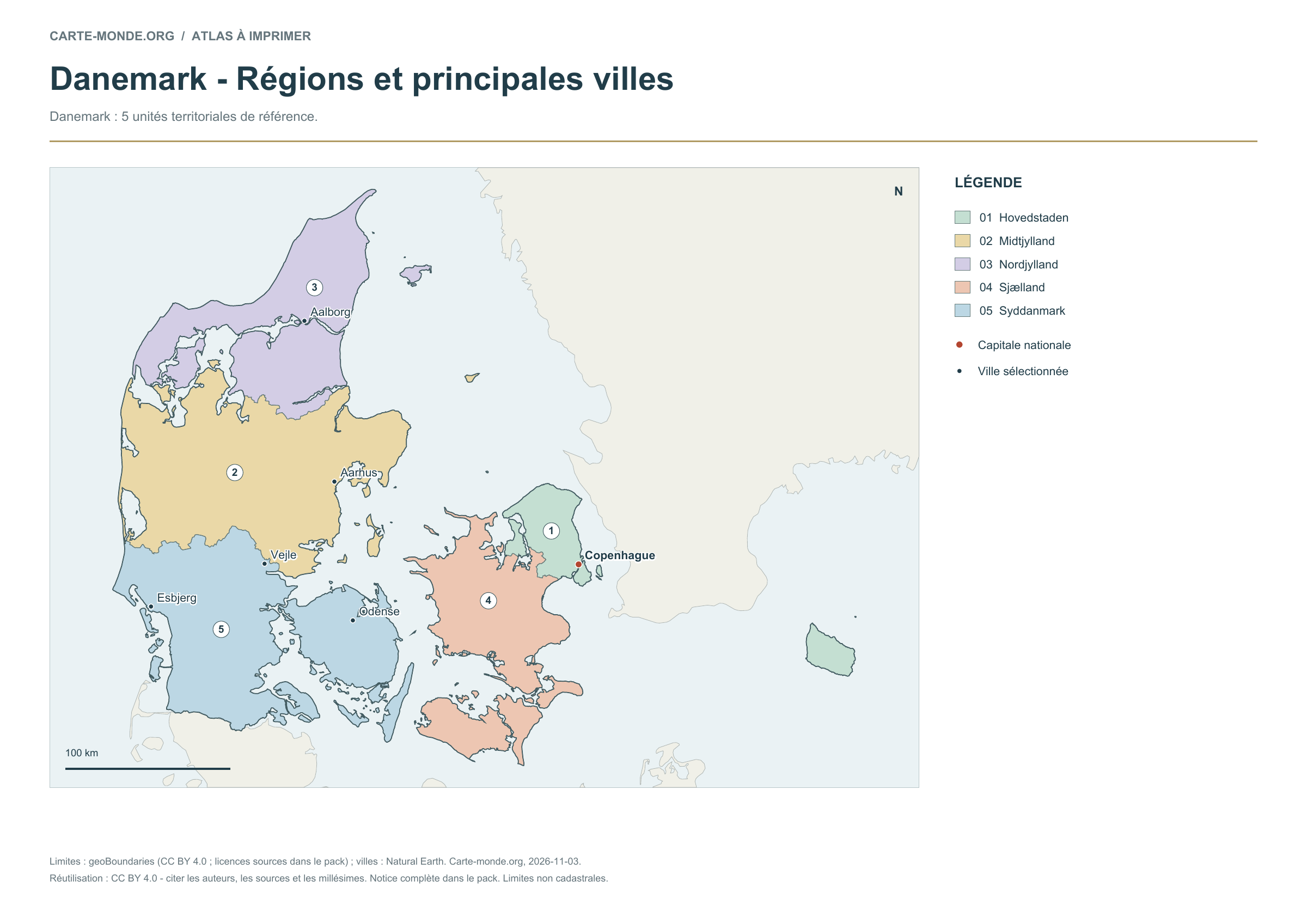
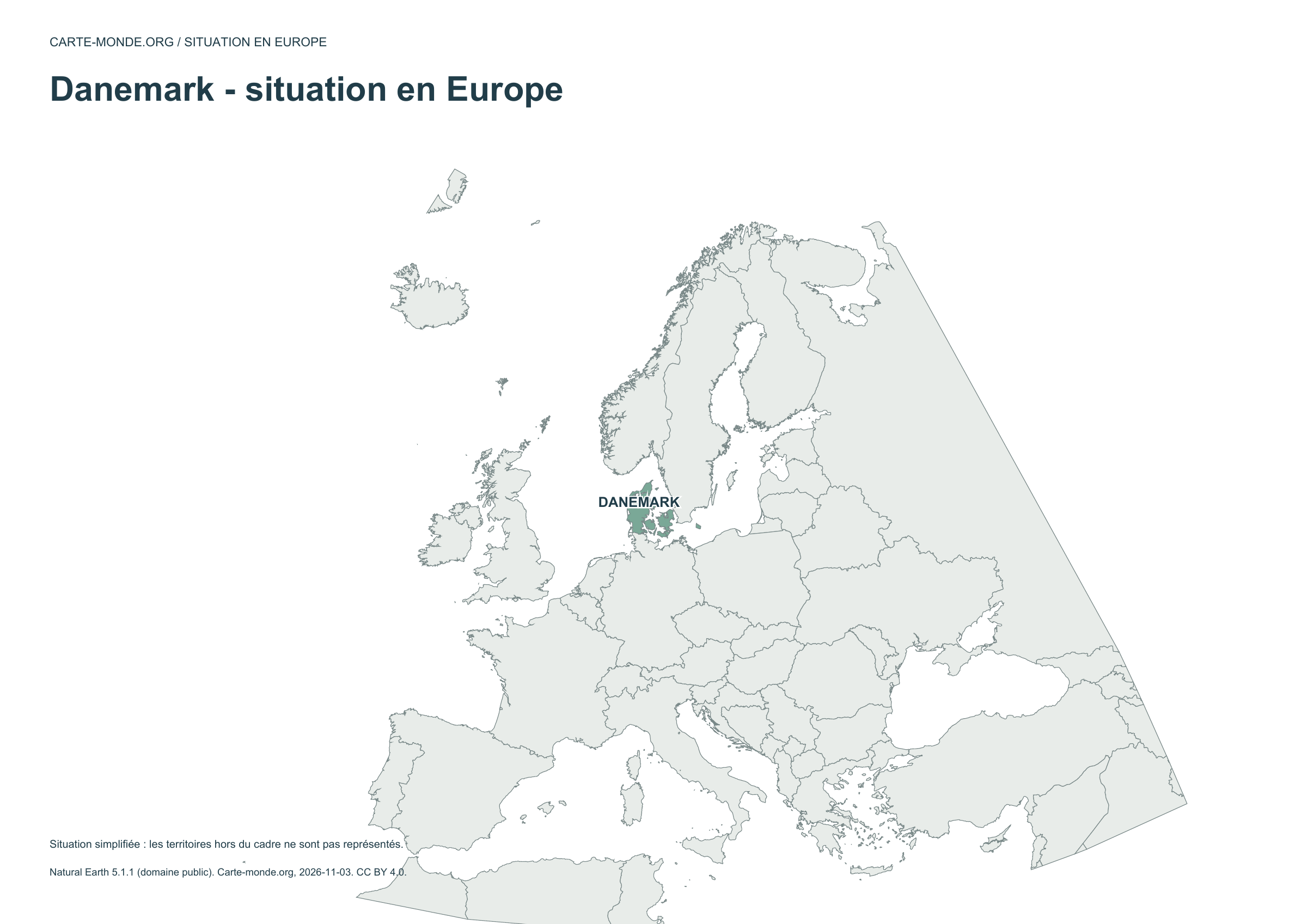
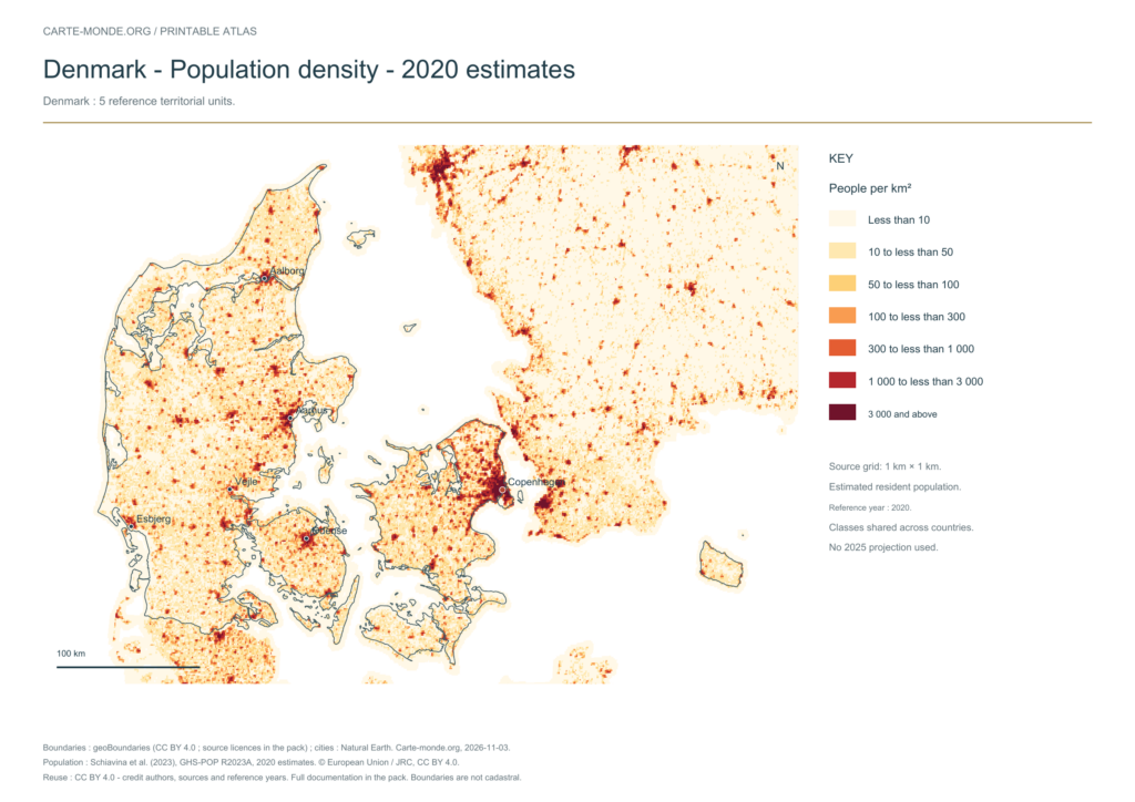
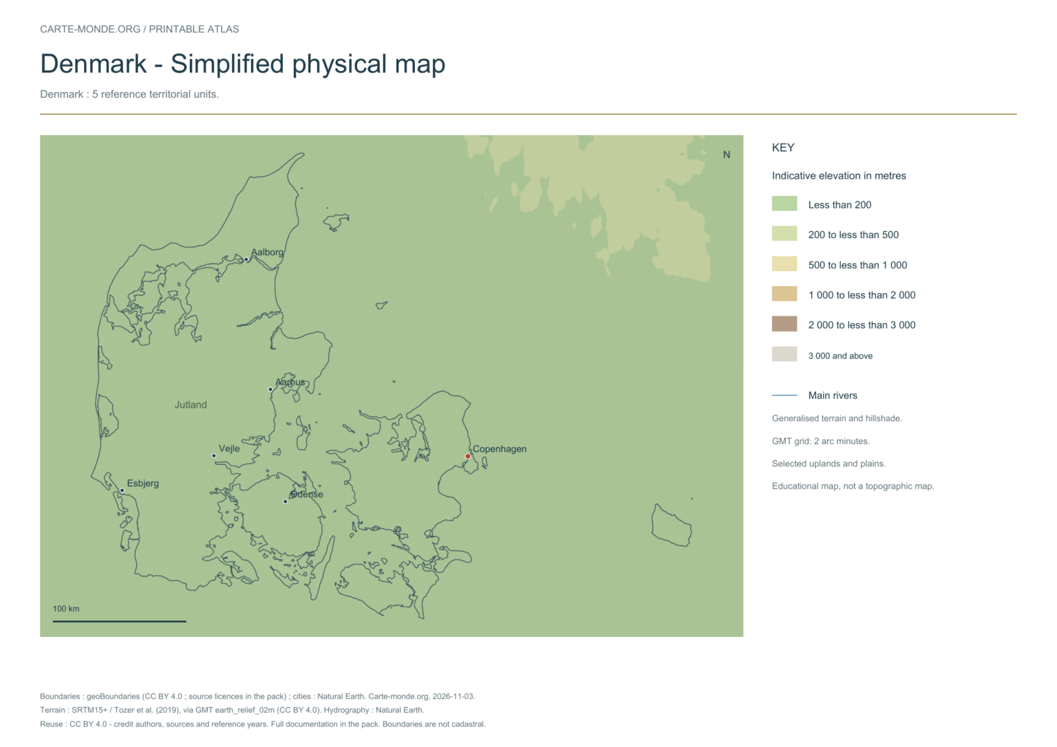
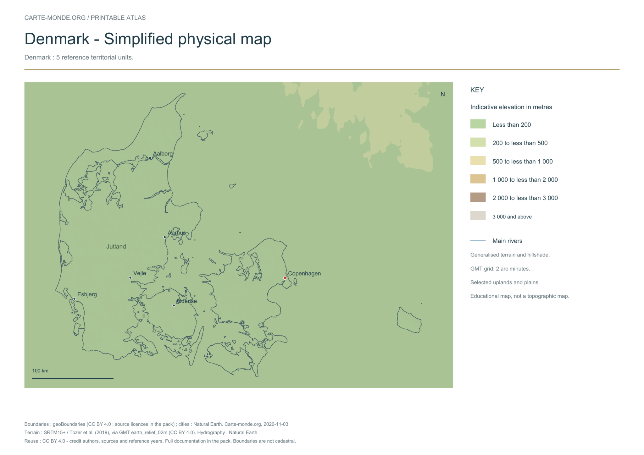
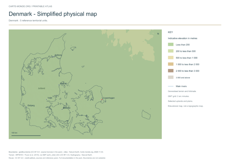
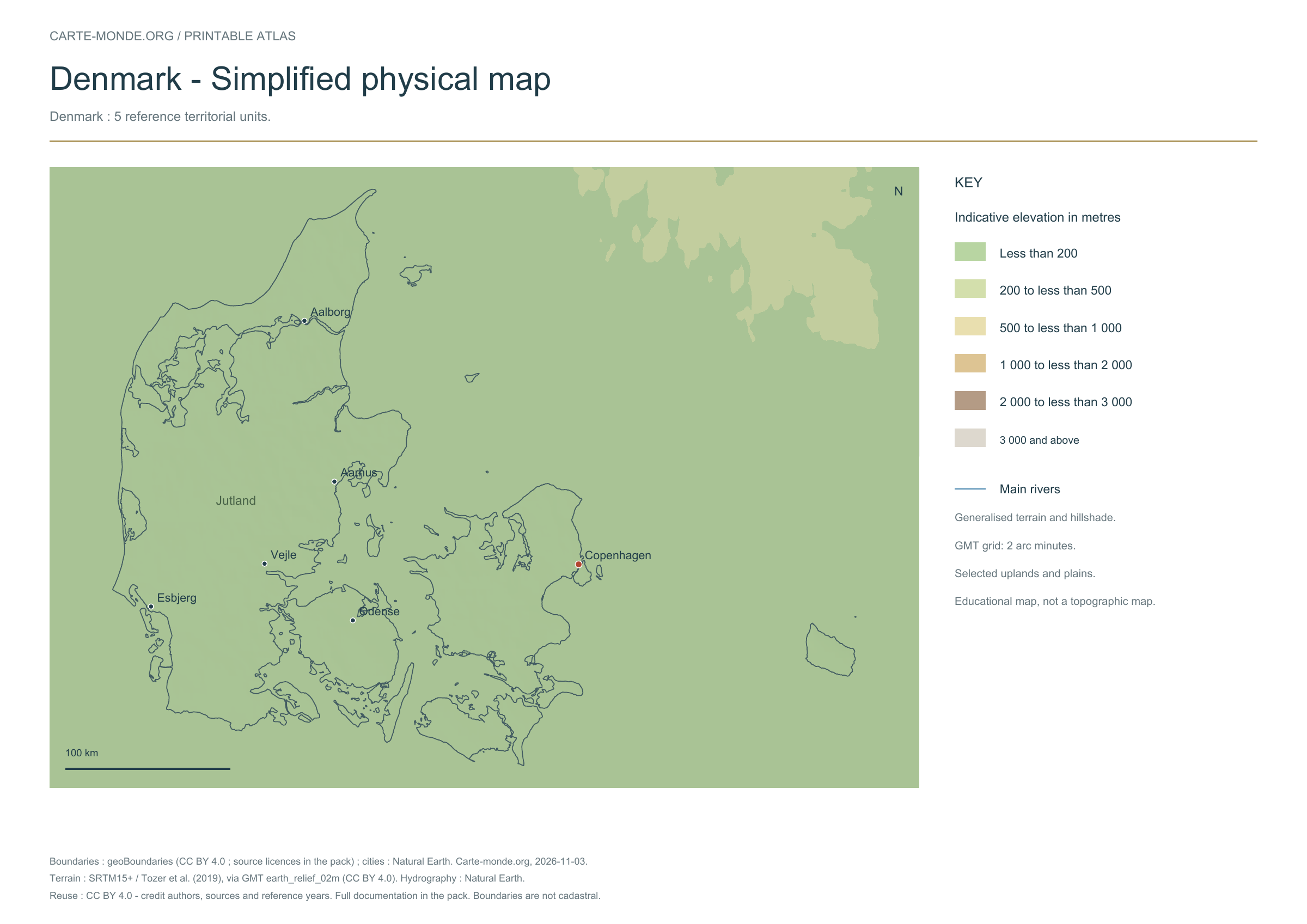
Five printable maps of Denmark: regions and cities, location in Europe, two views of the relief and population. PDFs, images and sources are available below.
Our five maps have English labels. Maps from other publishers retain their original language.
Raster base map, cities, rivers and lakes: Natural Earth, public domain. Other boundary credits and licences are retained in the pack. Cartographic work CC BY 4.0; ODbL-derived data retains its licence. No topographic accuracy is claimed.
Territory, data and selection of names
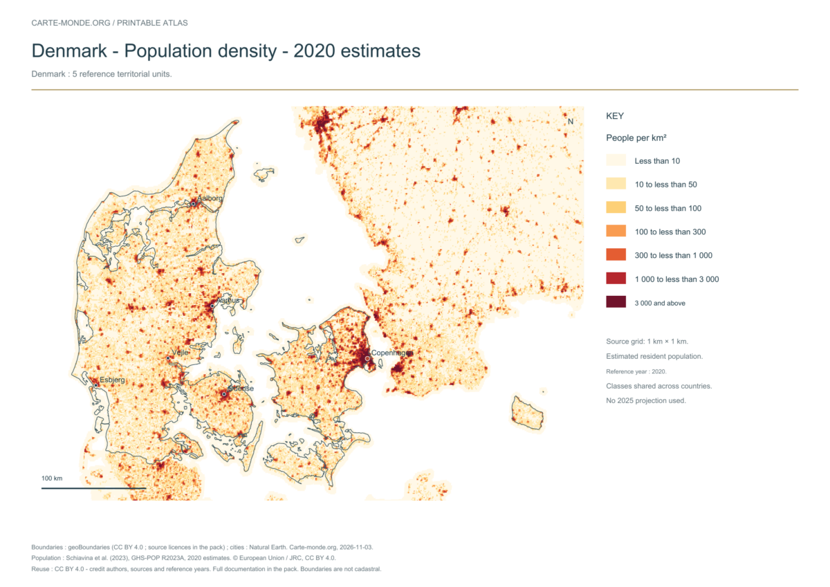
Denmark: 5 reference territorial units.
Natural Earth II shaded relief background, 10 selected cities. No named waterway from this global dataset was selected within this map extent.
The colours represent idealised natural cover; they do not correspond to elevation classes. This global background remains generalised, particularly for small states.
Carte-monde.org · November 2026
Simplified elevations
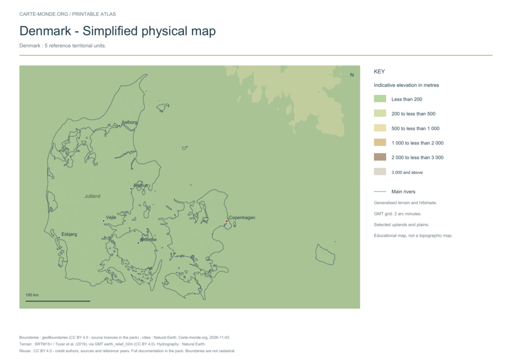
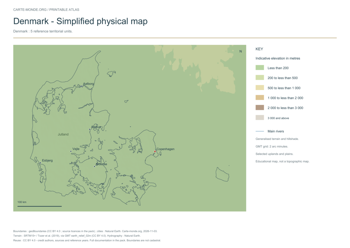
Smoothed relief, elevation colours, main mountain ranges, plains and watercourses. Educational map at national scale.
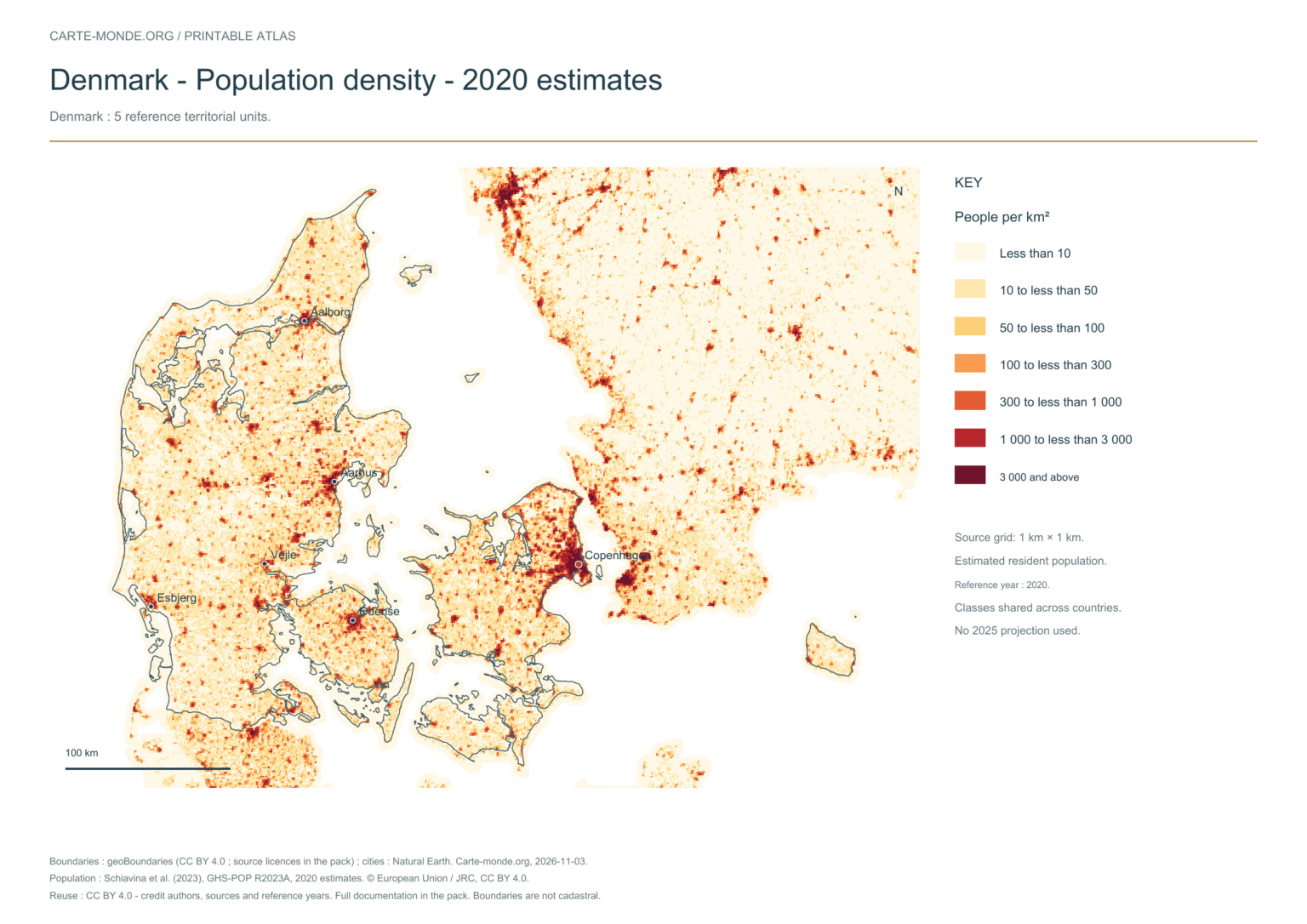
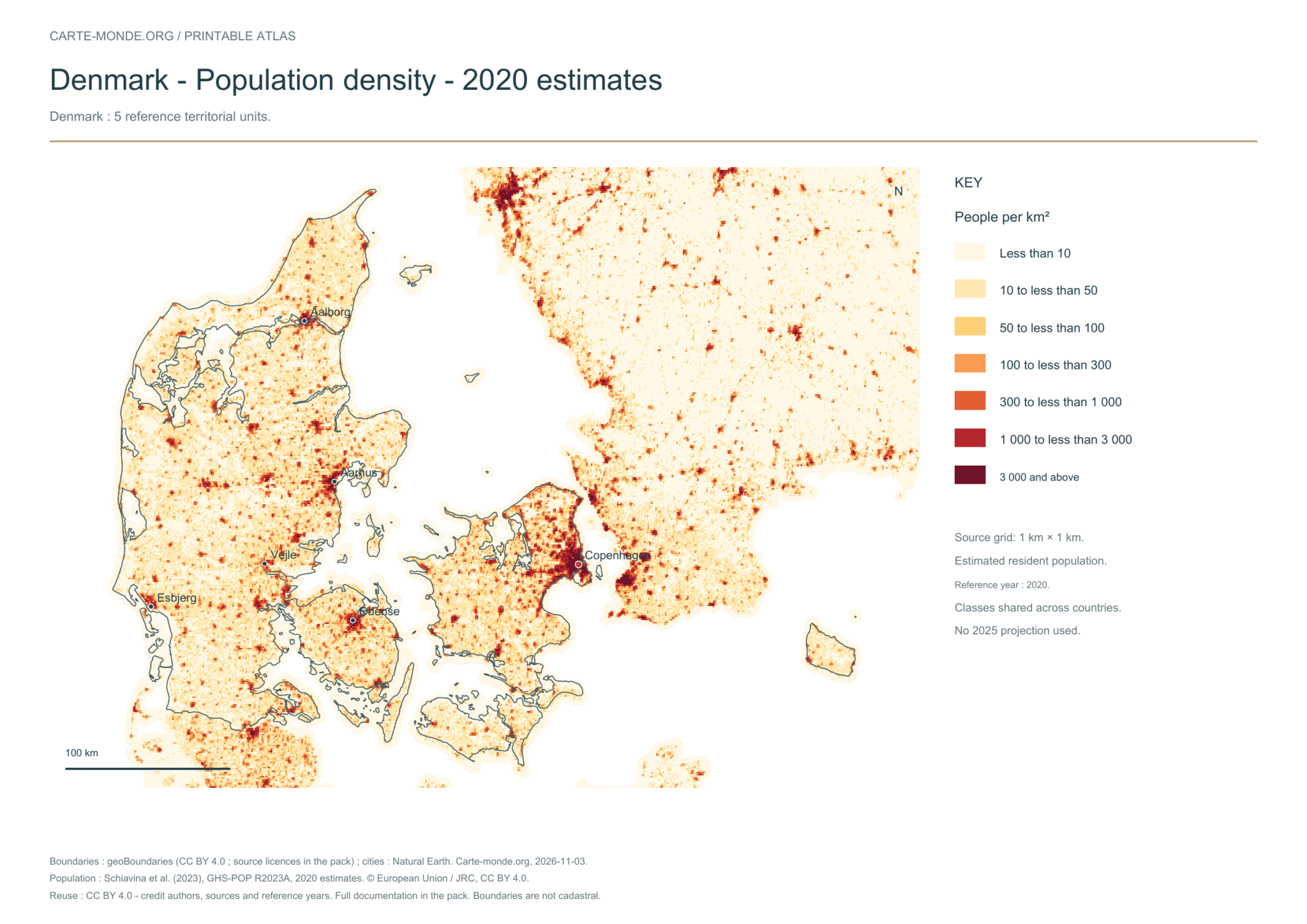
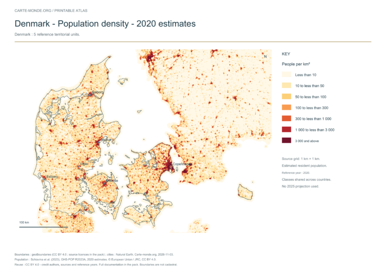
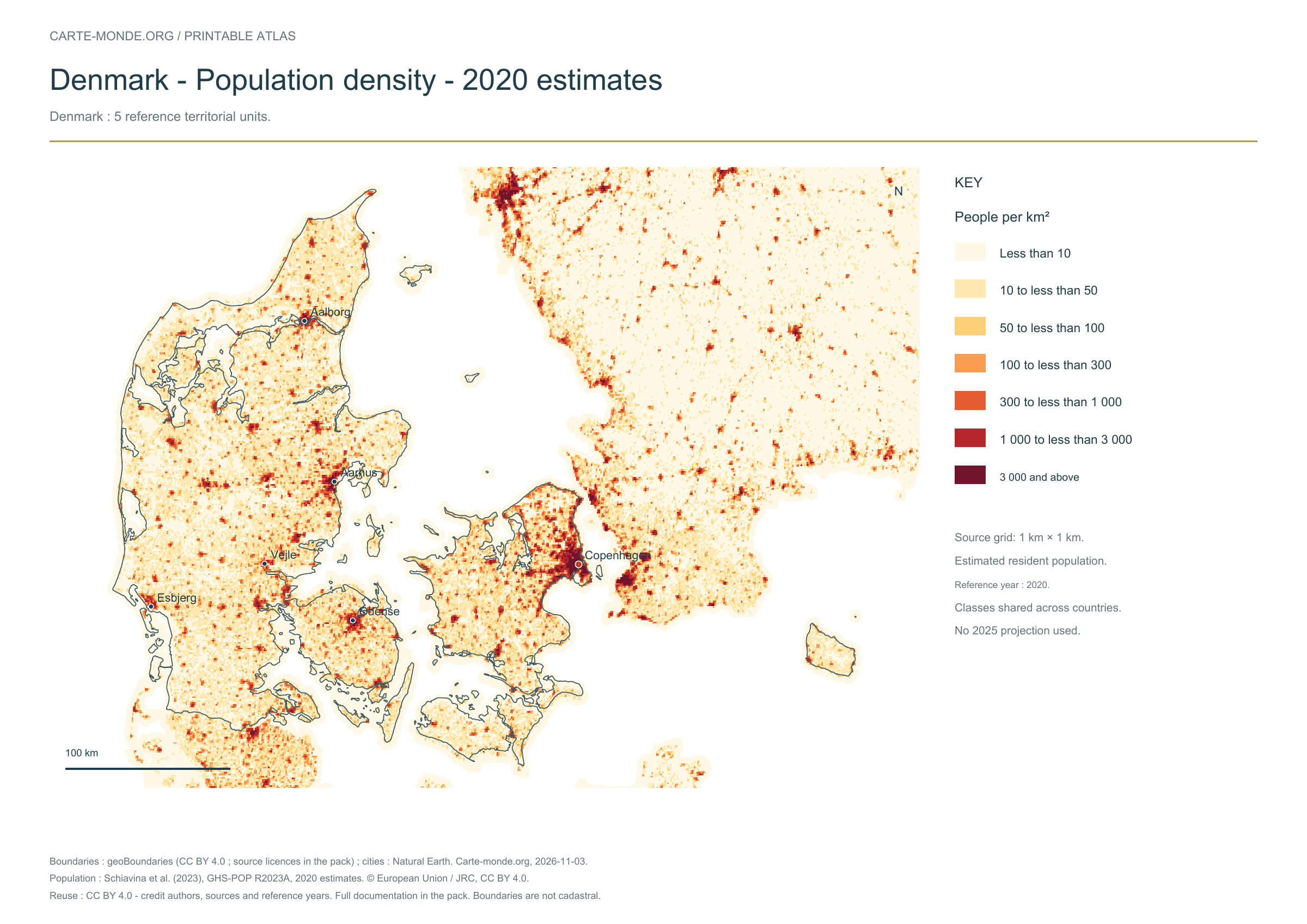
Estimated residential population in 2020, on a source grid of 1 km². Inhabitants/km² classes are shared across countries; no 2025 projection. Cells without data remain transparent and do not represent zero population.
The data represents estimated residential population in 2020, on a 1 km² source grid. The document’s creation date does not change this reference year.
The five in-house maps in one pack
Regions and cities, location in Europe, simplified elevations, 2020 population density and shaded relief: five A4 PDFs, their PNGs and SVGs, with sources and licences.
Regions and cities show how the territory is organized; the location map places the country; terrain shows the main natural regions; density shows population distribution. Print the in-house PDFs in A4 landscape with “Fit to page”. Insets have their own scales.
Administrative boundaries: geoBoundaries / geoBoundaries, Web Vectors Map. European Denmark, excluding Greenland and the Faroe Islands — Geographic reference year: 2021. The files’ edition date does not mean that all boundaries have been updated. Boundary source and terms. Primary license: Creative Commons Attribution 4.0 International (CC BY 4.0). The geometries used and credits are included in the pack; derived databases under ODbL remain under ODbL.
Neighbouring area, cities and hydrography: Natural Earth 5.1.1, public domain, generalised boundaries not for cadastral use.
Relief: SRTM15+ / Tozer et al. (2019), reference publication, via GMT earth_relief_02m derived from SRTM15+V2.7. Grid smoothed to two arc minutes, suitable for a national overview, without topographic precision.
The four new maps: created by Carte-monde.org, November 2026, under CC BY 4.0. Cite authors, sources and reference years, and indicate adaptations. Additional and older maps retain their own rights.
Raster base map, cities, rivers and lakes: Natural Earth, public domain. Other boundary credits and licences are retained in the pack. Cartographic work CC BY 4.0; ODbL-derived data retains its licence. No topographic accuracy is claimed.
Other maps: sources and reuse
Reference maps by external authors. Each document retains its licence, credits and date. “View map” links open the document on Commons; ZIP buttons provide access to the files kept in this collection.
To reuse a CC BY map, cite its authors, source and licence and indicate any changes. Adaptations of a CC BY-SA map retain the same or a compatible licence. CC0 documents may be reused freely; retaining the source makes them easier to identify. These rights do not make all administrative boundaries current.
Previous collection — original files preservedFlag of Denmark
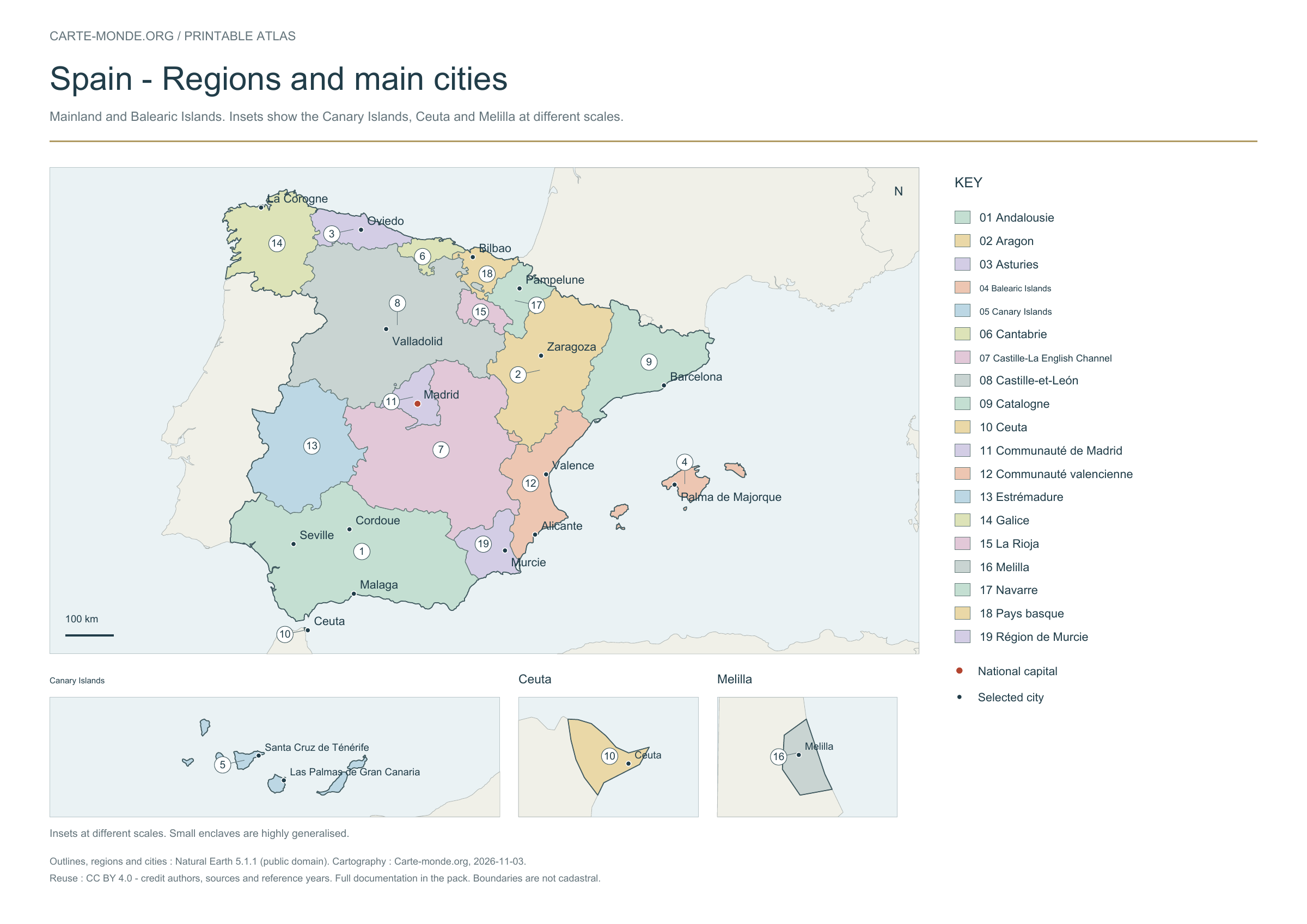
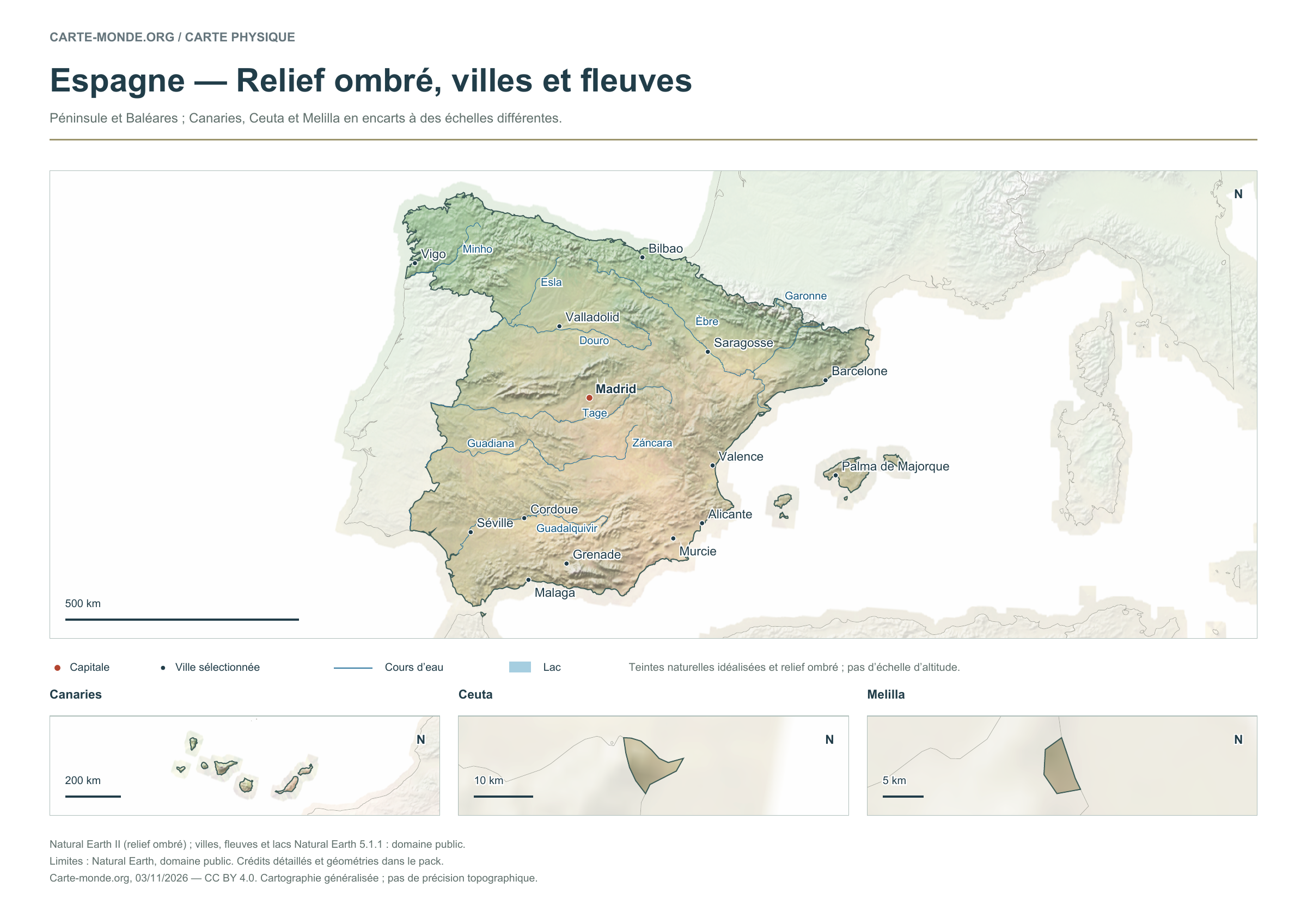
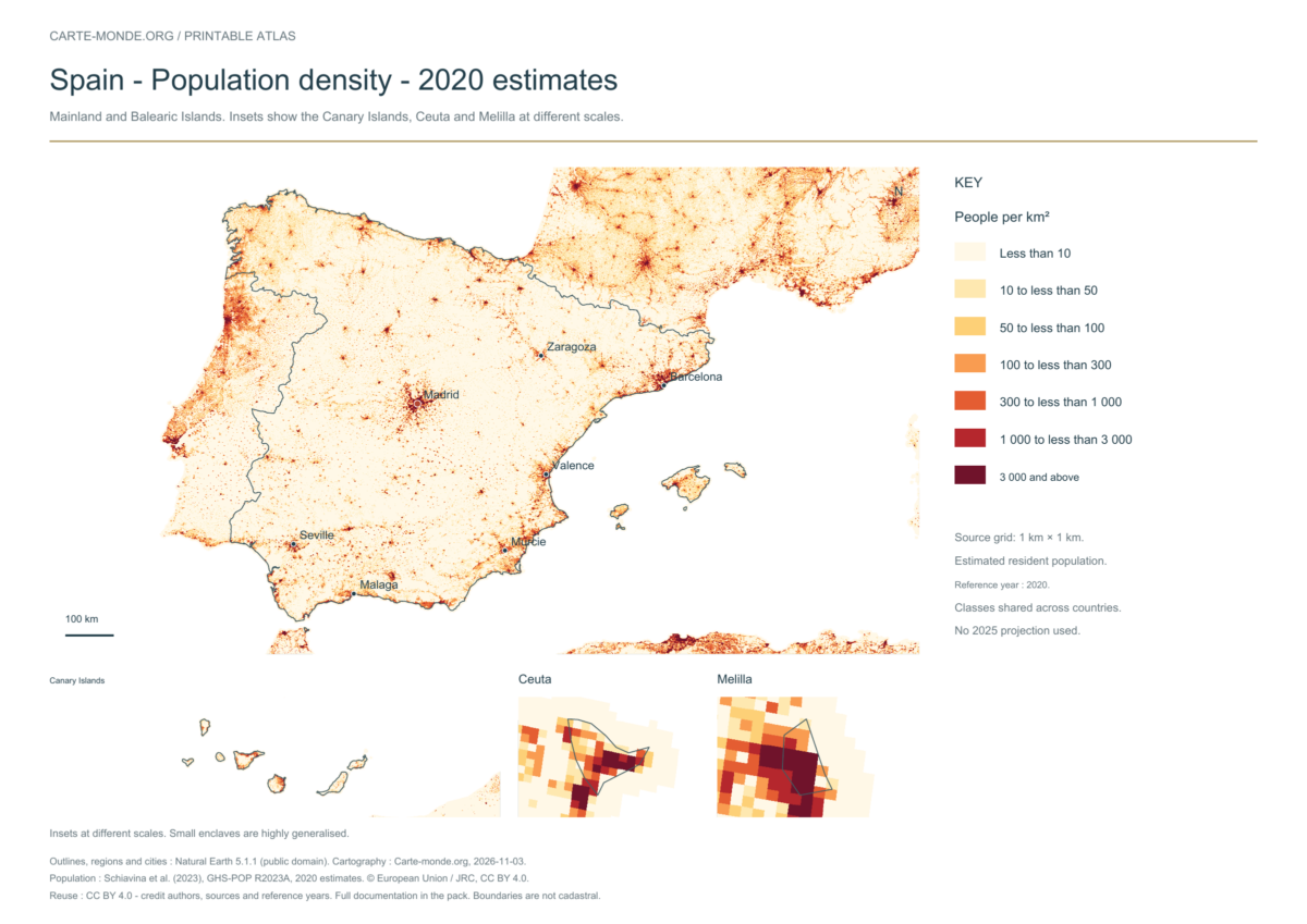
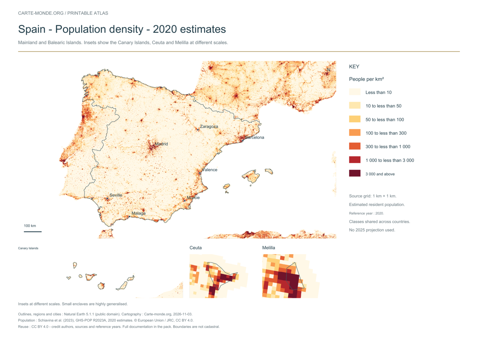
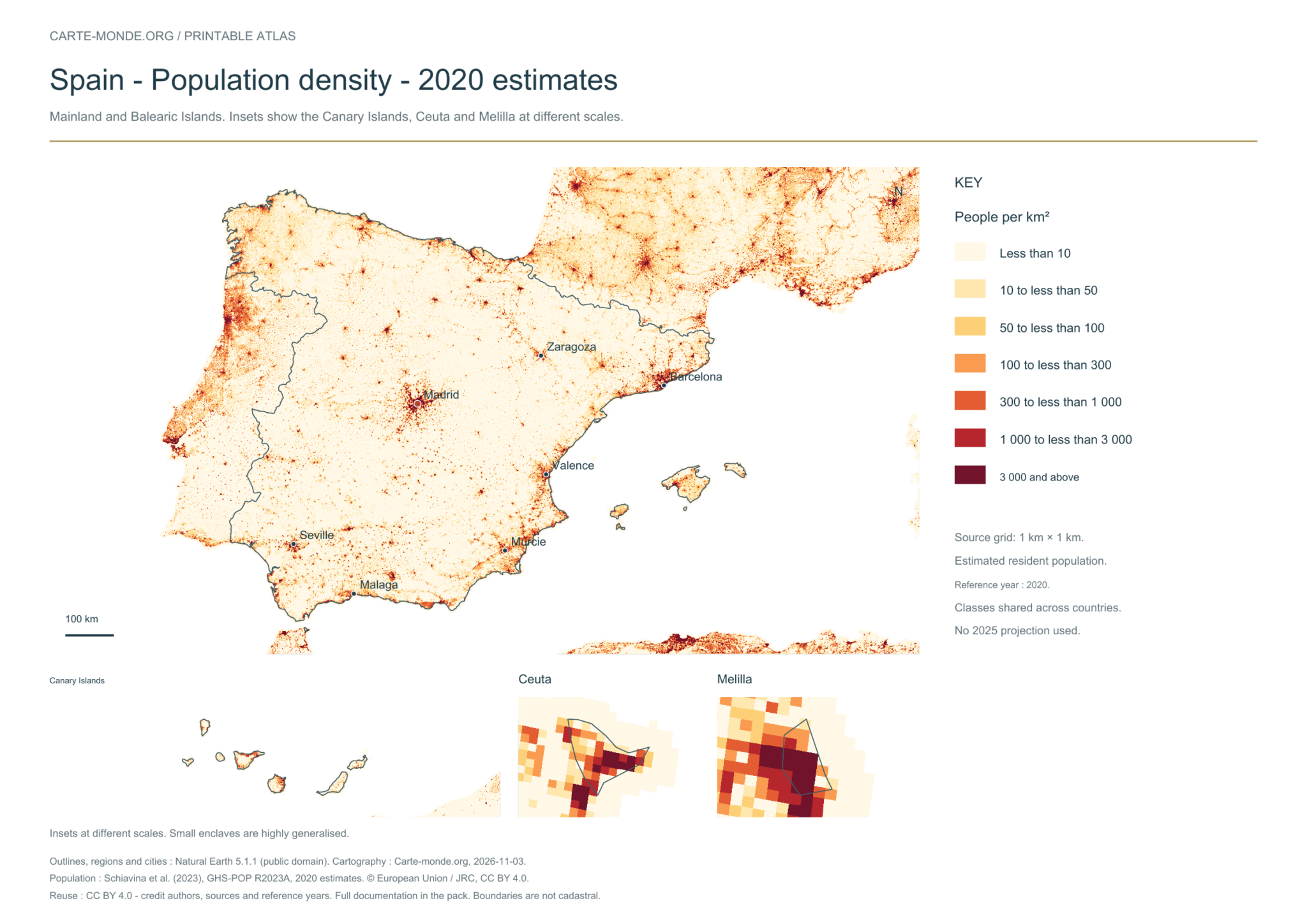
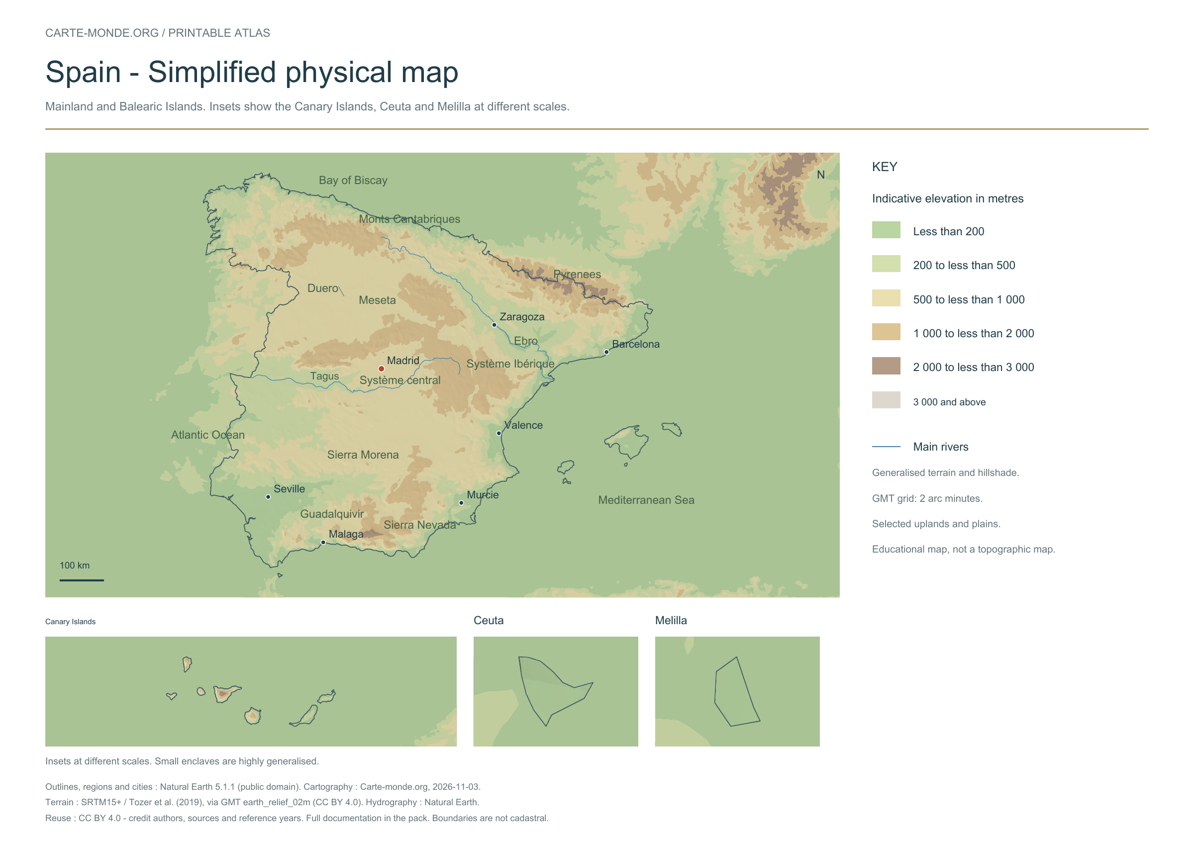
Five printable maps of Spain: regions and cities, location in Europe, two views of the relief and population. PDFs, images and sources are available below.
Our five maps have English labels. Maps from other publishers retain their original language.
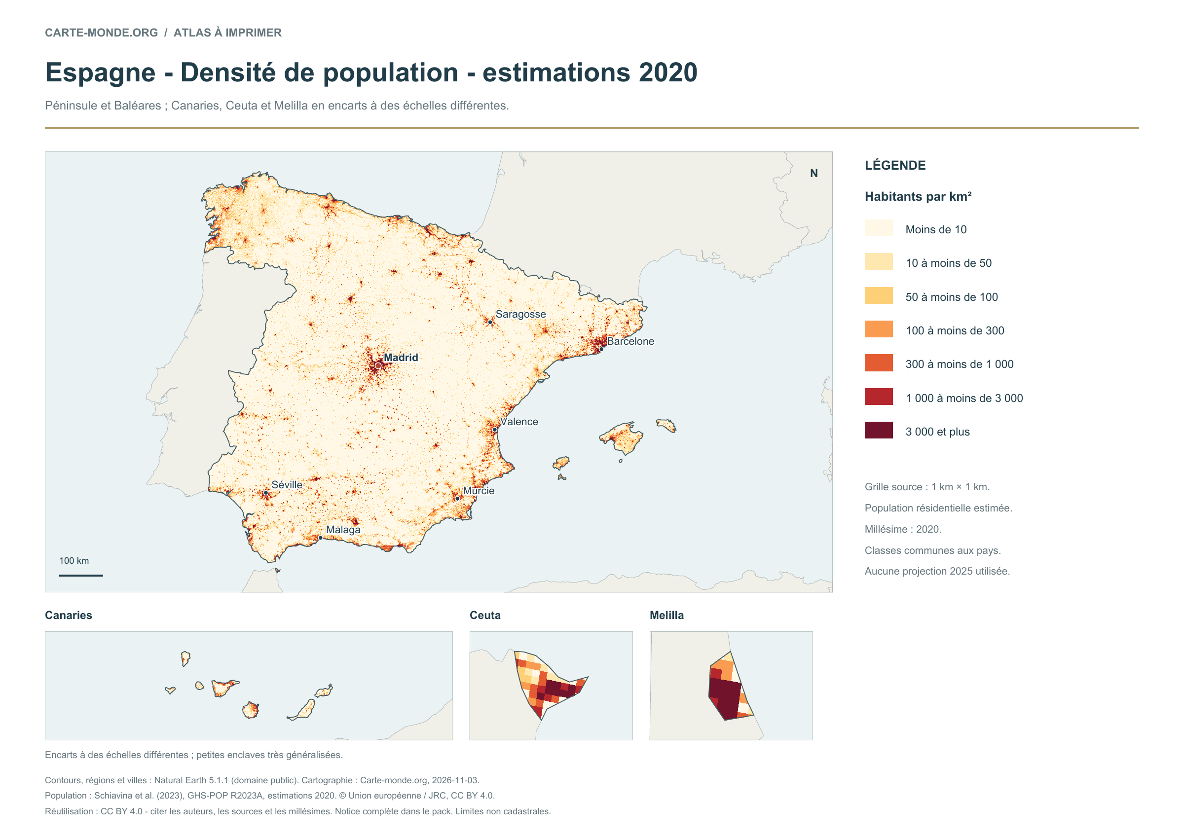
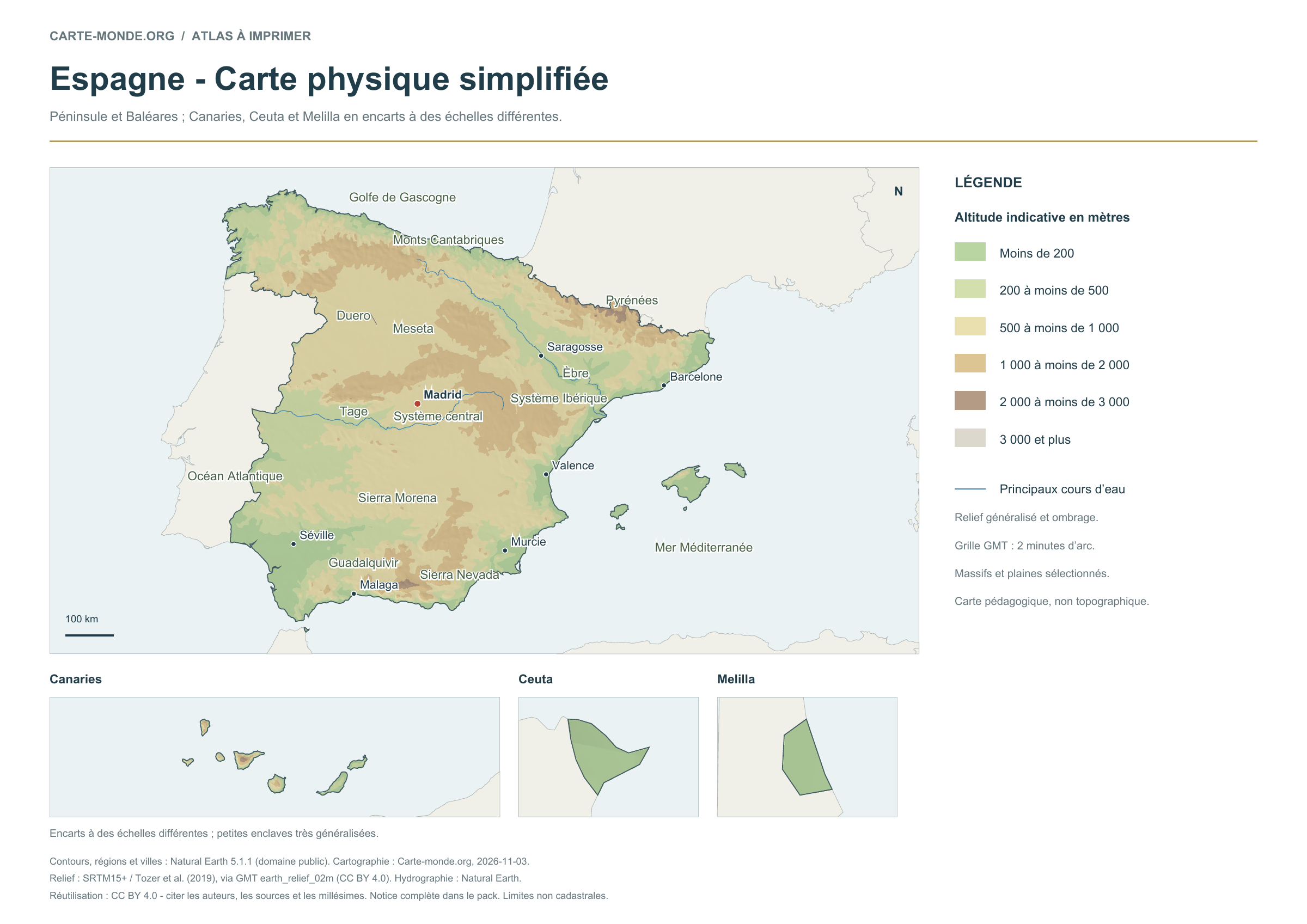
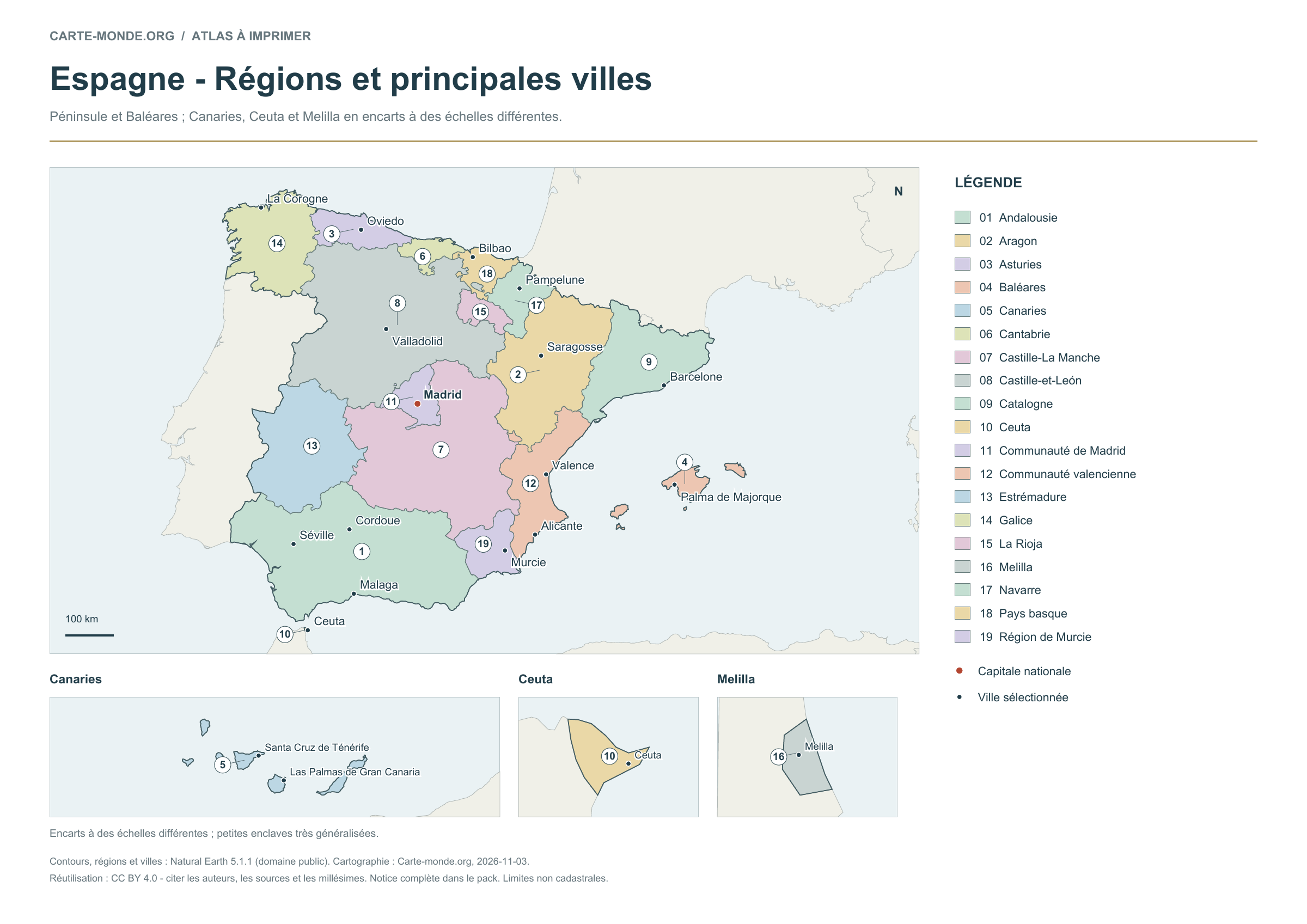
Mainland and Balearic Islands; Canary Islands, Ceuta and Melilla in insets at different scales.
Carte-monde.org · November 2026
Regions and main cities
The 19 autonomous communities and cities are identified by numbers and a legend. The map adds 19 cities selected for their importance and distribution across the country, with the capital in colour.
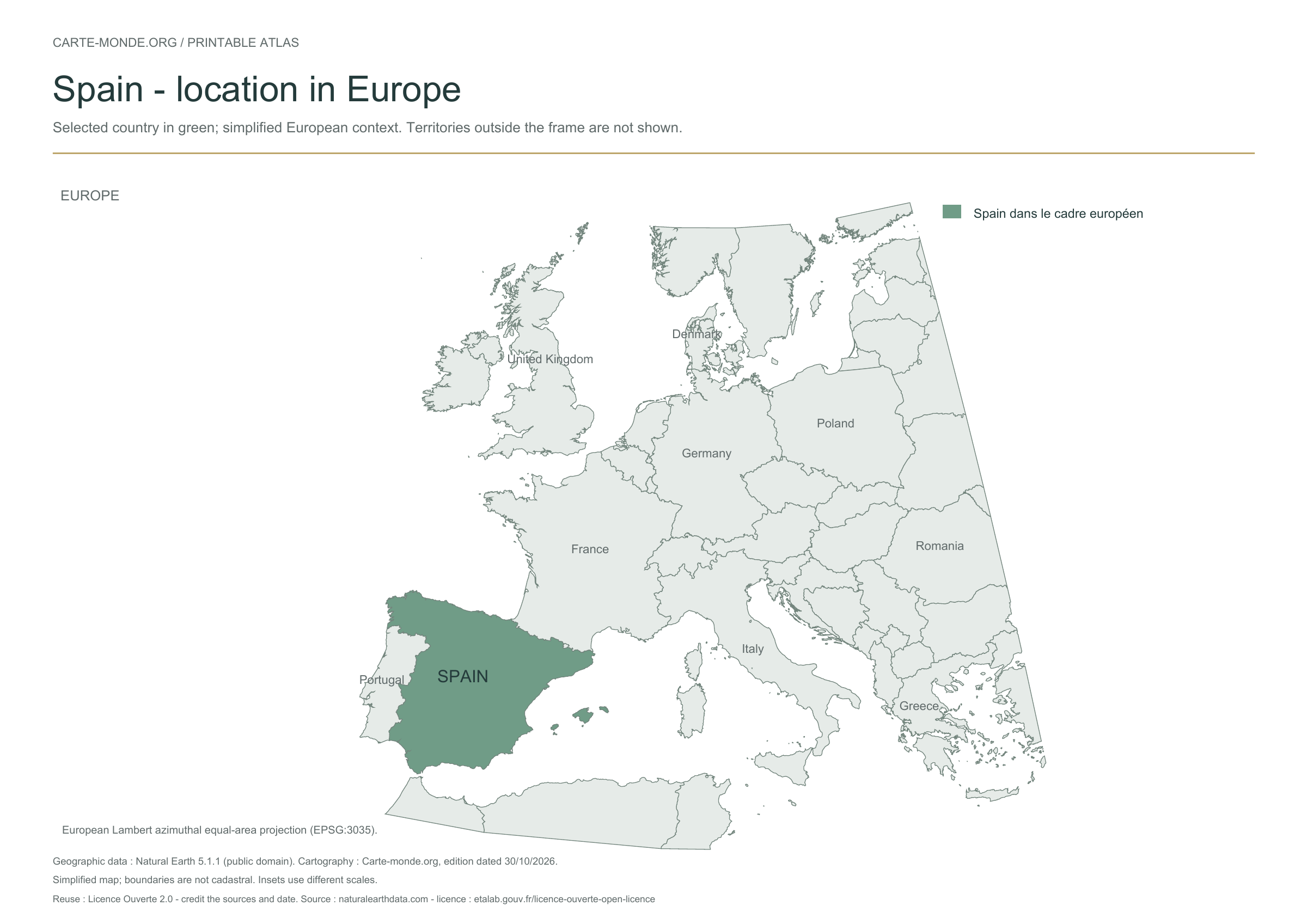
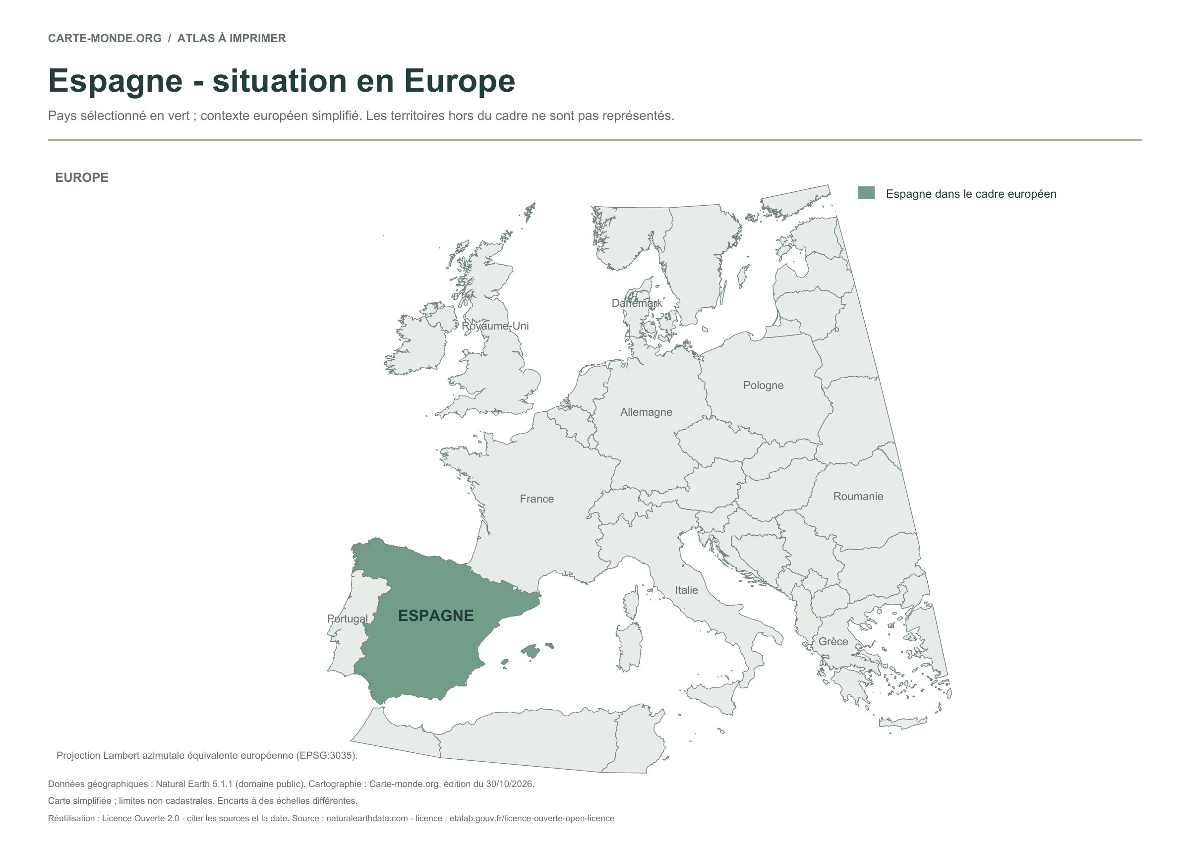
The previously published location map is retained unchanged: the country is highlighted in a simplified European map extent. Territories outside the frame are not shown.
Raster base map, cities, rivers and lakes: Natural Earth, public domain. Other boundary credits and licences are retained in the pack. Cartographic work CC BY 4.0; ODbL-derived data retains its licence. No topographic accuracy is claimed.
Territory, data and selection of names
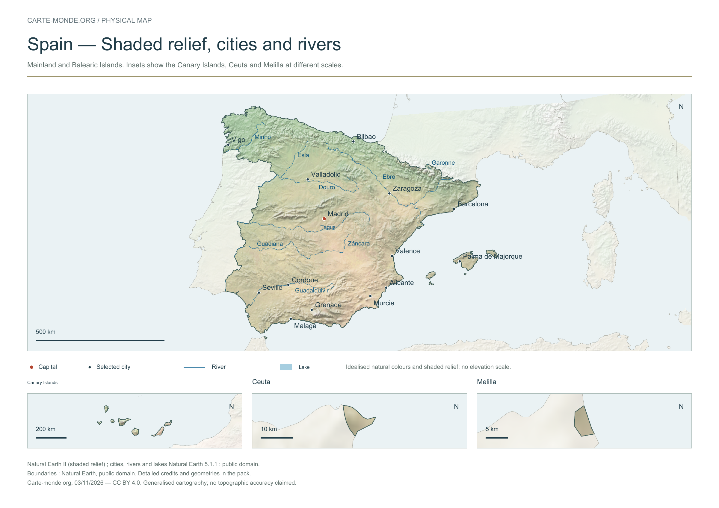
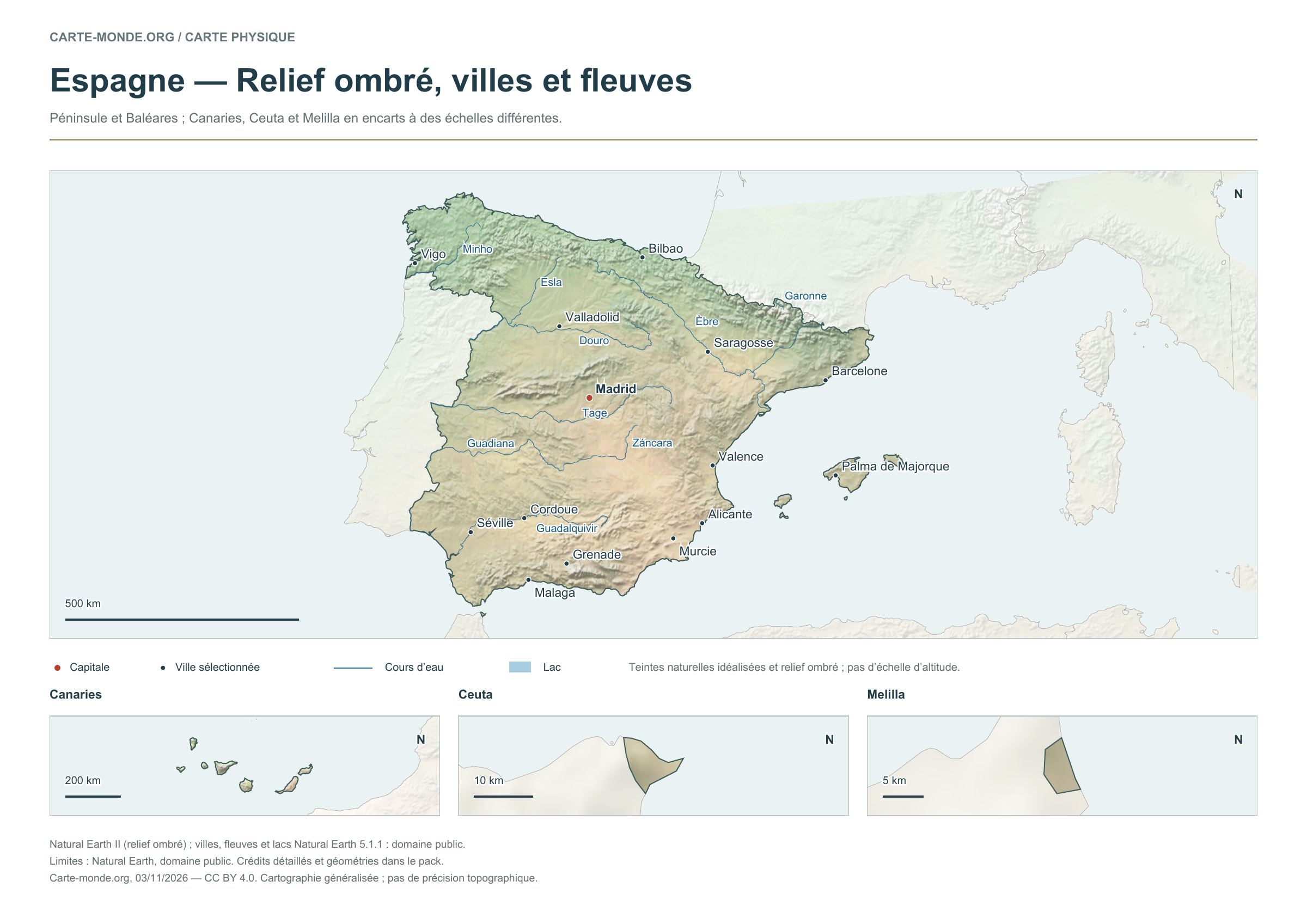
Mainland and Balearic Islands; Canary Islands, Ceuta and Melilla in insets at different scales.
Natural Earth II shaded relief background, 14 selected cities. Named waterways: Douro, Esla, Garonne, Guadalquivir, Guadiana, Minho, Tage, Záncara, Èbre.
The colours represent idealised natural cover; they do not correspond to elevation classes. This global background remains generalised, particularly for small states.
Carte-monde.org · November 2026
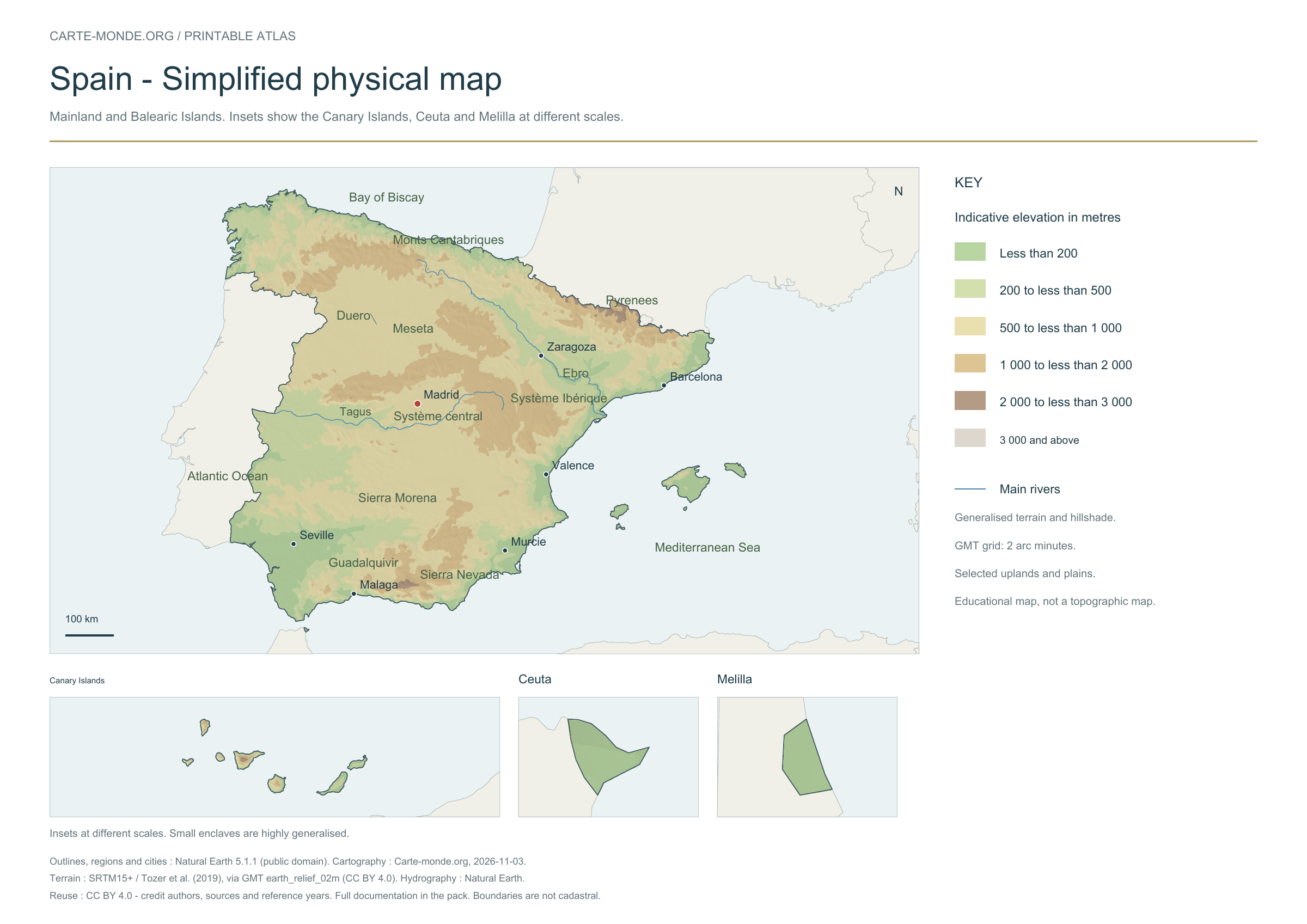
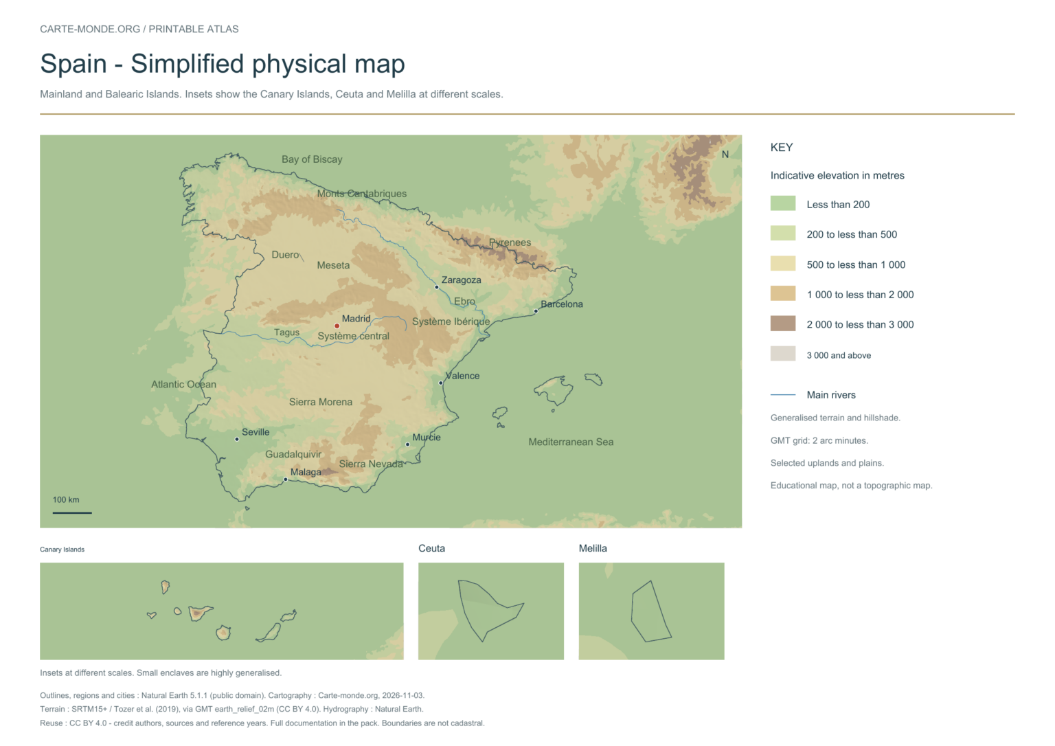
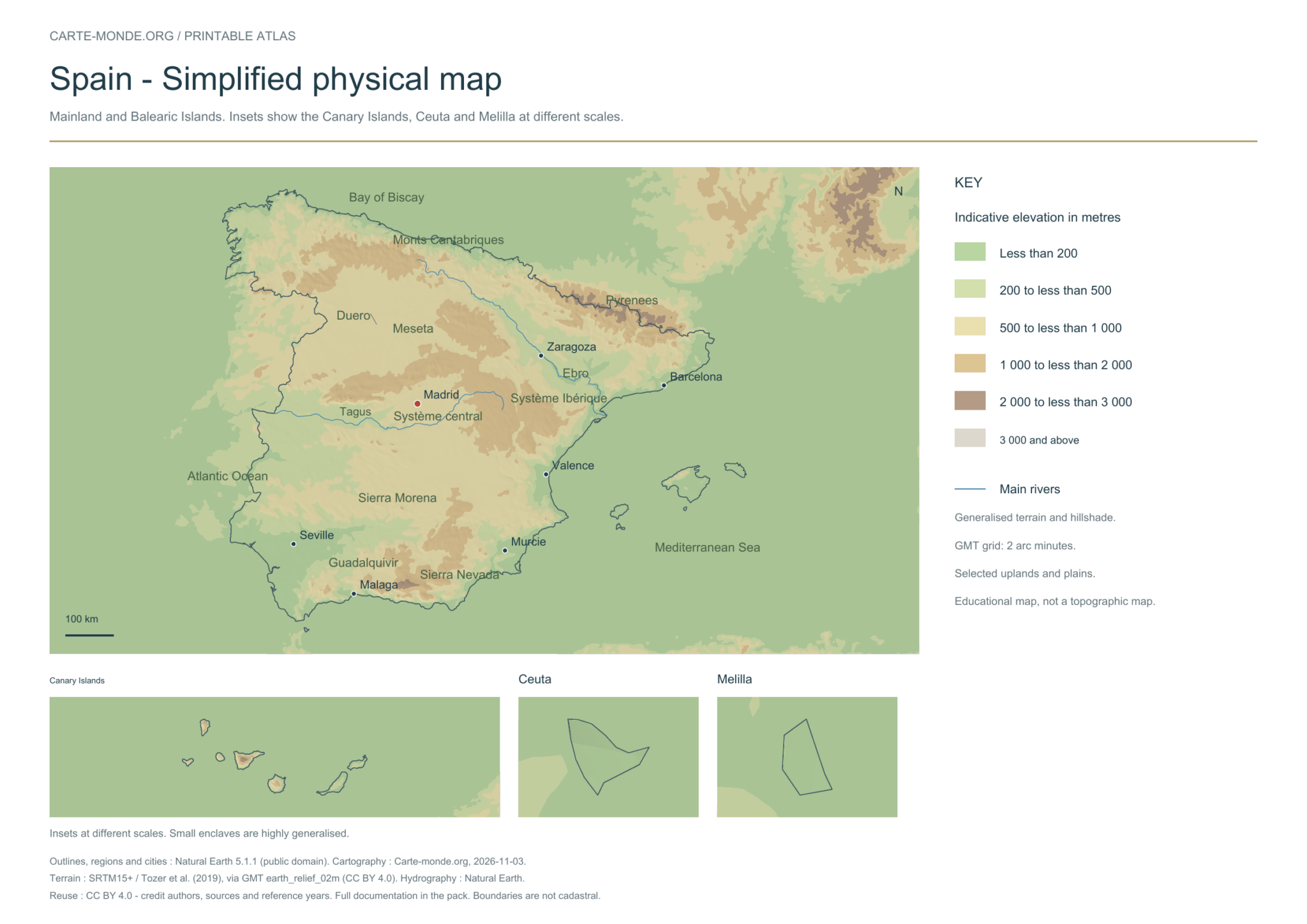
Simplified elevations
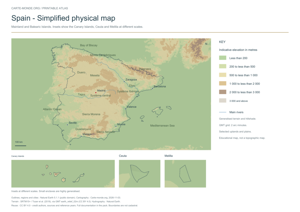
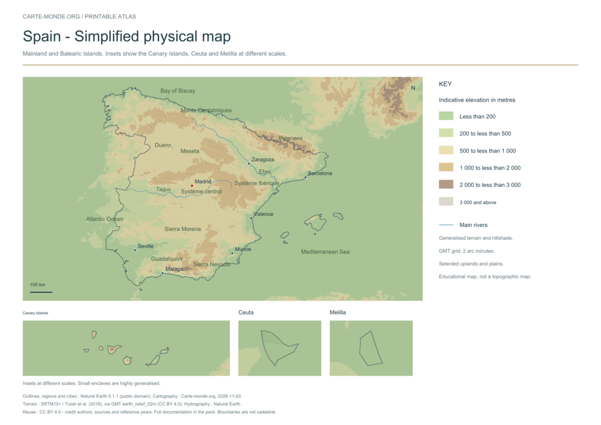
Elevation colours, shaded relief, major mountain ranges, plains and waterways. The relief is deliberately generalised for a national overview; this document does not replace a topographic map.
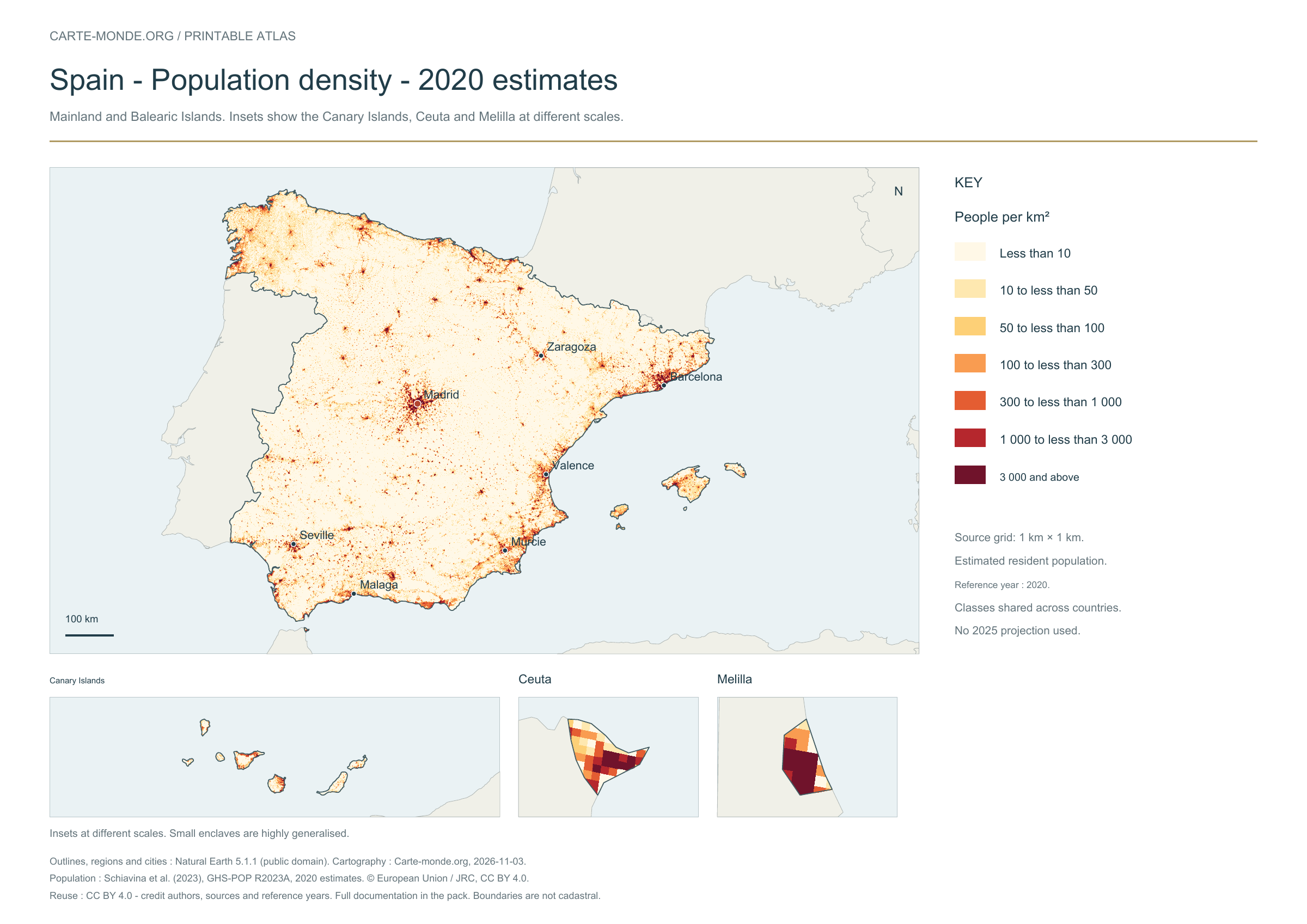
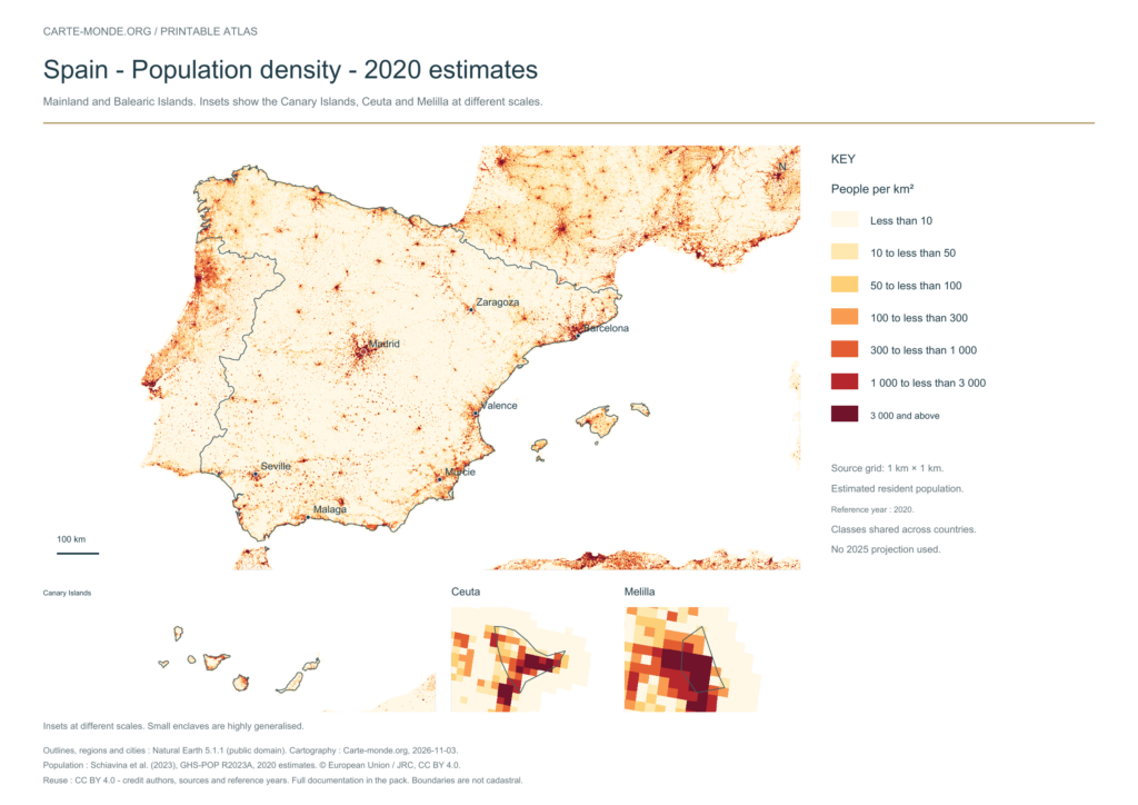
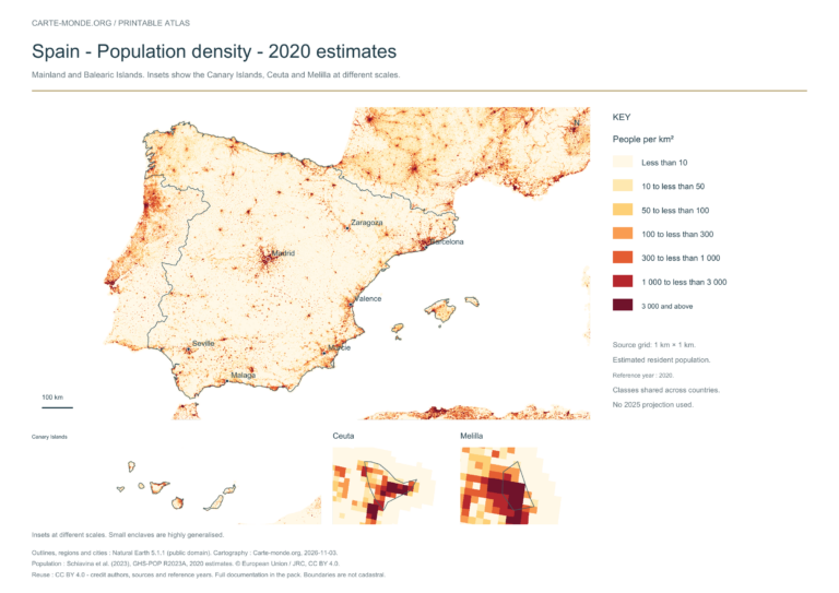
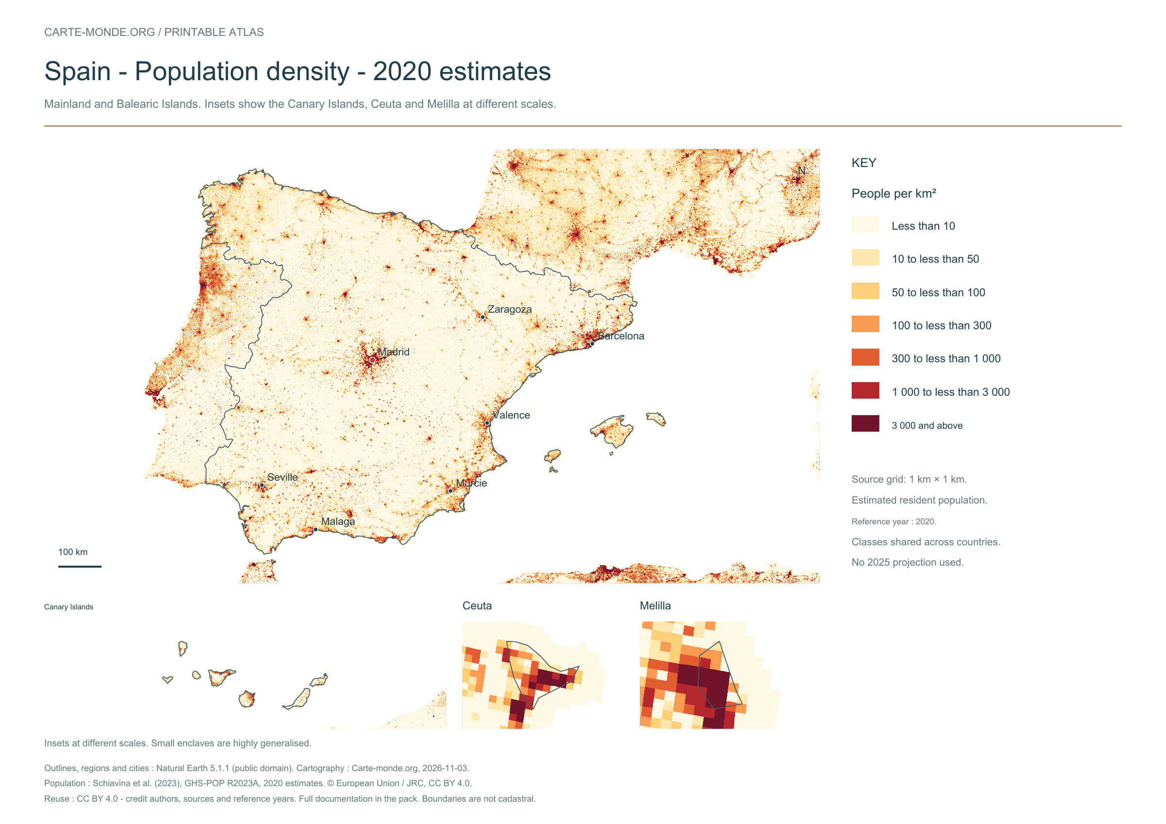
Estimated residential population distribution in 2020, on a source grid of 1 km². Inhabitants/km² classes are shared across countries. These are spatial estimates, with no 2025 projection.
The data represents estimated residential population in 2020, on a 1 km² source grid. The document’s creation date does not change this reference year.
The five in-house maps in one pack
Regions and cities, location in Europe, simplified elevations, 2020 population density and shaded relief: five A4 PDFs, their PNGs and SVGs, with sources and licences.
A4 PDF, PNG and SVG, with source notes. Text and linework are vector-based; terrain and density use images embedded in the PDFs and SVGs. The October location map is reused without uploading it again.
These existing maps are provided with their own credits and licences. Originals remain in their original language; previews are converted or reduced for display.
2025 · Spanish
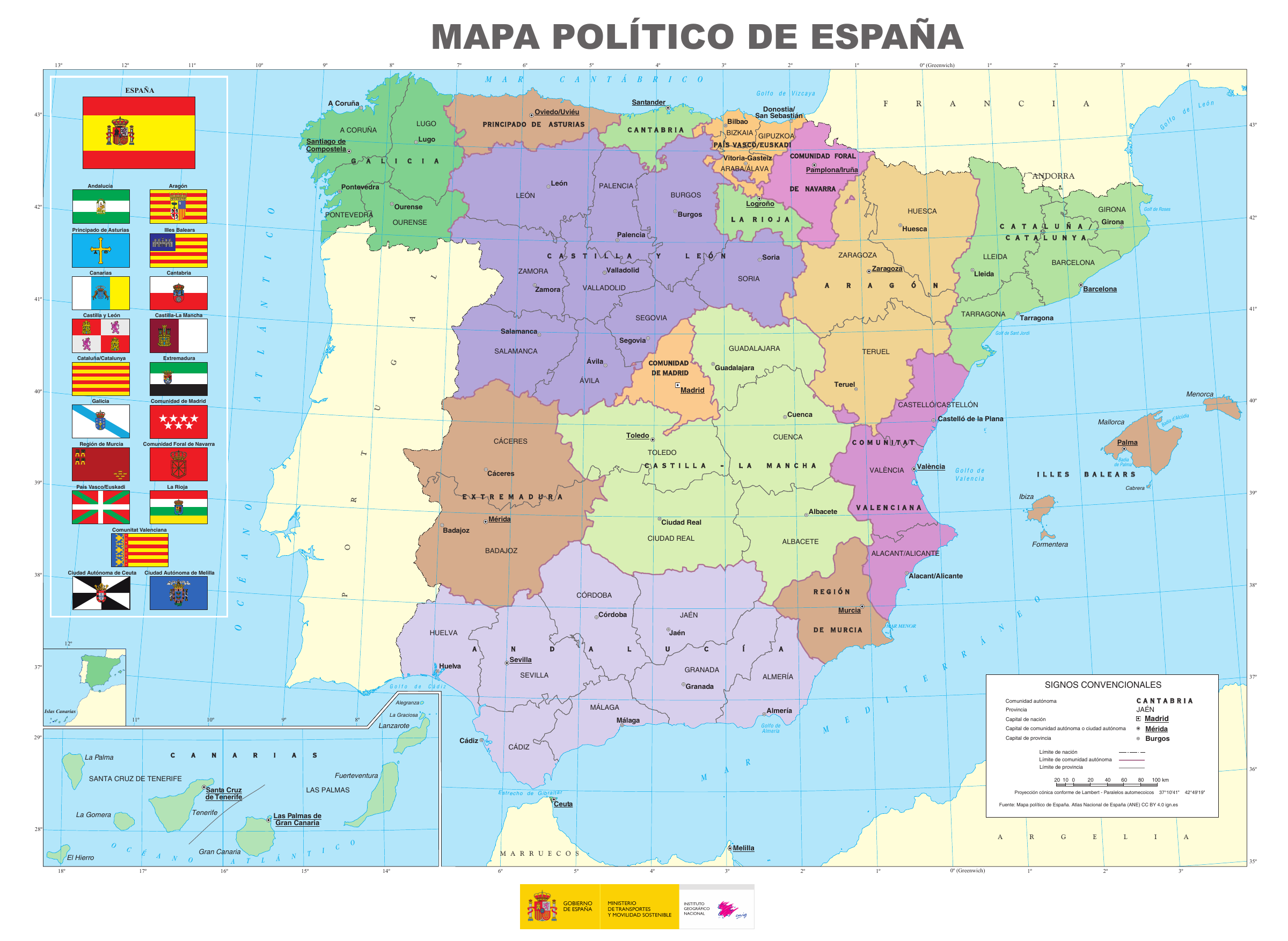
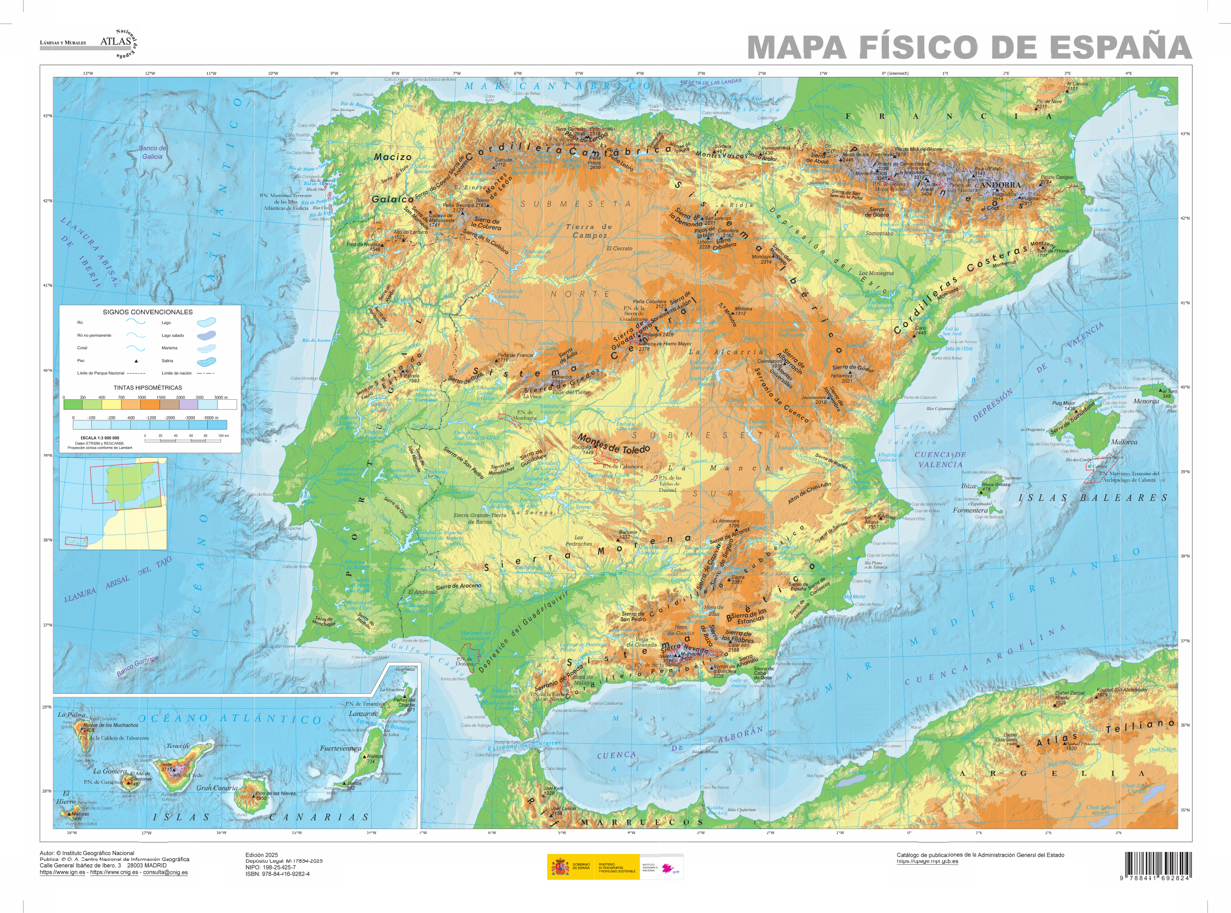
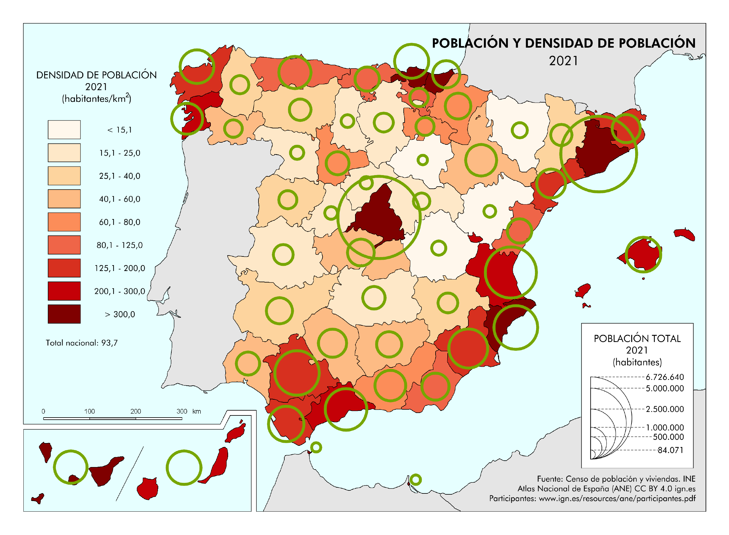
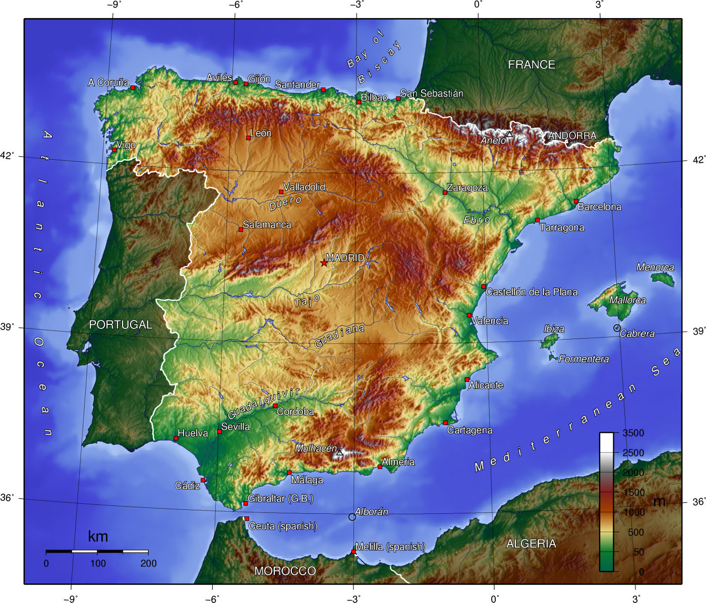
Political map of Spain — IGN
Autonomous communities, provinces and many localities. Attribution: Mapa político de España, Atlas Nacional de España (ANE), 2025, CC BY 4.0 ign.es. Original unchanged; preview converted to PNG.
Relief, peaks, rivers and marine hydrography, with a Canary Islands inset. Attribution: Mapa físico de España, Atlas Nacional de España (ANE), 2025, CC BY 4.0 ign.es. Original unchanged; preview converted to PNG.
Map combining population and density at provincial level. Statistical source: INE, 2021 census; cartography IGN. Attribution: Mapas temáticos del ANE 2021, CC BY 4.0 ign.es. Original unchanged; preview converted to PNG.
The files from the original collection, the first administrative map and the October pack are preserved at their old URLs. Access is grouped in the archives, with credits and notes about their currency.
Choose regions and cities for territorial organisation, the location map for geographical position, relief for major natural features and density for population distribution. The detailed maps provide more names and landmarks.
Choose the A4 PDF for printing. For an image to insert in a document, use the PNG; licences and data years are stated with each map.
Physical map: SRTM15+ / Tozer et al. (2019), reference publication, grid GMT earth_relief_02m, derived from SRTM15+V2.7. Relief smoothed to 2 arc minutes, Natural Earth hydrography; small enclaves are not detailed.
Our three new maps: created by Carte-monde.org, November 2026, under CC BY 4.0, retaining authors, sources, reference years and modification notices. Location in Europe: October 2026 map under Licence Ouverte 2.0, reused unchanged. Full notes accompany the packs.
Detailed maps retain the licenses stated beneath each document. CC BY-SA licenses require adaptations to retain an identical or compatible license. The new Carte-monde.org license does not apply to older files in the collection.
Raster base map, cities, rivers and lakes: Natural Earth, public domain. Other boundary credits and licences are retained in the pack. Cartographic work CC BY 4.0; ODbL-derived data retains its licence. No topographic accuracy is claimed.
Other maps: sources and reuse
Reference maps by external authors. Each document retains its licence, credits and date. “View map” links open the document on Commons; ZIP buttons provide access to the files kept in this collection.
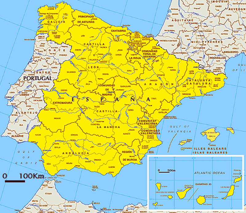
Date stated by the source: 2005-07-01; mainland Spain and the Balearic Islands, without the Canary Islands. The data year may differ from the document date; consult its legend.
Reduced preview; original preserved in the ZIP. The map retains its original licence.
To reuse a CC BY map, cite its authors, source and licence and indicate any changes. Adaptations of a CC BY-SA map retain the same or a compatible licence. CC0 documents may be reused freely; retaining the source makes them easier to identify. These rights do not make all administrative boundaries current.
Previous collection — original files preservedFlag of Spain
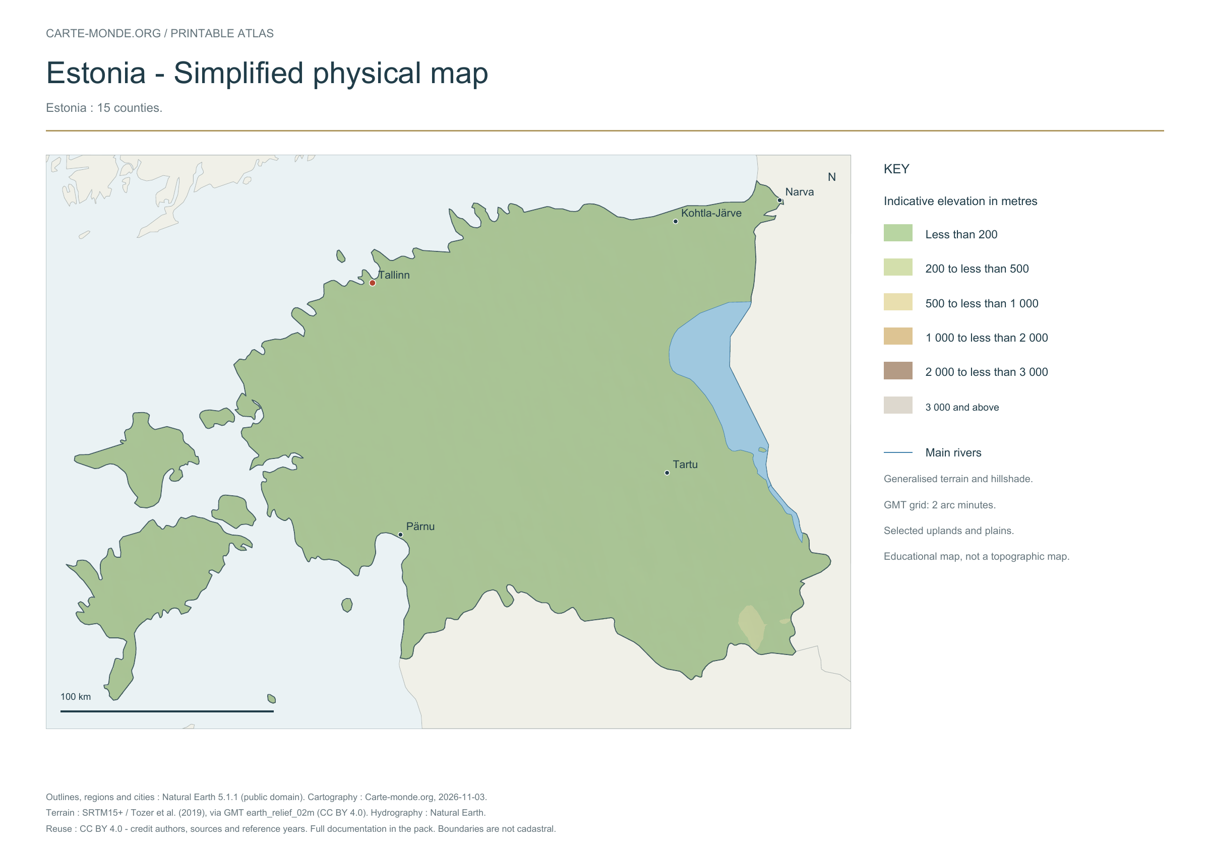
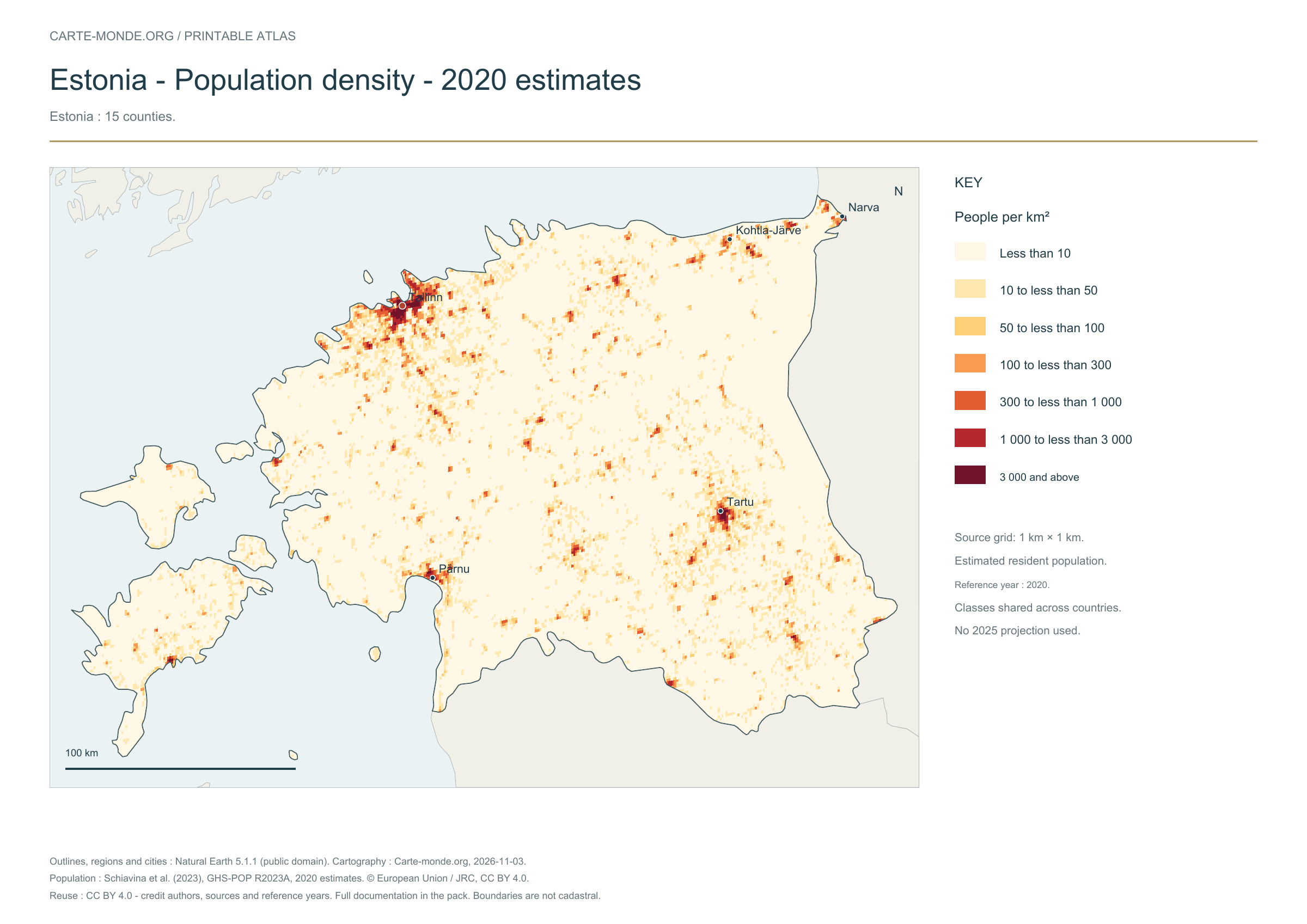
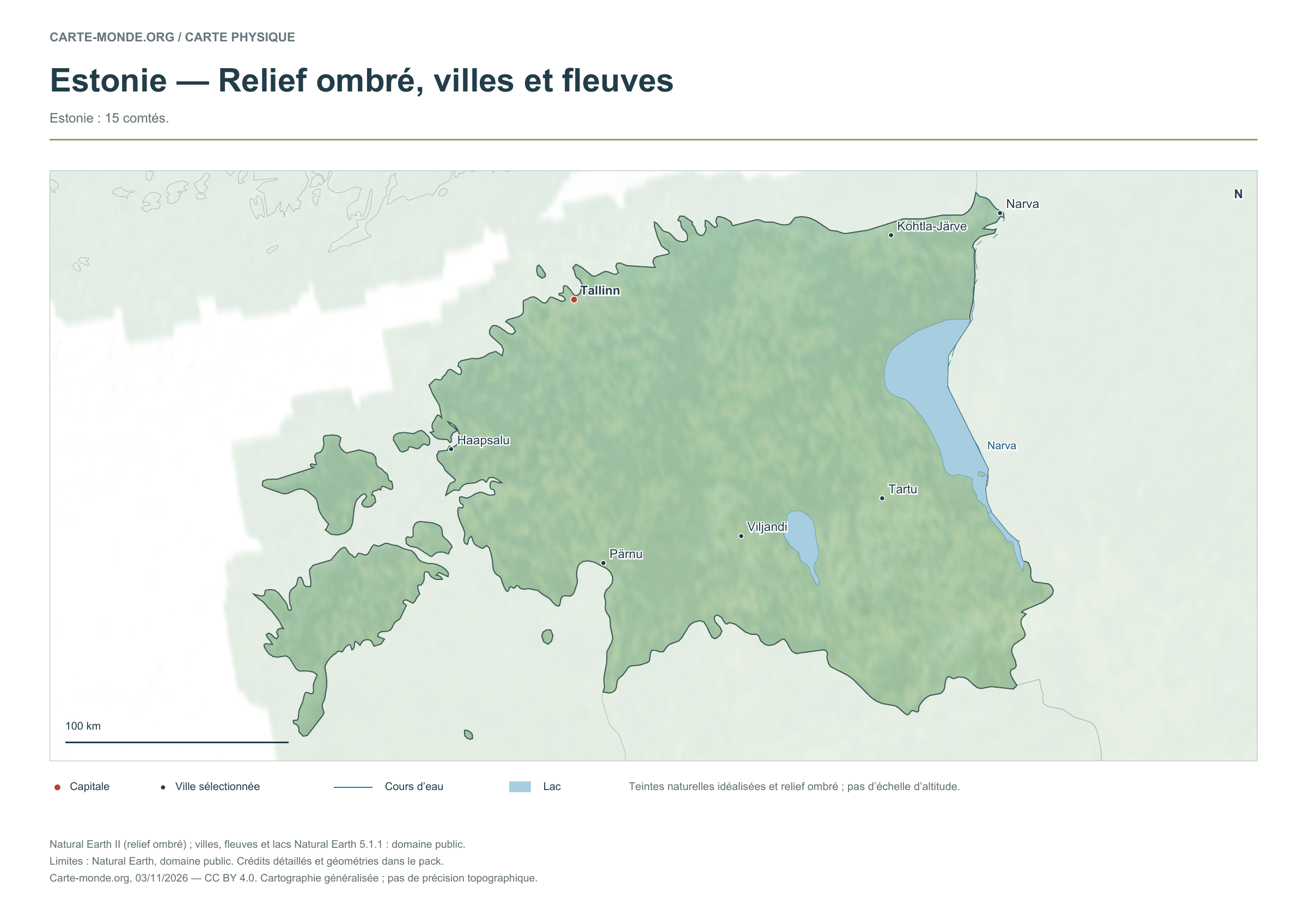
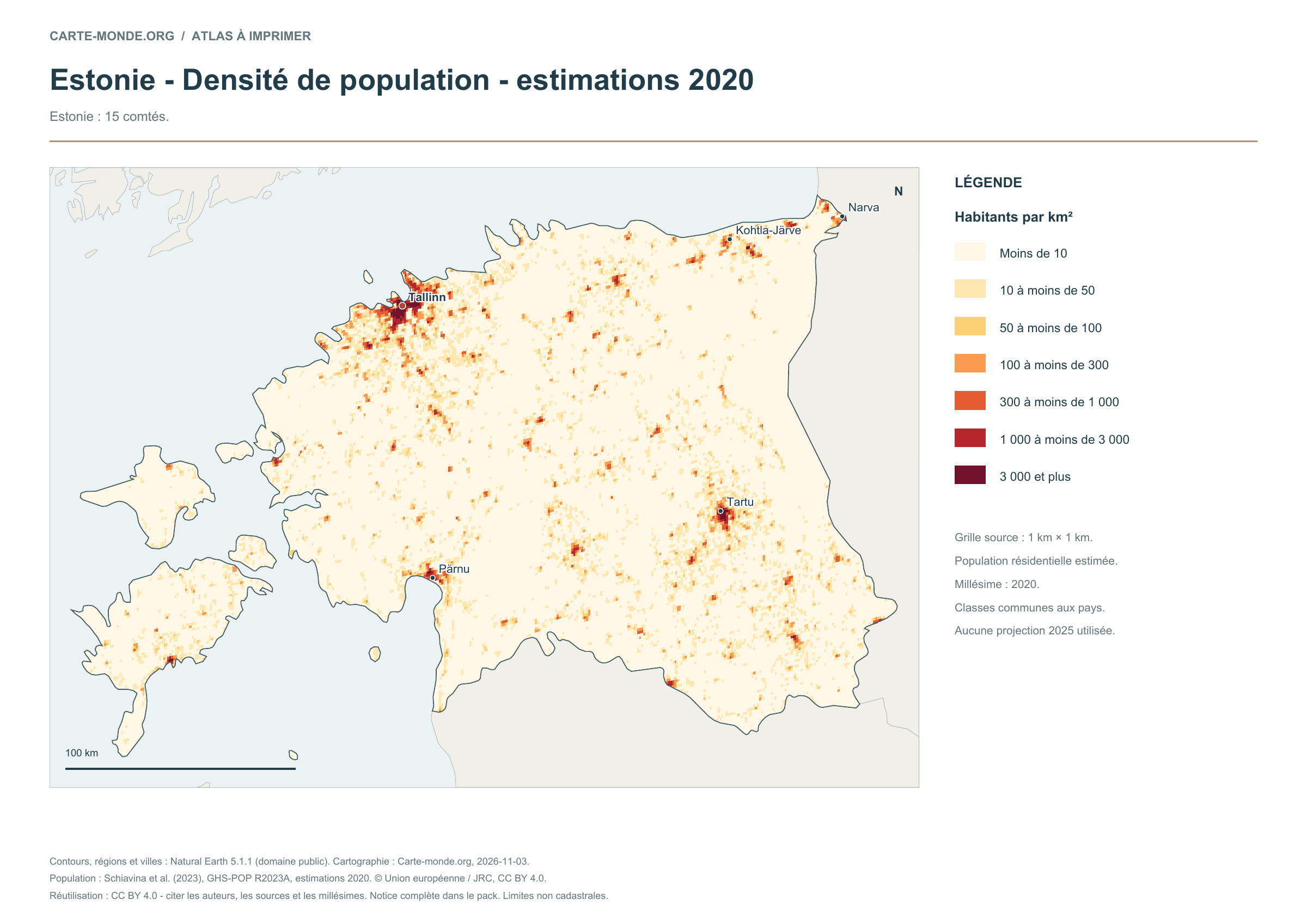
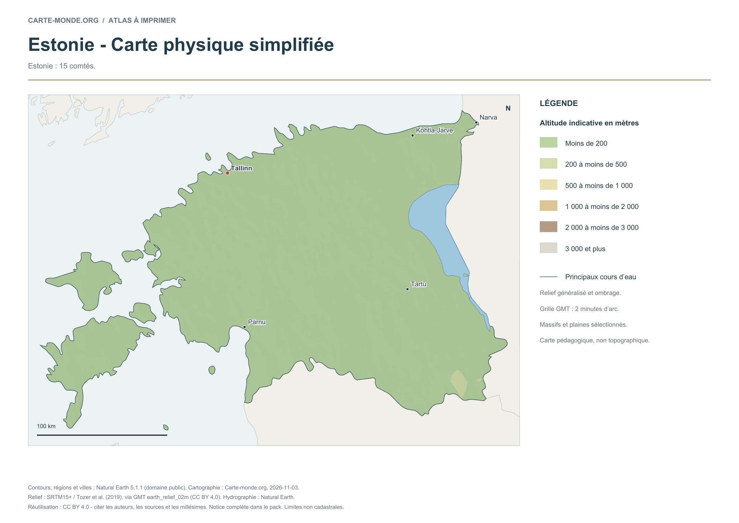
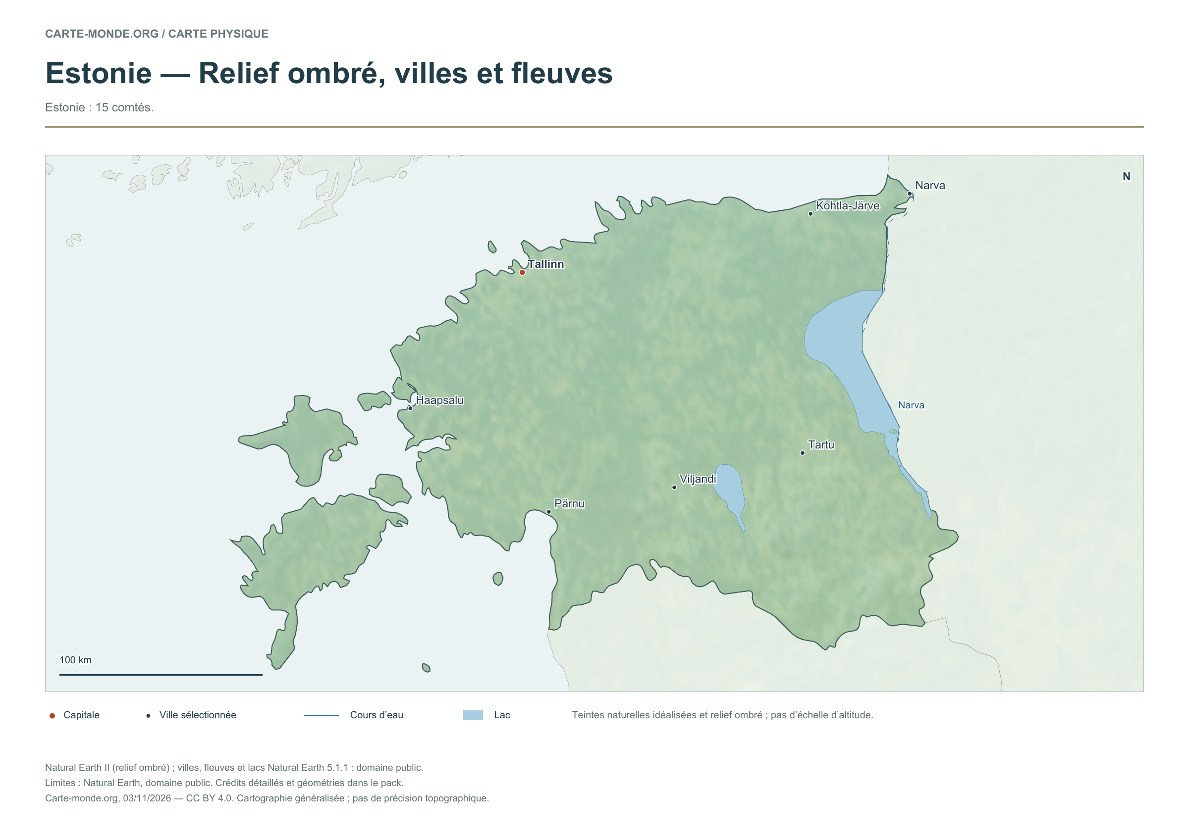
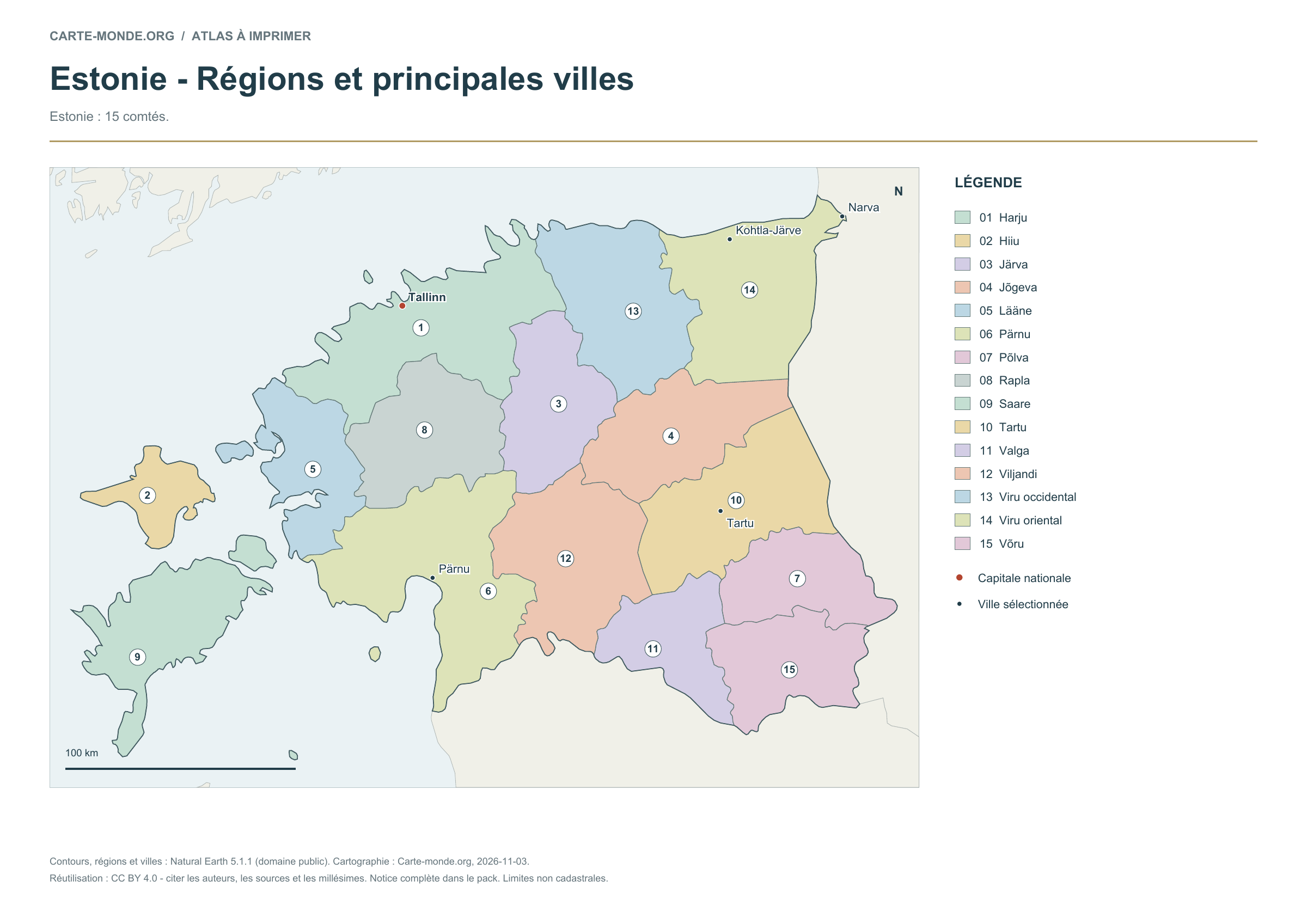
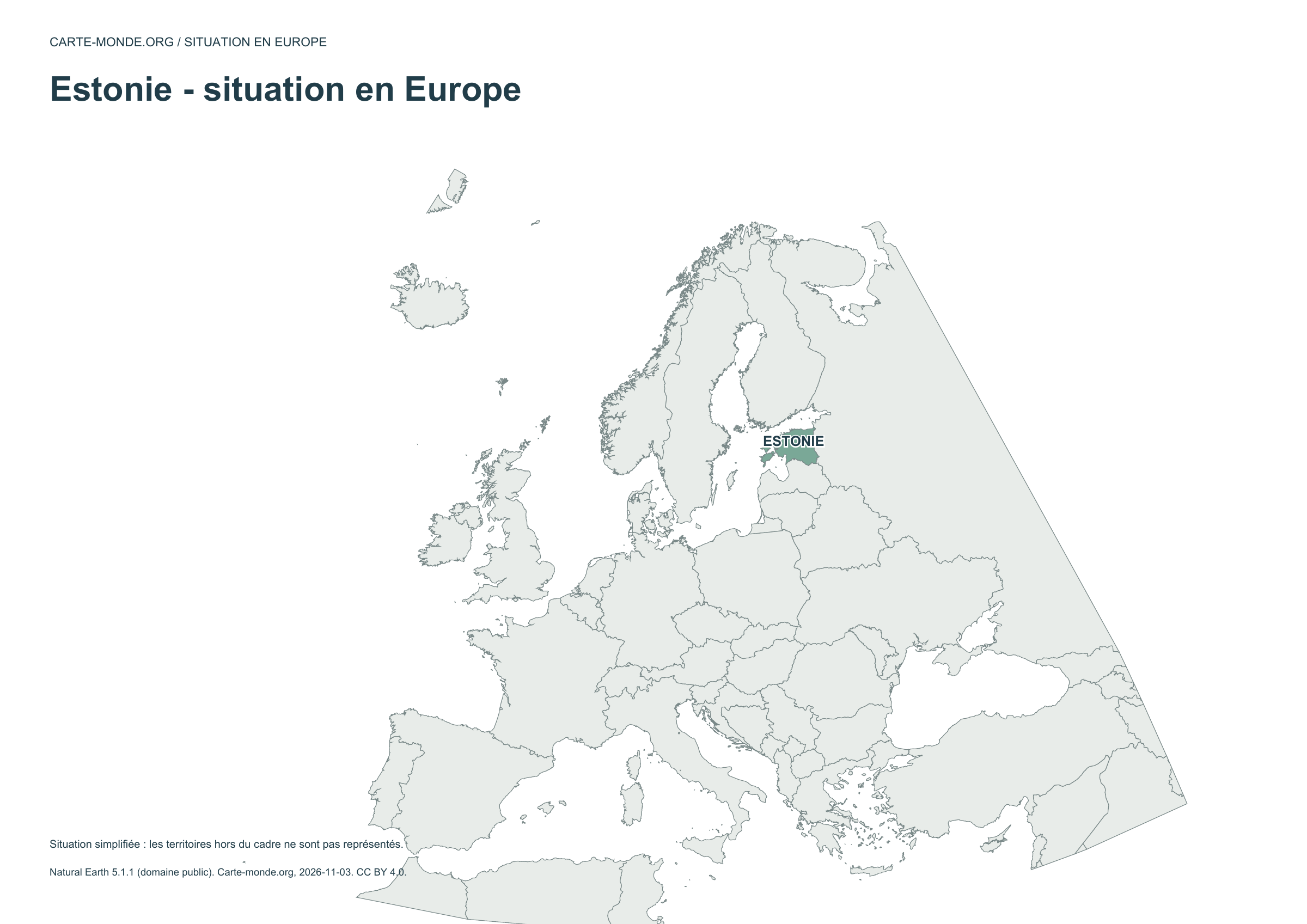
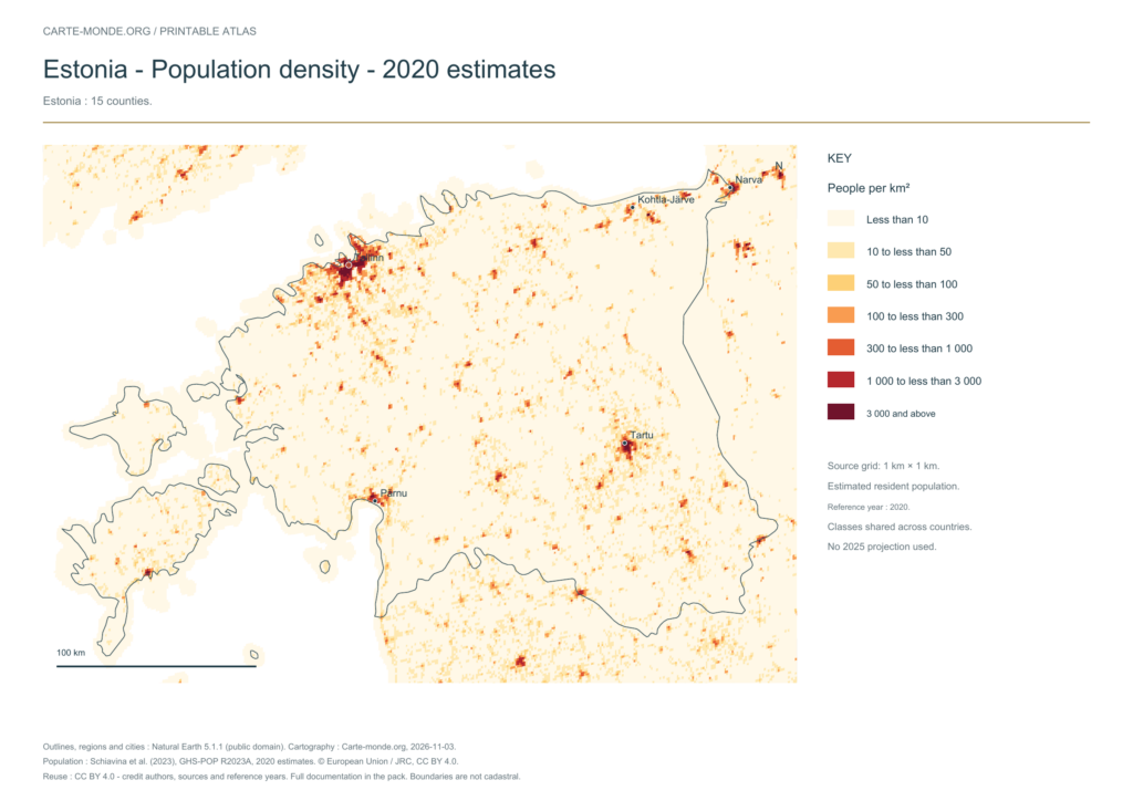
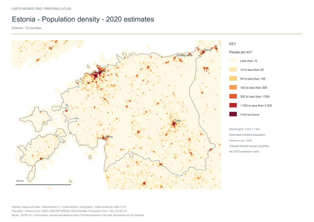
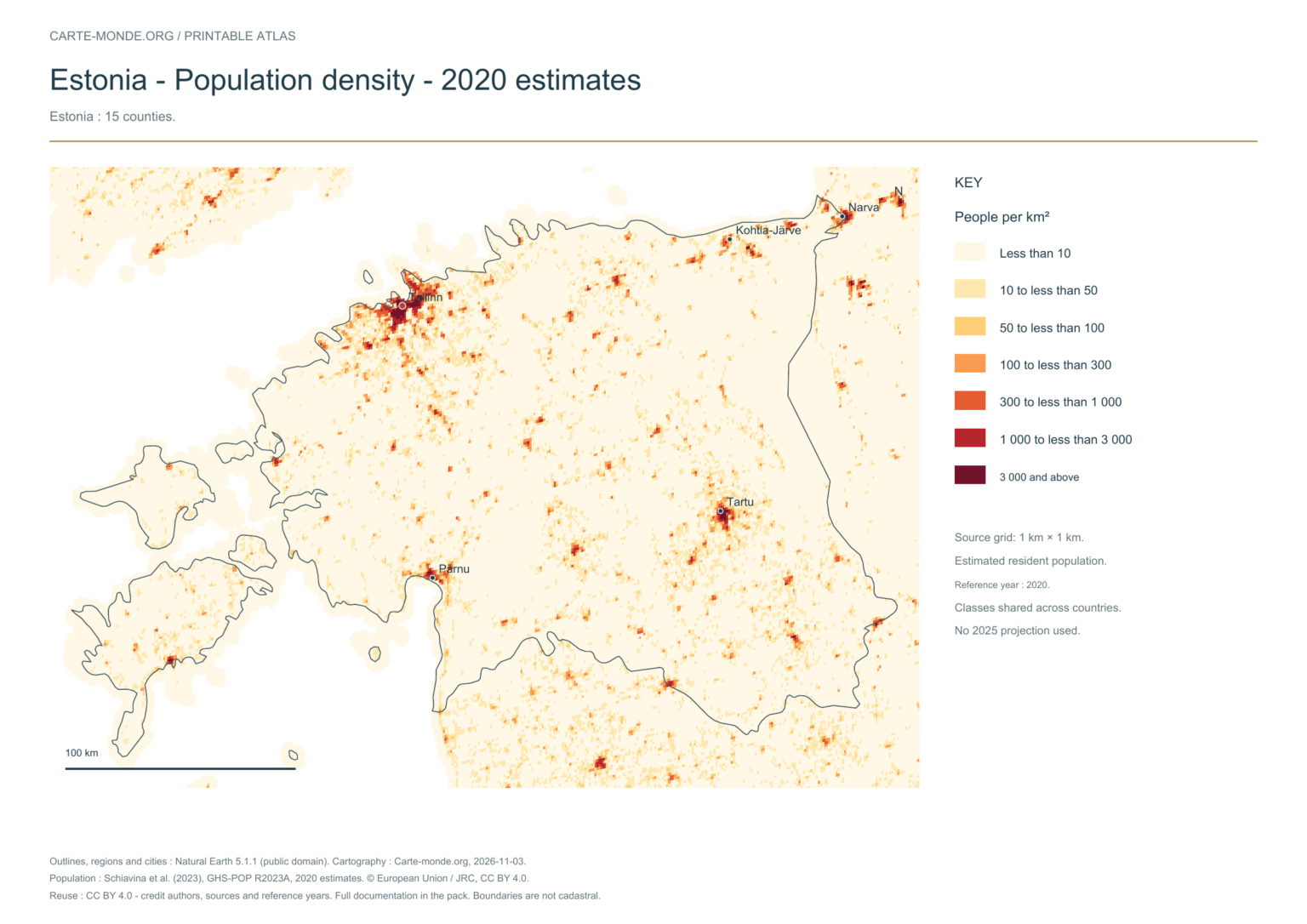
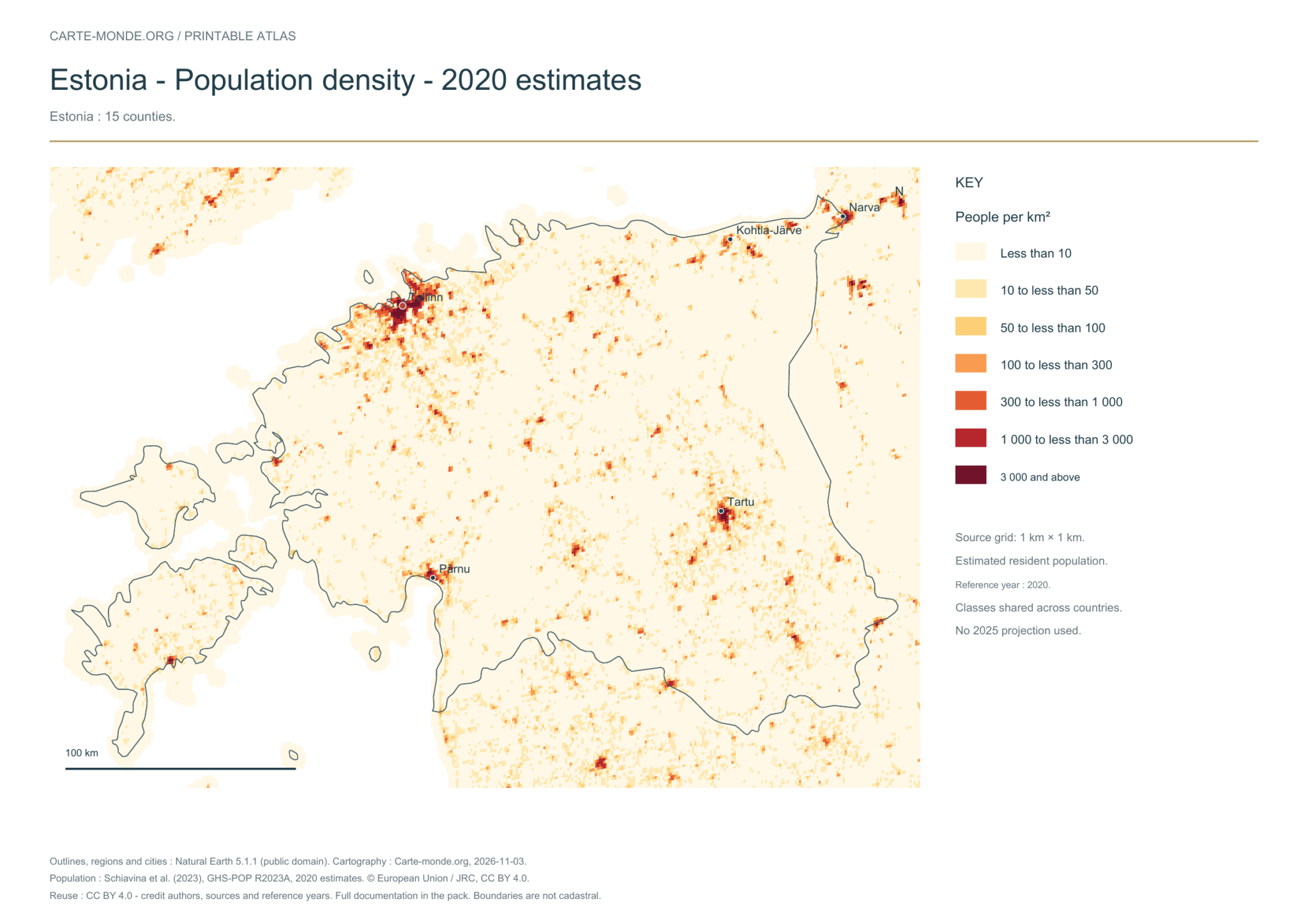
Five printable maps of Estonia: regions and cities, location in Europe, two views of the relief and population. PDFs, images and sources are available below.
Our five maps have English labels. Maps from other publishers retain their original language.
Raster base map, cities, rivers and lakes: Natural Earth, public domain. Other boundary credits and licences are retained in the pack. Cartographic work CC BY 4.0; ODbL-derived data retains its licence. No topographic accuracy is claimed.
Territory, data and selection of names
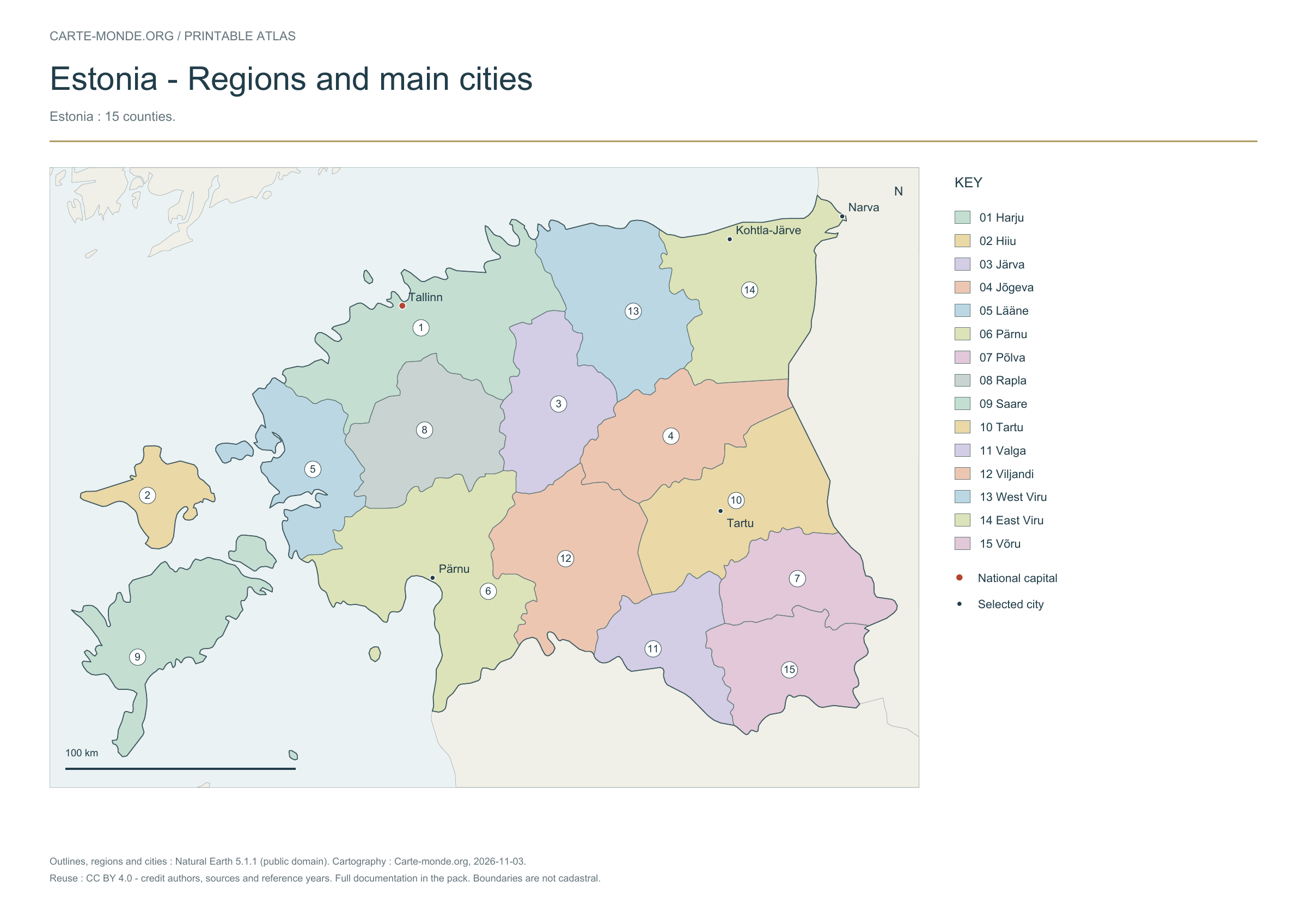
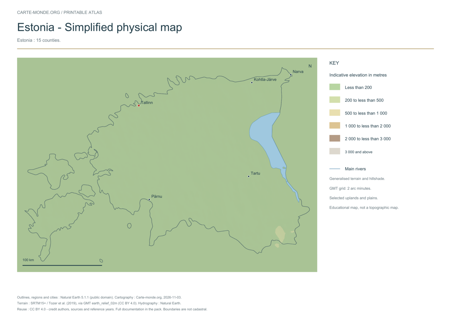
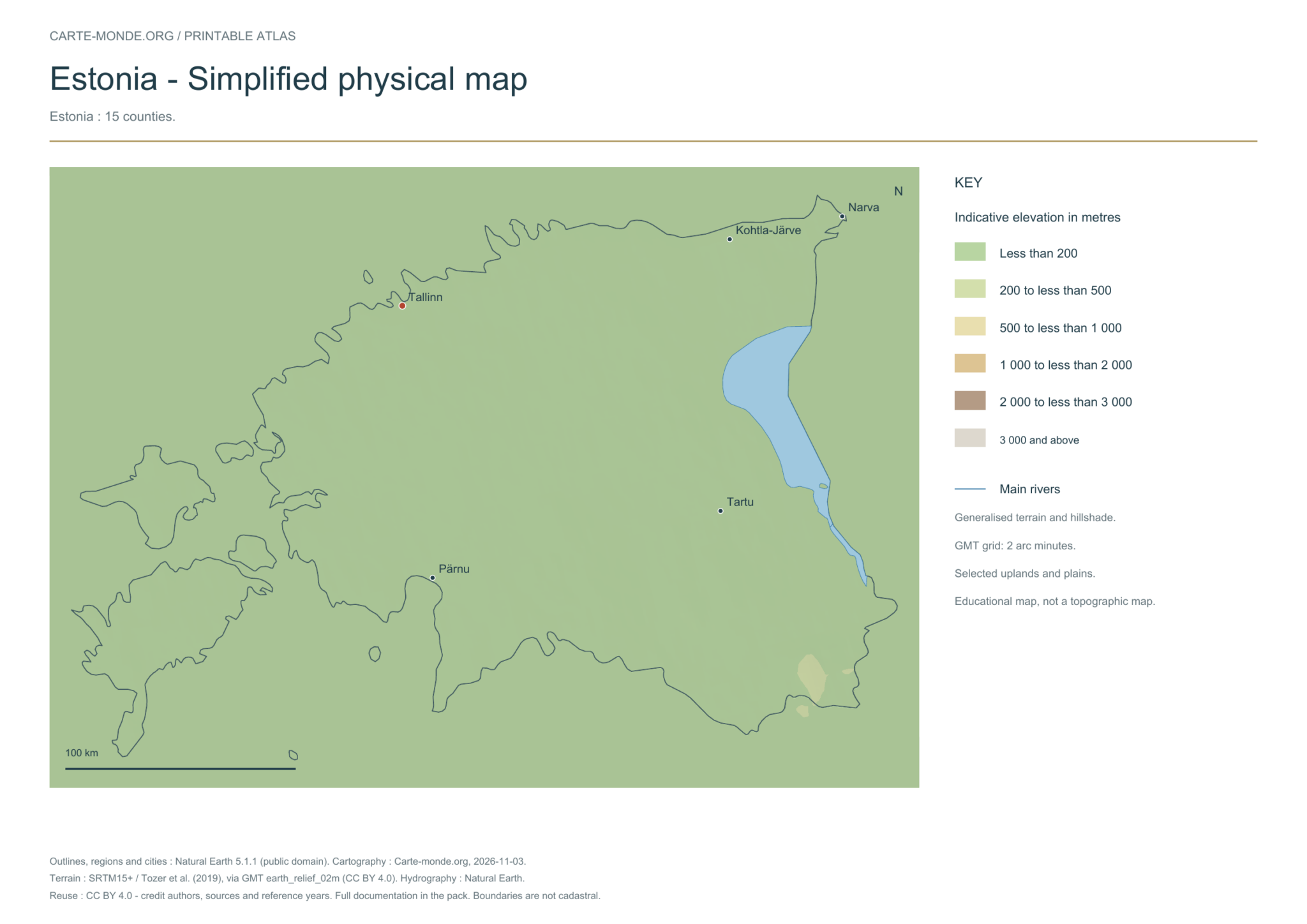
Estonia: 15 counties.
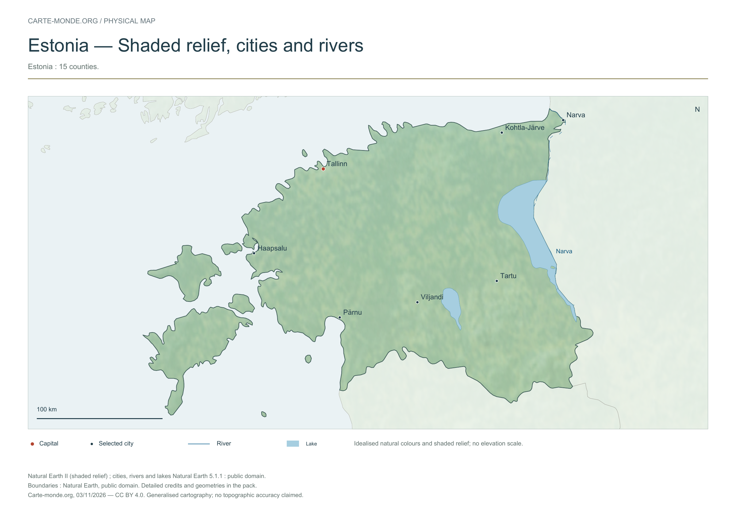
Natural Earth II shaded relief base map, 7 selected cities. Named rivers: Narva.
The colours represent idealised natural cover; they do not correspond to elevation classes. This global background remains generalised, particularly for small states.
Carte-monde.org · November 2026
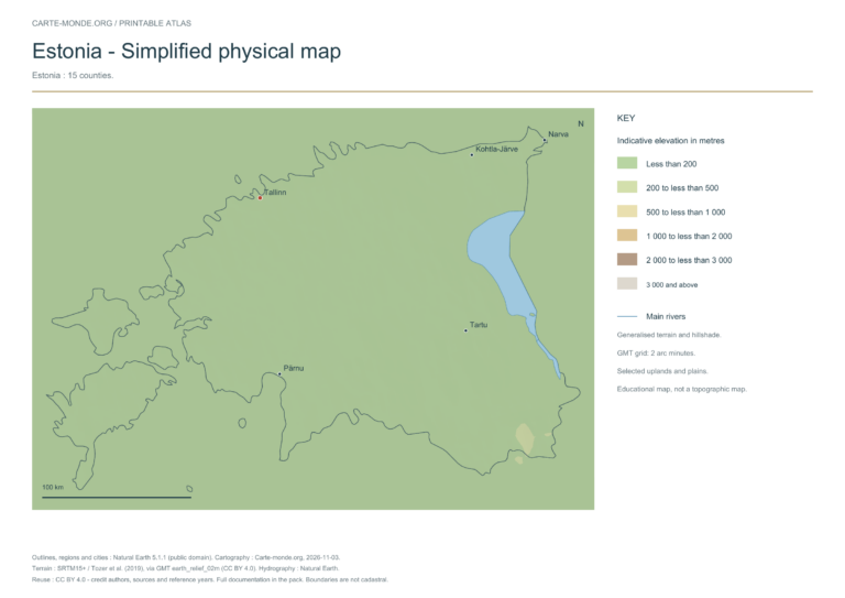
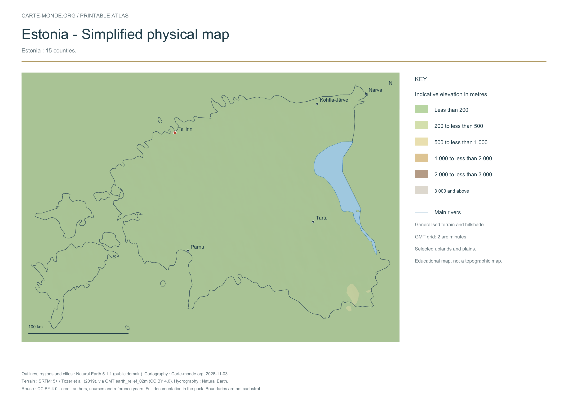
Simplified elevations
Smoothed relief, elevation colours, main mountain ranges, plains and watercourses. Educational map at national scale.
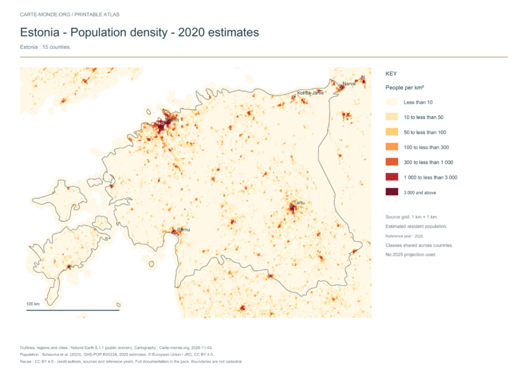
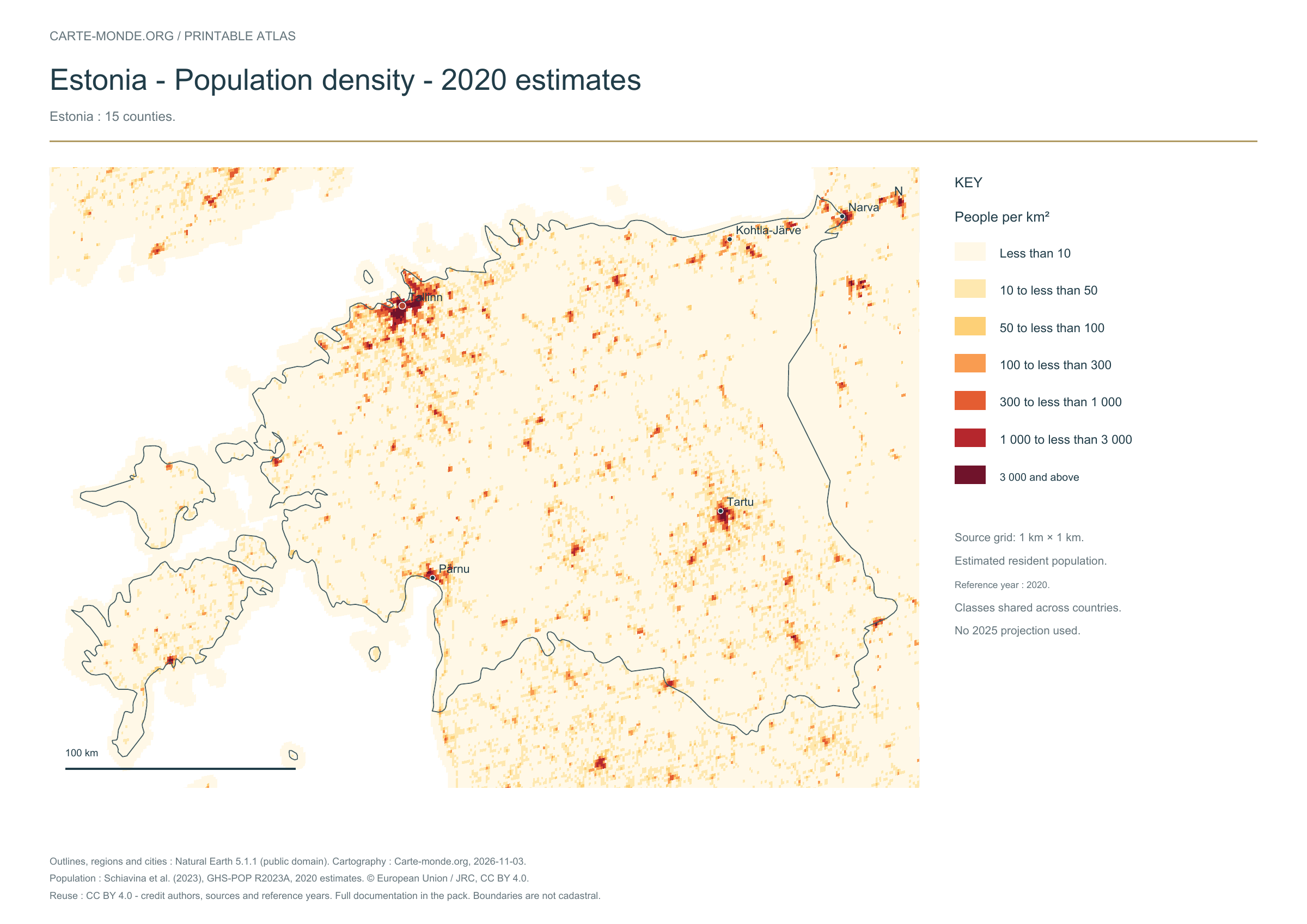
The data represents estimated residential population in 2020, on a 1 km² source grid. The document’s creation date does not change this reference year.
The five in-house maps in one pack
Regions and cities, location in Europe, simplified elevations, 2020 population density and shaded relief: five A4 PDFs, their PNGs and SVGs, with sources and licences.
Older documents in English provided by the University of Texas’s Perry–Castañeda collection. The links open the collection page where you can choose the indicated map. The dates below refer to the documents: these references do not necessarily describe the current situation.
Author: Central Intelligence Agency, except where otherwise stated on the document. Source: University of Texas Libraries. The collection states that most of its maps are in the public domain; retain these credits and check exceptions: reuse terms.
External references: no new file from this collection has been hosted on this site for this batch.
Find the old maps of Estonia
Previously published maps remain accessible at their original URLs, with the collection’s text and credits.
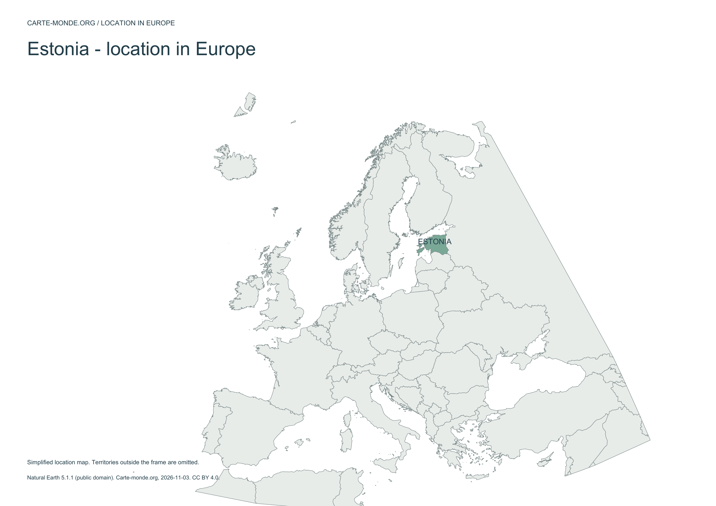
Regions and cities show how the territory is organized; the location map places the country; terrain shows the main natural regions; density shows population distribution. Print the in-house PDFs in A4 landscape with “Fit to page”. Insets have their own scales.
Outlines, regions, cities and hydrography:Natural Earth 5.1.1, public domain. Generalized boundaries at 1:10 million, not cadastral; edition year 2026 does not mean that all geometries have been updated.
Relief: SRTM15+ / Tozer et al. (2019), reference publication, via GMT earth_relief_02m derived from SRTM15+V2.7. Grid smoothed to two arc minutes, suitable for a national overview, without topographic precision.
The four new maps: created by Carte-monde.org, November 2026, under CC BY 4.0. Cite authors, sources and reference years, and indicate adaptations. Additional and older maps retain their own rights.
Raster base map, cities, rivers and lakes: Natural Earth, public domain. Other boundary credits and licences are retained in the pack. Cartographic work CC BY 4.0; ODbL-derived data retains its licence. No topographic accuracy is claimed.
Previous collection — original files preservedFlag of Estonia