
Egypt, Turkey, Iran, the Levant and the Arabian Peninsula. Generalised reference boundaries.
Map labels and downloadable files remain in their original language, often French.
Three maps to discover the region
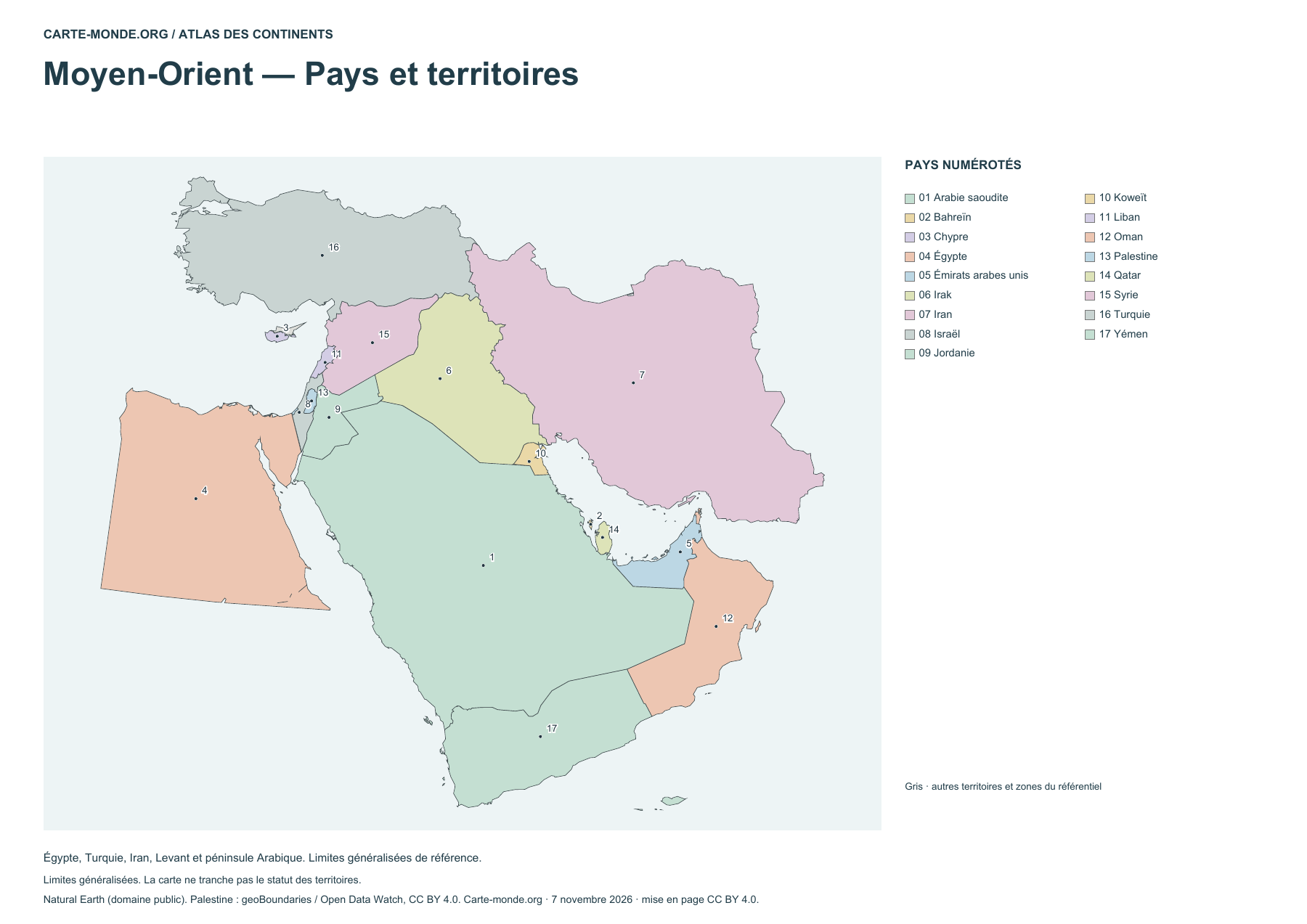
Middle East — Countries and territories
17 countries and territories identified by a number and a legend. Other areas in the reference dataset are gray.
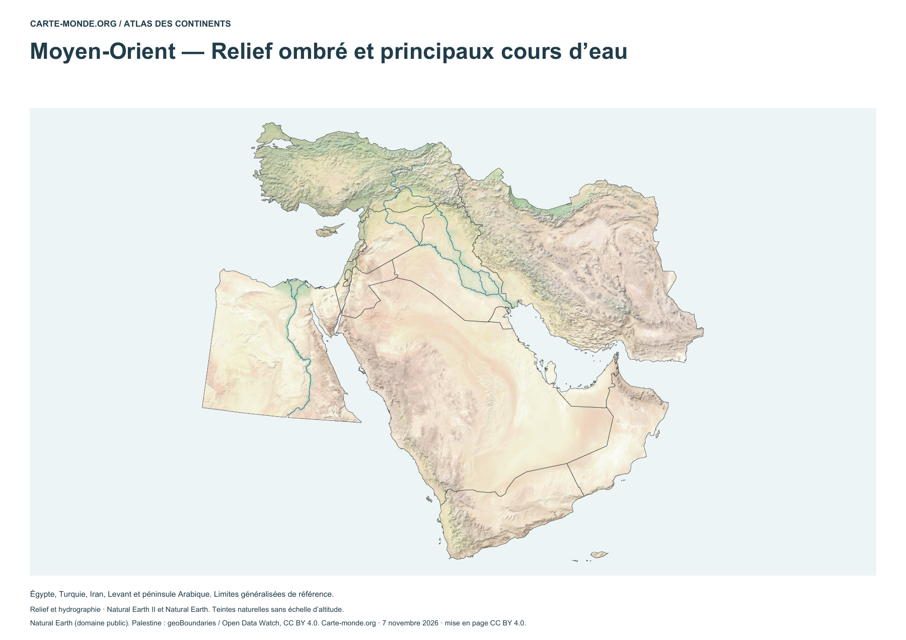
Middle East — Shaded relief and main rivers
Shaded relief and main rivers. Natural colors do not represent elevation classes.
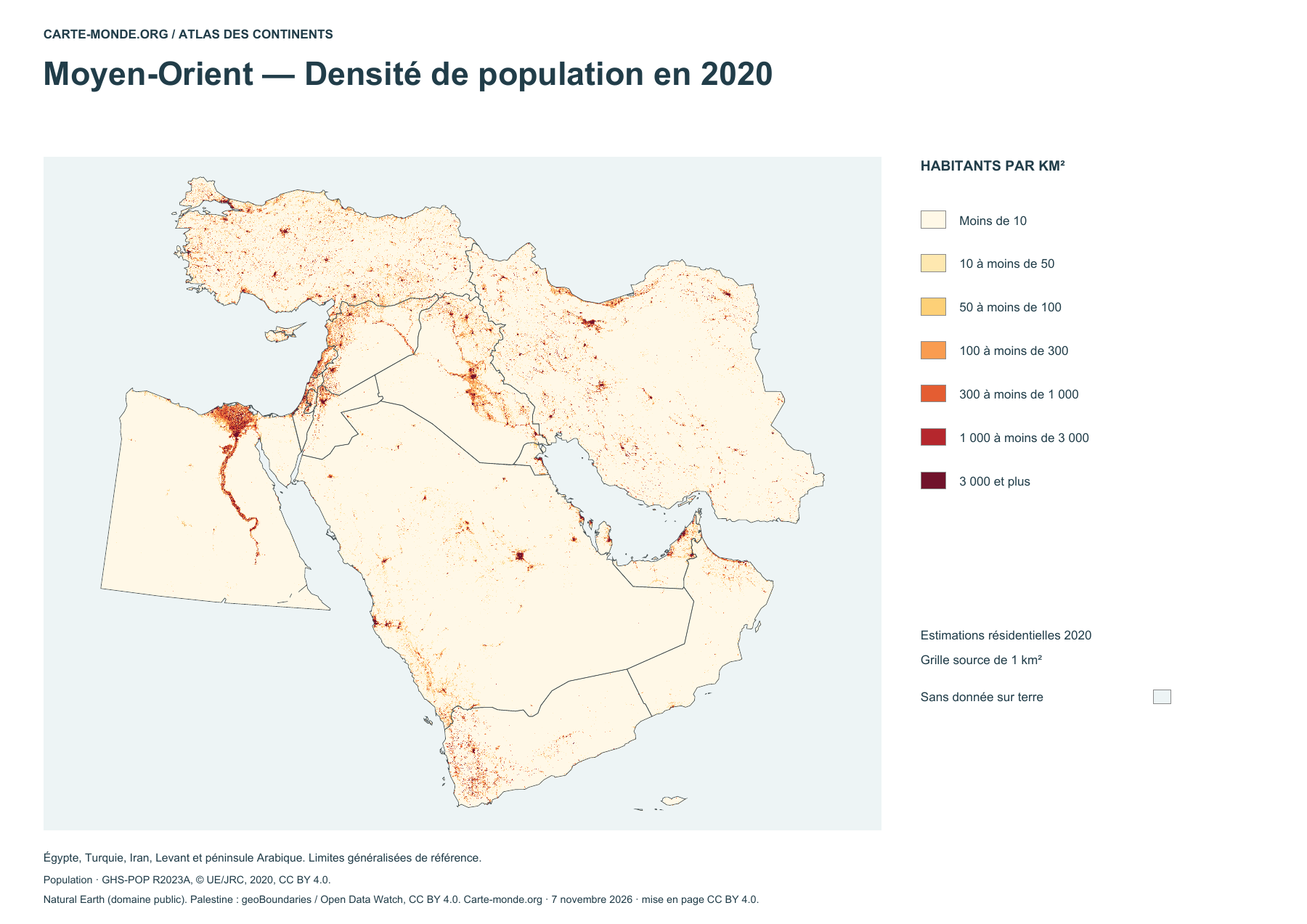
Middle East — Population density in 2020
Estimated residential density in 2020, in inhabitants per square kilometer. GHS-POP data.
Pack of the three maps
A4 PDF, PNG, SVG and source notes.
Download the ZIP packWorld Heritage and languages
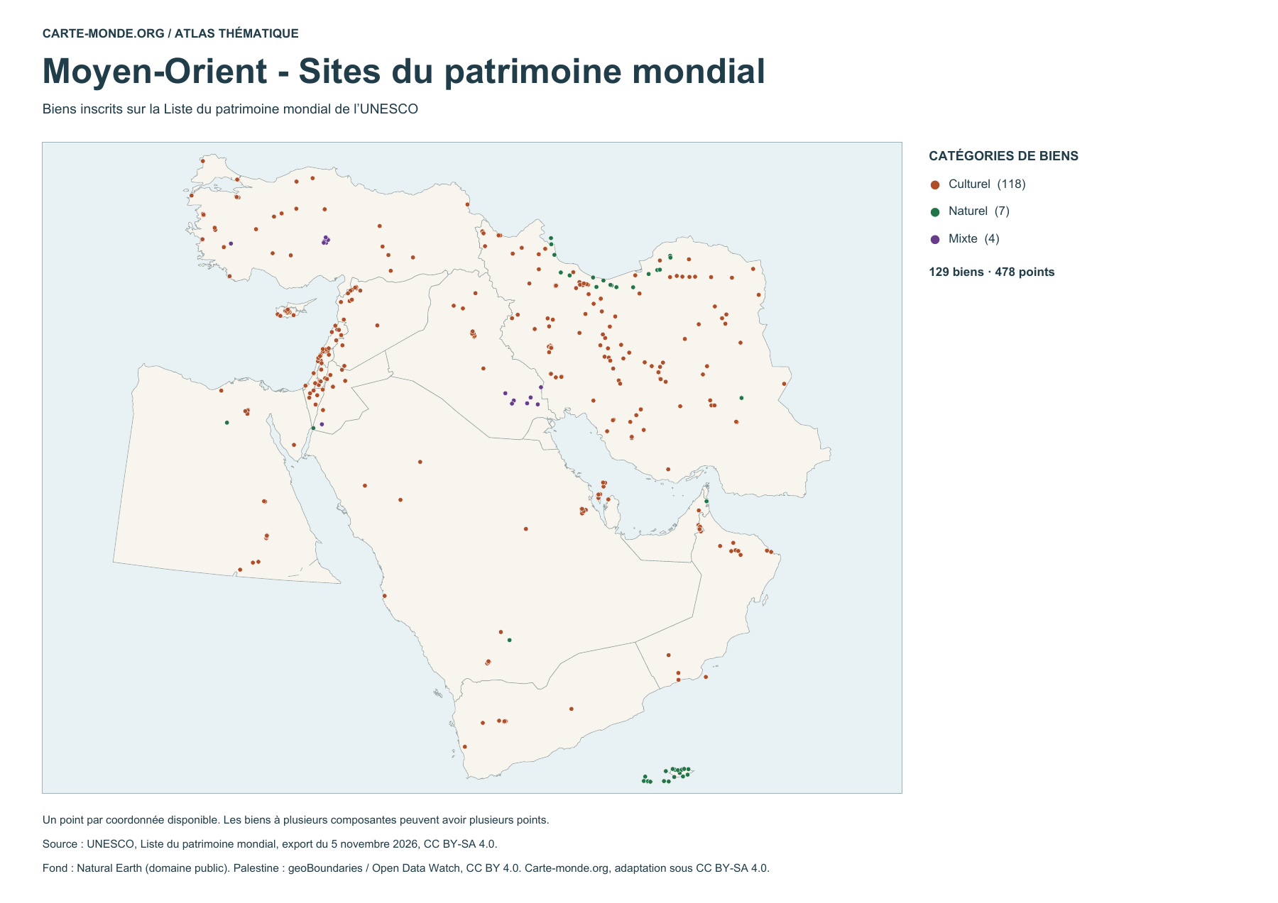
Middle East – World Heritage sites
129 properties represented by 478 points. A property may have several components. UNESCO export dated 5 November 2026.
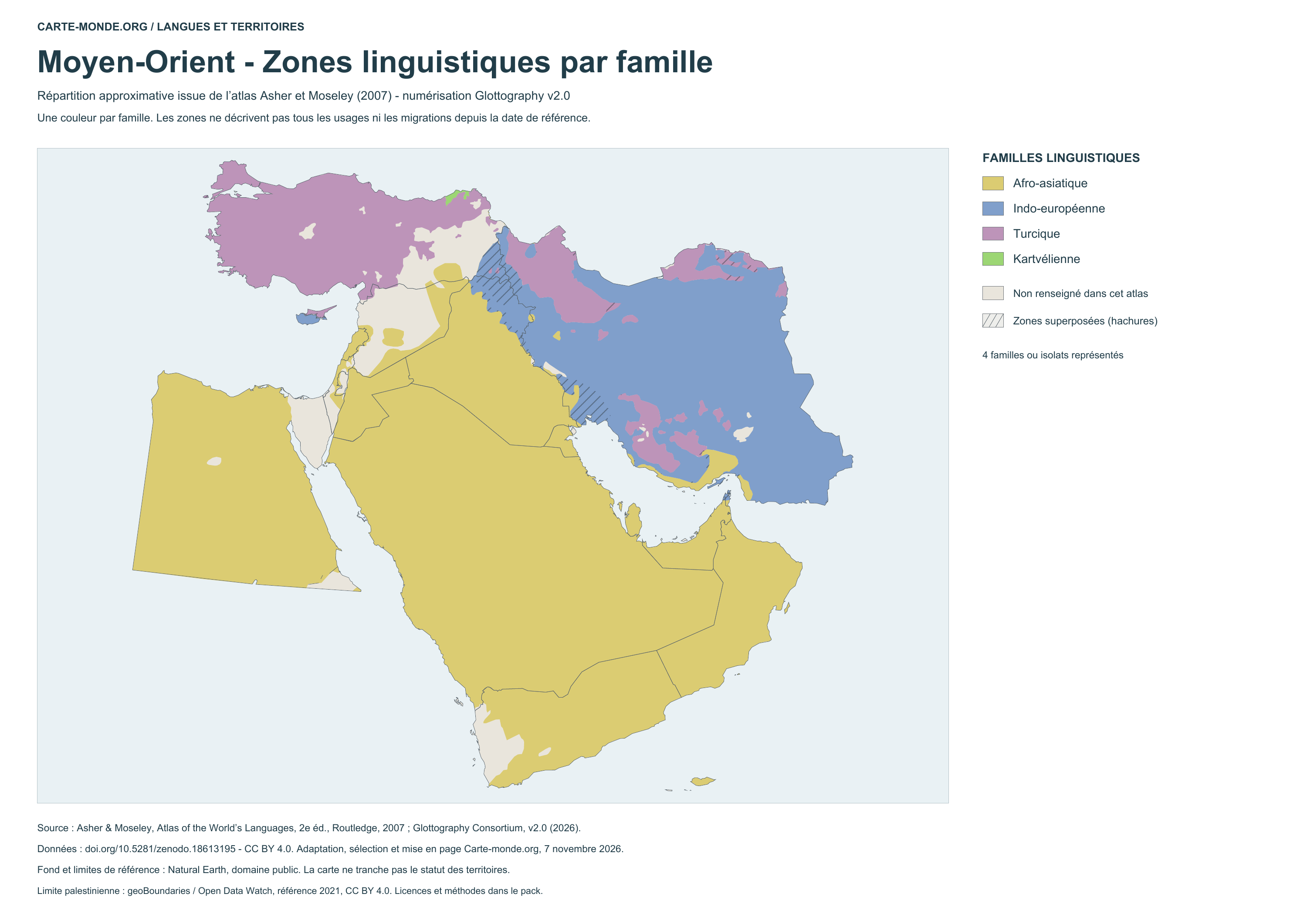
Language areas by family – 2007 atlas
Coloured areas show the approximate distribution of language families. Hatching indicates overlaps in the source; the neutral background marks areas without information. This map does not represent conditions measured in 2026.
Glottography v2.0, based on Asher and Moseley, 2007 atlas · CC BY 4.0. Adaptation by Carte-monde.org.
See also the language location map with points
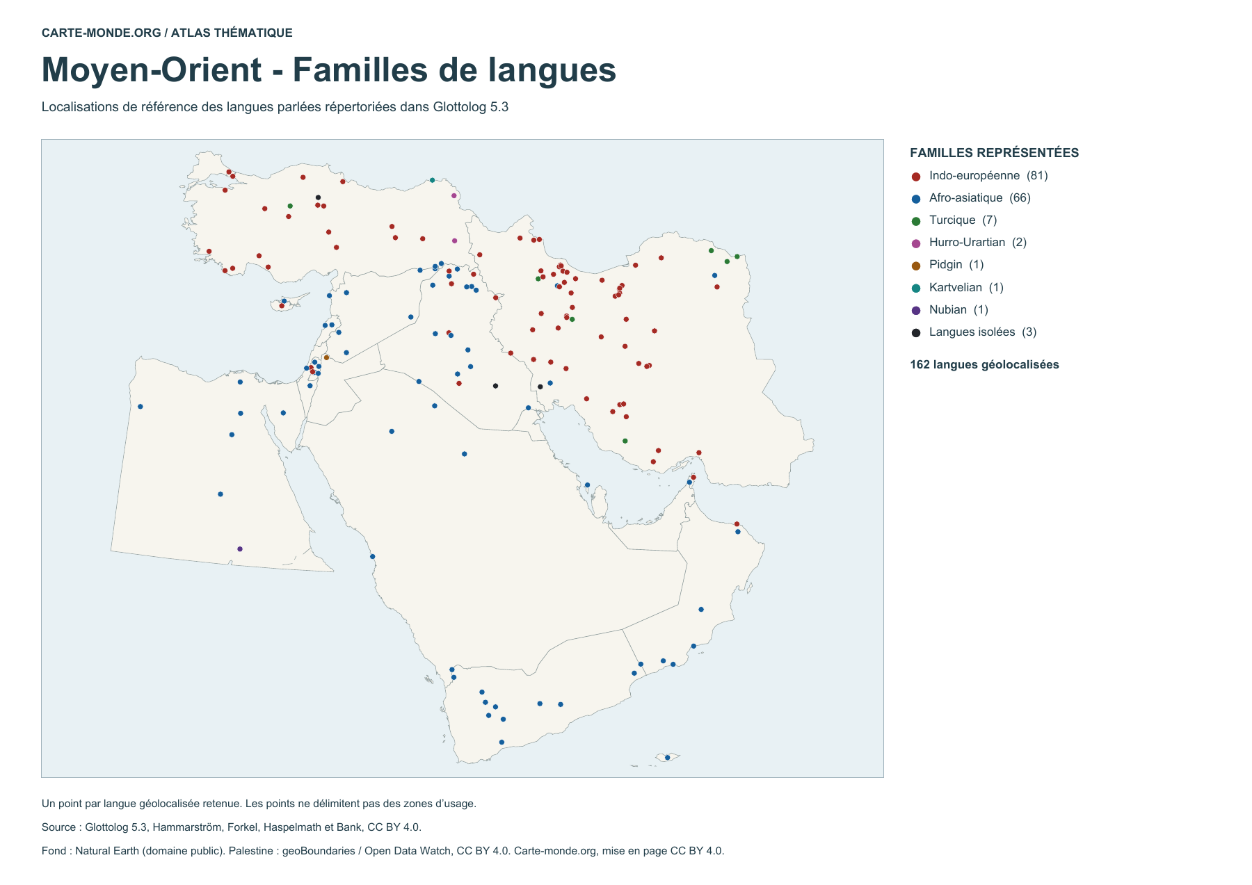
Language locations by family (points)
162 geolocated spoken languages, grouped by family. The points are reference locations and do not delimit areas of use.
Glottolog 5.3, Hammarström, Forkel, Haspelmath and Bank · CC BY 4.0
Sources and reuse
Boundaries, hydrography and relief Natural Earth, public domain. Population GHS-POP R2023A, © EU/JRC, 2020 estimates. Base maps under CC BY 4.0. Palestinian boundary geoBoundaries / Open Data Watch, 2021 reference, CC BY 4.0. The thematic maps retain the licences stated below each preview. The lines do not show current military control or determine the status of territories.


