
EUROPE AND THE EUROPEAN UNION
European Union maps: the 27 member states and capitals, population, world location and two blank maps to complete. PDFs and sources.
Map labels and downloadable files remain in their original language, often French.
Maps of Europe · Europe blank maps · EU maps · Maps of European countries
European Union and Europe: two distinct concepts
The European Union has 27 member states, according to the official list checked on 4 November 2026. Europe is a broader geographical area: the United Kingdom, Norway and Switzerland belong to it without being EU members.
These in-house maps show the territories within our European map extent. Territories outside this extent, including several outermost regions, are not shown. For overseas territories, also see the official map with insets below.
Three maps of the European Union
Carte-monde.org · 4 November 2026
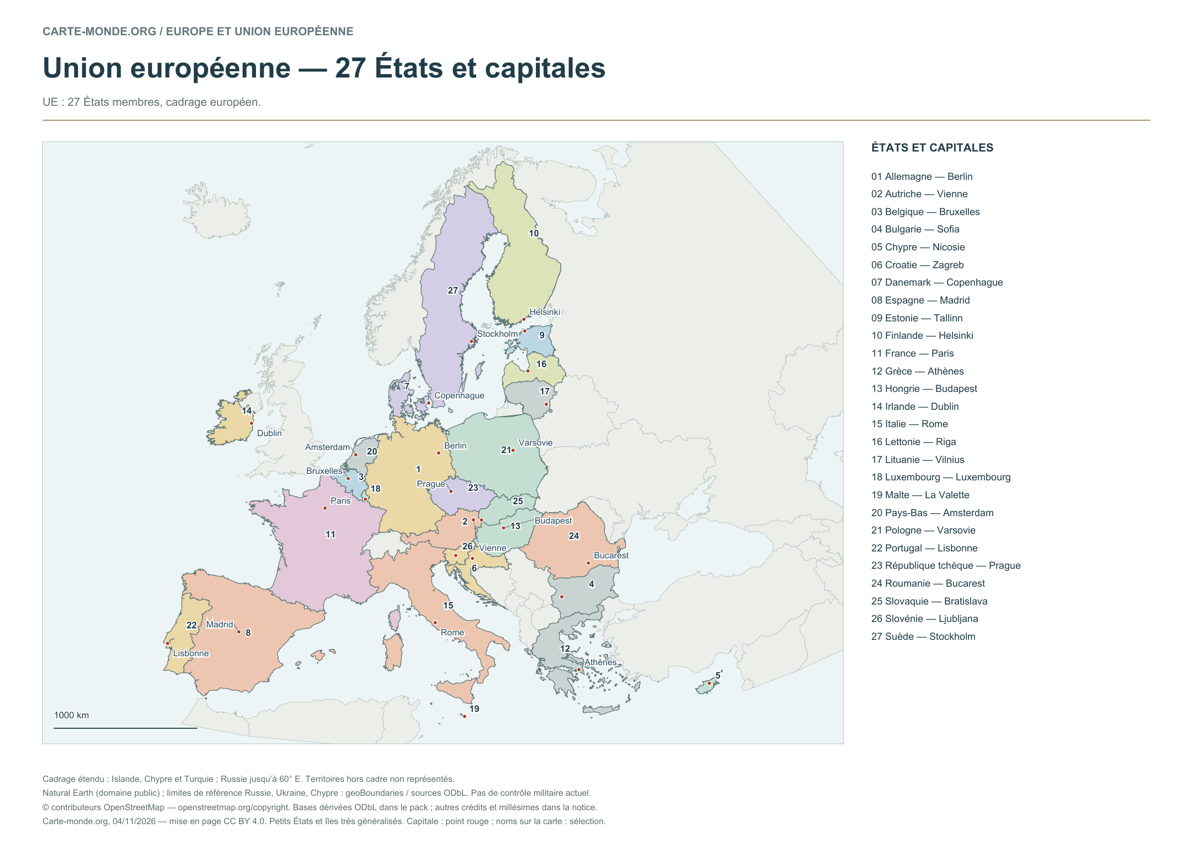
European Union — 27 states and capitals
The numbers refer to the key. Capitals are marked by dots; selected names appear on the map.
Layout CC BY 4.0. Sources: Natural Earth and, depending on the map, EU/JRC or geoBoundaries. Credits, dates and ODbL derived data in the pack.
Carte-monde.org · 4 November 2026
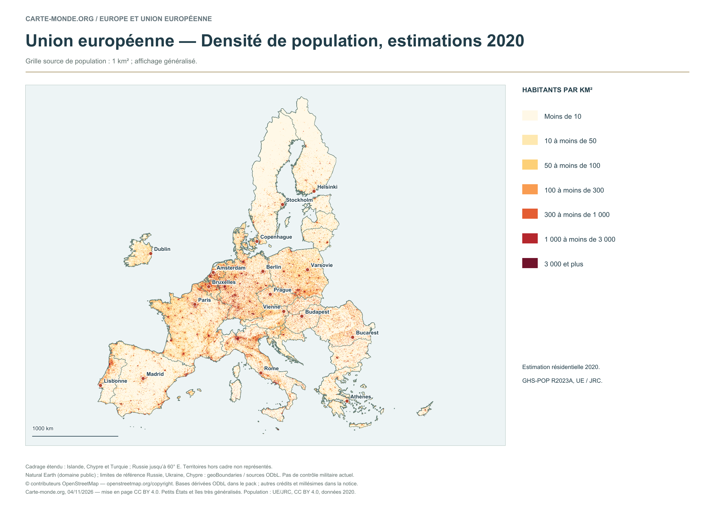
European Union — Population density, 2020 estimates
Estimated residential population in 2020: GHS-POP R2023A, 1 km² source grid. Generalised display; the data year remains 2020.
Layout CC BY 4.0. Sources: Natural Earth and, depending on the map, EU/JRC or geoBoundaries. Credits, dates and ODbL derived data in the pack.
Carte-monde.org · 4 November 2026
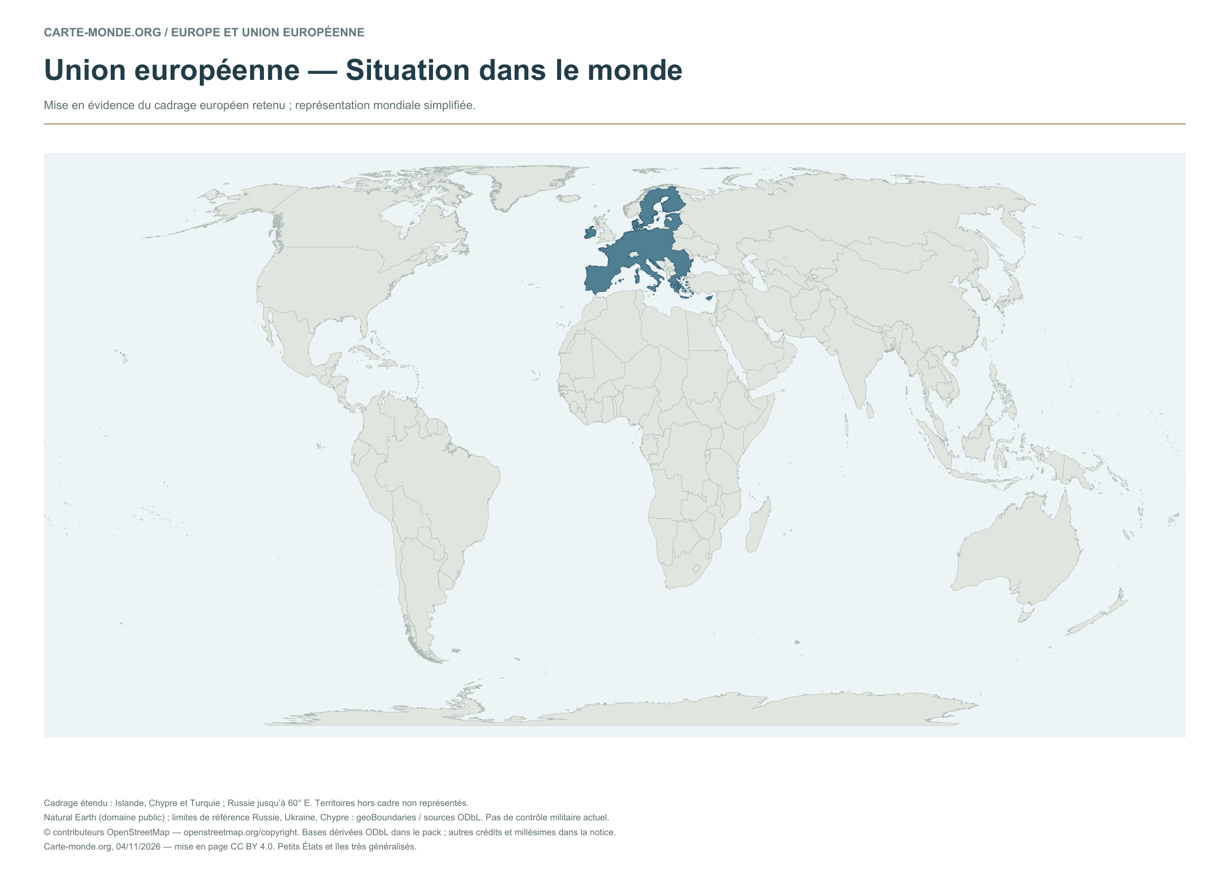
European Union — Location in the world
The territory within the European map area is highlighted on a simplified world map.
Layout CC BY 4.0. Sources: Natural Earth and, depending on the map, EU/JRC or geoBoundaries. Credits, dates and ODbL derived data in the pack.
Two blank EU maps to complete
Carte-monde.org · 4 November 2026
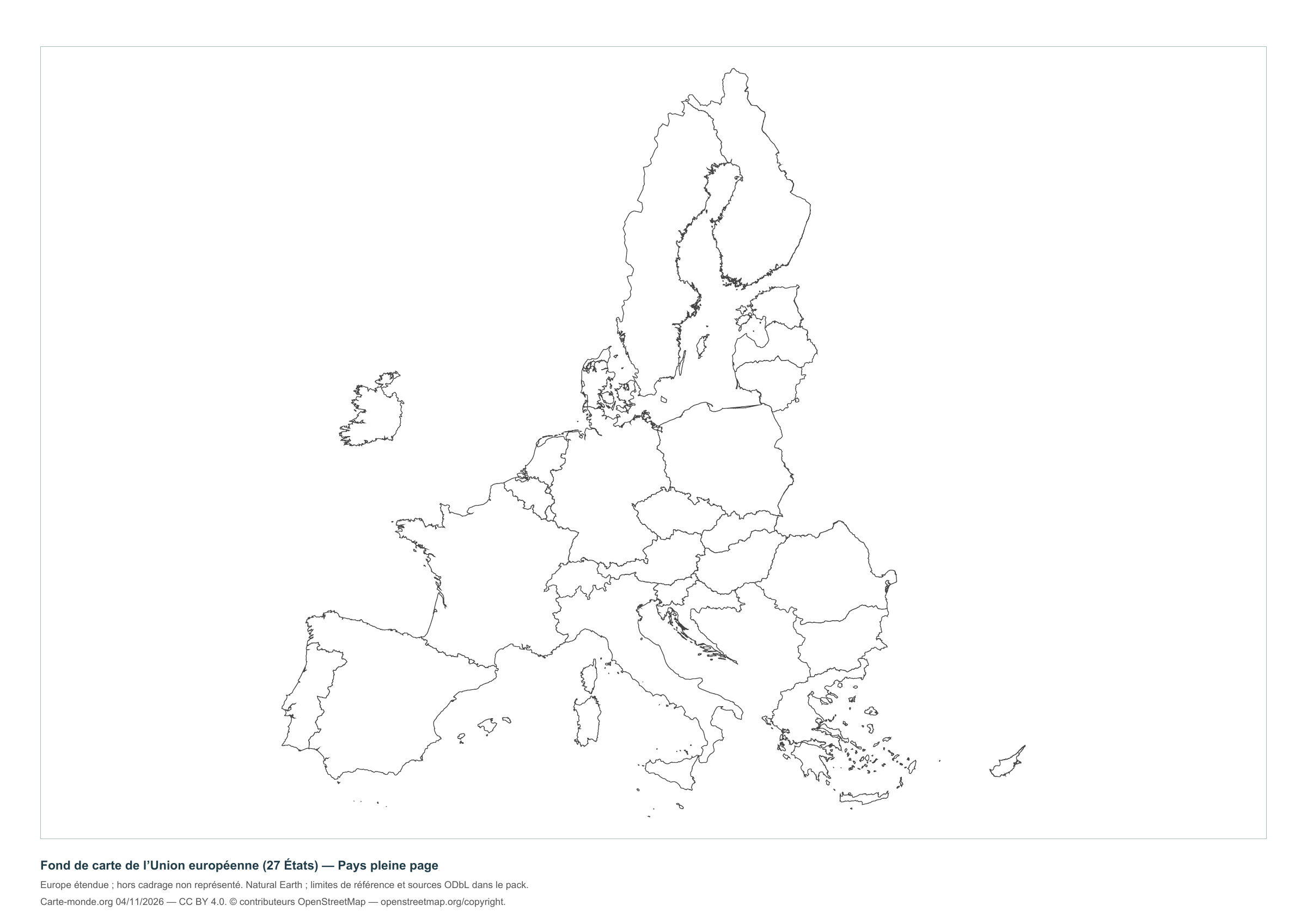
European Union — Full-page countries
Full-page version without names, with a brief reference at the bottom to reduce ink use.
Layout CC BY 4.0. Sources: Natural Earth and, depending on the map, EU/JRC or geoBoundaries. Credits, dates and ODbL derived data in the pack.
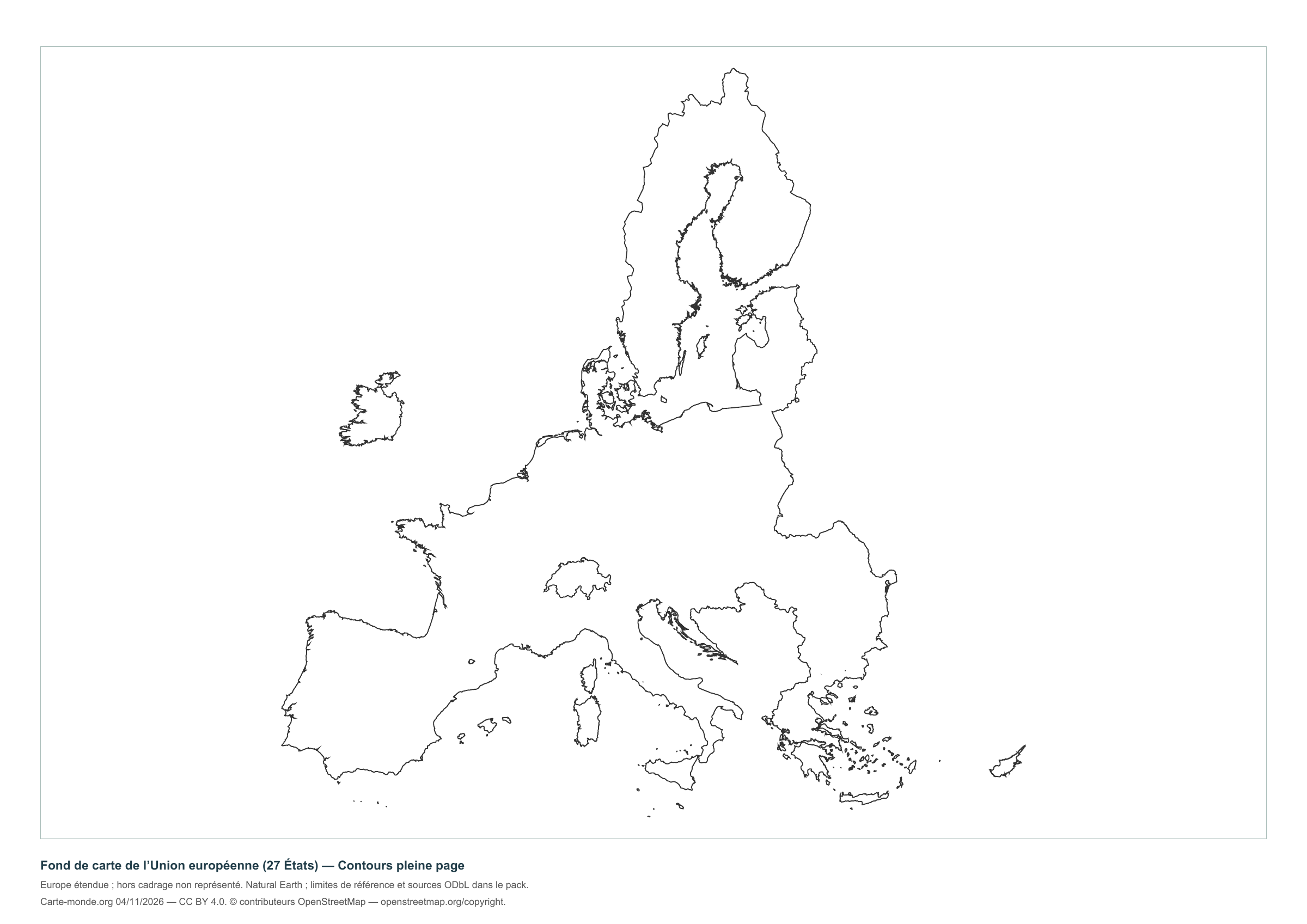
Carte-monde.org · 4 November 2026
European Union — Full-page outlines
Full-page version without names, with a brief reference at the bottom to reduce ink use.
Layout CC BY 4.0. Sources: Natural Earth and, depending on the map, EU/JRC or geoBoundaries. Credits, dates and ODbL derived data in the pack.
The three maps and two blank maps of the EU
A4 PDF, PNG and SVG with source documentation, licences and derived geometries.
Download the complete pack — ZIPOfficial map of the European Union
The Council of the European Union offers a map of the 27 member states, with flags and insets for non-continental and overseas territories. The consulted page describes the 2020 edition and links to editions available from the Publications Office.
This reference links to the official source: no Council file has been rehosted here. The Council reproduction terms require source attribution and provide exceptions for third-party rights.
What area is shown?
Extended coverage including Iceland, Cyprus and Turkey; Russia is shown as far as approximately 60° E. Territories outside this area are not shown. Small states and islands are highly generalised.
The reference boundaries do not describe current military control. Kosovo is identified as a territory with disputed status; the map takes no position on that status.
Sources, reference years and reuse
Outlines, countries, capitals and rivers: Natural Earth, public domain. Natural Earth II relief: idealised natural cover, without elevation classes or topographic precision.
Reference boundaries for Russia, Ukraine and Cyprus: geoBoundaries and sources under ODbL. © contributors OpenStreetMap. The derived databases and their documentation are included in the packs and remain under ODbL. Kastellorizo supplement: EuroGeoGraphics / Regional IM Working Group – Europe / geoBoundaries, 2016 edition, CC BY 4.0.
Population: Schiavina et al., GHS-POP R2023A, 2020 estimates, © European Union/JRC, CC BY 4.0. Reference and method. The new layouts are available under CC BY 4.0 : credit Carte-monde.org, the authors, sources and dates. Historical and third-party maps retain their own rights.
View older maps, including the 2008 EU map.
Maps of Europe · Europe blank maps · EU maps · Maps of European countries


