
The extent includes North America, Central America and the Caribbean, as well as Greenland. Hawaii and the Aleutians west of the 180th meridian are outside the map.
Map labels and downloadable files remain in their original language, often French.
Three maps to explore the region
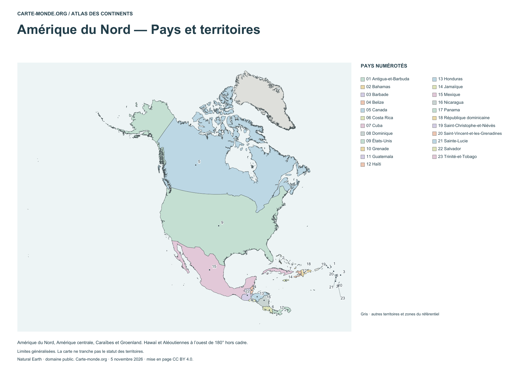
North America — Countries and territories
Map numbers refer to country names in the legend.
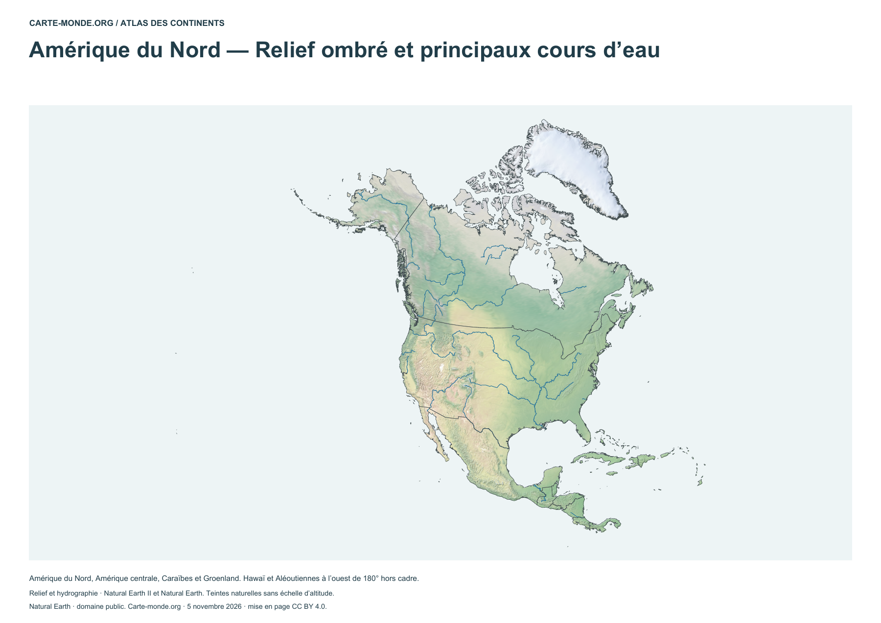
North America — Shaded relief and main rivers
Shaded relief and main rivers. Colors show natural environments.
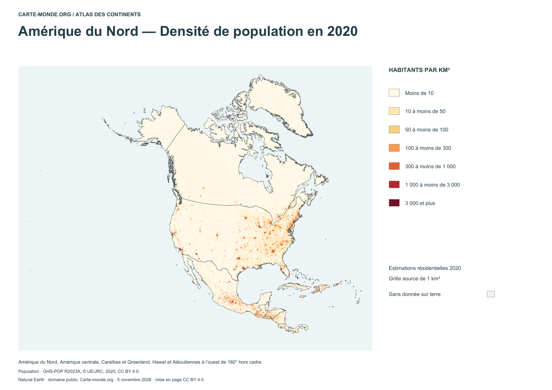
North America — Population density in 2020
Estimated resident population in 2020, in inhabitants per square kilometre.
Carte-monde.org collection
A4 PDF, PNG, SVG and source documentation.
Download the ZIP packSources and reuse
Boundaries, terrain and hydrography: Natural Earth, public domain. Population: GHS-POP R2023A, © EU/JRC, 2020 estimates, CC BY 4.0. Layout: Carte-monde.org under CC BY 4.0. Generalized boundaries follow the cartographic reference dataset.
Additional maps to reuse
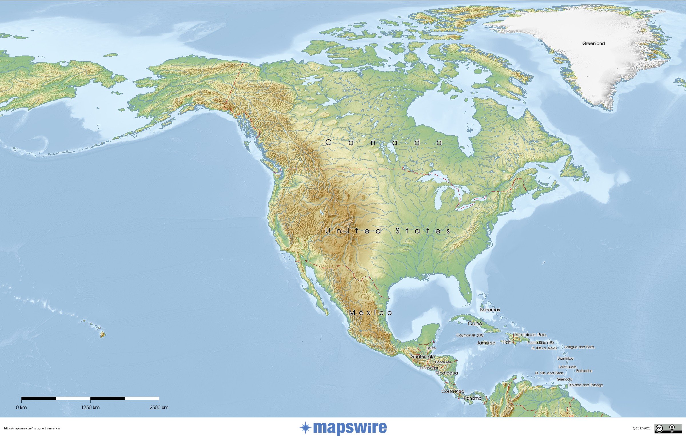
Detailed physical map
Terrain, major natural regions and geographical landmarks. Reference year not specified by the source.
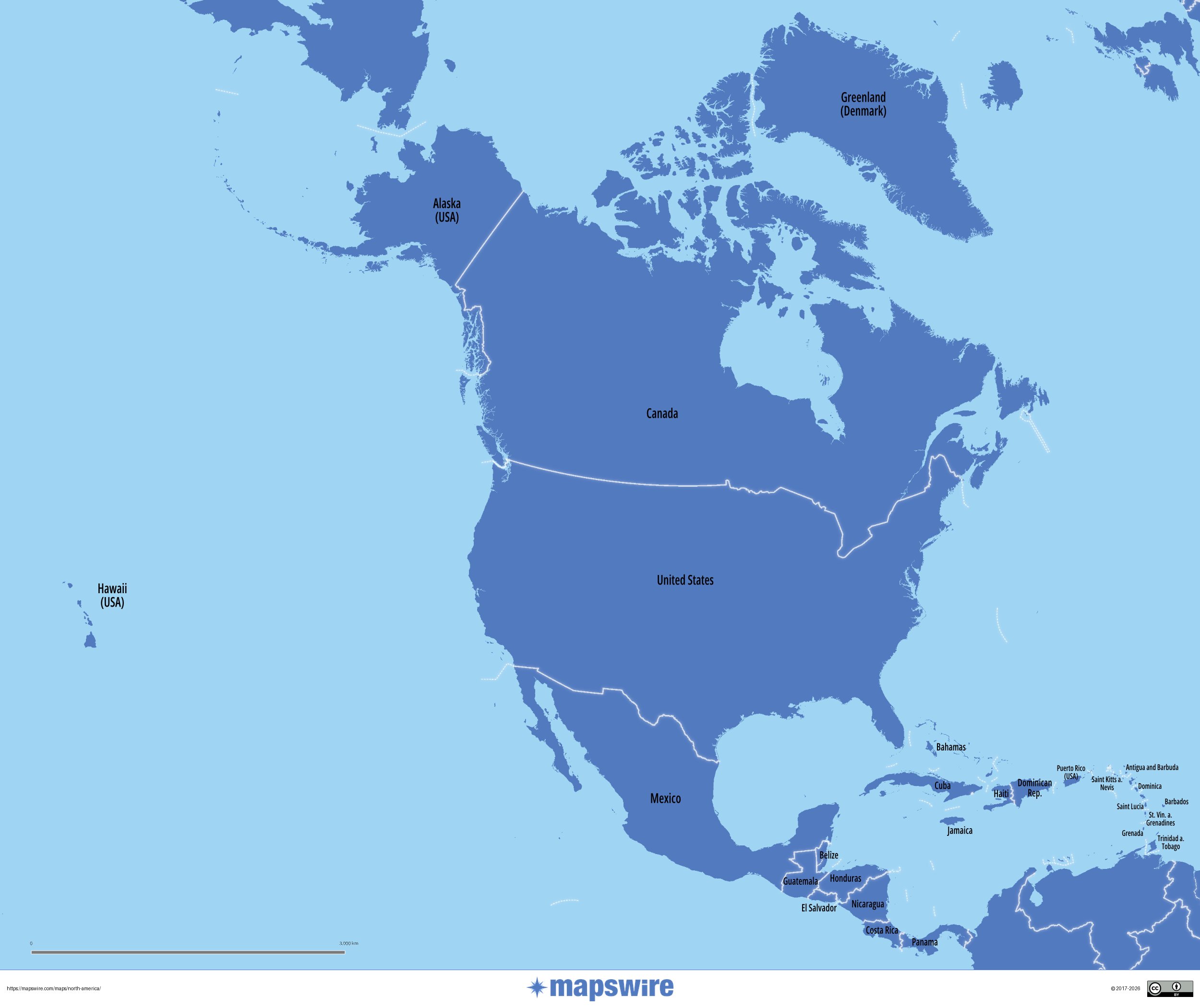
Political map with names
Countries and territories. Labels follow the source map. Reference year not specified by the source.
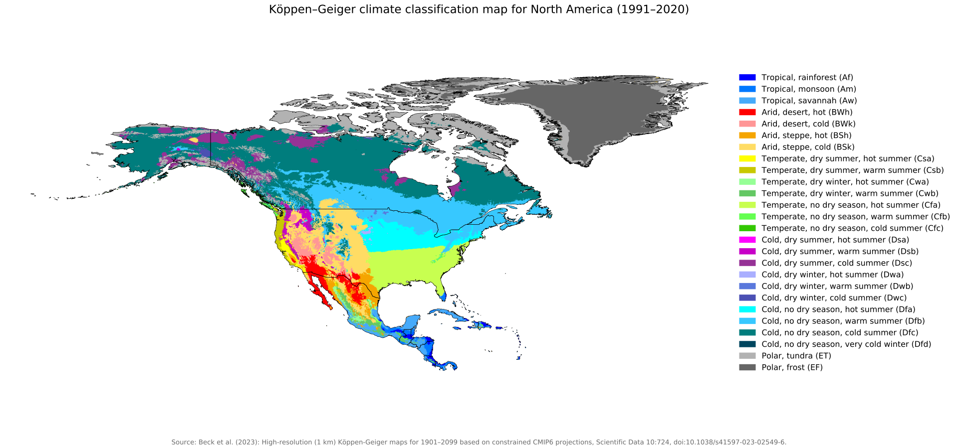
Köppen–Geiger climate zones (1991–2020)
Climate classification by temperature and precipitation, with the original legend in English.
Beck, H. E., McVicar, T. R., Vergopolan, N., Alexis, B., Lutsko, N. J., Dufour, A., Zeng, Z., Jian, X., van Dijk, A. I. J. M. et Miralles, D. G. (2023) · CC BY 4.0.
World Heritage and languages
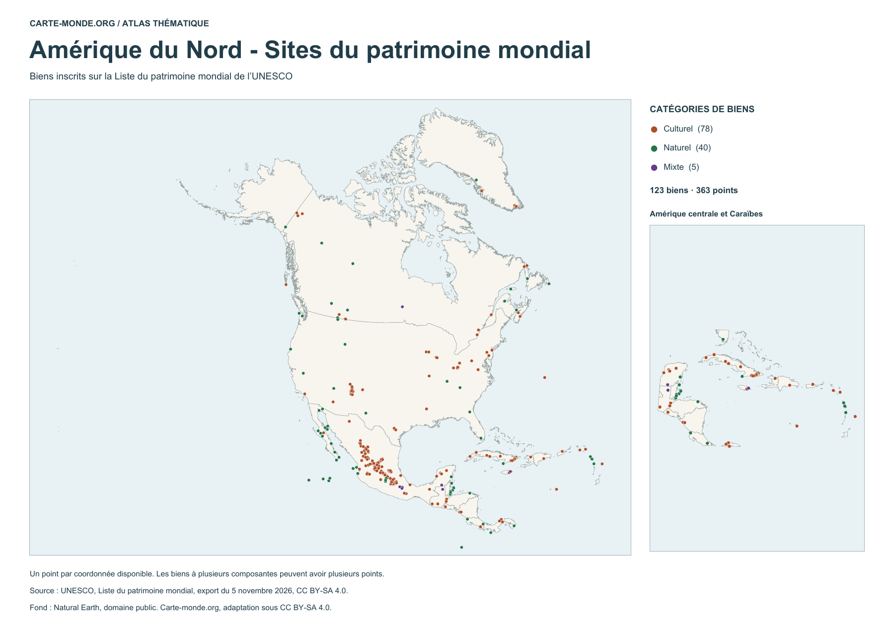
North America – World Heritage sites
123 listed properties represented by 363 points. Some properties have several components. The map distinguishes cultural, natural and mixed properties.
UNESCO · World Heritage List, export dated 5 November 2026 · CC BY-SA 4.0. Natural Earth base map, public domain.
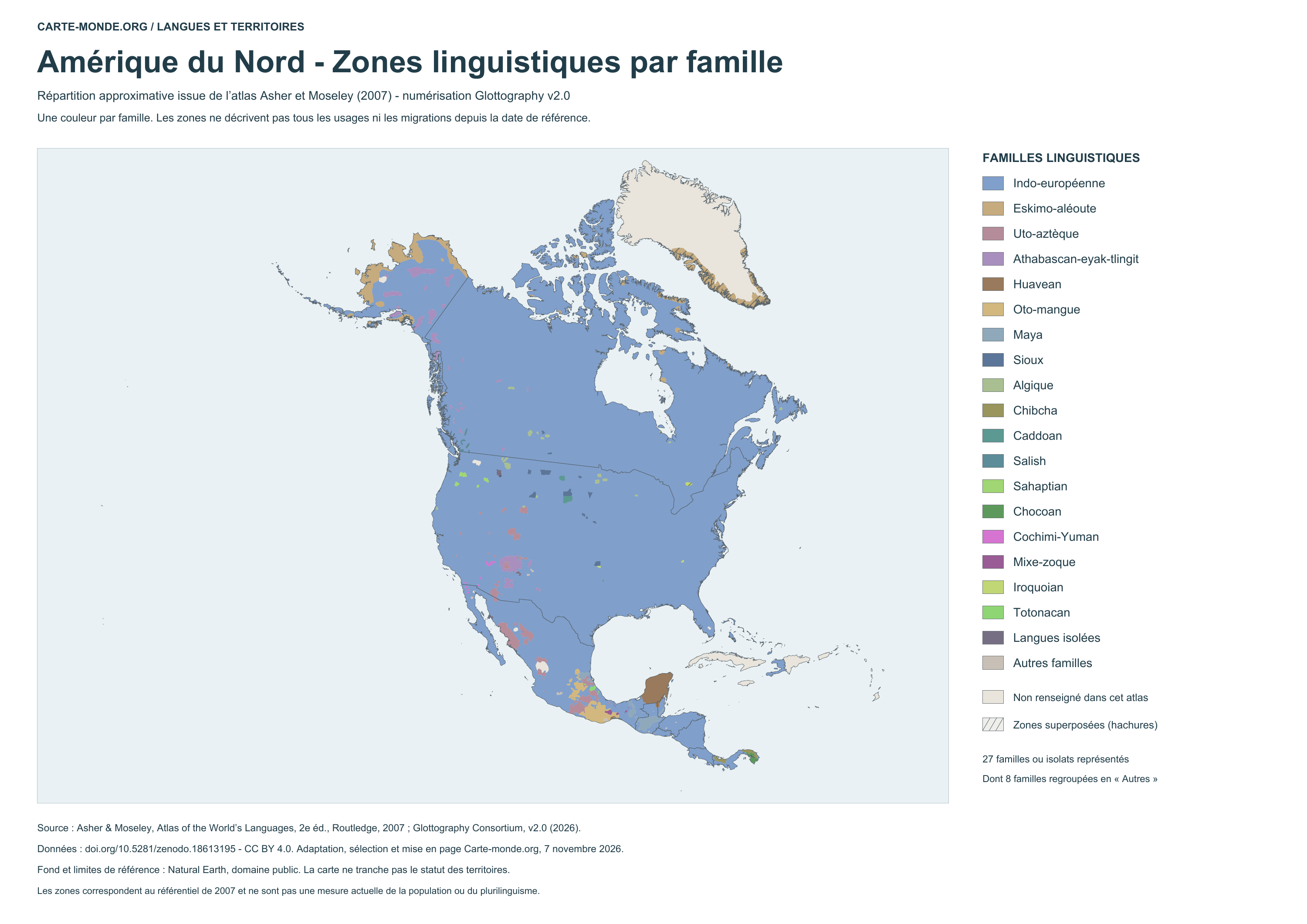
Language areas by family – 2007 atlas
Coloured areas show the approximate distribution of language families. Hatching indicates overlaps in the source; the neutral background marks areas without information. This map does not represent conditions measured in 2026.
Glottography v2.0, based on Asher and Moseley, 2007 atlas · CC BY 4.0. Adaptation by Carte-monde.org.
See also the language location map with points
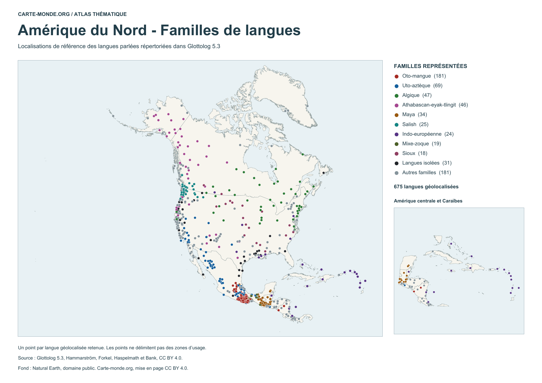
Language locations by family (points)
675 geolocated spoken languages, classified by family or identified as isolates. Each point indicates a reference location. The number of points does not measure the number of speakers.
Glottolog 5.3 · Hammarström, Forkel, Haspelmath and Bank · CC BY 4.0. Natural Earth base map, public domain.


