
LITHUANIA · PRINTABLE MAPS
Five printable maps of Lithuania: regions and cities, location in Europe, two views of the relief and population. PDFs, images and sources are available below.
Our five maps have English labels. Maps from other publishers retain their original language.
Regions, cities and location in Europe
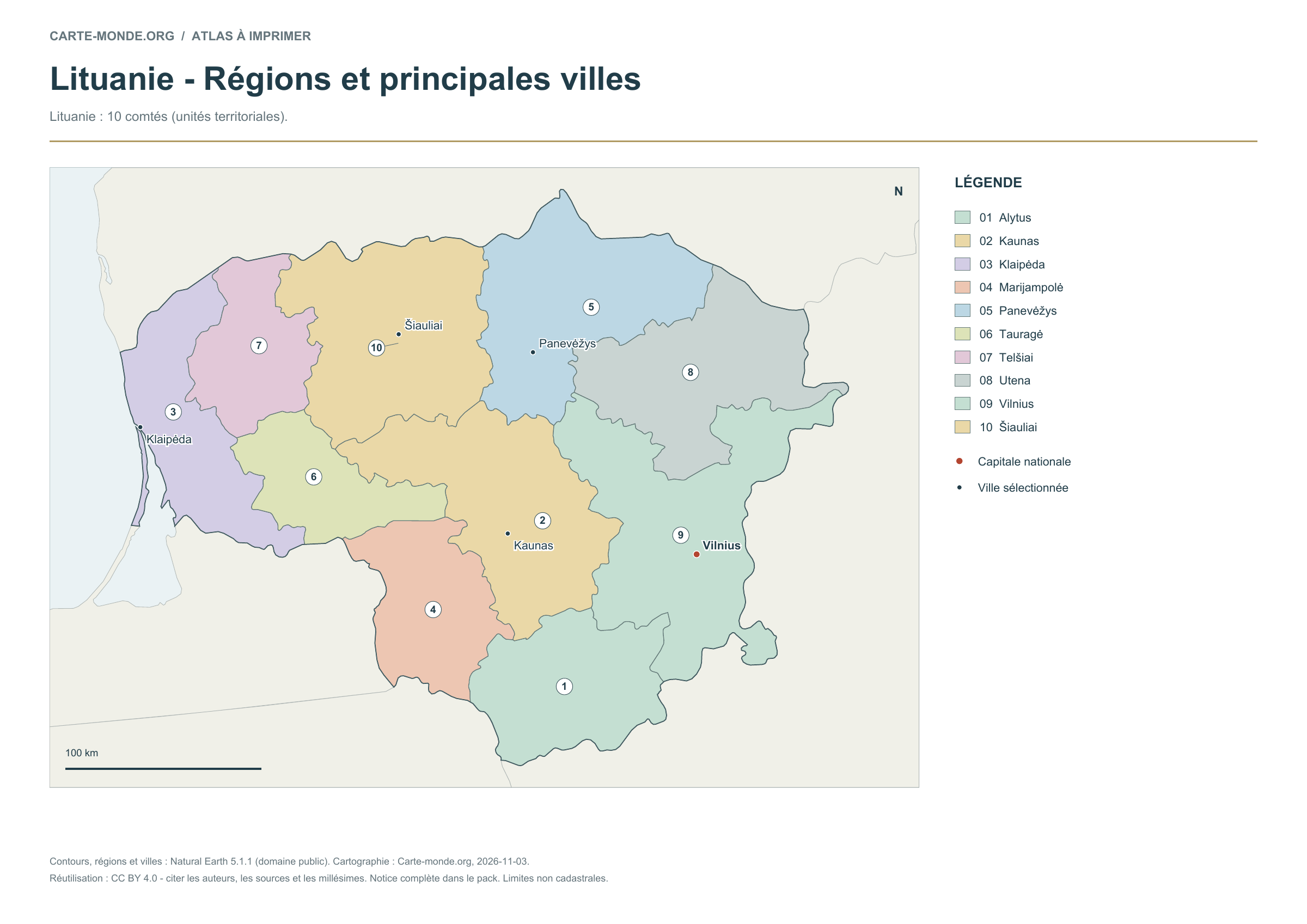
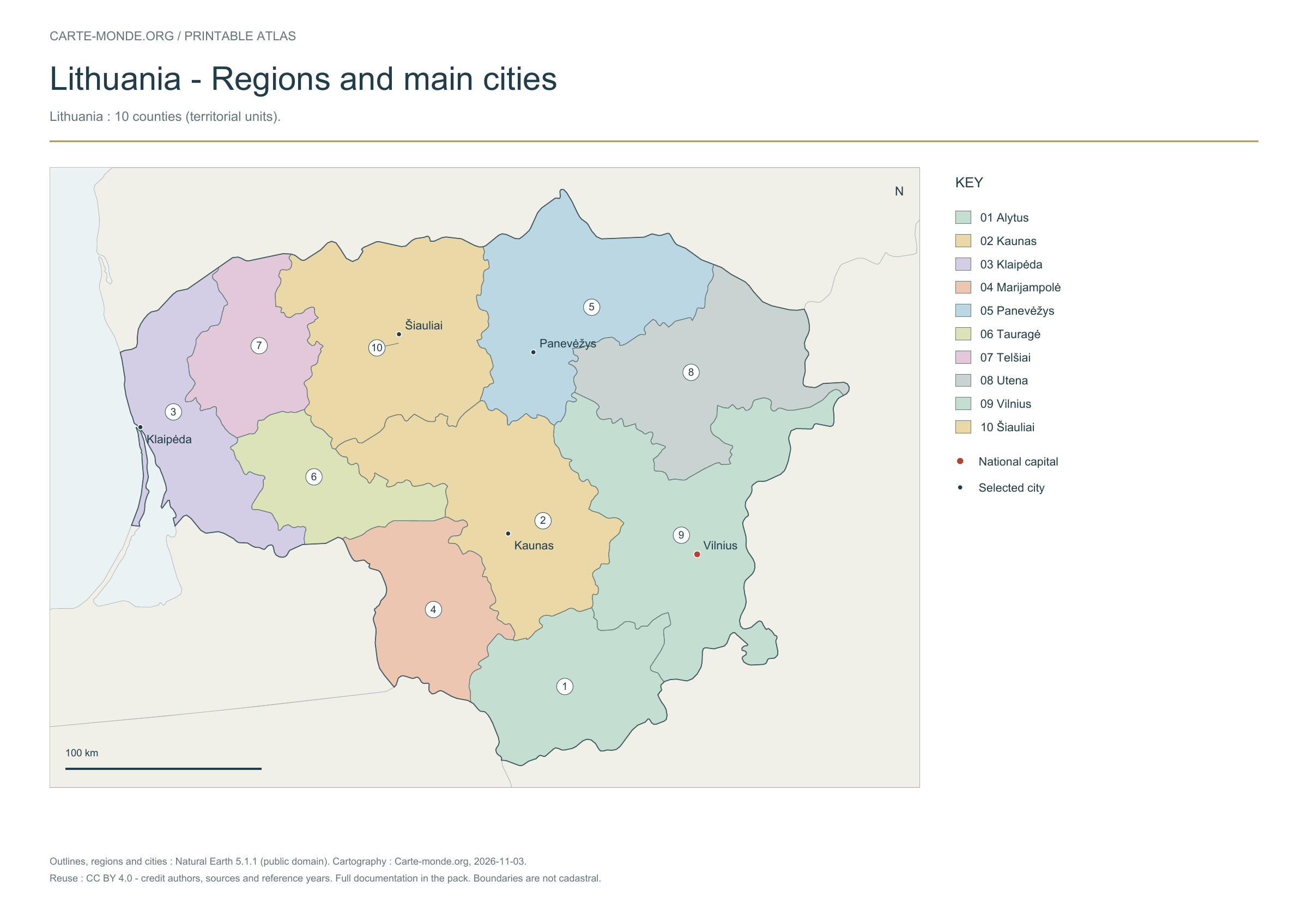
Lithuania: 10 counties (territorial units).
Carte-monde.org · November 2026
Regions and main cities
The 10 counties (territorial units) are numbered and named in the key, with selected cities and the capital.
A4 landscape PDF · PNG 2 400 px · CC BY 4.0
Carte-monde.org · November 2026
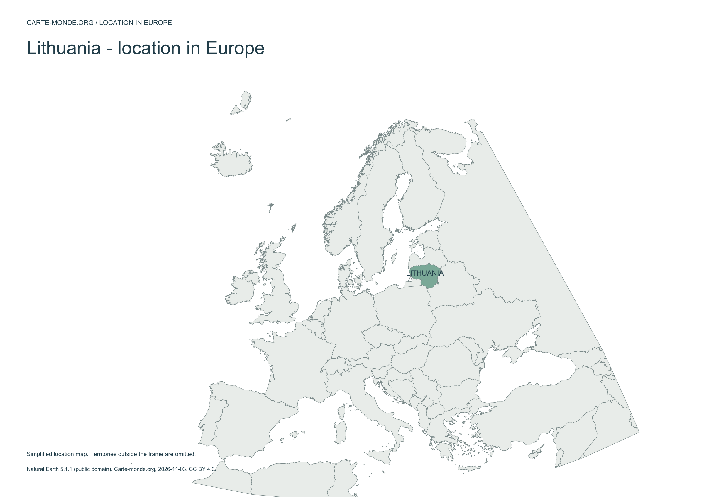
Location in Europe
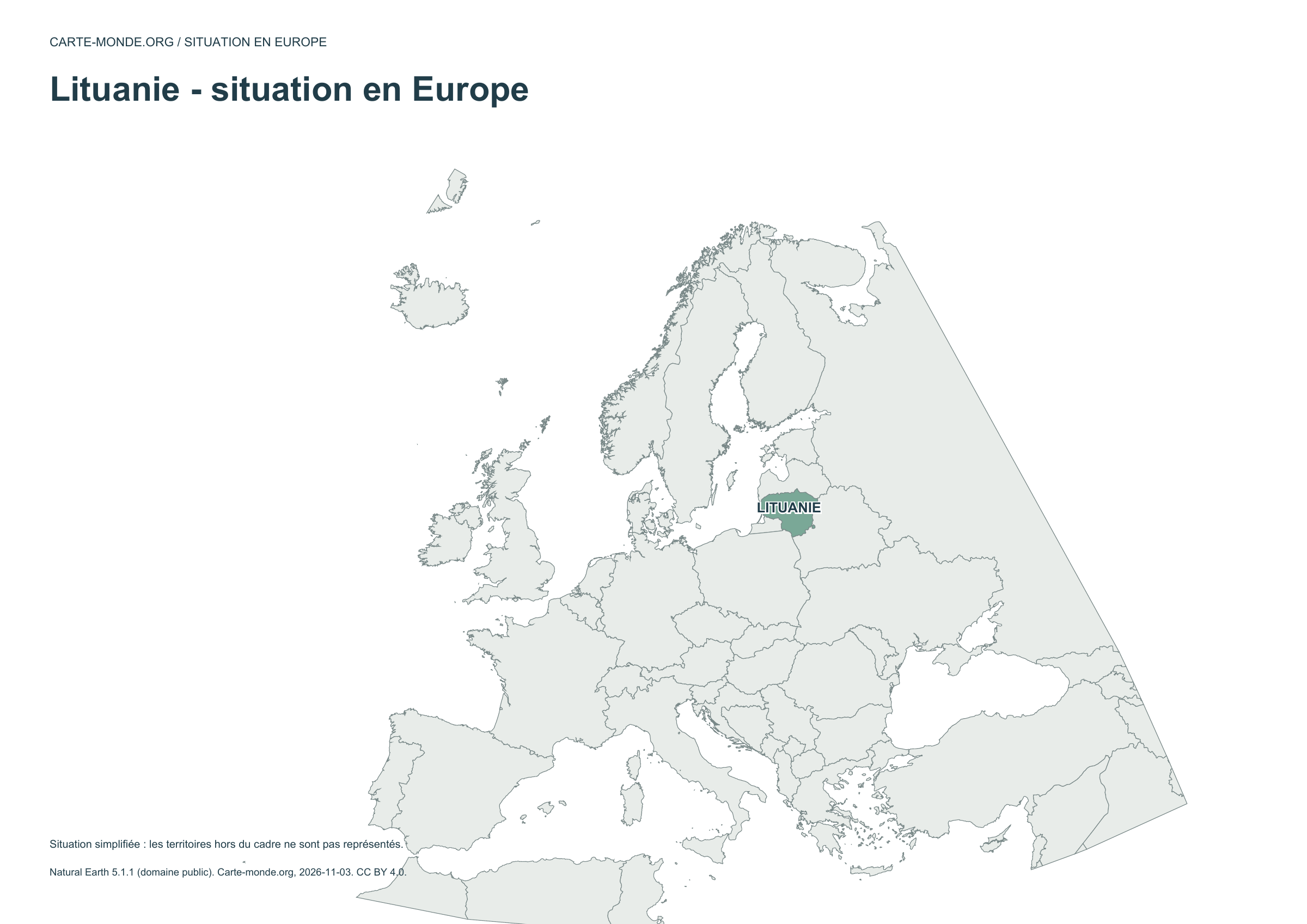
The country is highlighted within a simplified European frame; territories outside this frame are not shown.
A4 landscape PDF · PNG 2 400 px · CC BY 4.0
Two maps to understand the relief
Choose shaded relief for an overview, or elevation classes for school use.
Carte-monde.org · November 2026
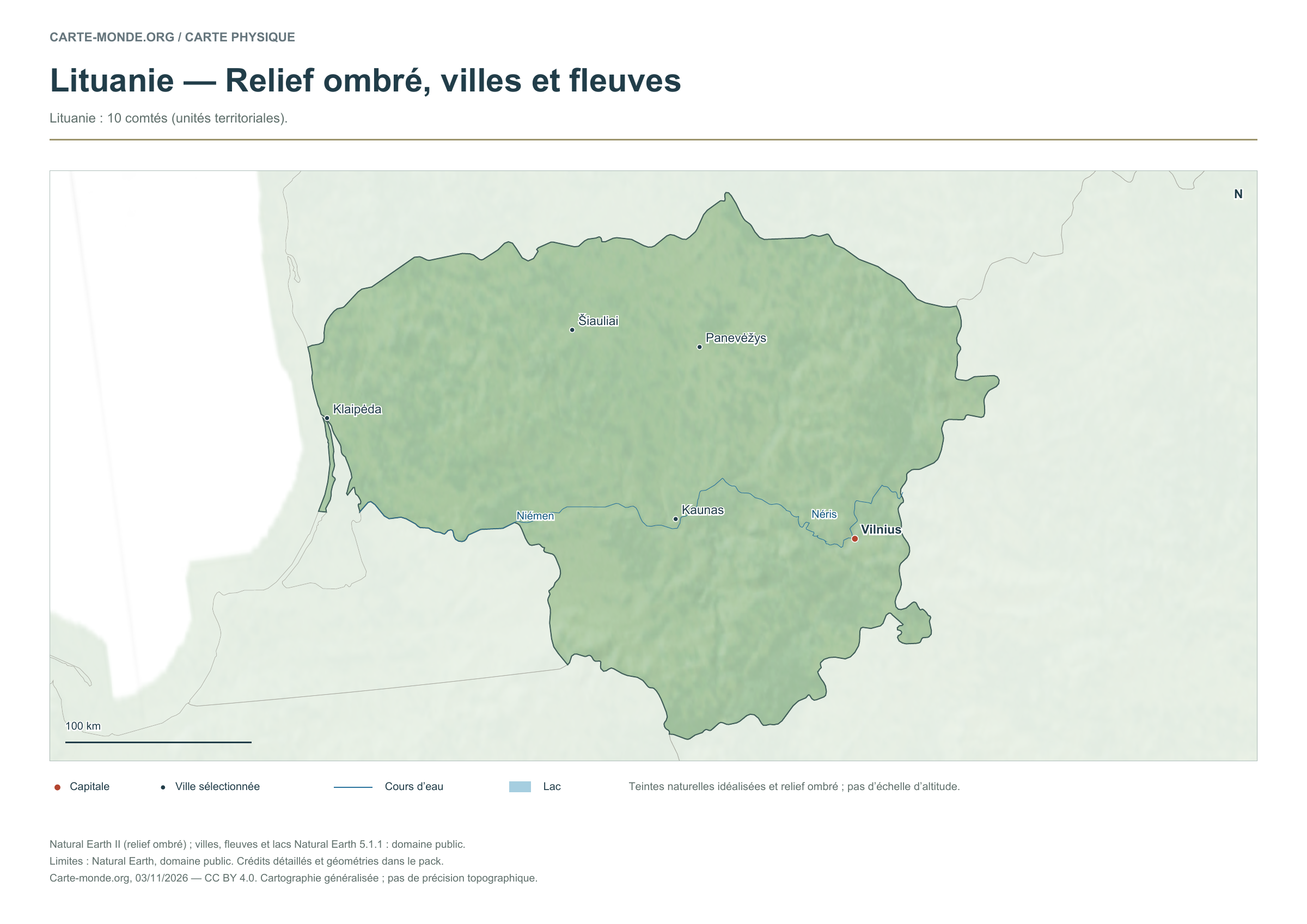
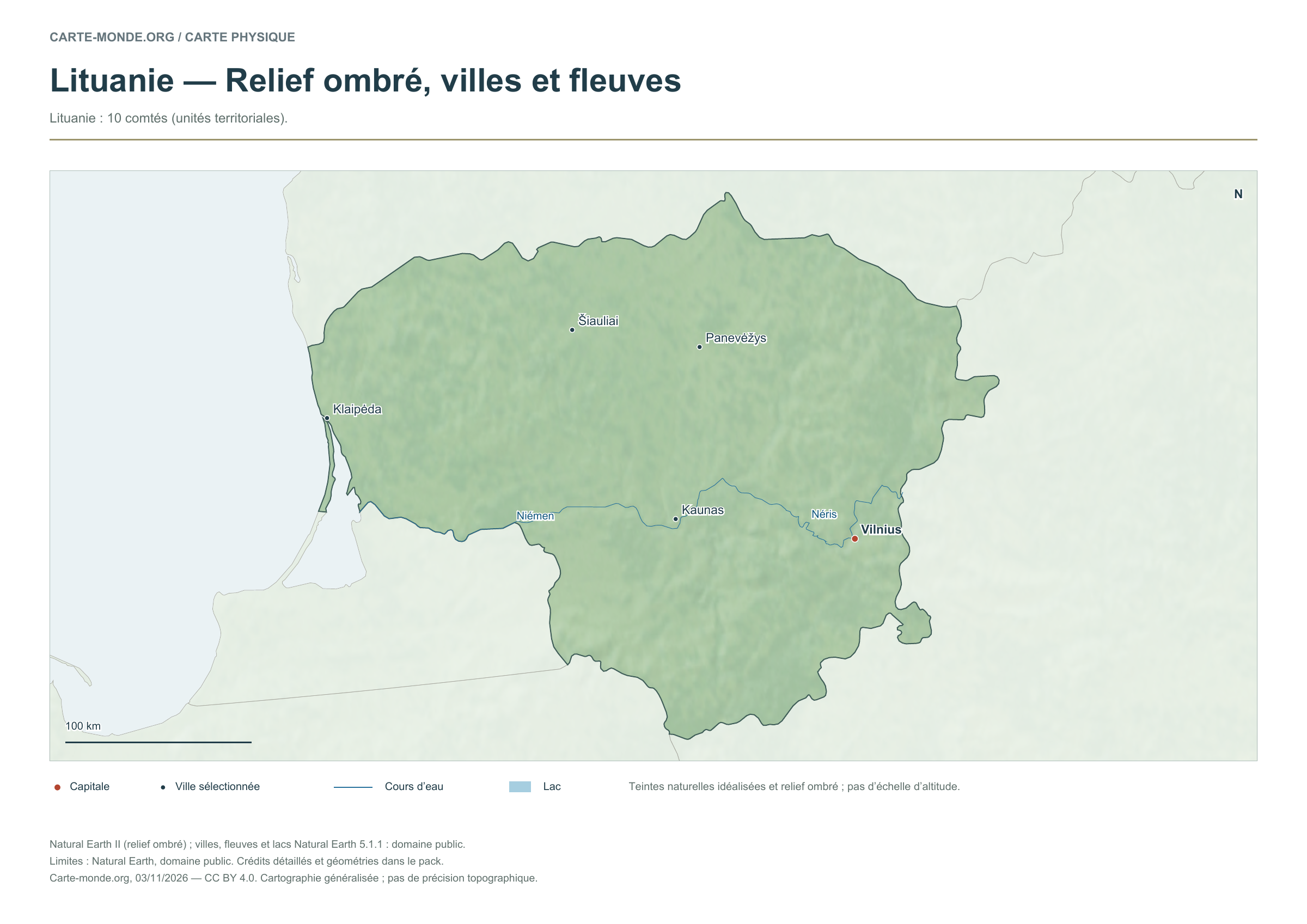
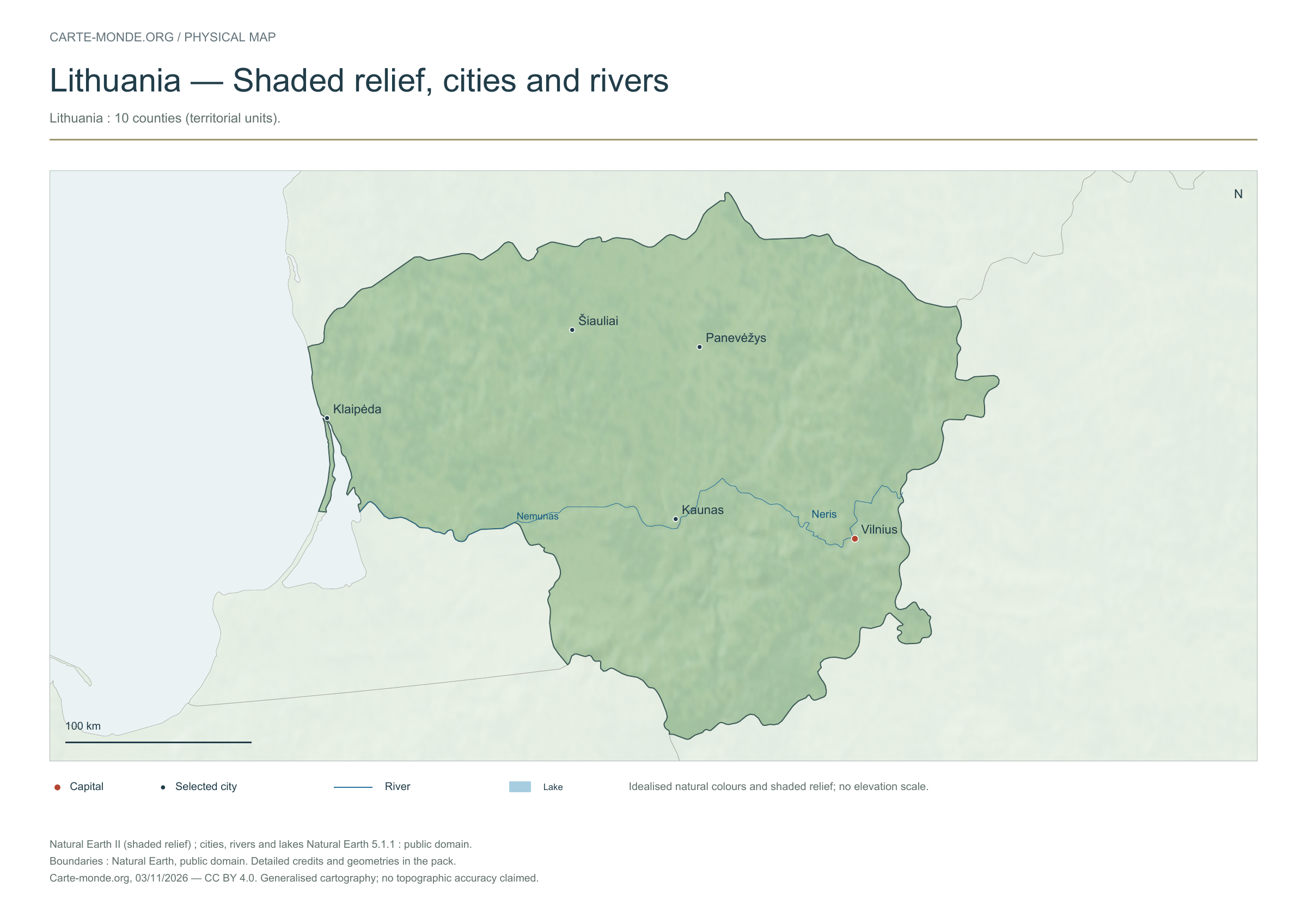
Shaded relief, cities and rivers
To identify major landforms, cities and the river network. The natural colours are not an elevation scale.
Raster base map, cities, rivers and lakes: Natural Earth, public domain. Other boundary credits and licences are retained in the pack. Cartographic work CC BY 4.0; ODbL-derived data retains its licence. No topographic accuracy is claimed.
Territory, data and selection of names
Lithuania: 10 counties (territorial units).
Natural Earth II shaded relief background, 5 selected cities. Named rivers: Niémen, Néris.
The colours represent idealised natural cover; they do not correspond to elevation classes. This global background remains generalised, particularly for small states.
Carte-monde.org · November 2026
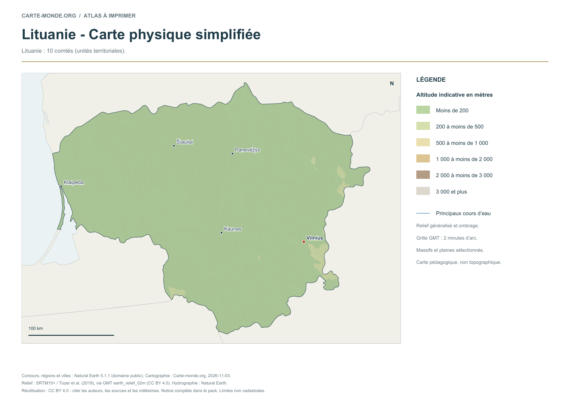
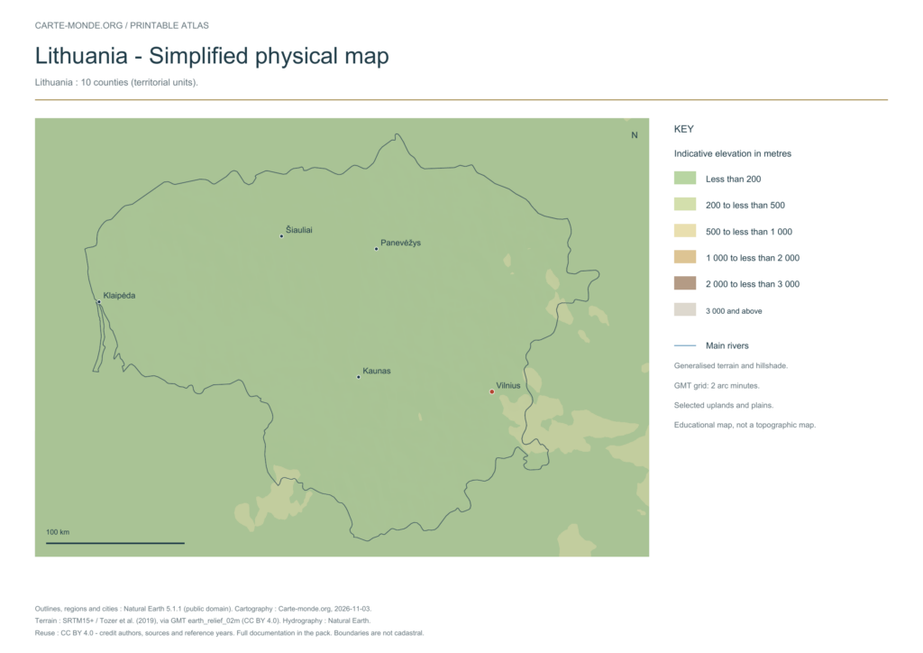
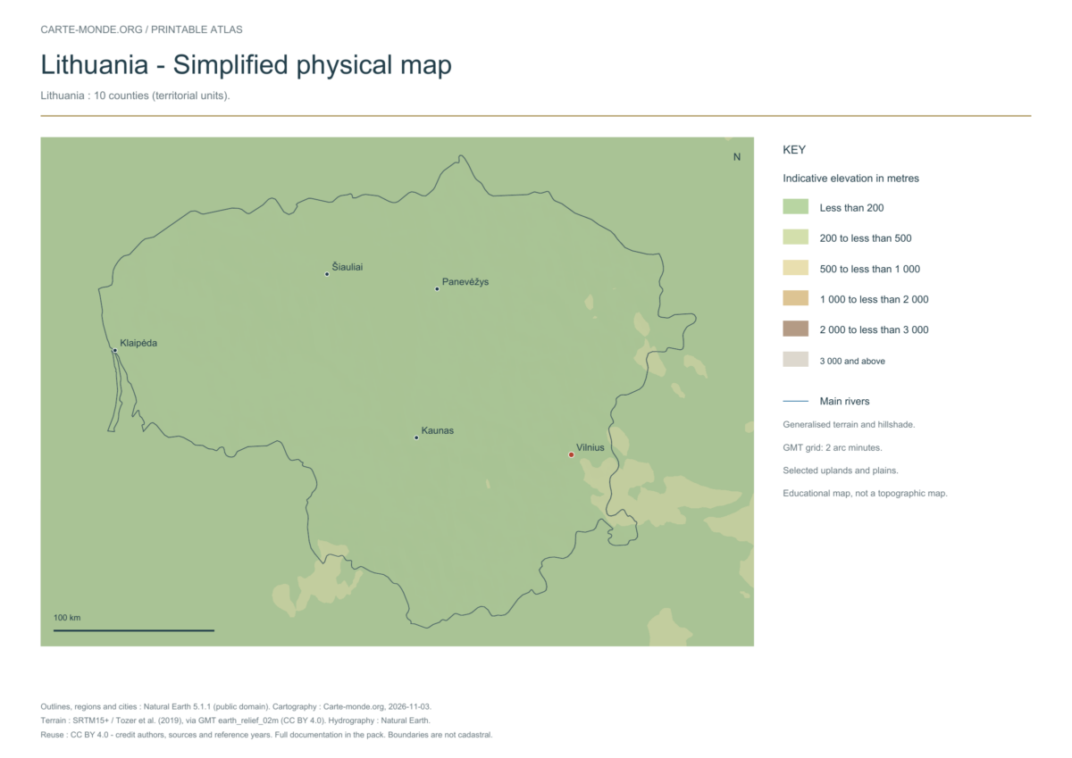
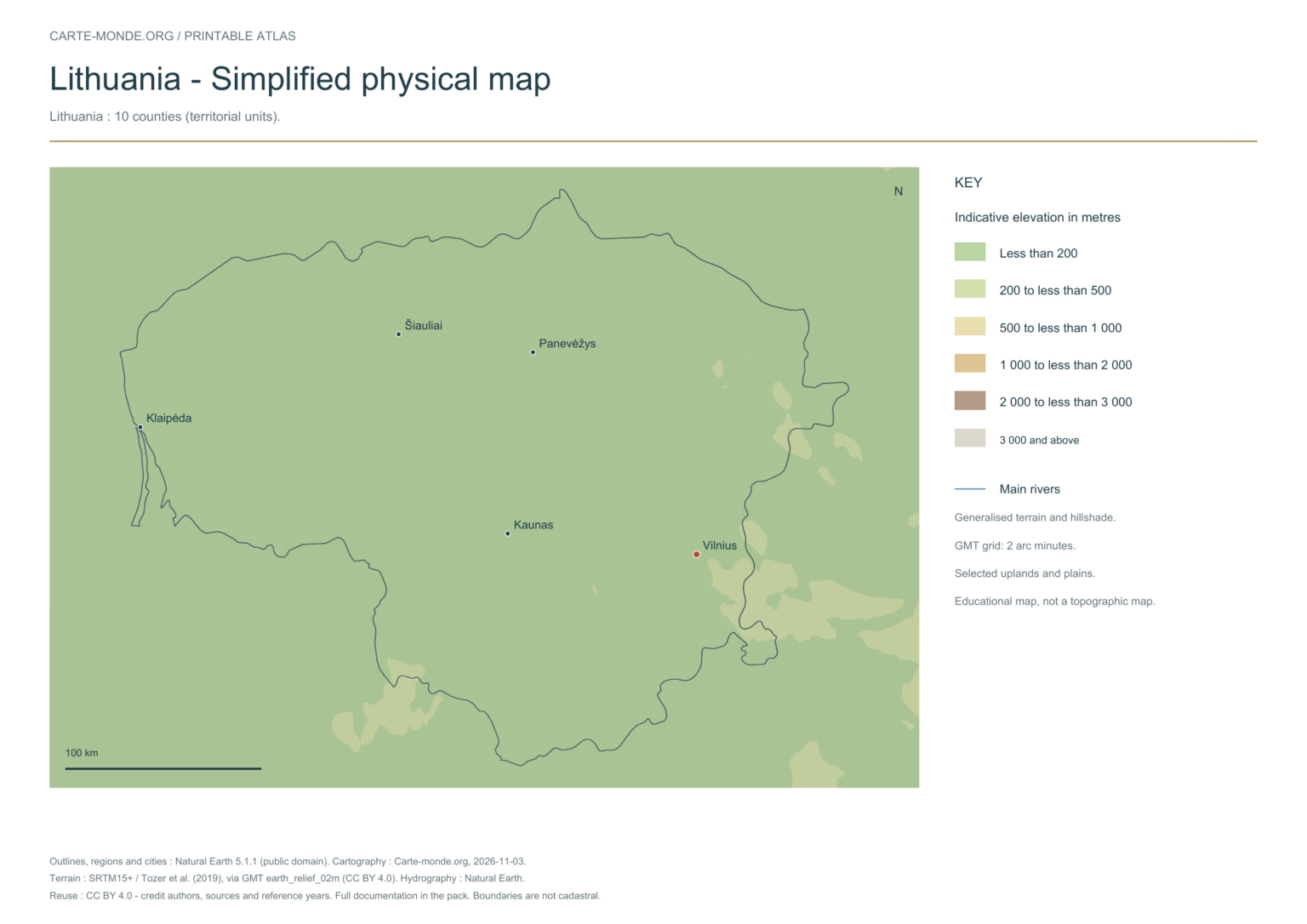
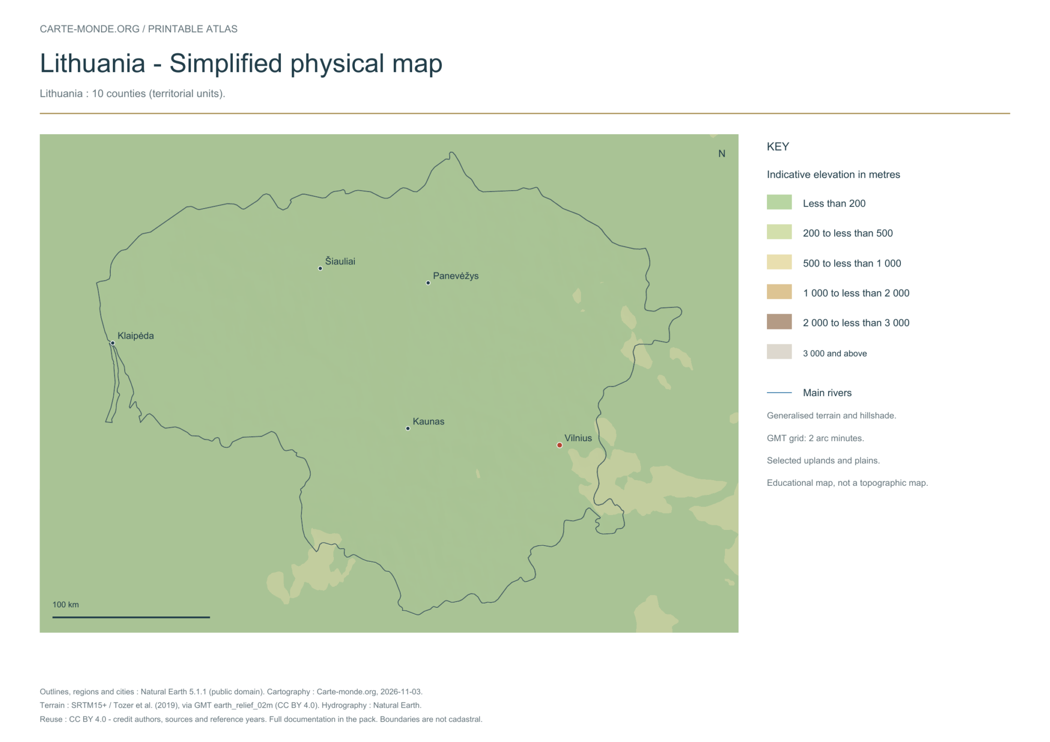
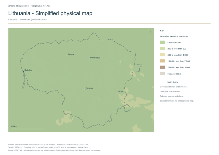
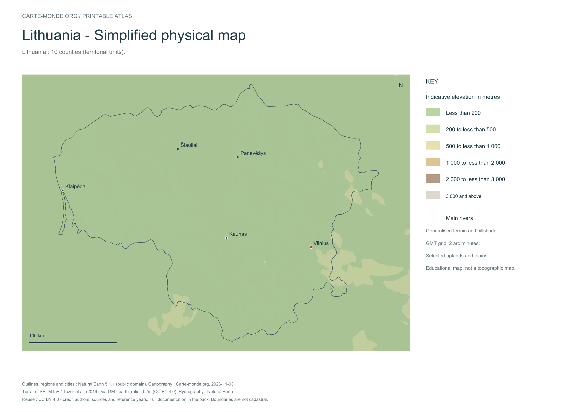
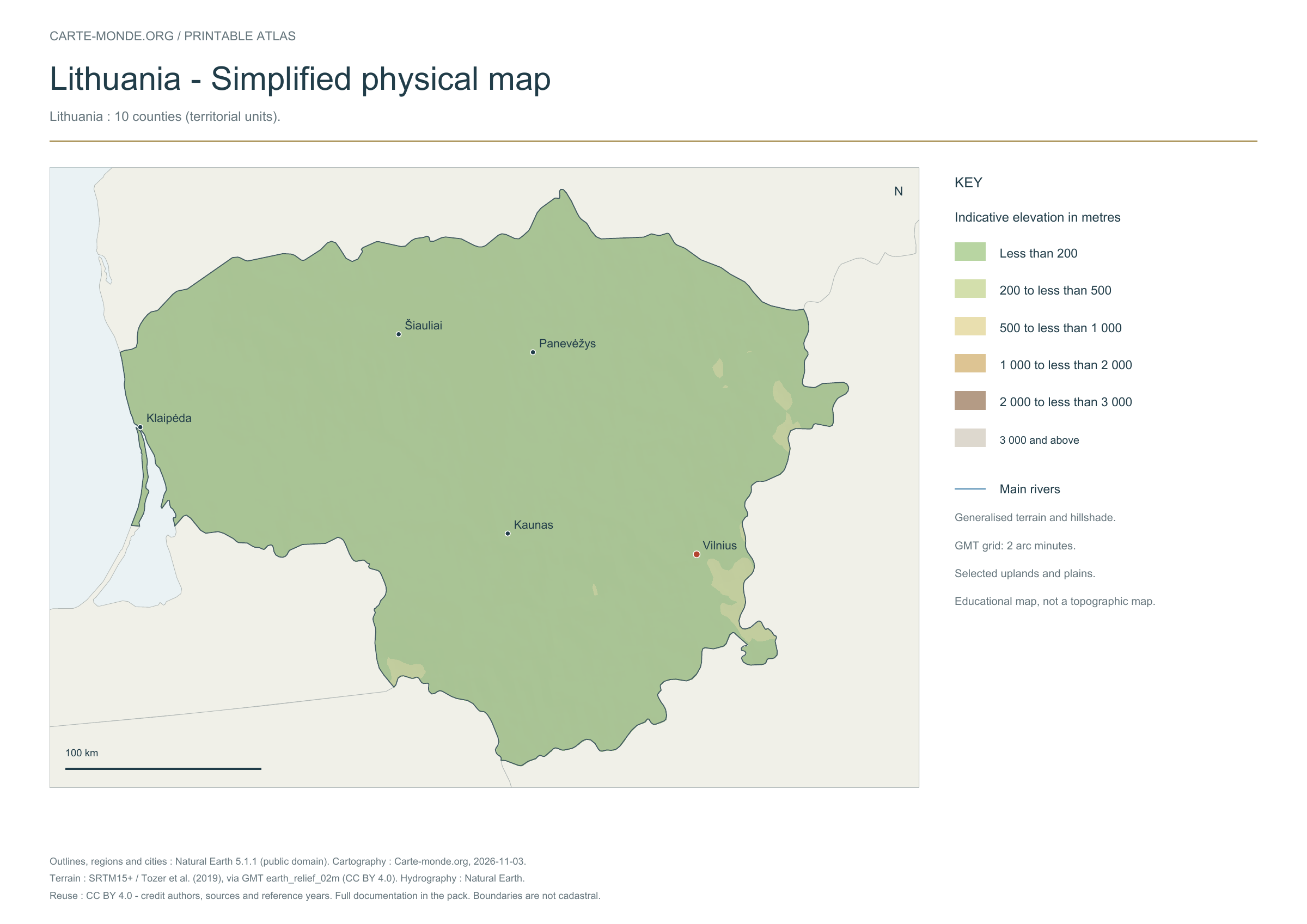
Simplified elevations
Smoothed relief, elevation colours, main mountain ranges, plains and watercourses. Educational map at national scale.
A4 landscape PDF · PNG 2 400 px · CC BY 4.0
Population density: 2020 estimates
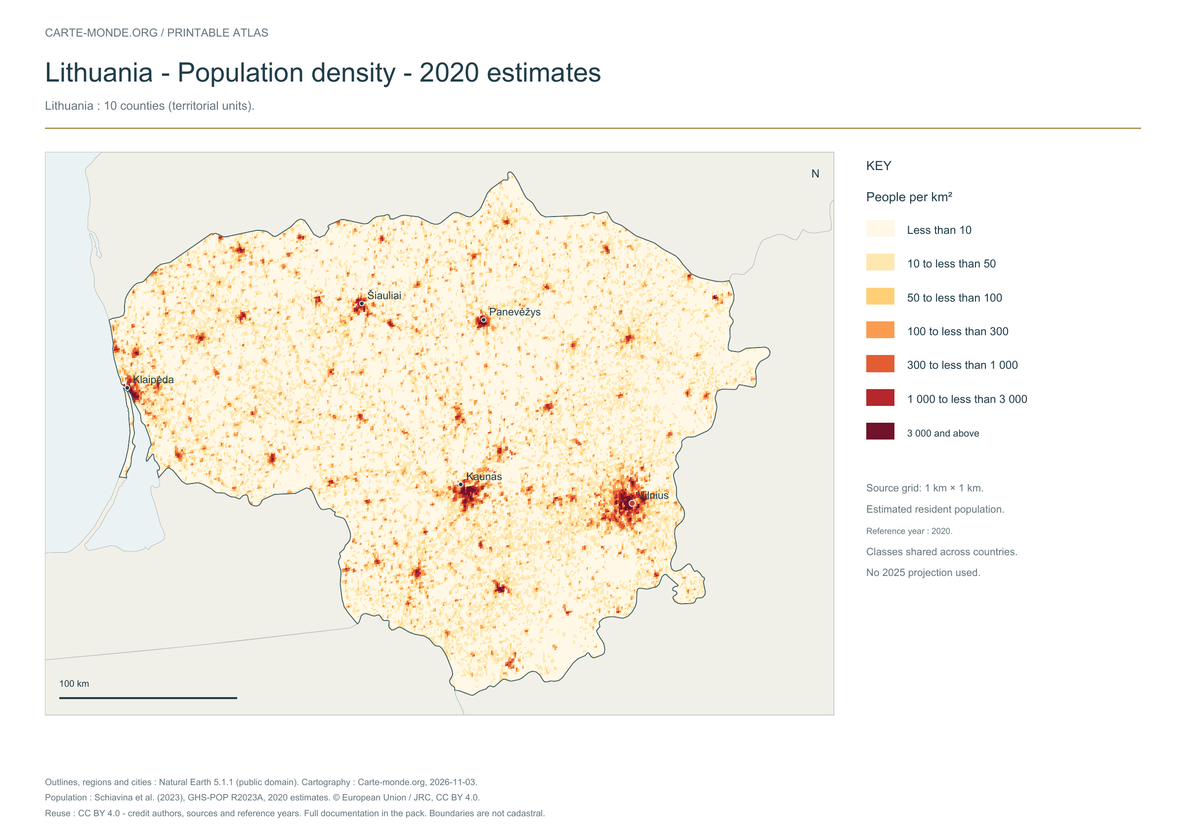
Carte-monde.org · November 2026
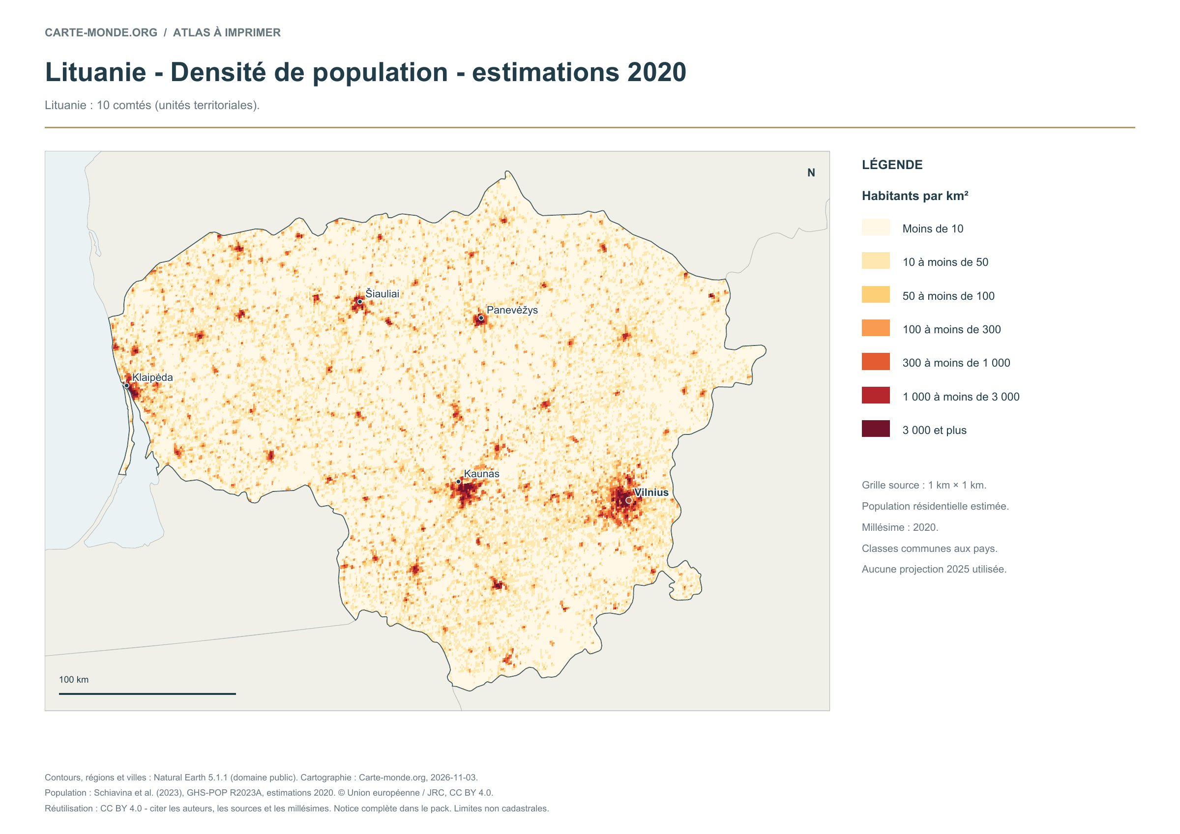
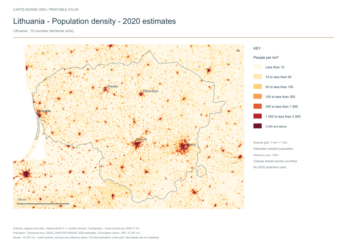
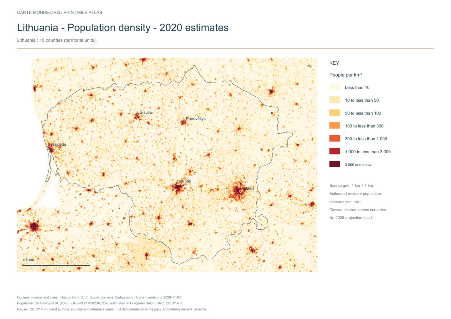
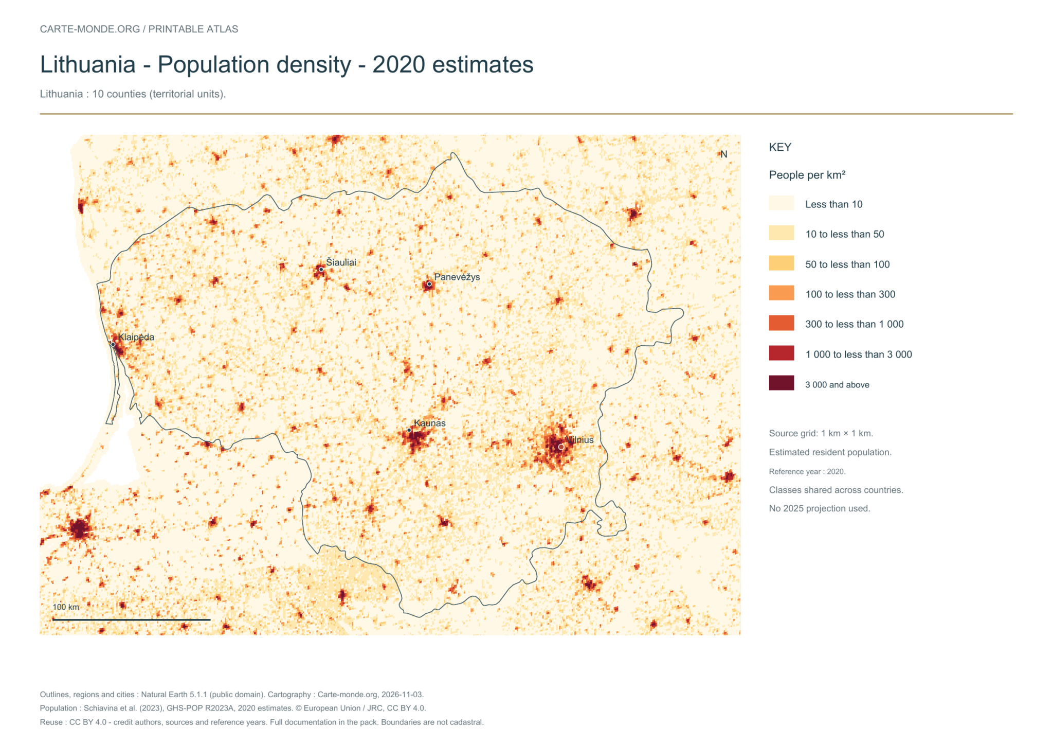
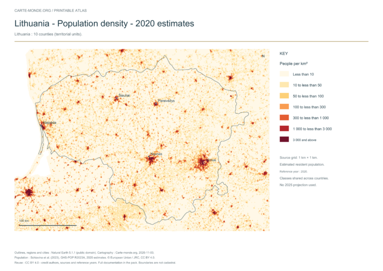
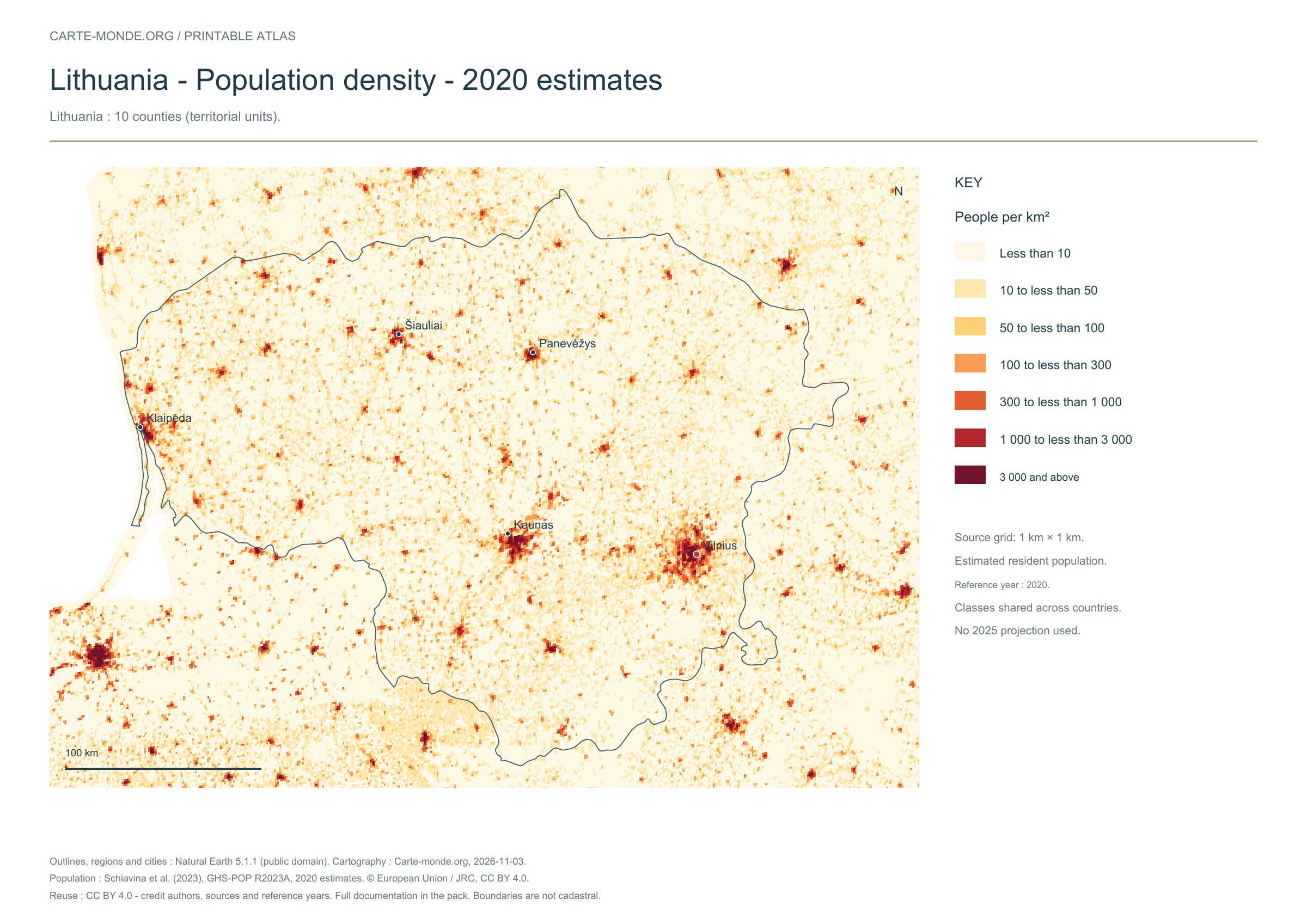
Population density — 2020 estimates
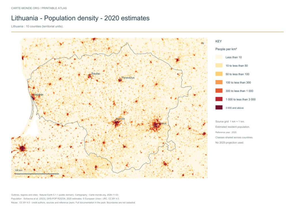
Estimated residential population in 2020, on a source grid of 1 km². Inhabitants/km² classes are shared across countries; no 2025 projection.
A4 landscape PDF · PNG 2 400 px · CC BY 4.0
The data represents estimated residential population in 2020, on a 1 km² source grid. The document’s creation date does not change this reference year.
The five in-house maps in one pack
Regions and cities, location in Europe, simplified elevations, 2020 population density and shaded relief: five A4 PDFs, their PNGs and SVGs, with sources and licences.
Download the five maps — ZIPPrevious edition packs
The four maps in one pack
Four A4 PDFs, their PNGs and SVGs, with full notes. Terrain and density use an embedded image background; text and linework remain vector-based.
Additional reference maps — CIA collection
Older documents in English provided by the University of Texas’s Perry–Castañeda collection. The links open the collection page where you can choose the indicated map. The dates below refer to the documents: these references do not necessarily describe the current situation.
Author: Central Intelligence Agency, except where otherwise stated on the document. Source: University of Texas Libraries. The collection states that most of its maps are in the public domain; retain these credits and check exceptions: reuse terms.
External references: no new file from this collection has been hosted on this site for this batch.
Find the old maps of Lithuania
Previously published maps remain accessible at their original URLs, with the collection’s text and credits.
Choose and print a map
Regions and cities show how the territory is organized; the location map places the country; terrain shows the main natural regions; density shows population distribution. Print the in-house PDFs in A4 landscape with “Fit to page”. Insets have their own scales.
Sources, reference years and reuse
Outlines, regions, cities and hydrography: Natural Earth 5.1.1, public domain. Generalized boundaries at 1:10 million, not cadastral; edition year 2026 does not mean that all geometries have been updated.
Relief: SRTM15+ / Tozer et al. (2019), reference publication, via GMT earth_relief_02m derived from SRTM15+V2.7. Grid smoothed to two arc minutes, suitable for a national overview, without topographic precision.
Population: Schiavina et al. (2023), GHS-POP R2023A, 2020 residential estimates, © European Union / JRC, CC BY 4.0. The 1 km² Mollweide cells are expressed in inhabitants/km². Methodology: Pesaresi et al. (2024).
The four new maps: created by Carte-monde.org, November 2026, under CC BY 4.0. Cite authors, sources and reference years, and indicate adaptations. Additional and older maps retain their own rights.
Country maps · Other maps and archives
Previous versions: maps and files preserved
These files remain available at their original URLs. For corrected maps, use the main links above. Each edition retains its credits and date.
- lituanie-physique-relief-villes-fleuves-2026-11-03.pdf
- lituanie-physique-relief-villes-fleuves-2026-11-03.png
- lituanie-physique-relief-villes-fleuves-2026-11-03.zip
Raster base map, cities, rivers and lakes: Natural Earth, public domain. Other boundary credits and licences are retained in the pack. Cartographic work CC BY 4.0; ODbL-derived data retains its licence. No topographic accuracy is claimed.
Other maps: sources and reuse
Reference maps by external authors. Each document retains its licence, credits and date. “View map” links open the document on Commons; ZIP buttons provide access to the files kept in this collection.
Lithuania-topo-en.png
Author: Equestenebrarum · CC BY 3.0 · Original file page, sources and licence
Date stated by the source: 08.06.2008. The data date may differ from the document date; check its key.
To reuse a CC BY map, cite its authors, source and licence and indicate any changes. Adaptations of a CC BY-SA map retain the same or a compatible licence. CC0 documents may be reused freely; retaining the source makes them easier to identify. These rights do not make all administrative boundaries current.
Previous collection — original files preserved
| Online Maps of Lithuania | |
 |
 |
 |
Original French files
- lituanie-cinq-cartes-completes-2026-11-03-v3.zip
- lituanie-densite-atlas-2026-11-03.pdf
- lituanie-densite-atlas-2026-11-03.png
- lituanie-physique-atlas-2026-11-03.pdf
- lituanie-physique-atlas-2026-11-03.png
- lituanie-physique-relief-villes-fleuves-2026-11-03-v3.pdf
- lituanie-physique-relief-villes-fleuves-2026-11-03-v3.png
- lituanie-regions-atlas-2026-11-03.pdf
- lituanie-regions-atlas-2026-11-03.png
- lituanie-situation-atlas-2026-11-03.pdf
- lituanie-situation-atlas-2026-11-03.png
Previous language edition
- lituanie-densite-en-2026-11-09-1024×724.png
- lituanie-densite-en-2026-11-09-1200×849.png
- lituanie-densite-en-2026-11-09-1536×1086.png
- lituanie-densite-en-2026-11-09-2048×1448.png
- lituanie-densite-en-2026-11-09-300×212.png
- lituanie-densite-en-2026-11-09-768×543.png
- lituanie-densite-en-2026-11-09.pdf
- lituanie-densite-en-2026-11-09.png
- lituanie-pack-main-en-2026-11-09.zip
- lituanie-physique-en-2026-11-09-1024×724.png
- lituanie-physique-en-2026-11-09-1200×849.png
- lituanie-physique-en-2026-11-09-1536×1086.png
- lituanie-physique-en-2026-11-09-2048×1448.png
- lituanie-physique-en-2026-11-09-300×212.png
- lituanie-physique-en-2026-11-09-768×543.png
- lituanie-physique-en-2026-11-09.pdf
- lituanie-physique-en-2026-11-09.png