
FRANCE · LABELLED MAPS
Five printable maps of France: regions and cities, location in Europe, two views of the relief and population. PDFs, images and sources are available below.
Our five maps have English labels. Maps from other publishers retain their original language.
Regions, cities and location in Europe
Regions: metropolitan territory and five overseas regions. Relief and population: metropolitan France and Corsica.
New series · 2026 edition
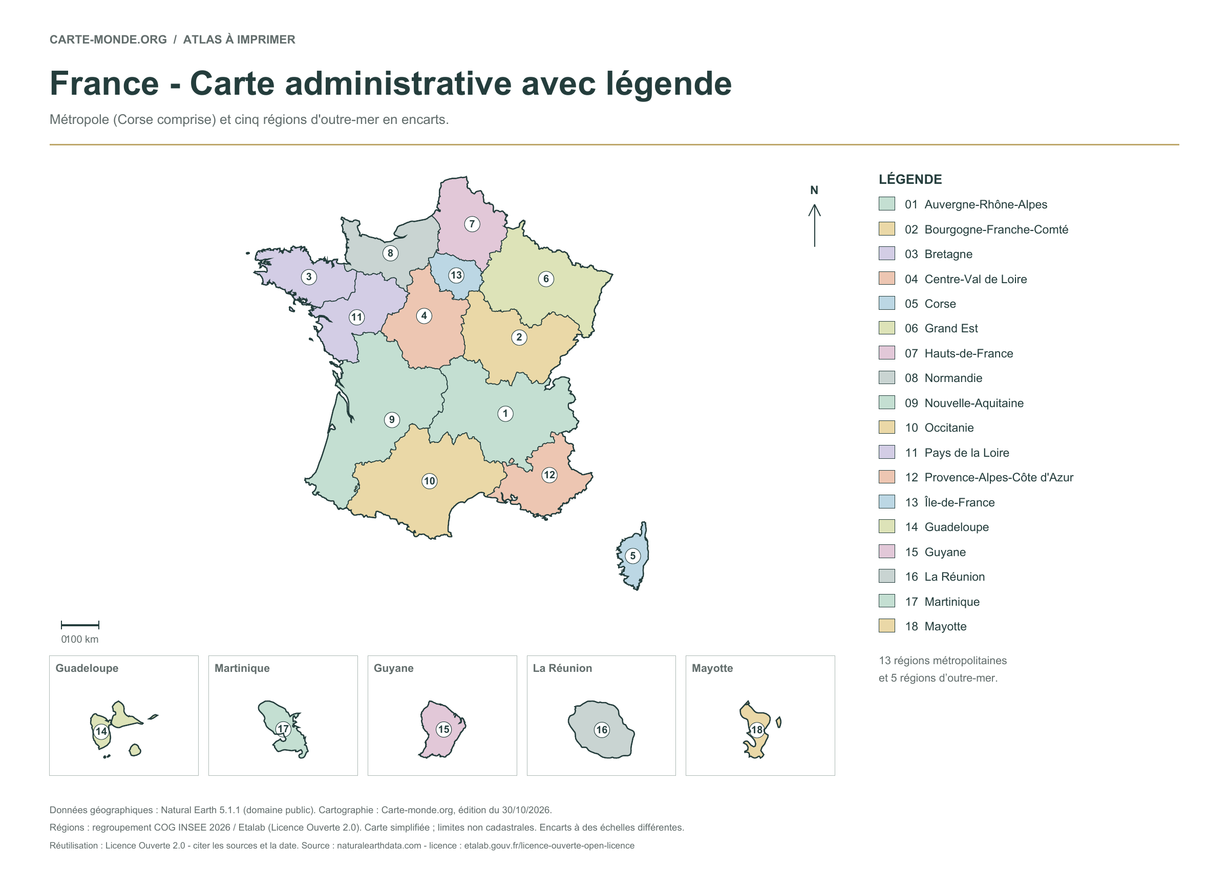
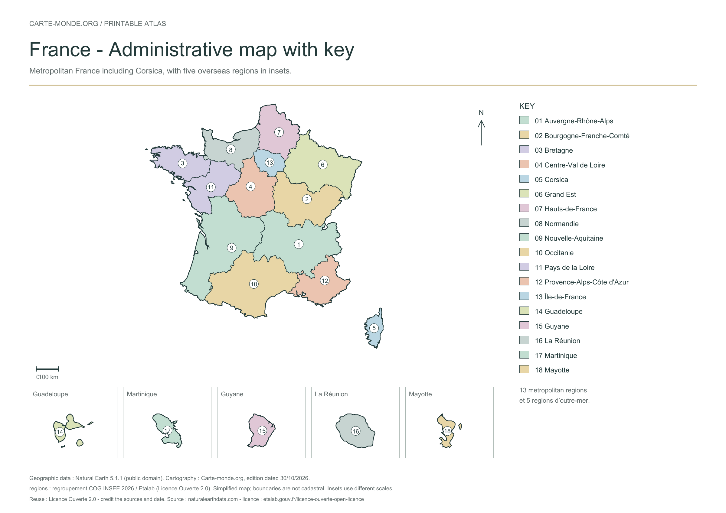
Regions of France
The 13 metropolitan regions and five overseas regions are numbered and named in the key. For named and numbered departments, see the IGN poster below.
A4 vector PDF · PNG 2 400 px · Licence Ouverte 2.0
New series · 2026 edition
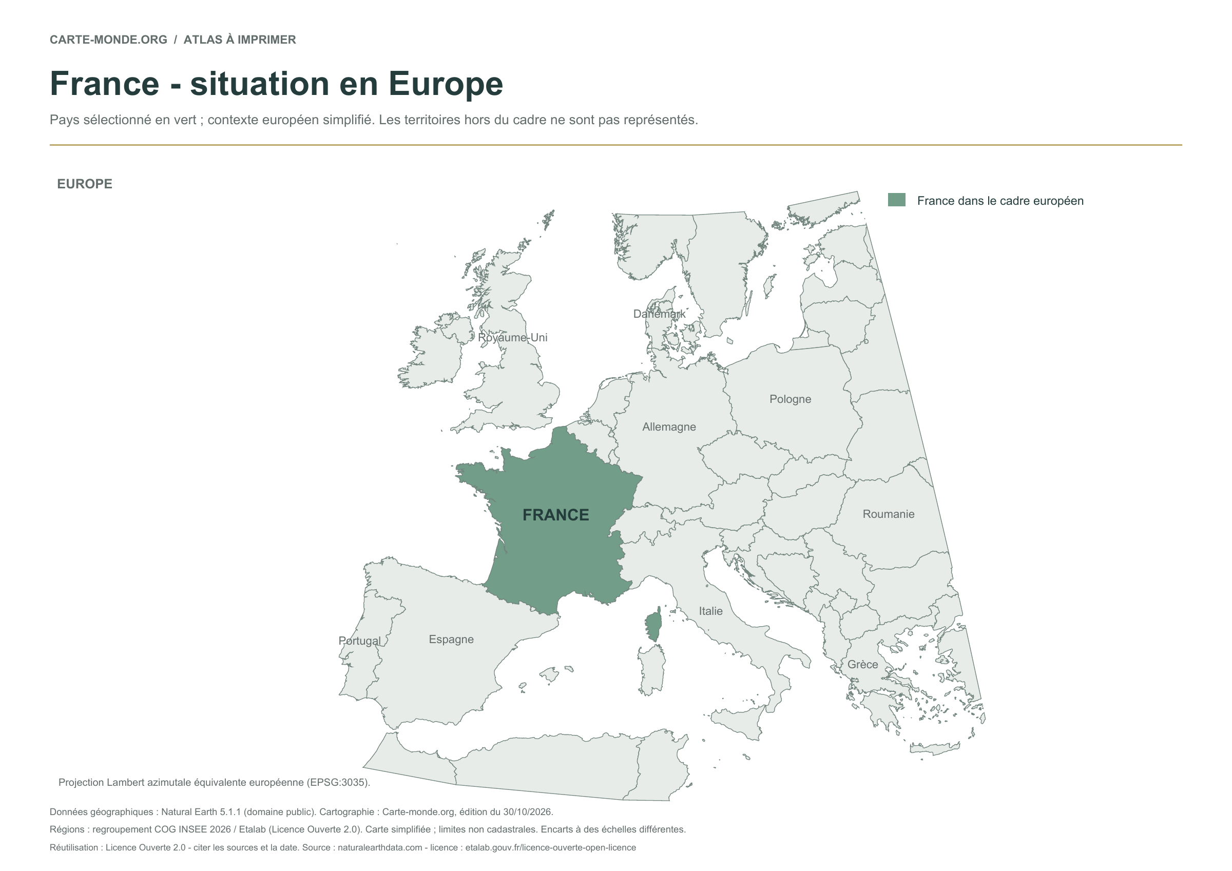
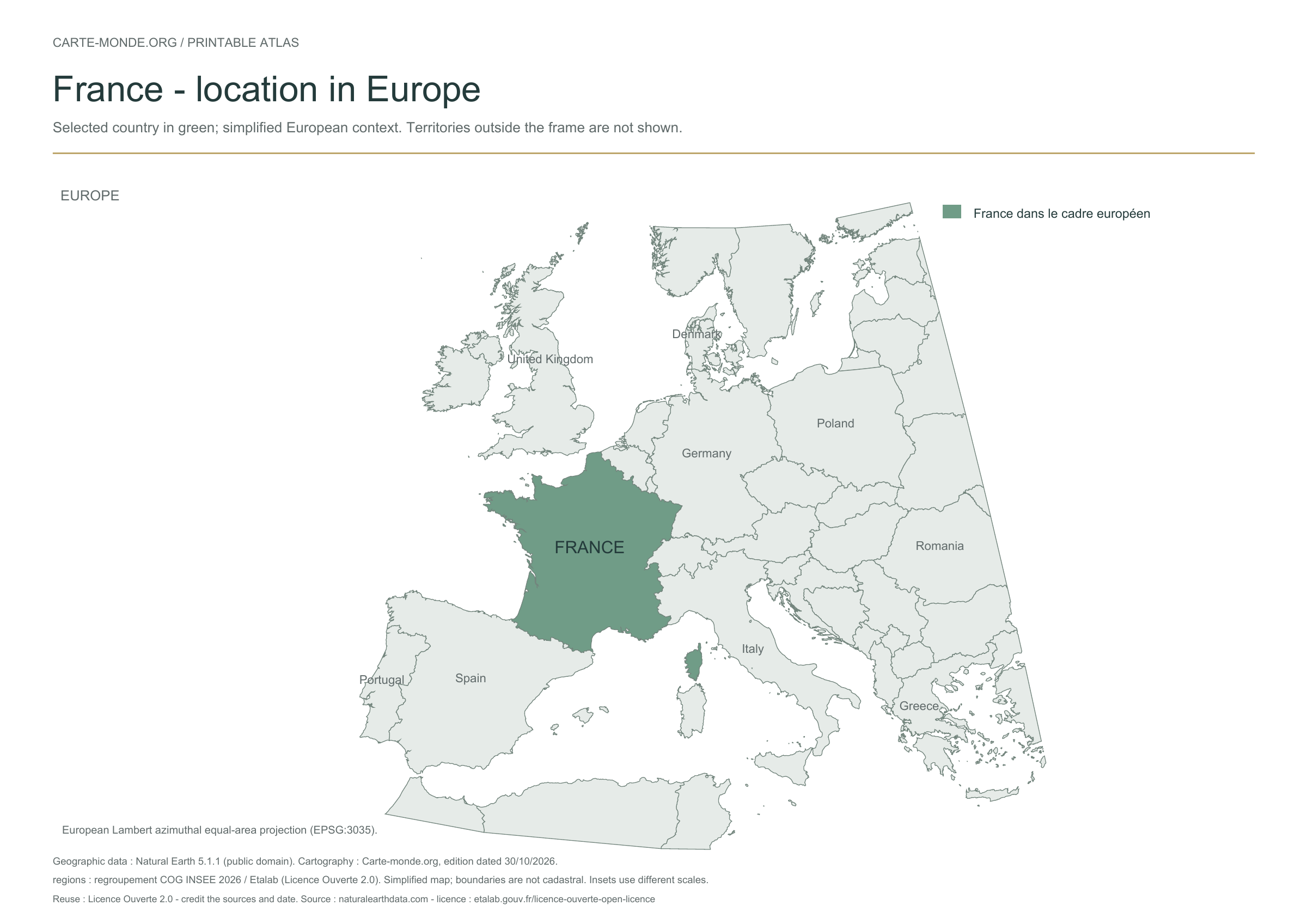
Location of France in Europe
The country is highlighted in colour among European states. Some neighbouring countries are named. This location view covers Europe and does not show territories outside that area.
A4 vector PDF · PNG 2 400 px · Licence Ouverte 2.0
Two maps to understand the relief
Choose shaded relief for an overview, or elevation classes for school use.
Carte-monde.org · November 2026
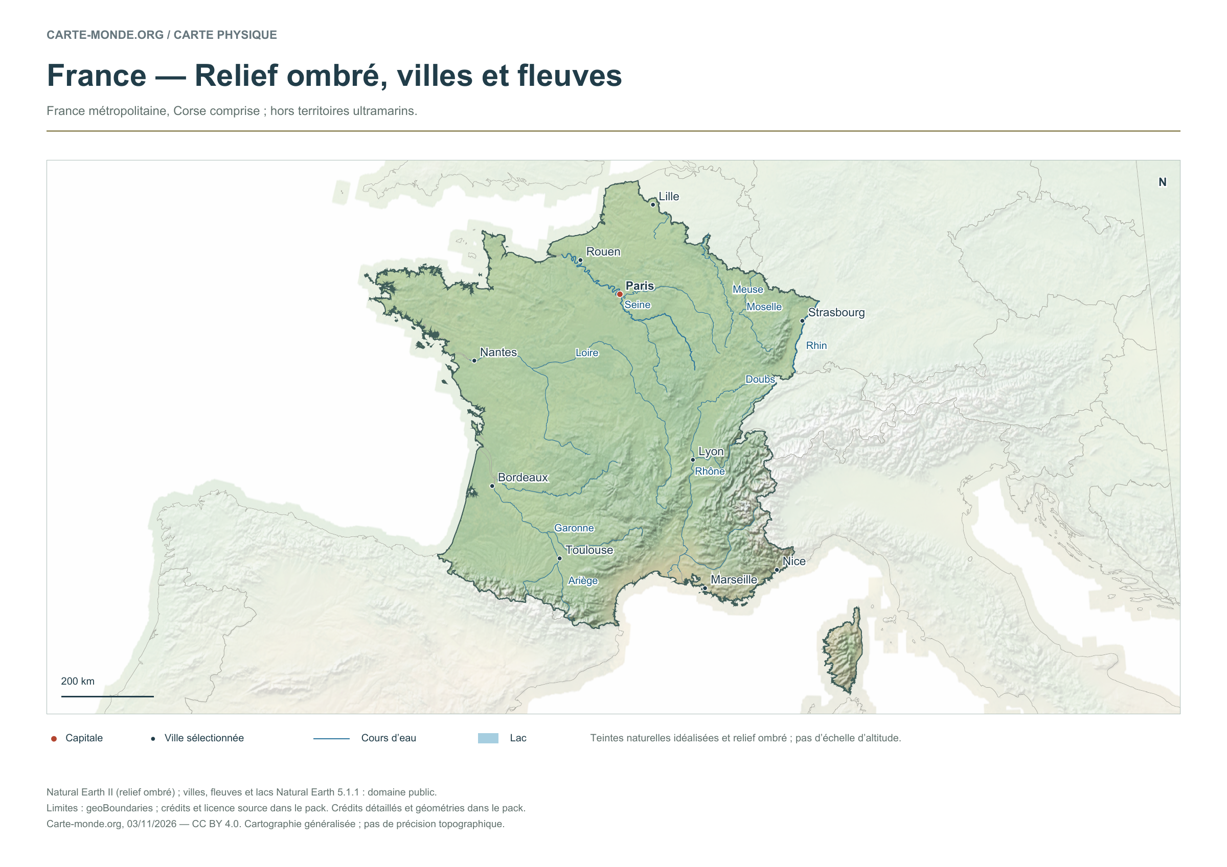
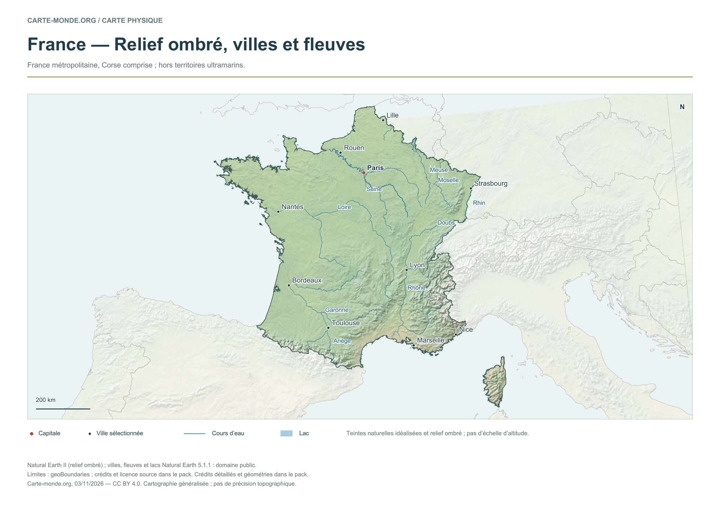
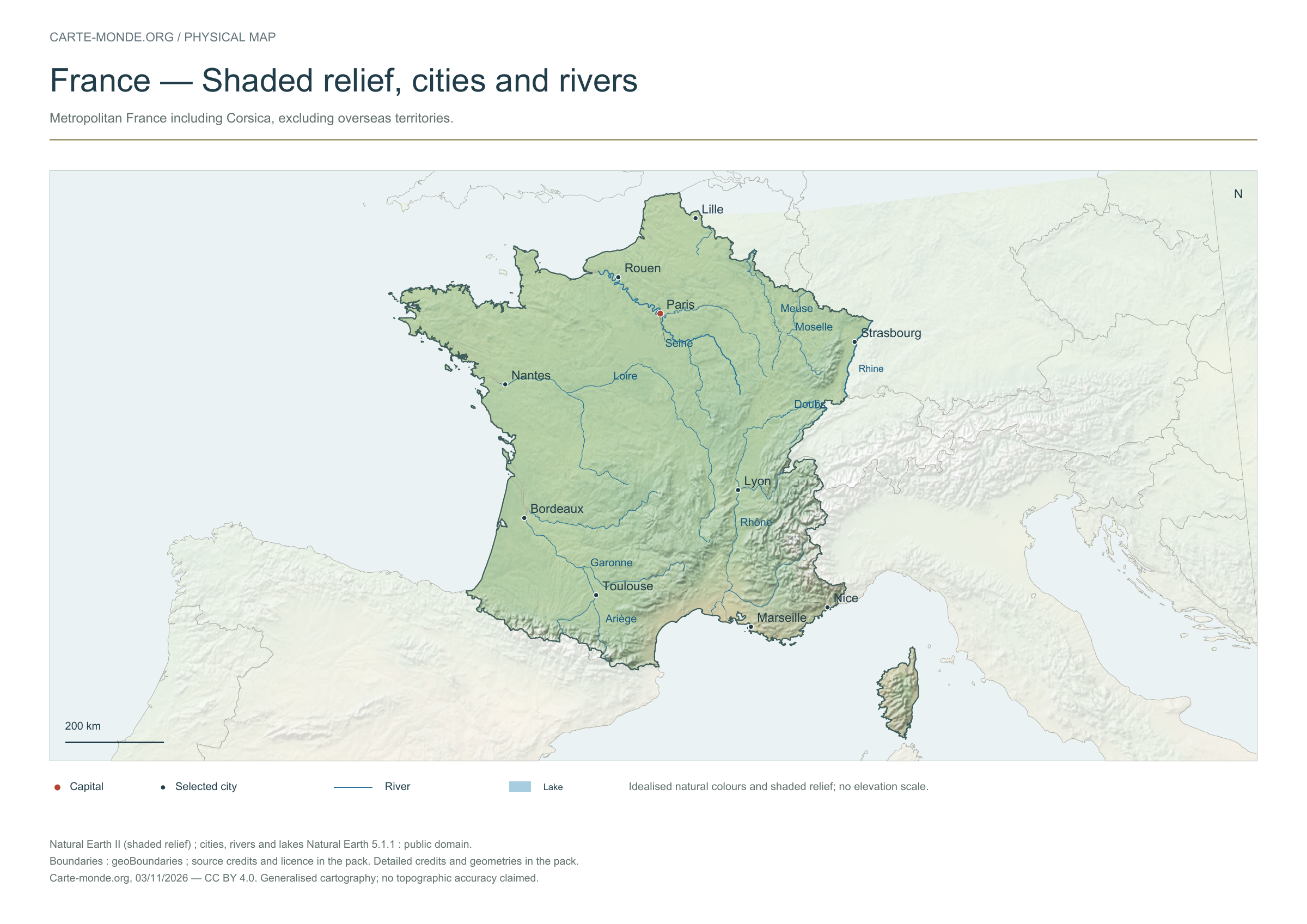
Shaded relief, cities and rivers
To identify major landforms, cities and the river network. The natural colours are not an elevation scale.
Raster base map, cities, rivers and lakes: Natural Earth, public domain. Other boundary credits and licences are retained in the pack. Cartographic work CC BY 4.0; ODbL-derived data retains its licence. No topographic accuracy is claimed.
Territory, data and selection of names
Metropolitan France, including Corsica; excluding overseas territories.
Natural Earth II shaded relief background, 10 selected cities. Named rivers: Ariège, Doubs, Garonne, Loire, Meuse, Moselle, Rhin, Rhône, Seine.
The colours represent idealised natural cover; they do not correspond to elevation classes. This global background remains generalised, particularly for small states.
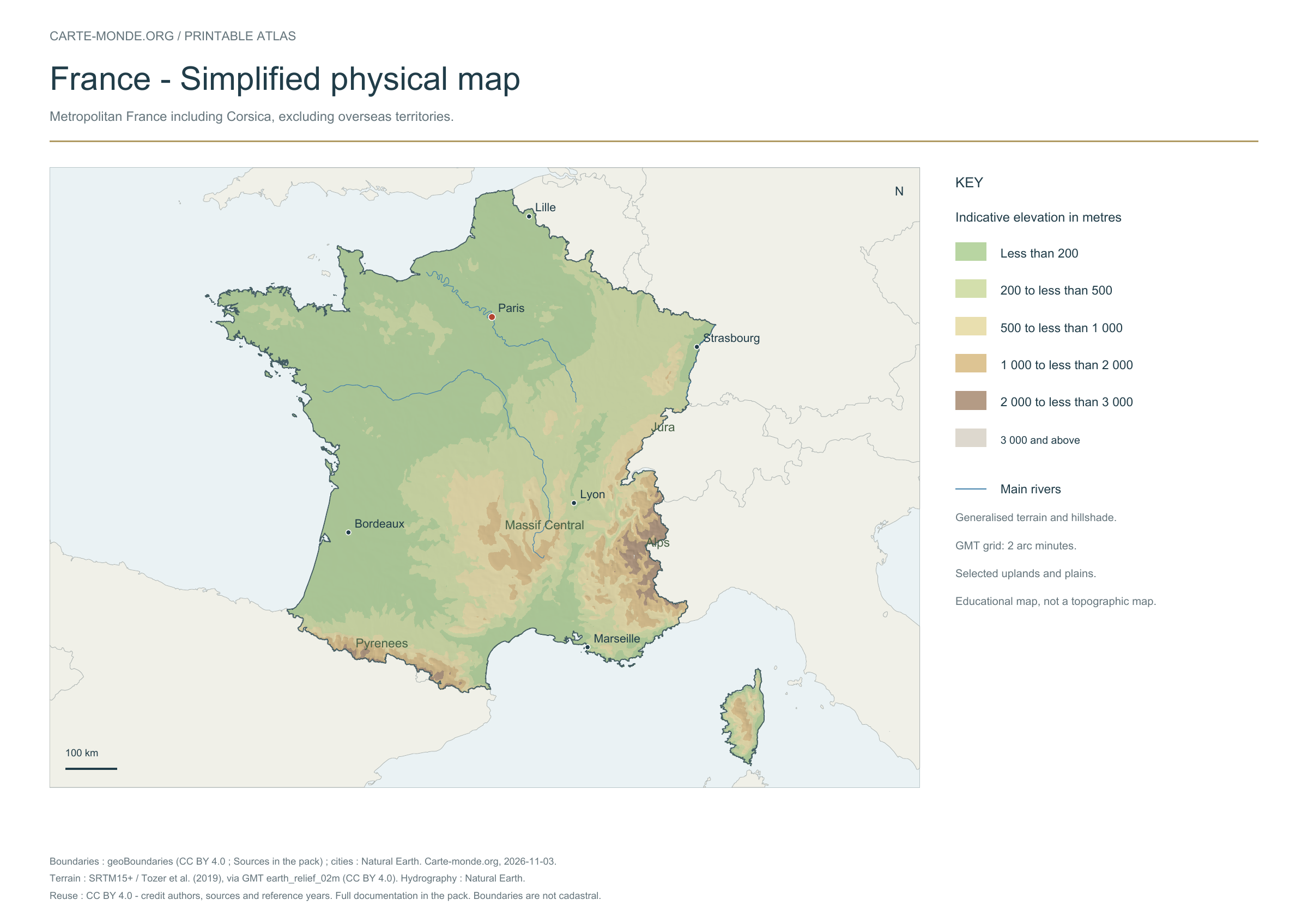
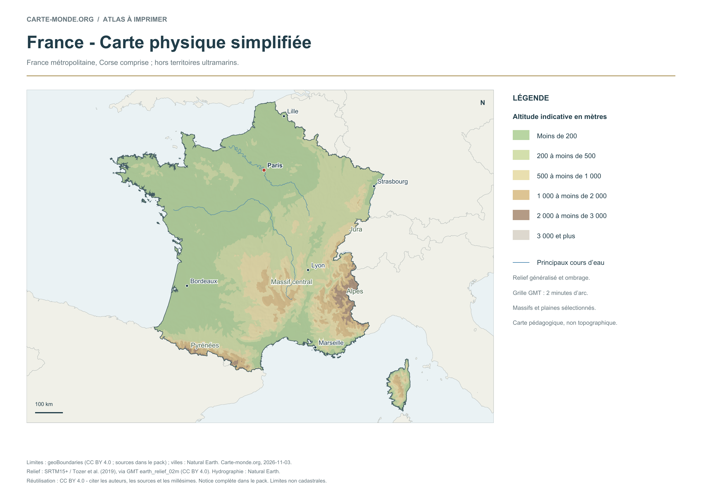
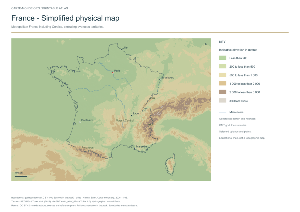
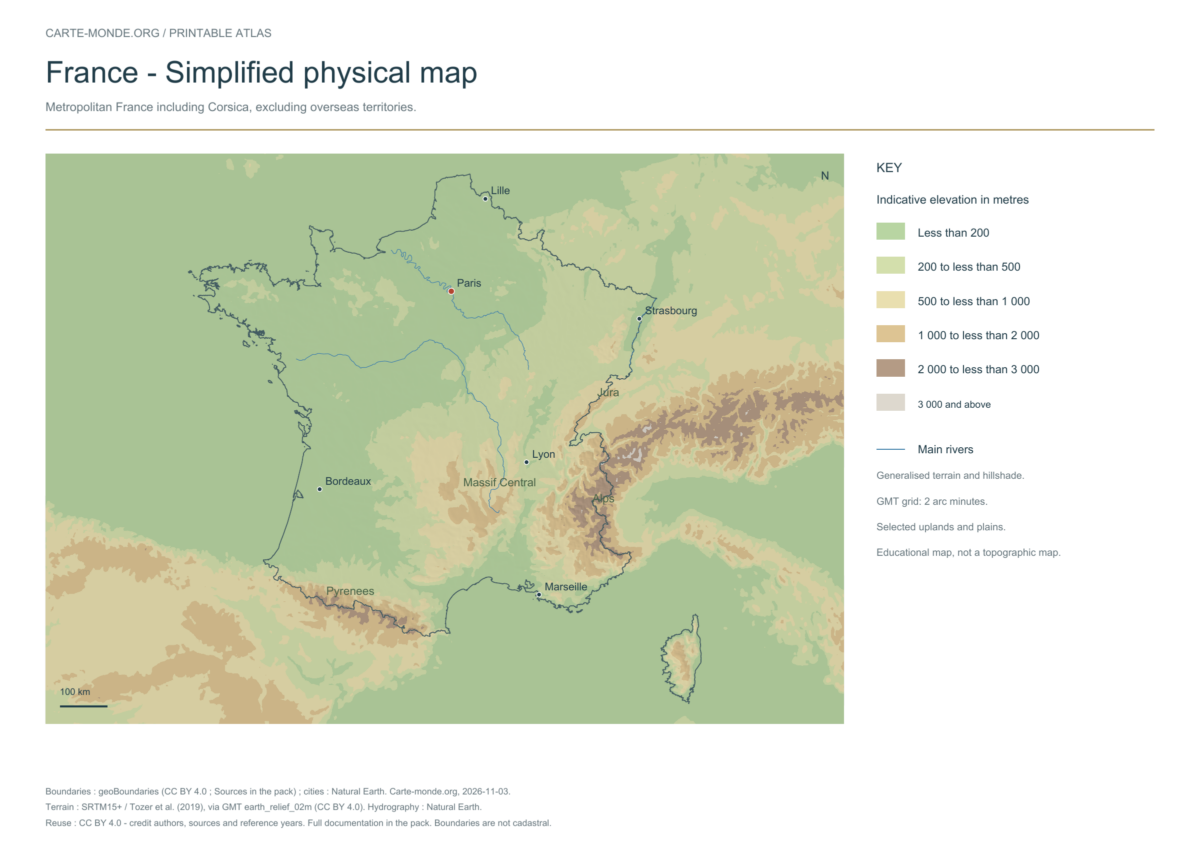
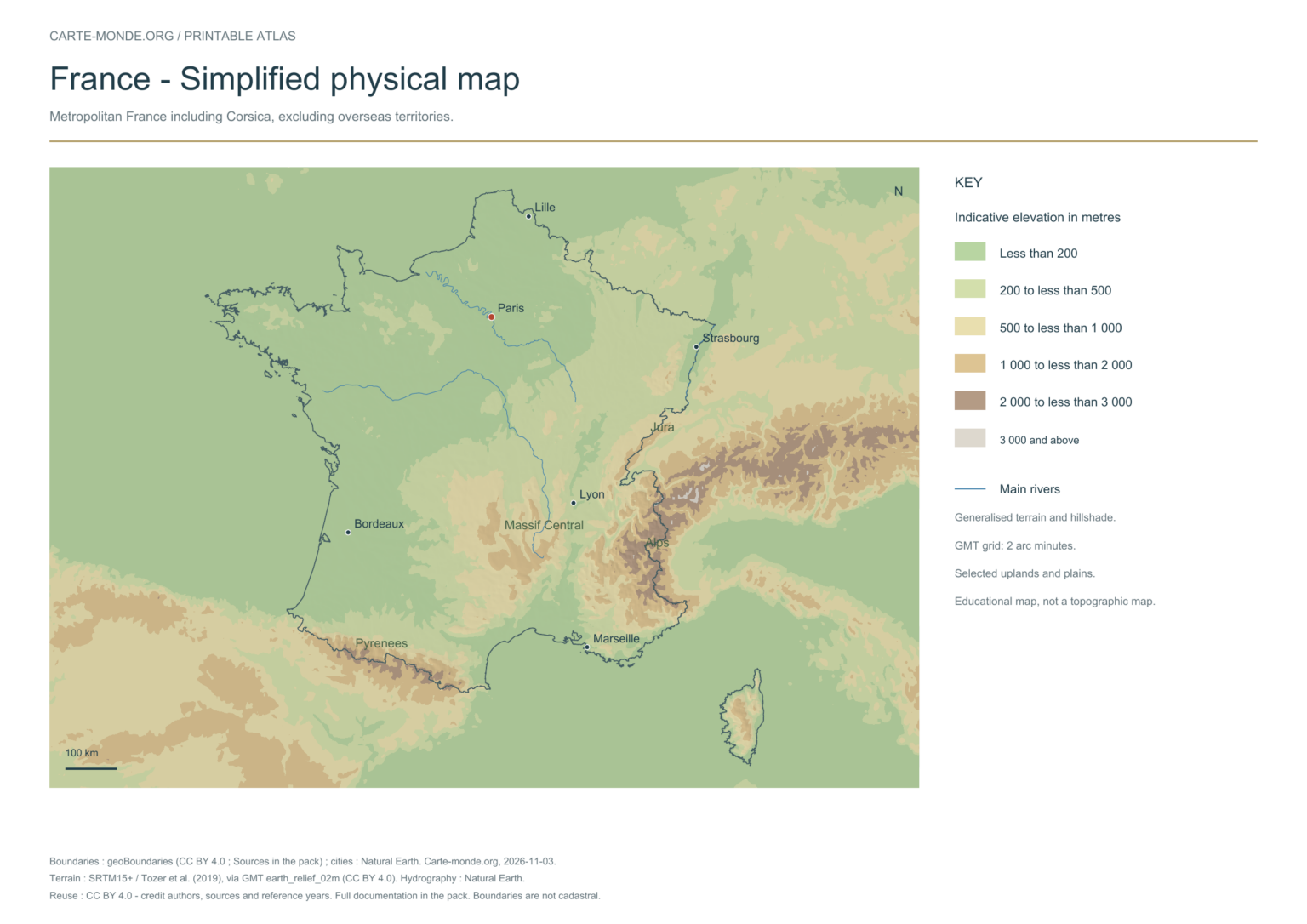
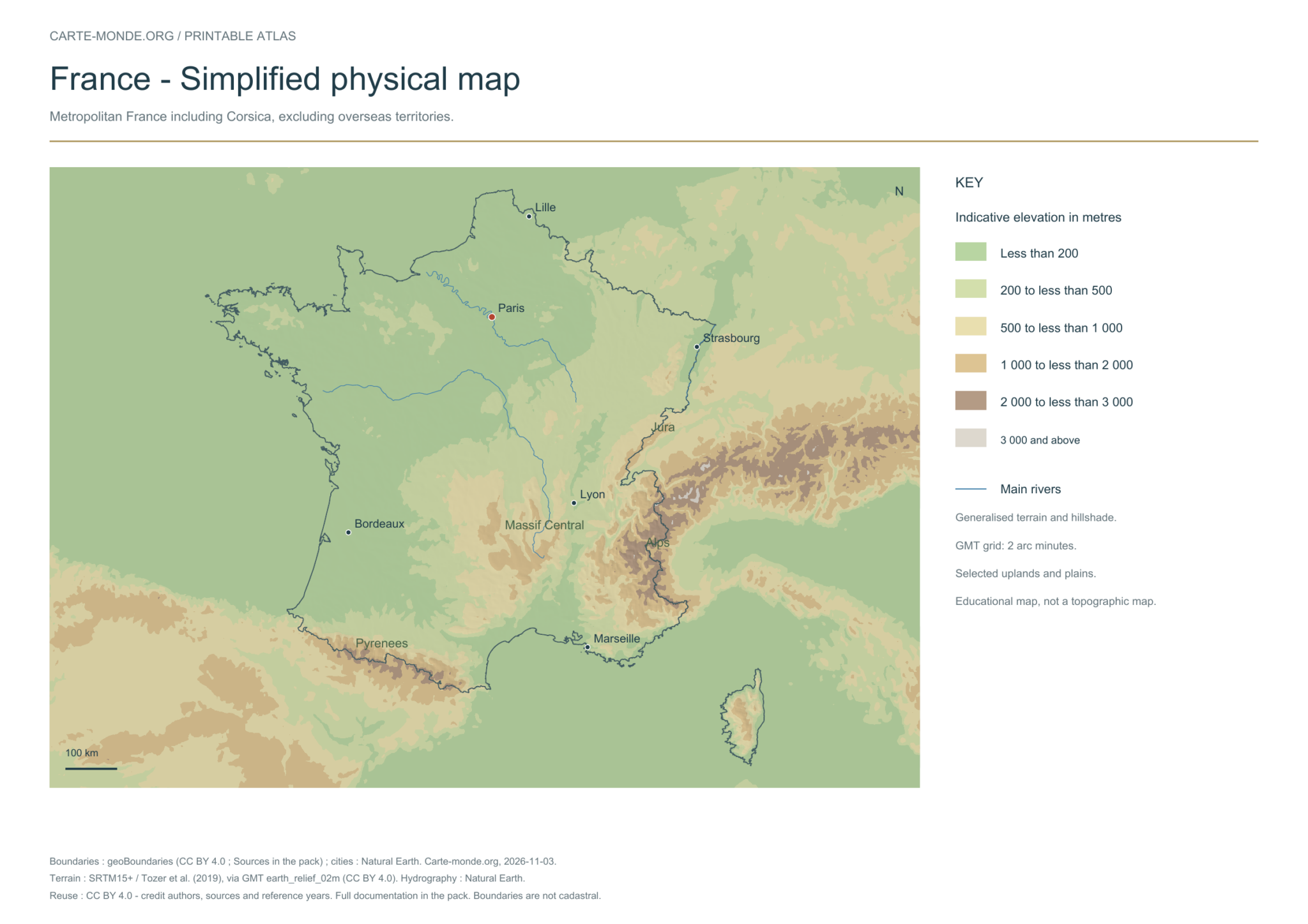
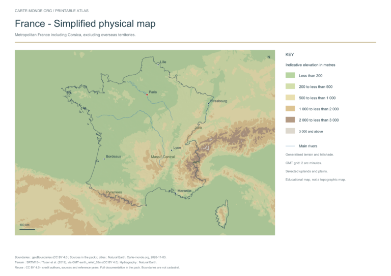
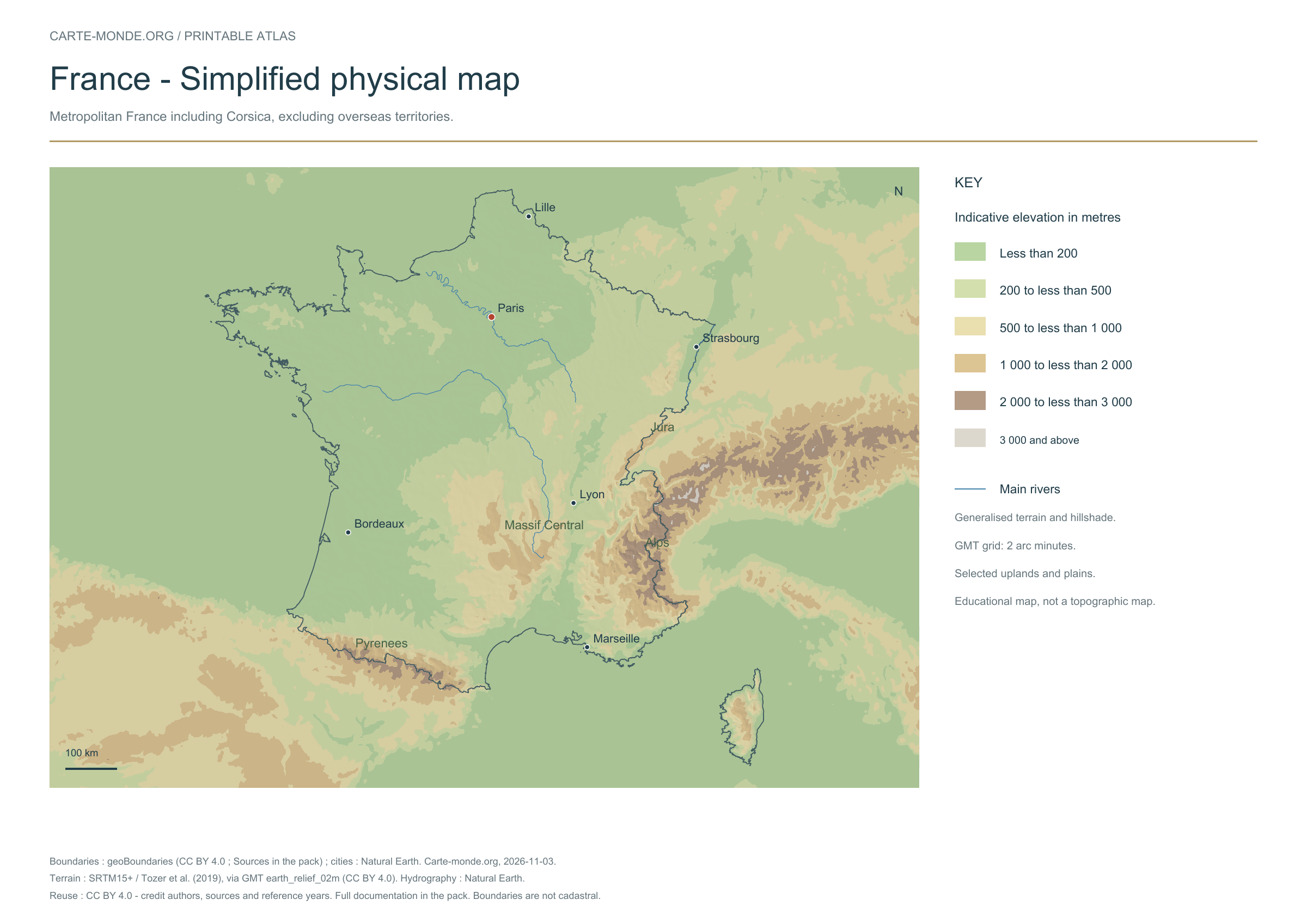
Simplified elevations
Smoothed relief and main natural regions. Metropolitan France, including Corsica; excluding overseas territories.
A4 landscape PDF and PNG · Carte-monde.org, November 2026 · CC BY 4.0.
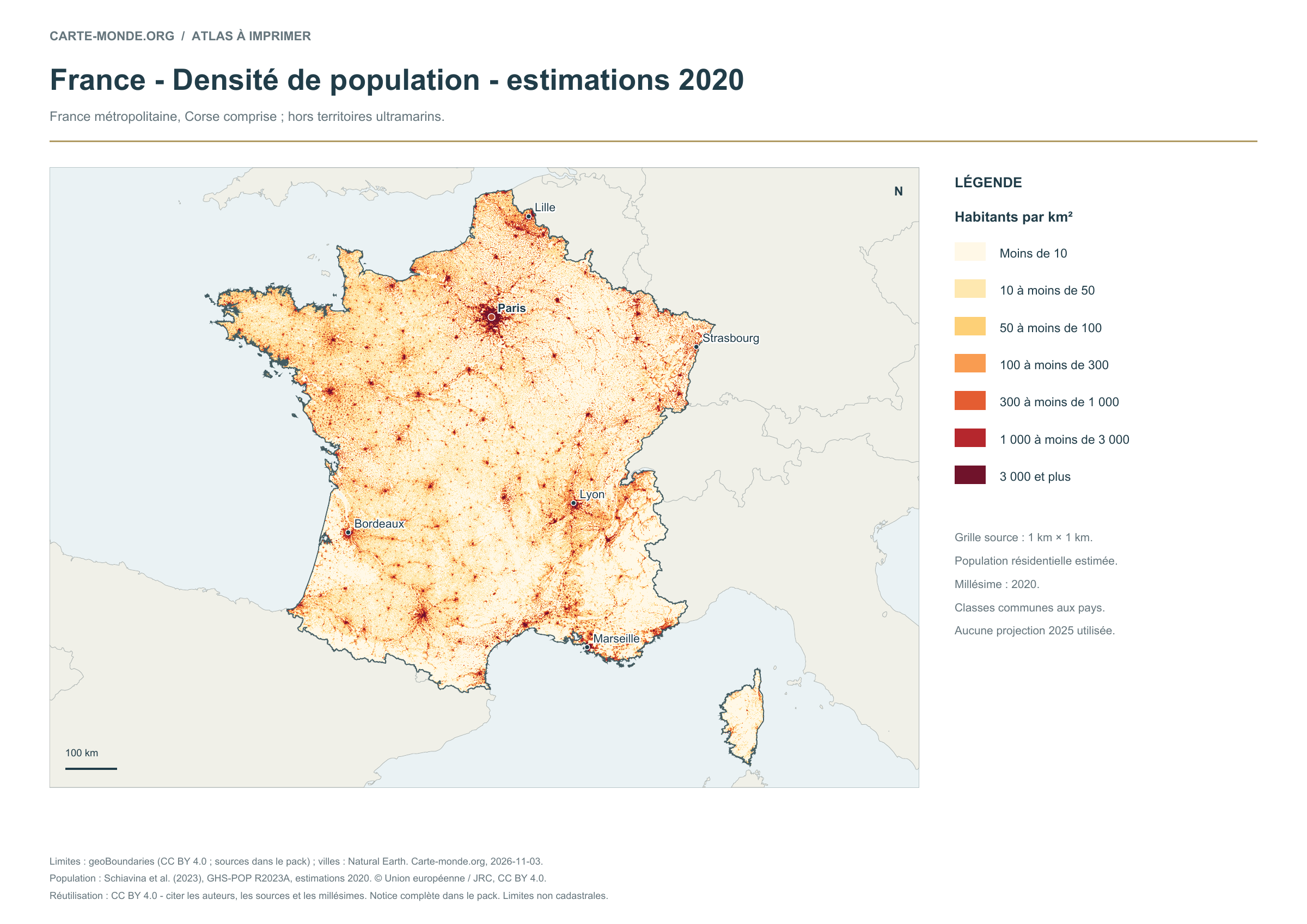
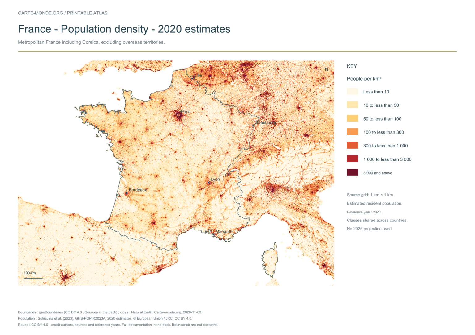
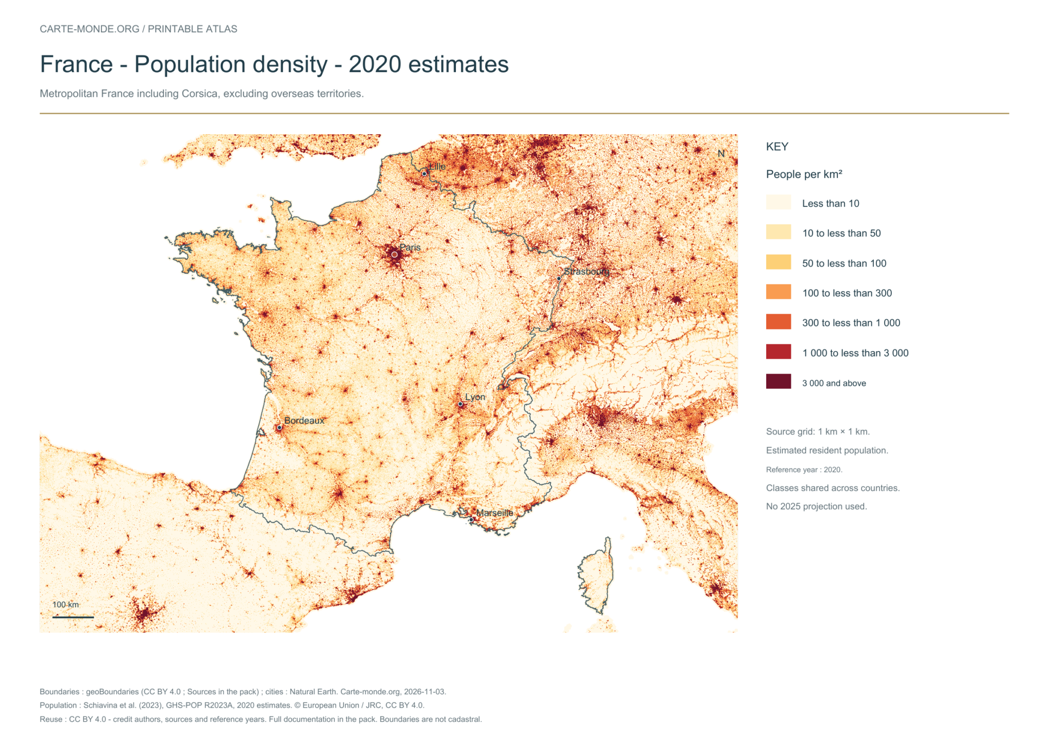
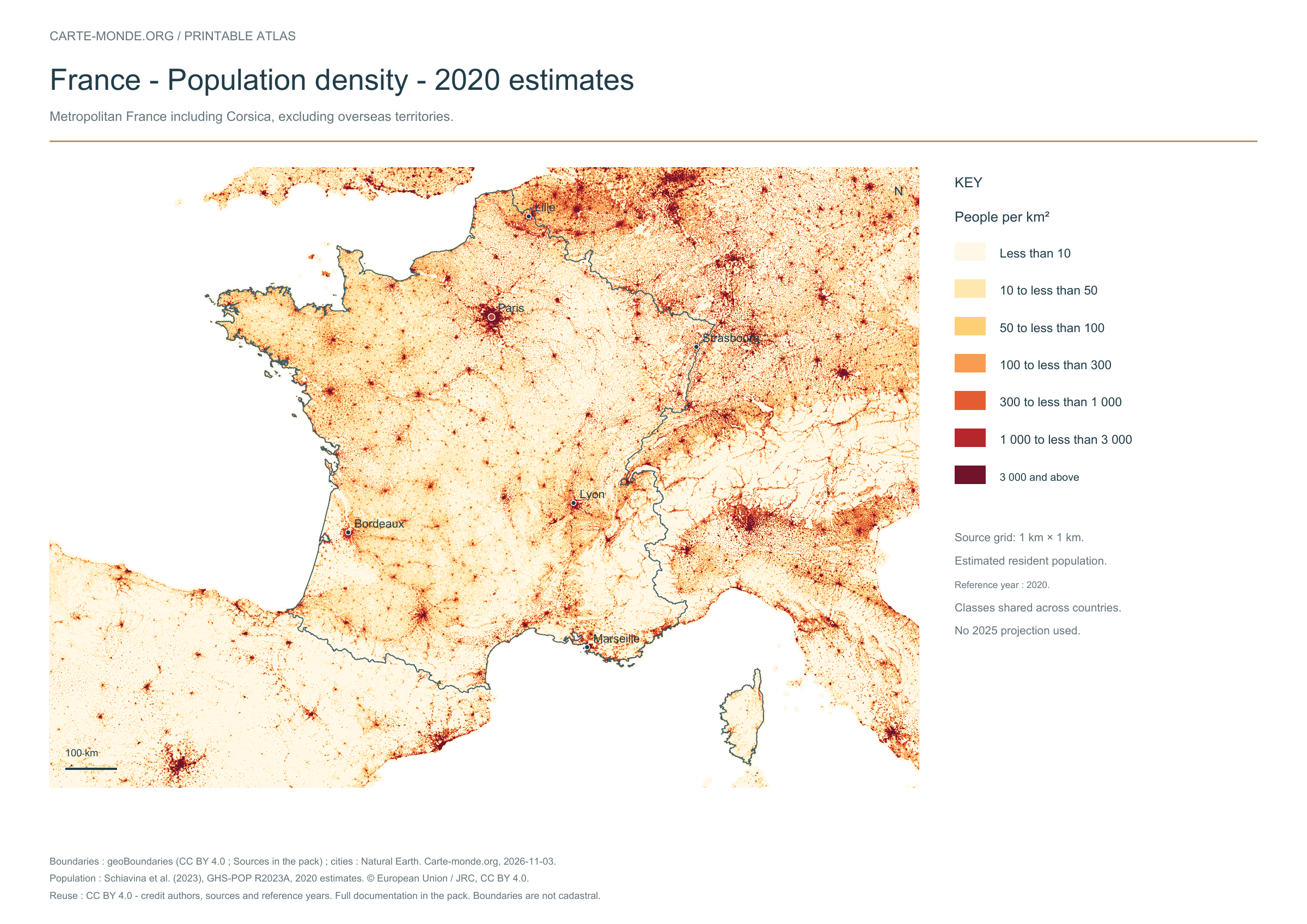
Population density: 2020 estimates
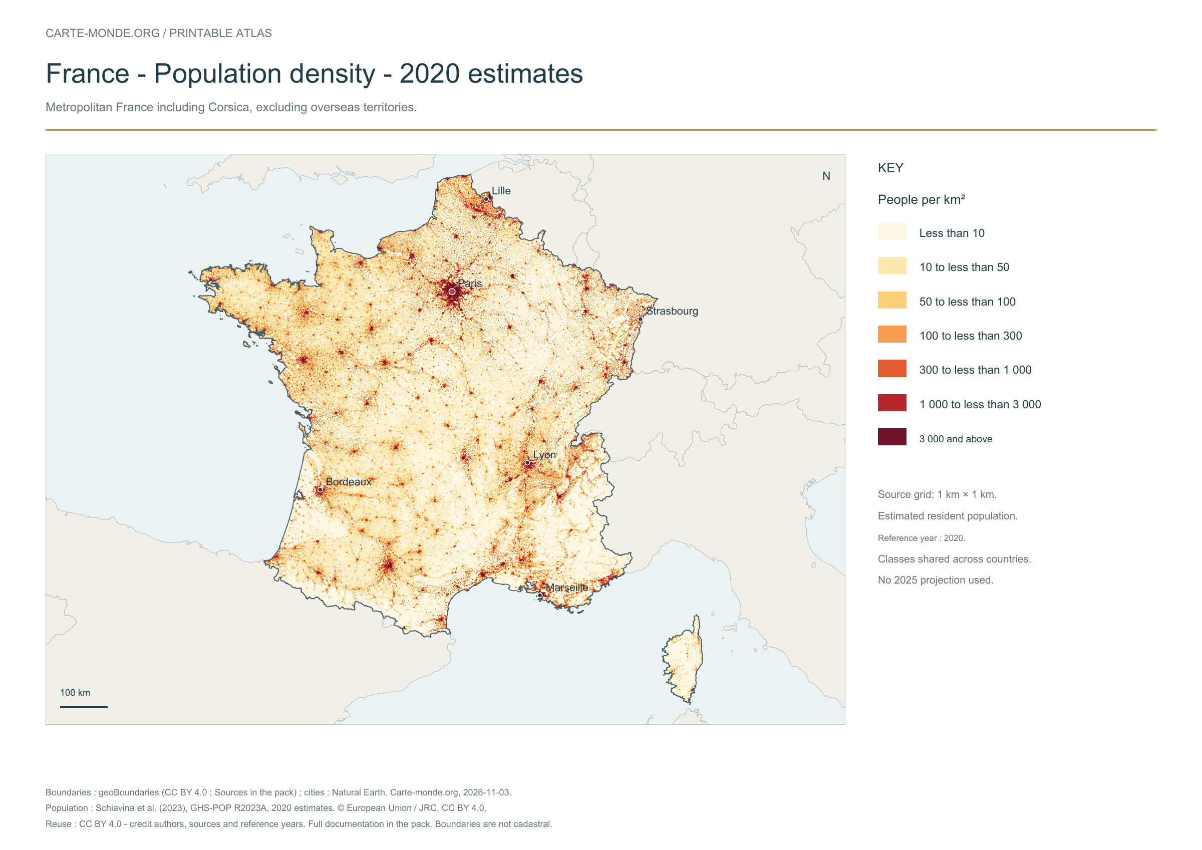
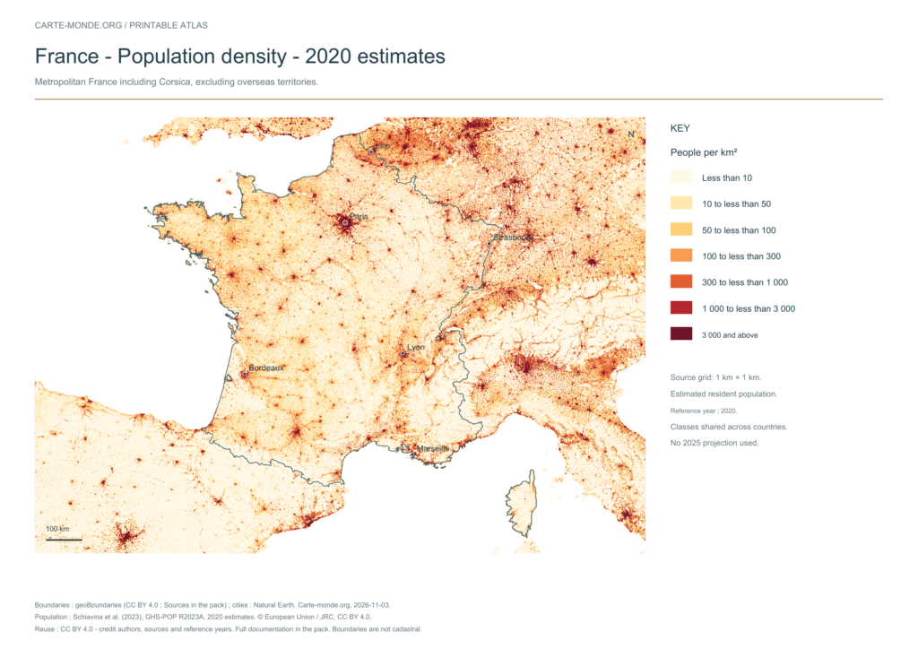
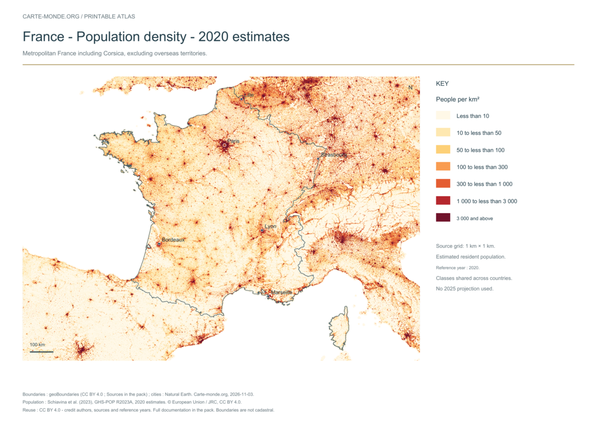
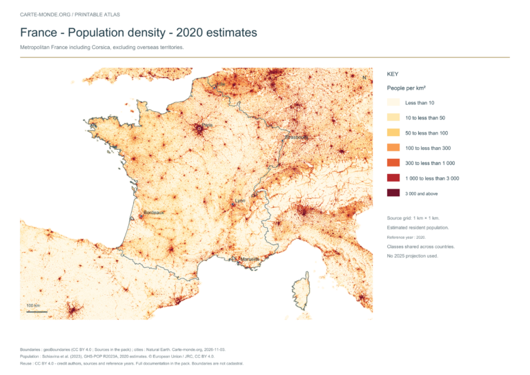
Population density — 2020 estimates
Estimated residential population in 2020, GHS-POP R2023A, 1 km² grid. Values in inhabitants/km². Metropolitan France, including Corsica; overseas territories excluded.
A4 landscape PDF and PNG · Carte-monde.org, November 2026 · CC BY 4.0.
The data represents estimated residential population in 2020, on a 1 km² source grid. The document’s creation date does not change this reference year.
The five in-house maps in one pack
Regions and cities, location in Europe, simplified elevations, 2020 population density and shaded relief: five A4 PDFs, their PNGs and SVGs, with sources and licences.
Download the five maps — ZIPPhysical map and population density
The four labelled maps in one pack
Regions, location in Europe, physical features and density, in PDF, PNG and SVG with sources. The first two October maps are reused unchanged under Licence Ouverte 2.0; the two new maps are under CC BY 4.0.
Download the four labelled maps — ZIP
Boundaries: geoBoundaries, credits and conditions in the pack. Surrounding areas, cities and hydrography: Natural Earth 5.1.1, public domain. Relief: SRTM15+V2.7 via GMT earth_relief_02m, CC BY 4.0. Population: GHS-POP R2023A, 2020 estimates, © European Union/JRC, CC BY 4.0. Retain attribution and dates. The grids are suitable for national overviews, without topographic precision.
Previous edition packs
Original pack: blank base maps and labelled maps
Outlines, boundaries, administrative map and location in Europe: each map is provided in PDF, PNG and editable SVG. The ZIP also includes notes with sources and the license.
Which map should I choose?
Use the administrative map to identify the regions. The location map places the country in its European surroundings. For an exercise without answers, open the blank maps on the companion page.
Additional maps: regions, relief and general map
Three existing IGN maps, reproduced without redrawing, with attribution and a licence link. Their date is 2016 : the poster shows current regional divisions, but these files are not 2026 editions.
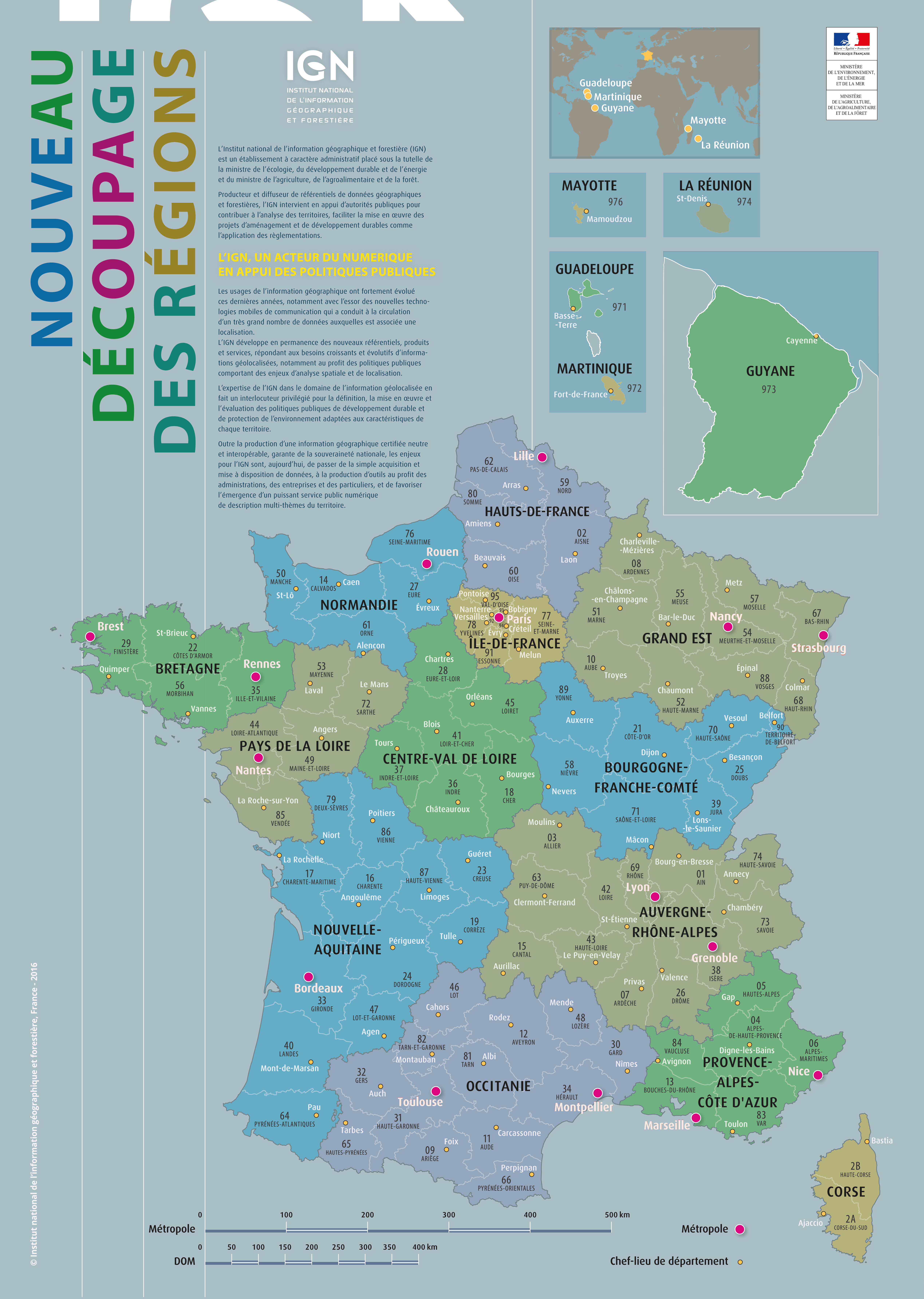
Existing map · IGN 2016
Regions and departments of France
Poster showing regions according to the current divisions, numbered departments and main cities, with overseas departments and regions (DROM) in insets. Grand Est, Hauts-de-France, Nouvelle-Aquitaine and Occitanie are named.
IGN 2016 – Licence Ouverte · Source and reuse terms
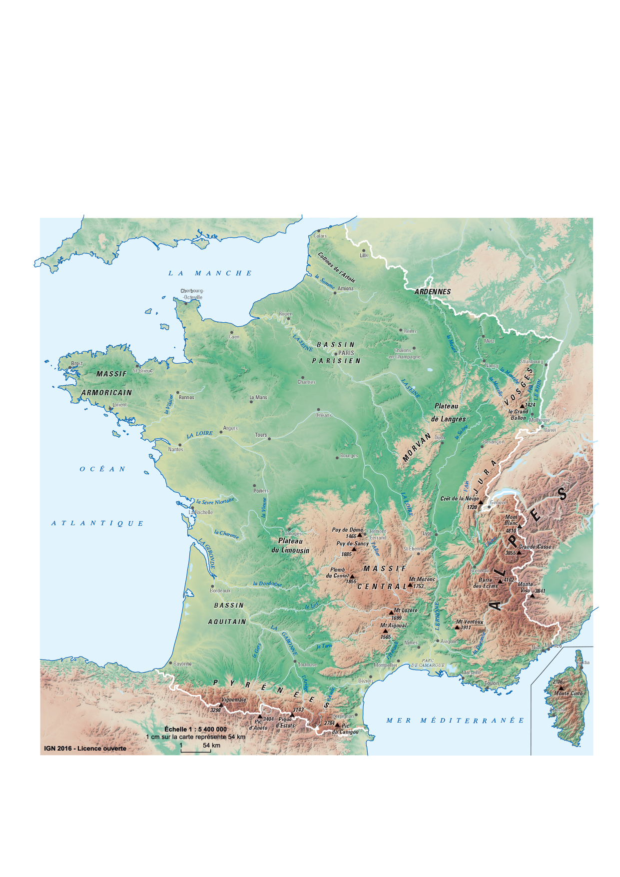
Existing map · IGN 2016
Relief of France
Physical map of France, covering metropolitan France with Corsica in an inset: mountains, basins, rivers and main cities. A document ready to download, without redrawing.
IGN 2016 – Licence Ouverte · Source and reuse terms
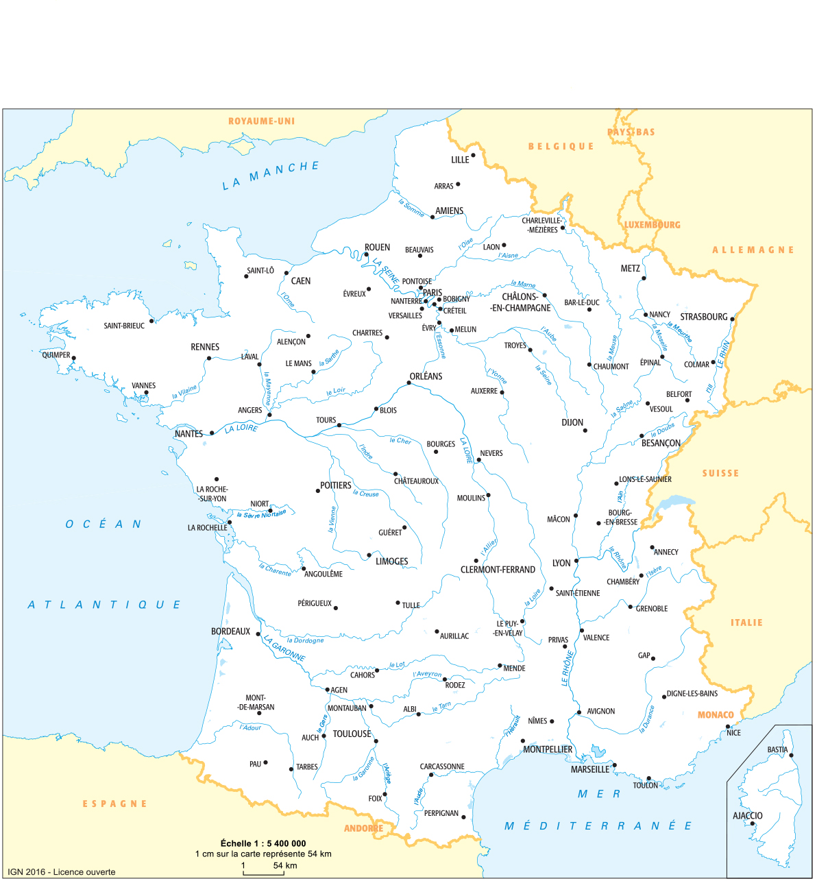
Existing map · IGN 2016
General map of France: cities and rivers
Main rivers, prefectures and neighboring countries to find your bearings in France, in its metropolitan area. This selection focuses on cities and hydrography rather than an older road network.
IGN 2016 – Licence Ouverte · Source and reuse terms
The five old maps in this collection remain available in Archives: maps of France from the original collection. Their images and URLs are preserved.
How do I download and print the map?
- Open the PDF beneath the preview for a sharp printed map. The PNG is suitable for a presentation or document.
- Save the file from your browser, then print using the document’s orientation and “Fit to page” if needed. IGN maps retain their original format.
- To change linework or colors, unzip the pack and open the SVG in a vector editor. Retain the source credit.
The insets have their own extent; the scale of the main map does not apply to them.
Sources and reuse terms
Carte-monde.org series: created by Carte-monde.org, October 2026, based on Natural Earth 5.1.1 (geometries at 1:10 million, public domain data). The French grouping follows the Code officiel géographique 2026, via Etalab, administrative divisions 6.0.0. The outlines are generalised and are unsuitable for cadastral use or legal boundary demarcation.
The new PDF, PNG and SVG files are available under Licence Ouverte 2.0 : copying, adaptation and commercial use permitted with source and date attribution. Example credit: Carte-monde.org, October 2026 edition — Natural Earth 5.1.1; COG 2026 / Etalab. Licence Ouverte 2.0.
IGN maps: existing files, 2016 edition, reused under the open licence stated on the official educational resources page. Credit to retain: IGN 2016 – Licence Ouverte. The original PDF and JPG files have not been redrawn.
Maps in the older collection, available in the archives, retain their own terms; their license is not confirmed here.
Continue exploring
Previous versions: maps and files preserved
These files remain available at their original URLs. For corrected maps, use the main links above. Each edition retains its credits and date.
- france-physique-relief-villes-fleuves-2026-11-03.pdf
- france-physique-relief-villes-fleuves-2026-11-03.png
- france-physique-relief-villes-fleuves-2026-11-03.zip
Raster base map, cities, rivers and lakes: Natural Earth, public domain. Other boundary credits and licences are retained in the pack. Cartographic work CC BY 4.0; ODbL-derived data retains its licence. No topographic accuracy is claimed.
Previous collection — original files preserved
| Downloadable maps of France | |
 |
 |
 |
 |
 |
Original French files
- france-administrative-carte-monde-2026.pdf
- france-administrative-carte-monde-2026.png
- france-situation-carte-monde-2026.pdf
- france-situation-carte-monde-2026.png
- france-cinq-cartes-completes-2026-11-03-v3.zip
- france-densite-atlas-2026-11-03.pdf
- france-densite-atlas-2026-11-03.png
- france-physique-atlas-2026-11-03.pdf
- france-physique-atlas-2026-11-03.png
- france-physique-relief-villes-fleuves-2026-11-03-v3.pdf
- france-physique-relief-villes-fleuves-2026-11-03-v3.png
Previous language edition
- france-densite-en-2026-11-09-1024×724.png
- france-densite-en-2026-11-09-1200×849.png
- france-densite-en-2026-11-09-1536×1086.png
- france-densite-en-2026-11-09-2048×1448.png
- france-densite-en-2026-11-09-300×212.png
- france-densite-en-2026-11-09-768×543.png
- france-densite-en-2026-11-09.pdf
- france-densite-en-2026-11-09.png
- france-pack-main-en-2026-11-09.zip
- france-physique-en-2026-11-09-1024×724.png
- france-physique-en-2026-11-09-1200×849.png
- france-physique-en-2026-11-09-1536×1086.png
- france-physique-en-2026-11-09-2048×1448.png
- france-physique-en-2026-11-09-300×212.png
- france-physique-en-2026-11-09-768×543.png
- france-physique-en-2026-11-09.pdf
- france-physique-en-2026-11-09.png