
North America, Central America, the Caribbean and South America, including Greenland. Hawaii and the part of the Aleutian Islands beyond the 180th meridian are outside the map.
Map labels and downloadable files remain in their original language, often French.
Three maps to explore the continent
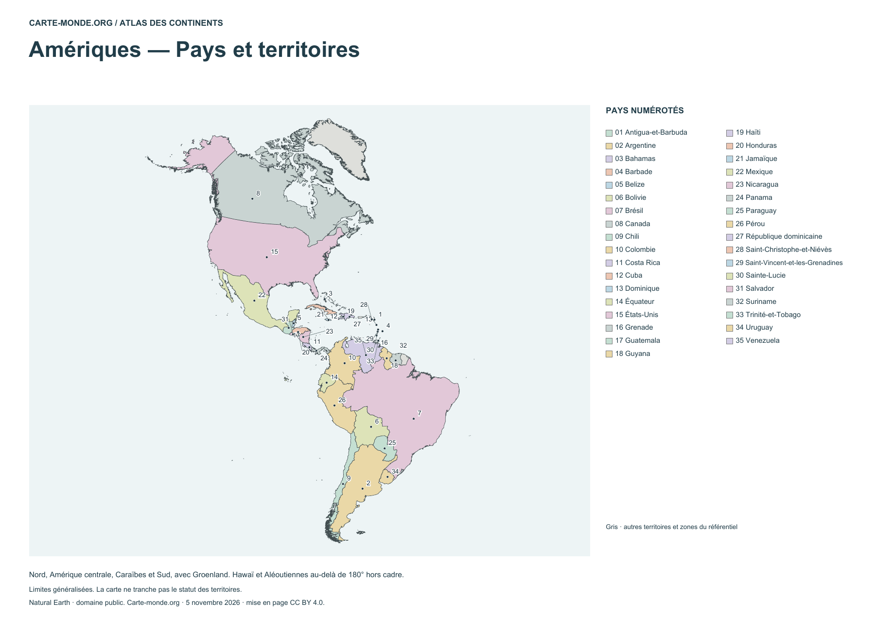
Americas — Countries and territories
Locate countries using the numbered legend. Boundaries are generalized.
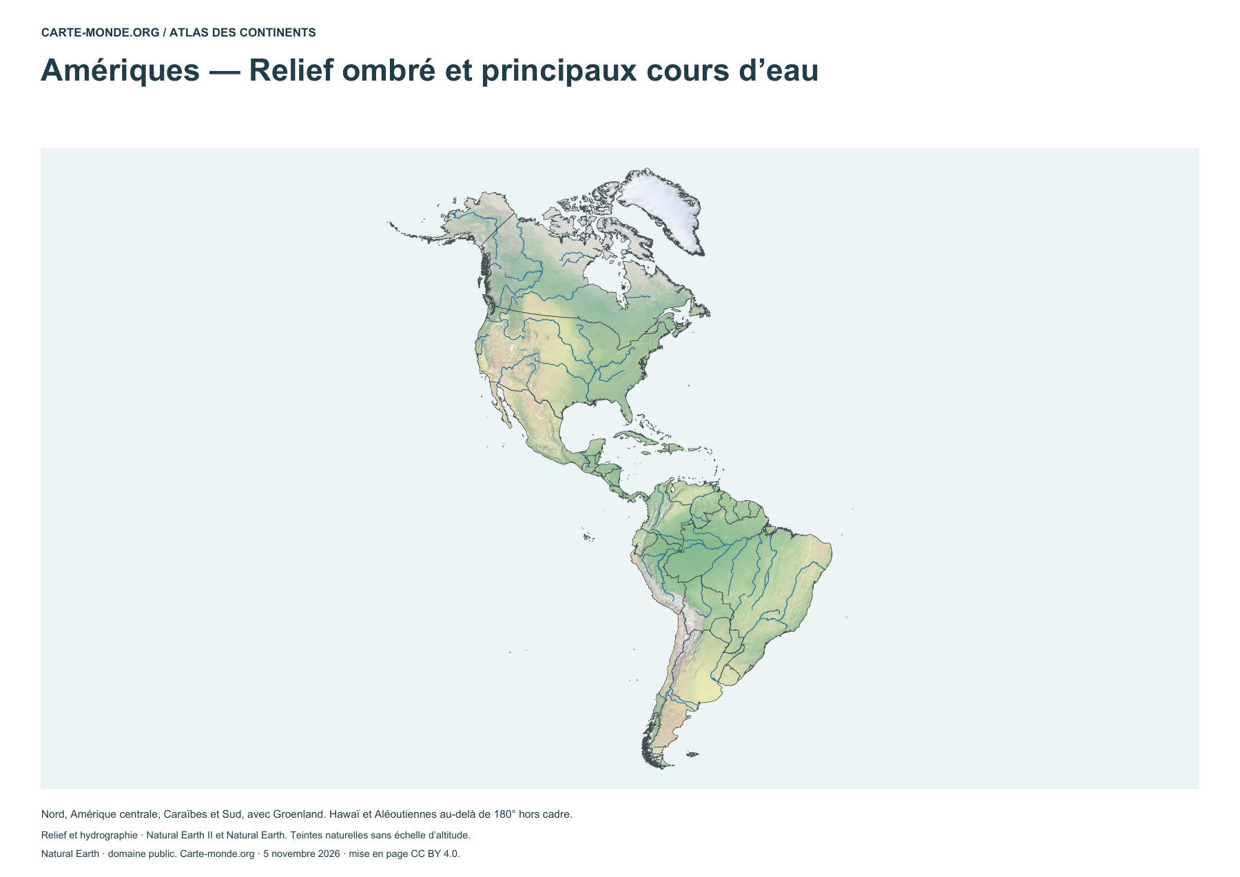
Americas — Shaded relief and main rivers
Identify landforms and main waterways. The natural colours do not form an elevation scale.
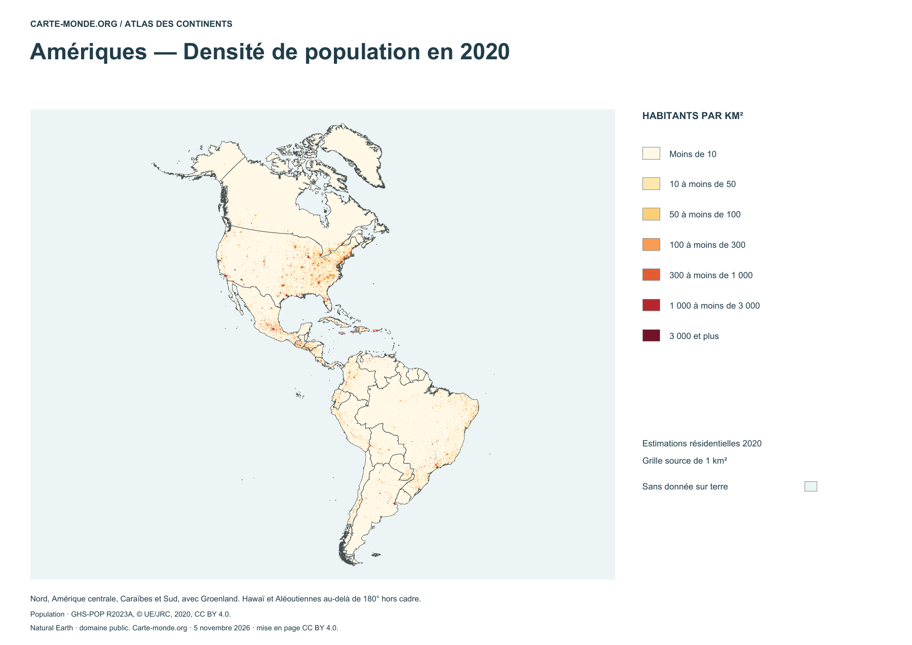
Americas — Population density in 2020
Estimated density in 2020, in inhabitants per square kilometer.
Complete collection
A4 PDF, PNG, SVG and source notes.
Download the ZIP packSources and reuse
Boundaries, relief and hydrography: Natural Earth, public domain. Population: GHS-POP R2023A, © EU/JRC, 2020 estimates, CC BY 4.0. Layout by Carte-monde.org under CC BY 4.0. The generalised lines do not determine the status of disputed areas.
North America and South America
Additional maps to reuse
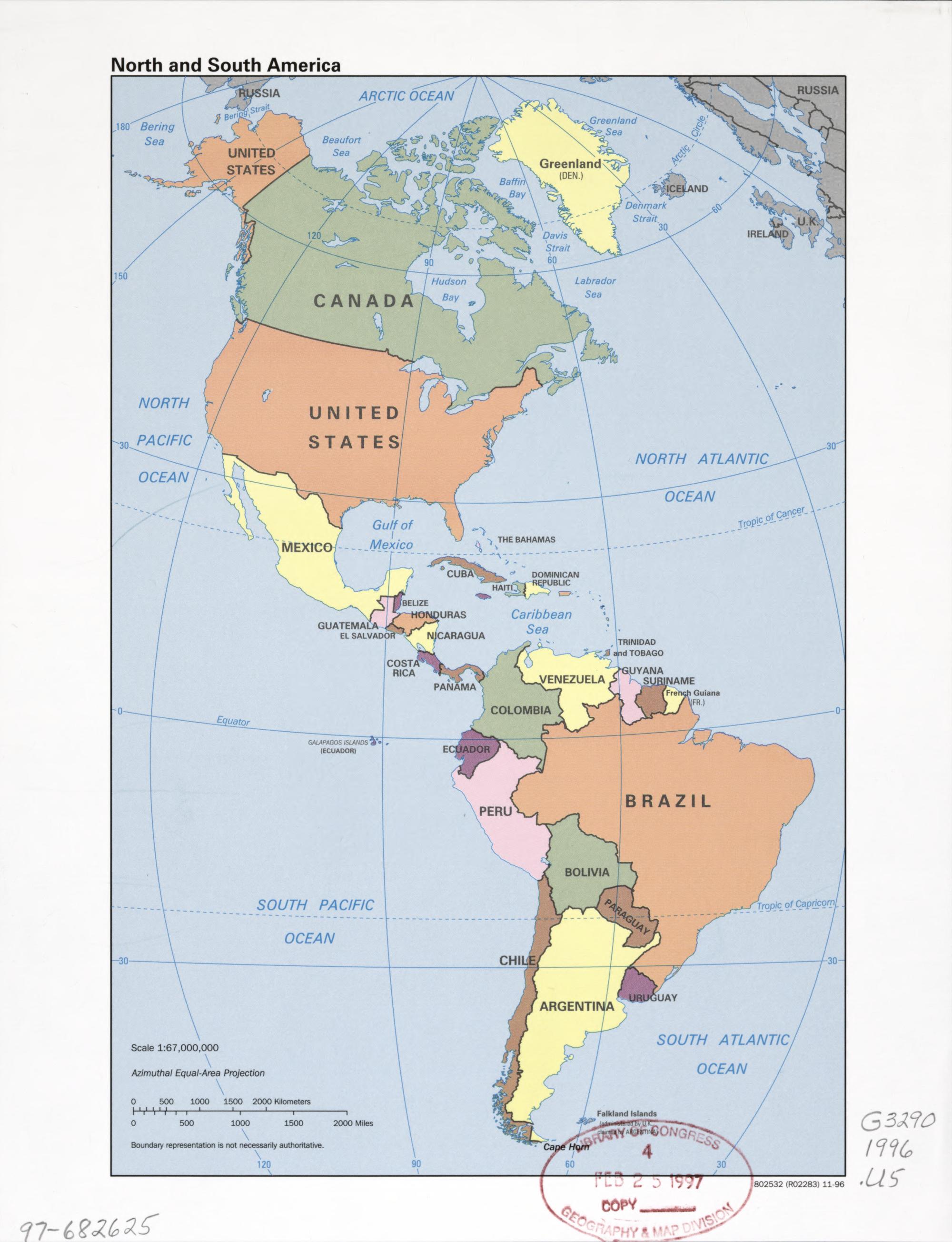
Historical map of the Americas (1996)
CIA reference map published in 1996. Names and boundaries reflect that edition.
Central Intelligence Agency · Library of Congress, Geography and Map Division · Free to reuse according to the Library of Congress.
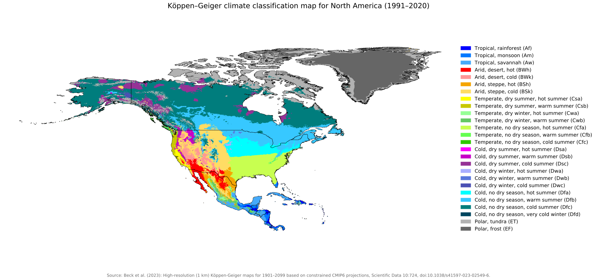
Köppen–Geiger climate zones (1991–2020) · North America
Climate classification by temperature and precipitation, with the original legend in English.
Beck, H. E., McVicar, T. R., Vergopolan, N., Alexis, B., Lutsko, N. J., Dufour, A., Zeng, Z., Jian, X., van Dijk, A. I. J. M. et Miralles, D. G. (2023) · CC BY 4.0.
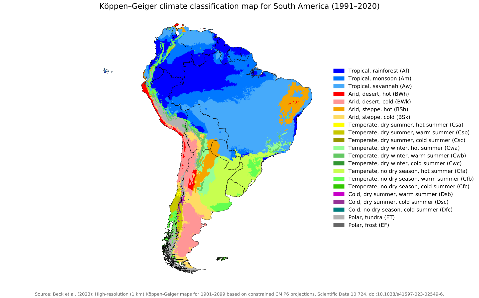
Köppen–Geiger climate zones (1991–2020) · South America
Climate classification by temperature and precipitation, with the original legend in English.
Beck, H. E., McVicar, T. R., Vergopolan, N., Alexis, B., Lutsko, N. J., Dufour, A., Zeng, Z., Jian, X., van Dijk, A. I. J. M. et Miralles, D. G. (2023) · CC BY 4.0.
World Heritage and languages
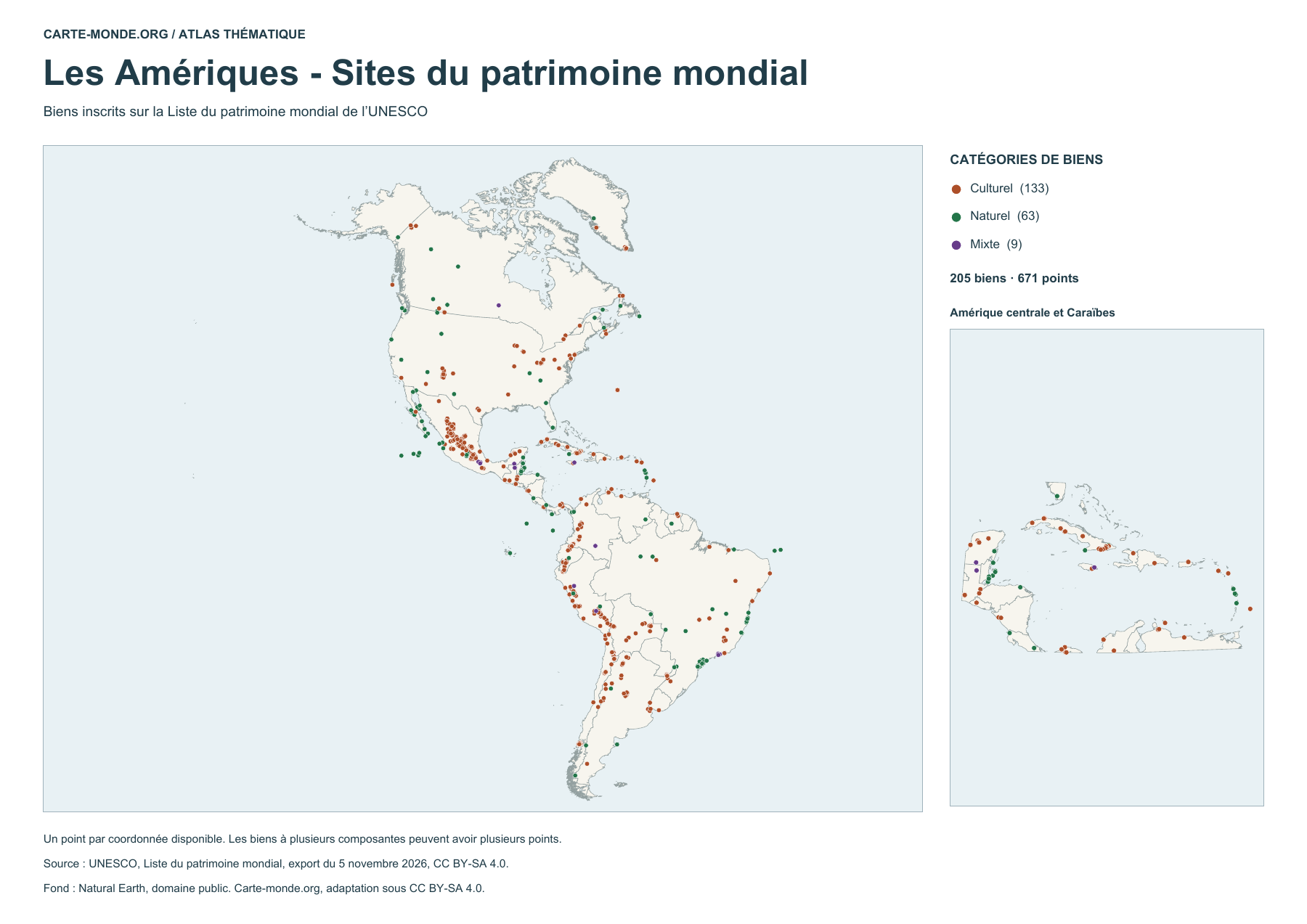
The Americas – World Heritage sites
205 listed properties represented by 671 points. Some properties have several components. The map distinguishes cultural, natural and mixed properties.
UNESCO · World Heritage List, export dated 5 November 2026 · CC BY-SA 4.0. Natural Earth base map, public domain.
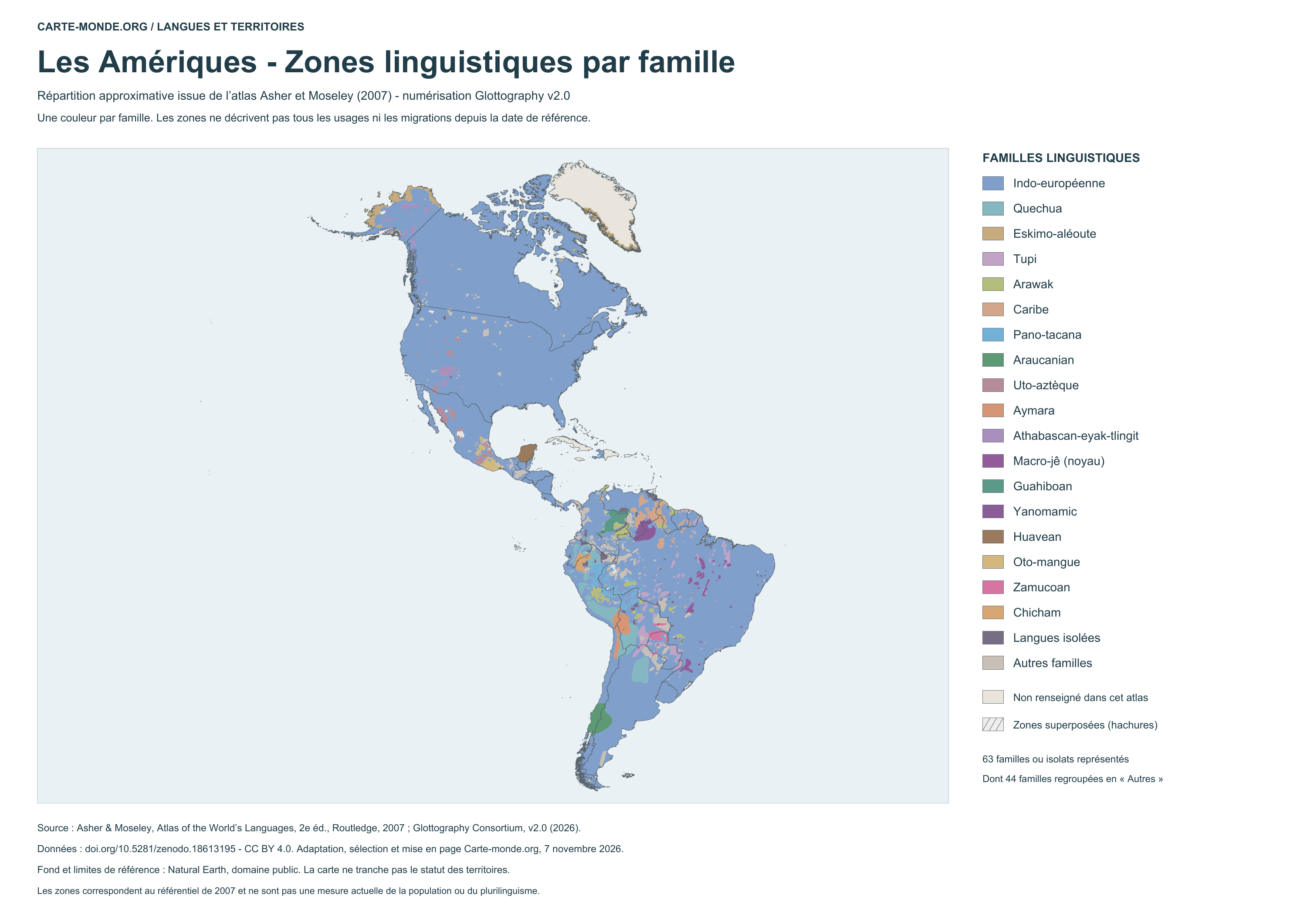
Language areas by family – 2007 atlas
Coloured areas show the approximate distribution of language families. Hatching indicates overlaps in the source; the neutral background marks areas without information. This map does not represent conditions measured in 2026.
Glottography v2.0, based on Asher and Moseley, 2007 atlas · CC BY 4.0. Adaptation by Carte-monde.org.
See also the language location map with points
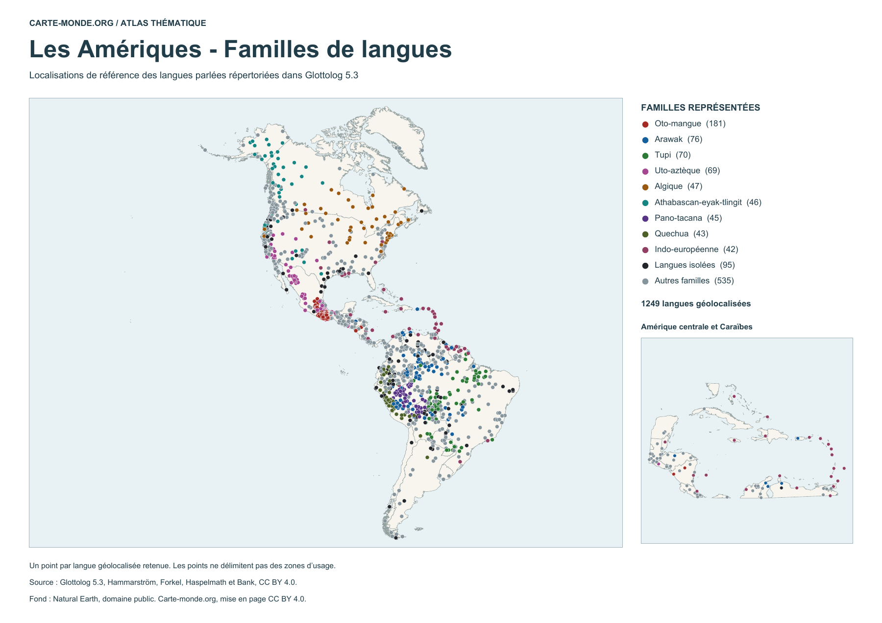
Language locations by family (points)
1249 geolocated spoken languages, classified by family or identified as isolates. Each point indicates a reference location. The number of points does not measure the number of speakers.
Glottolog 5.3 · Hammarström, Forkel, Haspelmath and Bank · CC BY 4.0. Natural Earth base map, public domain.


