
FRANCE · HISTORICAL COLLECTION
Find the old regional blank maps and labelled maps from the original collection: regions, departments, relief and general maps. Their files, credits and URLs remain accessible. Historical maps are distinguished from current selections.
Map labels and downloadable files remain in their original language, often French.
Maps to use as historical documents
The regional boundaries are old. The overseas insets also reflect the author’s earlier selection: they do not represent the 18 current regions.
The original files and credits embedded in the images, including © Daniel Dalet, are preserved. The licence for the site’s recent creations does not apply to these older files.
Four blank maps with the old regional divisions

Older collection · file archived in 2016
Older blank map of France with regions
Historical document: old regional divisions.
Open the original file
Older collection · file archived in 2016
Another regional blank map from the historical collection
Historical document: old regional divisions.
Open the original file
Older collection · file archived in 2016
Historical blank map of France with regions and cities
Historical document: old regional divisions.
Open the original file
Older collection · file archived in 2016
Historical blank map of France with regions and overseas territories
Historical document: old regional divisions.
Open the original fileLabelled maps from the original collection
These five images appeared on the France maps page. The administrative maps show the former regional divisions; the other files remain available for comparison. The licence for each older file still needs to be documented.

Older collection · file archived in 2016
French regions before 2016
Historical document: old regional divisions.
Open the original file
Older collection · file archived in 2016
Regions and departments before 2016
Historical document: old regional divisions.
Open the original file
Older collection · file archived in 2016
Relief of France
File from the original collection. Check the reference points before use.
Open the original file
Older collection · file archived in 2016
General map of France
File from the original collection. Check the reference points before use.
Open the original file
Older collection · file archived in 2016
Historical regions of France
Historical document: old regional divisions.
Open the original fileBack to current blank maps
Find ink-saving outlines and versions with the 13 metropolitan regions or the 18 regions including overseas departments and regions.
Other files in the collection
The old flags associated with the three pilot countries are also preserved: Flag: France · Flag: Germany · Flag: Spain. Their reuse conditions remain specific to each file.
Germany: historical maps
These maps remain accessible at their original URLs. Their archive date does not guarantee that the content is up to date; each file’s credits and licences are preserved.
Maps from the original collection
These earlier files are retained for their variants, terrain or exercises. Their archiving date does not guarantee that the content is up to date. Their origin and license still need checking: the new series’ license does not apply to these older files.

Older collection · file archived in 2016
Germany — general map
File from the original collection. Check the reference points before use.
Open the original file
Older collection · file archived in 2016
Germany — political map
File from the original collection. Check the reference points before use.
Open the original file
Older collection · file archived in 2016
Another map of Germany
File from the original collection. Check the reference points before use.
Open the original fileAdministrative map and October 2026 pack
First Carte-monde.org version, before cities were added: Natural Earth 5.1.1, Licence Ouverte 2.0.
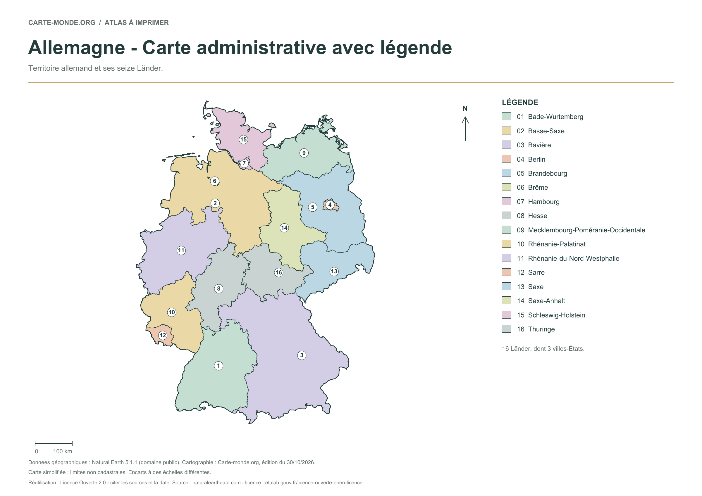
Old administrative PDF · Older administrative PNG · October 2026 pack: outlines, boundaries, administrative and location maps
Spain — older maps
These maps remain accessible at their original URLs. Their archive date does not guarantee that the content is up to date; each file’s credits and licences are preserved.
Maps from the original collection
These earlier files are retained for their variants, terrain or exercises. Their archiving date does not guarantee that the content is up to date. Their origin and license still need checking: the new series’ license does not apply to these older files.
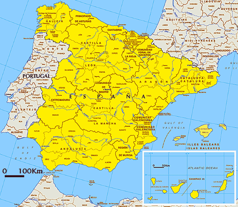
Older collection · file archived in 2016
Spain: general map
File from the original collection. Check the reference points before use.
Open the original file
Older collection · file archived in 2016
Spain — political map
File from the original collection. Check the reference points before use.
Open the original file
Older collection · file archived in 2016
Relief of Spain
File from the original collection. Check the reference points before use.
Open the original fileAdministrative map and October 2026 pack
First Carte-monde.org version, before cities were added: Natural Earth 5.1.1, Licence Ouverte 2.0.
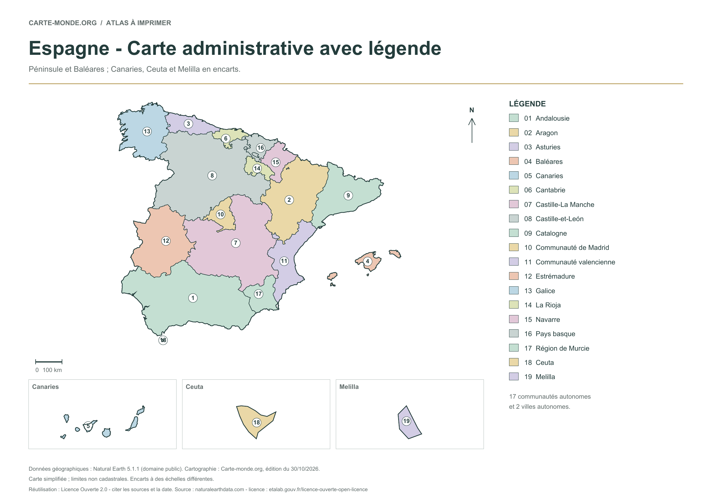
Old administrative PDF · Older administrative PNG · October 2026 pack: outlines, boundaries, administrative and location maps
Austria — older maps
Original collection retained at its old URLs. The dates and rights of these older files still need checking; statements in the historical text do not constitute current validation of their licenses.
Austria: six blank maps to print – outlines, boundaries, full-page maps and neighbouring countries, in A4 PDF and PNG.

| Downloadable maps | |
 |
 |
 |
Italy: historical maps
Original collection retained at its old URLs. The dates and rights of these older files still need checking; statements in the historical text do not constitute current validation of their licenses.
Italy: six blank maps to print – outlines, boundaries, full-page maps and neighbouring countries, in A4 PDF and PNG.

| Italy: downloadable maps | |
 |
 |
 |
 |
Poland: historical maps
Original collection retained at its old URLs. The dates and rights of these older files still need checking; statements in the historical text do not constitute current validation of their licenses.
Poland: six printable blank maps – outlines, boundaries, full-page maps and neighbouring countries, in A4 PDF and PNG.

| Online maps of Poland | |
 |
 |
 |
Older maps of Portugal
Original collection retained at its old URLs. The dates and rights of these older files still need checking; statements in the historical text do not constitute current validation of their licenses.
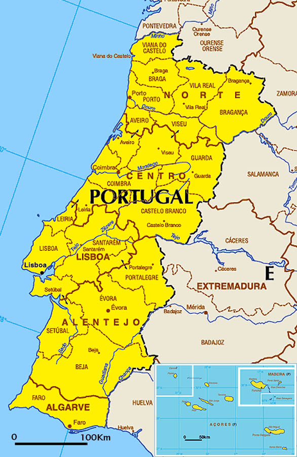
Portugal: six printable blank maps – outlines, boundaries, full-page maps and neighbouring countries, in A4 PDF and PNG.

| Portugal — online maps | |
 |
 |
 |
Czech Republic — older maps
Original collection retained at its old URLs. The dates and rights of these older files still need checking; statements in the historical text do not constitute current validation of their licenses.
Czech Republic: six printable blank maps – outlines, boundaries, full-page maps and neighbouring countries, in A4 PDF and PNG.

| Czech Republic — maps | |
 |
 |
 |
Belgium — older maps
Original collection retained at its old URLs. The dates and rights of these older files still need checking; statements in the historical text do not constitute current validation of their licenses.
Belgium: six blank maps to print – outlines, boundaries, full-page maps and neighbouring countries, in A4 PDF and PNG.

| Downloadable maps | |
 |
 |
Switzerland: historical maps
Original collection retained at its old URLs. The dates and rights of these older files still need checking; statements in the historical text do not constitute current validation of their licenses.
Switzerland: six printable blank maps – outlines, boundaries, full-page maps and neighbouring countries, in A4 PDF and PNG.

| Online maps of Switzerland | |
 |
 |
 |
Sweden — older maps
Original collection retained at its old URLs. The dates and rights of these older files still need checking; statements in the historical text do not constitute current validation of their licenses.
Sweden: six printable blank maps – outlines, boundaries, full-page maps and neighbouring countries, in A4 PDF and PNG.

| Online maps of Sweden | |
 |
 |
 |
Romania — older maps
Original collection retained at its old URLs. The dates and rights of these older files still need checking; statements in the historical text do not constitute current validation of their licenses.
Romania: six printable blank maps – outlines, boundaries, full-page maps and neighbouring countries, in A4 PDF and PNG.

| Romania: online maps | |
 |
 |
 |
Older maps of Bulgaria
Original collection retained at its old URLs. The dates and rights of these older files still need checking; statements in the historical text do not constitute current validation of their licenses.
Bulgaria: six printable blank maps – outlines, boundaries, full-page maps and neighbouring countries, in A4 PDF and PNG.

| Bulgaria — online maps | |
 |
 |
 |
Croatia: historical maps
Original collection retained at its old URLs. The dates and rights of these older files still need checking; statements in the historical text do not constitute current validation of their licenses.
Croatia: six blank maps to print – outlines, boundaries, full-page maps and neighbouring countries, in A4 PDF and PNG.

| Croatia: downloadable maps | |
 |
 |
Slovakia: historical maps
Original collection retained at its old URLs. The dates and rights of these older files still need checking; statements in the historical text do not constitute current validation of their licenses.
Slovakia: six printable blank maps – outlines, boundaries, full-page maps and neighbouring countries, in A4 PDF and PNG.

| Slovakia: online maps | |
 |
 |
 |
Older maps of Greece
Original collection retained at its old URLs. The dates and rights of these older files still need checking; statements in the historical text do not constitute current validation of their licenses.
Greece: six blank maps to print – outlines, boundaries, full-page maps and neighbouring countries, in A4 PDF and PNG.

| Greece — downloadable maps | |
 |
 |
Estonia: historical maps
Original collection retained at its old URLs. The dates and rights of these older files still need checking; statements in the historical text do not constitute current validation of their licenses.
Estonia: six blank maps to print – outlines, boundaries, full-page maps and neighbouring countries, in A4 PDF and PNG.

| Estonia: downloadable maps | |
 |
 |
 |
Older maps of Lithuania
Original collection retained at its old URLs. The dates and rights of these older files still need checking; statements in the historical text do not constitute current validation of their licenses.
Lithuania: six printable blank maps – outlines, boundaries, full-page maps and neighbouring countries, in A4 PDF and PNG.

| Online maps of Lithuania | |
 |
 |
 |
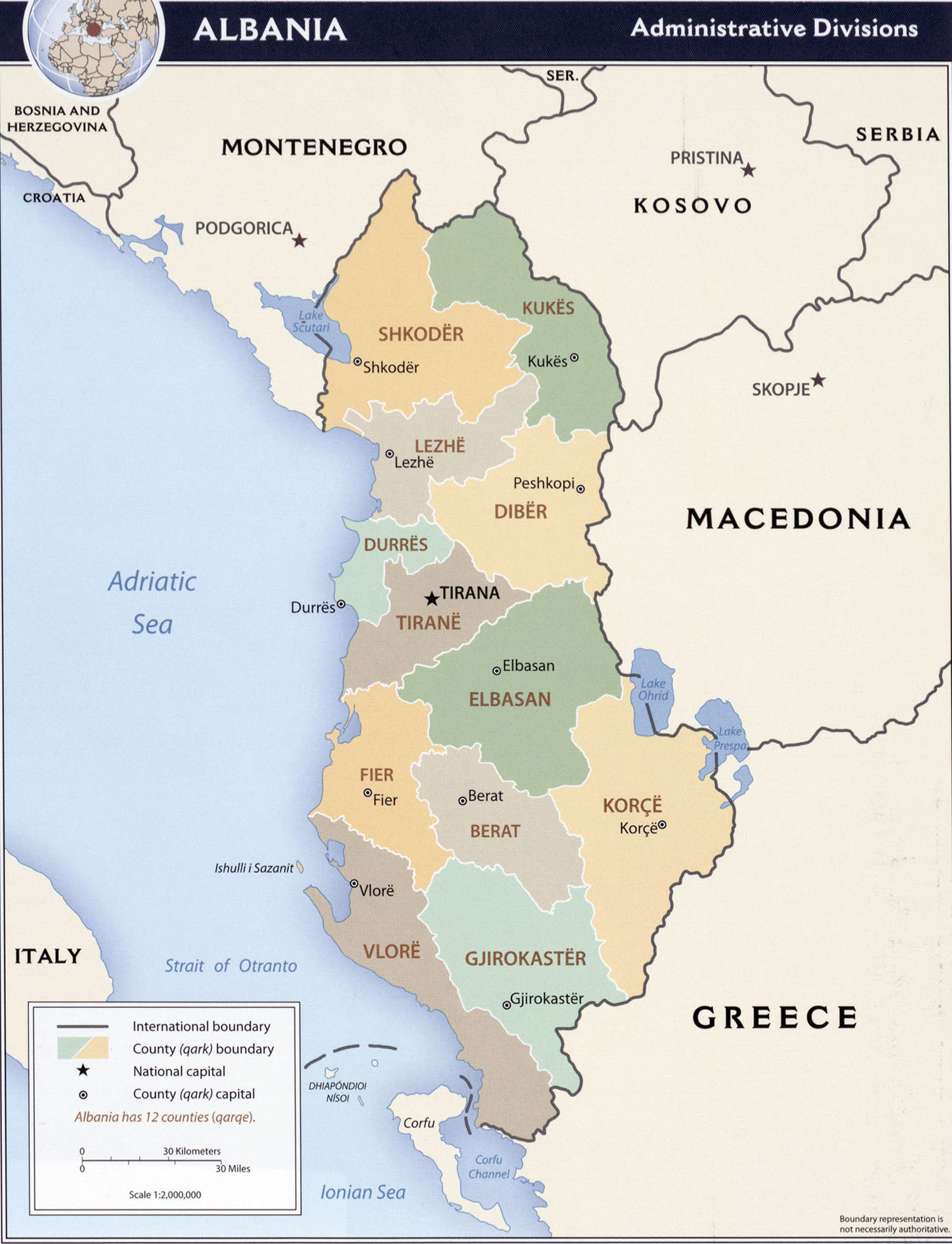
Albania — older maps
Original collection retained at its old URLs. The dates and rights of these older files still need checking; statements in the historical text do not constitute current validation of their licenses.
Downloads: six printable blank maps of Albania — outlines, boundaries, full-page and neighboring countries, in A4 PDF and PNG.
| Albania: online maps | |
 |
 |
 |
Belarus: historical maps
Original collection retained at its old URLs. The dates and rights of these older files still need checking; statements in the historical text do not constitute current validation of their licenses.
Belarus: six printable blank maps – outlines, boundaries, full-page maps and neighbouring countries, in A4 PDF and PNG.

| Belarus — online maps | |
 |
 |
Bosnia and Herzegovina — older maps
Original collection retained at its old URLs. The dates and rights of these older files still need checking; statements in the historical text do not constitute current validation of their licenses.
Bosnia and Herzegovina: six printable blank maps – outlines, boundaries, full-page maps and neighbouring countries, in A4 PDF and PNG.

| Bosnia and Herzegovina: online maps | |
 |
 |
Older maps of Cyprus
Original collection retained at its old URLs. The dates and rights of these older files still need checking; statements in the historical text do not constitute current validation of their licenses.
Cyprus: six blank maps to print – outlines, boundaries, full-page maps and neighbouring countries, in A4 PDF and PNG.

| Online maps of Cyprus | |
 |
 |
 |
Older maps of Denmark
Original collection retained at its old URLs. The dates and rights of these older files still need checking; statements in the historical text do not constitute current validation of their licenses.
Denmark: six blank maps to print – outlines, boundaries, full-page maps and neighbouring countries, in A4 PDF and PNG.

| Downloadable maps of Denmark | |
 |
 |
 |
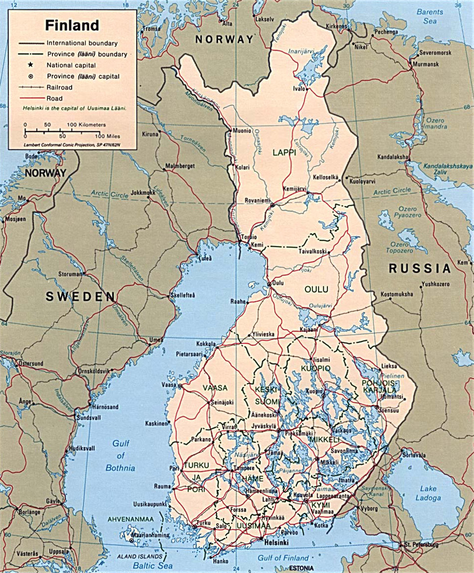
Finland: historical maps
Original collection retained at its old URLs. The dates and rights of these older files still need checking; statements in the historical text do not constitute current validation of their licenses.
Finland: six printable blank maps – outlines, boundaries, full-page maps and neighbouring countries, in A4 PDF and PNG.

| Finland — online maps | |
 |
 |
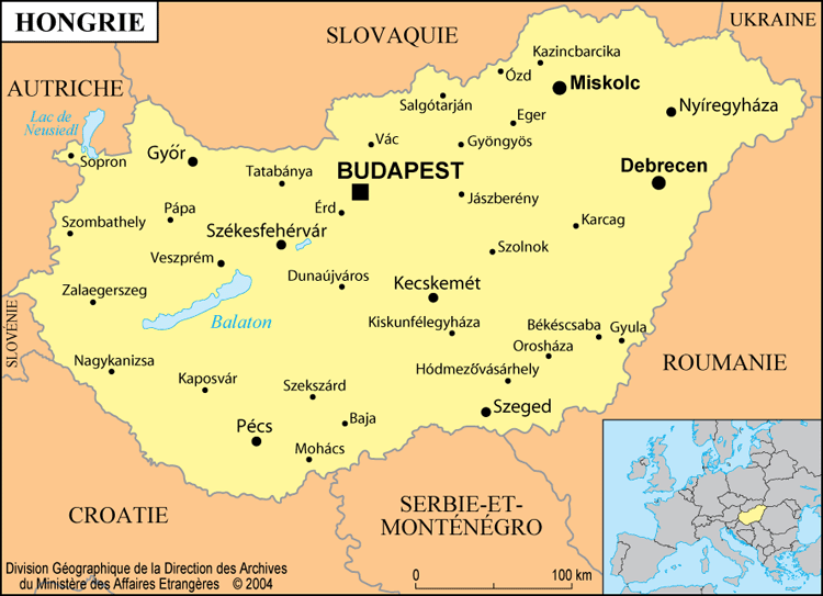
Hungary: historical maps
Original collection retained at its old URLs. The dates and rights of these older files still need checking; statements in the historical text do not constitute current validation of their licenses.
Hungary: six blank maps to print – outlines, boundaries, full-page maps and neighbouring countries, in A4 PDF and PNG.

| Hungary: downloadable maps | |
 |
 |
 |
Ireland: historical maps
Original collection retained at its old URLs. The dates and rights of these older files still need checking; statements in the historical text do not constitute current validation of their licenses.
Ireland: six printable blank maps – outlines, boundaries, full-page maps and neighbouring countries, in A4 PDF and PNG.

| Ireland — downloadable maps | |
 |
 |
Iceland — older maps
Original collection retained at its old URLs. The dates and rights of these older files still need checking; statements in the historical text do not constitute current validation of their licenses.
Iceland: six blank maps to print – outlines, boundaries, full-page maps and neighbouring countries, in A4 PDF and PNG.

| Iceland: online maps | |
 |
 |
Latvia — older maps
Original collection retained at its old URLs. The dates and rights of these older files still need checking; statements in the historical text do not constitute current validation of their licenses.
Latvia: six printable blank maps – outlines, boundaries, full-page maps and neighbouring countries, in A4 PDF and PNG.

| Maps of Latvia | |
 |
 |
 |
Liechtenstein — older maps
Original collection retained at its old URLs. The dates and rights of these older files still need checking; statements in the historical text do not constitute current validation of their licenses.
Liechtenstein: six printable blank maps – outlines, boundaries, full-page maps and neighbouring countries, in A4 PDF and PNG.

| Liechtenstein: online maps | |
 |
 |
Older maps of Luxembourg
Original collection retained at its old URLs. The dates and rights of these older files still need checking; statements in the historical text do not constitute current validation of their licenses.
Luxembourg: six printable blank maps – outlines, boundaries, full-page maps and neighbouring countries, in A4 PDF and PNG.

| Luxembourg: online maps | |
 |
|
North Macedonia: historical maps
Original collection retained at its old URLs. The dates and rights of these older files still need checking; statements in the historical text do not constitute current validation of their licenses.
North Macedonia: six printable blank maps – outlines, boundaries, full-page maps and neighbouring countries, in A4 PDF and PNG.

| Online maps of Macedonia | |
 |
 |
 |
Older maps of Malta
Original collection retained at its old URLs. The dates and rights of these older files still need checking; statements in the historical text do not constitute current validation of their licenses.
Malta: six blank maps to print – outlines, boundaries, full-page maps and neighbouring countries, in A4 PDF and PNG.

| Malta: online maps | |
 |
 |
 |
Older maps of Moldova
Original collection retained at its old URLs. The dates and rights of these older files still need checking; statements in the historical text do not constitute current validation of their licenses.
Moldova: six blank maps to print – outlines, boundaries, full-page maps and neighbouring countries, in A4 PDF and PNG.

| Moldova: online maps | |
 |
 |
 |
Monaco — older maps
Original collection retained at its old URLs. The dates and rights of these older files still need checking; statements in the historical text do not constitute current validation of their licenses.
Monaco: six printable blank maps – outlines, boundaries, full-page maps and neighbouring countries, in A4 PDF and PNG.

| Monaco: online maps | |
 |
 |
Montenegro — older maps
Original collection retained at its old URLs. The dates and rights of these older files still need checking; statements in the historical text do not constitute current validation of their licenses.
Montenegro: six blank maps to print – outlines, boundaries, full-page maps and neighbouring countries, in A4 PDF and PNG.

| Montenegro — online maps | |
 |
 |
 |
Norway: historical maps
Original collection retained at its old URLs. The dates and rights of these older files still need checking; statements in the historical text do not constitute current validation of their licenses.
Norway: six blank maps to print – outlines, boundaries, full-page maps and neighbouring countries, in A4 PDF and PNG.

| Norway — online maps | |
 |
|
 |
 |
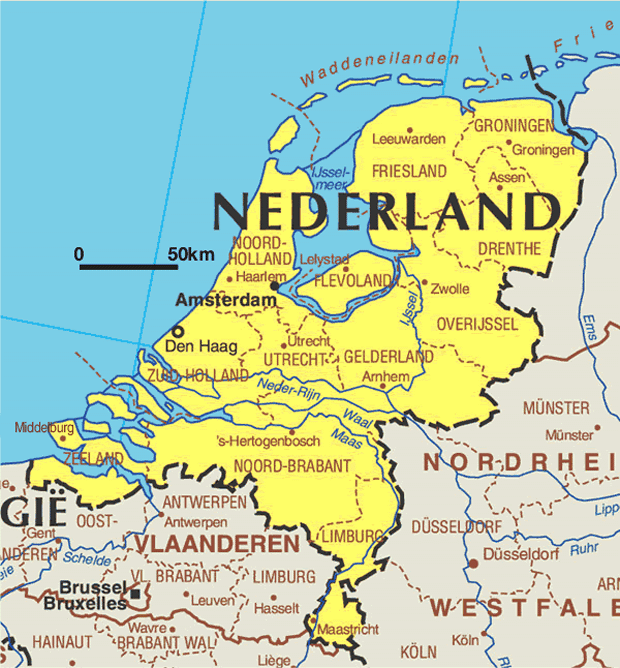
Older maps of the Netherlands
Original collection retained at its old URLs. The dates and rights of these older files still need checking; statements in the historical text do not constitute current validation of their licenses.
Netherlands: six blank maps to print – outlines, boundaries, full-page maps and neighbouring countries, in A4 PDF and PNG.

 |
 |
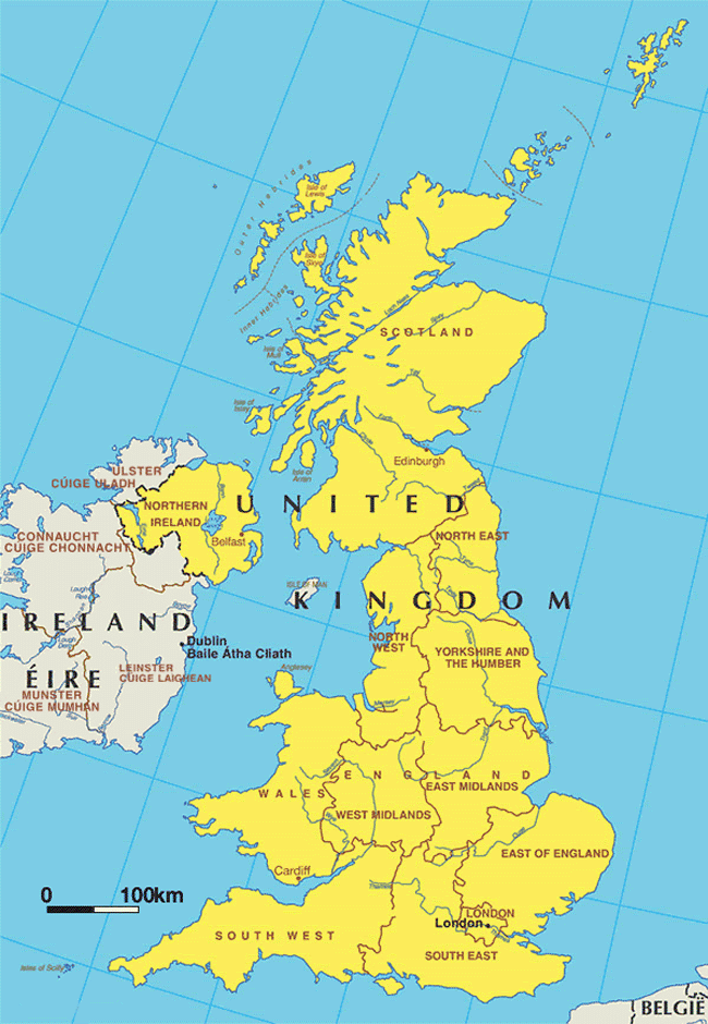
United Kingdom: historical maps
Original collection retained at its old URLs. The dates and rights of these older files still need checking; statements in the historical text do not constitute current validation of their licenses.
United Kingdom: six printable blank maps – outlines, boundaries, full-page maps and neighbouring countries, in A4 PDF and PNG.

| United Kingdom: online maps | |
 |
 |
 |
Russia: historical maps
Original collection retained at its old URLs. The dates and rights of these older files still need checking; statements in the historical text do not constitute current validation of their licenses.
Russia: six printable blank maps – outlines, boundaries, full-page maps and neighbouring countries, in A4 PDF and PNG.

| Russia — online maps | |
 |
 |
 |
 |
Older maps of San Marino
Original collection retained at its old URLs. The dates and rights of these older files still need checking; statements in the historical text do not constitute current validation of their licenses.
San Marino: six blank maps to print – outlines, boundaries, full-page maps and neighbouring countries, in A4 PDF and PNG.

| Online maps of San Marino | |
 |
 |
Serbia: historical maps
Original collection retained at its old URLs. The dates and rights of these older files still need checking; statements in the historical text do not constitute current validation of their licenses.
Serbia: six printable blank maps – outlines, boundaries, full-page maps and neighbouring countries, in A4 PDF and PNG.

| Serbia: online maps | |
 |
 |
 |
Slovenia: historical maps
Original collection retained at its old URLs. The dates and rights of these older files still need checking; statements in the historical text do not constitute current validation of their licenses.
Slovenia: six printable blank maps – outlines, boundaries, full-page maps and neighbouring countries, in A4 PDF and PNG.

| Online maps of Slovenia | |
 |
 |
 |
Older maps of Turkey
Original collection retained at its old URLs. The dates and rights of these older files still need checking; statements in the historical text do not constitute current validation of their licenses.
Turkey: six printable blank maps – outlines, boundaries, full-page maps and neighbouring countries, in A4 PDF and PNG.

| Online maps of Turkey | |
 |
 |
 |
Ukraine — older maps
Original collection retained at its old URLs. The dates and rights of these older files still need checking; statements in the historical text do not constitute current validation of their licenses.
Ukraine: six printable blank maps – outlines, boundaries, full-page maps and neighbouring countries, in A4 PDF and PNG.

| Online maps of Ukraine | |
 |
 |
 |
 |


