
SPAIN · PRINTABLE MAPS
Five printable maps of Spain: regions and cities, location in Europe, two views of the relief and population. PDFs, images and sources are available below.
Our five maps have English labels. Maps from other publishers retain their original language.
Regions, cities and location in Europe
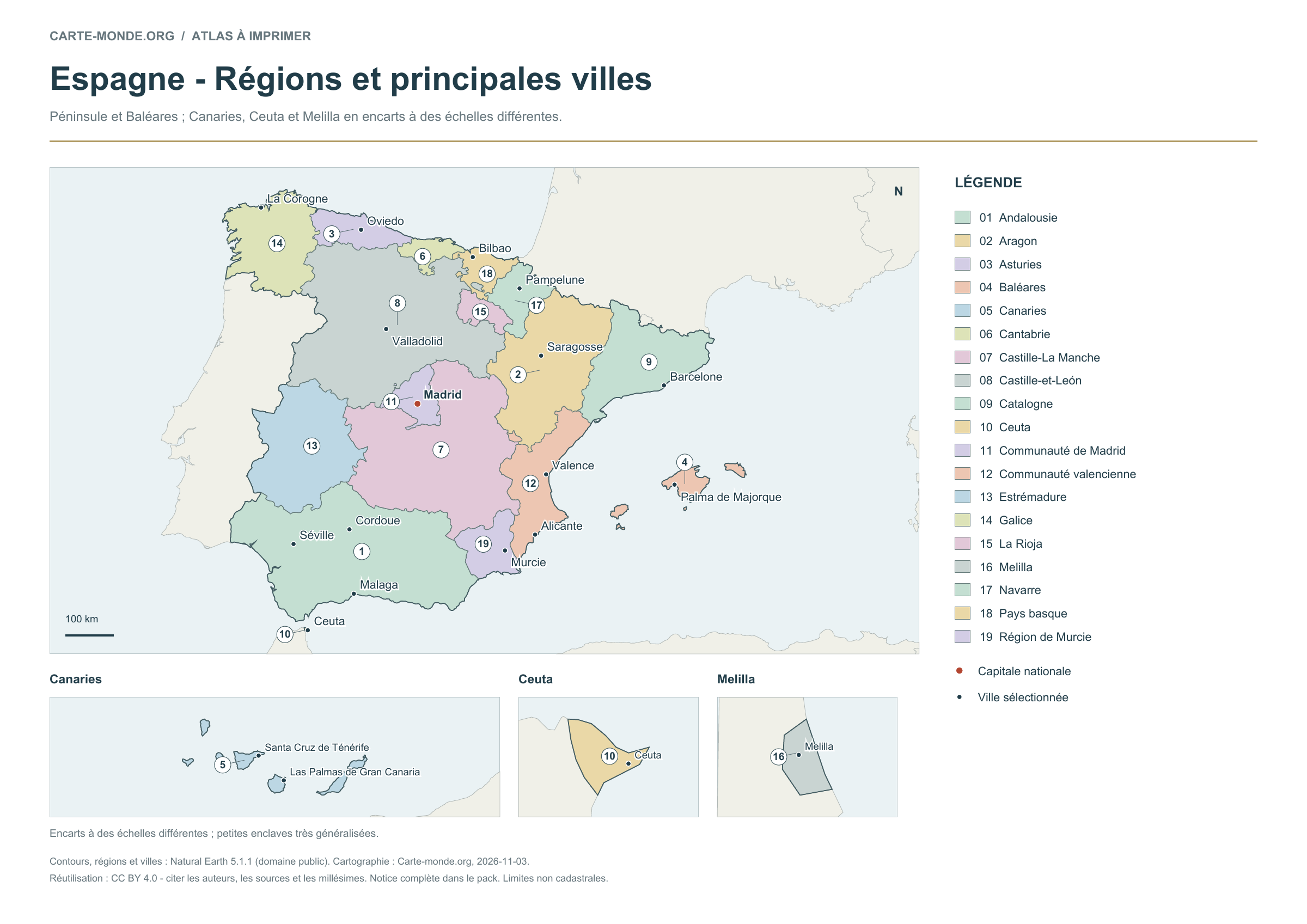
Mainland and Balearic Islands; Canary Islands, Ceuta and Melilla in insets at different scales.
Carte-monde.org · November 2026
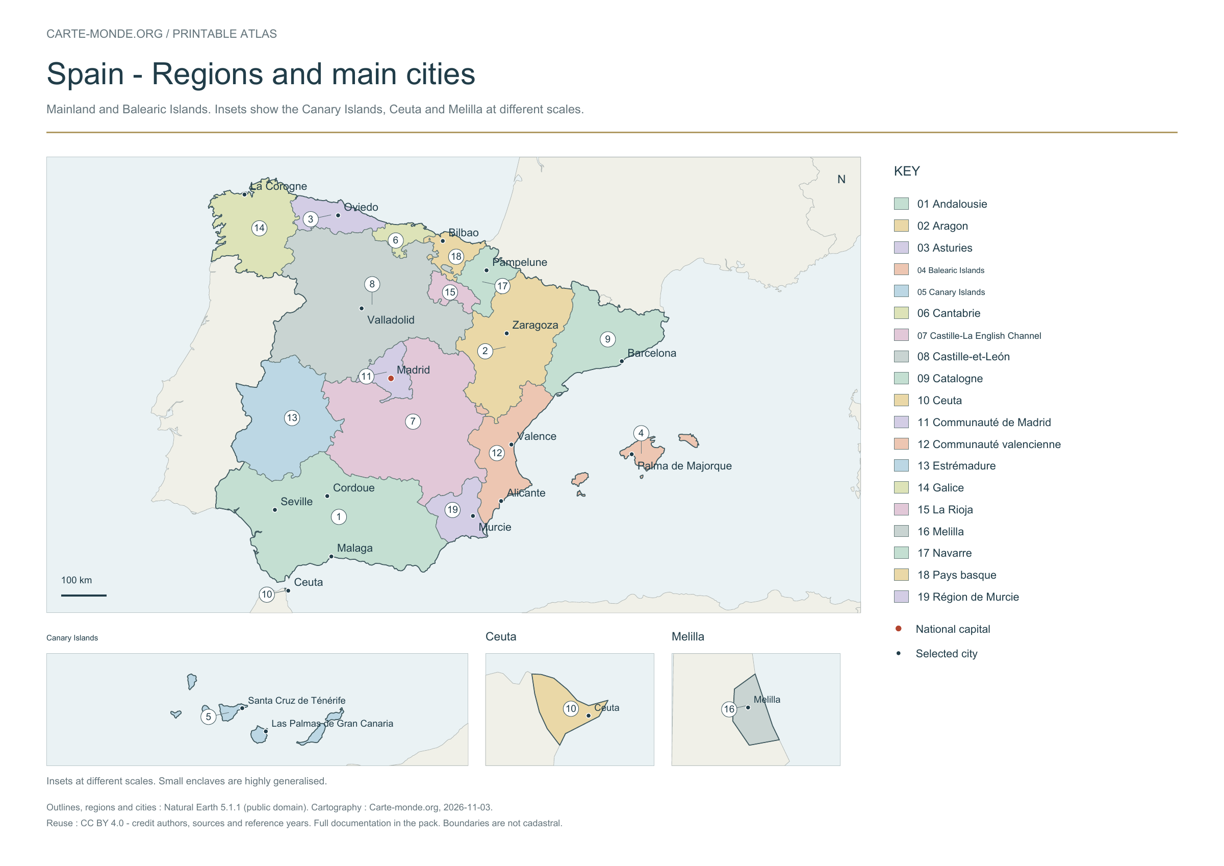
Regions and main cities
The 19 autonomous communities and cities are identified by numbers and a legend. The map adds 19 cities selected for their importance and distribution across the country, with the capital in colour.
A4 landscape PDF · PNG 2 400 px · CC BY 4.0
Carte-monde.org · October 2026, reused
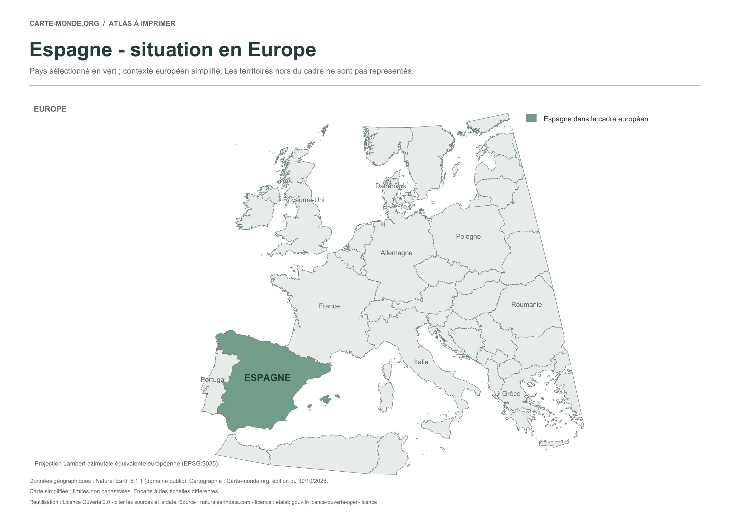
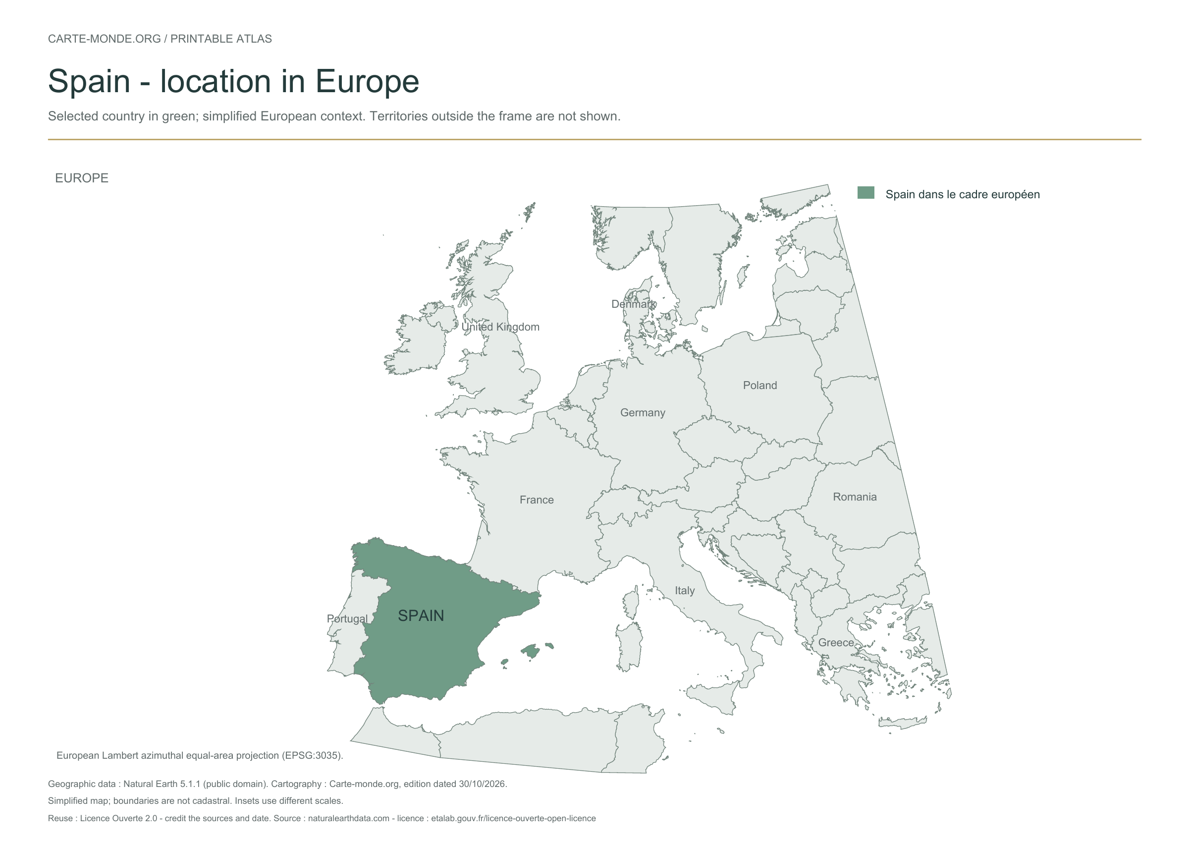
Location in Europe
The previously published location map is retained unchanged: the country is highlighted in a simplified European map extent. Territories outside the frame are not shown.
A4 landscape PDF · PNG 2 400 px · Licence Ouverte 2.0
Two maps to understand the relief
Choose shaded relief for an overview, or elevation classes for school use.
Carte-monde.org · November 2026
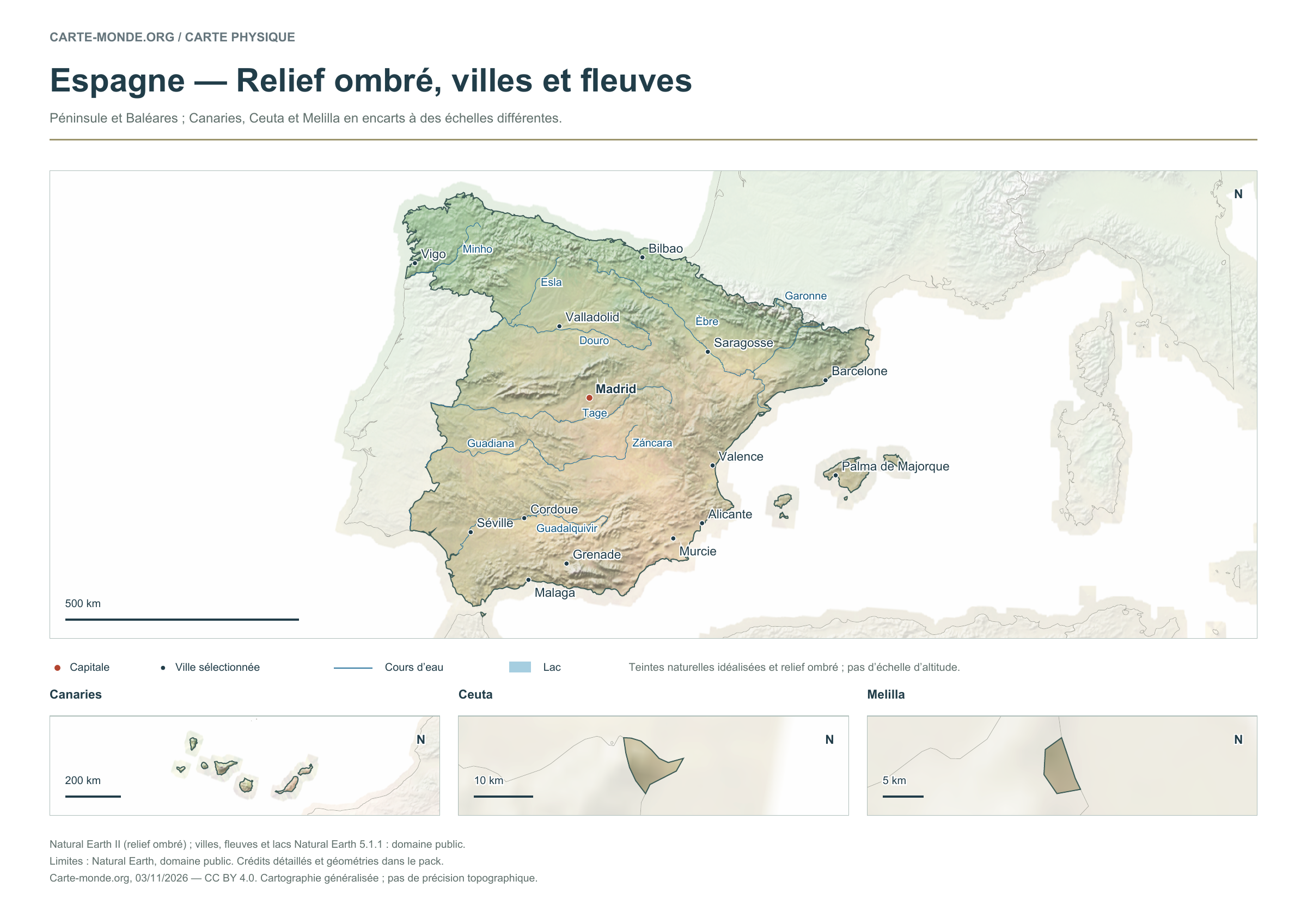
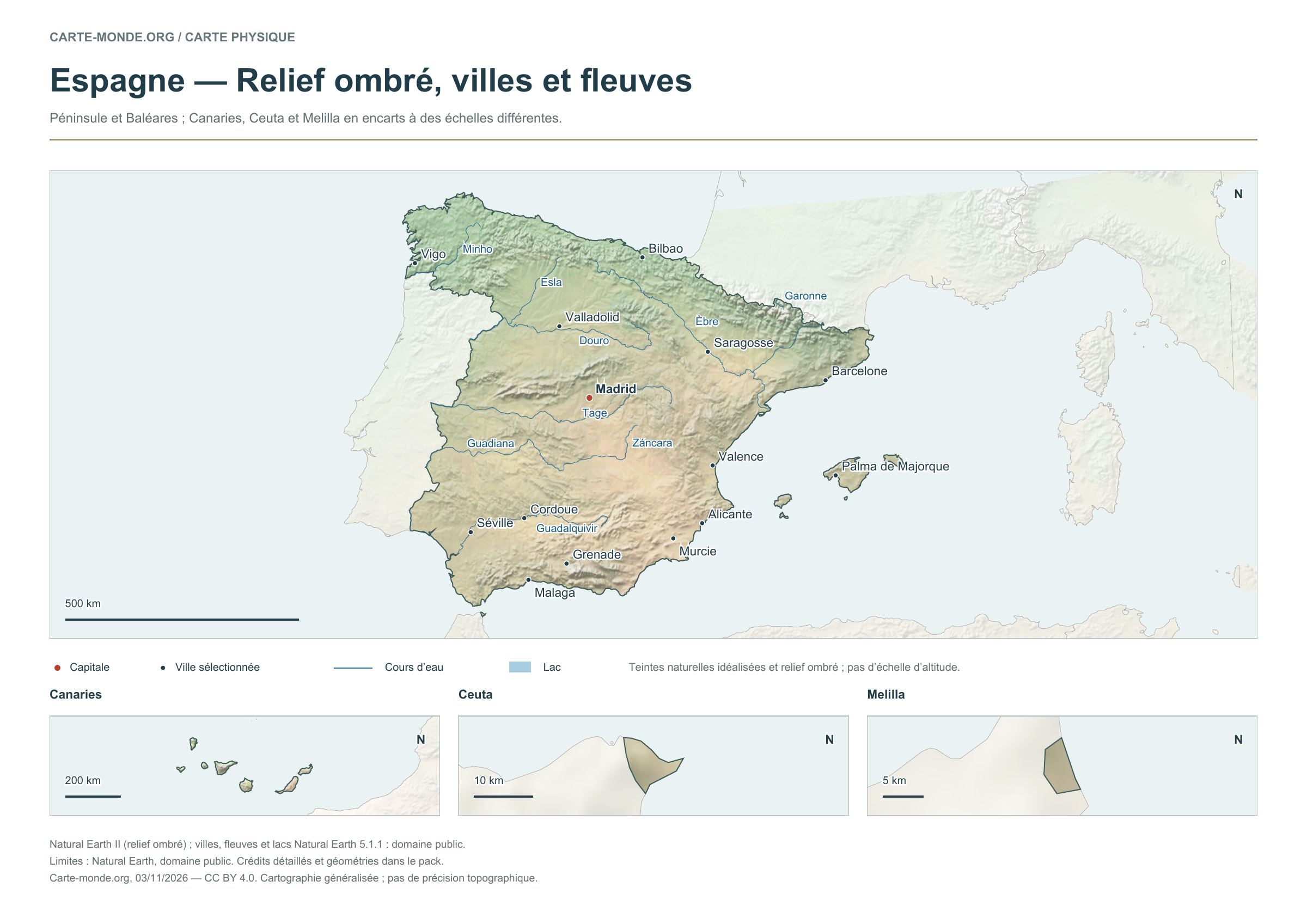
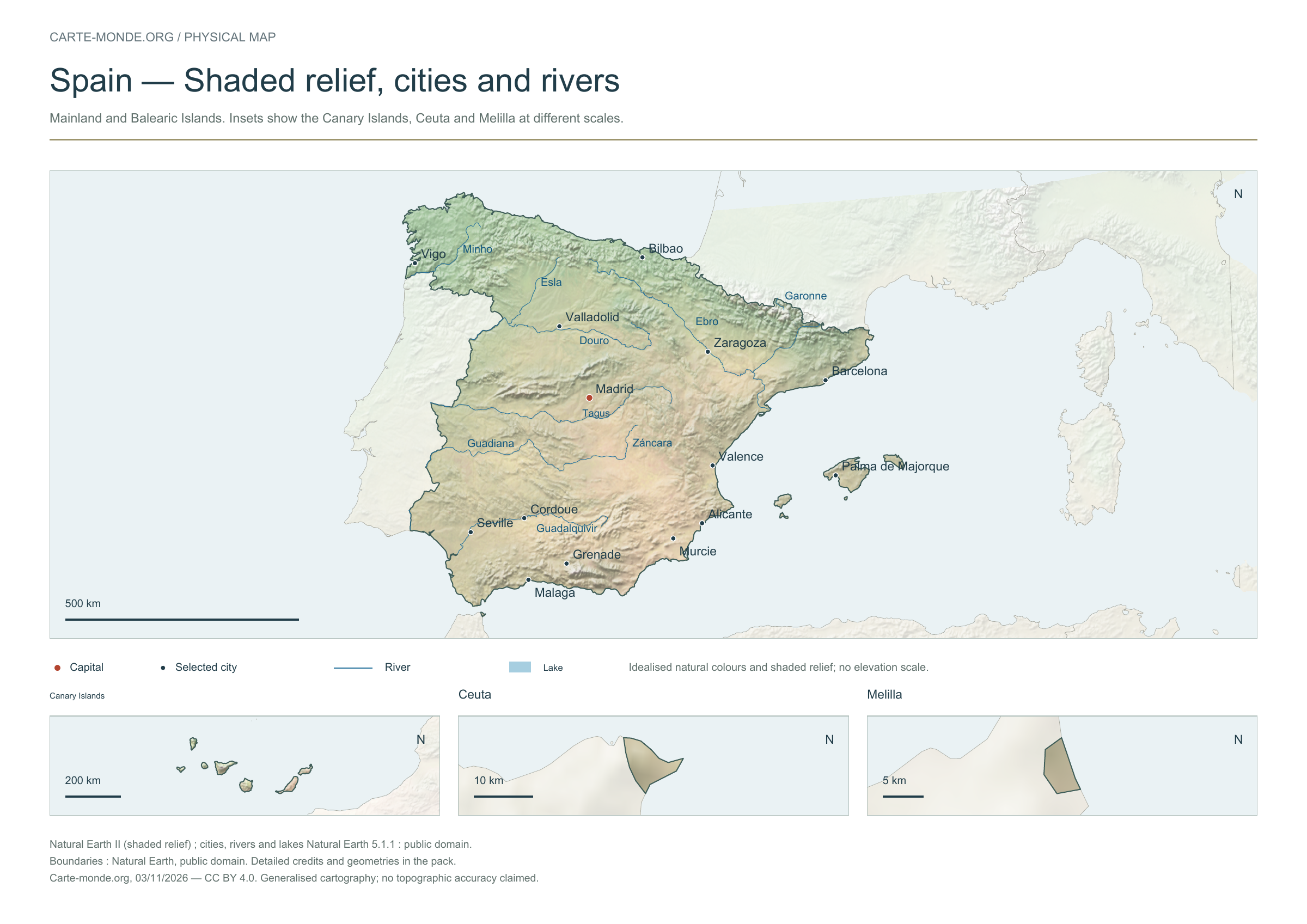
Shaded relief, cities and rivers
To identify major landforms, cities and the river network. The natural colours are not an elevation scale.
Raster base map, cities, rivers and lakes: Natural Earth, public domain. Other boundary credits and licences are retained in the pack. Cartographic work CC BY 4.0; ODbL-derived data retains its licence. No topographic accuracy is claimed.
Territory, data and selection of names
Mainland and Balearic Islands; Canary Islands, Ceuta and Melilla in insets at different scales.
Natural Earth II shaded relief background, 14 selected cities. Named waterways: Douro, Esla, Garonne, Guadalquivir, Guadiana, Minho, Tage, Záncara, Èbre.
The colours represent idealised natural cover; they do not correspond to elevation classes. This global background remains generalised, particularly for small states.
Carte-monde.org · November 2026
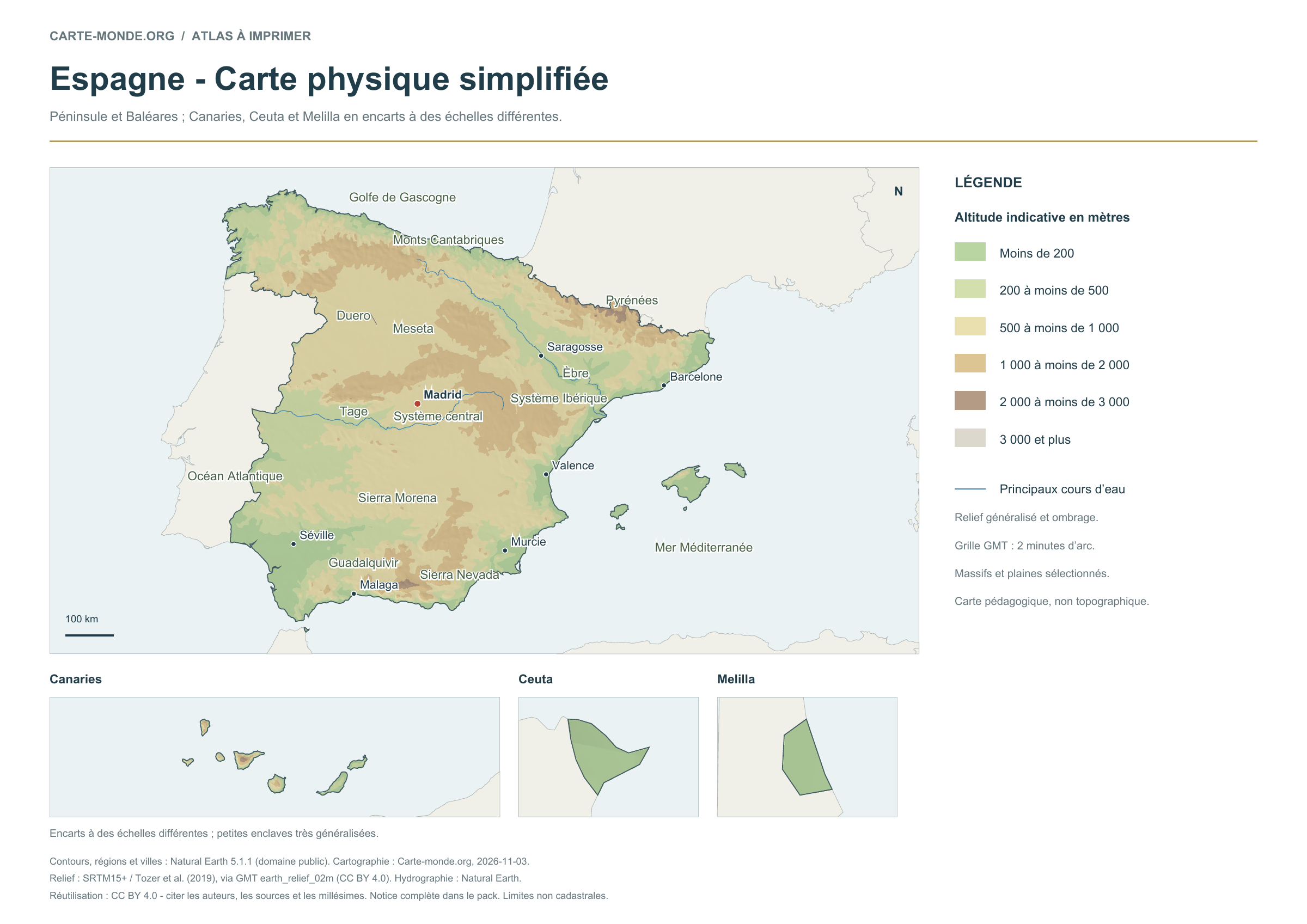
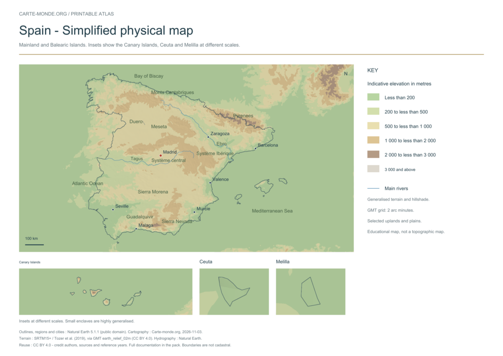
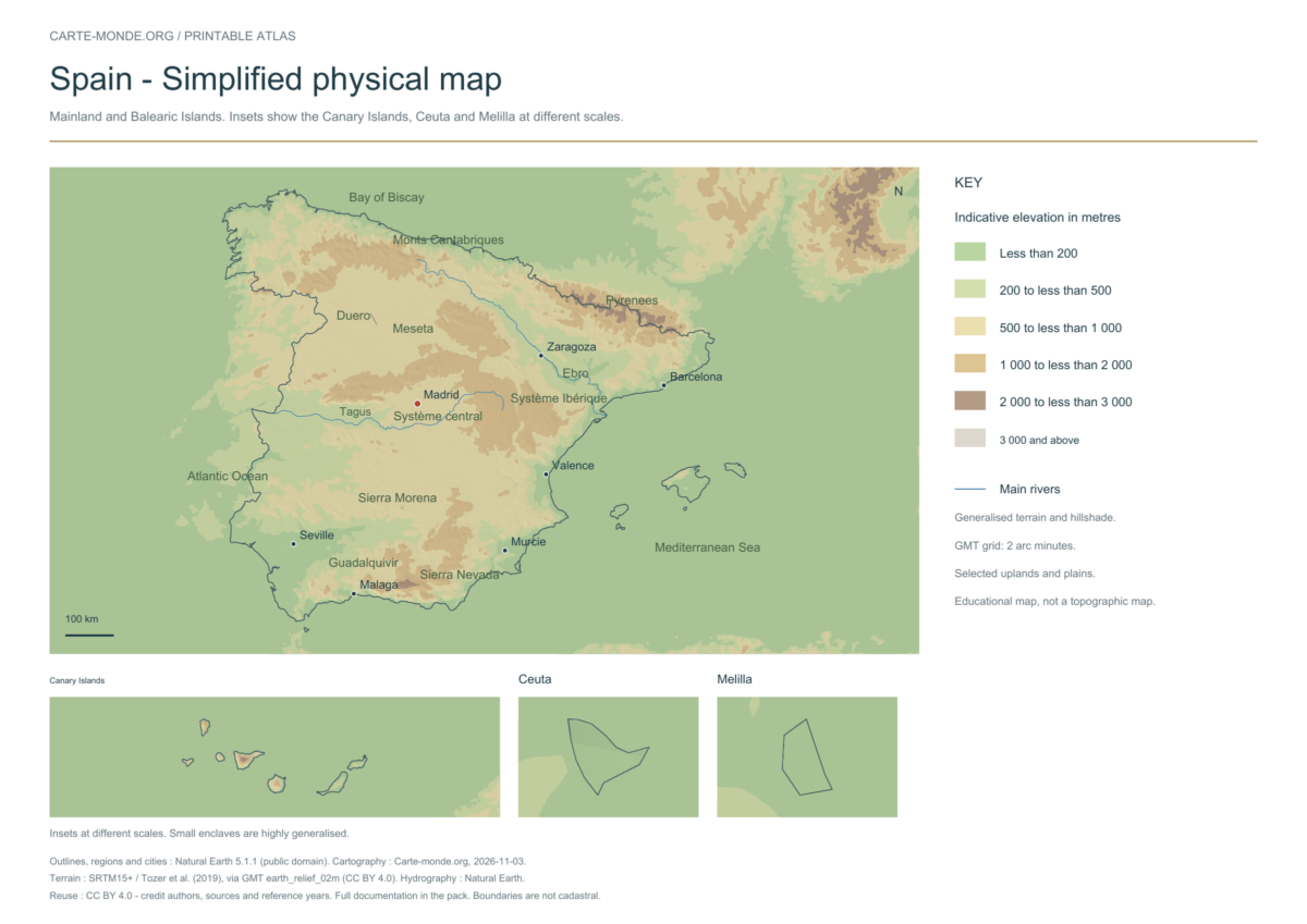
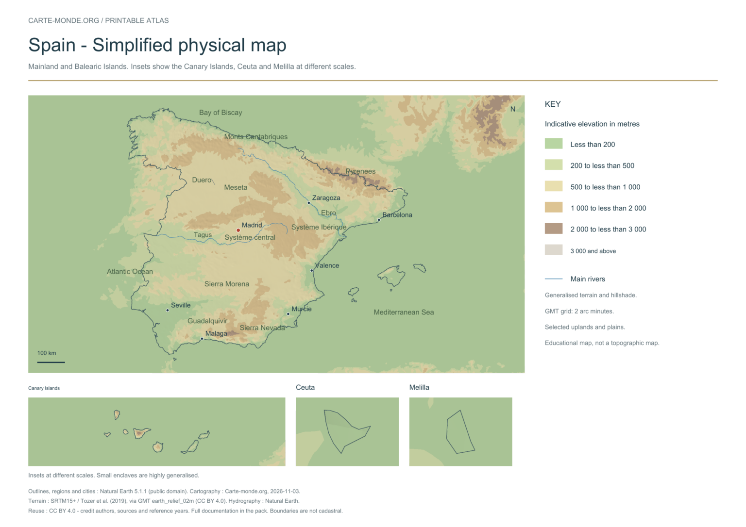
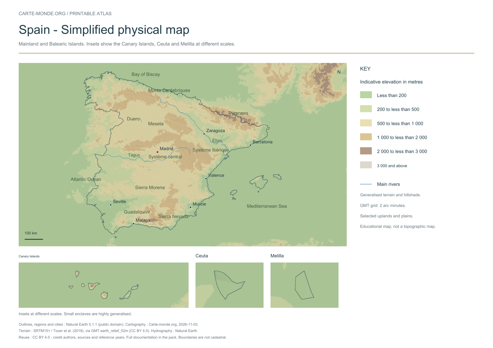
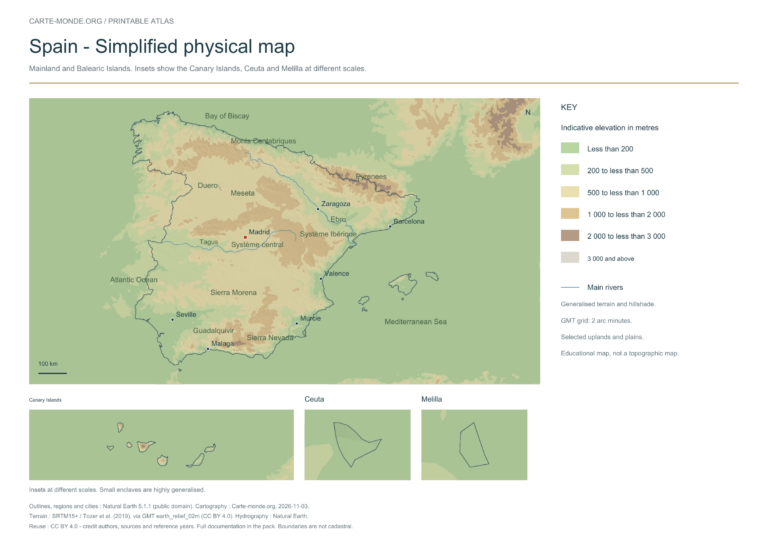
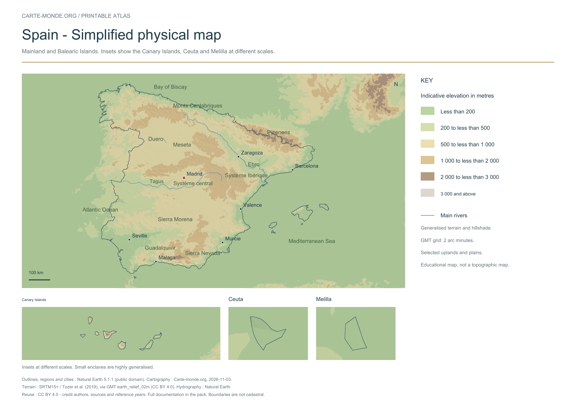
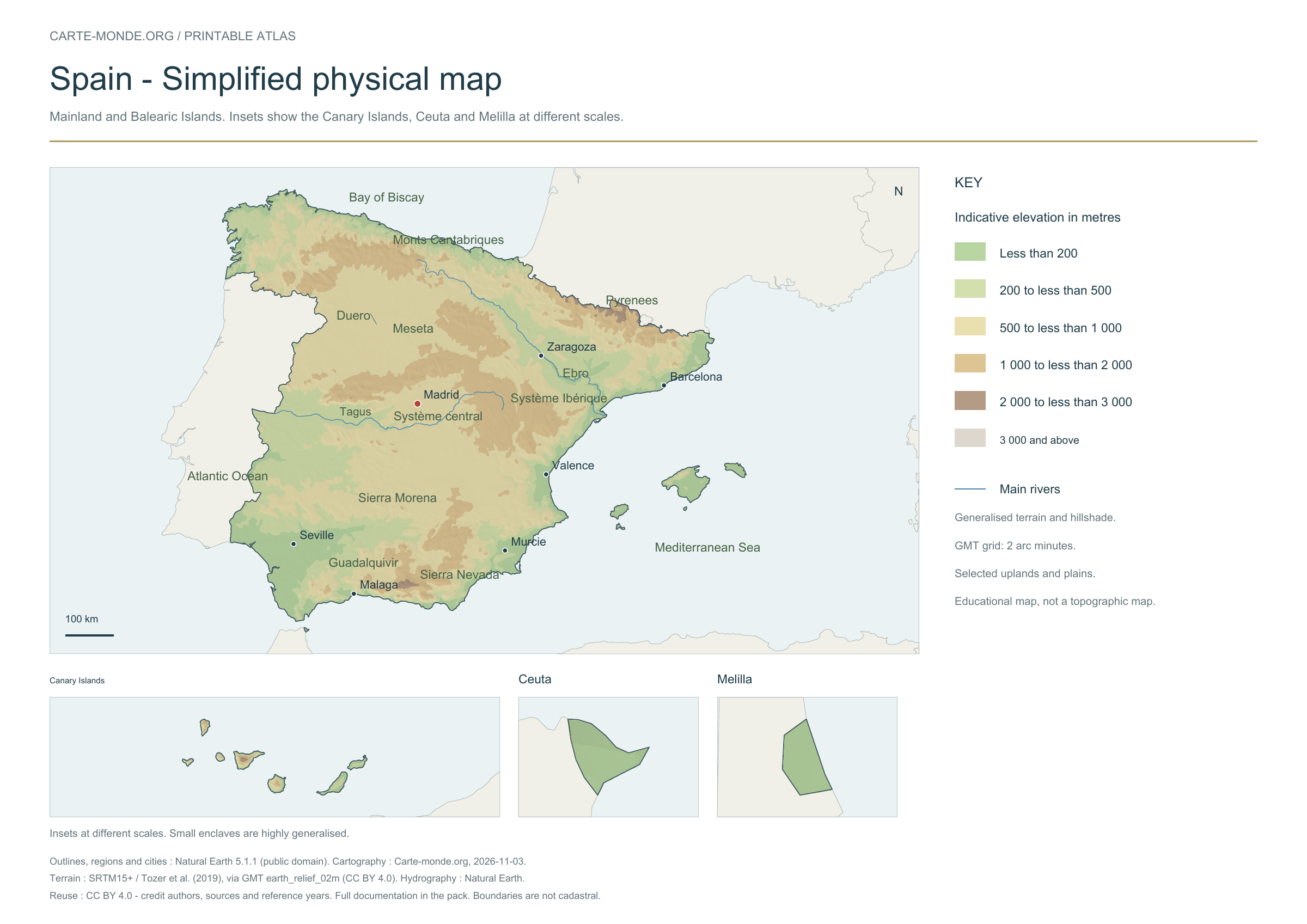
Simplified elevations
Elevation colours, shaded relief, major mountain ranges, plains and waterways. The relief is deliberately generalised for a national overview; this document does not replace a topographic map.
A4 landscape PDF · PNG 2 400 px · CC BY 4.0
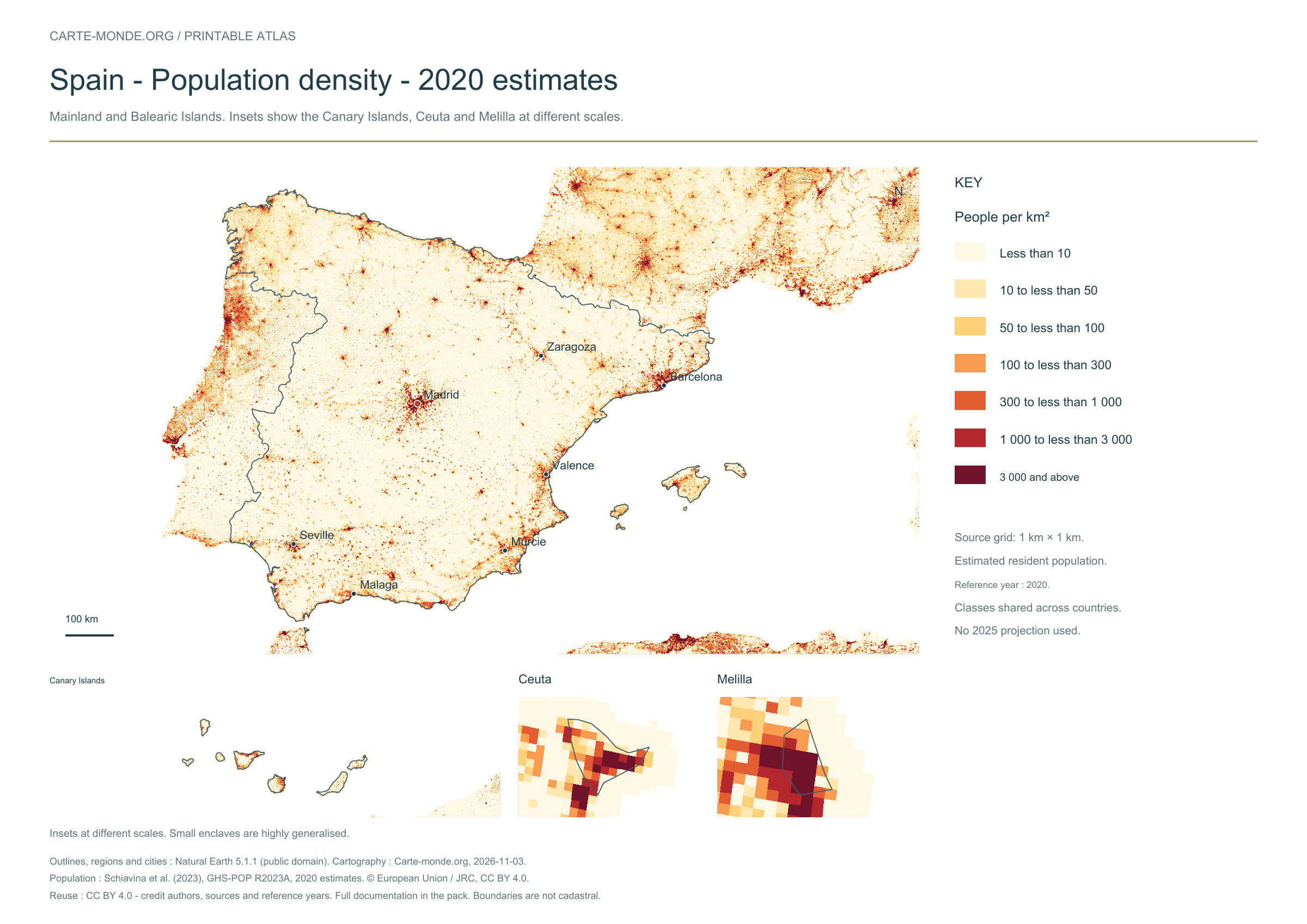
Population density: 2020 estimates
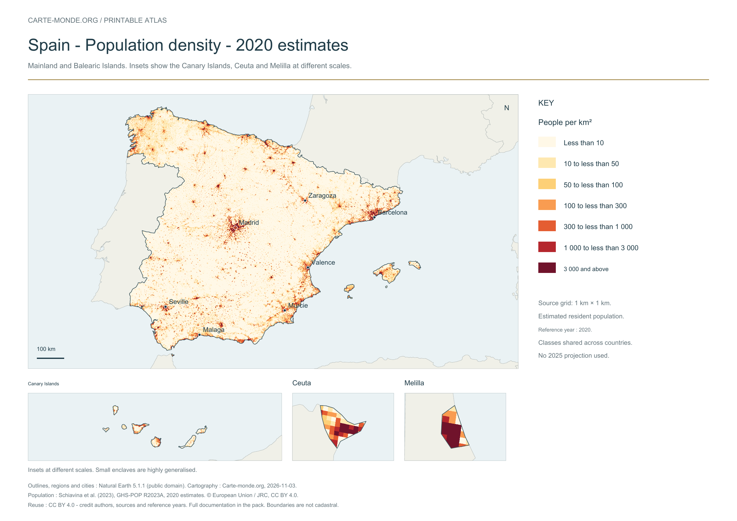
Carte-monde.org · November 2026
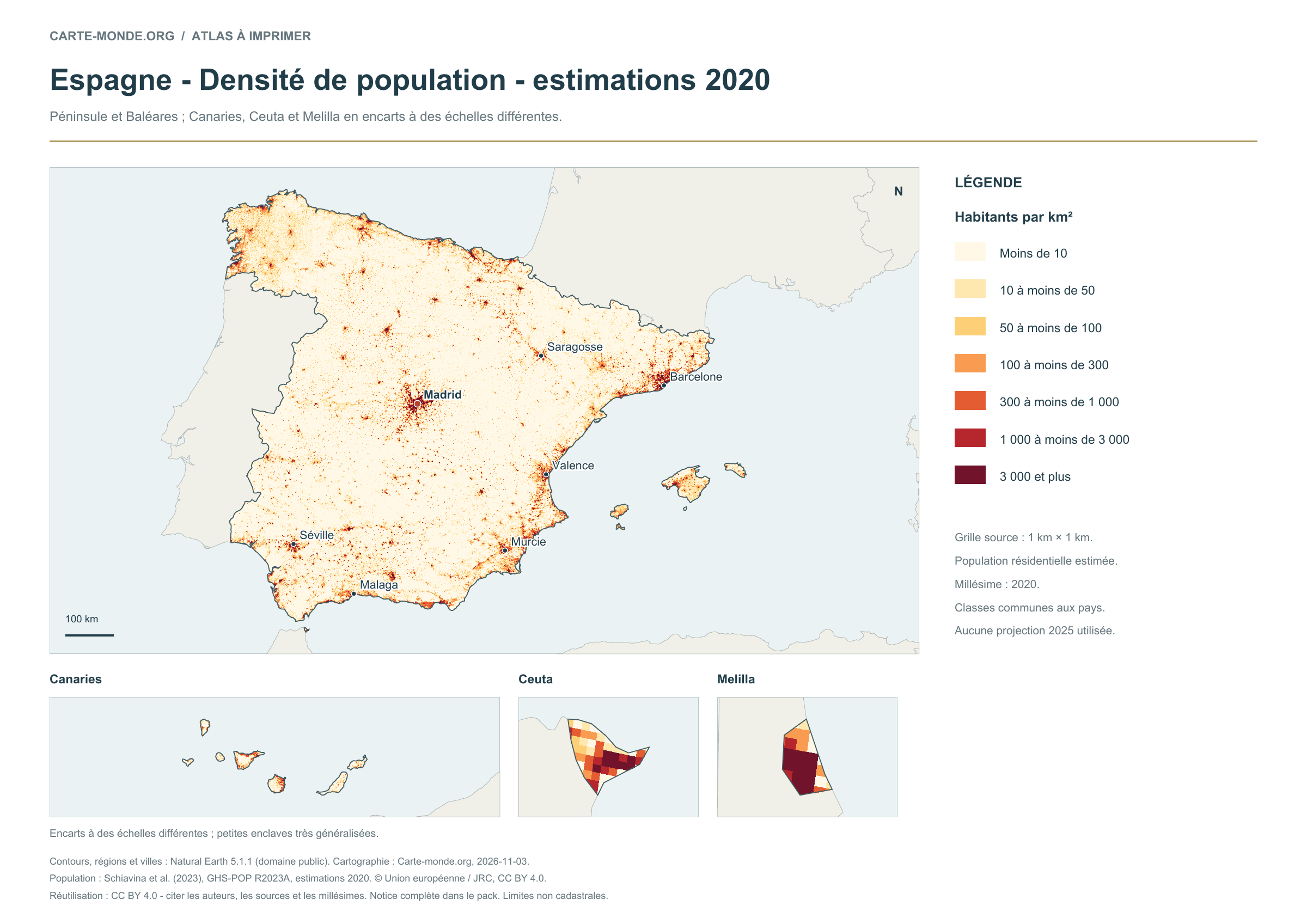
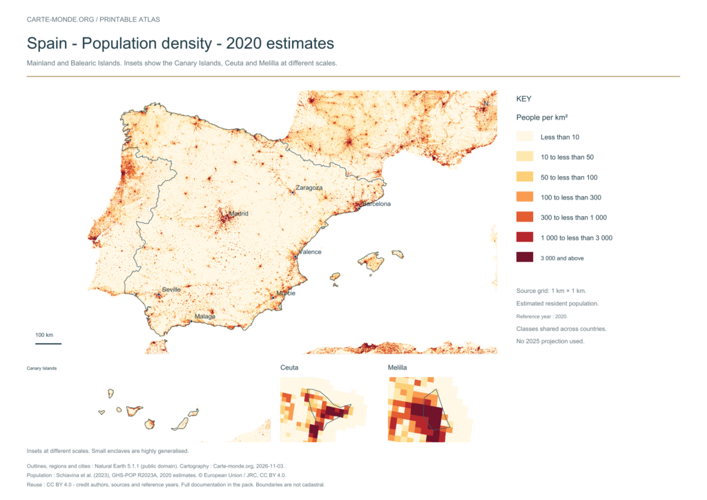
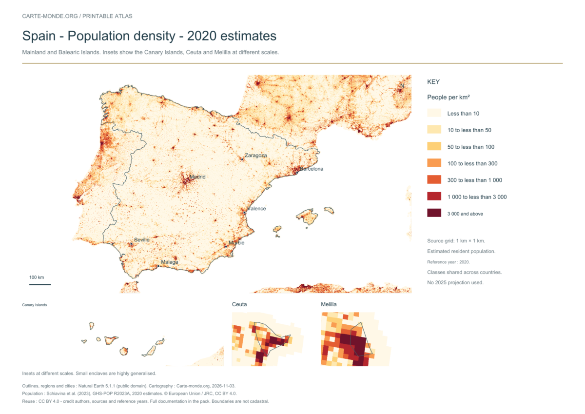
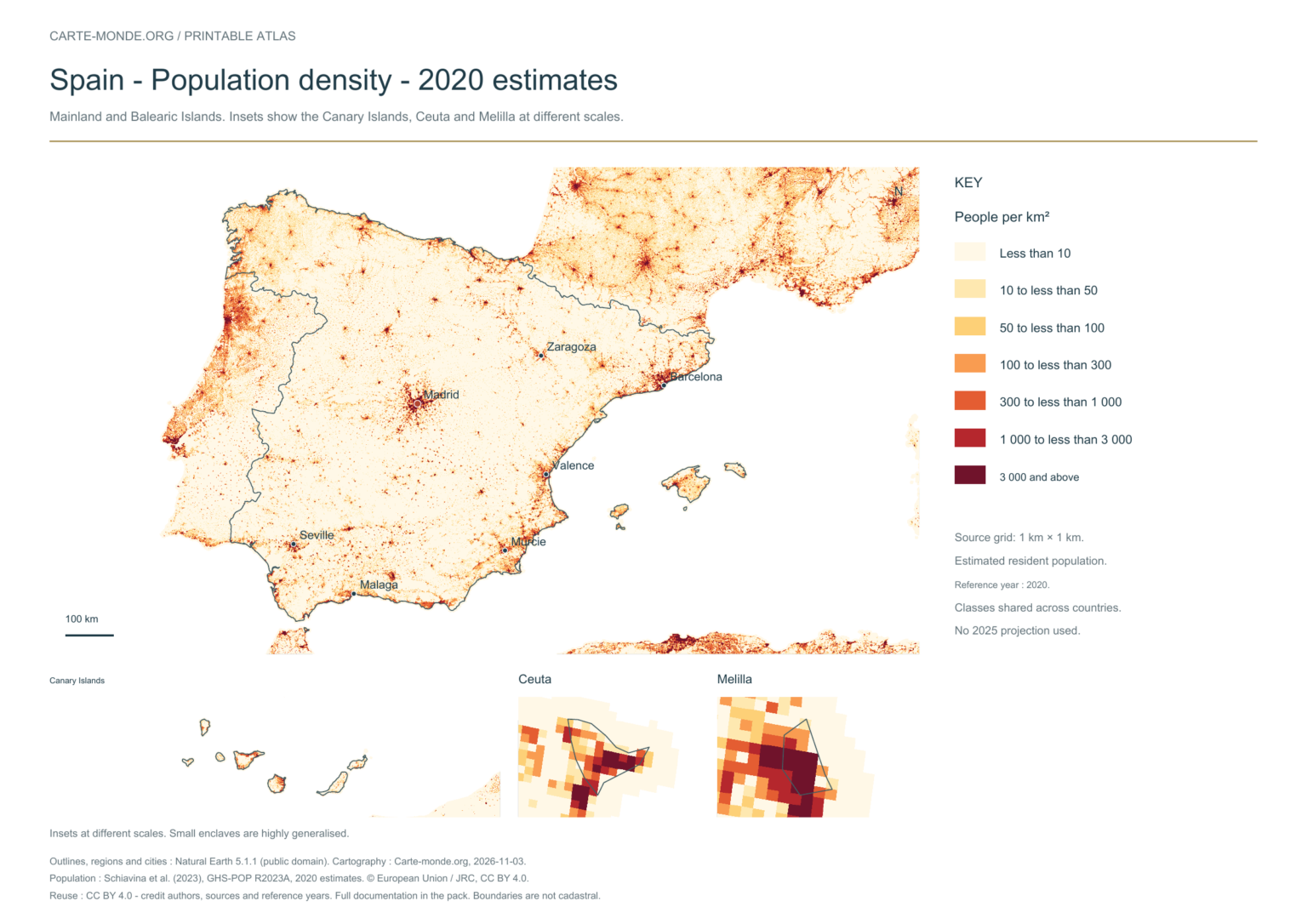
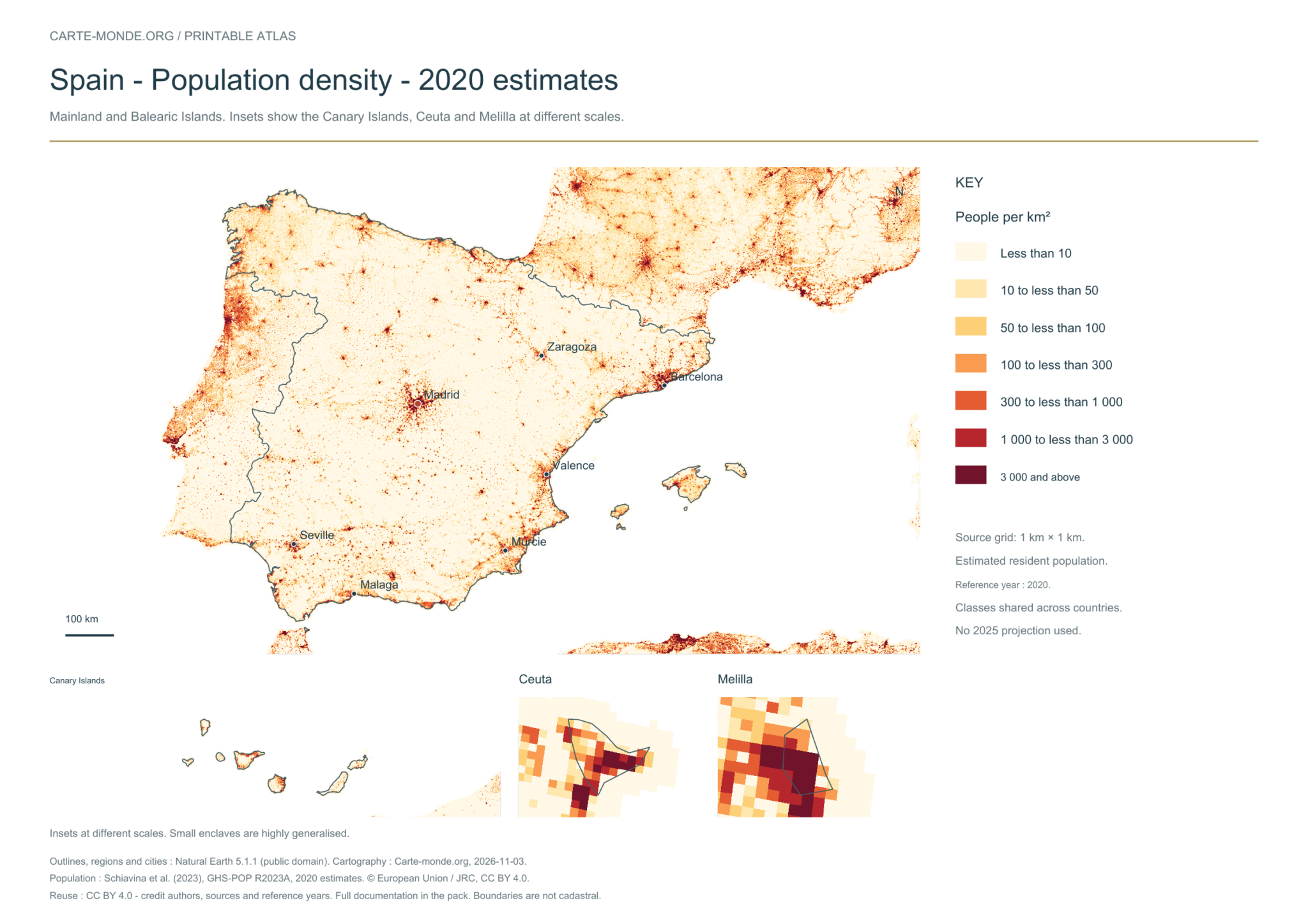
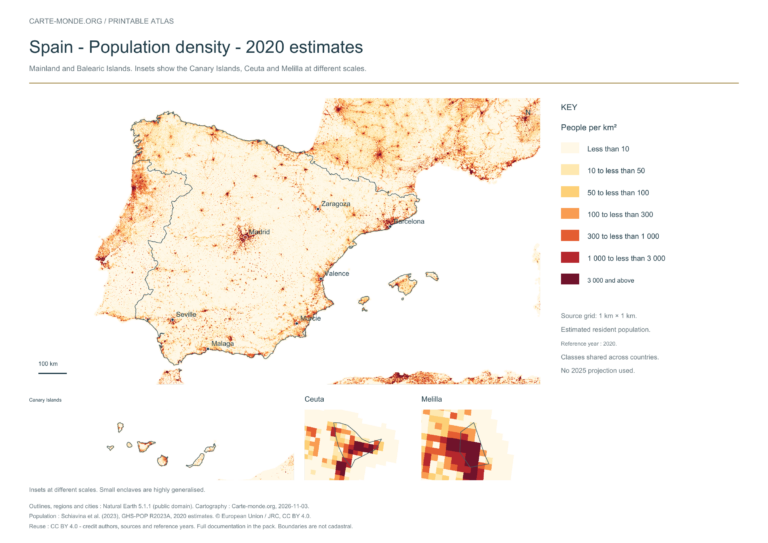
Population density — 2020
Estimated residential population distribution in 2020, on a source grid of 1 km². Inhabitants/km² classes are shared across countries. These are spatial estimates, with no 2025 projection.
A4 landscape PDF · PNG 2 400 px · CC BY 4.0
The data represents estimated residential population in 2020, on a 1 km² source grid. The document’s creation date does not change this reference year.
The five in-house maps in one pack
Regions and cities, location in Europe, simplified elevations, 2020 population density and shaded relief: five A4 PDFs, their PNGs and SVGs, with sources and licences.
Download the five maps — ZIPPrevious edition packs
The four in-house maps in one pack
A4 PDF, PNG and SVG, with source notes. Text and linework are vector-based; terrain and density use images embedded in the PDFs and SVGs. The October location map is reused without uploading it again.
Three detailed maps to download
These existing maps are provided with their own credits and licences. Originals remain in their original language; previews are converted or reduced for display.
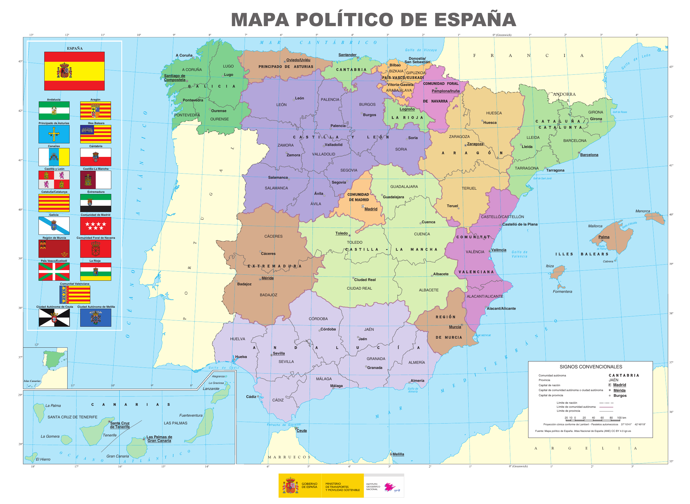
2025 · Spanish
Political map of Spain — IGN
Autonomous communities, provinces and many localities. Attribution: Mapa político de España, Atlas Nacional de España (ANE), 2025, CC BY 4.0 ign.es. Original unchanged; preview converted to PNG.
Instituto Geográfico Nacional / Atlas Nacional de España (ANE) · Source and original file page · CC BY 4.0
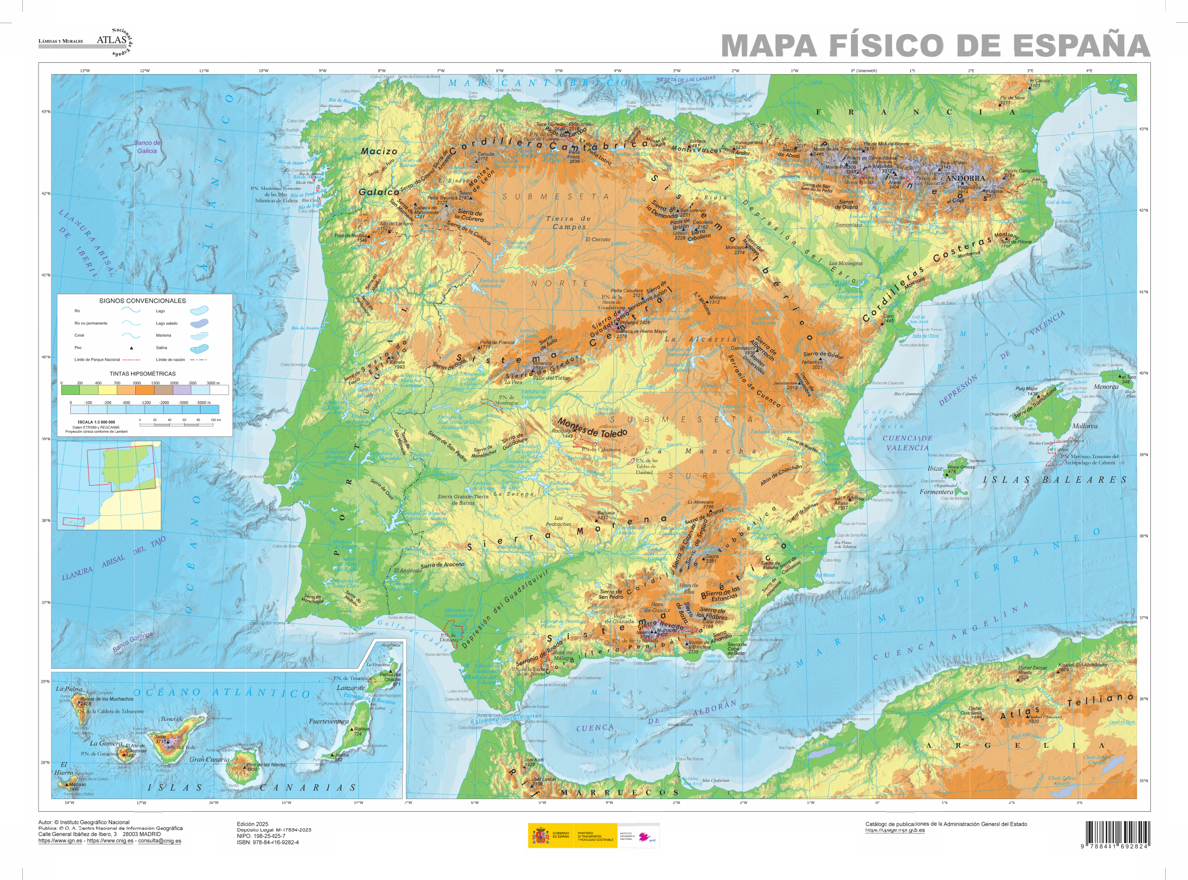
2025 · Spanish
Physical map of Spain — IGN
Relief, peaks, rivers and marine hydrography, with a Canary Islands inset. Attribution: Mapa físico de España, Atlas Nacional de España (ANE), 2025, CC BY 4.0 ign.es. Original unchanged; preview converted to PNG.
Instituto Geográfico Nacional / Atlas Nacional de España (ANE) · Source and original file page · CC BY 4.0
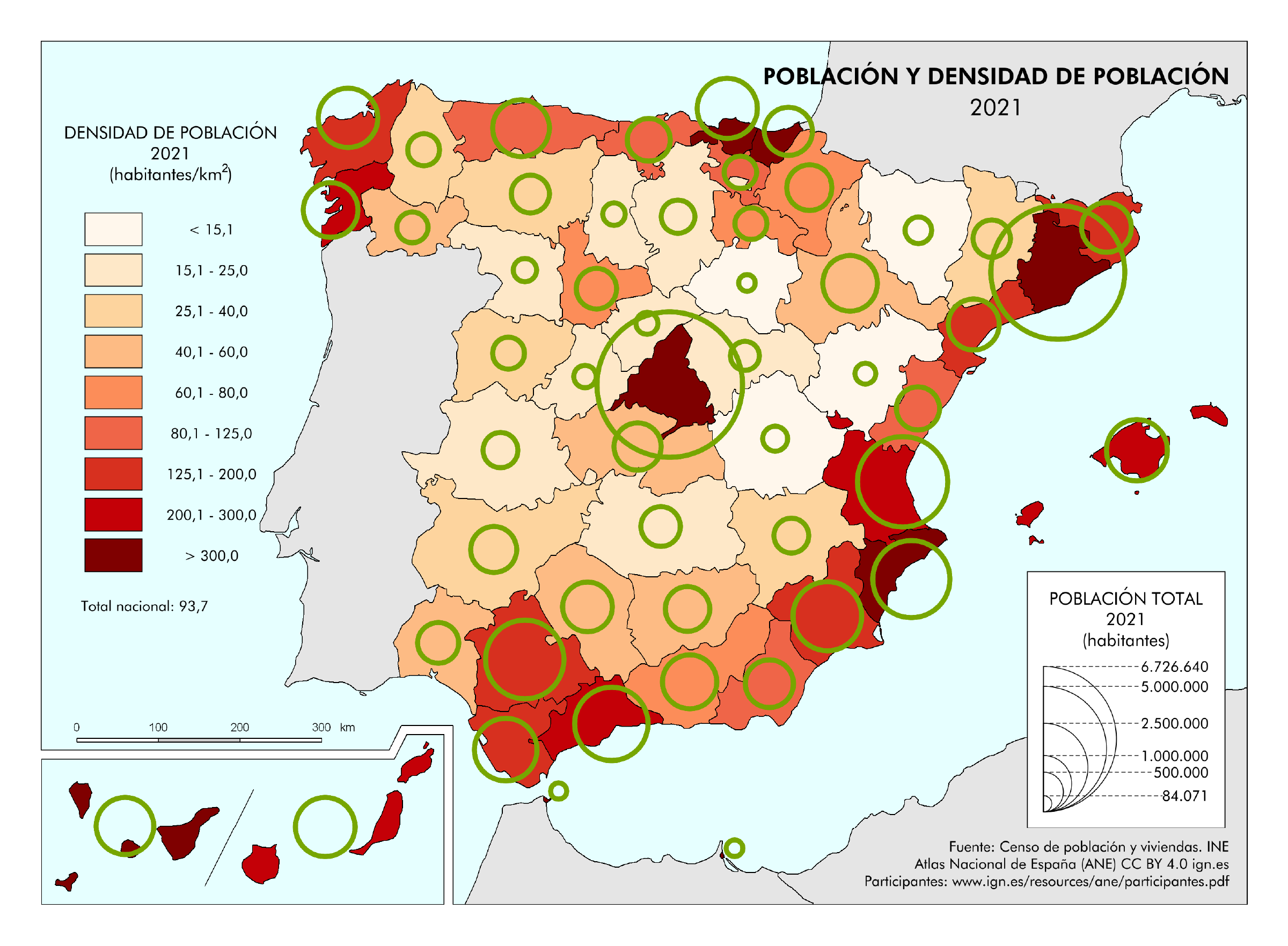
2021 census data · Spanish
Population and density by province — IGN
Map combining population and density at provincial level. Statistical source: INE, 2021 census; cartography IGN. Attribution: Mapas temáticos del ANE 2021, CC BY 4.0 ign.es. Original unchanged; preview converted to PNG.
Instituto Geográfico Nacional / ANE; INE data · Source and original file page · CC BY 4.0
Find the old maps of Spain
The files from the original collection, the first administrative map and the October pack are preserved at their old URLs. Access is grouped in the archives, with credits and notes about their currency.
Which map should I choose and how do I print it?
Choose regions and cities for territorial organisation, the location map for geographical position, relief for major natural features and density for population distribution. The detailed maps provide more names and landmarks.
Choose the A4 PDF for printing. For an image to insert in a document, use the PNG; licences and data years are stated with each map.
Sources, dates and reuse terms
Regions and cities: Natural Earth 5.1.1, public domain, geometries generalised at 1:10 million. The boundaries are not cadastral.
Physical map: SRTM15+ / Tozer et al. (2019), reference publication, grid GMT earth_relief_02m, derived from SRTM15+V2.7. Relief smoothed to 2 arc minutes, Natural Earth hydrography; small enclaves are not detailed.
Population: Schiavina, Freire, Carioli and MacManus (2023), GHS-POP R2023A, 2020 residential population estimates on a 1 km² Mollweide grid, © European Union / JRC. Methodology: Pesaresi et al. (2024). The counts per cell are expressed here in inhabitants/km²; enlarging the printout does not add precision.
Our three new maps: created by Carte-monde.org, November 2026, under CC BY 4.0, retaining authors, sources, reference years and modification notices. Location in Europe: October 2026 map under Licence Ouverte 2.0, reused unchanged. Full notes accompany the packs.
Detailed maps retain the licenses stated beneath each document. CC BY-SA licenses require adaptations to retain an identical or compatible license. The new Carte-monde.org license does not apply to older files in the collection.
Continue exploring
Base maps of European countries · Maps of Germany · Other maps and archives
Previous versions: maps and files preserved
These files remain available at their original URLs. For corrected maps, use the main links above. Each edition retains its credits and date.
- espagne-physique-relief-villes-fleuves-2026-11-03.pdf
- espagne-physique-relief-villes-fleuves-2026-11-03.png
- espagne-physique-relief-villes-fleuves-2026-11-03.zip
Raster base map, cities, rivers and lakes: Natural Earth, public domain. Other boundary credits and licences are retained in the pack. Cartographic work CC BY 4.0; ODbL-derived data retains its licence. No topographic accuracy is claimed.
Other maps: sources and reuse
Reference maps by external authors. Each document retains its licence, credits and date. “View map” links open the document on Commons; ZIP buttons provide access to the files kept in this collection.
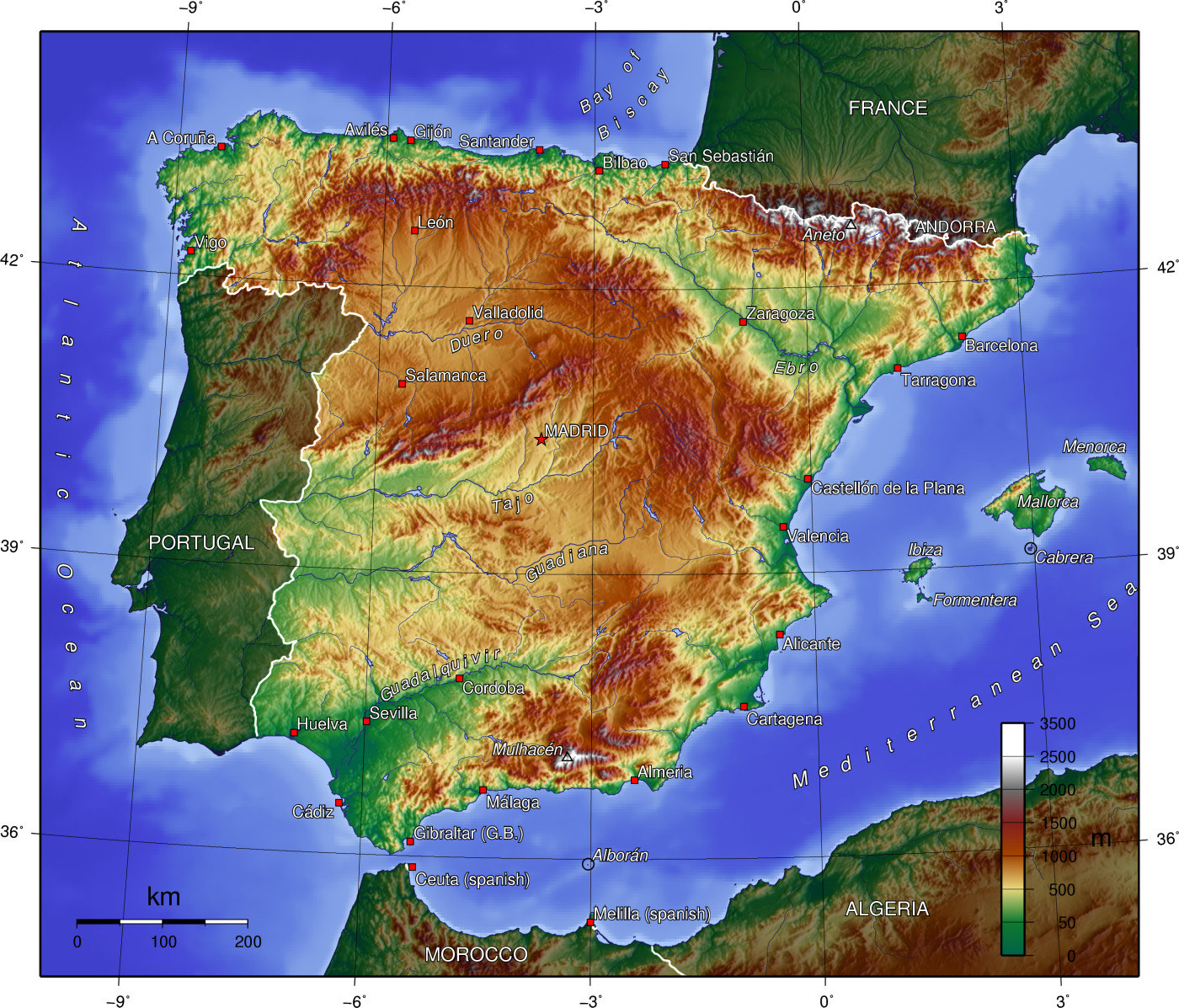
Spain topo.jpg
Author: User:Captain Blood~commonswiki · CC BY-SA 3.0 · Original file page, sources and licence
Date stated by the source: 2005-07-01; mainland Spain and the Balearic Islands, without the Canary Islands. The data year may differ from the document date; consult its legend.
Download the original and its credits — ZIP
Reduced preview; original preserved in the ZIP. The map retains its original licence.
To reuse a CC BY map, cite its authors, source and licence and indicate any changes. Adaptations of a CC BY-SA map retain the same or a compatible licence. CC0 documents may be reused freely; retaining the source makes them easier to identify. These rights do not make all administrative boundaries current.
Previous collection — original files preserved
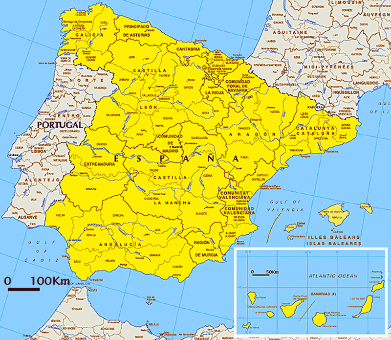
| Online Maps of Spain | |
 |
 |
 |
Original French files
- espagne-situation-carte-monde-2026.pdf
- espagne-situation-carte-monde-2026.png
- espagne-cinq-cartes-completes-2026-11-03-v3.zip
- espagne-densite-atlas-2026-11-03.pdf
- espagne-densite-atlas-2026-11-03.png
- espagne-physique-atlas-2026-11-03.pdf
- espagne-physique-atlas-2026-11-03.png
- espagne-physique-relief-villes-fleuves-2026-11-03-v3.pdf
- espagne-physique-relief-villes-fleuves-2026-11-03-v3.png
- espagne-regions-atlas-2026-11-03.pdf
- espagne-regions-atlas-2026-11-03.png
Previous language edition
- espagne-densite-en-2026-11-09-1024×724.png
- espagne-densite-en-2026-11-09-1200×849.png
- espagne-densite-en-2026-11-09-1536×1086.png
- espagne-densite-en-2026-11-09-2048×1448.png
- espagne-densite-en-2026-11-09-300×212.png
- espagne-densite-en-2026-11-09-768×543.png
- espagne-densite-en-2026-11-09.pdf
- espagne-densite-en-2026-11-09.png
- espagne-pack-main-en-2026-11-09.zip
- espagne-physique-en-2026-11-09-1024×724.png
- espagne-physique-en-2026-11-09-1200×849.png
- espagne-physique-en-2026-11-09-1536×1086.png
- espagne-physique-en-2026-11-09-2048×1448.png
- espagne-physique-en-2026-11-09-300×212.png
- espagne-physique-en-2026-11-09-768×543.png
- espagne-physique-en-2026-11-09.pdf
- espagne-physique-en-2026-11-09.png