
The collection’s historical world map is available at 7 500 × 3 800 pixels. Also discover the official map of states and capitals in French, published in June 2026.
Map labels and downloadable files remain in their original language, often French.
Large world maps from the collection

Political world map from the collection
Click the preview to view the image at its original size.
|
| Downloadable maps | |
|
7500 x 3800 |
 2500 x 1869 |
 640 x 325 |
States and capitals of the world · June 2026
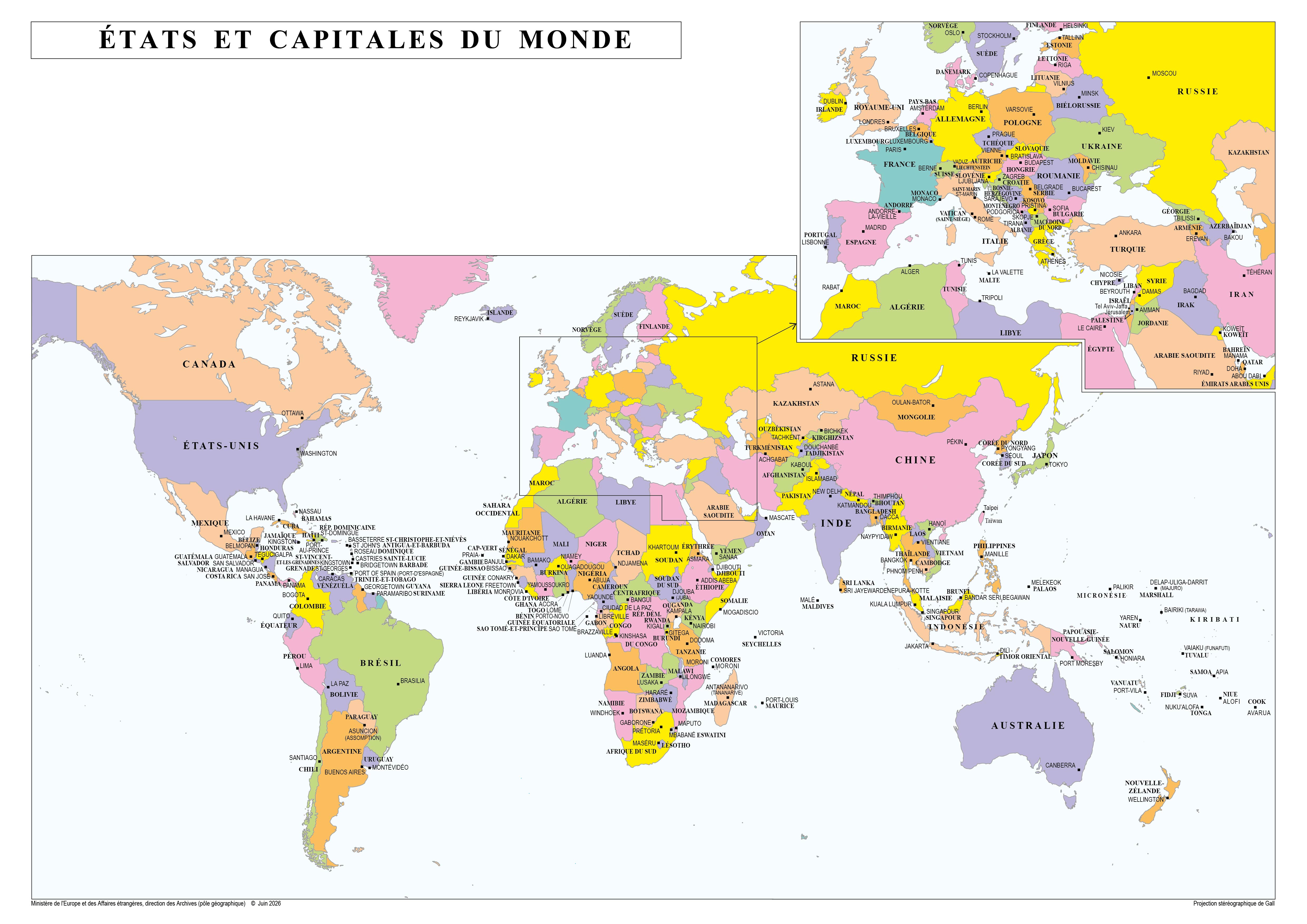
World map in French with the names of states and their capitals, and an inset for Europe and the Near East.
Ministère de l’Europe et des Affaires étrangères, direction des Archives (pôle géographique), June 2026 · Licence Ouverte 2.0.
Previous collection — original files preserved
|
| Downloadable maps | |
|
7500 x 3800 |
2500 x 1869 |
|
640 x 325 |


